Biblical Sites in Israel: Gath of the Philistines

April 9, 2016

A visit to the biblical site of Gath, Tel es Safi, on Israel’s coastal plain is worthwhile. Gath was the land of giants (Josh. 11:22). Goliath was from Gath: “Then a champion named Goliath, from Gath, came out from the Philistine camp. He was nine feet, nine inches tall” (1 Sam. 17:4, Holman’s Christian Standard Bible).

It is sad to read how that David (after killing Goliath) had to flee from Saul. He fled to Gath of the Philistines, but there, fearing for his life, pretended to be insane (1 Sam 21:10-15; cf. Psalms 34 and 56). Later David again fled to Gath and was given refuge (1 Sam. 27); the king of Gath gave David and his 600 men the city of Ziklag.

When David was residing when he heard news of the death of King Saul, and his three sons (1 Sam. 31) he composed a song which included the words “Tell it not in Gath, Proclaim it not in the streets of Ashkelon — Lest the daughters of the Philistines rejoice, Lest the daughters of the uncircumcised triumph” (2 Sam. 1:20).

Our photo here gives a view of the large tel.
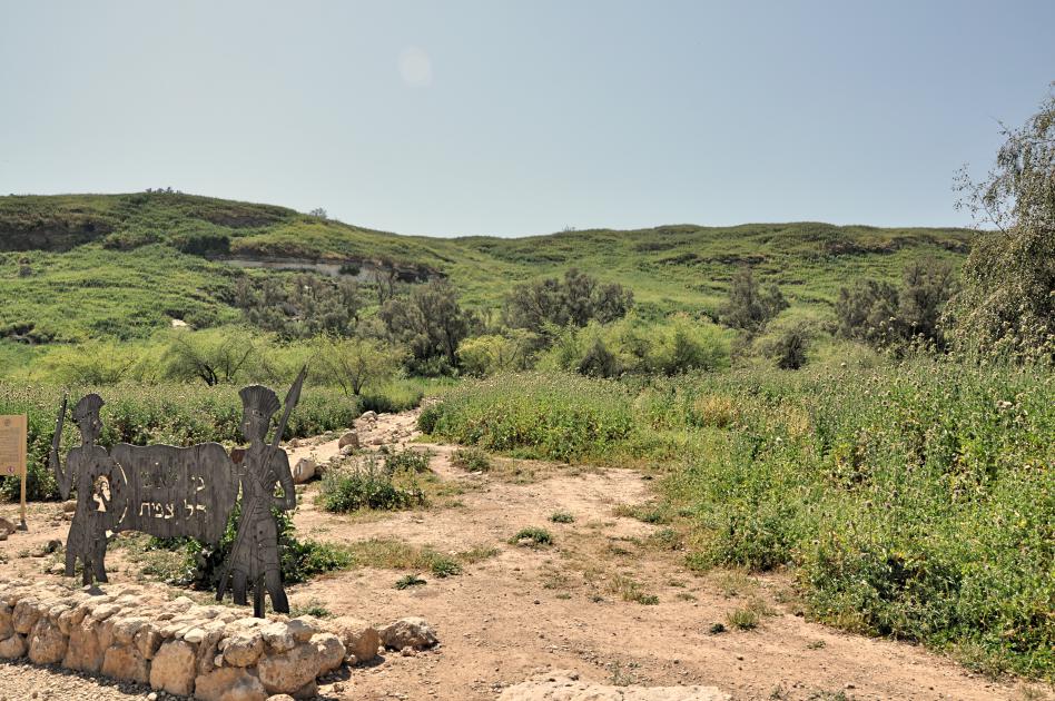
Tel Gath of the Philistines. Photo by Leon Mauldin.

Tel Gath of the Philistines. Photo by Leon Mauldin.

We were also able to see some of the excavations of the cities lower wall.
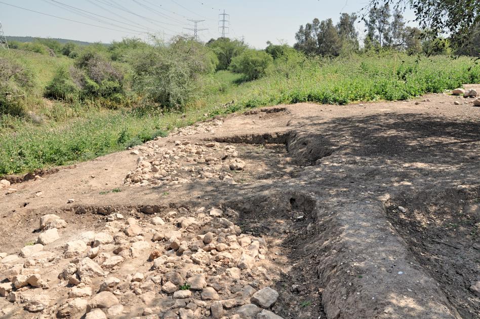
Recent Excavations at Gath. Lower wall of city. Photo by Leon Mauldin.

Recent Excavations at Gath. Lower wall of city. Photo by Leon Mauldin.

I have previously posted on Gath here (aerial photo).

Dr. Aren Maeir maintains a blog here devoted to news about Gath, Tel es Safi.

Tonight we are at Tiberias, on the Sea of Galilee; more photos and info to come. Thanks for following our travels.


Kiriath-jearim and Beth-shemesh in Israel

April 8, 2016

Today Ferrell Jenkins and I visited sites in Jerusalem, but for our post for now I wanted to note a couple of biblical sites we visited yesterday.

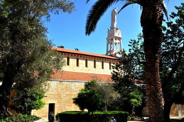
One was Kiriath-jearim. This location is of importance because the Ark of the Covenant was there from the days of Samuel (after Eli’s death and the Philistine destruction of Shiloh 1 Sam. 4-5). We read in 1 Samuel 6:21, “So they sent messengers to the inhabitants of Kiriath-jearim, saying, ‘The Philistines have brought back the ark of the LORD; come down and take it up to you.'”

At Kiriath-jearim. Our Lay of the Ark of the Covenant. Photo by Leon Mauldin.

At Kiriath-jearim. Our Lay of the Ark of the Covenant. Photo by Leon Mauldin.

Once the ark was returned to Israel by the Philistine enemies, ca. 1100 BC, it would remain there until King David made Jerusalem his capital, ca. 1003 BC, i.e. for 100 years. But first the ark came to Beth-shemesh. The biblical narrative explains how the hand of God was involved as two milk cows, with their calves kept behind, pulled a cart carrying the ark straight from Ekron of the Philistines to the border town of Beth-shemesh of Israel (1 Sam. 6).

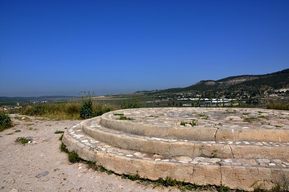
Beth Shemesh, where the ark was returned from the Philistines. Photo by Leon Mauldin.

Beth-shemesh, where the ark was returned from the Philistines. Photo by Leon Mauldin.

Our photo shows the suggested site in Beth-shemesh (in foreground) where the cows pulling the ark were slain as sacrifices. Our view looks toward Philistia in the distance (left from center), the direction from which the ark would have come. As stated above (1 Sam. 6:21), from Beth-shemesh the ark was taken to Kiriath-jearim, where it remained until the days of King David.

We have previously posted here on Kiriath-jearim and here on Beth-shemesh, with aerial photo.


Traveling in Israel: Gibeon and More!

April 7, 2016

Today was a delightful day in Israel. We were able to see biblical sites from Jerusalem westward all the way to the coastal Philistine city of Gath.

Just north of Jerusalem (OT territory of Benjamin) is Gibeon, (Arabic El-Jib). This was formerly the Canaanite city that deceived Joshua and the men of Israel by pretending to be from a great distance, and thus entered into a covenant with Israel during the days of the Conquest (Joshua 9). There are subsequently several biblical references to this site.

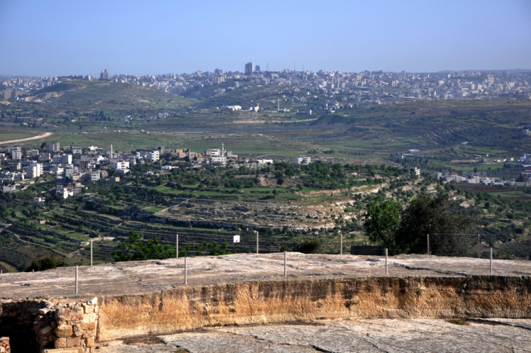
Gibeon. Many OT texts refer to this site. Photo by Leon Mauldin.

Gibeon at center of photo. Many OT texts refer to this site. Photo by Leon Mauldin.

We have previously posted on Gibeon here and here.

Today we also saw Kiriath-Jeariam and  numerous sites in the Shephalah, including the valley of Elah, where David killed Goliath, Lachish, Beth-Shemesh, and the Philistine city of Gath, plus others. More on these later!


Odeion at Troy

April 1, 2016

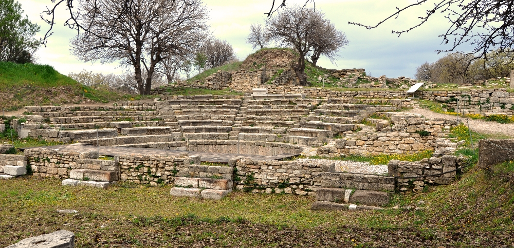
Ancient Troy has been made famous by Homer’s Iliad. Troy is located within the province of Çanakkale, located in extreme western Turkey. Troy’s extensive remains are the most significant and substantial evidence of the first contact between the civilizations of Anatolia and the Mediterranean world. This past Spring, 2015, we were able to visit Troy. Among the fascinating ruins there was the Roman Odeion, a small theater where concerts, lectures and other events took place.

Roman Odeion at Troy, Turkey. Photo by Leon Mauldin.

Roman Odeion at Troy, Turkey. Photo by Leon Mauldin.

The skene, stage building included a larger-than-life statue of the Emperor Hadrian (AD 117-138). Also, a sculpted head of Augustus was found at the odeion, causing some to surmise that this may have been erected in honor of his visit here in 20 BC. Beyond the odeion at the back you can see a portion of the fortification wall of Troia VI.

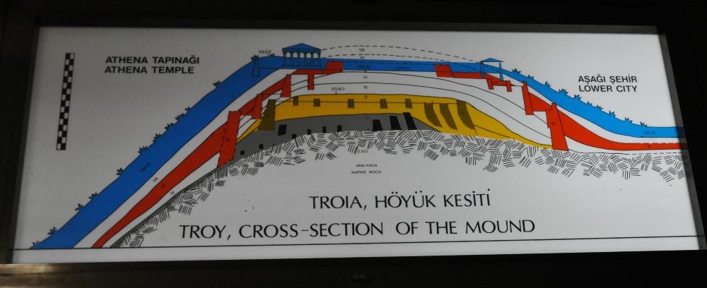
The Roman odeion is in Troy’s Level IX. Over the centuries there were nine levels of occupation.

Cross-section of Troy, showing 9 occupation levels. Istanbul Museum. Photo by Leon Mauldin.

Cross-section of Troy, showing 9 occupation levels. Istanbul Museum. Photo by Leon Mauldin. 

Wikipedia has this helpful chart:

Troy I 3000–2600 BC (Western Anatolian EB 1)
Troy II 2600–2250 BC (Western Anatolian EB 2)
Troy III 2250–2100 BC (Western Anatolian EB 3 [early])
Troy IV 2100–1950 BC (Western Anatolian EB 3 [middle])
Troy V: 20th–18th centuries BC (Western Anatolian EB 3 [late])
Troy VI: 17th–15th centuries BC
Troy VIh: late Bronze Age, 14th century BC
Troy VIIa: c. 1300–1190 BC, most likely setting for Homer’s story
Troy VIIb1: 12th century BC
Troy VIIb2: 11th century BC
Troy VIIb3: until c. 950 BC
Troy VIII: c. 700–85 BC
Troy IX: 85 BC–c. AD 500

Biblical significance: It was here at Troy (Ilium) at the temple of Athena that Xerxes (Ahasuerus) of the book of Esther sacrificed 1,000 head of cattle en route on his march through the Hellespontine region towards Greece. This was 480 BC.

We have previously posted on Troy here.


Jordan River

February 17, 2016

In preparing for our mid-week Bible study tonight (Life of Christ) I came across a photo of the River Jordan I took back in Sept. 2011.

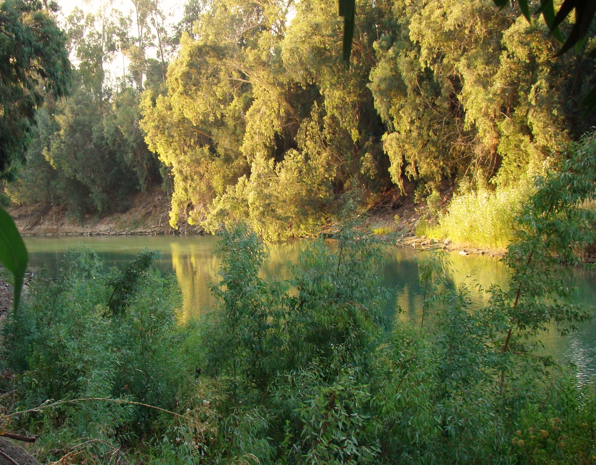
Jordan River. Photo by Leon Mauldin.

Jordan River. Photo by Leon Mauldin.

This is where the Jordan continues its flow just south of the Sea of Galilee.

Some of my other posts and photos of the Jordan River may be seen by clicking here and here.

Click image for larger view.


Hazor, One of Solomon’s Fortress Cities

February 13, 2016

1 Kings 9:15 reads, “Now this is the account of the forced labor which King Solomon levied to build the house of the LORD, his own house, the Millo, the wall of Jerusalem, Hazor, Megiddo, and Gezer.

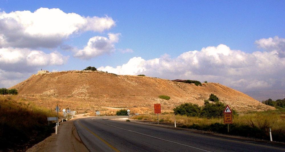
During the time of pre-conquest Canaanite occupation, “Hazor formerly was the head of all these kingdoms” (Josh. 11:10), a reference to the city states of northern Canaan. It was located on the strategic Via Maris. This is a view of the tel:

Tel Hazor, one of the cities Solomon fortified. Photo by Leon Mauldin.

Tel Hazor, one of the cities Solomon fortified. Photo by Leon Mauldin.

I have previously written on Hazor here.

Click image for larger view.


His Eternal Power and Deity

February 6, 2016

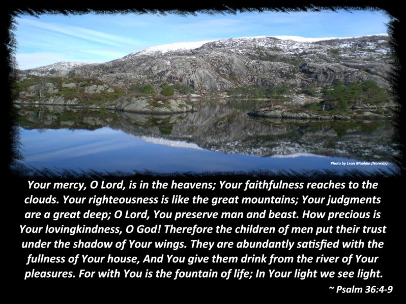
Paul observed that God’s invisible attributes, his everlasting power and deity, are clearly seen, being understood by the things that are made (Rom.1:20). This is true “since the creation of the world” (ibid.). Several years ago Jonathan Perz paired a text in Psalm 36 with one of my photos. Many of the psalms make reference to God’s power and glory as seen in the creation.

God's Handiwork in Norway. Photo by Leon Mauldin.

God’s Handiwork in Norway. Photo by Leon Mauldin.


Qumran and the Dead Sea Scrolls

December 2, 2015

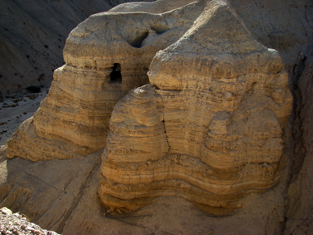
“The Dead Sea Scrolls are undoubtedly the most important discovery found in Israel in the field of the Bible and history of Judaism and Christianity.”1 Fragments of about 900 scrolls from the 2nd Temple period (some dating as early as 3rd century BC) were found in the Qumran caves (NW shore of Dead Sea), between 1947 and 1956. Every book of the Old Testament (except Esther) were represented in the finds, including one complete copy of Isaiah.

Some of the Qumran Caves where the Dead Sea Scrolls were discovered (1946ff.). Photo by Leon Mauldin.

Some of the Qumran Caves where the Dead Sea Scrolls were discovered (1946ff.). Photo by Leon Mauldin.

I remember when studying archaeology under the late Dr. James Hodges that he said the main value of the Dead Sea Scrolls was in the discipline of apologetics. The scrolls were about 1,000 years older (!) than the previously available manuscripts with which translators had to work. The huge find of fragments provided abundant samples with which to compare our Hebrew manuscripts. The result was:

it may now be more confidently asserted than ever before that the modern Hebrew text faithfully represents the Hebrew text as originally written by the authors of the Old Testament. Dead Sea discoveries have enabled us to answer this question with much greater assurance than was possible before 1948.2

Dr. Hodges pointed out that no new translations had to be made as a result of the discovery of the scrolls; they confirmed the accuracy of transmission of what we already have.

Another contribution:

“As a result of Dead Sea Scroll discoveries, it is no longer possible to date portions or entire Old Testament books as late as some scholars used to do. It is impossible to date any biblical work or any extensive part of one later than the early second century B.C. Fragments of the Pentateuch and the prophets date from the second century B.C. Ecclesiastes, sometimes believed to have been composed in the second or first century B.C., appears in a Cave 4 manuscript dating from 175 to 150 B.C. A second-century B.C. Copy of the Psalms indicates that the collection of Psalms was fixed by Maccabean times. A manuscript of Daniel dating about 120 B.C. brings into question the alleged Maccabean date of its composition. Moreover, the Dead Sea Scrolls do not support the existence of a deutero- or trito-Isaiah, at least during the second century B.C. The complete Isaiah and the long fragment of Isaiah from Cave 1 (second century B.C.) treat the book as a unit.”3 

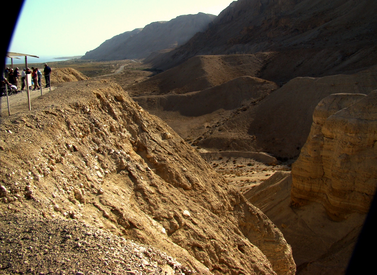
View from Qumran looking south. Dead Sea is in upper left of photo. Photo by Leon Mauldin.

View from Qumran looking south. Dead Sea is in upper left of photo. Photo by Leon Mauldin.


Click photos for larger view.

1 Yigael Yadin quoted by Hanan Eshel in Qumran: Scrolls∙Caves∙History (p.7)

2 See F. B. Bruce, Second Thoughts on the Dead Sea Scrolls (pp.61-69)

3 Bible and Spade (1978), 7(1), pp.12–14.


Solomon’s Song of Songs

November 19, 2015

At ETS in Atlanta this afternoon I heard Dr. Tremper Longman III, professor of Biblical Studies at Westmont College in Santa Barbara, California, and prolific author (including commentaries on the  Song of Solomon), lecture on the Song of Solomon. His view of the book is that it is an anthology of love poems, rather than a narrative with a plot; a collection of poems that both celebrate sexual love (within marriage) but also give warnings. It was an interesting lecture.

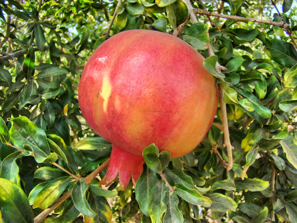
He read from Song of Solomon 4:3, which includes this compliment: “Your lips are like a scarlet thread, And your mouth is lovely. Your temples are like a slice of a pomegranate Behind your veil.” You might want to remember this text when you wish to praise your wife for her beauty.

Pomegranate such as that referenced in Song of Solomon 4:3. Photo by Leon Mauldin.

Pomegranate such as that referenced in Song of Solomon 4:3. Photo by Leon Mauldin.

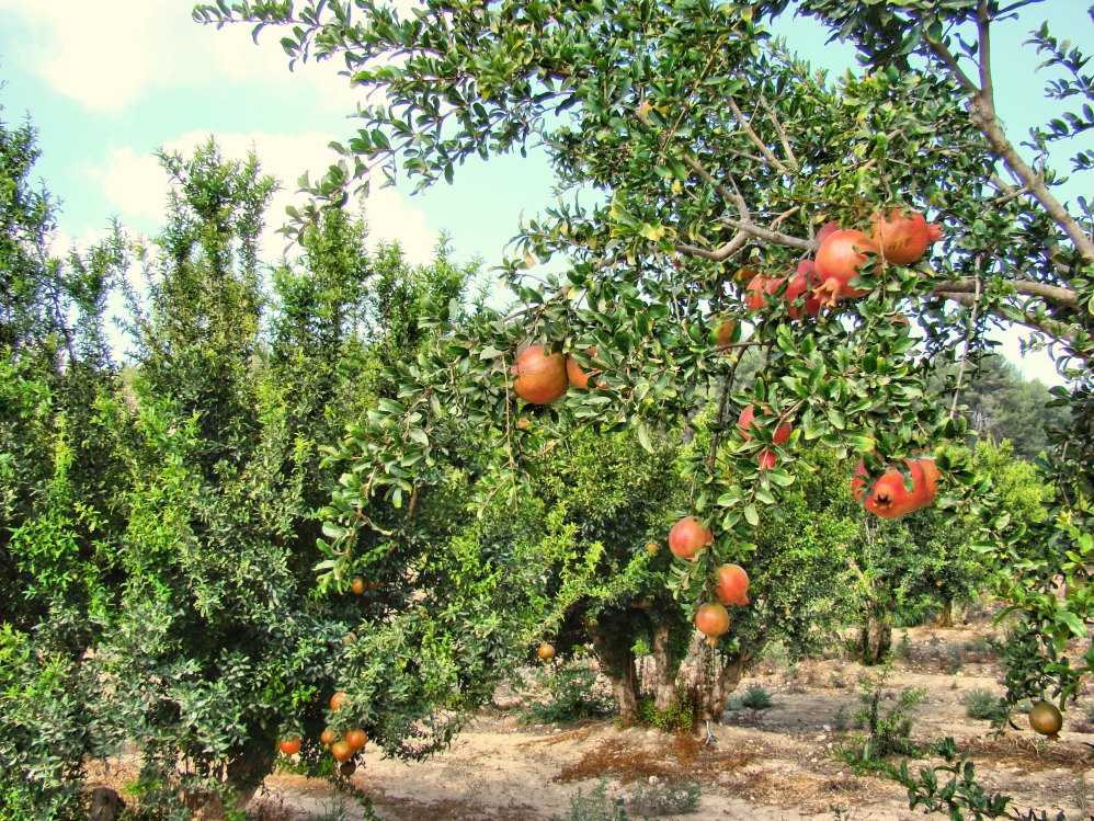
This pomegranate orchard is located near biblical Lachish.

Pomegranate orchard near Lachish in southern Israel. Photo by Leon Mauldin.

Pomegranate orchard near Lachish in southern Israel. Photo by Leon Mauldin.

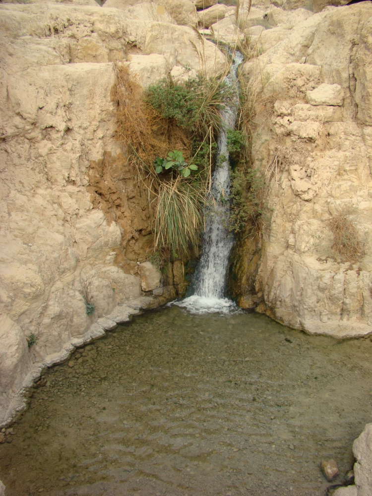
One of the geographical references in the Song of Solomon is found in 1:14, where the young woman/bride says, “My beloved is to me a cluster of henna blossoms In the vineyards of Engedi.” Pictured here is a beautiful waterfall at Engedi, located on the west side of the Dead Sea.

Waterfall at Engedi. Photo by Leon Mauldin.

Waterfall at Engedi. Photo by Leon Mauldin.

I have a previous post making a brief reference to the pomegranate here.

Click images for larger view.


Gezer, Ongoing Excavations

November 17, 2015


In ATL, attending meetings of the Near East Archaeological Society. Two of the eight sessions I attended today were on biblical Gezer. A great deal of archaeological work has been done here for the past several seasons, including the ancient tunnel/water system, with more yet scheduled.

There are several Old Testament references to this site. It was one of the cities King Solomon fortified:

Now this is the account of the forced labor which King Solomon levied to build the house of the LORD, his own house, the Millo, the wall of Jerusalem, Hazor, Megiddo, and Gezer. 16 For Pharaoh king of Egypt had gone up and captured Gezer and burned it with fire, and killed the Canaanites who lived in the city, and had given it as a dowry to his daughter, Solomon’s wife. 17 So Solomon rebuilt Gezer and the lower Beth-horon 18 and Baalath and Tamar in the wilderness, in the land of Judah, 19 and all the storage cities which Solomon had, even the cities for his chariots and the cities for his horsemen, and all that it pleased Solomon to build in Jerusalem, in Lebanon, and in all the land under his rule. (1 Kings 9:15-19).

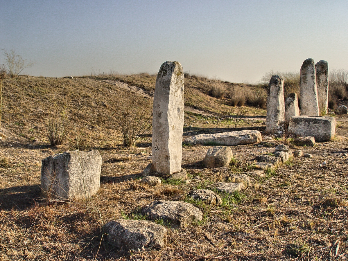
Our photo here shows the standing stones at the high place at Gezer.

Standing Stones at Gezer. Photo by Leon Mauldin.

Standing Stones at Gezer. Photo by Leon Mauldin.

Gezer guarded the entrance into the Shephelah region. It is located approximately thirty kilometers northwest of Jerusalem. Gezer was strategically situated at the junction of the Via Maris, the international coastal highway, and the highway connecting it with Jerusalem through the valley of Ajalon.

I have several previous posts with photos & info here, here, here, here, and here.

Hint: pronounce Gezer with “short” e, not GEEzer (def.: old man).