High Place at Dan

October 1, 2015

A study of the biblical “Divided Kingdom” period is challenging, (1 Kgs. 11ff. and 2 Chron. 11ff.) to say the least. The 1st of Israel’s kings, Jeroboam, made several (unauthorized) changes in the pattern for worship that Yahweh had revealed (see our previous post here). Jeroboam’s motive was to solidify his power, and to prevent his subjects from going south to Jerusalem to worship, which he thought would likely cause their loyalty to shift.

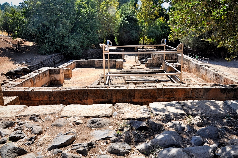
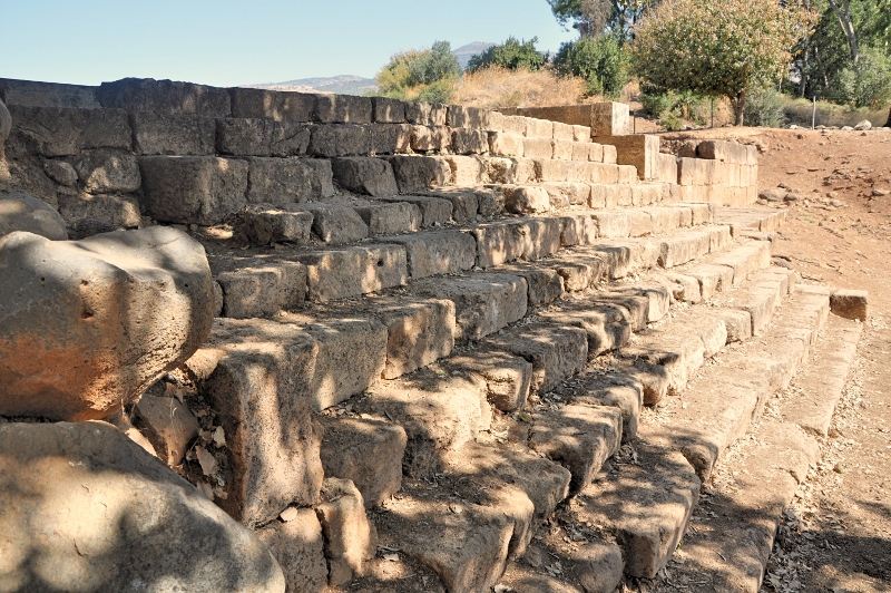
At Dan it is possible today to see the site referenced so many times in scripture, that of the high place where Jeroboam placed his golden calf. cf. 1 Kings 12:30: “Now this thing became a sin, for the people went to worship before the one [golden calf] at Dan.” “This event became sin to the house of Jeroboam, even to blot it out and destroy it from off the face of the earth” (13:34). Reference is made to the sins of Jeroboam “which he committed and with which he made Israel to sin” (14:16).

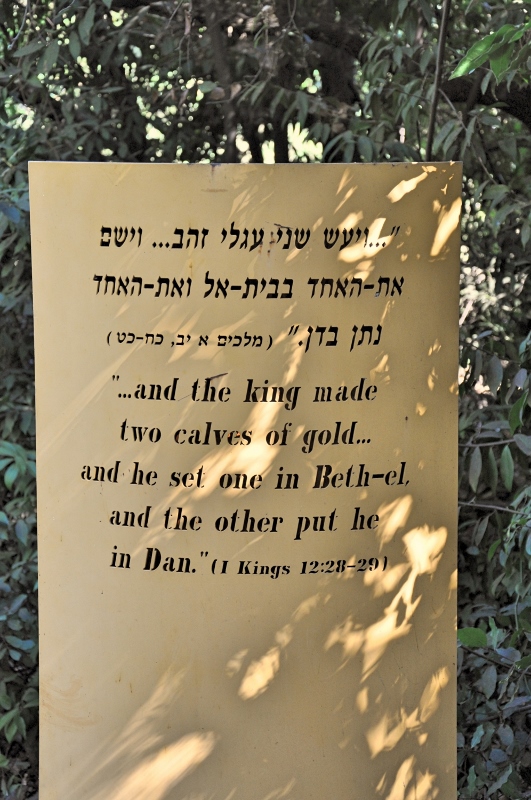
Info Sign at High Place at Dan. Photo by Leon Mauldin.

Info Sign at High Place at Dan. Photo by Leon Mauldin.

View of the altar where sacrifices were offered. Photo by Leon Mauldin.

View of the altar where sacrifices were offered. Photo by Leon Mauldin.

Steps leading up to the platform where the golden calf was enshrined. Photo by Leon Mauldin.

Steps leading up to the platform where the golden calf was enshrined. Photo by Leon Mauldin.

Click images for larger view.


“Like a Cylinder Seal over Your Heart”

July 17, 2015

While running some biblical references yesterday I came across a text in Song of Solomon 8:6: “Set me like a cylinder seal over your heart, like a signet on your arm. For love is as strong as death, passion is as unrelenting as Sheol. Its flames burst forth, it is a blazing flame” (NET Bible).

The NET Bible with its translation notes has some very useful material on the significance of the similes cylinder seal and signet as used in this passage:

In the ancient Near East (khotam “seal”) was used to denote ownership and was thus very valuable (Jer 22:24; Hag 2:23; Eccl 17:22). Seals were used to make a stamp impression to identify the object as the property of the seal’s owner (HALOT 300). Seals were made of semi-precious stone upon which was engraved a unique design and an inscription, e.g., LMLK [PN] “belonging to king […].” The impression could be placed upon wet clay of a jar or on a writing tablet by rolling the seal across the clay. Because it was a valuable possession its owner would take careful precautions to not lose it and would keep it close to him at all times.

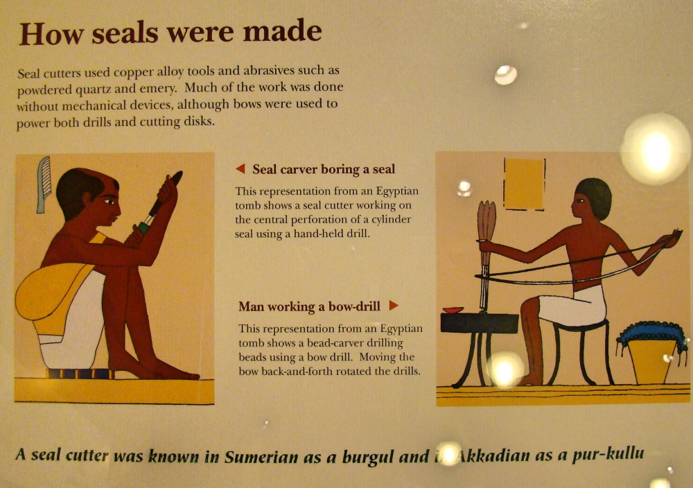
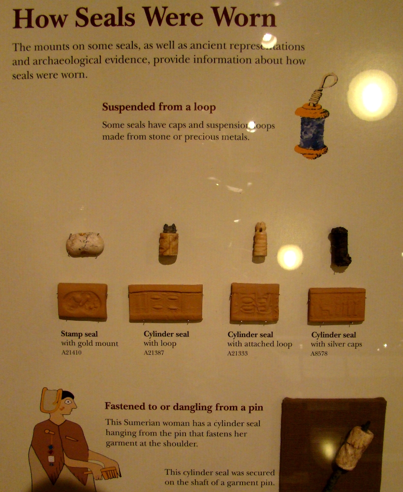
The Oriental Institute Museum of the University of Chicago has some helpful displays of ancient seals, how they were made, how worn, along with several examples of actual seals and their imprints.

How Seals Were Made. Oriental Museum Chicago. Photo by Leon Mauldin.

How Seals Were Made. Oriental Museum Chicago. Photo by Leon Mauldin.

Seals, How Worn.  Oriental Institute. Photo by Leon Mauldin.

Seals, How Worn. Oriental Institute. Photo by Leon Mauldin.

Note that this above display shows both the stamp seal as well as cylinder seal. The Hebrew word for seal, khotam or chotham, occurs twice in our text, characteristic of the parallelism of Hebrew poetry. The NET Bible renders the same word khotam as cylinder seal and then signet in the verse (Song of Solomon 8:6).

There were two kinds of cylinder seals in the ancient Near East, namely, those worn around one’s neck and those worn around one’s wrist. The typical Mesopotamian seal was mounted on a pin and hung on a string or necklace around one’s neck. The cylinder seal hung around one’s neck would, figuratively speaking, rest over the heart (metonymy of association). The Beloved wished to be to Solomon like a cylinder seal worn over his heart. She wanted to be as intimate with her lover as the seal worn by him (W. W. Hallo, “‘As the Seal Upon Thy Heart’: Glyptic Roles in the Biblical World,” BRev 2 [1985]: 26). (NET notes).

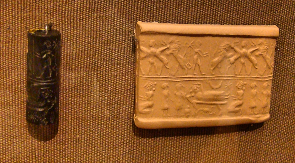
Seal on display, Oriental Institute. Photo by Leon Mauldin.

Seal on display, Oriental Institute. Photo by Leon Mauldin.

This cylinder above has a contest scene at top and what may be a childbirth scene at bottom.

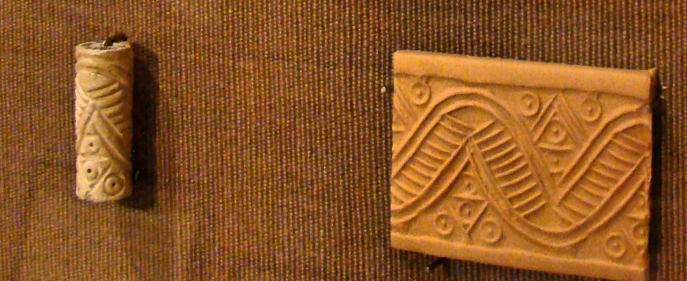
Ancient seal Oriental Institute. Photo by Leon Mauldin.

Ancient seal Oriental Institute. Photo by Leon Mauldin.

This seal is dated at 2,900-2,750 BC according to its accompanying placard.

More on Khotam:

Literally “cylinder-seal” or “seal.” The term (khotam, “cylinder-seal”) is repeated in Sol 8:6 for emphasis. The translation above uses the terms “cylinder seal” and “signet” simply for the sake of poetic variation. The Beloved wanted to be as safe and secure as a cylinder seal worn on the arm or around the neck, hanging down over the heart. She also wanted to be placed on his heart (emotions), like the impression of a cylinder seal is written on a document. She wanted to be “written” on his heart like the impression of a cylinder seal, and kept secure in his love as a signet ring is worn around his arm/hand to keep it safe. (NET notes).

Finally re: the word rendered “arm,” (Song of Solomon 8:6) zeroa:

Alternately, “wrist.” In Palestine cylinder seals were often hung on a bracelet worn around one’s wrist. The cylinder seal was mounted on a pin hanging from a bracelet. The cylinder seal in view in Song 8:6 could be a stamp seal hung from a bracelet of a type known from excavations in Israel. (NET notes).

Click images for larger view.


Setting of King Saul’s Final Battle

June 25, 2015

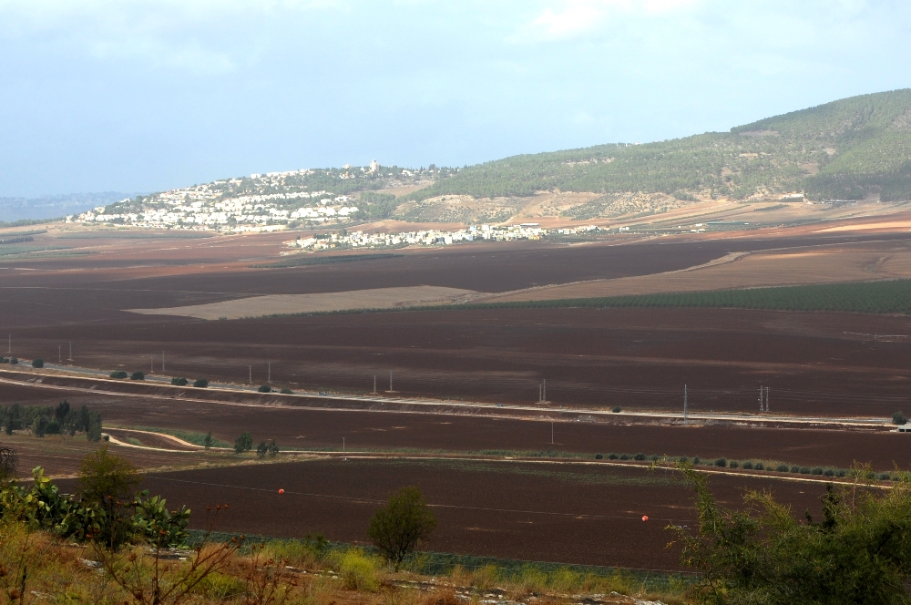
1 Sam. 28:4: “So the Philistines gathered together and came and camped in Shunem; and Saul gathered all Israel together and they camped in Gilboa.”

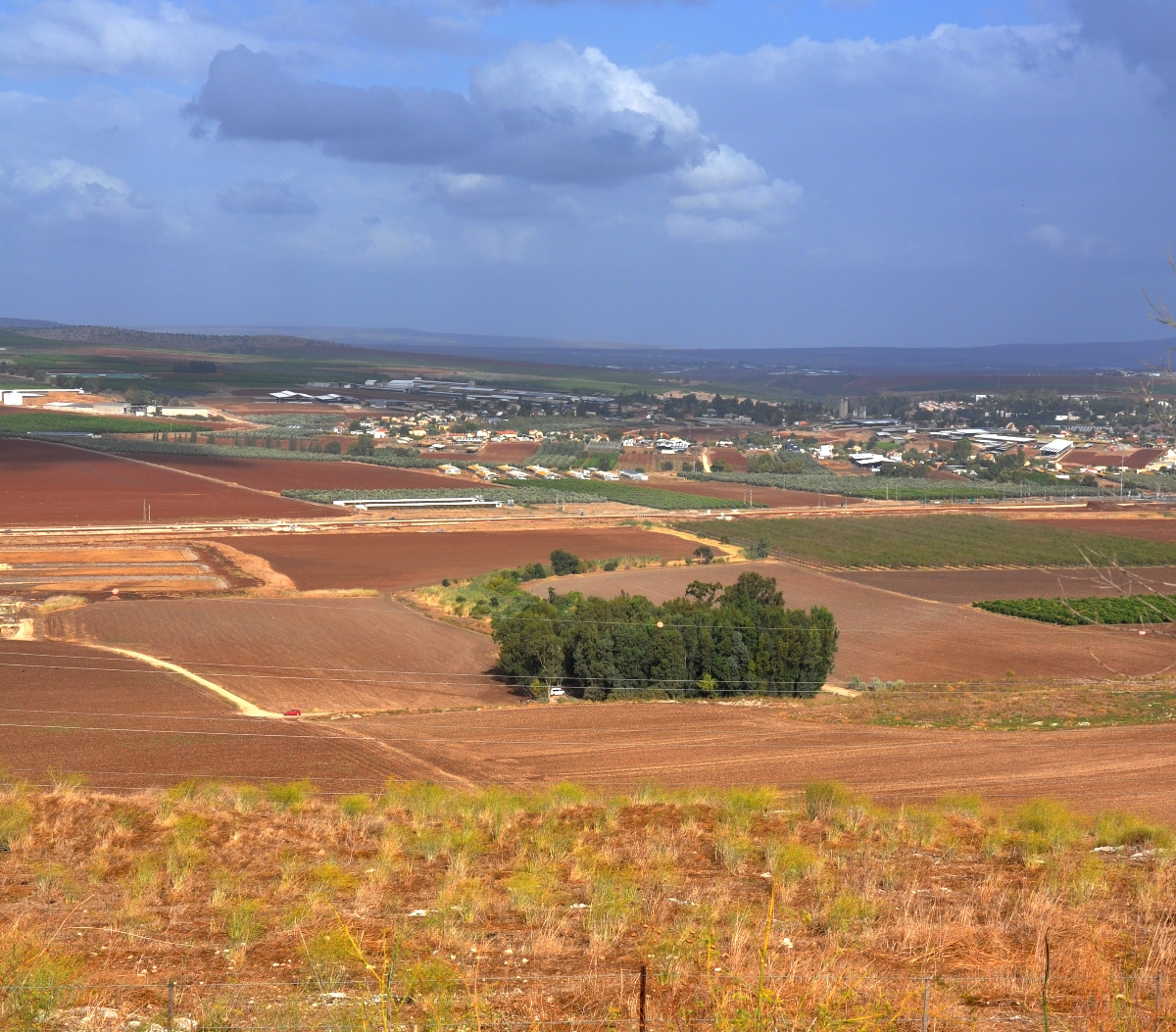
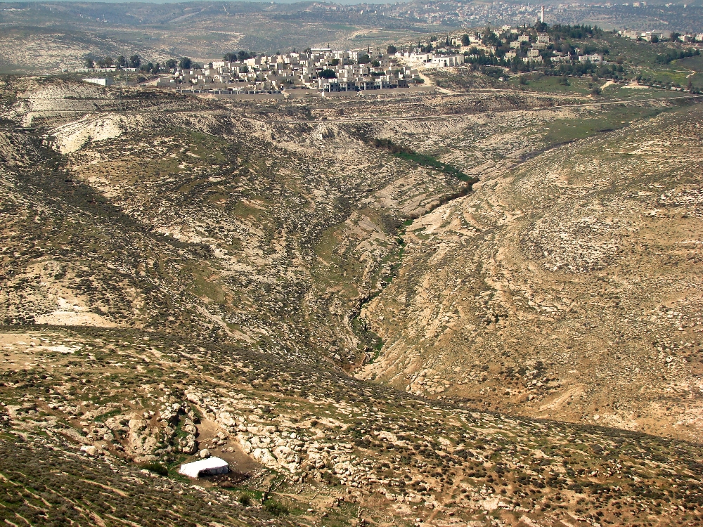
The horizontal cluster of white buildings in the upper center of photo mark the spot of ancient Shunem, the site of the Philistine encampment referenced in our text.

Shunem, note white buildings upper center. Photo by Leon Mauldin.

Shunem, note white buildings upper center. Photo by Leon Mauldin.

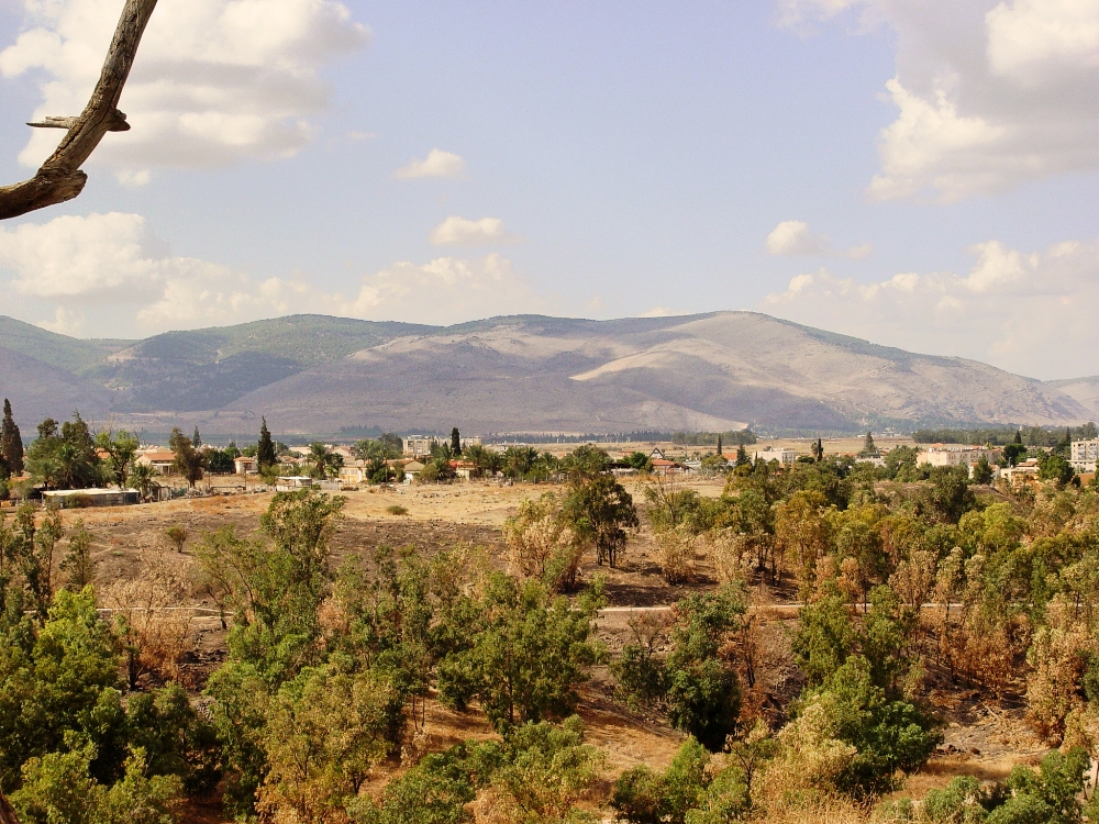
Saul and the forces of Israel were encamped at Gilboa. This view of Gilboa is from Beth Shan.

Gilboa as seen from Beth Shan. Photo by Leon Mauldin.

Gilboa as seen from Beth Shan. Photo by Leon Mauldin.

As the 1 Samuel narrative continues, the next chapter states, ” Now the Philistines gathered together all their armies to Aphek, while the Israelites were camping by the spring which is in Jezreel” (29:1) We have previously posted photos/articles on Aphek here and here, where the Philistines at this time gathered all their armies. At Jezreel one can see the spring mentioned here in 1 Sam. 29:1.

Jezreel Spring. Note greenery at center.  Tel Jezreel is in foreground. Photo by Leon Mauldin.

Jezreel Spring. Note greenery at center. Tel Jezreel is in foreground. Photo by Leon Mauldin.

Saul and his three sons (including David’s best friend Jonathan) died at Mt. Gilboa, a great victory for the Philistines. It was a sad day for Israel:

8 It came about on the next day when the Philistines came to strip the slain, that they found Saul and his three sons fallen on Mount Gilboa. 9 They cut off his head and stripped off his weapons, and sent them throughout the land of the Philistines, to carry the good news to the house of their idols and to the people. 10 They put his weapons in the temple of Ashtaroth, and they fastened his body to the wall of Beth-shan. (1 Sam. 31:8-10).

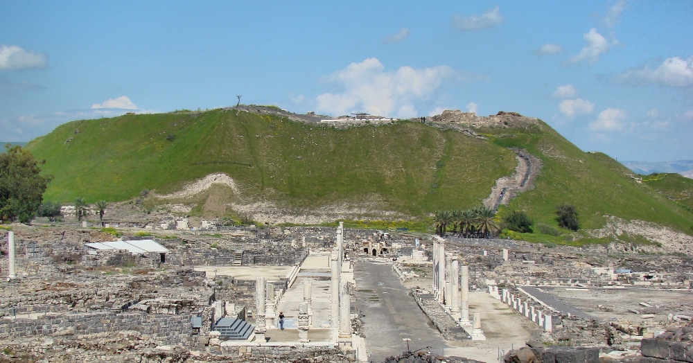
We are told that also the bodies of Saul’s sons were nailed to the walls of Beth Shan (1 Sam. 31:12).

Beth Shan, where the Philistines nailed the bodies of Saul & sons. Photo by Leon Mauldin.

Beth Shan, where the Philistines nailed the bodies of Saul & sons. Photo by Leon Mauldin.

These photos may be used along with maps to show where the events of 1 Sam. 28-31 transpired. Click on images for larger view.


The Brook Besor

June 9, 2015

1 Samuel 18-31 details an extensive period of David’s life when his major concern was escaping King Saul’s efforts to kill him. At one point David left Israel’s territory to live in Philistia, where he and his men were given the city of Ziklag. While David was away, Amalekites invaded the South including Ziklag (1 Sam. 30:1). They burned the city, and took the women and children as captives. Upon returning and learning what had transpired, David and his men pursued. The text states:

So David went, he and the six hundred men who were with him, and came to the Brook Besor, where those stayed who were left behind. 10 But David pursued, he and four hundred men; for two hundred stayed behind, who were so weary that they could not cross the Brook Besor (1 Sam. 30:9-10).

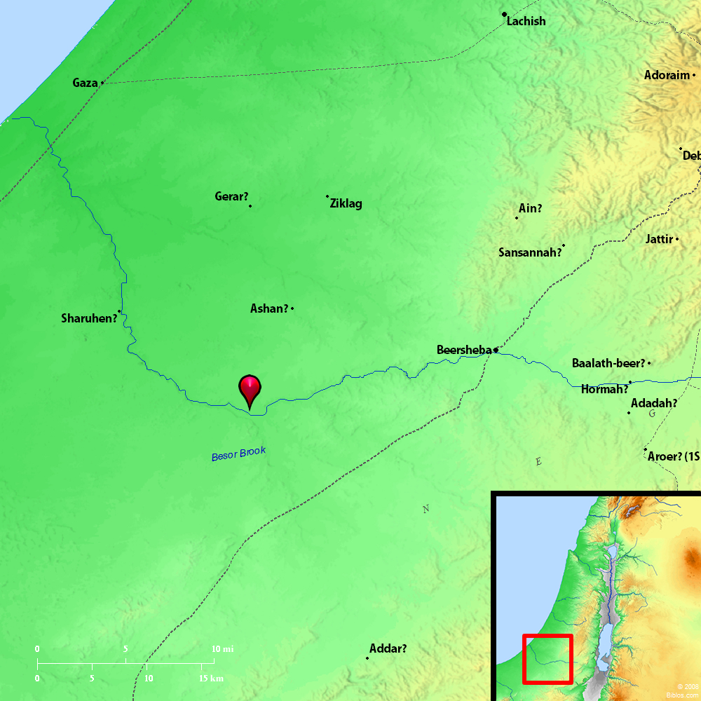
Brook Besor. Map by BibleAtlas.org.

Brook Besor. Map by BibleAtlas.org.

The Brook Besor, mentioned in the text, has been identified as Wâdī Ghazzleh, and empties into the Mediterranean south of Gaza.

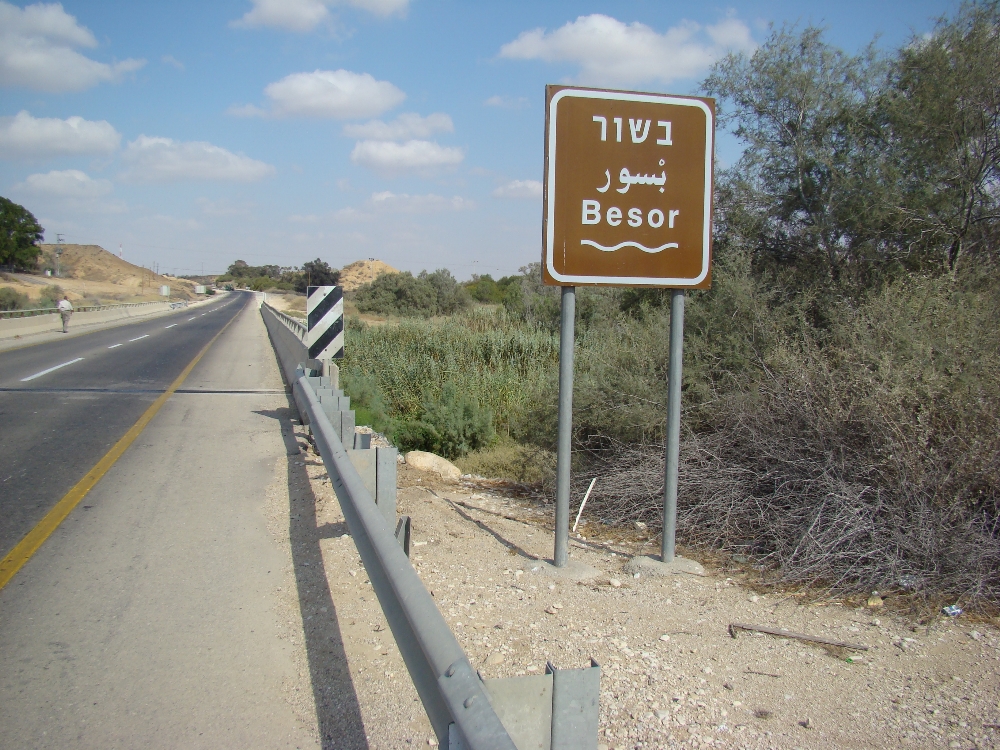
Bridge crossing the Besor. Photo by Leon Mauldin.

Bridge crossing the Besor. Photo by Leon Mauldin.

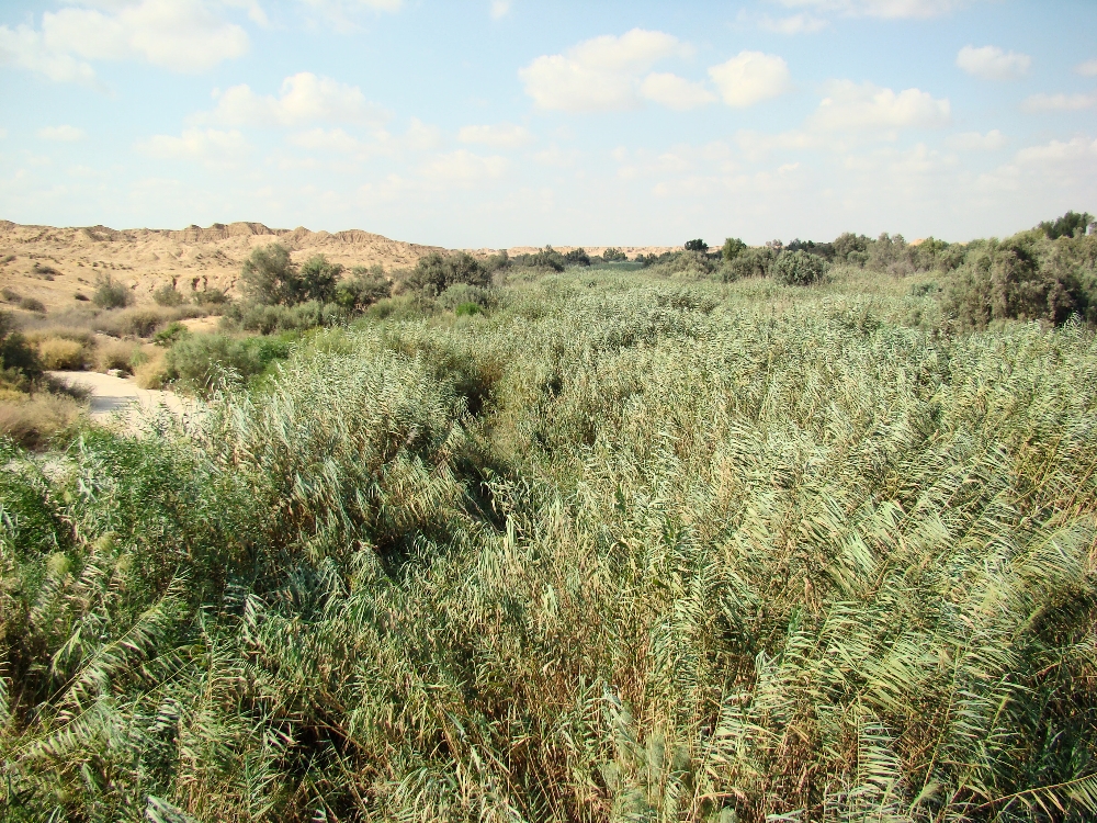
The brook is mostly filled with reeds.

Brook Besor. View from bridge. Photo by Leon Mauldin.

Brook Besor. View from bridge. Photo by Leon Mauldin.

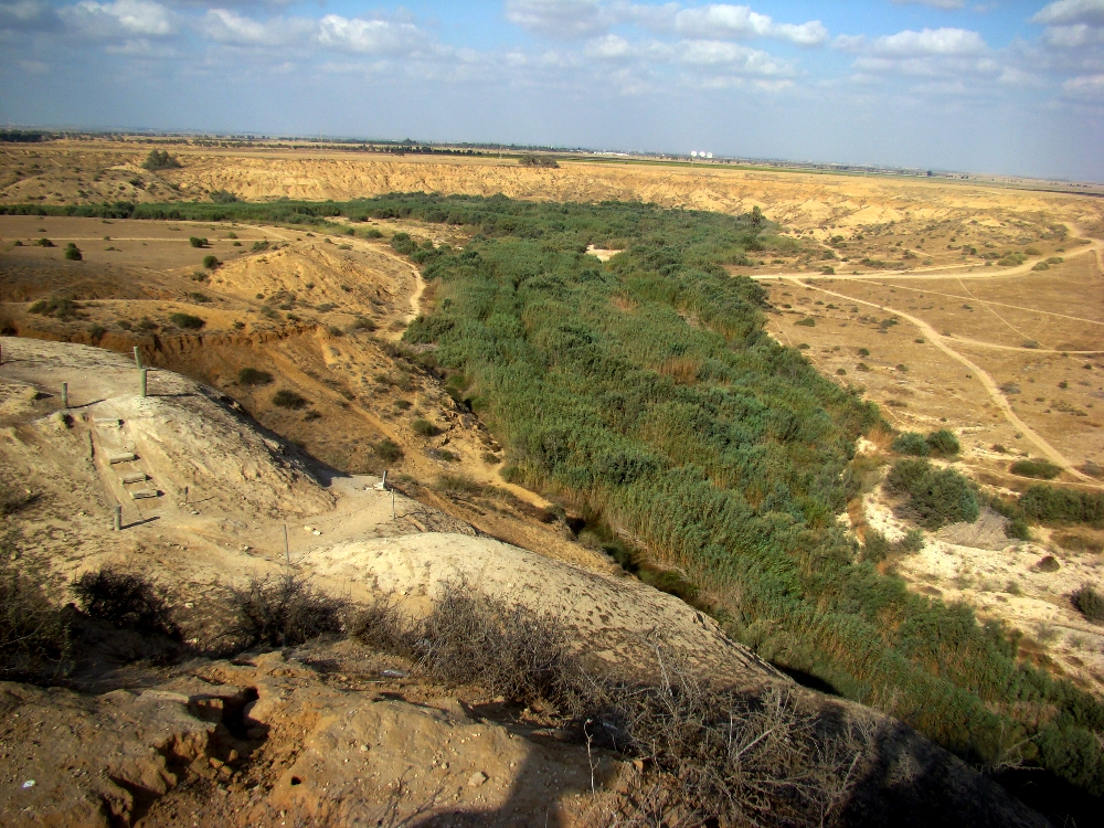
Here is a view from the tel at Besor. The green vegetation in a desert area is always an indication of water.

Besor. View from tel. Photo by Leon Mauldin.

Besor. View from tel. Photo by Leon Mauldin.

The text goes on to state that David and the 400 men who were able to pursue were successful in their recovery of persons and possessions (1 Sam. 30:11-20). Upon returning to the Brook Besor, here’s what happened:

Now David came to the two hundred men who had been so weary that they could not follow David, whom they also had made to stay at the Brook Besor. So they went out to meet David and to meet the people who were with him. And when David came near the people, he greeted them. 22 Then all the wicked and worthless men of those who went with David answered and said, “Because they did not go with us, we will not give them any of the spoil that we have recovered, except for every man’s wife and children, that they may lead them away and depart.” 23 But David said, “My brethren, you shall not do so with what the LORD has given us, who has preserved us and delivered into our hand the troop that came against us. 24 “For who will heed you in this matter? But as his part is who goes down to the battle, so shall his part be who stays by the supplies; they shall share alike.” 25 So it was, from that day forward; he made it a statute and an ordinance for Israel to this day (1 Sam. 30:21-25).

It is exciting as well as educational to see such landmarks as the Brook Besor that are mentioned in the biblical text.

Click images for larger view.


Michmash, Site of Battle Israel vs Philistines

March 11, 2015

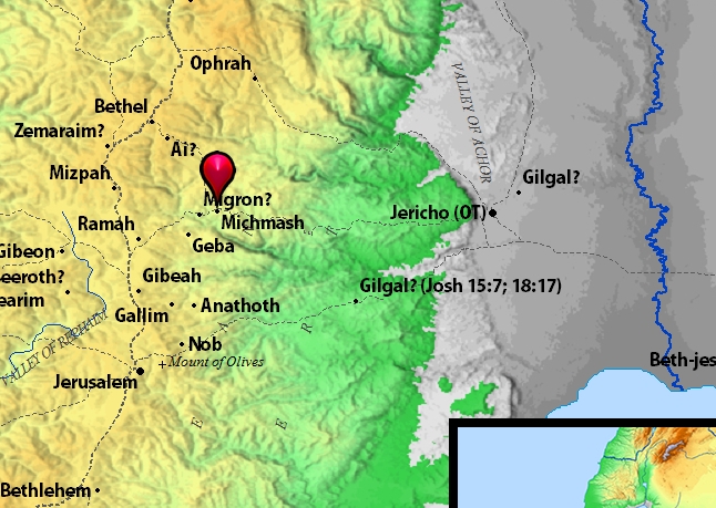
In the days of King Saul there was war between Israel and the Philistines. Whereas the Philistines’ territory was on the SW coast of Israel, at the time referenced in 1 Samuel 13-14 they were well advanced into Israel’s central territory and beyond. “Now a Philistine garrison took control of the pass at Michmash” (1 Sam. 13:23).

Philistines at Michmash. Map BibleAtlas.org.

Philistines at Michmash. Map BibleAtlas.org.

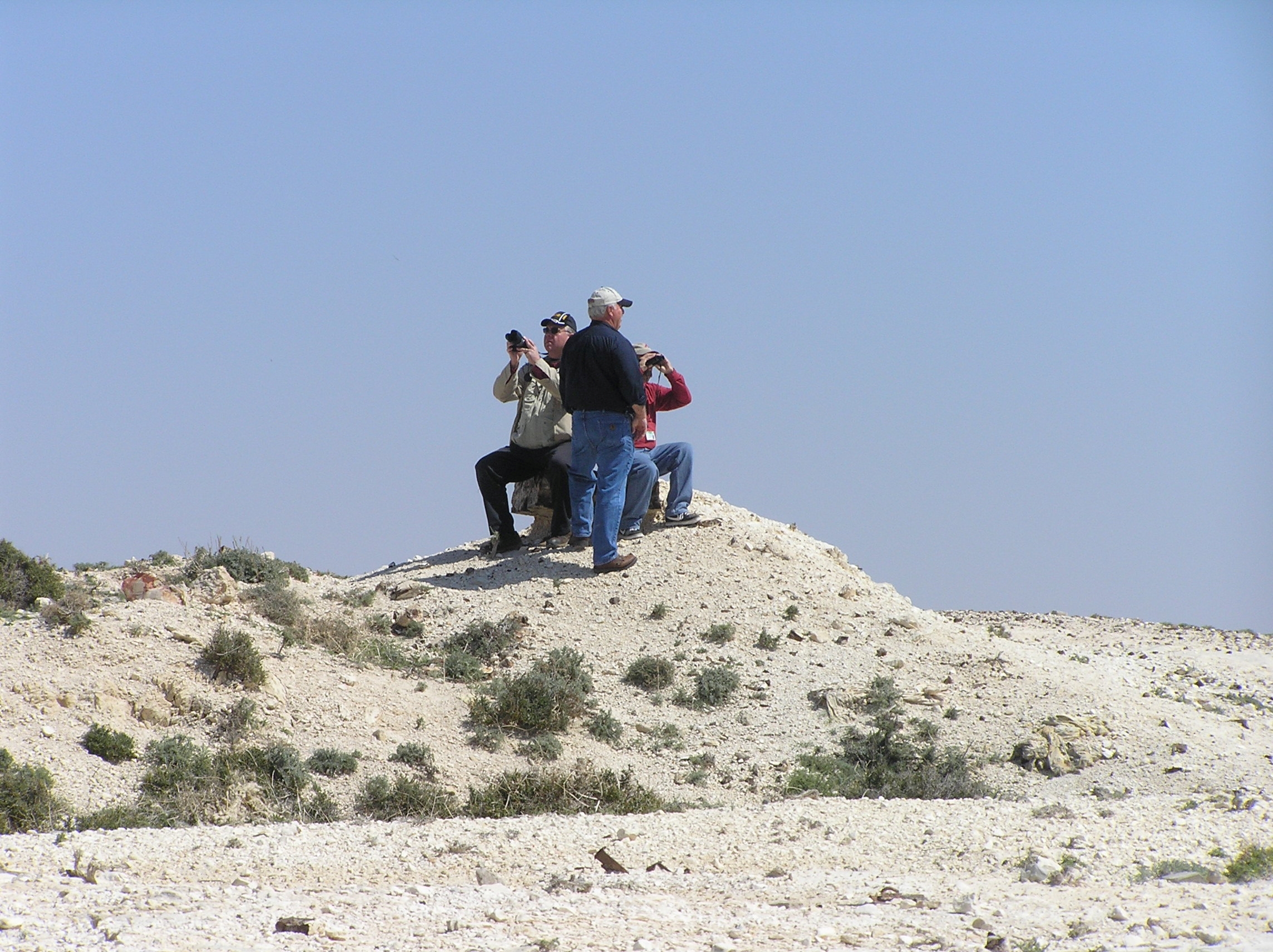
You have a great view of the territory from this high vantage point.

At Michmash. Leon Mauldin, left, Randy Parrish, center, Elie Ben Meir at right. Photo by Jenny Reed.

At Michmash. Leon Mauldin, left, Randy Parrish, center, Elie Ben Meir at right. Photo by Jenny Reed.

Saul’s son Jonathan and his armor-bearer took the initiative as they scaled up the steep bank and engaged the Philistines. They killed 20 men within a half-acre. Then the Philistines fled, pursued by Saul’s army.

This photo shows the area where the battle began. The modern town of Michmash may be seen the background.

Michmash, area of battle between Israel and Philistia. Photo by Leon Mauldin.

Michmash, area of battle between Israel and Philistia. Photo by Leon Mauldin.

See my previous post on Michmash here.

Dr. Carl Rasmussen has a very helpful post on these events at Michmash here.

Click images for larger view.


View from Roman Forum in Athens Greece

February 10, 2015

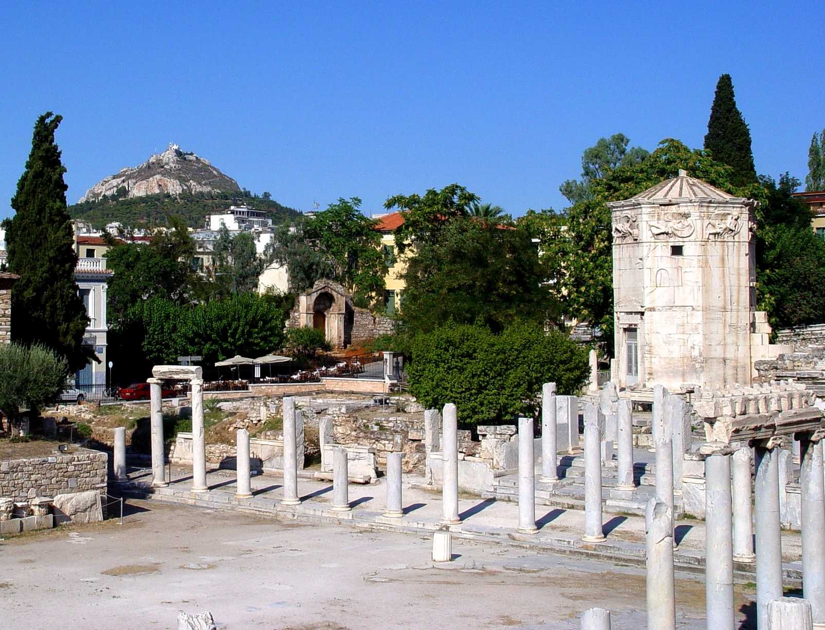
Yesterday we had another view down the south side of the acropolis in Athens, Greece. Now we move to the north side, down below the acropolis, to the Roman Forum. In our photo here you can see a portion of the forum, the Tower of the Winds (right), and to your distant left Mount Lykavittos.

Roman Forum, Tower, and Mt. Lykavittos in Athens, Greece. Photo by Leon Mauldin.

Roman Forum, Tower, and Mt. Lykavittos in Athens, Greece. Photo by Leon Mauldin.

The Tower of the Winds has an interesting history:

The Tower of the Winds stands in the Pláka below the north side of the Acropolis. In the planning of the modern city of Athens in the 19th century. Eólou Street, named after the wind god Ailos, was aligned directly on the tower, which forms a landmark at its southern end.

Built about 40 B.C., the tower is an octagonal structure 12m/40ft high, with sundials on the external walls; it originally housed a water-clock.

Around the top runs a frieze with reliefs representing the eight wind gods – the beardless Notos, pouring out rain from an urn (south); Lips, holding the stern ornament of a ship (southwest); Zephyros, a youth scattering flowers (west); Sykron the bringer of snow (northwest); the bearded Boreas, blowing into a shell (north); Kaikias, also bearded, the bringer of hail (northeast); Apeliotes, a young man bearing ears of corn and fruit (east); and Euros, wrapped in a cloak (southeast).

To the south of the tower is a building of the Roman period (first century A.D.) with the springing points of arches. Its function is uncertain (office of the market police, Caesareum?).

Adjoining the entrance to the excavated area is a marble latrine with seating for nearly 70.

The water-clock is located outside the western entrance to the Roman Market. It served as a form of meteorological station by combining a sundial, a waterclock and a weathervane showing the direction of the wind.

The clock is commonly known as “Aerides” (the winds) (Planetware.com).

A highly visible landmark, Lykavittos, also known as Lykabettos, stands 227 meters/909 feet in altitude. It was:

once well outside Athens but now surrounded by the city on all sides, is the dominant hill in the plain of Attica. It is a hill of cretaceous chalk, covered with various species of plant life, and is a popular place to go to escape from the hurly-burly of city life. At the top stands the chapel dedicated to St George, from where there are extensive views of the whole city (Planetware.com).

Click photo for larger view. Use search box at upper right for more posts on Athens, as well as other biblical sites.


Sanctuary of Asclepius at Athens

January 31, 2015

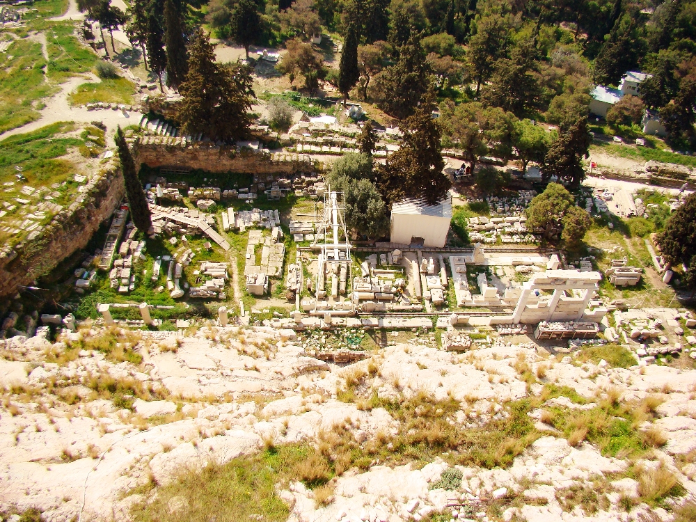
In biblical times, Asclepius was widely worshiped as the god of healing. As we continue our view down the southern slope of the Athenian acropolis, we can see the remains of the sanctuary of Asclepius.

Athen's Sanctuary of Asclepius, the god of healing. Photo by Leon Mauldin.

Sanctuary of Asclepius, the god of healing. Athens, Greece. Photo by Leon Mauldin.

Fant and Reddish observe, “Above the Stoa of Eumenes, and to the left (west) of the Theater of Dionysus, can be seen the scant remains of the Asclepeion, a center for healing run by the priests of Asclepius. The sacrificial altar remains, but it is difficult to discern amid the various stones currently being stored there” (A Guide to Biblical Sites in Greece and Turkey, p.26). (We should note that when they say “left” it is from the perspective of one who is down from the acropolis. When you’re on the acropolis looking down, the sanctuary would be to your right of the theater of Dionysus–LM). 

We have previous written on Asclepius here and here  regarding the famous healing center at Pergamum. Even in Israel there was a temple devoted to this god.

Planetware.com has this info:

On a narrow terrace above the Stoa of Eumenes, directly under the steep south face of the Acropolis, is the Asklepieion, the sanctuary of the healing god Asklepios, whose cult – initiated largely by Sophocles – was brought to Athens from Epidauros in 420 B.C. The sanctuary is centered on two sacred springs.

The earliest part of the sanctuary lay at the western end of the precinct, where there are the foundations of a stoa and a small temple. A number of herms have been brought together in the stoa. At the west end of the complex is a rectangular system with polygonal walls dating from the same period. To the south is a later cistern.

The buildings in the eastern part of the precinct were erected about 350 B.C. Immediately under the Acropolis rock, here hewn into a vertical face, is a stoa 50m/165ft long, originally two- storyed, designed to accommodate the sick who came here to seek a cure. Associated with it is the cave containing a spring which is still credited with healing powers; and accordingly the cave is now used as a chapel.

Parallel to this stoa, which was rebuilt in Roman times, another stoa was constructed, also in Roman times, on the southern edge of the precinct; of this second stoa some remains survive.
Both stoas faced towards the center of the precinct, in which stood the temple. This was oriented to the east and had four columns along the front (prostylos tetrastylos). The foundations of the temple and the altar which stood in front of it are still to be seen.
In early Christian times a basilica was built over the remains of the temple and the altar, and some architectural fragments from this can be seen lying about the site.

(http://www.planetware.com/athens/asklepieion-gr-ath-askle.htm)

Click on image for larger view.


Propylaea of Athens

January 23, 2015

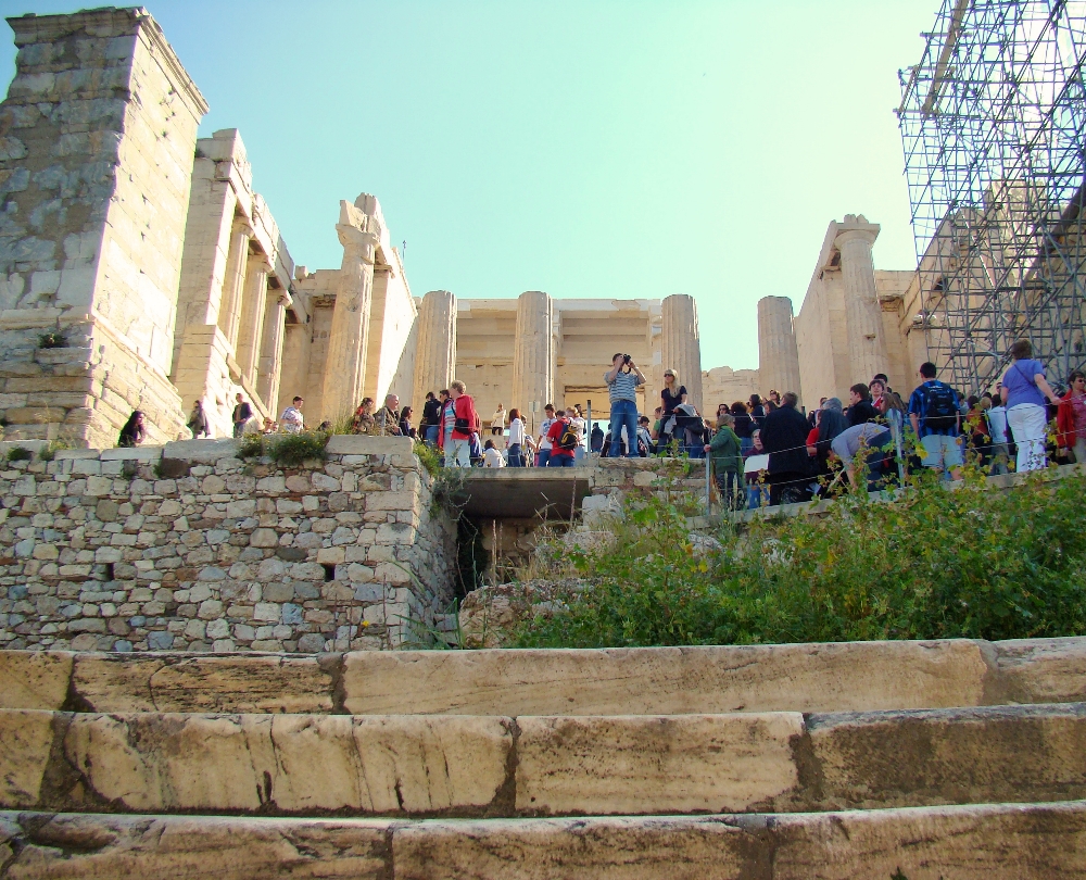
The Propylaea (entrance before the gate) still stands as the access to the Acropolis today. This monumental entrance gate was commissioned by the great statesman and builder of the Acropolis, Pericles. Construction was begun in 437 B.C.

Propylaea leading to Athens Acropolis. Photo by Leon Mauldin.

Propylaea leading to Athens Acropolis. Photo by Leon Mauldin.

Fant and Reddish have this information:

The Propylaea (“before the gate”) visible today is the fourth of such structures to be built at this site; earlier ones were destroyed in various wars. The road from the agora below, the Panathenaic Way, led up to this point. A flight of marble steps ascends to the hall of the Propylaea. One step is of gray Eleusinian marble; the others are of white Pentelic marble. The monumental pedestal (25 feet tall) on the left of the steps originally was designed for a statue with a chariot and four horses to honor King Eumenes II of Pergamum for his contribution of the Stoa of Eumenes. Later it was reinscribed with a dedication to Marcus Agrippa in honor of the odeion he contributed to the agora. Designed by the architect Mnesicles and begun upon the completion of the Parthenon (437 B.C.E.), the Propylaea consisted of a central section with five doorways, originally fitted with wooden doors, and projecting wings on either side. The wing on the left side, the north wing, was known as the Pinakotheke, or art gallery, because of the magnificent collection of paintings inside. In 150 C.E. Pausanius named a number of the paintings he could recognize, including some by Polygnatus of Homer (5th century B.C.E.). The room was used for official banquets by dignitaries who reclined on couches in the Greek fashion. The wing on the right side, the south wing, could not match the other in design because of the Temple of Athena Nike and other buildings that impinged upon it. This wing was never completed due to the start of the Peloponnesian War (431 B.C.E.). (A Guide to Biblical Sites in Greece and Turkey).

We are looking forward to seeing Athens again in a couple of months.

Click image for larger view.


Aphek, Setting of 1 Samuel 4

December 31, 2014

1 Sam. 4:1 mentions a Philistine encampment at Aphek, when the Philistines drew up in battle array to meet Israel. Apparently the site of the battle itself was between Ebenezer and Aphek. Israel was defeated soundly in two back-to-back battles there. Our photo shows Aphek at bottom and left; view is from the south. As you look to the north you are seeing the Sharon plain. The modern highway at this point is following the route of the ancient Via Maris.

Aphek at lower left. View from south. Photo by Leon Mauldin.

Aphek at lower left. View from south. Photo by Leon Mauldin.

I earlier posted on Aphek here. Aphek became Antipatris by NT times (Acts 23:31). See also Ferrell Jenkins’ post here.

In Todd Bolen’s Pictorial Library of Bible Lands (#2, Samaria and the Center), Todd summarizes the History of the excavations at Aphek in his PowerPoint notes on “Sharon Plain” (slide 15): (BTW, I highly recommend this set!)

Aphek: History of the Excavation

1.In 1923, Albright’s survey confirmed identification of the site as Aphek.

2.From 1935 to 1936, J. Ory, an employee of the British Department of Antiquities, dug two test pits in two areas on the north side of the site, in connection with the British pumping station.

3.The Palestine Department of Antiquities excavated in 1946.

4.In 1961, A. Eitan excavated for the Israel Department of Antiquities.

5.From 1972 to 1985, a major excavation was carried out by Moshe Kochavi of Tel Aviv University.

Aphek has a fascinating history. The Archaeological Encyclopedia of the Holy Land (3rd ed.) has this info on Aphek/Antipatris:

An important station on the ancient Via Maris, mentioned in the list of Pharaoh Tuthmosis III. The King of Aphek was one of the 31 rulers of Canaan vanquished by Joshua (Josh. 12:18). The Philistines gathered their armies there to go into battle against Israel (1 Sam. 4:1; 29:1). Scholars believe that in both cases Aphek in the Sharon is referred to. In a later period the place is mentioned in one of the inscriptions of Esarhaddon, and also in a letter written in Aramaic that was sent to Pharaoh before the Babylonian conquest of Palestine.

Early in the Hellenistic period a fort on the border between the districts of Samaria and the Sharon was built at this place, then known as Pegai. John Hyrcanus I conquered it in about 132 BC. At that period it was also known as Arethusa, both names implying that it was built near rich sources of water, as indeed it was. After the conquest by Pompey in 63 BC the town of Arethusa was rebuilt. When Herod the Great ascended to the throne he built a new city at Arethusa, renaming it Antipatris, after his father Antipater. This new city became the center of a district with many prosperous villages. In the later Roman period it was named Antipatris Antoniniana, probably after Elagabalus. The Mishna mentions it under the name of Mei Piga, the Waters of Piga.

Aphek-Antipatris is identified with Tell Ras el-Ain, which is rich in springs and vegetation. The sizeable mound is now occupied by a large Turkish citadel, built on the remains of a Crusader castle. Trial digs unearthed remains from the Bronze Age to the Roman period, including a large Roman mausoleum.

Extensive excavations were carried out on the site in the years 1974–84 by M. Kochavi on behalf of Tel Aviv University and American archaeological institutions. The earliest remains on the site are those of a city wall of the Early Bronze Age found in the northern part of the mound. On the acropolis on the western part of the mound were discovered a series of palaces. The earliest of these palaces belongs to the Middle Bronze Age IIA. Its walls are 4 feet thick, and are still standing to a height of 5 feet. The palace consists of a central hall with a roof supported by two columns. Numerous rooms are grouped around this spacious hall. It was destroyed by a fierce fire in the middle of the 16th century BC. Two city walls also belong to this period. Above this palace another, larger palace was built in the Late Bronze Age. This spacious building contained numerous rooms; a staircase tower gave access to the rooms on the upper story, where the princes of Aphek lived. North of the palace was a spacious court, and another service building east of it. Wine presses discovered nearby and numerous grape pips uncovered in the ruins of the palace attest to the existence of a wine industry. In the ruins of the palace were discovered Egyptian, Hittite and Accadian documents, among them a cuneiform bilingual, Sumerian-Accadian dictionary, and a fragment of a trilingual Sumerian-Accadian-Canaanite dictionary. This is the only known multilingual dictionary which includes the Canaanite language. Most of these documents date from the 14th–13th centuries BC. The acropolis was destroyed at the end of the 13th century BC. Scanty occupation remains are found from the end of the Late Bronze Age. A small faience plaque discovered in the Early Iron Age level bears the names of Pharaoh Rameses II written in ink and a dedication to the goddess Isis, indicating the possible existence of a temple dedicated to this goddess. In the 12th century BC Aphek was occupied by the Philistines. The new city consisted of various quarters each built according to a different plan and different standard of construction, and each apparently inhabited by a different class of citizens. The houses were almost square and consisted of a large front hall with smaller rooms in the rear. The poorer houses were oblong structures, set closely together, and built with thin walls. In this quarter were discovered fishing-net weights, copper fishing hooks and tortoise shells. Numerous storage bins from the 10th century BC, the Israelite period, testify to the conquest of the site by David. Two levels containing dwellings were found from the time of the United Kingdom. Above the ruins of the Middle Bronze Age II palace were discovered two Israelite houses of the four-room type, from the 10th and 8th centuries BC.

In the higher levels of the mound Ptolemaic, Seleucid, Hasmonean and Herodian levels were encountered. In the Herodian period the city was laid out along a new plan. At the junction of the main streets was the forum; it was rebuilt in the Late Roman period. One of the streets leading to the forum was lined with shops. In the time of Herod Agrippa I the street was repaved and workshops were built along it. The city declined after the fall of the Second Temple and was not rebuilt before the 2nd century AD. From the Roman period large sections of the cardo, the main street, were discovered. A theater stood at the southern end of the street. From this period a market and a quarter for the wealthier citizens were also found. In AD 363 the entire city was destroyed in an earthquake.

Click image for larger view. Happy New Year!

Ekron, a City of the Philistine Pentapolis

December 30, 2014

I love to study 1 Samuel, though there is much sadness in it. For example, in the days of the Judges when the Philistines defeated Israel at Aphek, God allowed the Philistines to take the Ark of the Covenant (1 Sam. 4:11). Contextually, God permitted this because of Israel’s apostasy.

Meanwhile the Philistines triumphantly took the Ark to the house of their god Dagon at Ashdod. The god was providentially broken, and the residents of Ashdod became sick, so they moved it to Gath, with the same results there; tumors broke out on them (1 Sam. 5:1-9). Next it was moved to Ekron: “So they sent the ark of God to Ekron. And as the ark of God came to Ekron the Ekronites cried out, saying, ‘They have brought the ark of the God of Israel around to us, to kill us and our people'” (v.10).

The next chapter (1 Sam. 6) narrates how the Philistines had kept the Ark to their full satisfaction (!), and thus returned it to Israel’s territory.

I had the opportunity (along with Ferrell Jenkins) to make a personal study trip to Israel in 2009 that included Ekron, Tel Miqne.

Ekron info sign at site. Photo by Leon Mauldin.

Ekron info sign at site. Photo by Leon Mauldin.

Though originally in Israel’s territory at the time of the Conquest led by Joshua (Josh. 15:11, 45-56), Ekron was later in the hands of the Philistines by the time of the Judges. Ekron was one of five cities of the Philistine Pentapolis: Ashdod, Gaza, Ashkelon, Gath and Ekron (1 Sam. 6:16).

Map here shows location of Ekron:

Ekron. Map by BibleAtlas.Org.

Ekron. Map by BibleAtlas.Org.

Ekron is a large tel, composed of about 50 acres. It was known for its olive oil industry.

Remnants of olive presses at Ekron. Photo by Leon Mauldin.

Remnants of olive oil industry at Ekron. Photo by Leon Mauldin.

Holman Illustrated Bible Dictionary has this information on Ekron:

Northernmost of the five major Philistine cities known as the Pentapolis. The site of ancient Ekron has been much debated but now is generally agreed to be modern Tell Miqne, about 14 miles inland from the Mediterranean Sea and 10 miles from Ashdod. The site is one of the largest in Palestine, covering some 50 acres. Ekron lies on the road leading from Ashdod into the Judean hill country and up to Jerusalem through the Sorek Valley.

Ekron was assigned to both Judah (Josh. 15:11, 45–46) and Dan (Josh. 19:43) in the tribal allotments. It probably lay on the border between the tribes. Judges 1:18 reports that Judah captured Ekron along with other parts of the Philistine coast, but Ekron was certainly in Philistine hands at the time the ark was captured (1 Sam. 5:10). It was also the place to which the Philistines retreated after David slew Goliath (1 Sam. 17:52). Ahaziah, the son of King Ahab of Israel, called on the god of Ekron, Baal-zebub, when he was sick (2 Kings 1:2–16).

Excavations at Tell Miqne have discovered much pottery that is typically Philistine. From the last period before Tell Miqne was destroyed by the Babylonians, the excavators found an important industrial complex near the city gate. A hoard of iron agricultural tools was found. Hundreds of whole pottery vessels were present. Perhaps most importantly, a well-preserved olive press was discovered. This press is the largest and best preserved known in Israel. A horned altar was also found during the excavations. (pp. 469–470).

Click on images for larger view. Happy New Year!