2 Kings 15:1-7 summarizes the reign of Judah’s good King Uzziah (Azzariah), who reigned 790-740 BC. The parallel in 2 Chronicles 26 gives much more information. There his successful wars with the Philistine and Arabians are recorded. He fortified the walls of Jerusalem. Also he constructed towers in the desert and dug many wells, which promoted agriculture & vine growing. The explanation is given, “for he loved the soil” (2 Chron. 26:10). Azariah also had an organized army of 307,500 (2 Chron. 26:13). Indeed, his “fame spread far and wide, for he was marvelously helped till he became strong” (2 Chron. 26:15).
The next verse however, begins with the word “But.” “But when he became strong, his heart was so proud that he acted corruptly, and he was unfaithful to the LORD his God, for he entered the temple of the LORD to burn incense on the altar of incense” (2 Chron. 26:16). Because of this presumption (only the Levitical priests were authorized to do this; Uzziah was of the tribe of Judah), God struck him with leprosy. “King Uzziah was a leper to the day of his death; and he lived in a separate house” (v.21). When Uzziah died, “they buried him with his fathers in the field of the grave which belonged to the kings” (v.23). I.e., he was not buried in the tomb of the kings, because he was a leper. He was buried in the field.
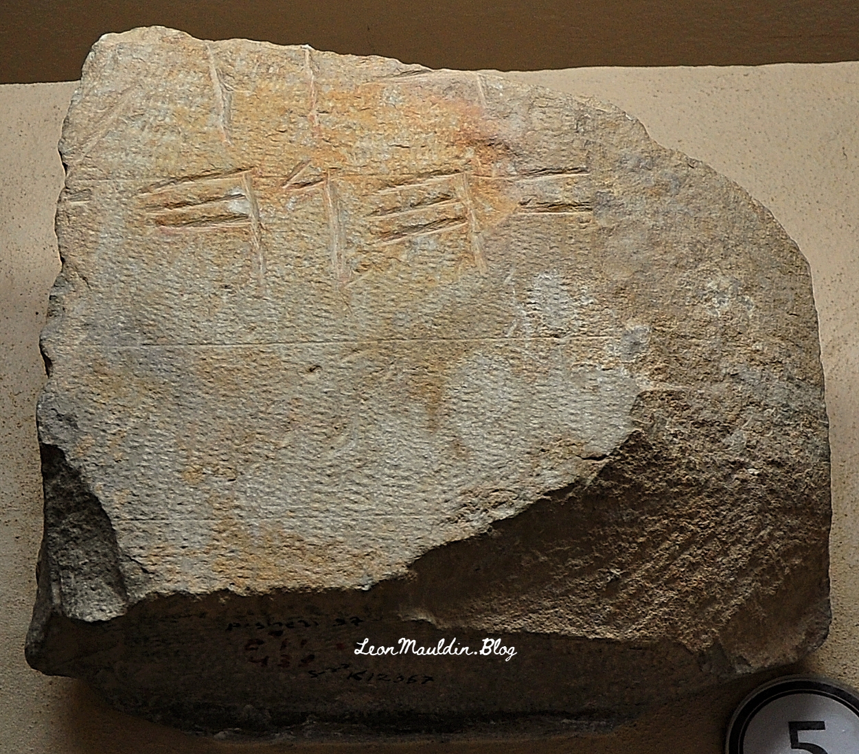
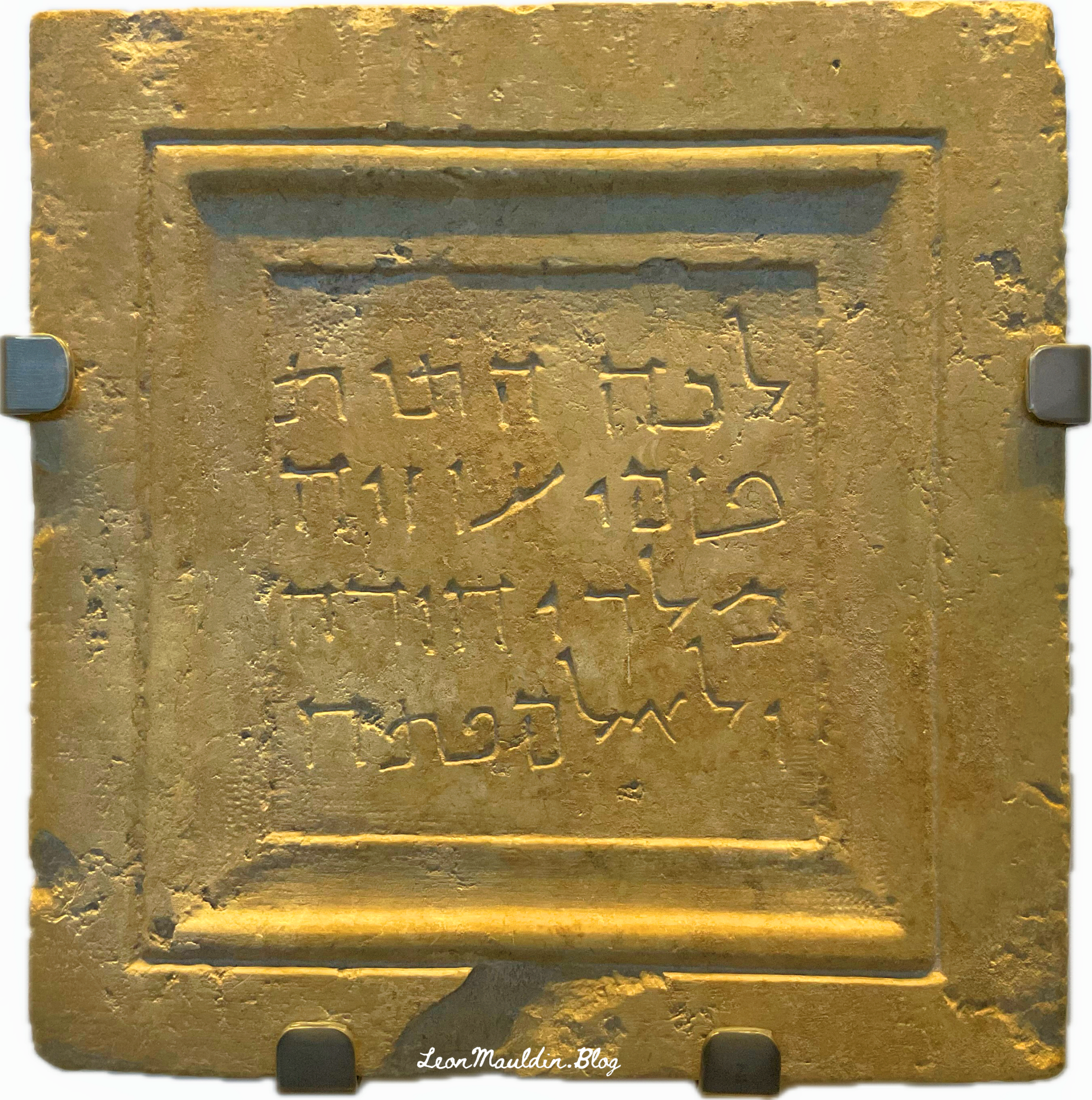
When the city of Jerusalem expanded, the remains of King Uzziah were reinterred. This fascinating grave marker marked the spot of the new burial of Uzziah. The inscription reads, “To this place were brought the bones of Uzziah, king of Judah. Do not open!” This marker is dated ca. 1st century BC.
Linguists tell us that it is written in Aramaic script of the type which was used about the time of Christ. Uzziah, however, was reigning as king of Judah about 775 B.C. II Chronicles 26 describes his successful reign in some detail—how he equipped a large standing army and made war successfully against the Philistines and the Arabians, regaining control of the trade routes to Egypt and to the Red Sea, but how he was stricken with leprosy, died, and was “buried with his fathers in the field of burial which belonged to the kings.” The inscription on the slab dates over six or seven hundred years after his death. It would seem that for one reason or another the traditional grave of Uzziah was cleared, and the bones which were found were gathered up and deposited in a new mausoleum. The gravestone is exceedingly interesting, for one thing because it shows the reverence paid even two thousand years ago to the graves of great men of the past, and also because it has on it the longest connected Aramaic inscription of the time of Christ, and shows the way in which the language commonly spoken in Palestine at that time was written. (Biblical Archaeologist 1-4).
The Lexham Bible Dictionary has the following info:
The Uzziah Inscription The (Aramaic) Uzziah Inscription reads, “Hither were brought the bones of Uzziah, King of Judah. Do not open” (Bahat, Atlas, 50). From the style of the inscription, Uzziah’s bones seem to have been reburied during the Second Temple period. Uzziah was apparently buried separately from the other kings of Judah, as the Chronicler states, “they buried him with his fathers in the field of the grave which belonged to the kings, for they said, “He is a leper’ ” (2 Chr 26:23). Josephus notes that “he was buried by himself in his own gardens” (Josephus, Antiquities 9:227). The exact location is unknown; the inscription itself was brought, without noting its place of origin, to the Russian Church on the Mount of Olives during the nineteenth century. In 1968, the Israel Museum purchased the stone, which is still displayed at the museum. (Udd, K. J. Funerary Inscriptions of Ancient Palestine. The Lexham Bible Dictionary)
This important artifact is housed in the Israel Museum in Jerusalem.
This is an apt title for a book authored by M.B. Van’t Veer, a 440-page work that focuses on the text of 1 Kings 16:34-19:21. The days of Elijah, when Ahab and Jezebel ruled Israel, were times of unprecedented corruption. God raised up Elijah to show the awesome power of Israel’s true God YAHWEH, and the power of His word. Great emphasis and purposeful repetition is given in this section of scripture on “the word of the LORD.” Elijah was unapologetically His spokesman; his very name means, “My God is YAHWEH”! The name YAHWEH, in Paleo-Hebrew script, is on the inscription here below:
Paleo-Hebrew Inscription with divine name YAHWEH. From Mt. Gerizim. Photo by Leon Mauldin.
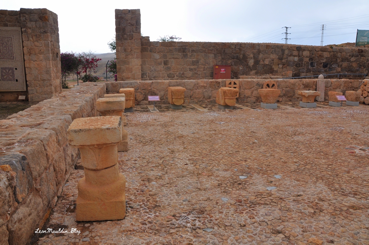
The above inscription is displayed at the Good Samaritan Museum, located between Jericho and Jerusalem.
Church at Good Samaritan Inn.
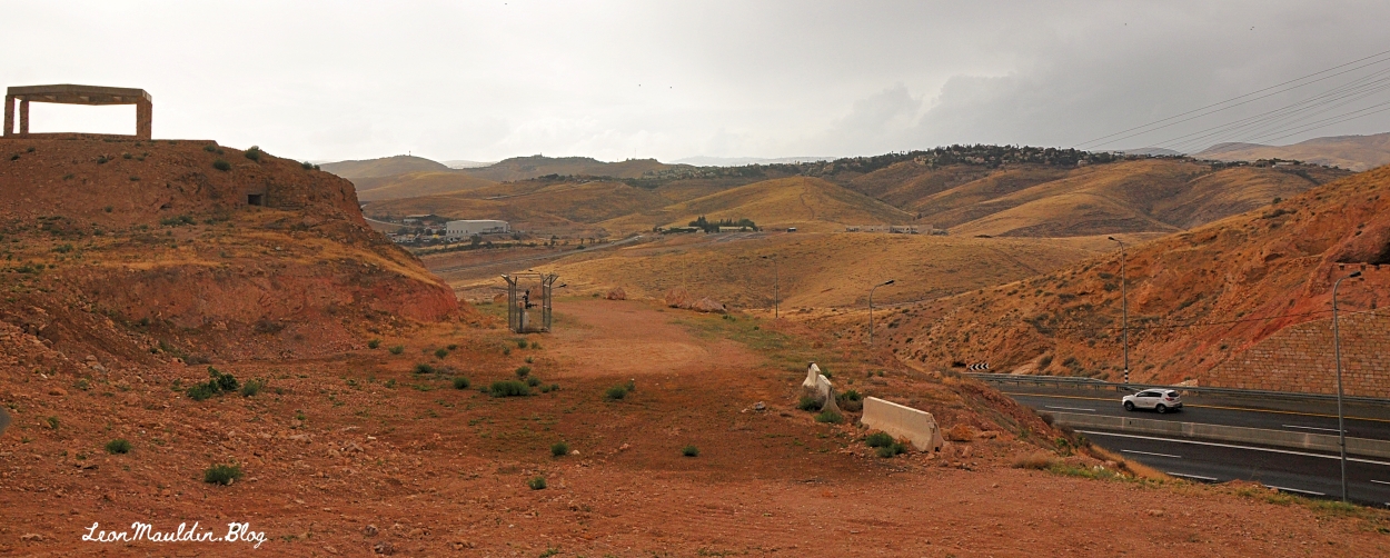
Here is the view from the Good Samaritan Inn looking toward Jerusalem:
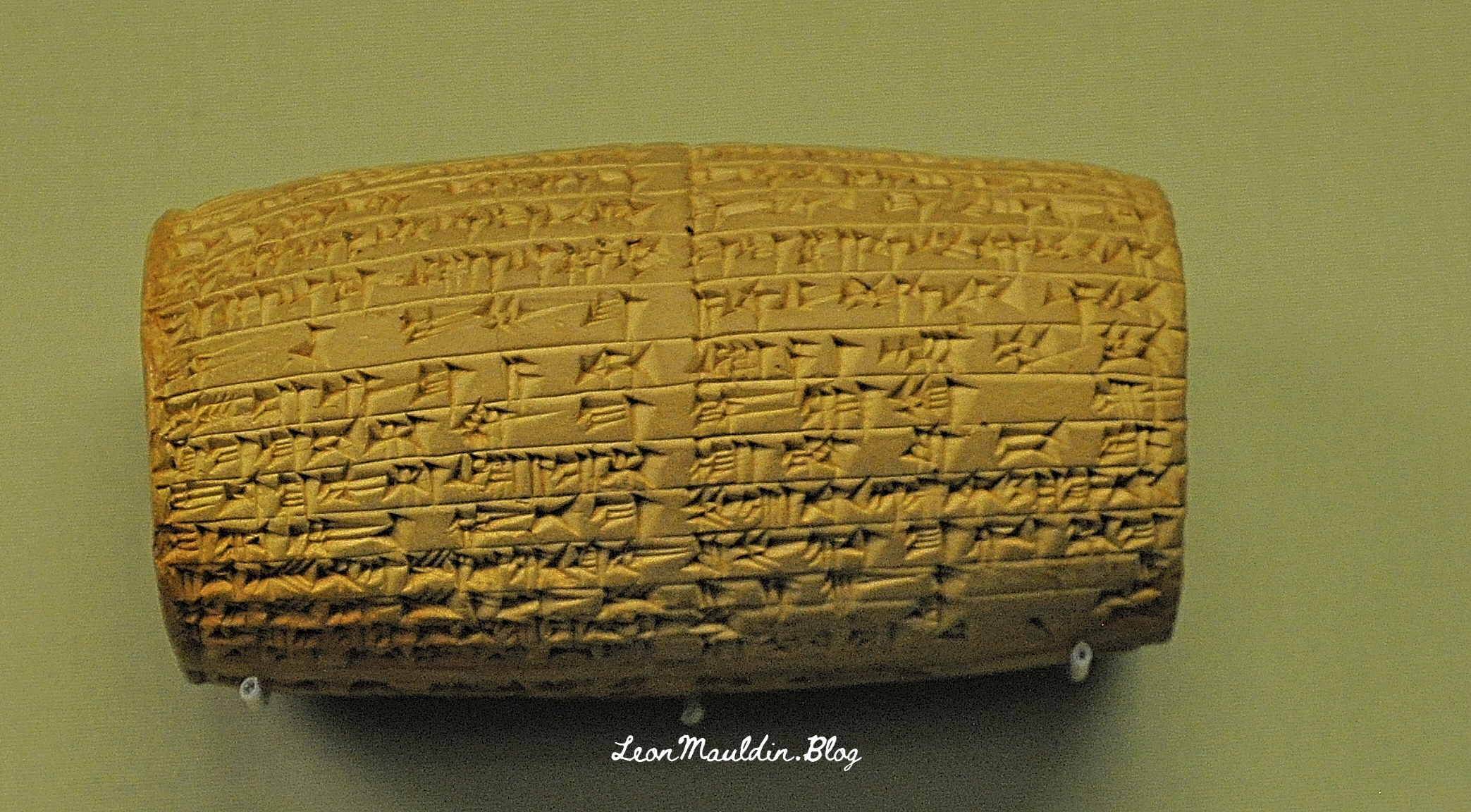
Daniel 8 gives the chronological notation of Daniel’s vision as the third year of the reign of King Belshazzar. Because it was known that Nabonidus (r. 556-539 BC) was Babylon’s last king, many “scholars” thought that Belshazzar was just a figment of the author’s imagination. But archaeologists uncovered clay cylinders in southern Iraq, written in cuneiform, which shed light on this matter. The answer turned out to be that Belshazzar shared a co-regency with his father Nabonidus.
This cylinder records the restoration of Sin’s ziggurat at Ur. Sin was the Babylonian moon god. The inscription also includes the request that the god would protect Nabonidus and his son, Belshazzar.
It was this king, Belshazzar, that saw the “handwriting on the wall” (Dan. 5). Note that the events of Daniel 5 are after those of chapter 8.
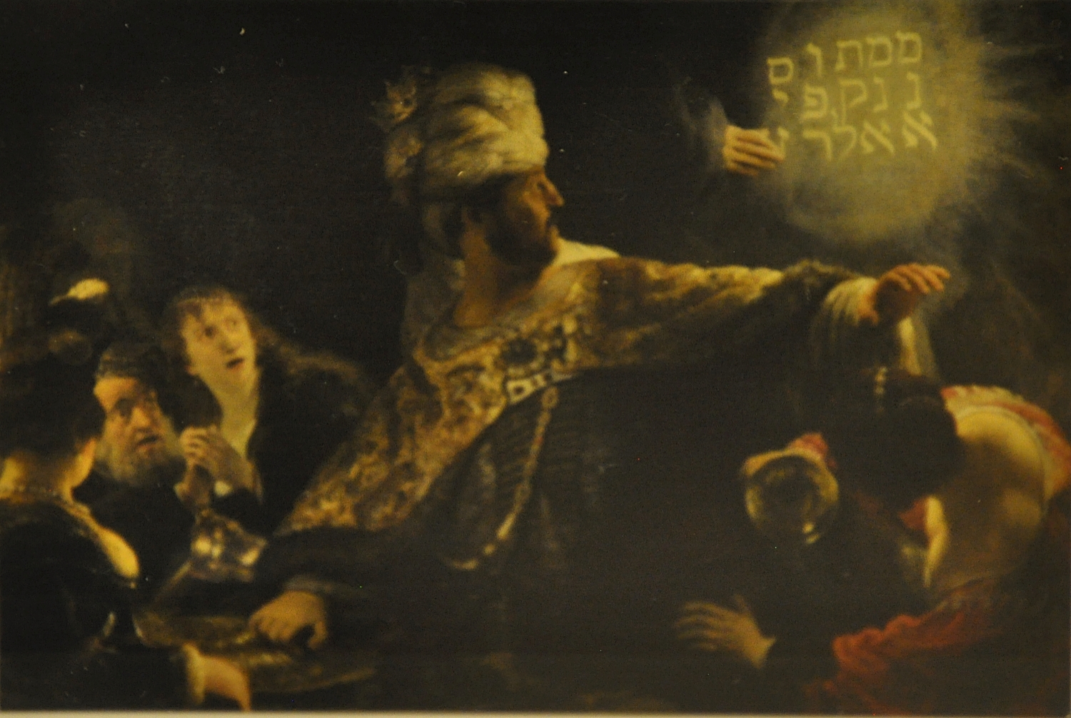
The writing depicted in Rembrandt’s artwork is from Daniel 5:25 (he painted the Hebrew letters vertically) “Mene, Mene, Tekel, Upharsin.” מְנֵ֥א מְנֵ֖א תְּקֵ֥ל וּפַרְסִֽין God has numbered your kingdom, and finished it. You have been weighed in the balances, and found wanting. Your kingdom has been divided, and given to the Medes and Persians. (Dan. 5:26-28).
Belshazzar had promised Daniel that he would be “third ruler in the kingdom” if he could interpret the writing (Dan. 5:16). Why third? That makes perfect sense since we now know that Belshazzar had “second place” as co-regent with his father; the next highest position would be third place. Though Daniel interpreted the writing, he cared nothing for the king’s reward: “Let your gifts be for yourself, and give your rewards to another” (v.17).
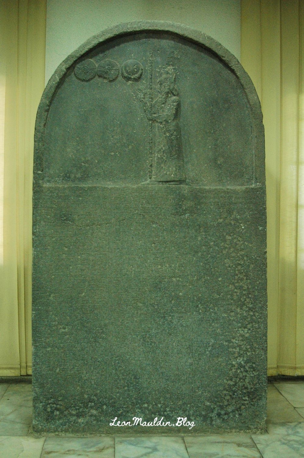
Here below we see a stele of King Nabonidus, father of King Belshazzar:
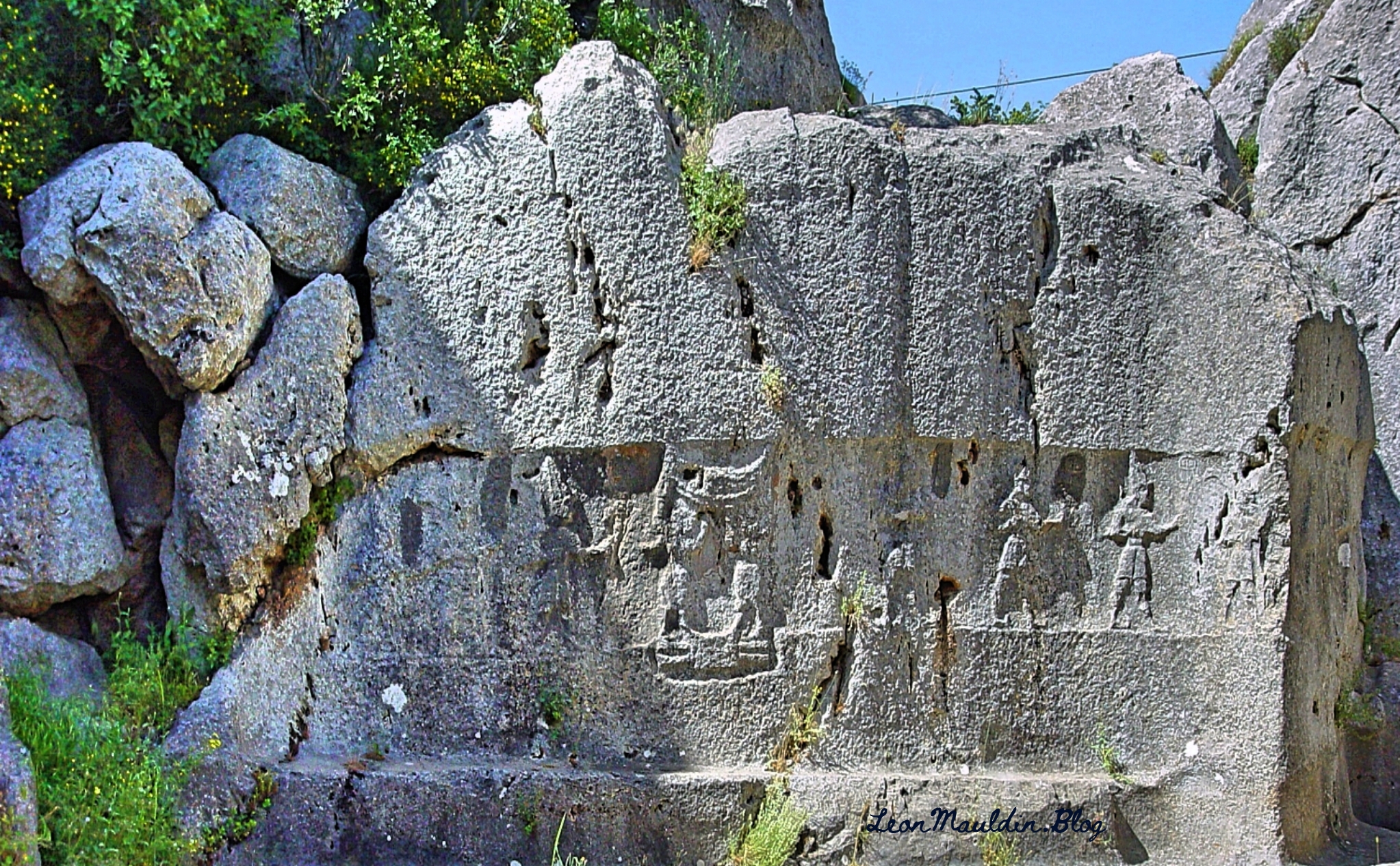
Yazılıkaya is an open-air rock sanctuary located about 1 mile NE of the Great Temple of Hattuşa, in the heart of Hittite country (New Kingdom). It consists of two chambers (A and B) formed inside a group of rock outcrops.
Hittite King Tudhaliya IV reigned 1245-1215 BC (Middle Chronology), or 1237-1209 BC (Short Chronology).
Trevor Bryce writes:
This renovation of the city was the inspiration of King Hattusili III (c. 1267–1237 B.C.), though his son and successor, Tudhaliya IV (c. 1237–1209 B.C.), did most of the work. Not only did Tudhaliya substantially renovate the acropolis; he more than doubled the city’s size, developing a new area lying south of and rising above the old city. In the new “Upper City,” a great temple complex arose. Hattusa could now boast at least 31 temples within its walls, many built during Tudhaliya’s reign. Though individually dwarfed by the enormous Temple of the Storm God in the “Lower City,” the new temples left no doubt about Hattusa’s grandeur, impressing upon all who visited the capital that it was the religious as well as the political and administrative heart of the Hittite empire.
Tudhaliya also constructed massive new fortifications. The main casemate wall was built upon an earthen rampart to a height of 35 feet, punctuated by towers at 70-foot intervals along its entire length. The wall twice crossed a deep gorge to enclose the Lower City, the Upper City and an area to the northeast; this was surely one of the most impressive engineering achievements of the Late Bronze Age. (https://library.biblicalarchaeology.org/article/the-last-days-of-hattusa/)
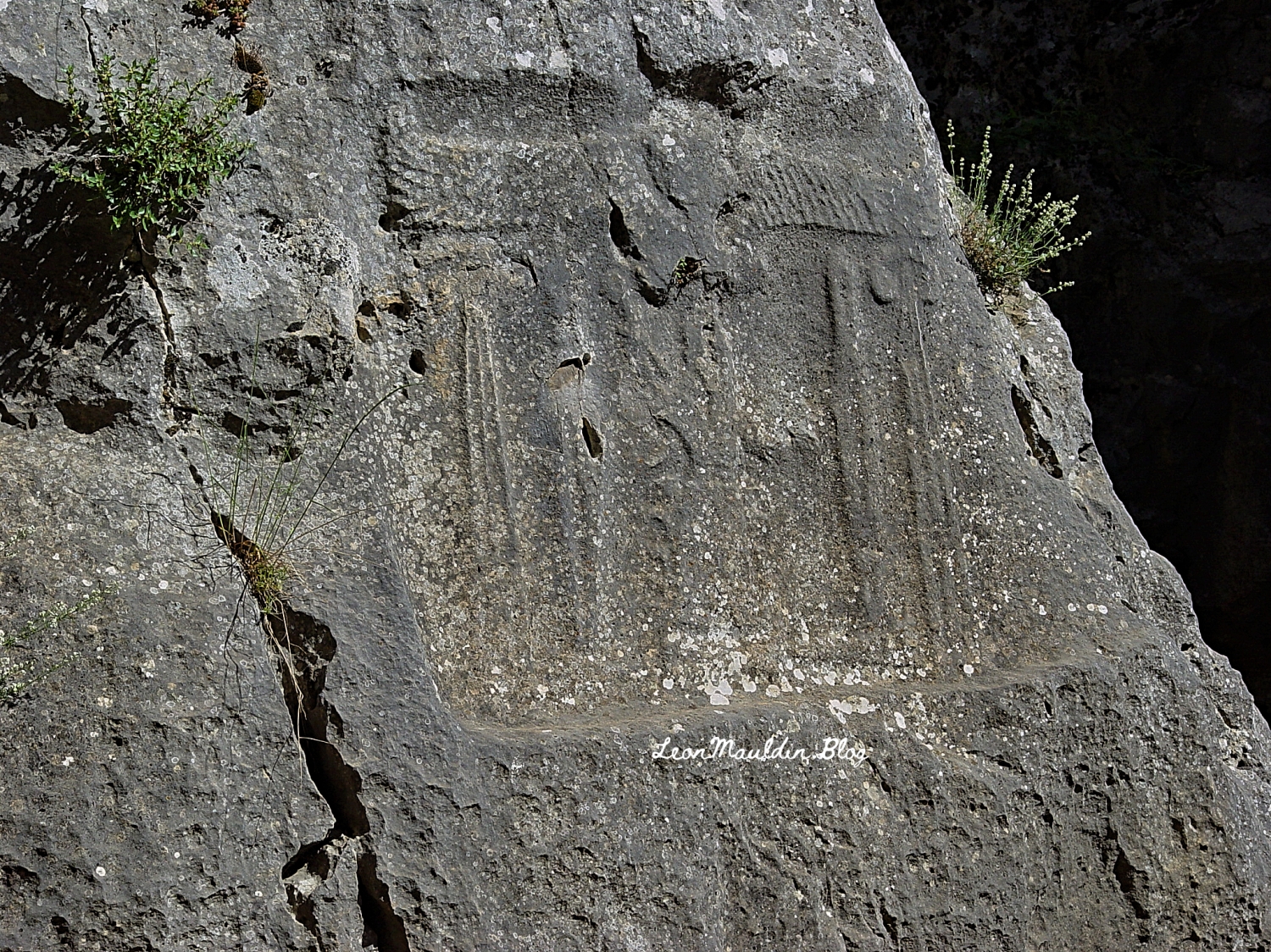
Here inscribed on the rock wall at Yazılıkaya is the cartouch of Great King Tudhaliya IV:
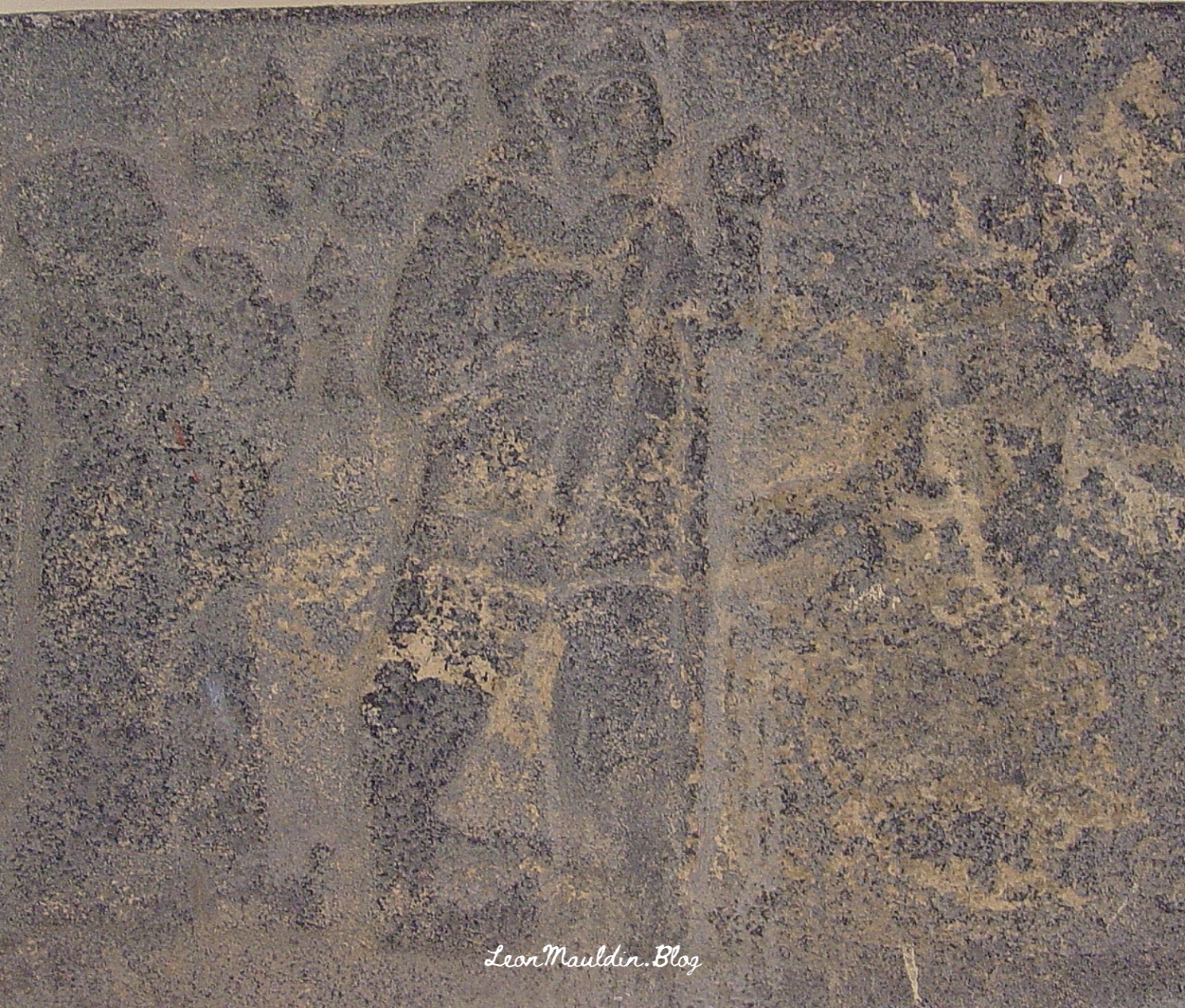
In 2007 I photographed this relief of Tudhaliya IV (dated to 13th century BC), at the Archaeological Museum in Antakya. Antakya is in Turkey, but in New Testament times was Antioch of Syria (Acts 11:20, etc.).
One of the most important roads in the Roman world was the Via Egnatia, which linked Dyrrhachium on the Adriatic Sea, to Byznatium, a distance of 260 miles. From the standpoint of Paul’s travels in Acts, the road crossed through Macedonia westward to Illyricum, linking the Aegean Sea to the Adriatic Sea.
Dr. Mark Wilson writes:
Around 146 BC the governor Gnaeus Egnatius began a road project across the Balkan Peninsula to link the Adriatic to his province of Macedonia on the Aegean Sea. Before 56 BC the road had been extended through Thrace to Byzantium (Cicero, On the Consular Provinces 2.4). Its length was 746 RM (696 mi. [1,120 km]). Travelers wishing to continue east from the port of Brundisium ferried across the Adriaticum (modern Adriatic) either to Dyrrachium or Apollonia (Strabo, Geography 7.7.4,8; he calls the former city by its Greek name Epidamnus). Branches of the Via Egnatia terminated at these Adriatic ports in the province of Illyricum. The remains of a mutatio are found at Ad Quintum (modern Bradashesh). Lychnidos (modern Ohrid) was the last major city in eastern Illyricum. Heraclea Lyncestis (modern Bitola) was the first major Macedonian city, then Edessa where a branch ran south to Berea. After Pella came the provincial capital Thessalonica on the Aegean coast. Eastward the road ran through Apollonia, Amphipolis, Philippi, and back to the coast at Neapolis.
Wilson, M. (2019). The Roman Road System around the Mediterranean (Acts 8:26; 20:1–3; 23:23–33; 28:13–16; Romans 15:19). In B. J. Beitzel, J. Parks, & D. Mangum (Eds.), Lexham Geographic Commentary on Acts through Revelation (pp. 180–181). Lexham Press.
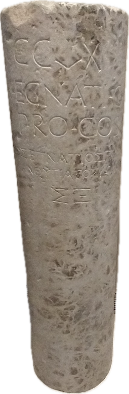
One very important archaeological find on the Via Egnatia is the milestone pictured here above. The inscription is bilingual. It contains the name of the governor of the province of Macedonia, Gnaius Egnatus (served in late 140s BC), who was responsible for the construction of this Roman road. Hence the name, Via Egnatia. The milestone was found near the point where the Via Egnatia crossed the Gallikos River, west of Thessaloniki. This inscription also accurately reports the length of the road to be 260 miles.
The Via Egnatia (like other Roman roads) was built to move the Roman army to the East. But the special significance of this road to Bible students is seen (beginning with the Second Missionary Journey) as Paul (and companions) crosses the Aegean from Troas to Neapolis, and from there gets on the Via Egnatia. Luke, the author of Acts and having joined Paul at Troas, traces the evangelist work from Philippi (Acts 16), passing through Amphipolis and Apollonia (Acts 17:1f; did not preach there) then to Thessalonica, where “a great multitude” (Acts 17:4) were persuaded to become Christians. But because of intense persecution, Paul then left the Via Egnatia and moved southward to Berea, where there was great success (Acts 17:10-15). Paul would have made use of this road again on the Third Journey (Acts 20:1-3).
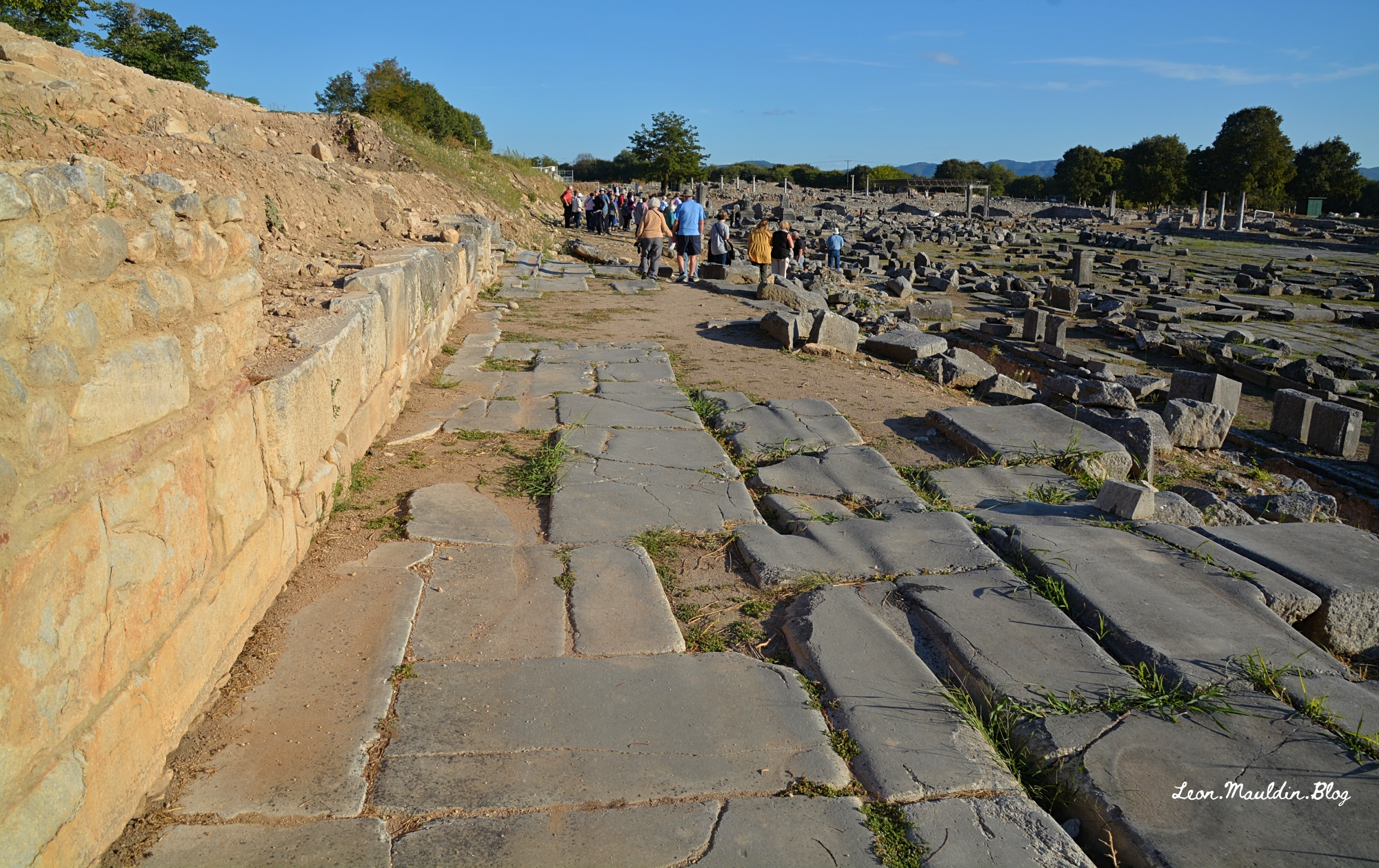
Here is a view of the Via Egnatia in Philippi, looking east. You can also see the agora to your right.
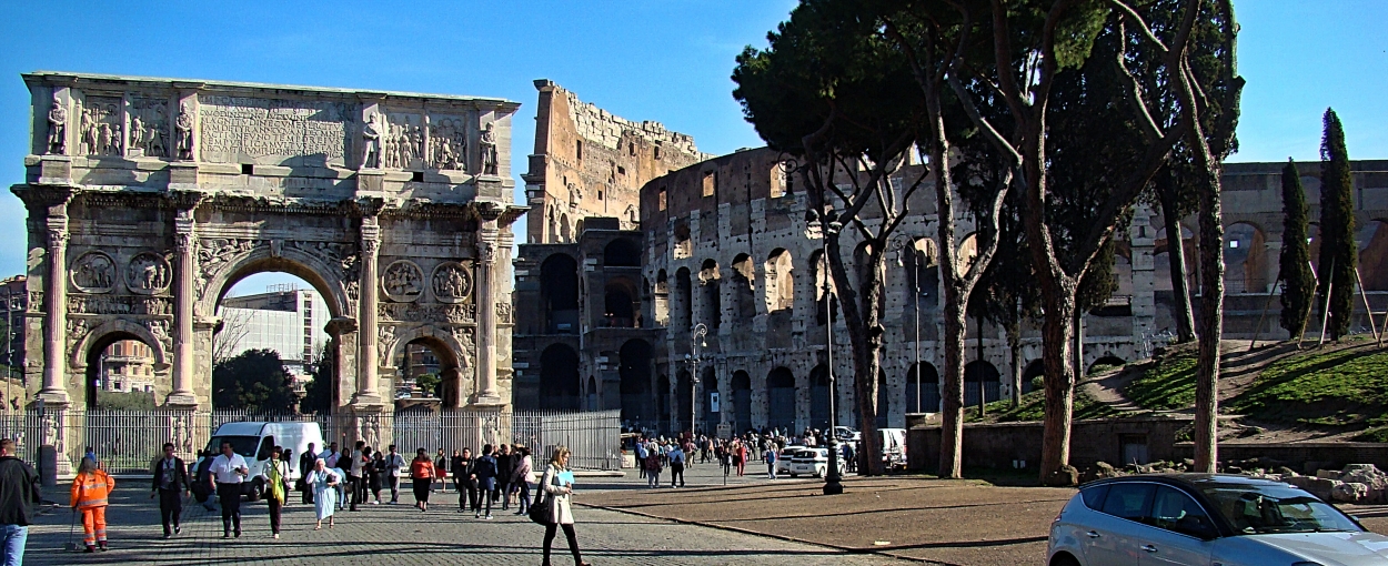
In our previous post we saw Roman Emperor Constantine’s Arch, commemorating his victory over his rival Maxentius at the Milvian Bridge.
Arch of Constantine. (Colosseum on the right). Photo by Leon Mauldin.
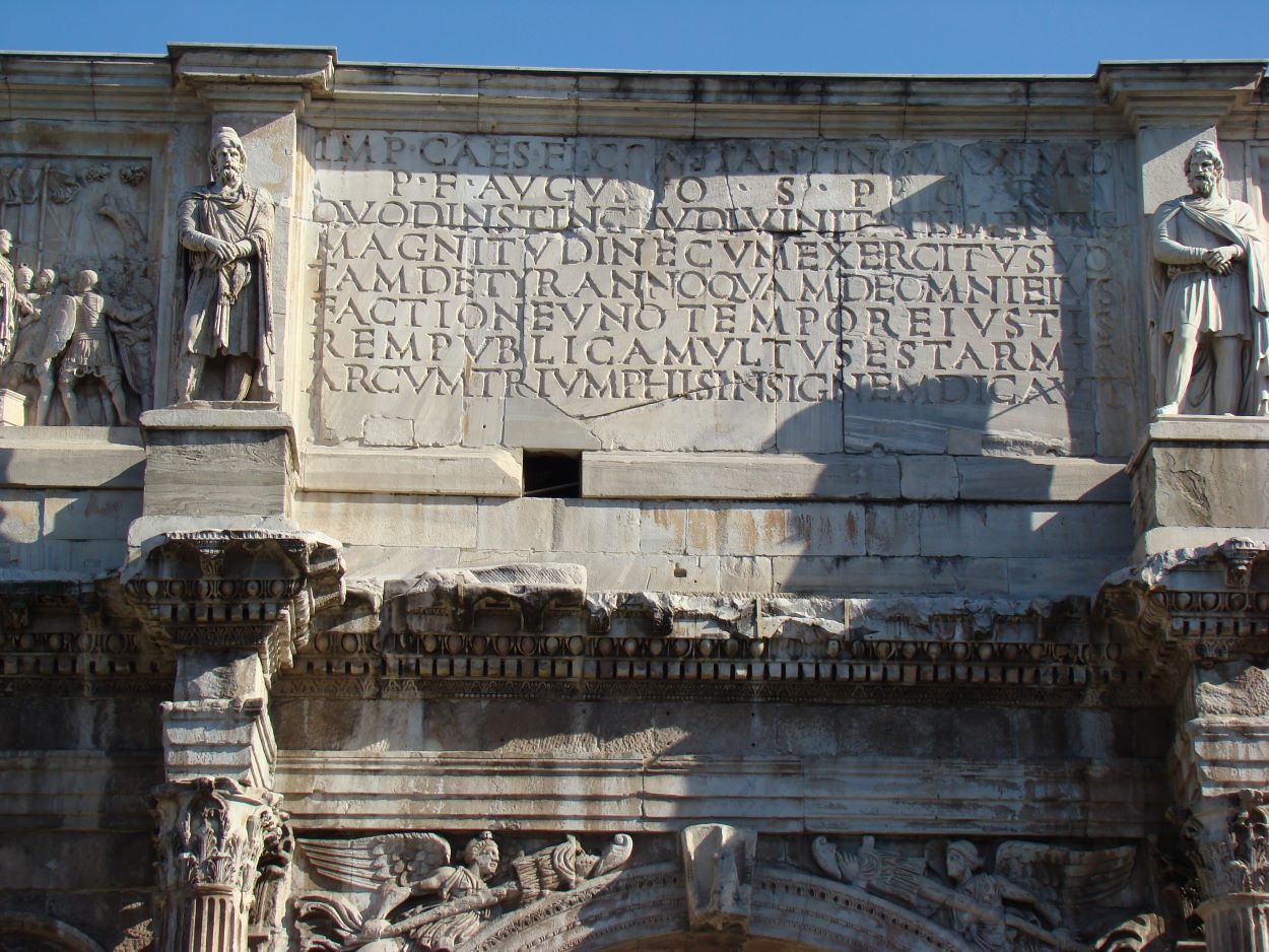
There is a lengthy official inscription at the top center of the arch, explaining its purpose.
Inscription on Arch of Constantine. Photo by Leon Mauldin.
Here is the Latin inscription with the English translation, from Rome, an Oxford Archaeological Guide:
IMP(eratori) CAES(ari) FL(avio) CONSTANTINO MAXIMO To the emperor Flavius Constantine, the Great, P(io)F(elici) AUGUSTO S(enatus) P(opulus)Q(ue)R(omanus) pious and fortunate, the Senate and People of Rome, QUOD INSTINCTU DIVINITATIS MENTIS because by divine inspiration and his own greatness of spirit MAGNITUDINE CUM EXERCITU SUO with his army TAM DE TYRANNO QUAM DE OMNI EIUS on both the tyrant and all his FACTIONE UNO TEMPORE IUSTIS faction at once in rightful REM PUBLICAM ULTUS EST ARMIS battle he avenged the State, ARCUM TRIUMPHIS INSIGNEM DICAVIT dedicated this arch as a mark of triumph
It is very popular to have group photos of tours taken with the arch as the background. Perhaps this will help in some small way to understand its historical significance.
We are looking forward to again touring Sicily/Italy in March 2024, the Lord willing. I was recently reviewing some photos from previous trips and wanted to share a few of these. Pompeii was covered with volcanic ash by the eruption of Mount Vesuvius (August AD 79).
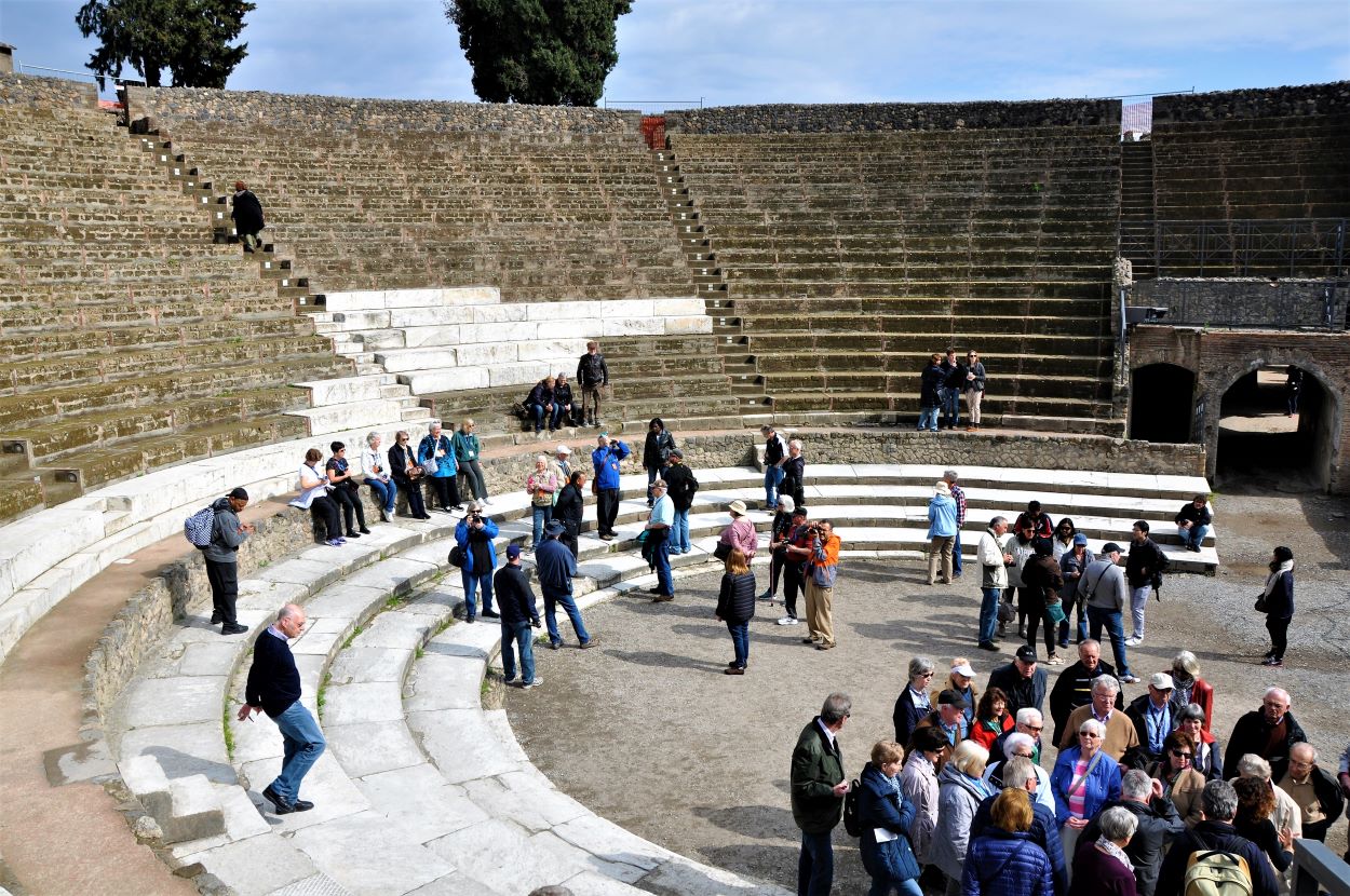
In this post we will look at the Odeum at Pompeii. Here is the view of Pompeii just inside the entrance (Mt. Vesuvius is in the background):
The city had two theaters, the large theater, which seated about 5,000 spectators, and the small theater, the odeon. The seating capacity of this small theater was about 1,000 people. A pyramid-shaped roof would have covered it. It would have been used for musical performances and mime.
An inscription at the site states that the duumviri C. Quintius Valgus and M. Porcius, two leading citizens of Pompeii, financed the construction of the theater. In 80 BC Pompeii became a Roman colony with the name of Colonia Cornelia Veneria Pompei.
Some biblical texts are especially illuminated by archaeological finds. For example, Acts 21:28 records the false charge against Paul, “He also brought Greeks into the temple and has defiled this holy place” (v.28). The next verse shows this they “supposed” (NET “assumed). Ephesians 2:14 speaks of Jesus’ death breaking down “the middle wall of separation” between Jews and Gentiles.
Temple Inscription Fragment. Israel Museum. Photo by Leon Mauldin.
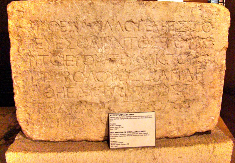
Our photo shows one of the warnings posted marking the boundary within the temple complex beyond which no Gentile could proceed. The inscription read, “NO FOREIGNER IS TO GO BEYOND THE BALUSTRADE AND THE PLAZA OF THE TEMPLE ZONE. WHOEVER IS CAUGHT DOING SO WILL HAVE HIMSELF TO BLAME FOR HIS DEATH WHICH WILL FOLLOW.” I took this photo earlier this month in the Israel Museum.
A complete tablet is housed in the Istanbul Museum, as seen in our photo here:
Complete Temple Inscription. Istanbul Archaeology Museum. Photo by Leon Mauldin.
So the Acts 21 text means that Paul was charged with taking a Gentile beyond the balustrade marked off by signs just like thsee.
The Ephesians 2 text shows that with Jesus’ death on the cross, reconciliation is made possible between men (Jew and Gentile) and God, and those reconciled unto God are reconciled to each other. The reconciled are in one body (the church, Eph. 1:22-23). That distinction epitomized by the wall of separation, and reflected by these warning signs, has been removed!
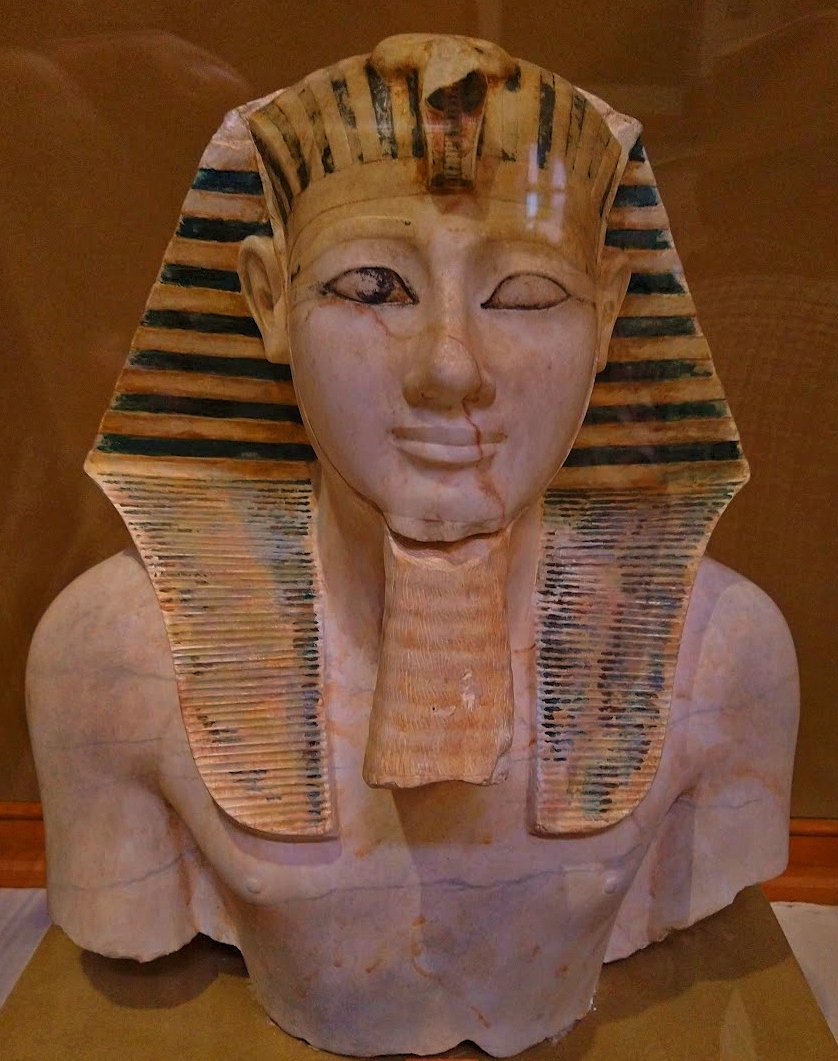
Thutmose III had a co-regency with Hatshepsut. When she died about 1483 BC he began his independent reign (of an additional 32 years). “At the end of some seventeen years of military campaigns, Thutmose III had successfully established Egyptian dominance over Palestine and had made strong inroads into southern Syria. His own reputation was assured, and the proceeds were extravagantly expended on behalf of the temples of Amun and other gods, as well as on those men who followed the king on his quests” (Betsy M. Bryan, The Oxford History of Ancient Egypt, ed. Ian Shaw, p. 243).
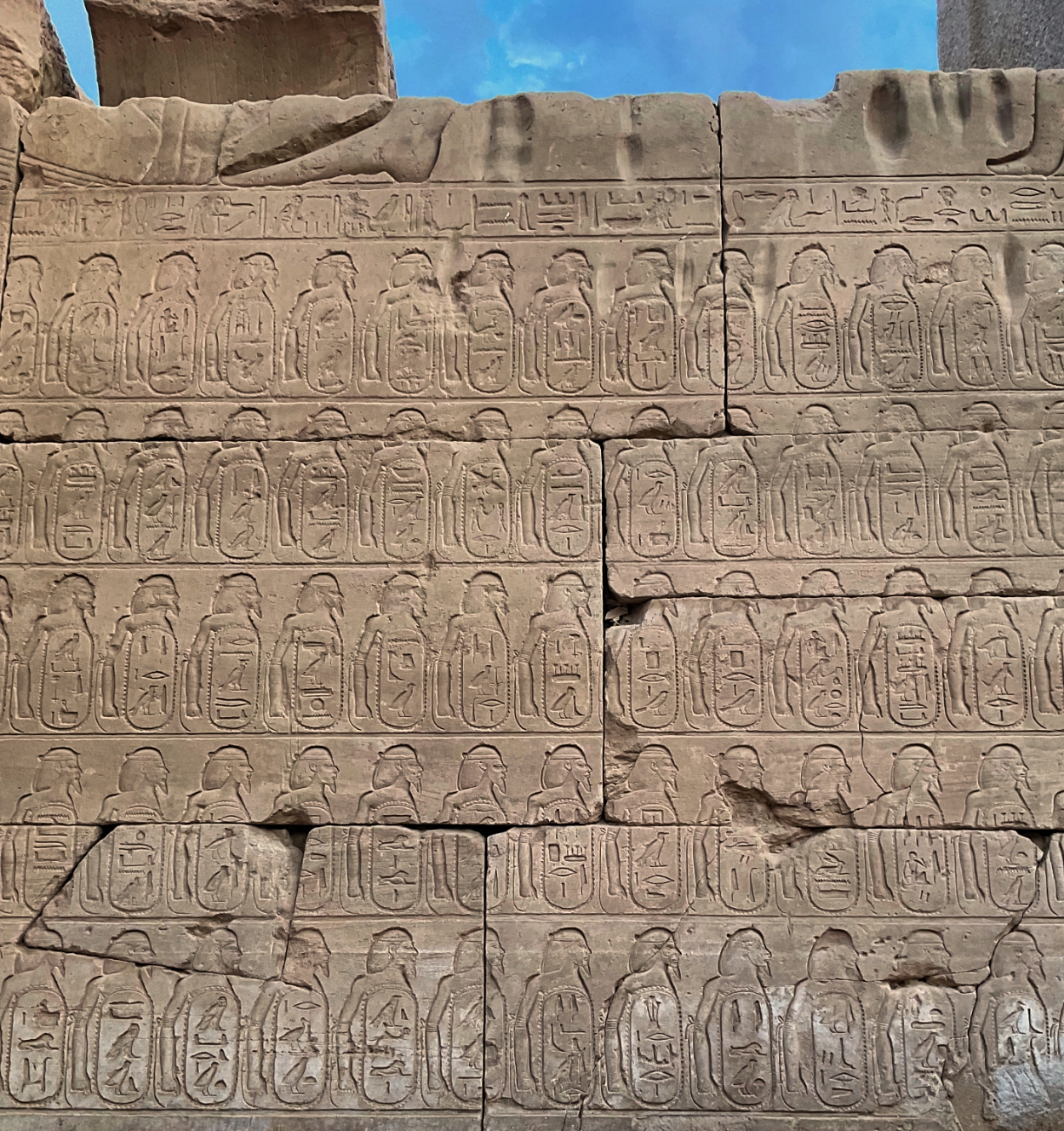
Thutmose III recorded a detailed account of his Near Eastern campaign on the inside walls of the central hallway after the hypostyle hall at the Karnak Temple. These inscriptions describe specific episodes of the warfare and booty lists.
. . . comes from the annals of the 18th Dynasty Pharaoh Thutmose III (r. 1479–1425 BC) inscribed on the walls of the Karnak temple complex in Luxor (ancient Thebes). Thutmose III campaigned into Canaan to quell a rebellion headed by an alliance of Canaanite leaders in the vicinity of Megiddo (appearing in the text as Ma-k-ta). The account indicates that Megiddo was strategically located near the opening of the Wadi Ara, referred to in the annals of Thutmose III as the Aruna pass. The pharaoh defeated the Canaanites, who then fled into the fortified city of Megiddo. Thutmose laid siege to the city and proclaimed that the taking of Megiddo is “the capture of a thousand towns”—a reference to the city’s strategic location (Lichtheim, Ancient Egyptian Literature, 33). Thutmose III’s campaign marked the beginning of Egyptian hegemony over Canaan, characterized by the establishment of numerous Egyptian strongholds in the southern Levant (see Rainey, The Sacred Bridge, 65–69; compare Aharoni, Avi-Yonah, Rainey, and Safrai, The Carta Bible Atlas, 31–33). Megiddo became an Egyptian administrative center and military garrison. Megiddo also appears in Thutmose III’s list of conquered cities (also at the Karnak temple complex; Rainey, The Sacred Bridge, 72–73), and in a list of Canaanite emissaries attributed to Thutmose III (found in Papyrus Leningrad 1116-A).
Kelley, J. L. (2016). Megiddo. The Lexham Bible Dictionary. Lexham Press.
I’ve previously posted on Thutmose III here and here and here.
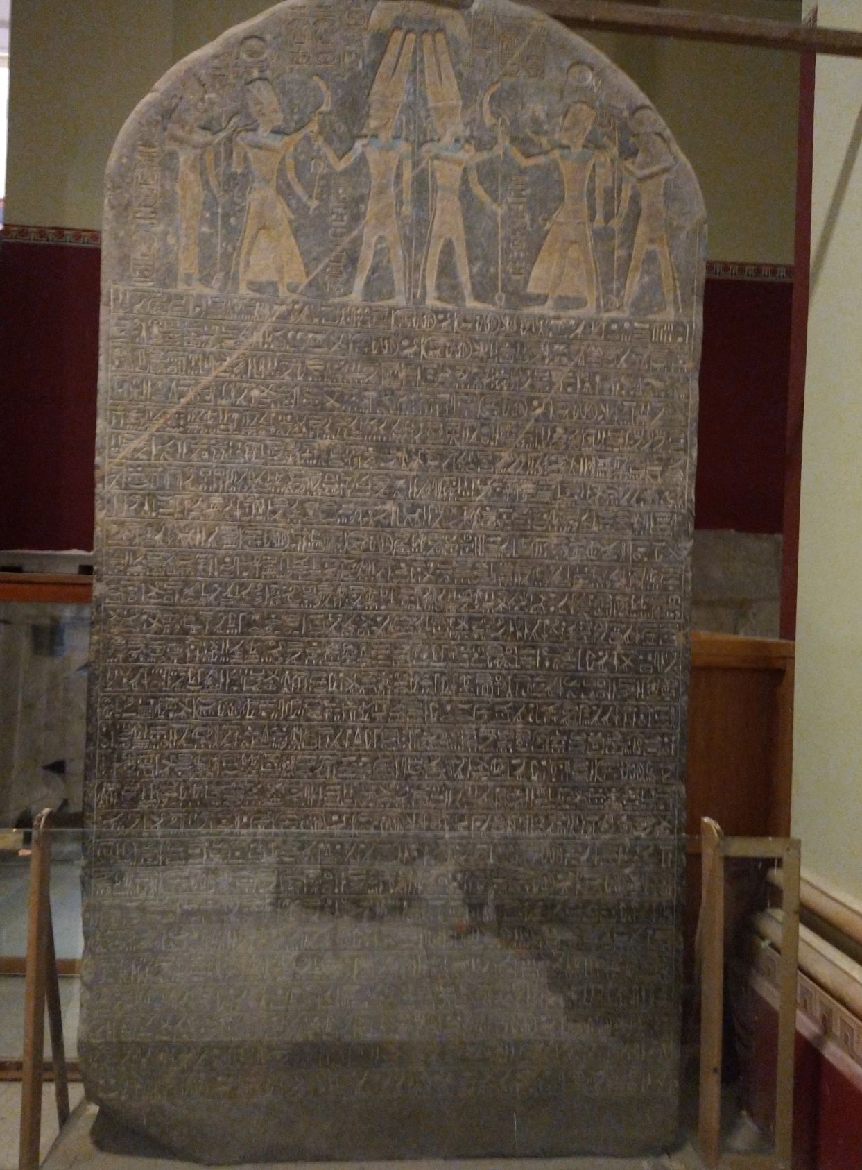
Merneptah, son of Rameses II, ruled Egypt 1213-1203 B.C., in the 19th Dynasty. The Merneptah Stele, made of granit, is an inscription of great archaeological and biblical importance. It contains the first mention of Israel in a source besides the Bible. On our recent tour of Egypt, this is one of the main artifacts I wanted our group to see and photograph while visiting the Egyptian Museum in Cairo.
The stele was discovered in 1896 at Thebes by F. Petrie in 1896. It is 7.5 feet high, and made of black granite. It is displayed now in the Egyptian Museum at Cairo. The inscription includes the lines:
The princes, prostrated, say "Shalom";
None raises his head among the Nine Bows,
Now that Tenhenu has come to ruin, Hatti is pacified.
Canaan has been plundered into every sort of woe. Ashkelon
has been overcome.
Gezer has been captured.
Yano'am was made non-existent.
Israel is laid waste (and) his seed is not.
Hurru has become a widow because of Egypt.
All lands have united themselves in peace.
Anyone who was restless, he has been subdued by the King
of Upper and Lower Egypt, Ba-en-Re-mery-Amun, son
of Re, Mer-ne Ptah Hotep-her-Ma'at, granted life like
Re, daily. (Frank Yurco, BAR, 16:05, Sept/Oct 1990)
The date of this inscription would be about 1207 B.C. By that point in time, Israel was established in the land of Canaan to such an extent that it would be included in a listing of nations defeated by the world’s most powerful monarch.
Many “scholars” deny that Israel even existed as a nation by this point in time, but the inscription proves them to be wrong.
For further reading I recommend Todd Bolen’s article in The Bible and Interpretation. Go to:
At the top of the stele there are two engraved scenes in which Pharaoh Merneptah is wearing ceremonial dress and offers Amun-Ra the reaping hook that symbolized victory and scepters of royalty. In the first scene Merneptah is followed by the goddess ut and in the second by the god Khonsu. Both were members of the Theban triads of gods with Amun-Ra.


 Posted by Leon Mauldin