Assyrian King Sennacherib

August 18, 2026

Assyrian King Sennacherib (r. 705-681 BC) is the pagan king who made the mistake of challenging YAHWEH, the LORD God of Israel, in the days of Judah’s King Hezekiah, as well as the prophet Isaiah. The history is narrated in 2 Kings 18-19; 2 Chronicles 32, and Isaiah 36-37. Against all odds, the Lord delivered Judah and in particular Jerusalem, from Sennacherib, for His name’s sake, and for His servant David’s sake.

King Sennacherib at far left, with attendants following. Oriental Institute Museum. Photo ©Leon Mauldin
Sennacherib on throne at upper right center. Watching over exiles of Lachish. British Museum. Photo ©Leon Mauldin.

For more on Sennacherib, click here.


“Peter’s Grotto Church” in Antioch of Syria

July 24, 2026

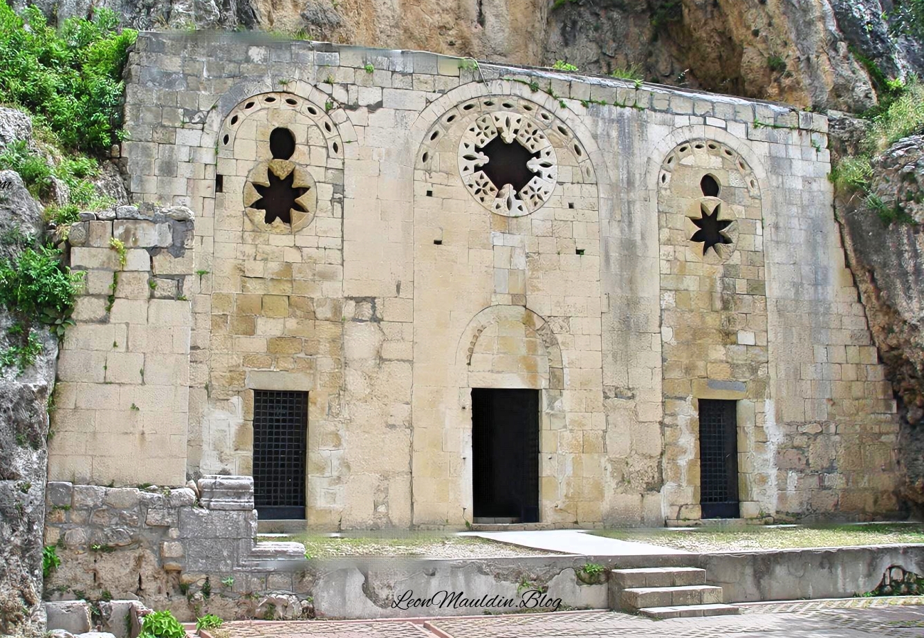
Acts 11 narrates the spread of the Gospel to Antioch of Syria. It was here that the disciples were first called Christians (v.26). One site of interest there (Antaka, Turkey) today is “St. Peter’s Grotto Church.”

The cave church of St. Peter on Mount Silpius. Photo ©Leon Mauldin.

Tradition holds that early Christians met here in the cave behind the façade (the façade is a Crusader Period addition, 12-13th centuries). The Byzantine Period (AD 330ff.) likely added interior plastering, an apse, a stone altar and mosaic flooring.

The three doorways, round windows, star-shaped tracery are Crusader. The concrete platform, steps and iron gates are modern.

I’ve posted on Antioch here, here, and here.

Click image for larger view.


Podcast Episode: Capernaum, “His [Jesus’] Own City”

July 22, 2026

Pip: Leon Mauldin’s blog takes you to the places the Gospel narratives actually name — not as metaphor, but as geography you can stand in.

Mara: Today we’re following that thread to Capernaum, the town the Gospels call Jesus’ own city, and what the archaeological record there still shows.

Pip: Let’s start with the city itself.

Capernaum: Jesus’ Home Base During His Galilean Ministry

Pip: The Gospels are specific about where Jesus lived during his public ministry — and it is not the town most people probably picture first. The question is what “his own city” actually means, and why it matters that the answer is Capernaum and not Nazareth.

Mara: Matthew 9:1 sets it up directly: “Getting into a boat, Jesus crossed over the sea and came to His own city.” And Matthew 4:13 fills in the backstory — “He left Nazareth behind and went to live in Capernaum by the sea, in the region of Zebulun and Naphtali.”

Pip: So this is not a visit. Multiple translations land on the same word: settled, made his home. Mark’s version is even more domestic — “it was heard that He was at home.” Capernaum is a residence, not a stop on a tour.

Mara: The location made it strategically significant. Aubrey Taylor, writing in the Lexham Geographic Commentary on the Gospels, describes it this way: “Capernaum, located on the shore of the Sea of Galilee, was a busy town along one of the branches of the international road that connected the Jezreel Valley, Phoenicia, and Damascus.”

Pip: A crossroads town. Which means the teaching that happened there — and the miracles — reached people who were already moving through, not just locals.

Mara: Mark 1:21 records the synagogue as a specific teaching site: “And they went into Capernaum, and immediately on the Sabbath he entered the synagogue and was teaching.” The post includes photographs of that synagogue as it stands today.

Pip: And here is where the archaeology gets layered in an interesting way.

Mara: The white limestone structure visible now postdates Jesus. But it sits directly on a first-century basalt foundation — so the site is continuous even if the building above it is not. The photographs show both layers clearly.

Pip: The stones underneath are doing the work the stones on top get the credit for.

Mara: That distinction — visible monument versus original foundation — is exactly what the post is drawing attention to with those images.


Pip: Geography as evidence. The text names a place, the place still exists, and the layers underneath confirm the story.

Mara: That’s the thread worth following. More from leonmauldin.blog next time.


Gravestone of Uzziah, King of Judah

July 22, 2026

2 Kings 15:1-7 summarizes the reign of Judah’s good King Uzziah (Azzariah), who reigned 790-740 BC. The parallel in 2 Chronicles 26 gives much more information. There his successful wars with the Philistine and Arabians are recorded. He fortified the walls of Jerusalem. Also he constructed towers in the desert and dug many wells, which promoted agriculture & vine growing. The explanation is given, “for he loved the soil” (2 Chron. 26:10). Azariah also had an organized army of 307,500 (2 Chron. 26:13). Indeed, his “fame spread far and wide, for he was marvelously helped till he became strong” (2 Chron. 26:15).

The next verse however, begins with the word “But.” “But when he became strong, his heart was so proud that he acted corruptly, and he was unfaithful to the LORD his God, for he entered the temple of the LORD to burn incense on the altar of incense” (2 Chron. 26:16). Because of this presumption (only the Levitical priests were authorized to do this; Uzziah was of the tribe of Judah), God struck him with leprosy. “King Uzziah was a leper to the day of his death; and he lived in a separate house” (v.21). When Uzziah died, “they buried him with his fathers in the field of the grave which belonged to the kings” (v.23). I.e., he was not buried in the tomb of the kings, because he was a leper. He was buried in the field.

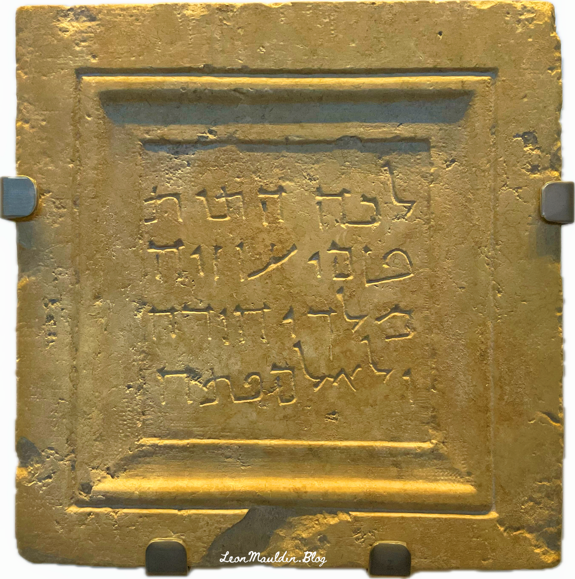
Burial marker for Judah’s King Uzziah. Photo ©Leon Mauldin.

When the city of Jerusalem expanded, the remains of King Uzziah were reinterred. This fascinating grave marker marked the spot of the new burial of Uzziah. The inscription reads, “To this place were brought the bones of Uzziah, king of Judah. Do not open!” This marker is dated ca. 1st century BC.

Linguists tell us that it is written in Aramaic script of the type which was used about the time of Christ. Uzziah, however, was reigning as king of Judah about 775 B.C. II Chronicles 26 describes his successful reign in some detail—how he equipped a large standing army and made war successfully against the Philistines and the Arabians, regaining control of the trade routes to Egypt and to the Red Sea, but how he was stricken with leprosy, died, and was “buried with his fathers in the field of burial which belonged to the kings.” The inscription on the slab dates over six or seven hundred years after his death. It would seem that for one reason or another the traditional grave of Uzziah was cleared, and the bones which were found were gathered up and deposited in a new mausoleum. The gravestone is exceedingly interesting, for one thing because it shows the reverence paid even two thousand years ago to the graves of great men of the past, and also because it has on it the longest connected Aramaic inscription of the time of Christ, and shows the way in which the language commonly spoken in Palestine at that time was written. (Biblical Archaeologist 1-4).

The Lexham Bible Dictionary has the following info:

The Uzziah Inscription
The (Aramaic) Uzziah Inscription reads, “Hither were brought the bones of Uzziah, King of Judah. Do not open” (Bahat, Atlas, 50). From the style of the inscription, Uzziah’s bones seem to have been reburied during the Second Temple period.
Uzziah was apparently buried separately from the other kings of Judah, as the Chronicler states, “they buried him with his fathers in the field of the grave which belonged to the kings, for they said, “He is a leper’ ” (2 Chr 26:23). Josephus notes that “he was buried by himself in his own gardens” (Josephus, Antiquities 9:227). The exact location is unknown; the inscription itself was brought, without noting its place of origin, to the Russian Church on the Mount of Olives during the nineteenth century. In 1968, the Israel Museum purchased the stone, which is still displayed at the museum. (Udd, K. J. Funerary Inscriptions of Ancient Palestine. The Lexham Bible Dictionary)

This important artifact is housed in the Israel Museum in Jerusalem.

Click image for larger view.


Capernaum, “His [Jesus’] Own City”

July 16, 2026

As the Gospel records narrate the Galilean ministry of Jesus, we read, “Getting into a boat, Jesus crossed over the sea and came to His own city” (Matt. 9:1, NASB). The parallel passage in Mark states, “When He had come back to Capernaum several days afterward, it was heard that He was at home” (Mark 2:1). Clearly “His own city” during the Galilean ministry is not Nazareth, (where Jesus grew up and lived prior to His public teaching), but Capernaum.

Entrance to Capernaum, where Jesus resided during His Galilean Ministry. Photo ©Leon Mauldin.

The wording of Matthew 4:13 is: “He left Nazareth behind and went to live in Capernaum by the sea, in the region of Zebulun and Naphtali” (CSB). The NASB renders the text, “He came and settled in Capernaum.” The NET Bible reads, “While in Galilee, he moved from Nazareth to make his home in Capernaum by the sea” (also NRS).

In a chapter entitled, “Capernaum: a Strategic Home for the Messiah,” Aubrey Taylor states, “Capernaum, located on the shore of the Sea of Galilee, was a busy town along one of the branches of the international road that connected the Jezreel Valley, Phoenicia, and Damascus” (Lexham Geographic Commentary on the Gospels, p. 88).

Much of Jesus’ teaching, and many of His miracles, were done in Capernaum. The synagogue there was the setting of his teaching as recorded in Mark 1:21: “And they went into Capernaum, and immediately on the Sabbath he entered the synagogue and was teaching” (ESV).

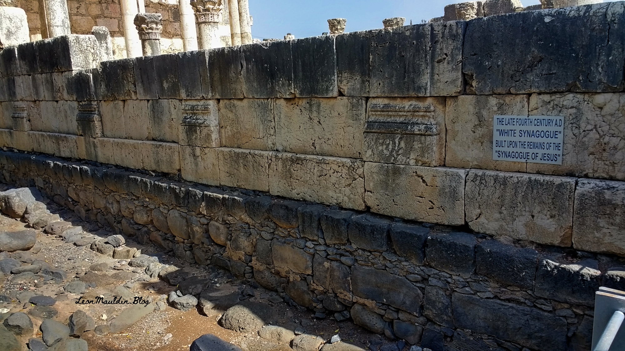
Synagogue in Capernaum. Believed to be the site of Jesus’ teaching. Photo ©Leon Mauldin.

The imported white limestone material you see here postdates the time of Jesus. But it is built upon the foundation of the 1st century structure, as can be seen here:

Structure visible today was built on the foundation of 1st century basalt stones. Photo ©Leon Mauldin.

Click images for larger view.


Ancyra/Ankara of Biblical Phrygia

July 13, 2026

The ancient city Ancyra in central Anatolia, today is Ankara, the capital of Turkey. The Lexham Geographic Commentary has the following info:

Ancyra (modern Ankara) was the second metropolis of Phrygia after Gordium, and both the Persians and the Seleucids sought to control it. It was situated at the junction of seven key trade routes in northern Asia Minor. Anycra is the caput viae for a group of milestones found around the city that date from the reigns of Titus, Domitian, and Trajan. Around 265 BC the Galatian tribe, Tectosages, made Ancyra its capital after receiving the site from the Pontic kingdom. In the early first century BC Mithradates VI Eupator took control the city until Pompey defeated him in 65 BC. After the Romans annexed Galatia in 25 BC, Augustus made Ancyra the capital of the new province also named Galatia. He founded a colony there around 22–21 BC called Sebasteni Tectosages Ancyrani. (Wilson, M. (2019). Peter’s Christian Communities in Asia Minor (1 Peter 1:1). In B. J. Beitzel, J. Parks, & D. Mangum (Eds.), Lexham Geographic Commentary on Acts through Revelation (p. 612). Lexham Press.

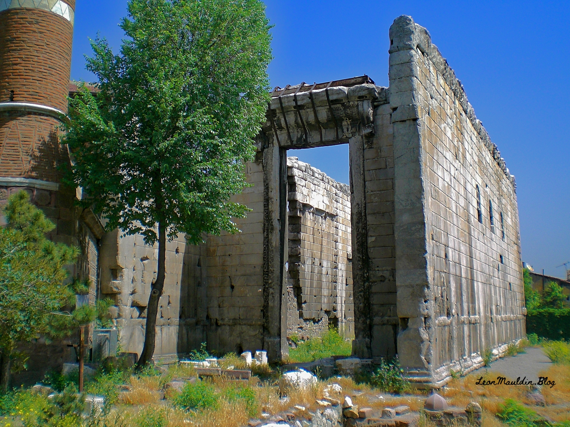
As mentioned above, the Emperor Augustus made Ancyra the capital of the province of Galatia. He built an imperial cult temple there (completed by his successor Tiberius).

Emperor Augustus Temple, Ankara, Turkey. Photo ©Leon Mauldin.

Emperor Augustus is mentioned in the Bible as the Roman ruler when Jesus was born (Luke 2:1).

Click image for larger view.


Behold Elisha Is in Dothan

March 10, 2026

Dothan is mentioned twice in the Bible, once as the site where Joseph was sold by his brothers, and again in the days of Elisha, in the context of Syrian raids into Israel.

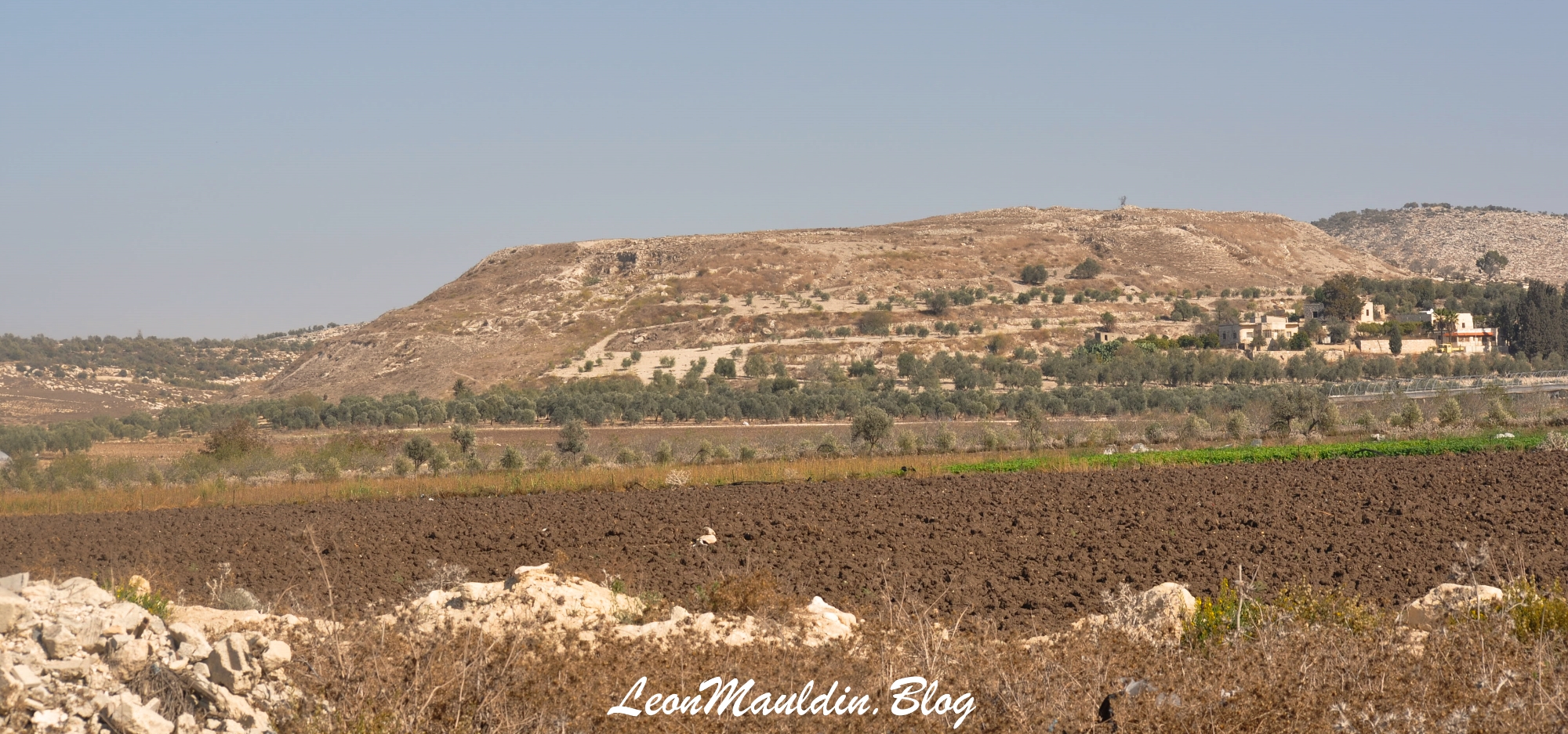
Dothan, in today’s West Bank. Photo by Leon Mauldin.

Our earlier article describing the account of Joseph’s being sold at this site by his jealous brother, may be accessed here. That event transpired in the days of the Patriarch.

2 Kings 6 takes place at a later biblical period, that of the Divided Kingdom. When the king of Syria, Ben-hadad II, was waring against Israel, Elisha the man of God repeated sent word to the king of Israel (Joram), warning him of Ben-hadad’s whereabouts. When a Syrian soldier revealed this information to the king, when he was further informed, “Behold, he is in Dothan” he immediately sent “horses, and chariots, and a great host” which surrounded Dothan (vv. 8-14).

Elisha’s servant was scared out of his wits when he saw that sight, but Elisha was unperturbed. “And when the servant of the man of God arose early and went out, there was an army, surrounding the city with horses and chariots. And his servant said to him, ‘Alas, my master! What shall we do?’ So he answered, ‘Do not fear, for those who are with us are more than those who are with them.’ And Elisha prayed, and said, ‘LORD, I pray, open his eyes that he may see.” Then the LORD opened the eyes of the young man, and he saw. And behold, the mountain was full of horses and chariots of fire all around Elisha” (2 Kings 6:15-17).

The text goes on to narrate how the Syrian army was temporarily struck with blindness and was led into the city of Samaria. There, instead of being slaughtered, they were fed and released. The power and glory of YAHWEH was thus displayed.

Dothan was excavated by J.A. Free. The New Bible Dictionary has the following info:

DOTHAN. The fertile plain of Dothan separates the hills of Samaria from the Carmel range. It provides an easy pass for travellers from Bethshan and Gilead on their way to Egypt. This was the route of the Ishmaelites who carried Joseph into Egypt. The good pasturage had attracted Jacob’s sons from Shechem, 32 km to the S. Near the town (now tell dōṯā) are rectangular cisterns about 3 m deep similar to the pit into which Joseph was put (Gn. 37:17ff.). Elisha led the Syrian force, which had been sent to capture him, along the hill road to Samaria, 16 km S. His servant was encouraged by a vision of heavenly forces arrayed on the hill to the E of the town (2 Ki. 6:13–23).
Excavations (1953–60) revealed a walled city of the Early and Middle Bronze Ages, and a Late Bronze Age settlement apparently using the older city wall. Thothmes III lists Dothan among his conquests (c. 1480 BC). It was probably one of the towns which was absorbed by the Israelites, but not actually conquered (cf. Jdg. 1:27). Areas of the Iron Age town which have been cleared show the narrow streets and small houses with storage-pits and bread-ovens of Elisha’s day. Among the finds are fifteen pieces of silver in a pottery box representing an individual’s savings. There was also settlement in the Assyrian and Hellenistic periods (cf. Judith 4:6; 7:3). (3rd ed., p. 281).

Click image for larger view.


Beth-Shemesh and Zorah

December 17, 2025

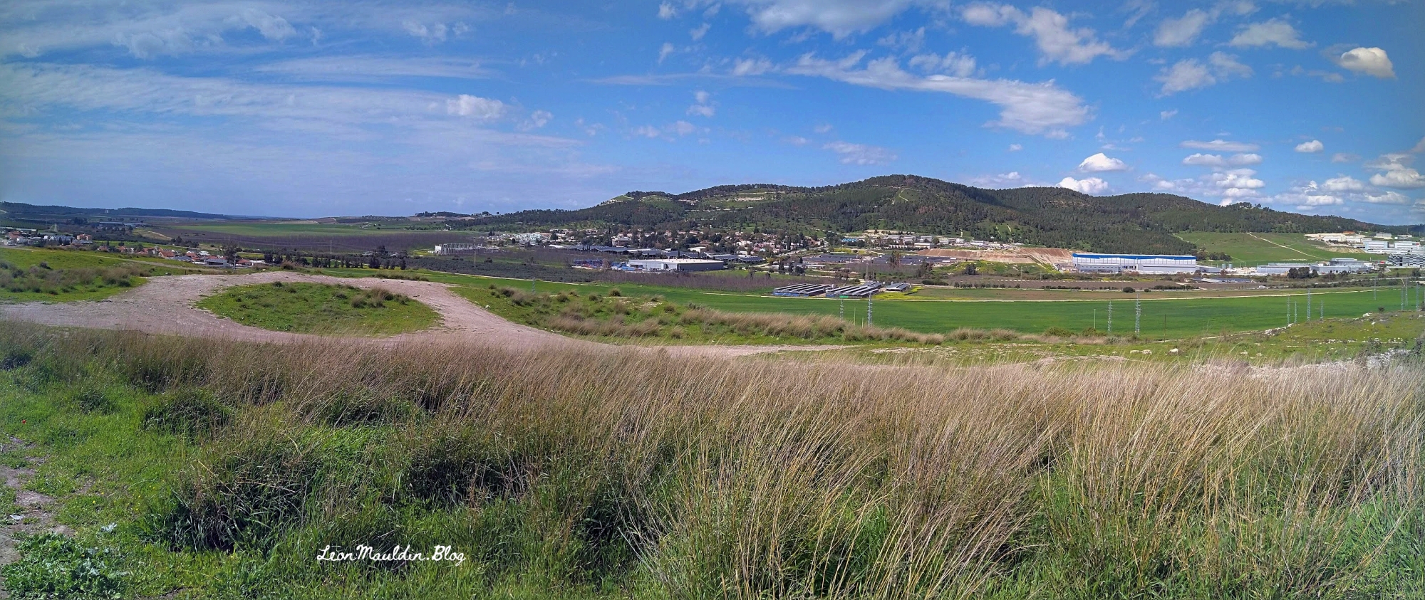
I’m currently teaching a class (homeschool) on the Judges. Visuals can help provided the setting for biblical events. Samson was born in Zorah (Judges 13:2ff.). Beth-Shemesh is in the foreground in our photo. Zorah can be seen in the distant right at the break in the tree line.

Biblical Beth-Shemesh in foreground; Zorah at far distant right. Photo by Leon Mauldin.

The Revised ISBE has the following info on Zorah:

A city in the Shephelah; the home of Manoah the father of Samson (Jgs. 13:2). Zorah (modern Ṣarʿah) was located in the northernmost district of the Shephelah, 2.5 km (1 1/2 mi) W of Eshtaol (Eshwaʿ) and 6 km (4 mi) S of Latrun. Overlooking the valley of Sorek (Wâdī eṣ-Ṣarâr), it was important to the defense of Judah throughout the history of Israel. Zorah, originally a Canaanite city, is mentioned in the Amarna Letters as one of the cities ruled by the king of Gezer (LBHG [rev ed 1979], p. 174).

According to Josh. 15:33 Zorah was allotted to Judah when the Israelites invaded Canaan. Apparently, however, it was assigned first to the tribe of DAN (Josh. 19:41), which encountered stiff opposition from the Amorites (and later the Philistines) when it attempted to occupy the region (Jgs. 1:34f.). The story of Samson, a Danite born in Zorah, is set in this region (13:2, 24f.). After struggling his entire life against the Philistines, Samson was buried in the city of his birth (16:31). Eventually the Danites decided to migrate north, and they sent out spies from Zorah to survey the land (18:2, 8, 11).
Centuries later, Rehoboam fortified Zorah as part of Judah’s western line of defense (2 Ch. 11:10). This line of fortresses served as an effective defense system for Judah in several wars during the next two or three generations (LBHG [rev ed 1979], pp. 330–33). When the Jews returned from exile in Babylon they occupied the site once again. Even the Crusaders found it an important site for their campaigns in Palestine. Located 335 m (1100 ft) above sea level and 244 m (800 ft) above the valley of Sorek, Zorah (Arab Ṣarʿah) has retained its strategic value throughout the centuries.

(J. E. MCKENNA McKenna, J. E. (1979–1988). Zorah. In G. W. Bromiley (Ed.), The International Standard Bible Encyclopedia, Revised (Vol. 4, pp. 1210–1211). Wm. B. Eerdmans.)


Jokneam, Strategic City in Ancient Israel

November 5, 2025

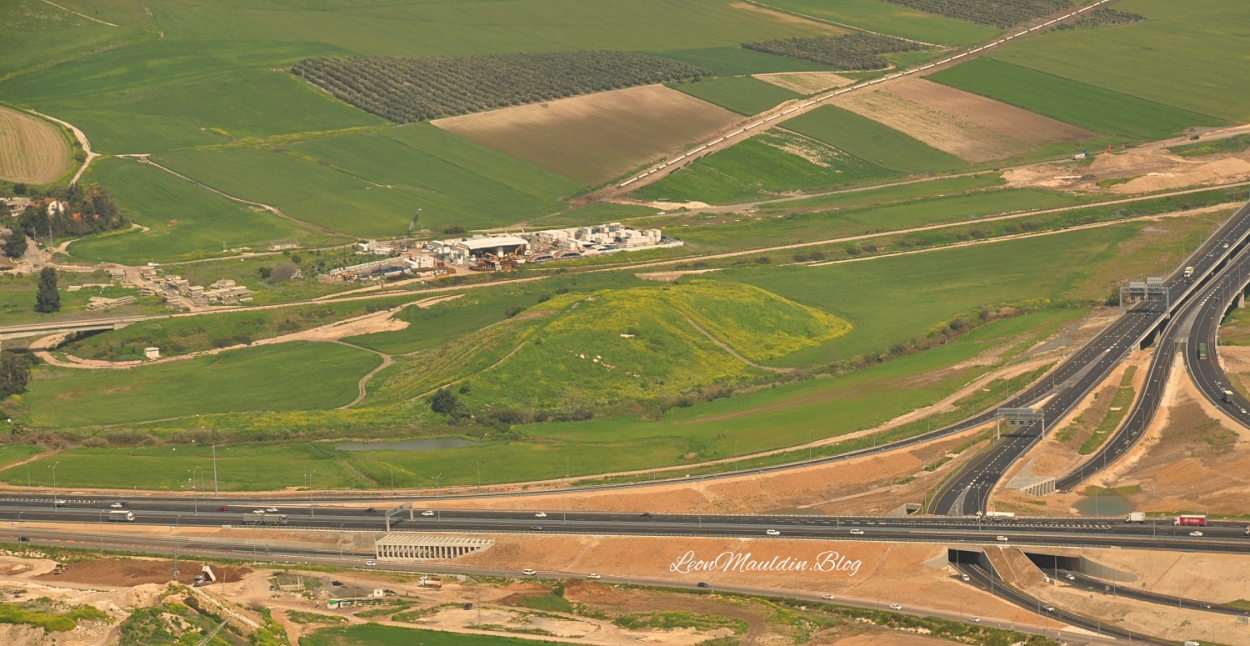
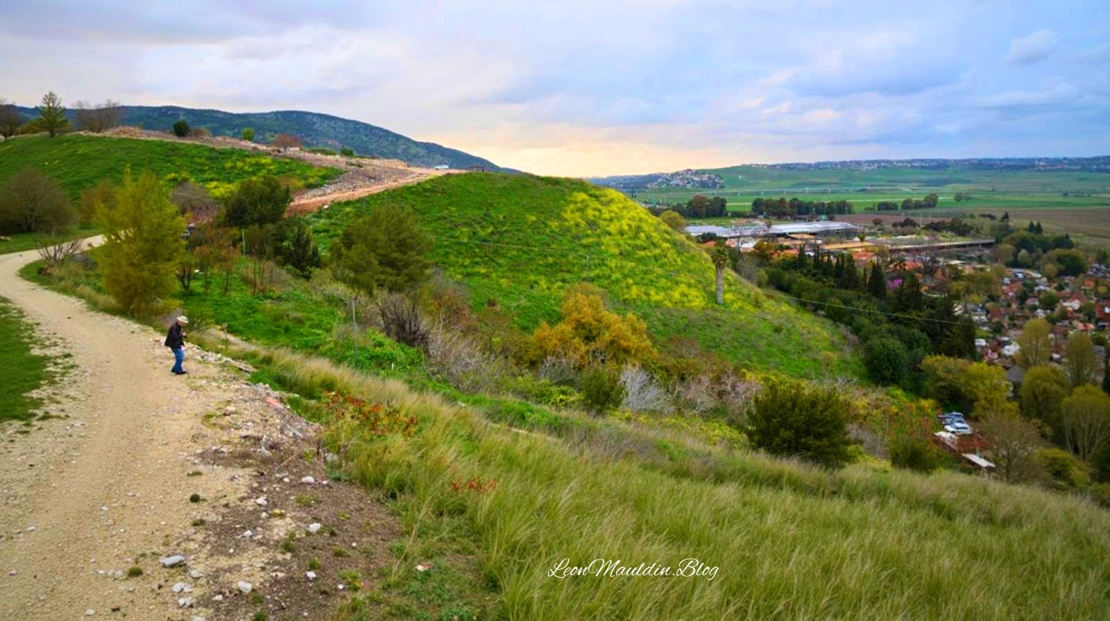
Jokneam was a strategic city-state of Canaan, located on the ancient international route which connected Egypt to Mesopotamia. It is listed among 31 other cities defeated by Joshua during the conquest of Canaan (Josh. 12:22).

Tel Jokneam. Mentioned in Joshua 12:22, taken during the Conquest. Photo by Leon Mauldin.

Jokneam is

a large mound rising above the surrounding plain and covering an area of 10 a., is situated at a point along the abutment of Mount Carmel and the Jezreel Valley, near the debouchment of Nahal Yoqne‘am (map reference 1604.2289) and at the northern outlet of Wadi Milh (Nahal Tut), on one of the major routes cutting across the Carmel Range. Via the Coastal Plain, the route passes close to Acco and then runs toward Phoenicia and other centers to its northwest.
Of the three major cities located in the western Jezreel Valley in antiquity—Jokneam, Shimron, and Megiddo—Jokneam was the smallest. It was continuously inhabited for an extremely long time: the survey conducted here, as part of a regional research project—the “Yoqneam Regional Project”—furnished evidence of a settlement on the mound from the Early Bronze Age to the Mameluke period, a span of nearly four thousand years, although the site was not fully occupied in all these periods. During the Arab and Crusader periods, Jokneam was the largest and most important center in the western Jezreel Valley. During the Roman period, the occupational sequence may have been interrupted, with the inhabitants moving to the nearby hill where modern Yoqne‘am ‘Illit is situated.
The favorable environmental conditions prevailing in the Jezreel Valley made it a very densely populated region throughout most periods. Sites such as Tel Qiri, about 2 km (1 mi.) south of Jokneam, and Tel Qashish, some 2 km to its north, were undoubtedly satellite settlements linked to the major city of Jokneam. This region thus provides an opportunity to investigate the material cultural aspect of the relationship between a city and its satellite towns, through simultaneous excavations at the three adjacent sites. (Ben-Tor, A. (1993). Jokneam. In E. Stern (Ed.), The New Encyclopedia of Archaeological Excavations in the Holy Land (Vol. 3, p. 805). Israel Exploration Society & Carta; Simon & Schuster).

I had seen Jokneam from the viewpoint of Mt. Carmel in the photo above a number of times. Then in 2022 Ferrell Jenkins and I were able to explore it more closely on one of our personal study trips.

Jokneam at center. Photo by Leon Mauldin.

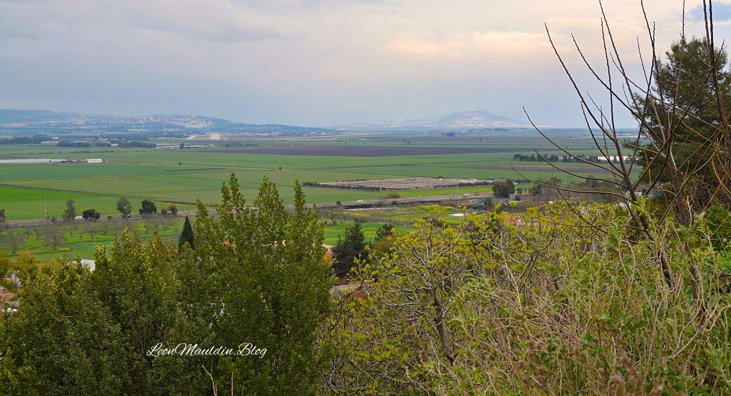
Here is a view of the Valley of Jezreel as seen from Jokneam:

Valley of Jezreel as viewed from Jokneam. Photo by Leon Mauldin.

We have previously written on Jokneam here.

Click images for larger view.


My God Is Yahweh

October 28, 2025

This is an apt title for a book authored by M.B. Van’t Veer, a 440-page work that focuses on the text of 1 Kings 16:34-19:21. The days of Elijah, when Ahab and Jezebel ruled Israel, were times of unprecedented corruption. God raised up Elijah to show the awesome power of Israel’s true God YAHWEH, and the power of His word. Great emphasis and purposeful repetition is given in this section of scripture on “the word of the LORD.” Elijah was unapologetically His spokesman; his very name means, “My God is YAHWEH”! The name YAHWEH, in Paleo-Hebrew script, is on the inscription here below:

Paleo-Hebrew Inscription with divine name YAHWEH. From Mt. Gerizim. Photo by Leon Mauldin.

The above inscription is displayed at the Good Samaritan Museum, located between Jericho and Jerusalem.

Church at Good Samaritan Inn.

Here is the view from the Good Samaritan Inn looking toward Jerusalem:

View looking west toward Jerusalem.

Click images for larger view.