Trip Summary &the Siq at Petra

March 30, 2018

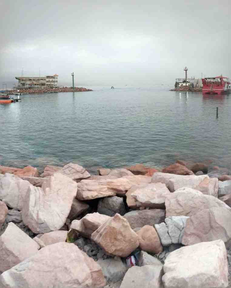
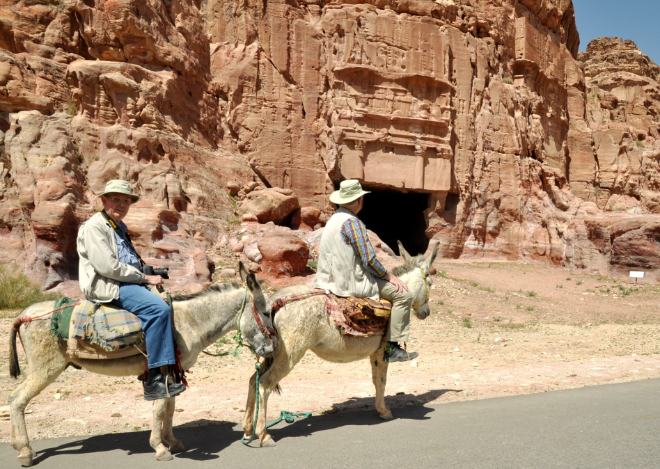
Ferrell Jenkins & I are at the TLV airport, awaiting flights (different airlines) to Florida and Sweet Home Alabama respectively. It has been a great trip. In Israel we’ve traveled and photographed from “Dan to Beersheba”, and on down to Elath. Our time was rather equally divided between Jordan and Israel. We’ve seen the Mediterranean, the Jordan (and some of its tributaries: the Banias, a sliver of the Dan, the Senir), the Dead Sea and the Red Sea. On the Jordan side we were able to see the Arnon and the Jabbok (where Jacob wrestled with the Angel).

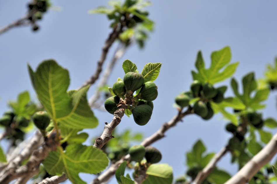
There is such variety in the land: a bit of snow could be seen on Mt. Hermon, the highest point of elevation in Israel. At the Dead Sea we were at the lowest point on earth. We traversed longitudinal zones: the coastal plain, the gently rising hills of the Shephelah, the hill country of Judea, Samaria and Galilee; the Jordan Valley, and the Trans-Jordan Plateau. We saw numerous green fields, some with crops, much agriculture, but also the barren desert.

I learned a lot on this trip, enjoyed the companionship of a valued professor, esteemed friend, and fellow-worker. I took a few thousand photos which hopefully find use in various venues of teaching, preaching, classes and writing, as well as resources for our local congregation.

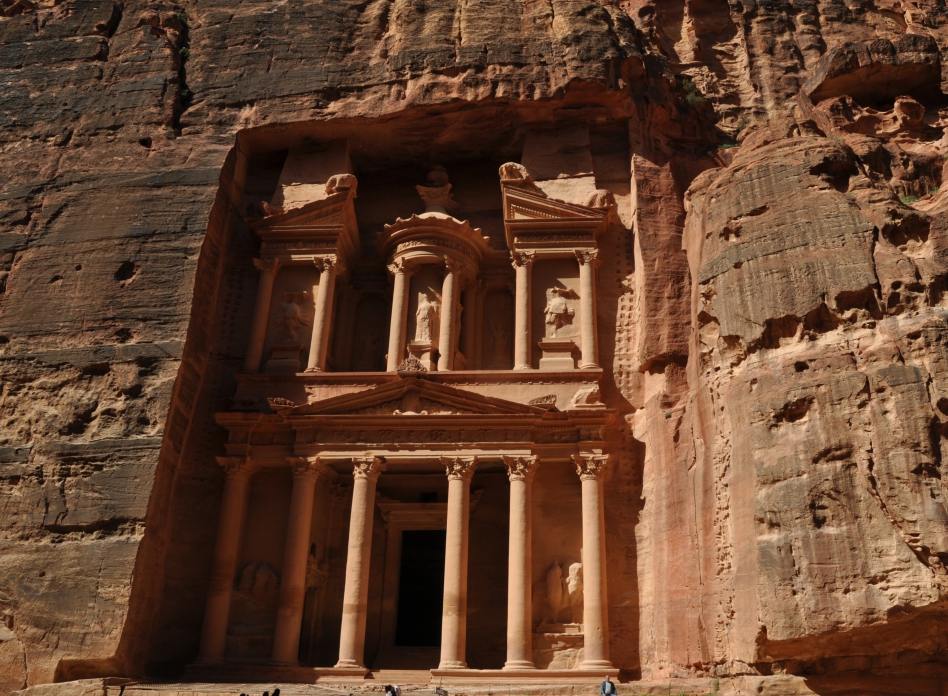
For now I’ll share a photo of the Siq at Petra:

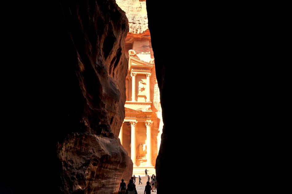
The Siq at Petra. Photo by Leon Mauldin.

The 1.2km siq, or canyon, with its narrow, vertical walls, is undeniably one of the highlights of Petra. The walk through this magical corridor, as it snakes its way towards the hidden city, is one full of anticipation for the wonders ahead – a point not wasted on the Nabataeans who made the passage into a sacred way, punctuated with sites of spiritual significance.

The Siq starts at an obvious bridge, beside a modern dam. The dam was built in 1963, on top of a Nabataean dam dated AD 50, to stop floodwater from Wadi Musa flowing through the Siq. To the right, Wadi Muthlim heads through a Nabataean tunnel – the start (or finish) of an exciting hike. The entrance to the Siq was once marked by a Nabataean monumental arch. It survived until the end of the 19th century, and some remains can be seen at twin niches on either side of the entrance. Many people charge through the Siq impatient to get to Petra. That’s a pity because the corridor of stone is worth enjoying for its own sake and the longer you take to travel through it, the more you can savour the final moment of arrival. Technically, the Siq, with its 200m-high walls, is not a canyon (a gorge carved out by water), but a single block that has been rent apart by tectonic forces. At various points you can see where the grain of the rock on one side matches the other – it’s easiest to spot when the Siq narrows to 2m wide. The original channels cut into the walls to bring water into Petra are visible, and in some places the 2000-year-old terracotta pipes are still in place. A section of Roman paving was revealed after excavations in 1997 removed 2m of soil accumulation.

Some historians speculate that the primary function of the Siq was akin to the ancient Graeco-Roman Sacred Way. Some of the most important rituals of Petra’s spiritual life began as a procession through the narrow canyon, and it also represented the end point for Nabataean pilgrims. Many of the wall niches that are still visible today along the Siq’s walls were designed to hold figures or representations (called baetyls) of the main Nabataean god, Dushara. These small sacred sites served as touchstones of the sacred for pilgrims and priests, offering them a link to the more ornate temples, tombs and sanctuaries in the city’s heart, reminding them that they were leaving the outside world, and on the threshold of what was for many a holy city. At one point the Siq opens out to reveal a square tomb next to a lone fig tree. A little further on, look for a weathered carving of a camel and caravan man on the left wall. The water channel passes behind the carving. Hereafter, the walls almost appear to meet overhead, shutting out the sound and light and helping to build the anticipation of a first glimpse of the Treasury. It’s a sublime introduction to the ancient city. (Lonely Planet Jordan: Travel Guide).


At Biblical Elath, on the Red Sea

March 27, 2018

The past two days Ferrell Jenkins and I have explored various sites in the Arabah (see Deut. 1:1 & etc., NASB), using Elath (spellings vary) as our base. This evening I took a photo looking out to the Red Sea.

Looking out to the Red Sea from Elath. Photo by Leon Mauldin.

It was in this area that King Solomon stationed a fleet of ships: “King Solomon also built a fleet of ships at Ezion Geber, which is near Elath on the shore of the Red Sea, in the land of Edom” (1 Kings 9:26).  This was made possible through the cooperation of the Phoenicians. 2 Chronicles 8 records, “Then Solomon went to Ezion Geber and Elath on the seacoast, in the land of Edom. And Hiram sent him ships by the hand of his servants, and servants who knew the sea. They went with the servants of Solomon to Ophir, and acquired four hundred and fifty talents of gold from there, and brought it to King Solomon” (vv.17-18).

Note the location of Elath:

Location of Elath on the Red Sea. BibleAtlas.com.

Click images for larger view.


Beit Shan in Israel, where King Saul’s Body Was Fastened

March 25, 2018

A slight (and temporary) “wrong turn” today put us in position to get a different view of Beit Shan than what I’ve previously had. What is so significant about this site (among many other considerations) is that when King Saul and his sons died in battle (on nearby Mt. Gilboa) against the Philistines, they decapitated Saul and fastened his lifeless body and that of his sons for display on the city walls.

Tel Beit Shan, where the bodies of Saul & his sons were desecrated. Photo by Leon Mauldin.

Your view to the left shows Trans-Jordan toward Jabesh-Gilead, from where brave Israelites came to take down the bodies. Read the text to see the story:

Now the Philistines were fighting against Israel, and the men of Israel fled from before the Philistines and fell slain on Mount Gilboa. 2 The Philistines overtook Saul and his sons; and the Philistines killed Jonathan and Abinadab and Malchishua the sons of Saul. 3 The battle went heavily against Saul, and the archers hit him; and he was badly wounded by the archers. 4 Then Saul said to his armor bearer, “Draw your sword and pierce me through with it, otherwise these uncircumcised will come and pierce me through and make sport of me.” But his armor bearer would not, for he was greatly afraid. So Saul took his sword and fell on it. 5 When his armor bearer saw that Saul was dead, he also fell on his sword and died with him. 6 Thus Saul died with his three sons, his armor bearer, and all his men on that day together. 7 When the men of Israel who were on the other side of the valley, with those who were beyond the Jordan, saw that the men of Israel had fled and that Saul and his sons were dead, they abandoned the cities and fled; then the Philistines came and lived in them. 8 It came about on the next day when the Philistines came to strip the slain, that they found Saul and his three sons fallen on Mount Gilboa. 9 They cut off his head and stripped off his weapons, and sent them throughout the land of the Philistines, to carry the good news to the house of their idols and to the people. 10 They put his weapons in the temple of Ashtaroth, and they fastened his body to the wall of Beth-shan. 11 Now when the inhabitants of Jabesh-gilead heard what the Philistines had done to Saul, 12 all the valiant men rose and walked all night, and took the body of Saul and the bodies of his sons from the wall of Beth-shan, and they came to Jabesh and burned them there. 13 They took their bones and buried them under the tamarisk tree at Jabesh, and fasted seven days. (1 Sam. 31:1-13).

In Roman times Beth Shan became one of the cities of the Decapolis.

For more articles on this site Click Here and here.

Click image for larger view.


The Spring of Jezreel in Israel

March 24, 2018

The Spring of Jezreel in Israel is mentioned in 1 Samuel 29 in connection with the closing episode of King Saul’s life. The text reads: “Now the Philistines gathered together all their armies to Aphek, while the Israelites were camping by the spring which is in Jezreel” (1 Sam. 29:1). Ferrell Jenkins & I were able to visit this spring this morning.

Spring of Jezreel in Israel. Photo by Leon Mauldin.

Within site of this spring is the mountain of Gilboa, where Saul and three of his sons died as the army of Israel was defeated by the Philistines.

Location of Jezreel. BbleAtlas.org.

I have previously written on King Saul and the geographical setting of his death here.

Click photo for larger view.


Caesarea Philippi

March 23, 2018

The Banias Spring emanates at Caesarea Philippi. At center of our photo you can see the Grotto of the god Pan.

Banias River at Caesarea Philippi. Photo by Leon Mauldin.

Jesus was in this area during the latter part of His earthly ministry, in that time-frame when He was trying to spend more private teaching/training time with the apostles for the great evangelistic work for which He had chosen them. Text–Matthew 16:

13 Now when Jesus came into the district of Caesarea Philippi, He was asking His disciples, “Who do people say that the Son of Man is?” 14 And they said, “Some say John the Baptist; and others, Elijah; but still others, Jeremiah, or one of the prophets.” 15 He said to them, “But who do you say that I am?” 16 Simon Peter answered, “You are the Christ, the Son of the living God.” 17 And Jesus said to him, “Blessed are you, Simon Barjona, because flesh and blood did not reveal this to you, but My Father who is in heaven. 18 “I also say to you that you are Peter, and upon this rock I will build My church; and the gates of Hades will not overpower it. 19 “I will give you the keys of the kingdom of heaven; and whatever you bind on earth shall have been bound in heaven, and whatever you loose on earth shall have been loosed in heaven.”

Downstream are the Banias Falls, one of the primary sources of the Jordan.

Also while at Caesarea we saw some figs today.

Figs at Caesarea Philippi. Photo by Leon Mauldin.

Click images for larger view.


Zarethan (Tell es Sa’idiyeh) in the Jordan Valley

March 22, 2018

This morning we left  the Dead Sea, made our way to the border crossing at the King Hussein Bridge into Israel, and arrived after dark at Tiberias on the Sea of Galilee, with brief stops at Jerusalem and Caesarea on the way. We plan as time permits to share more photos/info from this past week in Jordan, as well as more to come in Israel.

For tonight I wanted to mention Zarethan in the Jordan Valley, of biblical significance in the Old Testament. When Solomon was building the temple and its vessels, some of the metal casting  (bronze) was done in the area of Zarethan.

Zarephan, mentioned in connection with casting bronze for use in Solomon’s temple. Photo by Leon Mauldin.

1 Kings 7:

40 Now Hiram made the basins and the shovels and the bowls. So Hiram finished doing all the work which he performed for King Solomon in the house of the LORD: 41 the two pillars and the two bowls of the capitals which were on the top of the two pillars, and the two networks to cover the two bowls of the capitals which were on the top of the pillars; 42 and the four hundred pomegranates for the two networks, two rows of pomegranates for each network to cover the two bowls of the capitals which were on the tops of the pillars; 43 and the ten stands with the ten basins on the stands; 44 and the one sea and the twelve oxen under the sea; 45 and the pails and the shovels and the bowls; even all these utensils which Hiram made for King Solomon in the house of the LORD were of polished bronze. 46 In the plain of the Jordan the king cast them, in the clay ground between Succoth and Zarethan. (verses 40-46)

The British Museum website has some interesting info:

Tell es Sa’idiyeh, identified as the biblical city of Zarethan, lies at the heart of the central Jordan Valley. The huge, double occupation mound occupies a key strategic position, commanding the crossroads of two major trade routes, and dominating some of the richest and most fertile agricultural land east of the River Jordan.

Excavations undertaken since 1985, by a British Museum expedition under the direction of Jonathan N. Tubb, have revealed the great antiquity of the site’s occupational history, with settlement phases extending from the Early Islamic period of the seventh century AD, as far back at least as the Early Bronze Age of the third millennium BC. Excavations have shown that by about 2900 BC, Tell es-Sa’idiyeh was a large and prosperous city, with well constructed architecture and evidence for highly developed municipal planning. The most significant finding in this Early Bronze Age phase has been of a large palace complex on the lower tell, with areas set aside for olive oil production and storage, wine-making and textile preparation. All three of these activities were conducted on an industrial scale, clearly designed for international commerce. The pottery and other artifacts recovered from this early city display a level of refinement and sophistication unparalleled elsewhere in the Levant.

Equally remarkable discoveries relate to the city of the twelfth century BC, where excavations have uncovered evidence to suggest that Tell es-Sa’idiyeh, like Beth Shan or Gaza on the other side of the Jordan River, was a major centre for the Egyptian control of Canaan during the final years of its New Kingdom empire. Substantial architecture, including an elaborate water system and Egyptian-style public buildings have been found on the upper mound, and the same strong Egyptian component is also found in the contemporary cemetery which was cut into the long-abandoned and eroded ruins of the Early Bronze Age city on the lower mound. The expedition has excavated, to date, some 450 graves, many of which show unusual Egyptian features, both in terms of the grave-goods and burial customs. (http://www.britishmuseum.org/research/research_projects/tell_es-sa%E2%80%98idiyeh_excavations.aspx).

A couple of days ago I posted a sunset view of the Dead Sea; here is our view of the Dead Sea from the Jordan side looking across to Israel this morning.

Morning view of Dead Sea looking west. Photo by Leon Mauldin.

Click images for larger view.


Making Friends in the Jordan Valley

March 21, 2018

Ferrell Jenkins & I are continuing to enjoy our present opportunity to visit and photograph biblical/archaeological sites in Jordan and Israel. We also enjoy meeting many friendly people along the way. Today as we were looking for Tell es Sa’idiyeh, identified as the biblical city of Zarethan, we stopped for a bite of lunch in the Jordan Valley, in the biblical region of Perea.

Photo by Leon Mauldin.

Photo by Leon Mauldin.

The food was good (we each had a 1/2 chicken), but it was also pleasant to meet friendly people.

Thanks for continuing to follow our travels.


Greetings from Jordan

March 20, 2018

Today’s travels/photography included the proposed site of Tel Heshbon (mentioned numerous times, Num. 21:25, etc.) and Madaba, famous for its large Byzantine-era mosaic map of Israel.

Here is today’s sunset view from Jordan, across the Dead Sea looking to Israel. The mountains of Moab are at our back.

Sunset at Dead Sea. Photo by Leon Mauldin.

Thanks for following our travels.

Click image for larger view.


The Treasury at Petra

March 19, 2018

This morning we enjoyed a visit to Petra, the capital of the Roman province of Arabia during the time of Christ. During Old Testament times Petra was in the territory of Edom. There is so much to see. For now I will share a photo of the “Treasury.”

“Treasury” at Petra. Photo by Leon Mauldin.

Known locally as the Treasury, this tomb is where most visitors fall in love with Petra. The Hellenistic facade is an astonishing piece of craftsmanship. Although carved out of iron-laden sandstone to serve as a tomb for the Nabataean King Aretas III (c 100 BC– AD 200), the Treasury derives its name from the story that an Egyptian pharaoh hid his treasure here (in the facade urn) while pursuing the Israelites. Some locals clearly believed the tale because the 3.5m-high urn is pockmarked by rifle shots. As with all rock-hewn monuments in Petra, the interior is unadorned. (Lonely Planet).

It’s been a while since I’ve been on horseback, and I had never ridden a donkey, but I did both today.

Ferrell Jenkins and Leon Mauldin riding donkeys at Petra. Photo by local Bedouin.

Tonight we’re on the eastern shore of the Dead Sea as we continue to explore and photograph Jordan.

Click images for larger view.


On the Banks of Jordan

March 18, 2018

On the banks of the Jordan River: Ferrell Jenkins and I are enjoying an opportunity to explore biblical sites in Israel/Jordan, currently in Jordan. We have seen Pella and Jerash, which were cities of the Decapolis. The past two nights we stayed at Bethany, within easy walking distance of the Jordan.

On the banks of the Jordan at Bethany, the traditional location of Jesus’ baptism. Photo by Ferrell Jenkins.

Seeing the reeds here along the Jordan reminded me of some biblical references. Jesus asked the people regarding John: “As these men were going away, Jesus began to speak to the crowds about John, “What did you go out into the wilderness to see? A reed shaken by the wind?” (Mt. 11:7). John was certainly no reed shaken by the wind!

Today we saw Mt. Nebo, where Moses stood when he looked across to see the Promise Land, then Dibon, where the famous Moabite stone was discovered. We had stunning views of the Arnon gorge, and made our way on the King’s Highway to Petra, arriving after dark.

I’ve previously posted on the Jordan River here, here, and here.

I’ve not posted until now due to internet issues, but plan to be able now to share more photos.