Jokneam was a strategic city-state of Canaan, located on the ancient international route which connected Egypt to Mesopotamia. It is listed among 31 other cities defeated by Joshua during the conquest of Canaan (Josh. 12:22).
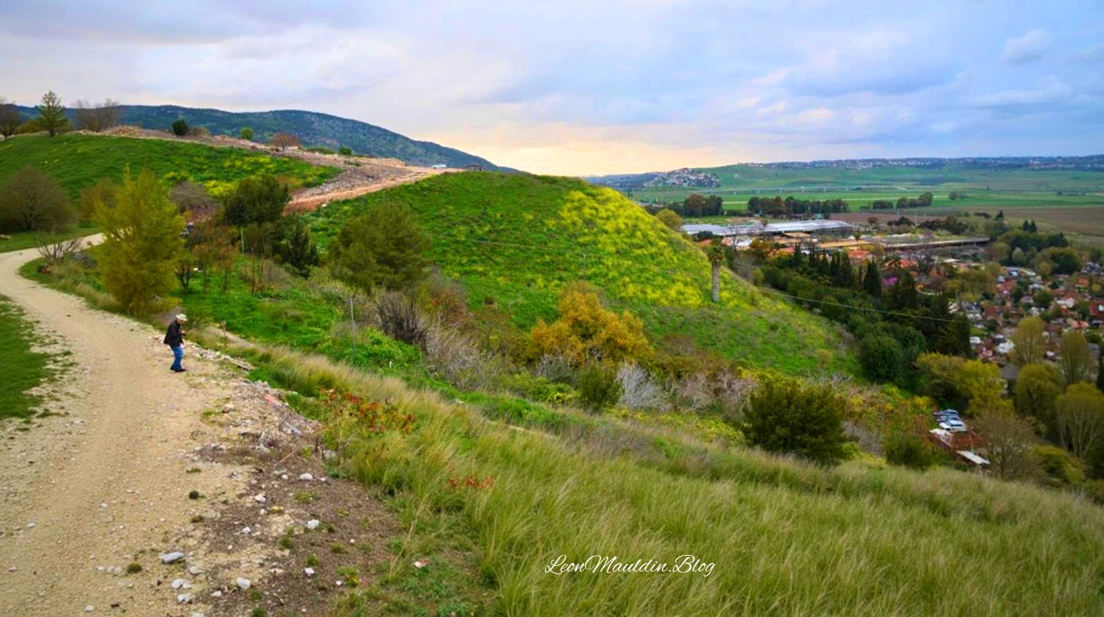
Tel Jokneam. Mentioned in Joshua 12:22, taken during the Conquest. Photo by Leon Mauldin.
Jokneam is
a large mound rising above the surrounding plain and covering an area of 10 a., is situated at a point along the abutment of Mount Carmel and the Jezreel Valley, near the debouchment of Nahal Yoqne‘am (map reference 1604.2289) and at the northern outlet of Wadi Milh (Nahal Tut), on one of the major routes cutting across the Carmel Range. Via the Coastal Plain, the route passes close to Acco and then runs toward Phoenicia and other centers to its northwest. Of the three major cities located in the western Jezreel Valley in antiquity—Jokneam, Shimron, and Megiddo—Jokneam was the smallest. It was continuously inhabited for an extremely long time: the survey conducted here, as part of a regional research project—the “Yoqneam Regional Project”—furnished evidence of a settlement on the mound from the Early Bronze Age to the Mameluke period, a span of nearly four thousand years, although the site was not fully occupied in all these periods. During the Arab and Crusader periods, Jokneam was the largest and most important center in the western Jezreel Valley. During the Roman period, the occupational sequence may have been interrupted, with the inhabitants moving to the nearby hill where modern Yoqne‘am ‘Illit is situated. The favorable environmental conditions prevailing in the Jezreel Valley made it a very densely populated region throughout most periods. Sites such as Tel Qiri, about 2 km (1 mi.) south of Jokneam, and Tel Qashish, some 2 km to its north, were undoubtedly satellite settlements linked to the major city of Jokneam. This region thus provides an opportunity to investigate the material cultural aspect of the relationship between a city and its satellite towns, through simultaneous excavations at the three adjacent sites. (Ben-Tor, A. (1993). Jokneam. In E. Stern (Ed.), The New Encyclopedia of Archaeological Excavations in the Holy Land (Vol. 3, p. 805). Israel Exploration Society & Carta; Simon & Schuster).
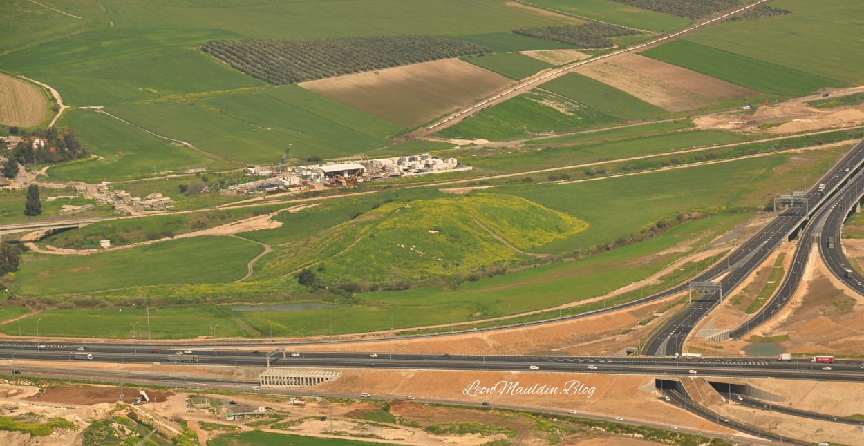
I had seen Jokneam from the viewpoint of Mt. Carmel in the photo above a number of times. Then in 2022 Ferrell Jenkins and I were able to explore it more closely on one of our personal study trips.
Jokneam at center. Photo by Leon Mauldin.
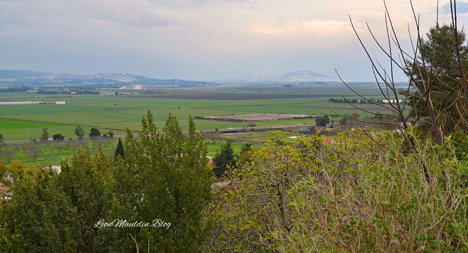
Here is a view of the Valley of Jezreel as seen from Jokneam:
Valley of Jezreel as viewed from Jokneam. Photo by Leon Mauldin.
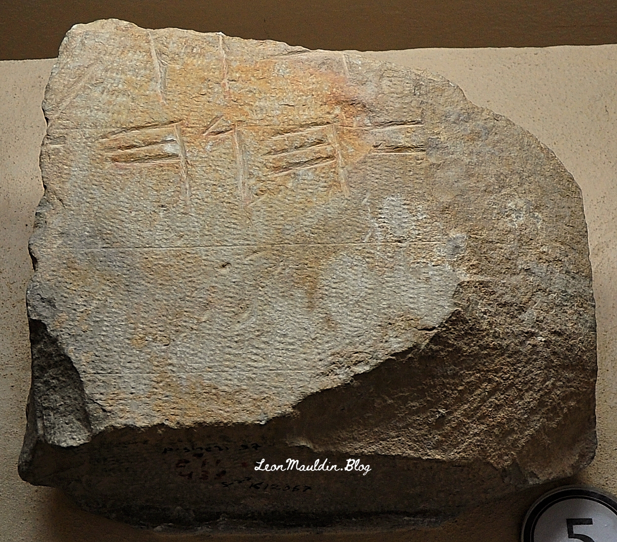
This is an apt title for a book authored by M.B. Van’t Veer, a 440-page work that focuses on the text of 1 Kings 16:34-19:21. The days of Elijah, when Ahab and Jezebel ruled Israel, were times of unprecedented corruption. God raised up Elijah to show the awesome power of Israel’s true God YAHWEH, and the power of His word. Great emphasis and purposeful repetition is given in this section of scripture on “the word of the LORD.” Elijah was unapologetically His spokesman; his very name means, “My God is YAHWEH”! The name YAHWEH, in Paleo-Hebrew script, is on the inscription here below:
Paleo-Hebrew Inscription with divine name YAHWEH. From Mt. Gerizim. Photo by Leon Mauldin.
The above inscription is displayed at the Good Samaritan Museum, located between Jericho and Jerusalem.
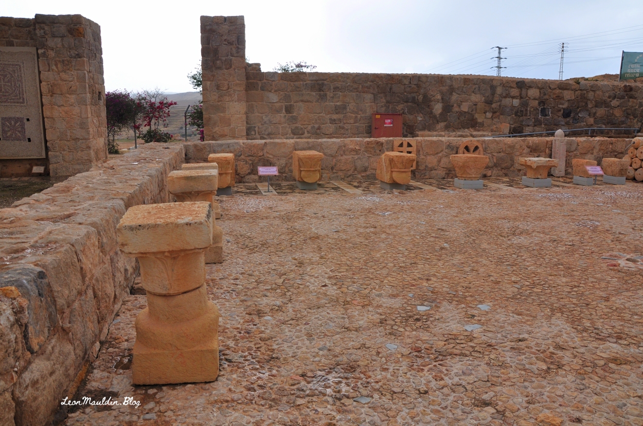
Church at Good Samaritan Inn.
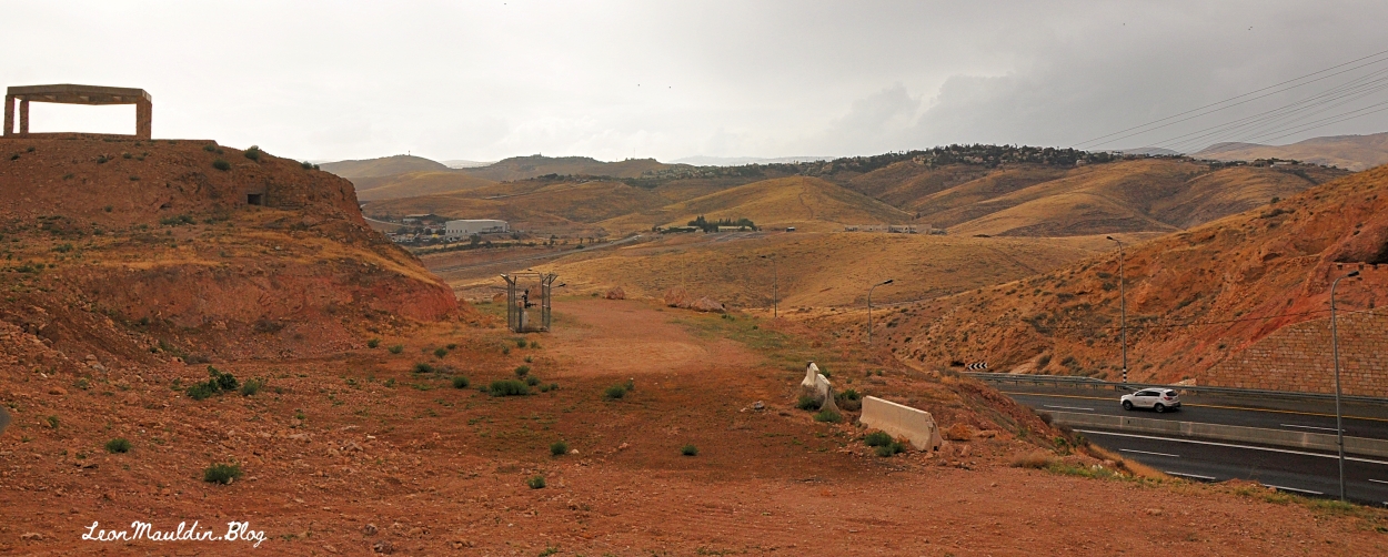
Here is the view from the Good Samaritan Inn looking toward Jerusalem:
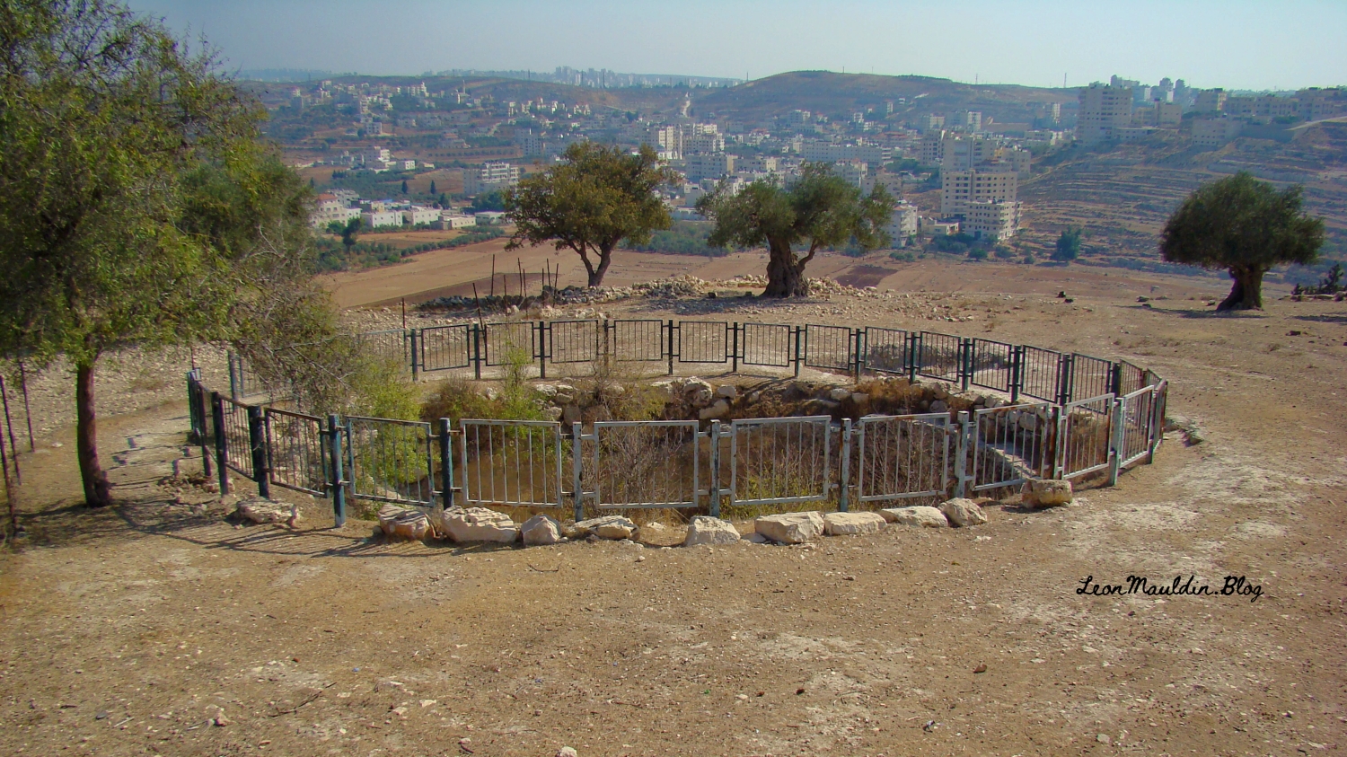
2 Samuel narrates an event early in the reign of King David, when initially he was king of Judah, prior to his reign over all Israel. When Ishbosheth, Saul’s son, was the rival king of Israel to the north, and Abner was his commander, there was a meeting at the pool of Gibeon, with Abner and his forces, and Joab, David’s commander, and his men. The text reads,
And Joab the son of Zeruiah, and the servants of David, went out and met them by the pool of Gibeon. So they sat down, one on one side of the pool and the other on the other side of the pool. Then Abner said to Joab, “Let the young men now arise and compete before us.” And Joab said, “Let them arise.” So they arose and went over by number, twelve from Benjamin, followers of Ishbosheth the son of Saul, and twelve from the servants of David. And each one grasped his opponent by the head and thrust his sword in his opponent’s side; so they fell down together. Therefore that place was called the Field of Sharp Swords, which is in Gibeon. So there was a very fierce battle that day, and Abner and the men of Israel were beaten before the servants of David (2 Sam. 2:13-17).
Abner and his forces were soundly defeated, suffering 360 casualties, while David’s men led by his commander Joab had a total of 20 losses (v. 25-31). It was a sad and unnecessary chapter in Israel’s history. Gibeon was located within the tribal territory of Benjamin. Today it is in the West Bank.
Here is a closer view of the pool mentioned in our text:
The Baker Encyclopedia of the Bible has the following entry, dealing with the pool, as well as more info regarding the site of Gibeon:
The Great Pool. This is referred to several times in the Bible and can now be identified. It was 37 feet in diameter and 82 feet deep, cylindrical in shape with perpendicular sides cut into bed-rock. There was a spiral stairway of 79 steps which gave access to fresh water 80 feet below street level. The pool lay inside the city walls.
The Stepped Tunnel. There was a second plan for obtaining water in time of siege. An underground sloping tunnel which descended by a series of 93 steps led to an underground reservoir fed by a spring originating in the rock mass below the city. This spring had been traced and a feeder tunnel enabled its water to flow more readily to the reservoir. Any overflow found its way via a conduit to the village below. This was a remarkable engineering achievement. The stepped tunnel reached down to a depth of 80 feet and was 167 feet long. In its walls were niches to hold oil lamps. Probably it was here that the “drawers of water” (Jos 9:27) obtained their supplies.
Inscriptions and Royal Stamp Seals. Sixty-one jar handles have been found on which inscriptions were cut in the archaic Hebrew script. On 31 of these is the word for Gibeon in whole or in part. Another 80 jar handles carry the letters lmlk, “belonging to the king.” Several well-known OT names such as Azariah, Amariah, Hananiah, and Neriah and a number of place-names such as Hebron, Socoh, and Ziph appear on these inscriptions.
Industrial Area. A remarkable industrial area came to light in the excavations, located both north and south of the pool. Here there were numerous winepresses, fermenting basins, and 63 underground cellars for cooling large wine jars. The whole area covered over 1100 square yards with cellars sunk into the limestone, some of these being over seven feet deep and equipped with stone covers. It is estimated that up to 25,000 gallons of wine could be stored in the jars. Some of the cellars were used as tombs in Roman times, but in Byzantine and modern times their use as wine cellars continued. In detail the cellars were bottle-shaped and averaged 7.2 feet in depth and 6.6 feet across at the bottom. The opening to the cellars averaged 2.2 feet in diameter at the top. The jars in which the wine was stored had a capacity of 9.75 gallons. It is clear that the manufacture of wine was an important element in the economy of Gibeon in OT times.
Fortifications. Gibeon was a walled city. Two impressive stone walls which encircled the city at different periods have been exposed. No traces of walls were found that could be dated to the Early, Middle, or Late Bronze periods although the remains of house walls, pottery, and tombs demonstrate that the city was occupied then. The excavator concluded that the construction of the earlier wall dates to the 12th century BC. and the later wall was built in the 10th century BC. and continued in use to the end of the 7th century BC. The average thickness of the wall was about 13 feet. The circumference of the fortification was 3125 feet.
The Necropolis. The burial place of Gibeon was situated to the west of the city halfway down the rock scarp. Many of the graves contained skeletal remains, pottery, scarabs, and other artifacts. The size of the tombs varied considerably, but most consisted of a vertical cylindrical shaft about 3.7 feet in diameter, the depths varying from 3.3 feet to 13 feet. The tombs were sealed by either one large stone or several smaller ones at the foot of the vertical shaft where the burial chamber opened to one side. JOHN A. THOMPSON Vol. 1, p. 864).
I have previously posted on Gibeon here, here and here.
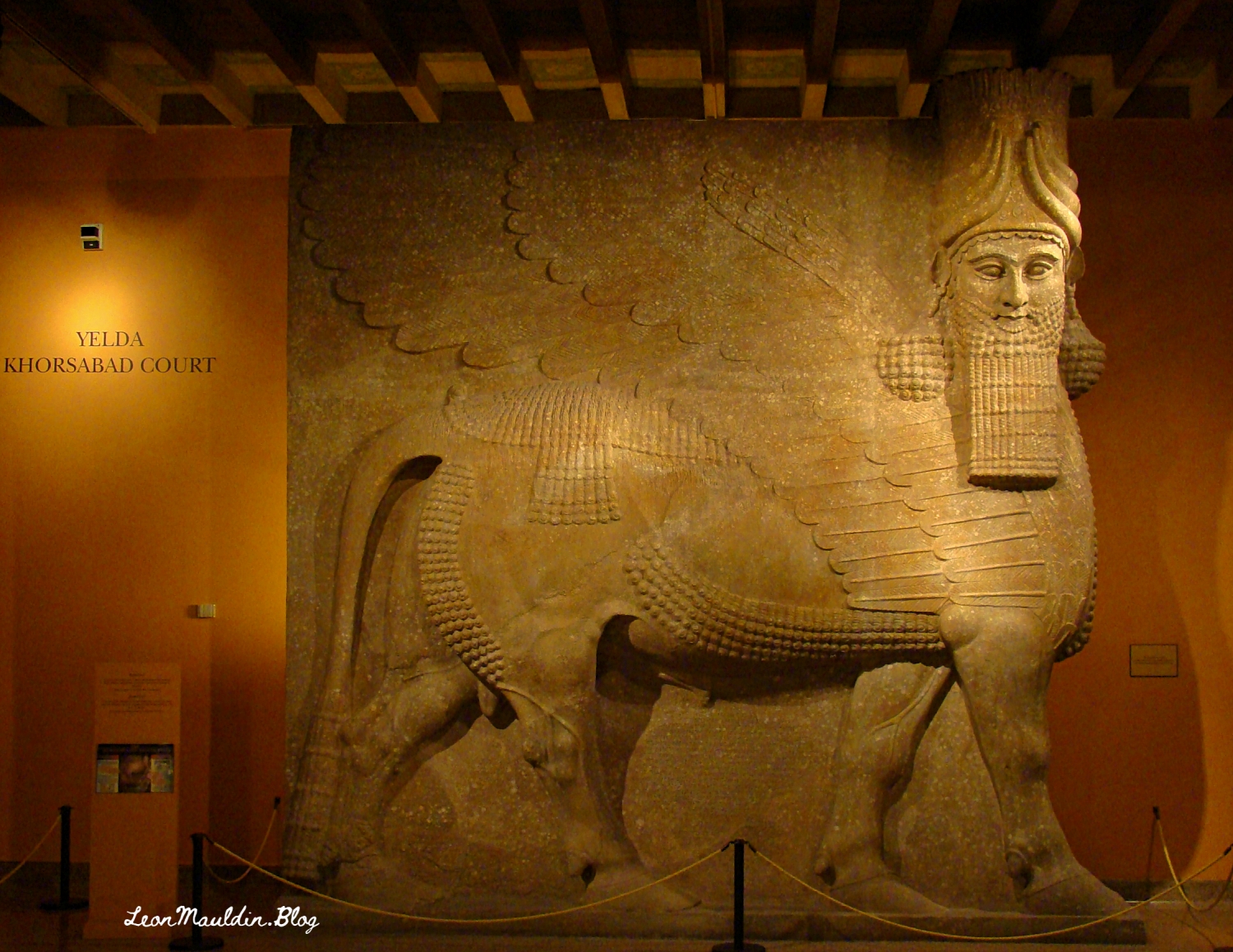
2 Kings 17 records the sad, catastrophic fall of the northern Kingdom of Israel (722 BC), as well as the reasons for that calamity: their sin and rebellion against Yahweh. The siege of Israel’s capital city Samaria, begun by Assyrian King Shalmaneser (r. 726-722 named in v. 3), lasted three years (v.5). The text continues to narrate that “the king of Assyria took Samaria and carried Israel away to Assyria. . .” (v.6). According to Assyrian records, Shalmaneser V died just before the siege was finished; the conquest was completed by his successor Sargon II (r. 722-705).
Though not mentioned by name in the 2 Kings text, Sargon II is cited in Isaiah 20:1, in the context of his capturing Ashdod of Philistia.
When you study the Scriptures, you’re reading about real events, real people, real places! The Bible is not a book of fiction. It is the inspired word of God.
A scheduled study for today includes 1 Kings 19, the chapter which follows the triumph on Mt. Carmel (1 Kings 18) which showed that Elijah was the true servant of God, and Yahweh was the true God; Baal was nothing! But in 1 Kings 19, a discouraged Elijah leaves Jezebel & Ahab’s jurisdiction (northern Kingdom of Israel) and travels hundreds of miles south.
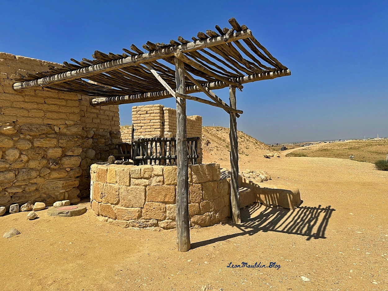
1 Kings 19:3 notes that he first traveled as far as Beersheba, which was the southernmost extent of Judah’s border.
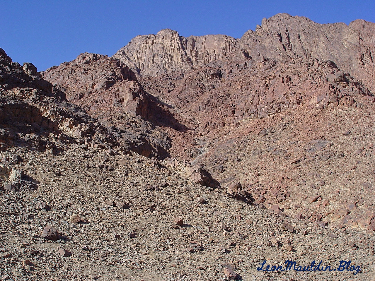
After some food and rest, Elijah continued his journey down to Mt. Sinai, here designated as “Horeb, the mountain of God” (1 Kings 19:8). Earlier at Mt. Sinai when God brought Israel out of Egypt by His servant Moses, He gave the Israelites the 10 Commandments (along with the other laws and ordinances) to Israel. (Note rendering of NLT is “Mount Sinai.”).
At various points in biblical history, we sometimes see that opposition to God’s purpose came from the outside, from those who are enemies of God’s revealed will. But on other occasions, the source of problems and discord is from within, from professed followers. This was the case in Nehemiah 5. Previously the inspired narrative had traced the opposition to rebuilding Jerusalem’s wall to men such as Sanballat the Horonite, Tobiah the Ammonite and Gehsem the Arab (2:10,19; 4:1,7), enemies from “without.” But in chapter 5 it is the “Jewish brethren” (v. 1), their “nobles and rulers” (v.7), who were taking advantage of the poor (Jews) for their own financial profit. The poor were having to borrow money, and even reduced to selling their children as slaves, to have something to eat. (Neh. 5:1-5). Hence their plea to Nehemiah: “Therefore let us get grain for them, that we may eat and live” (v.2).
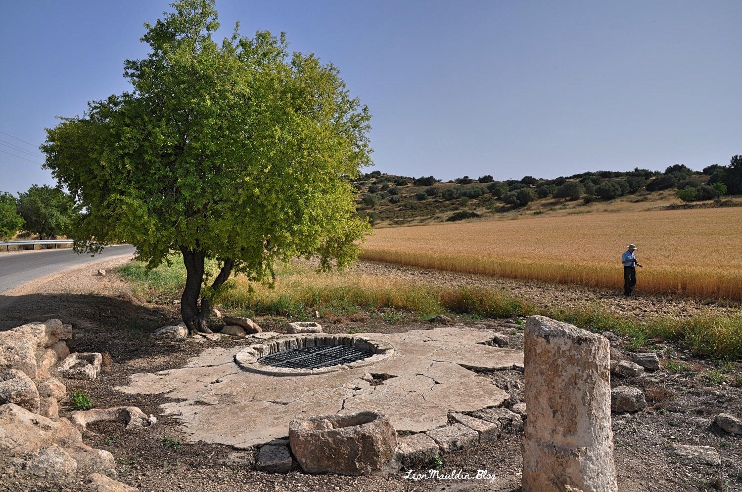
To illustrate, I want to share some photos from Maresha, near Beit Guvrin, Israel.
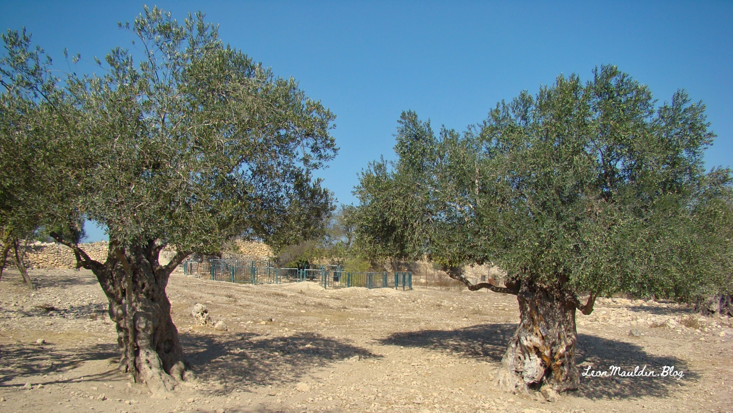
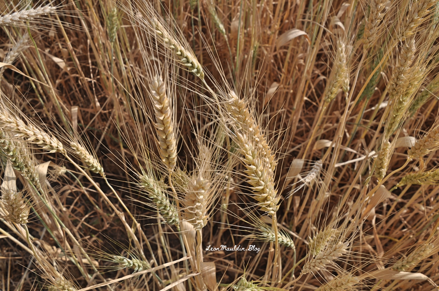
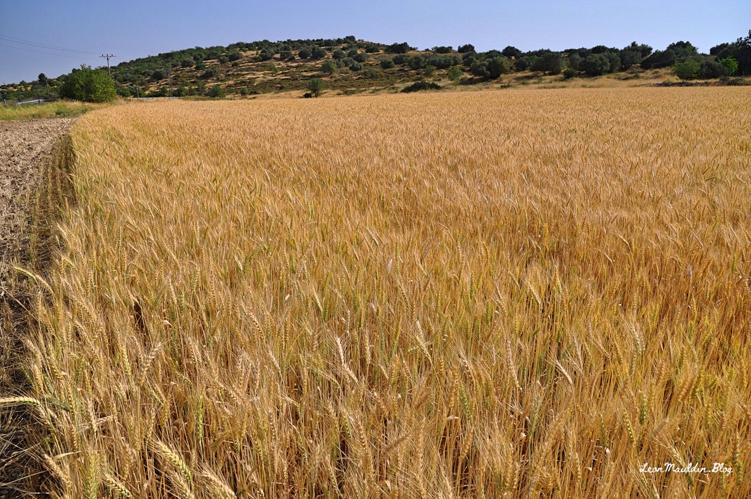
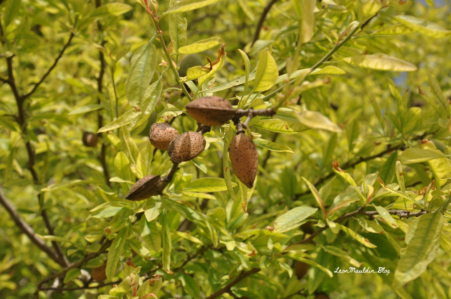
This photo shows a portion of the wheat field, plus an ancient well (note the rope marks), a manger, a milestone, an almond tree, and my good friend/brother Ferrell Jenkins. (He is “out standing” in his field). That’s a lot to get in one photo 🙂
In doing some study in the prophet Malachi this morning I came across one of the many biblical references to Esau (from whom descended the Edomites). Malachi 1:2-3 illustrates the necessity of contextual biblical study: “Jacob I have loved, But Esau I have hated.” In short, this had nothing to do with the salvation of individual Edomites, or God’s personal like or dislike of Jacob or Esau, but rather underscores God’s sovereignty in choosing to provide salvation in that descendant of Jacob, Jesus the Christ.
The territory occupied by Edom included Petra. By Roman Times the Edomites had been displaced by a people known as the Nabateans. Petra was the capital of the Roman Province of Arabia.
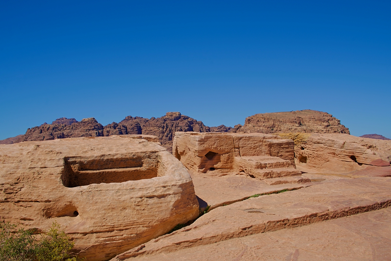
One of the many interesting archaeological finds at Petra is the High Place, including the altar for sacrifice. The photo here was taken in 2019 by tour member David Deason.
High Place at Petra. Altar at center (and slight right). Photo by David Deason.
The High Place at Petra is one of the best preserved of all such sacred installations in the ancient Near East. Its location is imposing, approximately 3,400 feet above sea level and 625 feet above the temenos. The altar platform was approached by three steps. It is situated about 3 feet above the level of an adjoining courtyard area and is equipped with drains and basins for sacrifices and ablutions.
The Biblical World in Pictures; BAS Biblical World in Pictures. (2003). Biblical Archaeology Society.
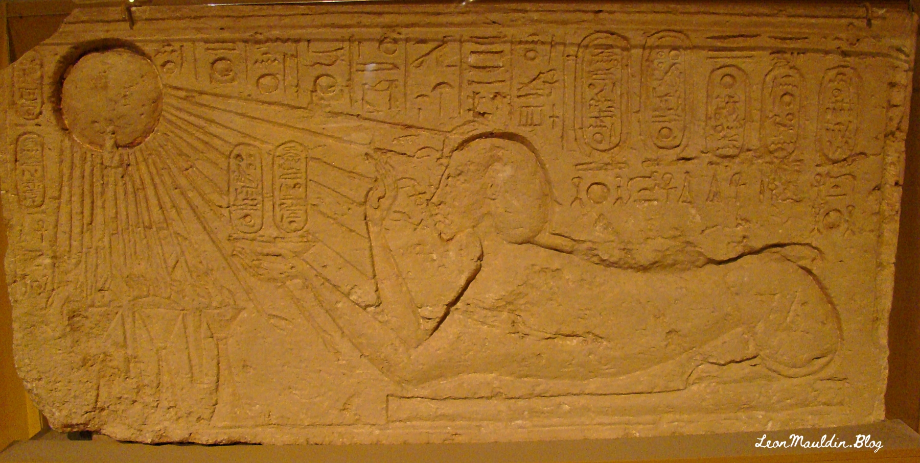
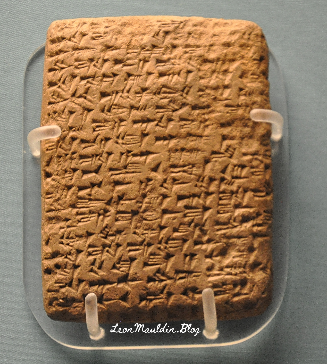
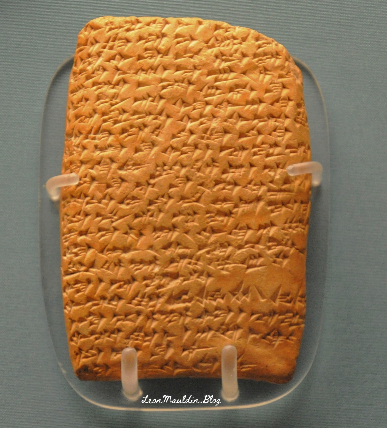
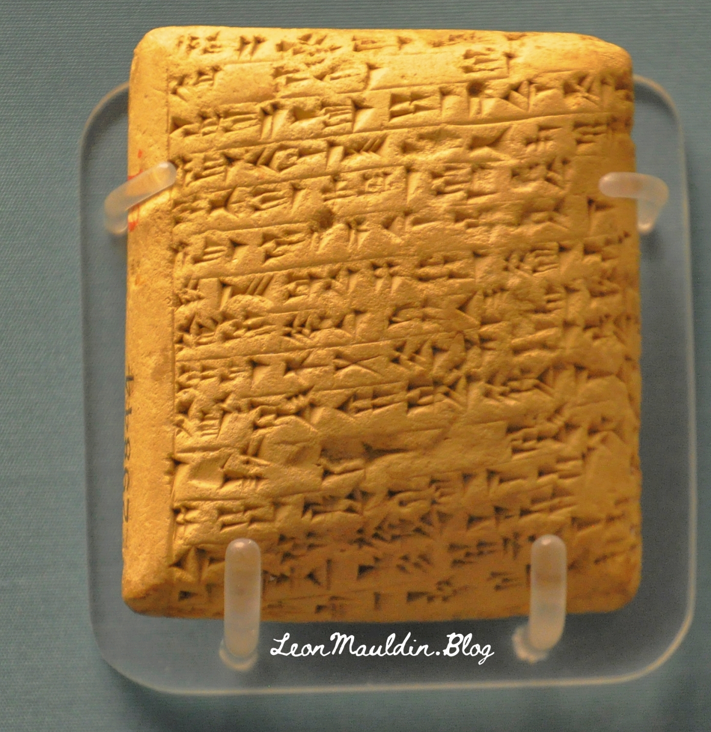
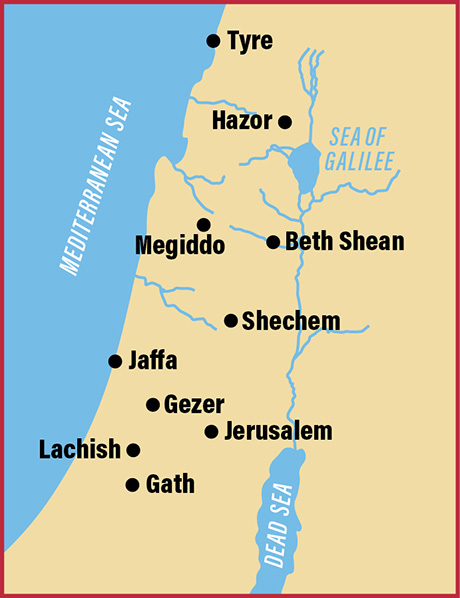
The collection of El-Amarna tablets represent diplomatic correspondence from princes/kings of from varioius parts of the Egpytian Empire during the reigns of Amenophis III, Akhenaton and Tutankhamun. These tablets were found in the ruins of Akhenaton’s (the “heretic” pharaoh) capital at El-Amarna. The British Museum displays some of the El-Amarna tablets from various locations in Canaan, which will be the focus of this post. We will feature tablets from Hazor, Lachish, Gezer, Megiddo and Shechem, all five of which were very important sites in Canaan.
Discovered at the site of Tell el-Amarna in Middle Egypt, these cuneiform documents are letters dating to the mid-14th century BCE that were written in varieties of Akkadian, the lingua franca of the time, by scribes from all over the ancient Near East on behalf of local kings. The letters are commonly divided into two groups: letters from the “greater” powers (the Egyptian, Mitannian, Hittite, Assyrian, and Kassite kings) and letters from the “lesser” powers (smaller kingdoms and city-states from across the Levant, including the land of Canaan). Interestingly, even though the Canaanite rulers were among the least powerful kings writing to Egypt (in fact, they were under Egyptian rule), they left behind the largest number of letters. Source: https://library.biblicalarchaeology.org/article/letters-to-pharaoh-the-canaanite-amarna-tablets/?utm_source=WhatCountsEmail&utm_medium=BHDA%20Spotlight%201-90&utm_campaign=TS%20BAS%20Scholars%20Series%208-21-24
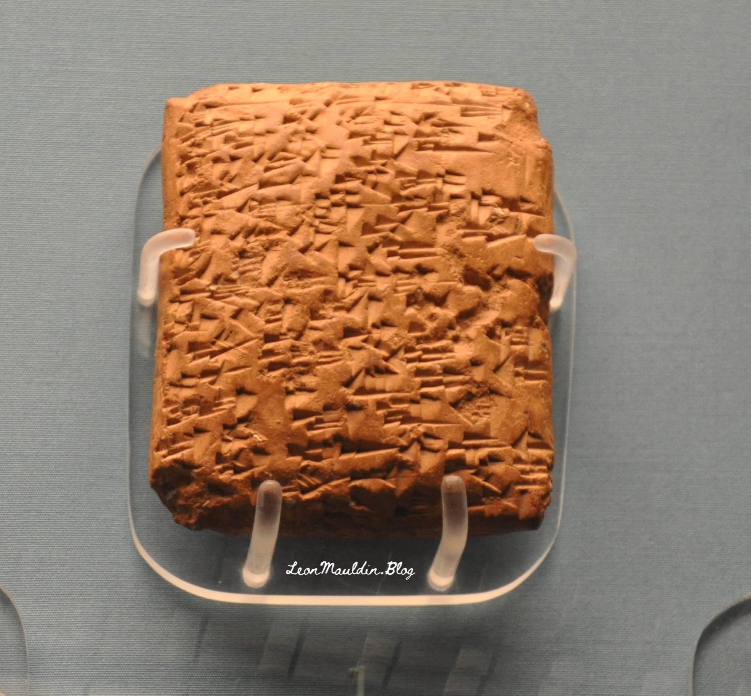
This tablet is from Abdi-Tirshi, King of Hazor. The info sign says that he “reassures pharaoh that he is loyal and is keeping his cities in good order.”
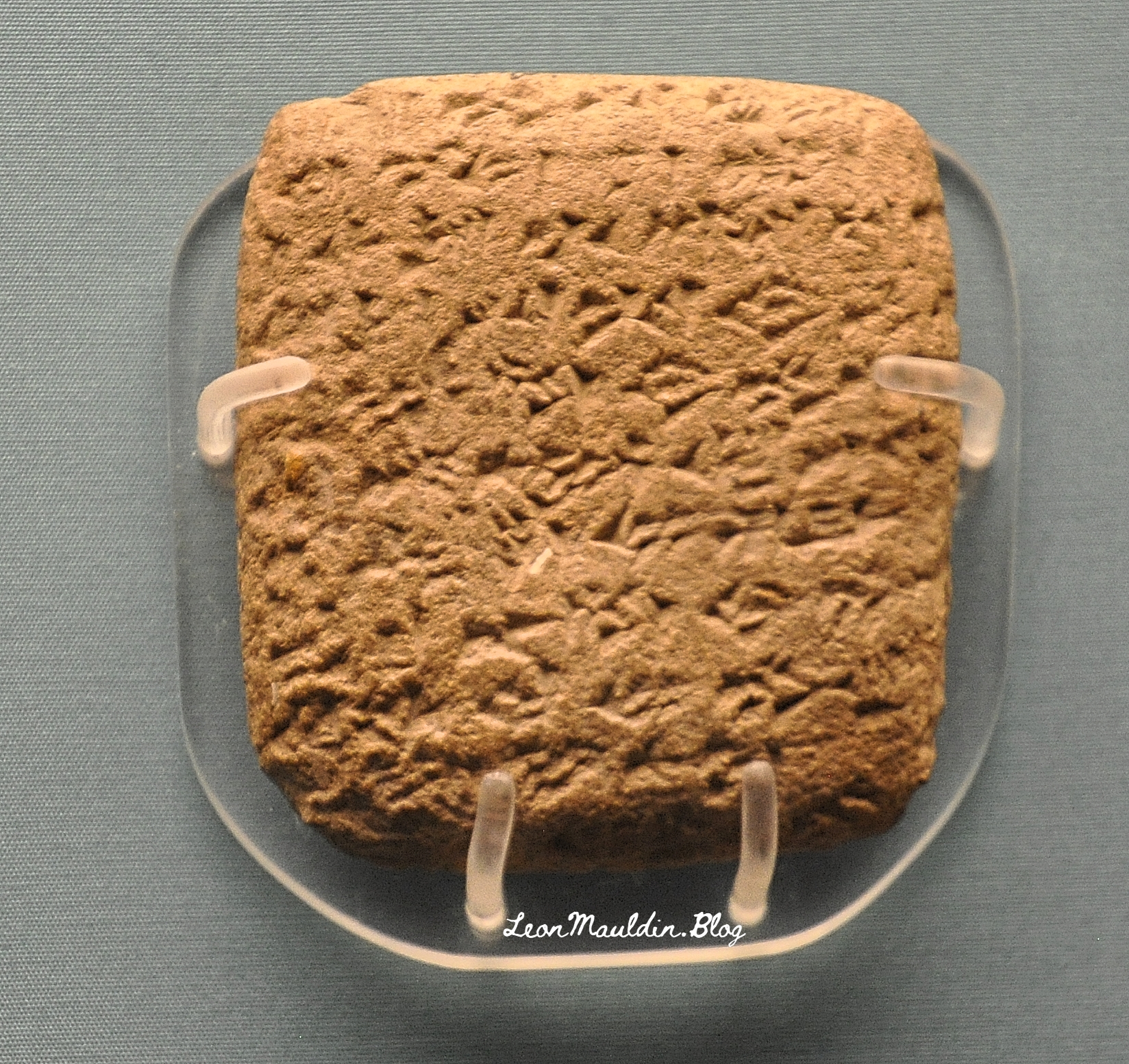
Here is the tablet from Gezer’s king Yapahu, who “begs pharaoh for help in defending his city against raids by the Hapiru.” Many scholars believe that the “Hapiru” here refer to the Hebrews.
Here is the tablet from Biridiya, king of Megiddo. He “accuses the king of Acco of treachery by releasing the captured Hapiru leader, Labayu, instead of sending him to Egypt.”
Mandell went on the say regarding the script of these tablets, “The Amarna Letters were not written in alphabetic or Egyptian scripts. They were written in cuneiform, a wedge-shaped script that was developed in Mesopotamia in the late fourth millennium BCE to write Sumerian and, later, Akkadian. By the Amarna period, ancient people from all over the Near East wrote in this script by impressing a stylus into clay to create wedge-shaped signs” (Ibid.).
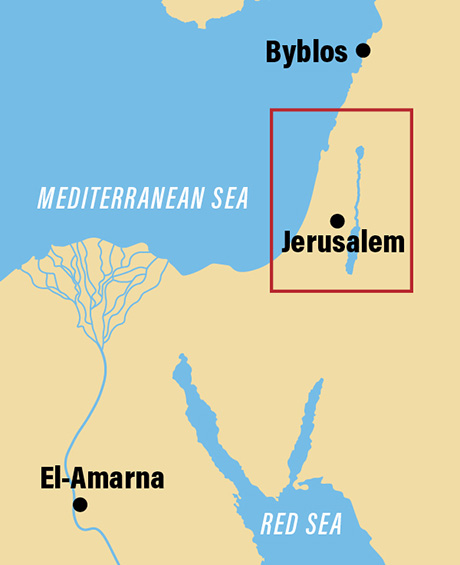
The BAS article also provided a couple of helpful maps.
Map shows the location of El-Amarna relative to Canaan.
Location of El-Amarna in Egypt. Map by BAS.
This map includes the sites of the origin of the tablets we featured above.
Cities in Canaan represented our display of tablets. Map by BAS.
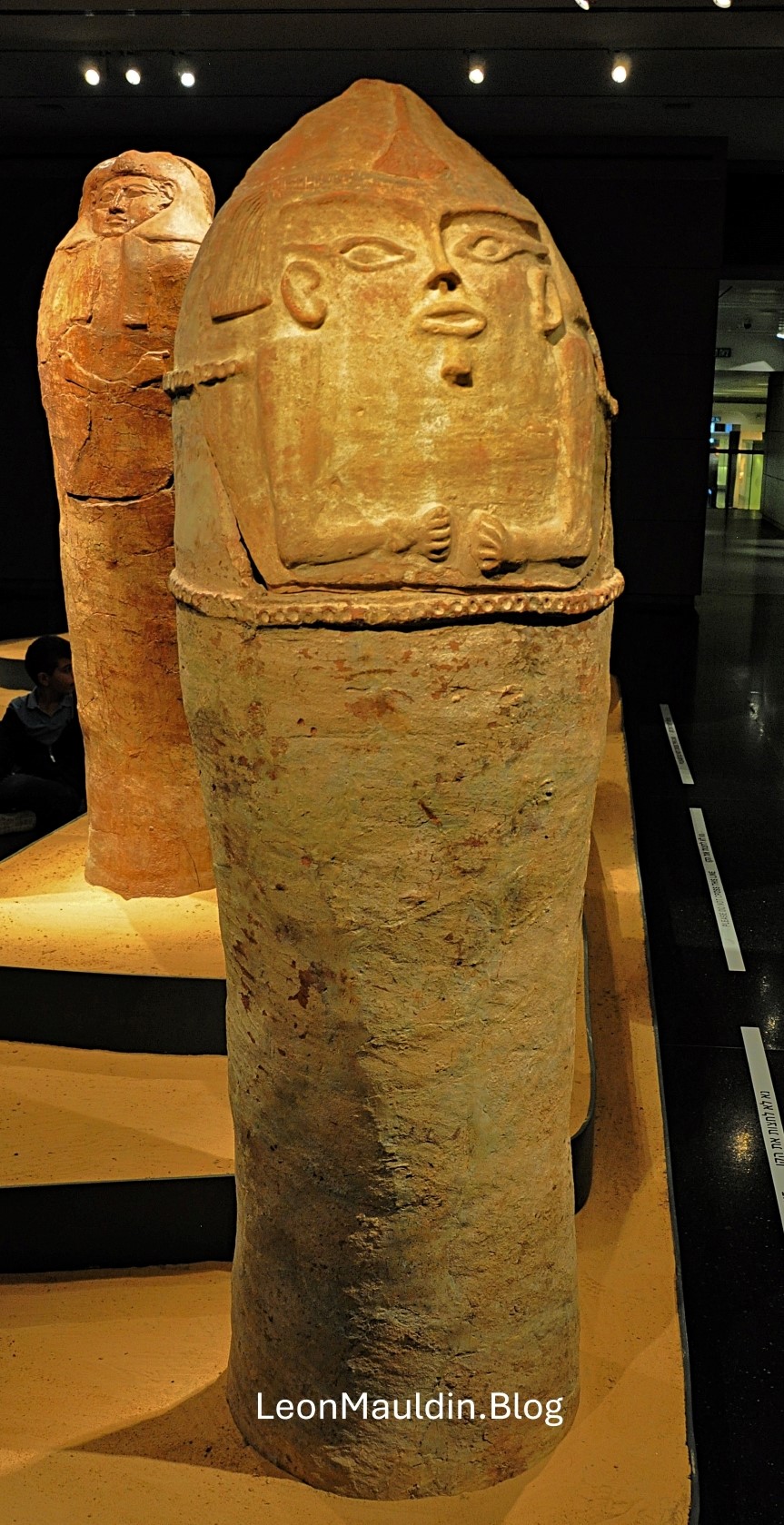
This post shows an Anthropoid Coffin from Deir el-Balah, south of Gaza, one of the cities of the Philistines. Scholars date this artifact to the 13th century BC. It demonstrates Egyptian influence reaching into the SW coast of Canaan. The patriarch Joseph may have been put in a coffin such as this.
The Philistines are mentioned numerous times in the Bible, in the days of the Judges and Kings, and as well as references in the prophets. For example, Zephaniah 2:4: “For Gaza shall be deserted, and Ashkelon shall become a desolation; Ashdod’s people shall be driven out at noon, and Ekron shall be uprooted” (ESV). This text mentions four of the five cities of the Philistine Pentapolis, the fifth being Gath (see 1 Sam. 6:16).
The context of Zephaniah’s prophecy is one of judgment, of the wrath of God, called “The great day of the LORD” (1:14). Though Zephaniah is addressing the Jews of Jerusalem/Judah, God is the God of all the nations. Here the prophet was warning of the destruction of the Philistines (2:5).
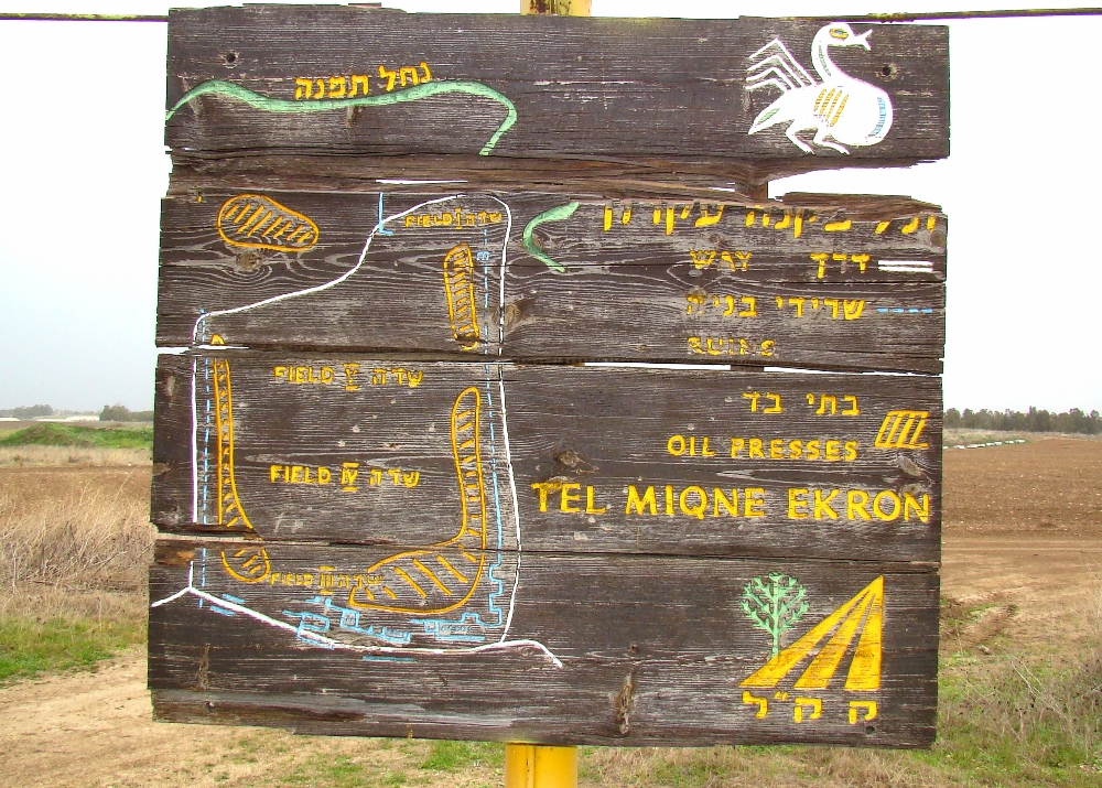
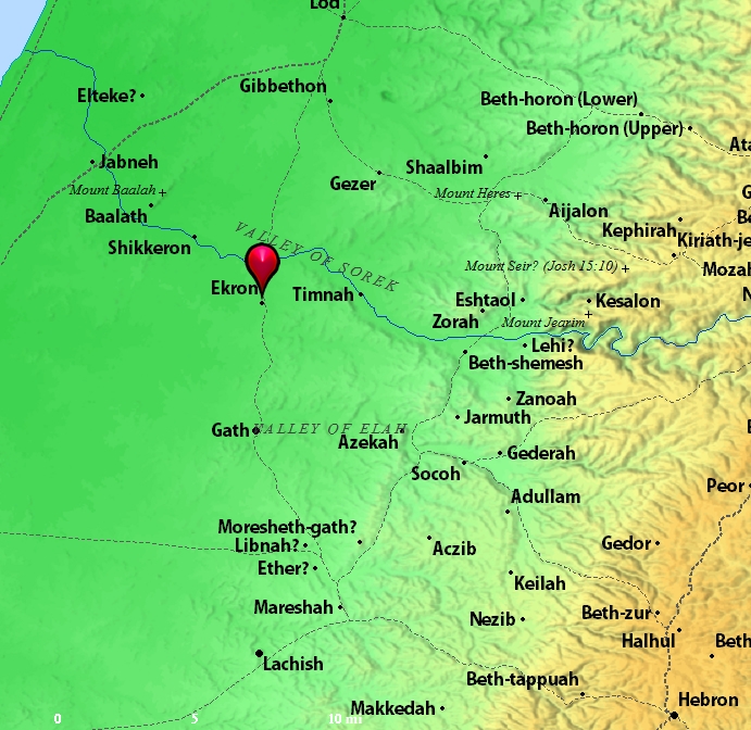
This post will deal briefly with Ekron, which today is known also as Tel Miqne.
Though originally in Israel’s territory at the time of the Conquest led by Joshua (Josh. 15:11, 45-56), Ekron was later in the hands of the Philistines by the time of the Judges. Much of the territory originally taken by the Israelites in the conquest was not retained in subsequent years, largely due to Israel’s lack of diligence and compromise with the surrounding nations.
Location of Ekron. Map by BibleAtlas.Org.
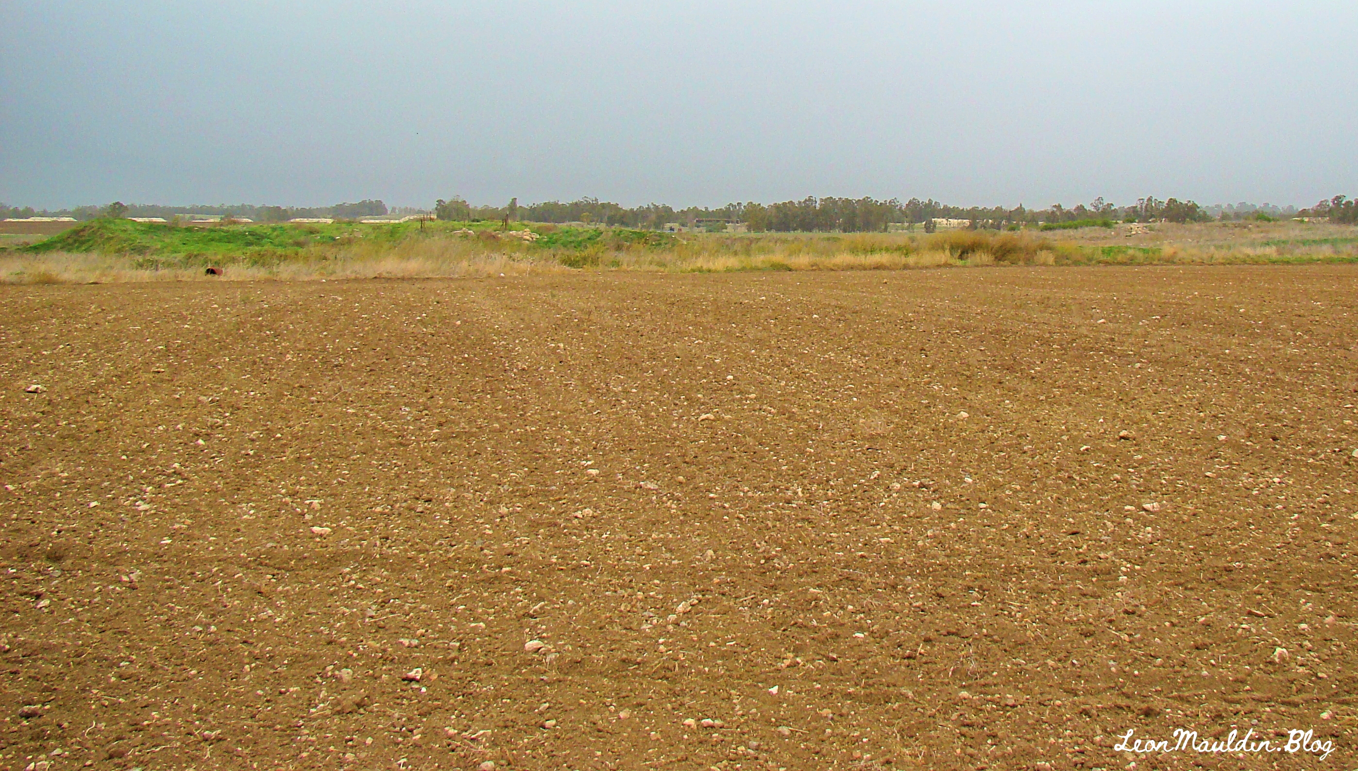
Ekron is a tel composed of about 50 acres. It was known for its olive oil industry.
Holman Illustrated Bible Dictionary has this information on Ekron:
Northernmost of the five major Philistine cities known as the Pentapolis. The site of ancient Ekron has been much debated but now is generally agreed to be modern Tell Miqne, about 14 miles inland from the Mediterranean Sea and 10 miles from Ashdod. The site is one of the largest in Palestine, covering some 50 acres. Ekron lies on the road leading from Ashdod into the Judean hill country and up to Jerusalem through the Sorek Valley.
Ekron was assigned to both Judah (Josh. 15:11, 45–46) and Dan (Josh. 19:43) in the tribal allotments. It probably lay on the border between the tribes. Judges 1:18 reports that Judah captured Ekron along with other parts of the Philistine coast, but Ekron was certainly in Philistine hands at the time the ark was captured (1 Sam. 5:10). It was also the place to which the Philistines retreated after David slew Goliath (1 Sam. 17:52). Ahaziah, the son of King Ahab of Israel, called on the god of Ekron, Baal-zebub, when he was sick (2 Kings 1:2–16).
Excavations at Tell Miqne have discovered much pottery that is typically Philistine. From the last period before Tell Miqne was destroyed by the Babylonians, the excavators found an important industrial complex near the city gate. A hoard of iron agricultural tools was found. Hundreds of whole pottery vessels were present. Perhaps most importantly, a well-preserved olive press was discovered. This press is the largest and best preserved known in Israel. A horned altar was also found during the excavations. (pp. 469–470).
I have previously posted on Ekron, Tel Miqne, here.


 Posted by Leon Mauldin