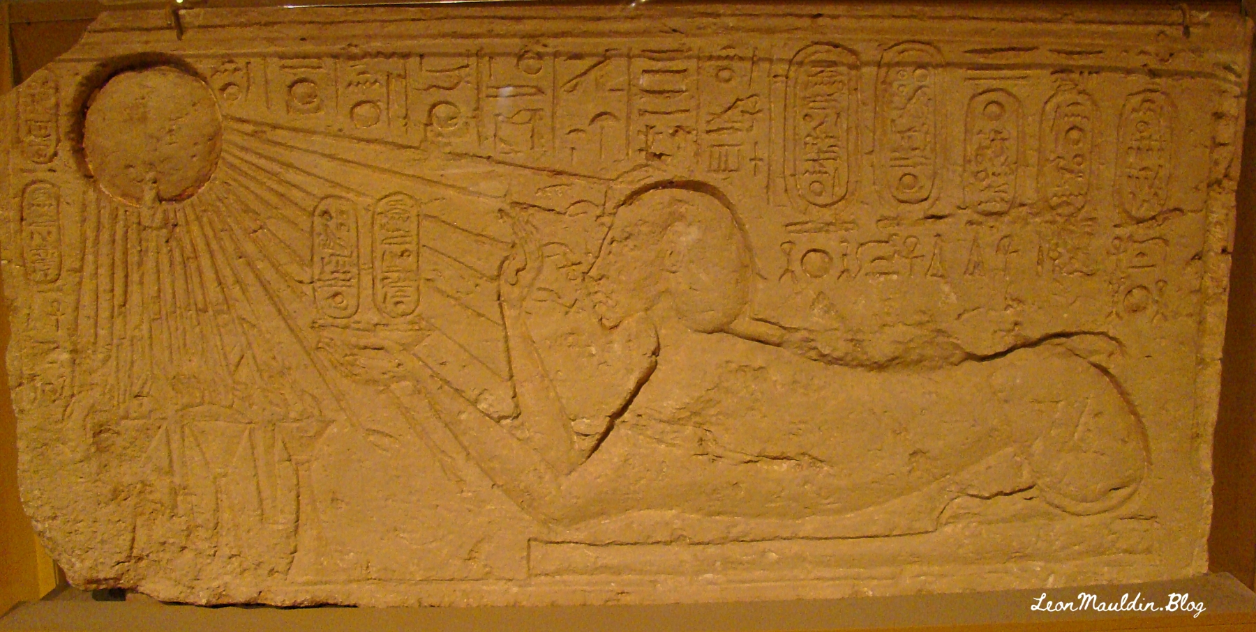
The collection of El-Amarna tablets represent diplomatic correspondence from princes/kings of from varioius parts of the Egpytian Empire during the reigns of Amenophis III, Akhenaton and Tutankhamun. These tablets were found in the ruins of Akhenaton’s (the “heretic” pharaoh) capital at El-Amarna. The British Museum displays some of the El-Amarna tablets from various locations in Canaan, which will be the focus of this post. We will feature tablets from Hazor, Lachish, Gezer, Megiddo and Shechem, all five of which were very important sites in Canaan.
Alice Mandell writes in BAS:
Discovered at the site of Tell el-Amarna in Middle Egypt, these cuneiform documents are letters dating to the mid-14th century BCE that were written in varieties of Akkadian, the lingua franca of the time, by scribes from all over the ancient Near East on behalf of local kings. The letters are commonly divided into two groups: letters from the “greater” powers (the Egyptian, Mitannian, Hittite, Assyrian, and Kassite kings) and letters from the “lesser” powers (smaller kingdoms and city-states from across the Levant, including the land of Canaan). Interestingly, even though the Canaanite rulers were among the least powerful kings writing to Egypt (in fact, they were under Egyptian rule), they left behind the largest number of letters. Source: https://library.biblicalarchaeology.org/article/letters-to-pharaoh-the-canaanite-amarna-tablets/?utm_source=WhatCountsEmail&utm_medium=BHDA%20Spotlight%201-90&utm_campaign=TS%20BAS%20Scholars%20Series%208-21-24
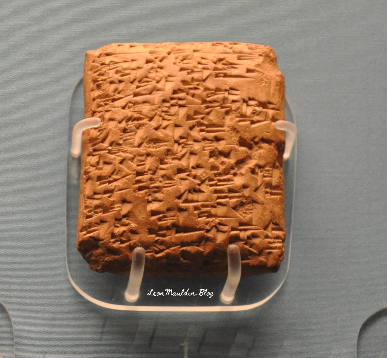
This tablet is from Abdi-Tirshi, King of Hazor. The info sign says that he “reassures pharaoh that he is loyal and is keeping his cities in good order.”
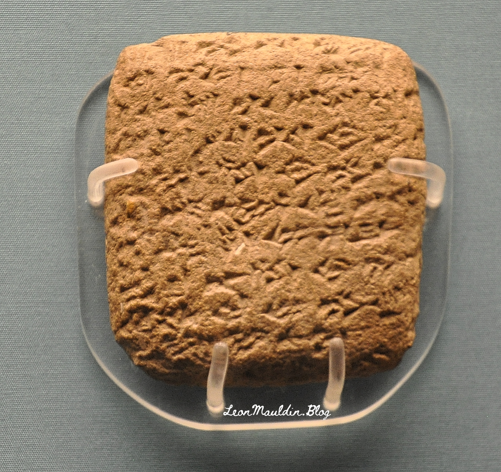
This tablet is from Shipti-Ba’al of Lachish. He also assures pharaoh of his loyalty.
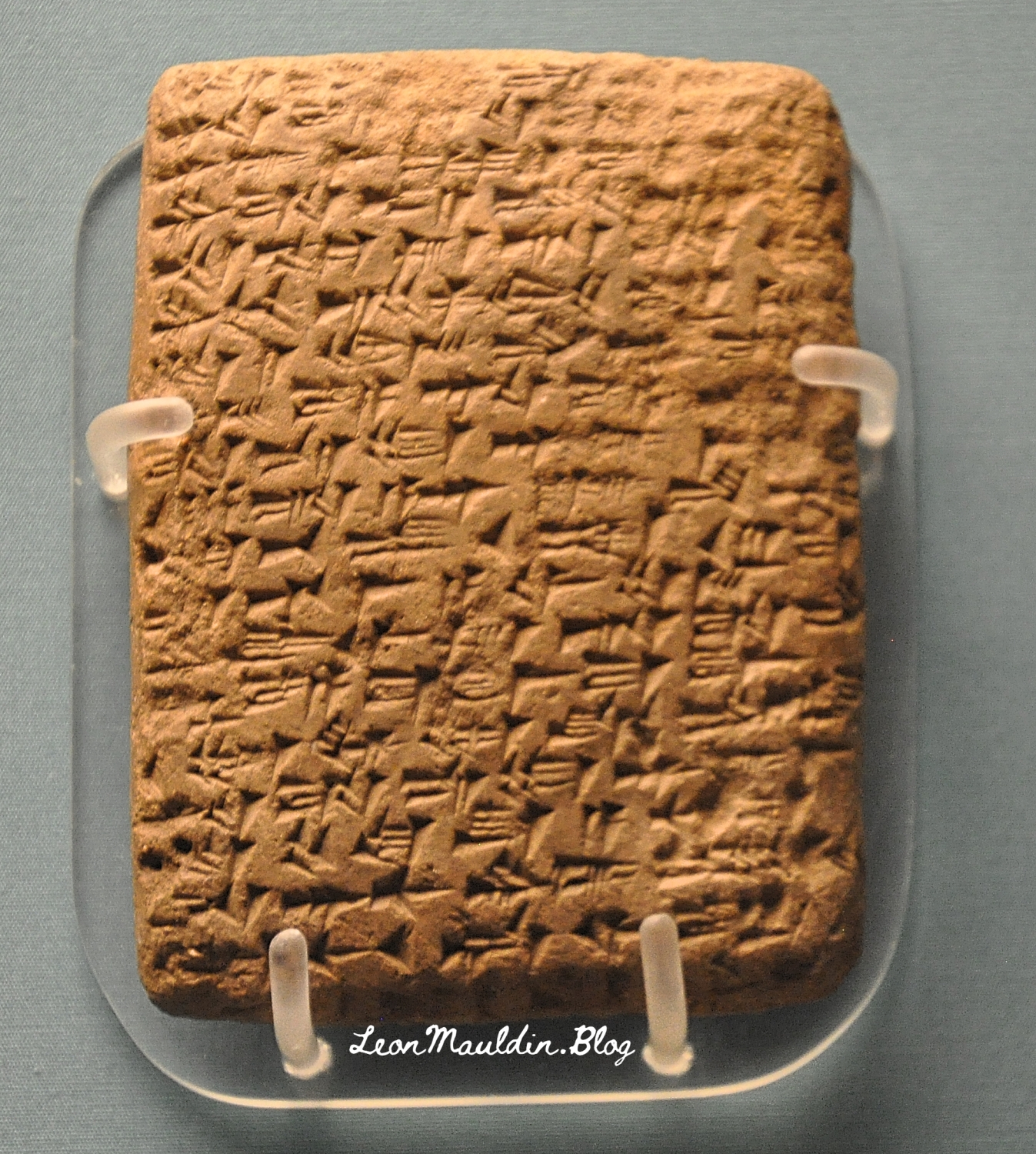
Here is the tablet from Gezer’s king Yapahu, who “begs pharaoh for help in defending his city against raids by the Hapiru.” Many scholars believe that the “Hapiru” here refer to the Hebrews.
Here is the tablet from Biridiya, king of Megiddo. He “accuses the king of Acco of treachery by releasing the captured Hapiru leader, Labayu, instead of sending him to Egypt.”
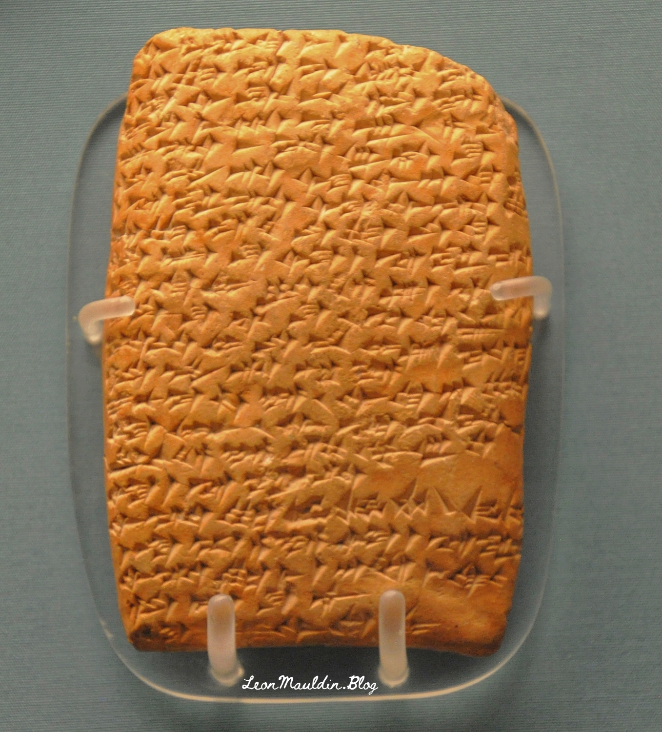
Our fifth tablet is from Labayu, ruler of Shechem. Shechem occurs frequently in the Old Testament (Gen. 12:6, et al.).
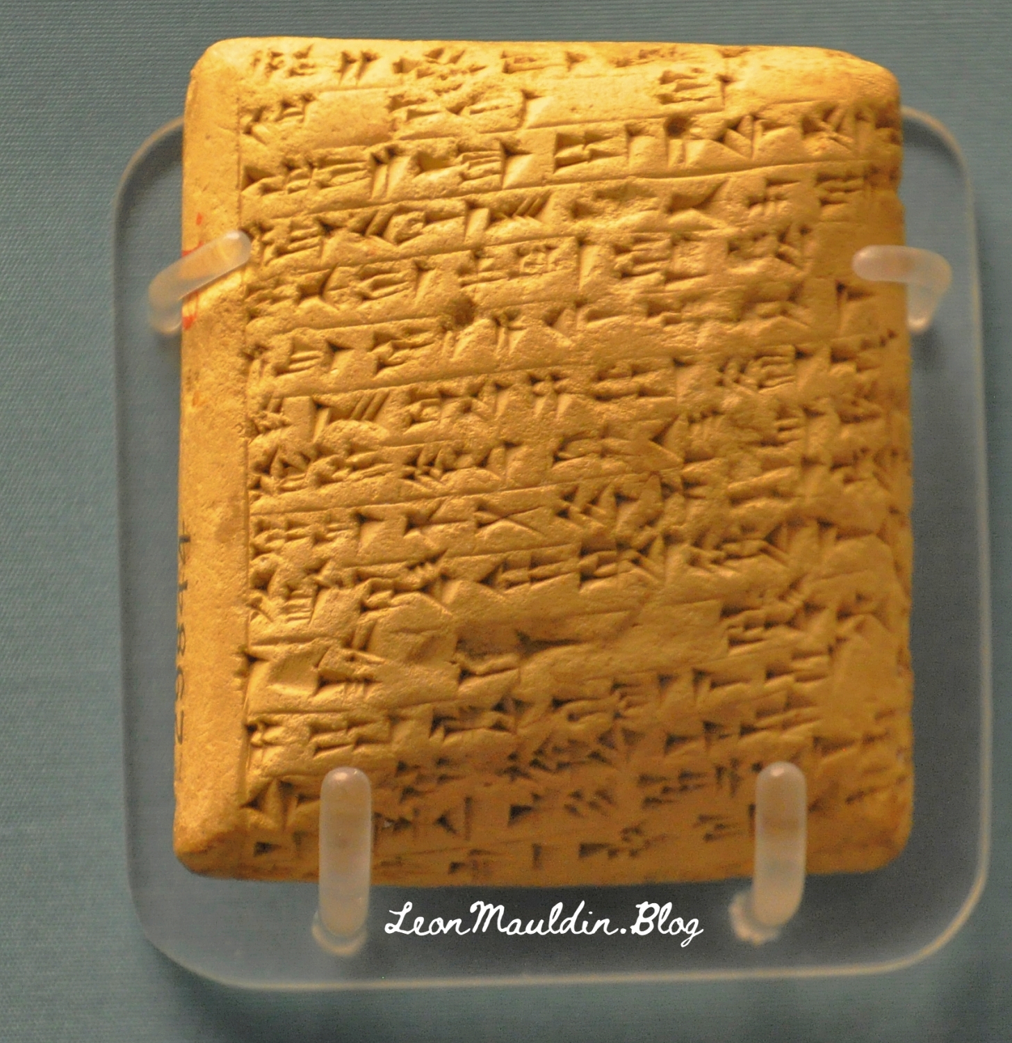
Mandell went on the say regarding the script of these tablets, “The Amarna Letters were not written in alphabetic or Egyptian scripts. They were written in cuneiform, a wedge-shaped script that was developed in Mesopotamia in the late fourth millennium BCE to write Sumerian and, later, Akkadian. By the Amarna period, ancient people from all over the Near East wrote in this script by impressing a stylus into clay to create wedge-shaped signs” (Ibid.).
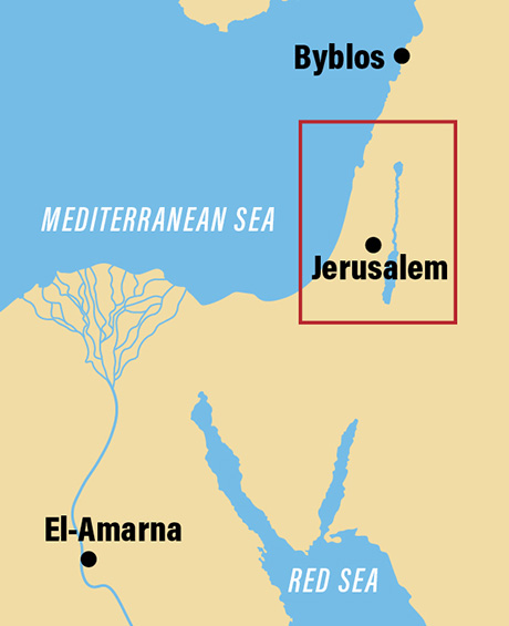
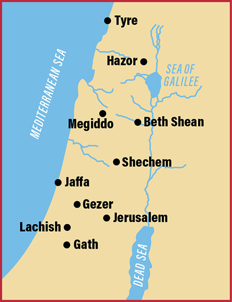
The BAS article also provided a couple of helpful maps.
Map shows the location of El-Amarna relative to Canaan.
This map includes the sites of the origin of the tablets we featured above.
Click images for larger view.


 Posted by Leon Mauldin