The Philistines are mentioned numerous times in the Bible, in the days of the Judges and Kings, and as well as references in the prophets. For example, Zephaniah 2:4: “For Gaza shall be deserted, and Ashkelon shall become a desolation; Ashdod’s people shall be driven out at noon, and Ekron shall be uprooted” (ESV). This text mentions four of the five cities of the Philistine Pentapolis, the fifth being Gath (see 1 Sam. 6:16).
The context of Zephaniah’s prophecy is one of judgment, of the wrath of God, called “The great day of the LORD” (1:14). Though Zephaniah is addressing the Jews of Jerusalem/Judah, God is the God of all the nations. Here the prophet was warning of the destruction of the Philistines (2:5).
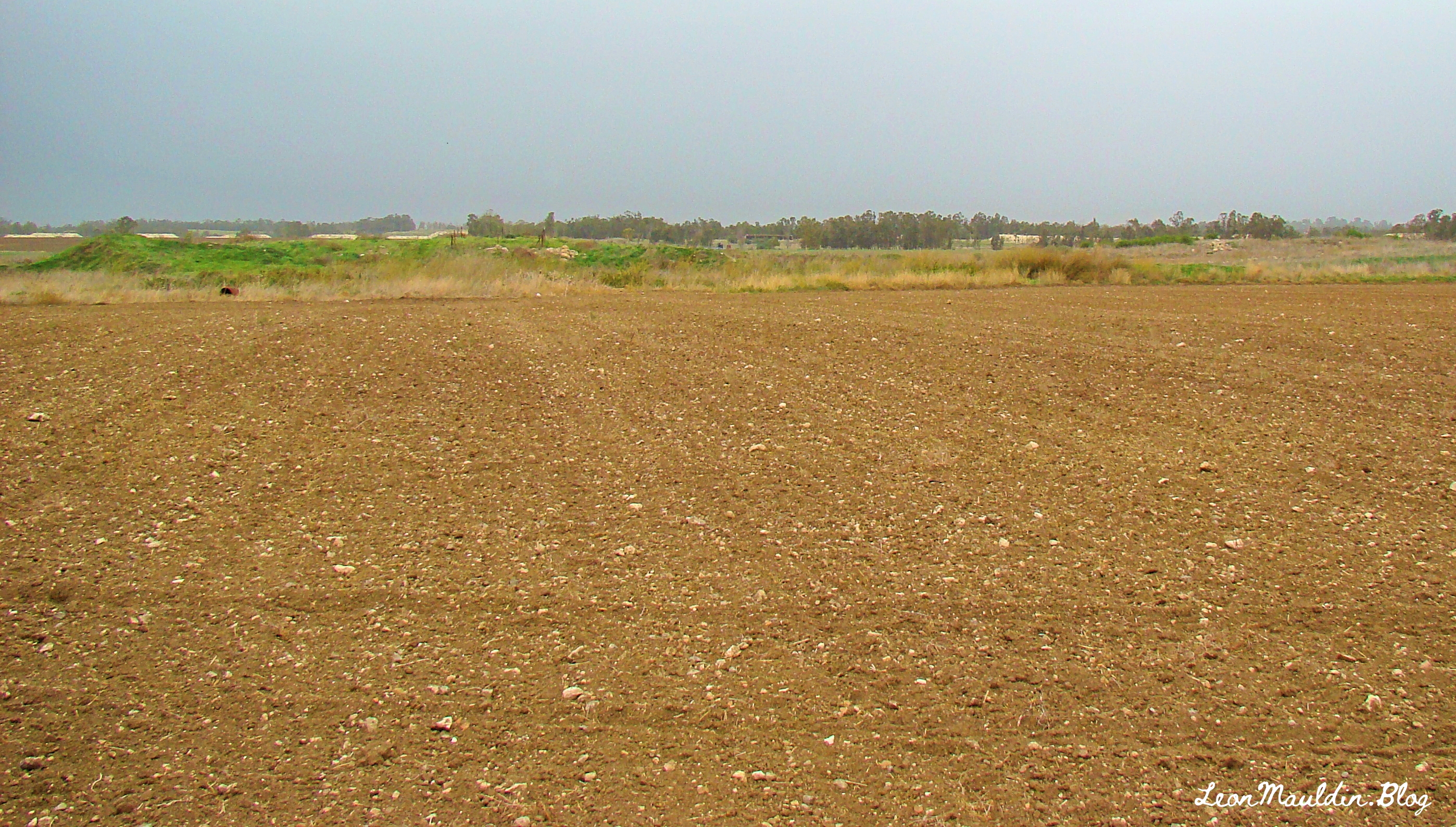
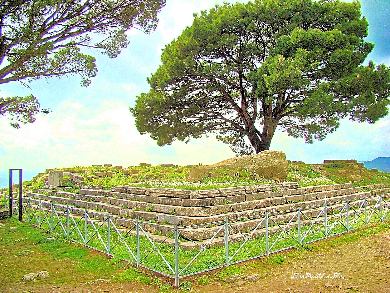
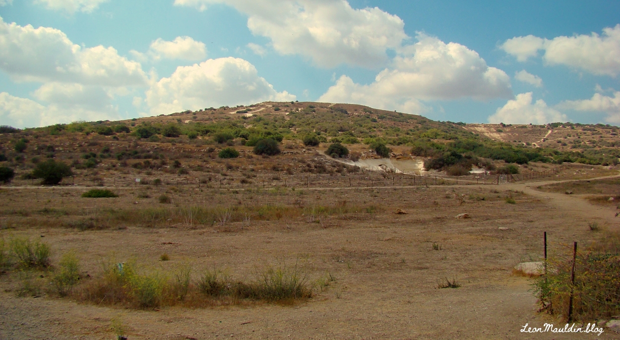
This post will deal briefly with Ekron, which today is known also as Tel Miqne.
Though originally in Israel’s territory at the time of the Conquest led by Joshua (Josh. 15:11, 45-56), Ekron was later in the hands of the Philistines by the time of the Judges. Much of the territory originally taken by the Israelites in the conquest was not retained in subsequent years, largely due to Israel’s lack of diligence and compromise with the surrounding nations.
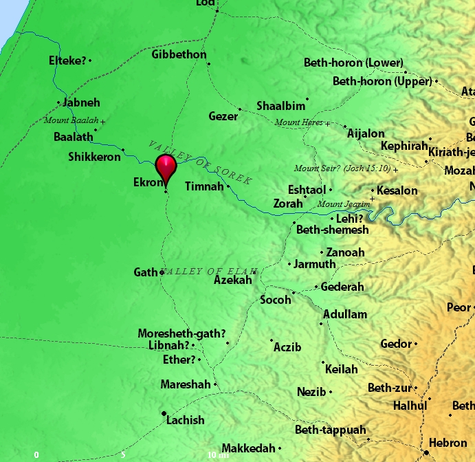
Location of Ekron. Map by BibleAtlas.Org.
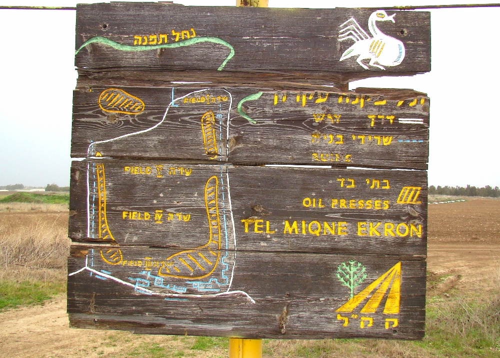
Ekron is a tel composed of about 50 acres. It was known for its olive oil industry.
Holman Illustrated Bible Dictionary has this information on Ekron:
Northernmost of the five major Philistine cities known as the Pentapolis. The site of ancient Ekron has been much debated but now is generally agreed to be modern Tell Miqne, about 14 miles inland from the Mediterranean Sea and 10 miles from Ashdod. The site is one of the largest in Palestine, covering some 50 acres. Ekron lies on the road leading from Ashdod into the Judean hill country and up to Jerusalem through the Sorek Valley.
Ekron was assigned to both Judah (Josh. 15:11, 45–46) and Dan (Josh. 19:43) in the tribal allotments. It probably lay on the border between the tribes. Judges 1:18 reports that Judah captured Ekron along with other parts of the Philistine coast, but Ekron was certainly in Philistine hands at the time the ark was captured (1 Sam. 5:10). It was also the place to which the Philistines retreated after David slew Goliath (1 Sam. 17:52). Ahaziah, the son of King Ahab of Israel, called on the god of Ekron, Baal-zebub, when he was sick (2 Kings 1:2–16).
Excavations at Tell Miqne have discovered much pottery that is typically Philistine. From the last period before Tell Miqne was destroyed by the Babylonians, the excavators found an important industrial complex near the city gate. A hoard of iron agricultural tools was found. Hundreds of whole pottery vessels were present. Perhaps most importantly, a well-preserved olive press was discovered. This press is the largest and best preserved known in Israel. A horned altar was also found during the excavations. (pp. 469–470).
I have previously posted on Ekron, Tel Miqne, here.
As one studies the biblical text, such as the letter to the church at Sardis (Rev. 3:1-6), one of the Seven Churches of Asia addressed in the book of Revelation, it is helpful to know somewhat of the conditions in which those first century Christians lived.
The city of Sardis has a rich history in many ways. This post will deal with just one: the Royal Road. Cyrus the Great (r. 559-529 BC) was the founder of the Persian Empire following his conquering of the Babylonian Empire. Cambyses II succeeded him (r. 529-522 BC), whose successor was Darius (r.521-486 BC). (This is the king who was defeated in 490 BC at the battle of Marathon).
But scholars make the case that his great achievement was his construction of the Royal Road, which extended from the capitol of Susa to Sardis:
Darius is perhaps best remembered for instituting an advanced highway system throughout the empire, a route traditionally called the “Persian Royal Road.” According to Herodotus, the “father of history,” this roadway stretched from Susa (in Elam) to Sardis (in Lydia) and was comprised of a total of 111 intermediate resting-stages, passing through some six Persian provinces, and requiring a total of 90 days to travel the entire course of approximately 1,685 miles. Herodotus adds that another three days were required to journey from Sardis to the coast at Ephesus, from which some scholars have deduced that the “Royal Road” may have extended as far as the Aegean coast. At its other end, a road continued from Susa that ran to Persepolis and beyond.
Beitzel, B. J. (2009). The New Moody Atlas of the Bible (p. 206). Moody Publishers.
The following map depicts this route:
Map shows route of Royal Road from Persian capital at Susa westward to Sardis. Map courtesy of Wikipedia Commons.
This linkage from the capital to Sardis “located Sardis on a major trade and communications route that persisted into the Roman period, positioning the city for ongoing prosperity” (deSilva, Lexham Geographic Commentary, p. 667).
Official communication. The historian Herodotus said of the Persian royal messengers:
Now there is nothing mortal that accomplishes a course more swiftly than do these messengers, by the Persians’ skillful contrivance. It is said that as many days as there are in the whole journey, so many are the men and horses that stand along the road, each horse and man at the interval of a day’s journey. These are stopped neither by snow nor rain nor heat nor darkness from accomplishing their appointed course with all speed.
Herodotus. (1920). Herodotus, with an English translation by A. D. Godley (A. D. Godley, Ed.). Harvard University Press.
Administration.
Rapid Troop Movemnt.
Trace and commerce.
In later history, Alexander the Great would make use of the Royal Road in his conquest of Persia. Dr. Mark Wison notes, “After Alexander the Great captured the city from the Persians in 334 BC, Sardis served as the western capital of the Selucid Empire nor nearly a hundred years (281-190 BC)” (Biblical Turkey, p. 290). In 133 BC Sardis became a part of the Roman province of Asia.
God had his people in Sardis. The church at Sardis was the 5th of the Seven Churches addressed by John (Rev. 1-3).
Sardis is the fifth of the seven churches addressed by Jesus through the Apostle John, while John was on the Island of Patmos. In summary, Jesus’ assessment of the church there was, “I know your works, that you have a name that you are alive, but you are dead” (Rev. 3:2).
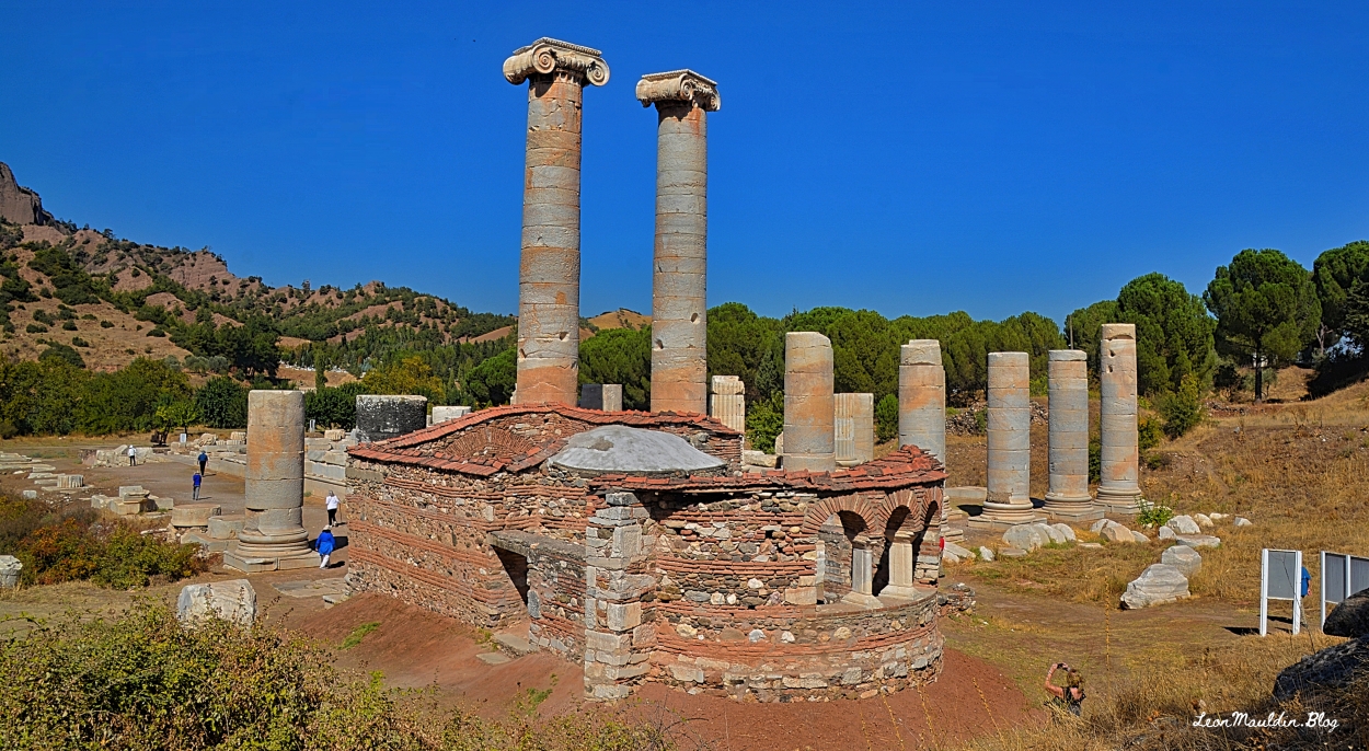
Archaeologists have uncovered and identified many structures and other items of interest at Sardis, including a Byzantine chapel in the southeast corner of the temple of Artemis.
Dr. Mark Wilson writes, “The inner western chapel dates to the 4C [4th century AD] and is one of the earliest preserved churches in western Asia Minor; the larger, outer apse dates to the 6C” (Biblical Turkey, A Guide to the cJewish and Christain sites of Asia Minor, p. 291).
The temple of Artemis, whose partial ruins are in view here, would have been in use when those Christians of the 1st century AD at Sardis received the letter (Rev. 3:1-6). It’s hard to overemphasize how pervasive idolatry was in the biblical world!
We have previously posted several articles on Sardis: click hereherehere and here.
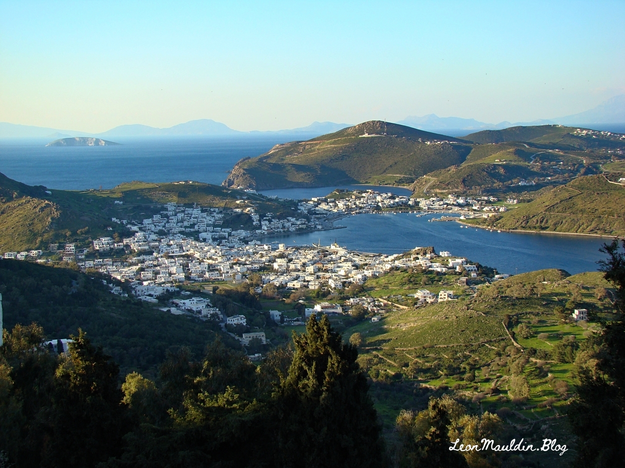
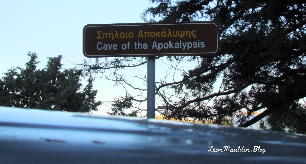
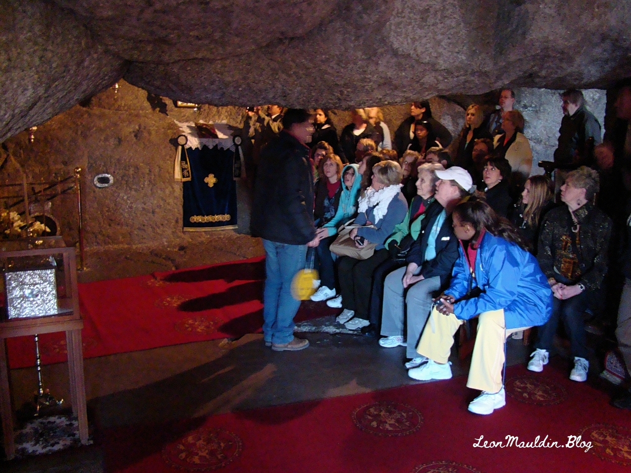
In our local congregation we are continuing to explore the Seven Churches of Asia, of Revelation 2-3. John the Apostle received the Revelation on the Island of Patmos.
While we cannot know the exact spot on the island where John was when he was “in the Spirit on the Lord’s Day” and told, “What you see, write in a book and send it to the seven churches which are in Asia” (Rev. 1:10-11), visitors to Patmos are shown a “traditional” location, known as the “Cave of the Apocalypse.”
The church at Pergamum lived “where Satan’s throne is . . . where Satan dwells (Rev. 2:13). There have been many suggestions as to the basis of this designation. Pergamum was known for its worship of Asklepios (god of healing), Serapis, Athena, Dionysus, Demeter, as well as being a center for the Imperial Cult (emperor worship).
David A. DeSilva suggests: “[T]he distinctive altar of Zeus on the brow of the acropolis may have been more in John’s view” (The Social and Geographical World of Pergamum (Revelation 1:11; 2:12–17). In B. J. Beitzel, J. Parks, & D. Mangum (Eds.), Lexham Geographic Commentary on Acts through Revelation (p. 638). Lexham Press).
The altar of Zeus, located on the southern crest of the acropolis, was without a doubt the most distinctive and most prominently visible structure overlooking Pergamum. Construction was begun in the early- to mid-second century BC under Eumenes II, possibly in connection with his victory over the invading Galatians. The massive throne-like altar complex resembled an open-air temple, complete with columned porticoes surrounding its staircase and inner courtyards. The whole had a footprint of about 120 by 110 feet (36.5 × 33.5 m), and it rose to a height of 40 feet (12 m). The sacrificial altar proper sat within the inner courtyard, which was approached by a wide, grand staircase. The reconstructed monument now sits in the Pergamum Museum in Berlin. The altar was adorned with nearly four hundred linear feet (122 m) of frieze, its scenes carved about seven feet (2 m) high. The frieze around the structure’s perimeter depicted the mythological battle between the Olympian gods and the giants, with Zeus and Athena prominently featured on the front side. An interior frieze told the story of Telephus, the mythic founder of Pergamum. An L-shaped agora or forum was set just below the precincts of the altar of Zeus. The identification of some of the buildings as warehouses makes it likely that this particular forum served as a commercial center in the old city.
deSilva, D. A. (2019). The Social and Geographical World of Pergamum (Revelation 1:11; 2:12–17). In B. J. Beitzel, J. Parks, & D. Mangum (Eds.), Lexham Geographic Commentary on Acts through Revelation (pp. 645–646). Lexham Press.
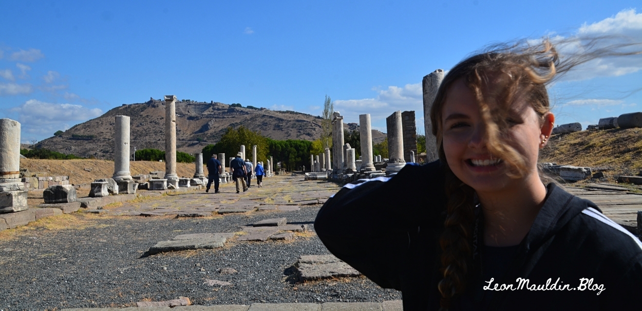
Here is a photo of the acropolis of Pergamum, with the Asklepion at our back. Sometimes it gets windy on our tours (as my granddaughter can attest).
Our preaching theme for January in our local congregation is a study of the Seven Churches of Asia (Rev. 2-3). I’m looking forward to this study. Ephesus is the first of the cities addressed (Rev. 2:1-7).
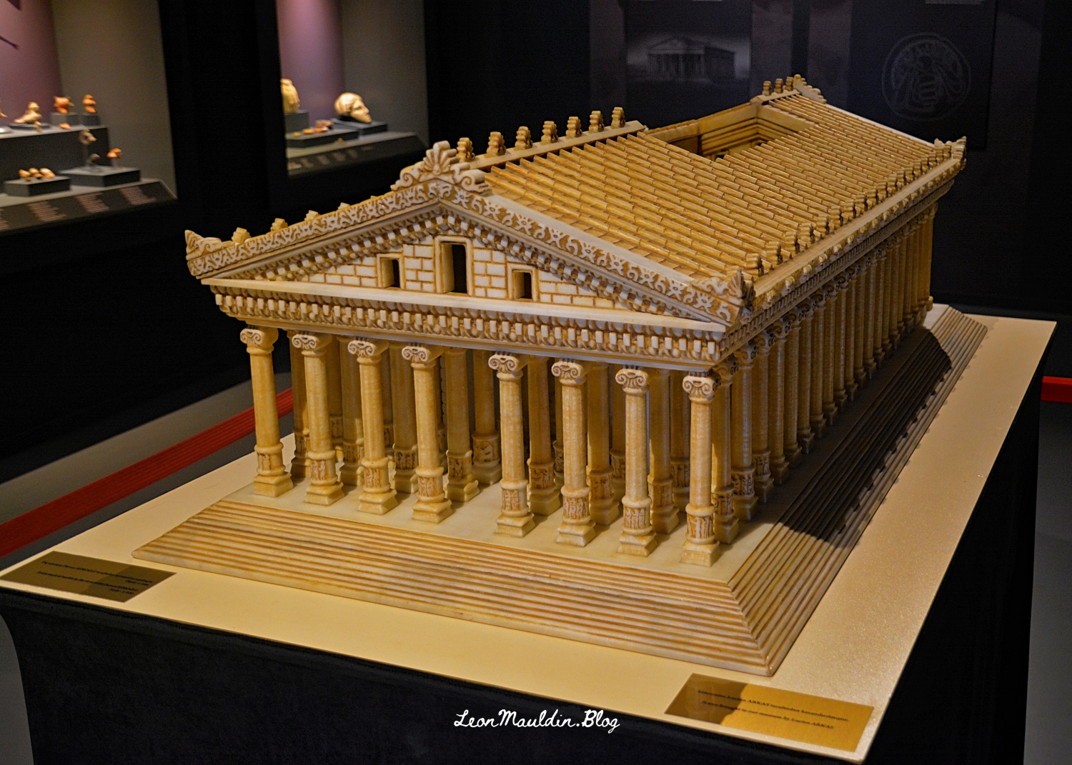
It is helpful to understand somewhat of the local conditions in which these 1st Century Christians lived. Ephesus was the city which featured the temple to the goddess Artemis (Diana), which at that time was one of the Seven Wonders of the World.
Here is a model of the temple which is housed in the museum at Ephesus:
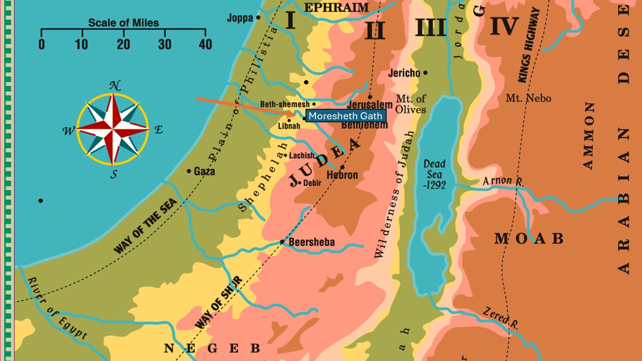
The 8th century BC prophet Micah identifies himself as “Micah of Moresheth” (Mic. 1:1). As his message continues in chapter one, he references “Moresheth Gath” (1:14). Moresheth Gath is tentatively identified by many scholars as Tel Goded (Tell ej-Judeideh).
The geography of Israel is defined by four longitudinal zones: The Coastal Plain, the Central Hill Country, the Jordan Valley, and the Transjordan Plateau. As one goes east from the coastal plain, before arriving in the hill country, one passes through the Shephelah (שְׁפֵלָה, usually rendered “lowland” in Scripture), which consists of gently rolling hills (see Deut. 1:7, etc.). See map here:
I am enjoying perusing the newly published Photo Companion to Genesis, the latest addition to the Photo Companion to the Bible, by Dr. Todd Bolen and his team. As with the other volumes in this set, each chapter in Genesis (all 50!) is treated separately with its own PowerPoint. For example, chapter one has 225 slides; chapter two has 171 slides, chapter 10 has 604 slides! Another helpful feature: the slides include notes with further explantion, suggested resources, photo credits, etc.
I have been using Dr. Bolen’s materials for more than 20 years, and highly recommend this new addition. Knowing the geographical, archaeological and cultural context of the Bible enhances our understanding of the biblical text, and can help fortify one’s faith. This collection of photos, maps, and explanation chapter by chapter is a great resource.
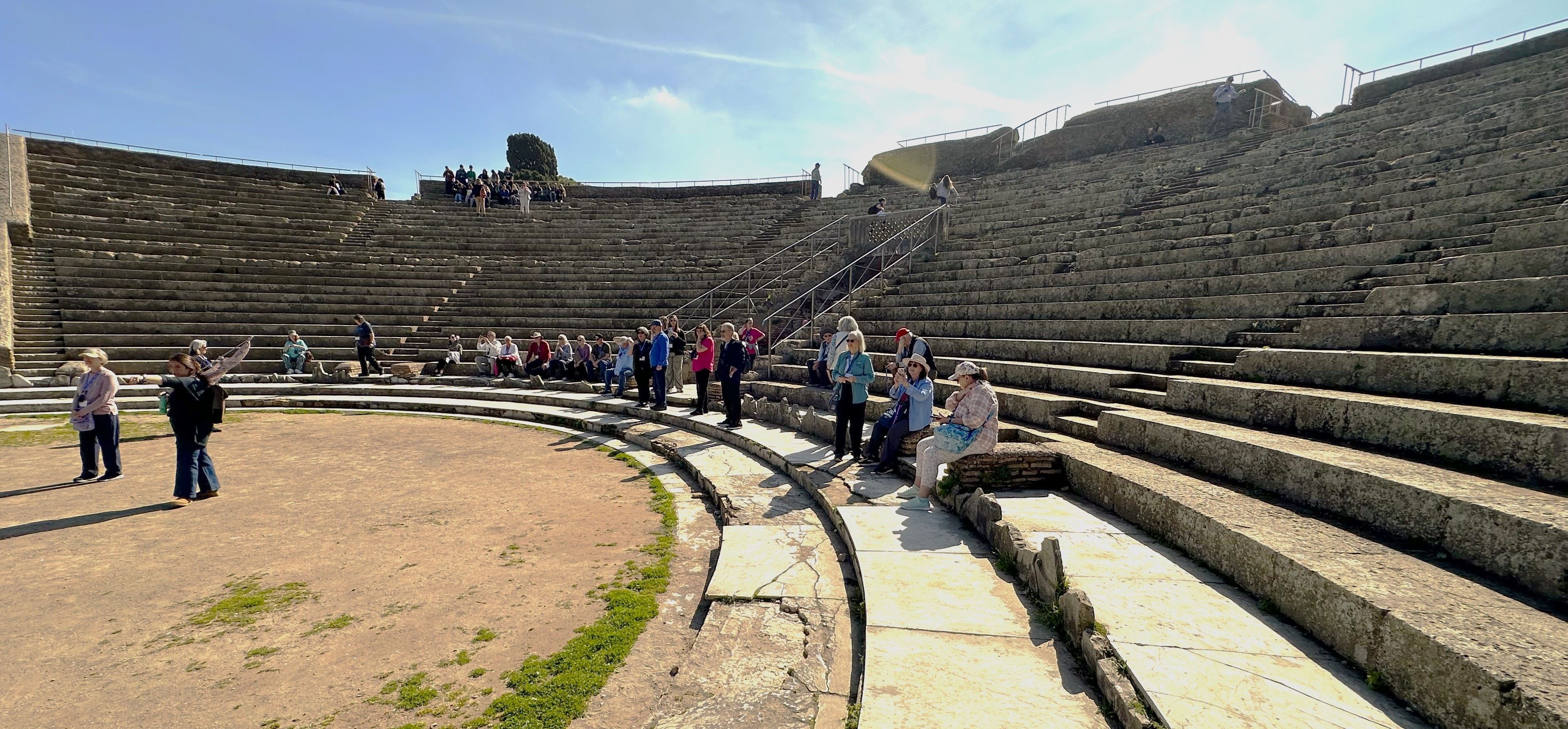
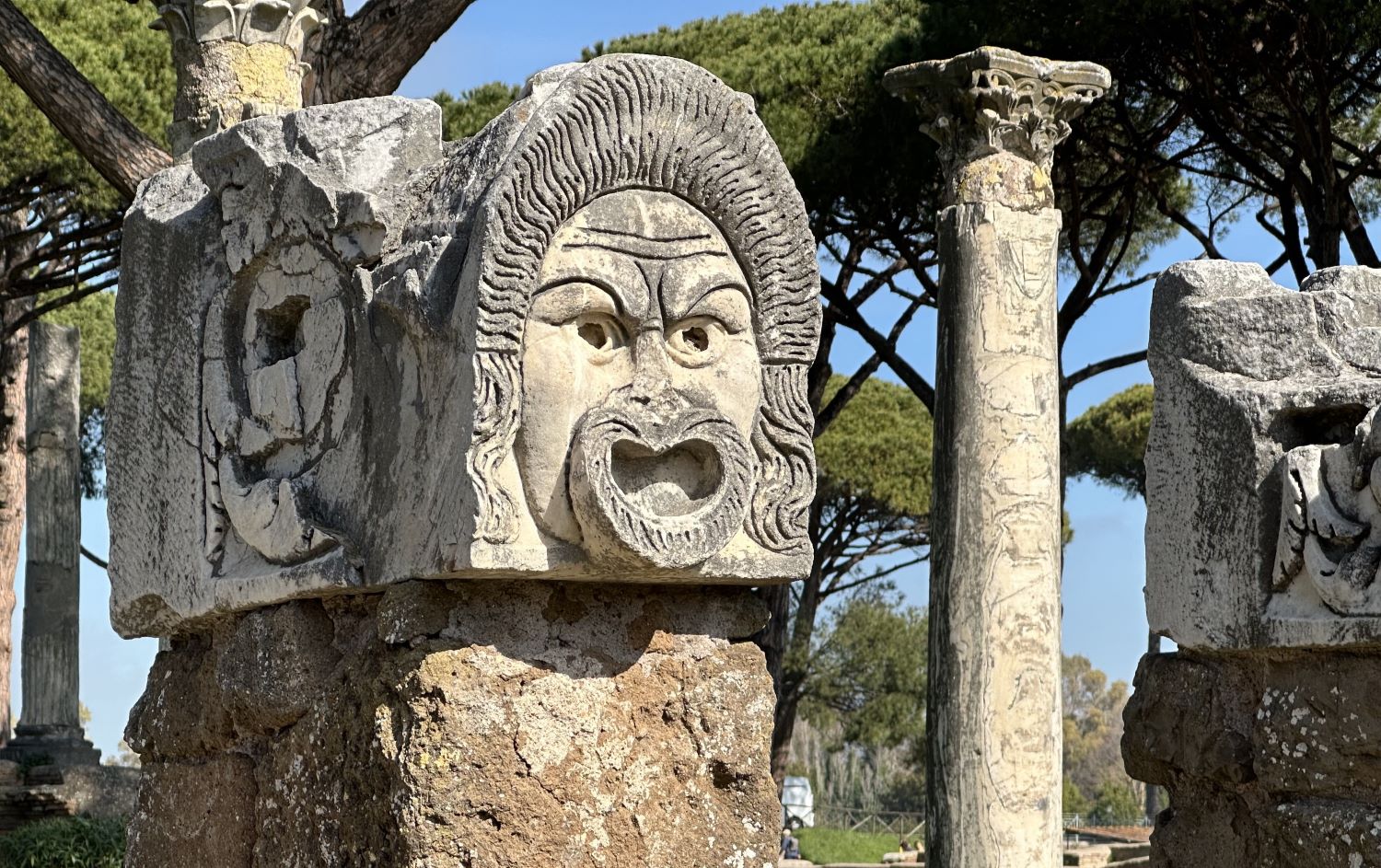
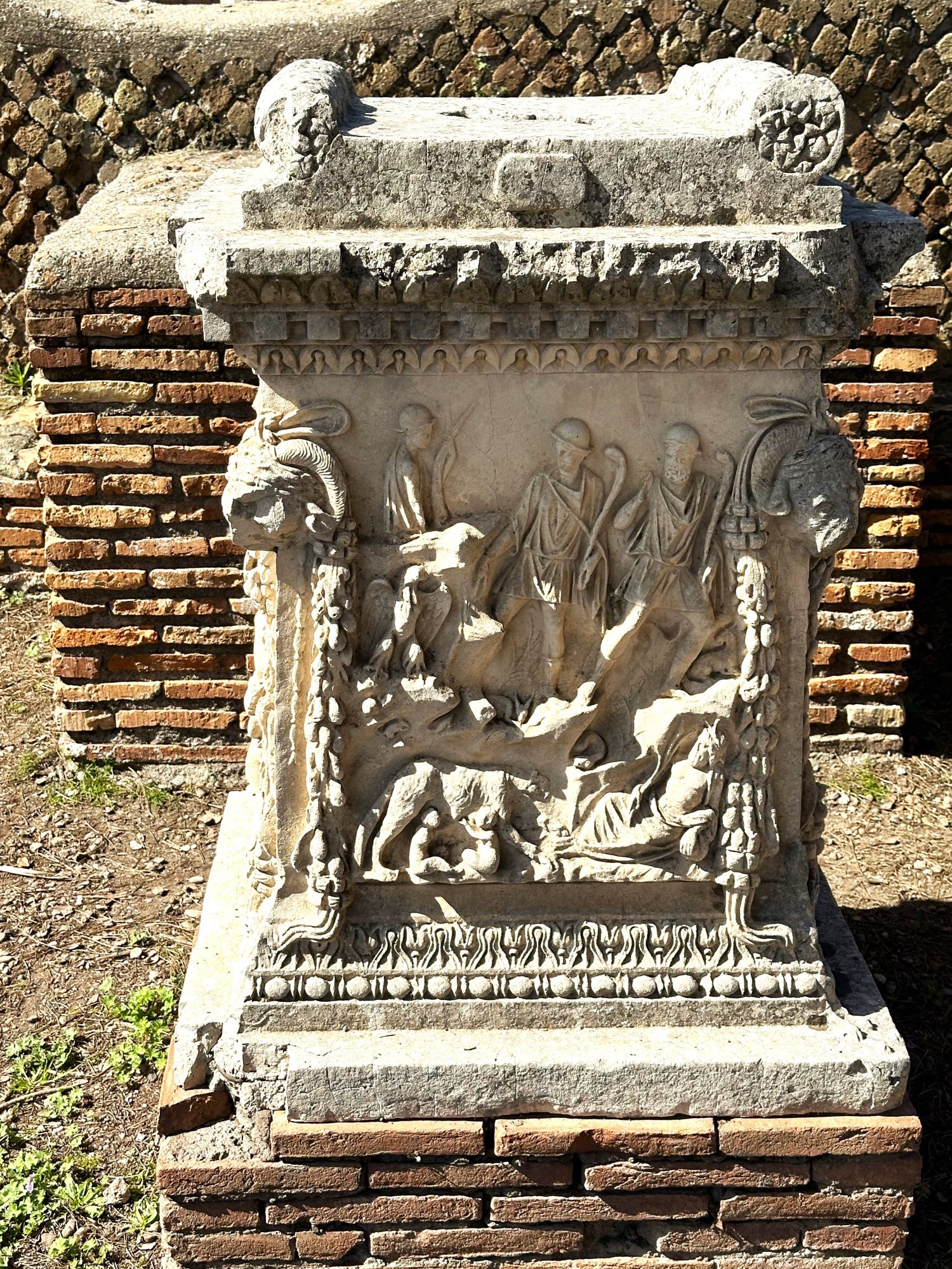
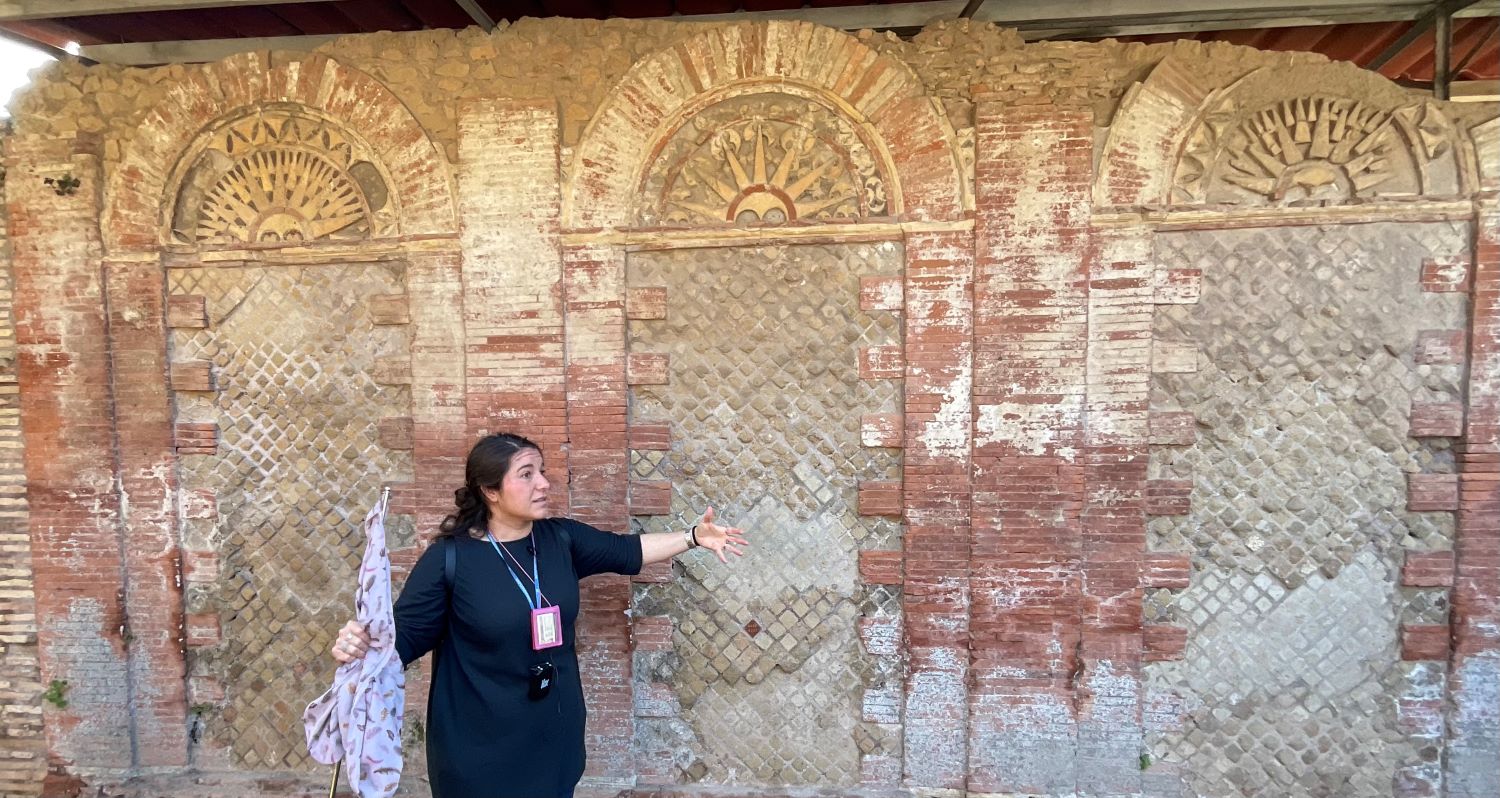
Today my tour group visited Ostia Antica, and saw some of the excavations there. Over time, the port silted up, but in antiquity it was of vital importance to Rome. The Lexham Bible Dictionary has the following information:
OSTIA An ancient port of Rome located at the mouth of the Tiber River. A vital strategic and commercial site of the Roman Empire.
Location and Biblical Relevance
Ostia was the nearest port that granted access to Rome for seafaring travelers of the New Testament world. Its name is derived from the Latin term ostium, meaning “doorway” or “entryway.” The name encapsulates the importance of the site, for it served as the maritime gateway to the capital of the Roman Empire.
The city and port of Ostia was located 22 miles (35 km) downstream from Rome at the mouth of the Tiber River. It was associated with sea trade, which brought in wares and cultural goods from throughout the Mediterranean.
Ostia was also an early base for Roman naval activities. In its first centuries, the city was hardly more than a Roman army camp populated by citizen colonists (Salmon, Roman Colonization, 26–27). Ostia was not an excellent harbor; its anchorage was exposed, leaving it vulnerable to storms and pirates. These problems would not be solved until the first and second centuries ad, when the rival port of Portus was constructed.
Brand, S. The Lexham Bible Dictionary. Lexham Press.
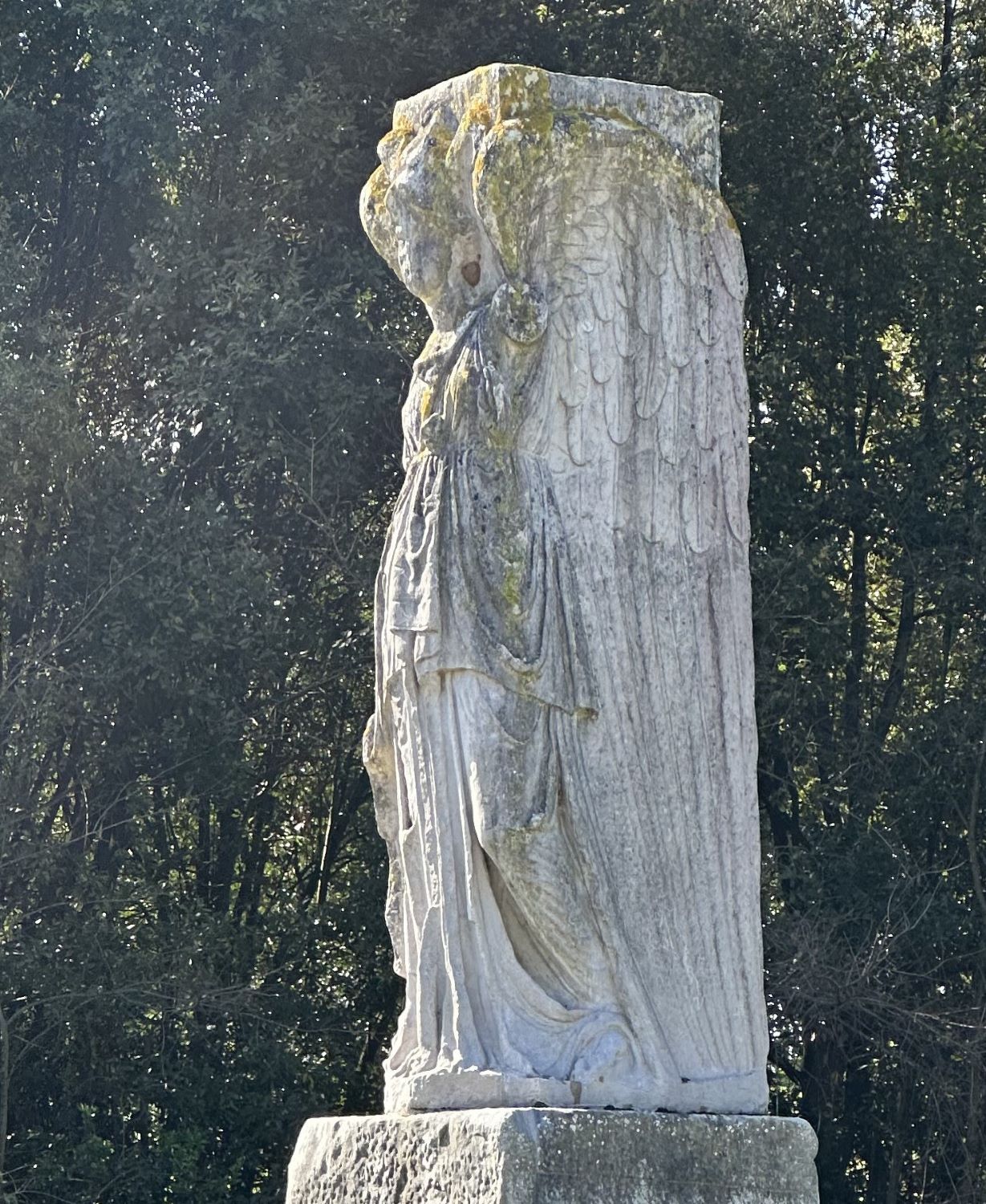
As one first enters the archaeological area, there is a statue of Minerva-Victory.
The writer of Hebrews closes with several imperatives, including this admonition in 13:5: “Keep your life free from love of money, and be content with what you have, for he has said, “I will never leave you nor forsake you” (ESV). For comparison: “Make sure that your character is free from the love of money, being content with what you have; for He Himself has said, “I WILL NEVER DESERT YOU, NOR WILL I EVER FORSAKE YOU” (NASB). The NET renders, “Your conduct must be free from the love of money and you must be content with what you have, for he has said, “I will never leave you and I will never abandon you.”
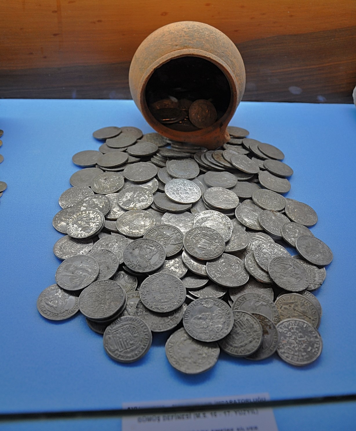
Some years ago, while at Samsun (Biblical Pontus) on the Black Sea, Ferrell Jenkins and I visited the Samsun Archaeology and Ethnography Museum there. Here are some photographs which might be helpful visuals in teaching this biblical text (Heb. 13:5):
One should note that it is not the money that is itself sinful, but the LOVE of money (compare 1 Timothy 6:10).
Also note the Hebrews 13:5 states what “He Himself” (God) has said. What follows is to be the Christian’s response: “So that WE may boldly say, ‘The LORD is my helper; I will not fear, What can man do to me?'” (v.6). This kind of “answering speech” runs throughout scripture: God takes the initiative, He speaks, He reveals Himself, and then there is to be the appropriate repsonse, the answer of faith on the disciple’s part. “Speak, LORD, thy servant heareth” (1 Samuel 3:9).
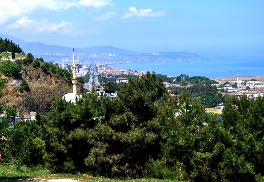
Pontus is mentioned three times in the New Testament. Jews from Pontus were present in Jerusalem on the Day of Pentecost (Acts 2:9). Aquila, one of Pau’s invaluable helpers, was from Pontus (Acts 18:2). Also the Apostle Peter addressessed Pontus (1 Pet. 1:).
Samsun (Amisus) was a leading city of Pontus. Regarding its biblical significance, Dr. Mark Wilson writes, “Amisus was at the northern terminus of the main road that ran across Asia Minor to Tarsus. Peter’s messenger undoubtedly disembarked at Amisus and initally made his way south along this route” (Biblical Turkey, pp. 334,336). Samsun is located between the deltas of the Kızıl and Yeşil rivers.
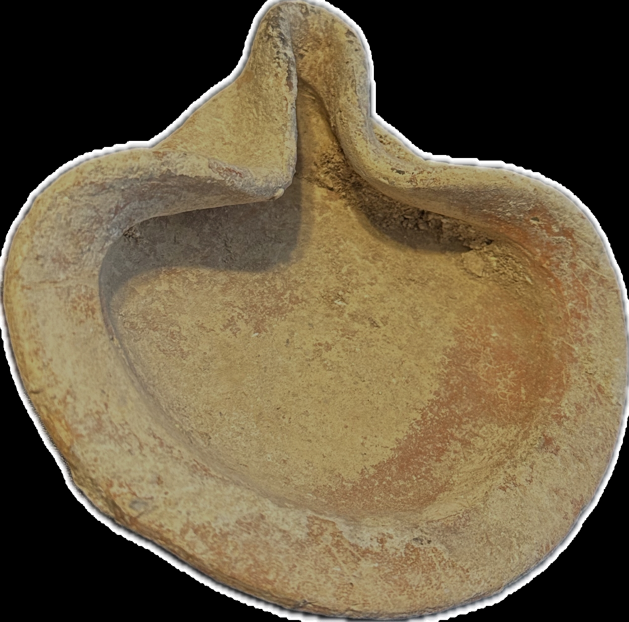
In 2 Chronicles in the context of the Divided Kingdom during the reign of Jehoram, king of Judah, the statement is made, “Yet the LORD was not willing to destroy the house of David because of the covenant which He had made with David, and since He had promised to give a lamp to him and his sons forever” (21:7). (The NET Bible reads, “But the LORD was unwilling to destroy David’s dynasty because of the promise he had made to give David a perpetual dynasty”).
To say that Jehoram was very wicked would be an understatement. His first act when his co-regency with his father Jehoshaphat (good king!) ended was to murder all six of his brothers! (21:4). Jehoram was married to Athaliah, the wicked daughter of Ahab and Jezebel, and greatly swayed by them. Though King of Judah, “he walked in the way of the kings of Israel, just as the house of Ahab had done” (21:6).
Lamp, dating to the time of the Divided Kingdom. Author’s personal collection. Photo by Leon Mauldin.
Our inspired historian is stating that although Jehoram deserved destruction, as had indeed been meted out to several dynasties in Israel, that Yahweh, the faithful God of the Covenant, would insure that the lineage of David would continue. The use of the word picture of a lamp which continues to burn, and is not extinguished, was a fitting metaphor. The Davidic lineage (here seen in the kings of Judah, both good and bad) would continue until the Messiah came to earth, God Incarnate. This fulfilled the promise made in 2 Samuel 7; cf. 1 Chron. 17, and etc.). Indeed, “the Scripture cannot be broken” (John 10:35).
I have earlier written about Judah’s King Jehoram here.


 Posted by Leon Mauldin
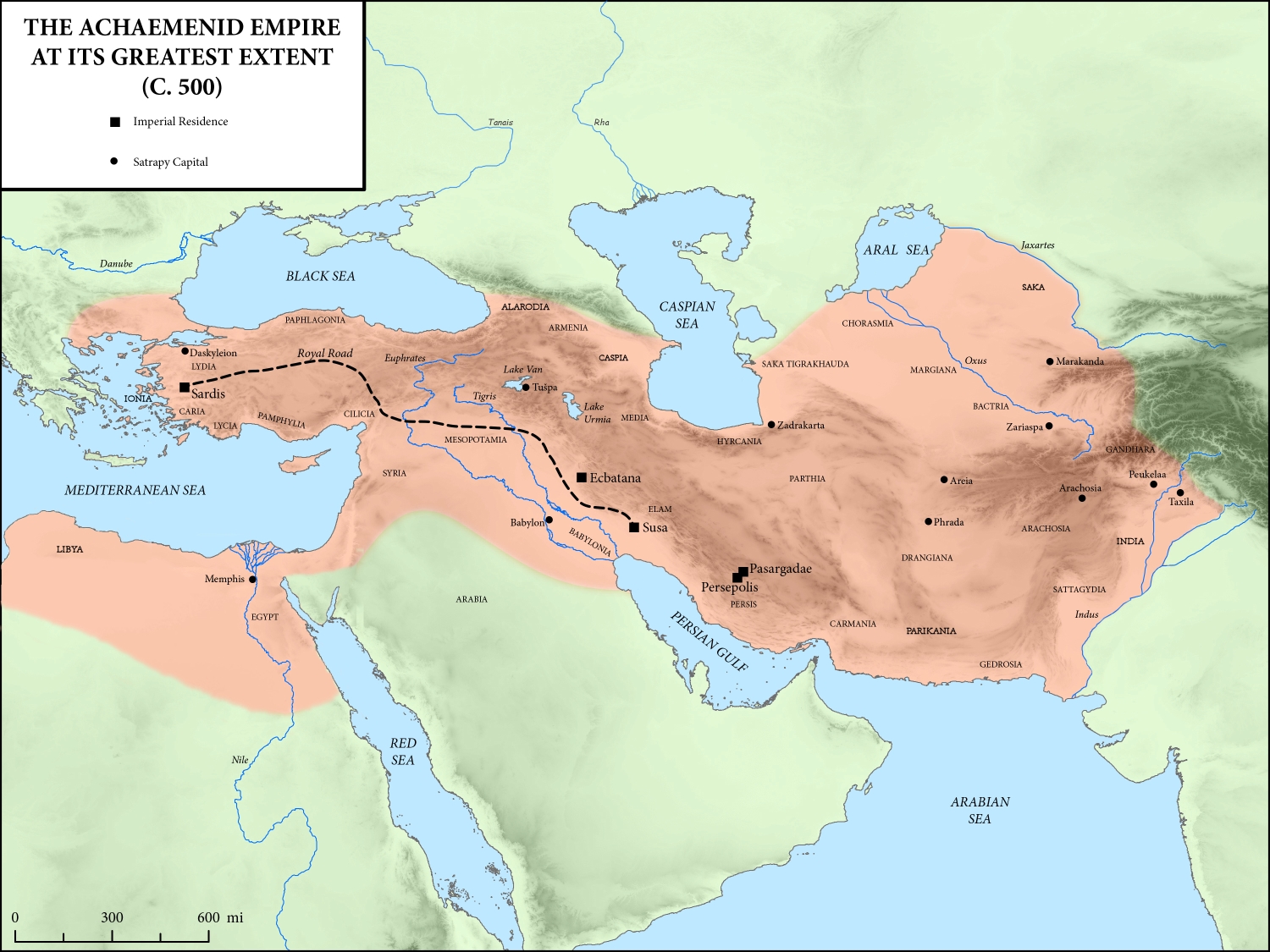


