Turkey Travel contd: Pamphylia

May 26, 2014

On Paul’s First Journey, he and Barnabas passed through Perga in Pamphylia (Acts 13:13-14). On the return portion of the trip they came again to Pamphylia (Acts 14:24), “and when they had spoken the word in Perga, they went down to Attalia, and from there they sailed to Antioch” (vv. 24-25). Notice here the region of Pamphylia:

Region of Pamphylia. Map by BibleAtlas.com.

Region of Pamphylia. Map by BibleAtlas.com.

Now notice specifically Antalia:

Attalia, seaport for Pamphylia. Photo by BibleAtlas.com.

Attalia, seaport for Pamphylia. Photo by BibleAtlas.com.

Ferrell Jenkins and I have been in biblical Attalia, modern Antalya, and the greater Pamphylia area for the past couple of days as we have visited sites in Turkey.

Notice the topography on the first map, and see as you leave the coastal area and go northward you run into the mountains, using Attalia and Perga in your second map as reference points. The plains of Pamphylia give way to the formidable terrain of the Taurus mountain range.
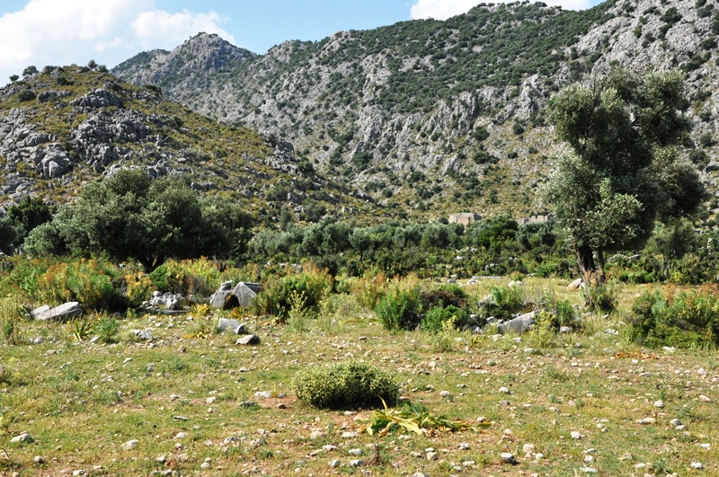
Pamphylian Plain Ends at Taurus Mountains. Photo by Leon Mauldin.

Pamphylian Plain Ends at Taurus Mountains. Photo by Leon Mauldin.

We spent some time exploring this area where a Roman Road cuts through the mountain pass. Dedicated men such as Paul and Barnabas had to negotiate through this type of terrain in their travels.

We found several matters of interest while there, such as this stork
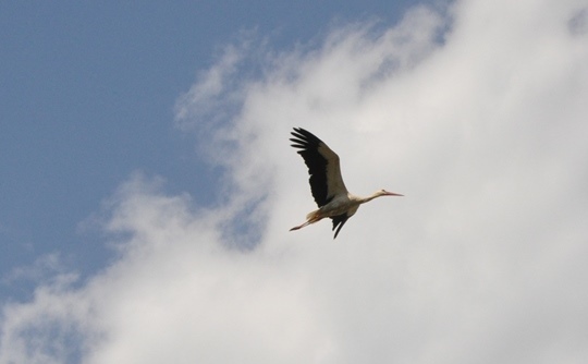
Stork in flight in Pamphylia. Photo ©Leon Mauldin.

Stork in flight in Pamphylia. Photo ©Leon Mauldin.

and this field of Barley:

Barley in Pamphylia. Photo ©Leon Mauldin.

Barley in Pamphylia. Photo ©Leon Mauldin.

Tonight we are north of biblical Hierapolis (mentioned in Colossians 4:13). En route here we saw Laodicea and Colossae. There is much to see at Hierapolis, and tomorrow we plan to explore and photograph in that area. Thanks for following along the journey. Much more to share as time permits.

Mr. Jenkins and I are both well. There’s nothing quite like on-site Bible study! It’s truly a continuing education course for us.


Harran, Home of the Patriarchs and More

May 24, 2014

Bible students think of Haran (today’s spelling: Harran) as temporary home to Abraham (Gen. 12:4) after he left Ur but before arriving in Canaan. This was also home to Rebekah (Gen. 27) wife of Isacc and mother of Jacob & Esau. Haran would be Jacob’s home for 20 years (Gen. 28-29), where he married his wives and had 11 of his 12 sons (Benjamin later would be born near Bethlehem, at which time Rachel died).

Location of Haran in Mesopotamia. Map by BibleAtlas.org.

Location of Haran in Mesopotamia. Map by BibleAtlas.org.

But like many other biblical locations, Harran was of strategic significance, as indicated by this entry from Wikipedia:

By the 19th century BCE, Harran was established as a merchant outpost due to its ideal location. The community, well established before then, was situated along a trade route between the Mediterranean and the plains of the middle Tigris. It lay directly on the road from Antioch eastward to Nisibis and Ninevah. The Tigris could be followed down to the delta to Babylon. The 4th-century Roman historian Ammianus Marcellinus (325/330–after 391) said, “From there (Harran) two different royal highways lead to Persia: the one on the left through Adiabene and over the Tigris; the one on the right, through Assyria and across the Euphrates.” Not only did Harran have easy access to both the Assyrian and Babylonian roads, but also to north road to the Euphrates that provided easy access to Malatiyah and Asia Minor.

According to Roman authors such as Pliny the Elder, even through the classical period, Harran maintained an important position in the economic life of Northern Mesopotamia.

Harran was also an ancient center for worship for the moon god Sin. This excavated mud brick site has been suggested as the location for a temple for the god that predates the well known later temple.

Haran Mud Brick Building. Proposed site of temple to moon god Sin. Photo ©Leon Mauldin.

Haran Mud Brick Building. Proposed site of temple to moon god Sin. Photo ©Leon Mauldin.

Our original flight this afternoon to Antalya was cancelled, which will result in a much later arrival this evening than previously scheduled. Those things happen when traveling. We are both well. Thanks for following our trip.


Traveling in Eastern Turkey

May 23, 2014

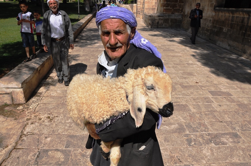
Yesterday upon our arrival in Gaziantep Ferrell Jenkins & I rented our car and from there went to Zeugma where we saw the Euphrates and the excavations of the temple of Dionysus. From there we drove to the ancient city of Haran, home (for a while) to Abraham; home to Jacob for twenty years. We overnighted in Sanliurfa, a strategically important city in upper Mesopotamia known as Edessa in Grecian and Roman times. This morning at Sanliurfa I photographed a man carrying a sheep.

At Sanliurfa, Turkey. Photo by Leon Mauldin.

At Sanliurfa, Turkey. Photo by Leon Mauldin.

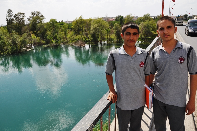
At Gobekli Tepe we saw the oldest known temple remains to be discovered thus far. From there we went on to Birecik for another view of the Euphrates as we made our way on to Carchemish.

High school boys at Belcik, Turkey, on bridge crossing Euphrates. Photo by Leon Mauldin.

High school boys at Birecik, Turkey, on bridge crossing Euphrates. Photo by Leon Mauldin.

We were able to see Carchemish from several vantage points and took lots of photos. We could see over into Syria. Tonight we are in Gaziantep.


At Nicaea of Bithynia

May 21, 2014

I am thankful for safe arrival yesterday at Istanbul, meeting up with Ferrell Jenkins who had just concluded a tour in Turkey. Today we crossed the Sea of Marmara by ferry to save driving time on our way to Nicaea, called Iznik today. Nicaea was one of the important cities in New Testament times in the Roman Province of Bithynia. Peter addressed Christians over a widely scattered area (covering much of what is the country of Turkey today): “Peter, an apostle of Jesus Christ, To the pilgrims of the Dispersion in Pontus, Galatia, Cappadocia, Asia, and Bithynia” (1 Pet. 1:1). Dr. Mark Wilson writes that Nicaea “vied with Nicomedia for the distinction of being the principle city of Bithynia” (Biblical Turkey: A Guide to the Jewish and Christian Sites of Asia Minor,  p.369).

It was a great opportunity to be in Nicaea today. The weather was very pleasant, and the lighting was excellent for most of the photos we made. Plus it’s just great to be in what was biblical Bithynia. The gospel made inroads there, as evidenced from 1 Peter (most conservative scholars believe that Peter’s second letter was written to the same audience). That means it was highly likely that the messenger with Peter’s letter would have contacted brethren there. Dr. Wilson says it a bit more emphatically, “. . . the messenger caring 1 Peter would certainly have visited Nicaea” p.370).

Nicaea is characterized by an ancient city plan which makes use of the decumanus maximus running east and west and the cardo maximus north and south. Nicaea was a walled city with four gates. Wilson says of the walls and gates that they are the most unique in western Turkey” (v.371). The Roman walls were built on Hellenistic walls, but the Roman walls then were reconstructed by the Goths after the Goths destroyed them (AD 268-270).

In AD 325 the first of the Ecumenical Councils (as well as the seventh) were held in Nicaea. It has been long-standing to date church history as pre-Nicaean and post-Nicaean.

Nicaea is situated on the east side of a beautiful lake which had commercial importance. We drove along side of it at times en route to Nicaea. This city was established under the Greek rule during the intertestamental period, 316 BC).

So Bithyna for sure and Nicaea almost certainly was important to the church in the first century, and Nicaea became very important in church history for time to come. Tonight we share a photo of Nicaea’s east gate.

Nicea East Gate. Photo  ©Leon Mauldin.

Nicaea East Gate. Photo ©Leon Mauldin.

Neither Mr. Jenkins nor I had been to Nicaea before today. We agreed it was really a good day. We got to the ferry with 5 minutes to spare.

Tomorrow we are to fly east to Gaziantep and see such sites as Zeugma and Haran. Haran, today spelled Harran, was Abraham’s home for a time, at of family that are prominent in the biblical Narrative.


Imperial Cult Worship

April 11, 2014

A book I have found helpful in understanding the background of Revelation is Imperial Cults and the Apocalypse of John: Reading Revelation in the Ruins, by Steven J. Friesen (pub Oxford). Friesen states:

The signal development, first manifest in the dedications of the Temple of the Sebastoi but reflecting broader trends in society was the use of neokoros as a technical title for a city with a provincial temple of the emperors. The power of this innovation was explosive. In a matter of years it changed the public rhetoric of empire in Asia. Within a century it had transformed the discourse of Roman imperialism in the eastern Mediterranean. From the late first century onward, the most prestigious self-designation that could be employed by a city in Asia was neokoros, indicating the presence of a provincial temple where the emperors and their relatives were worshipped (p.150).

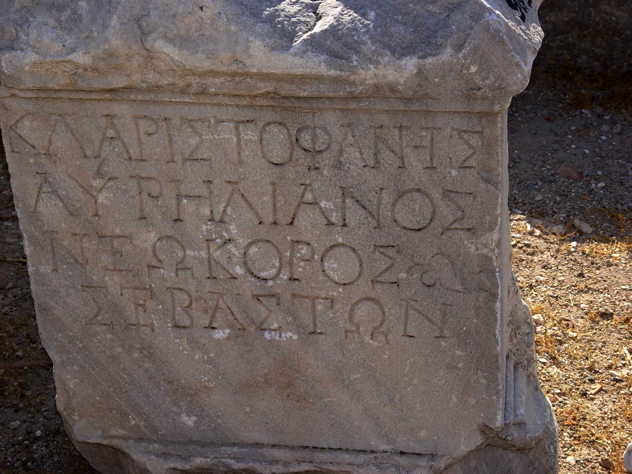
Neokoros literally means one who sweeps and cleans a temple; one who has charge of a temple, to keep and adorn it. It came to designate a city which maintained a temple for imperial worship. It is a historical fact that cities competed for this “honor.”

G. K. Beale observes, “Revelation presupposes that Christians were being required to participate to some degree in the imperial cult (e.g., 13:4-8,15-17; 14:9-11; 15:2; 16:2; 19:20; 20:4). . . in the Apocalypse persecution arises because of refusal to worship the ungodly king” (NIGTC Revelation, p.5).

Smyrna Inscription, designating it neokoros. Photo by Leon Mauldin.

Smyrna Inscription, designating it neokoros. Photo by Leon Mauldin.

This inscription found in biblical Smyrna (see Revelation 2:8-11; Smyrna was one of the seven churches of the Roman province of Asia addressed in Rev. 2-3), in lines 3 and 4 designates Smyrna as neokoros of Sebaston [Greek equivalent to Latin Augusti]. Dr. David McClister says, “This inscription is known in the scholarly literature as Smyrna 162. It is an honorary inscription for Cl(audius) Aristophanes Aurelianus,  dated AD 193/235” [lines 1 and 2), and further, “It appears to me to have been a statue base honoring this individual for his leadership in the emperor cult.”


Out of the Wilderness and into Canaan

February 28, 2014

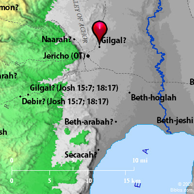
The book of Joshua transitions the reader from Israel’s wilderness wandering to their entrance into Canaan, the Promised Land. Upon their crossing the Jordan, and before taking the city of Jericho, they encamped at Gilgal.

Israel's encampment at Gilgal. BibleAtlas.org

Israel’s encampment at Gilgal. BibleAtlas.org

At Gilgal all the men were circumcised who during the 40 years of wilderness wandering had neglected (i.e., their parents had neglected) this special covenant token.

So Joshua made flint knives and circumcised the Israelite men at Gibeath-haaraloth.  This is the reason Joshua circumcised them: All the people who came out of Egypt who were males– all the men of war– had died in the wilderness along the way after they had come out of Egypt.  Though all the people who came out were circumcised, none of the people born in the wilderness along the way were circumcised after they had come out of Egypt.  For the Israelites wandered in the wilderness 40 years until all the nation’s men of war who came out of Egypt had died off because they did not obey the LORD. So the LORD vowed never to let them see the land He had sworn to their fathers to give us, a land flowing with milk and honey.  Joshua raised up their sons in their place; it was these he circumcised. They were still uncircumcised, since they had not been circumcised along the way.  After the entire nation had been circumcised, they stayed where they were in the camp until they recovered.  The LORD then said to Joshua, “Today I have rolled away the disgrace of Egypt from you.” Therefore, that place has been called Gilgal to this day (Josh. 5:3-9).

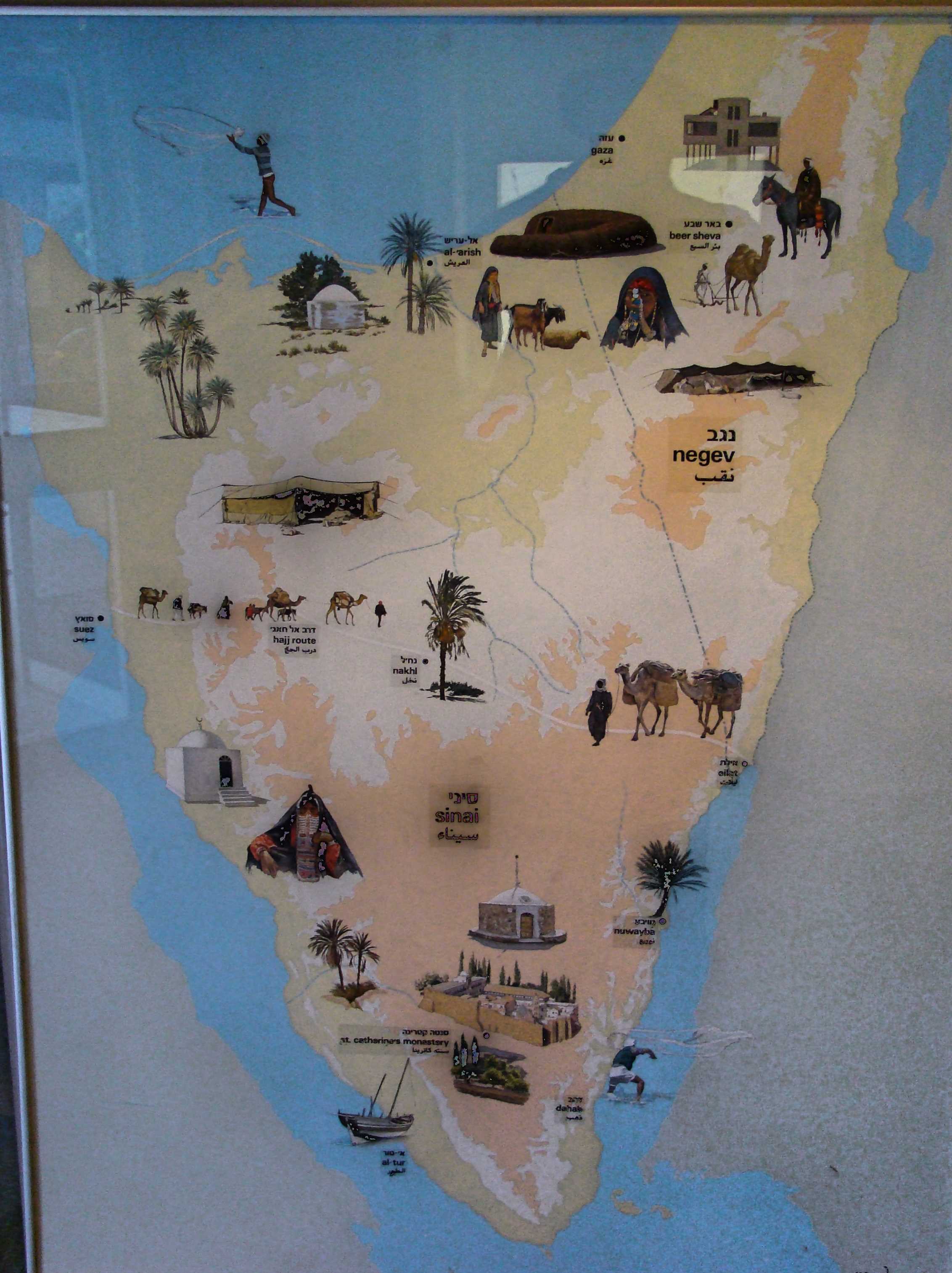
The Peninsula of Sinai was Israel’s home for that period referenced in this text.

Area of Wilderness Wandering.  Museum of Bedouin Culture. Photo ©Leon Mauldin.

Area of Wilderness Wandering. Museum of Bedouin Culture. Photo ©Leon Mauldin.

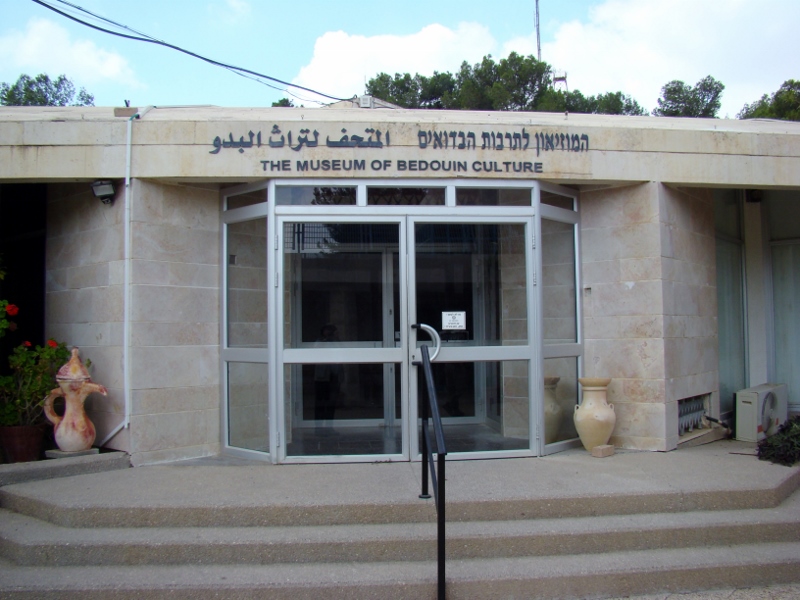
The photo of this artwork was taken in the Museum of Bedouin Culture at Kibbutz Lahav in the Israel’s Negev.

Museum of Bedouin Culture at Kibbutz Lahav. Photo ©Leon Mauldin.

Museum of Bedouin Culture at Kibbutz Lahav. Photo ©Leon Mauldin.

It was also at Gilgal that Israel observed the Passover at the appointed time, the 1st month, 14th day. It was at this time that the manna stopped, and Israel began to eat the produce of the land. This was at harvest season. The 40 years of wandering were over; a new era had dawned!

Click on images for larger view.


All the Land of the Hittites

February 26, 2014

Following the death and 30-day period of mourning for Moses (Deut. 34), Yahweh spoke words of encouragement to his successor, Joshua:

After the death of Moses the LORD’s servant, the LORD spoke to Joshua son of Nun, who had served Moses: “Moses My servant is dead. Now you and all the people prepare to cross over the Jordan to the land I am giving the Israelites. I have given you every place where the sole of your foot treads, just as I promised Moses.  Your territory will be from the wilderness and Lebanon to the great Euphrates River– all the land of the Hittites— and west to the Mediterranean Sea” (Joshua 1:1-4, CSB).

Holman’s Christian Standard Bible (Study Bible) has the following notation regarding the expression, “land of the Hittites”:

The land of the Hittites seems not to refer to the Hittite Empire of modern Turkey but the Egyptian and later Assyrian usage of this term to describe the region controlled by the Hittites in the western part of modern Syria. These lands and boundaries identify Canaan as it was known both to the Bible (Gn 10:19; Nm 13:17,21-22; 34:3-12) and to Egyptian writers of the second millennium B.C.

In numerous passages the Hittites are mentioned as one of several groups populating the land of Canaan. For example, Joshua told the Israelites, “You will know that the living God is among you and that He will certainly dispossess before you the Canaanites, Hittites, Hivites, Perizzites, Girgashites, Amorites, and Jebusites” (Joshua 1:10; cf. Gen. 15:20; Deut. 7:1, and etc.).

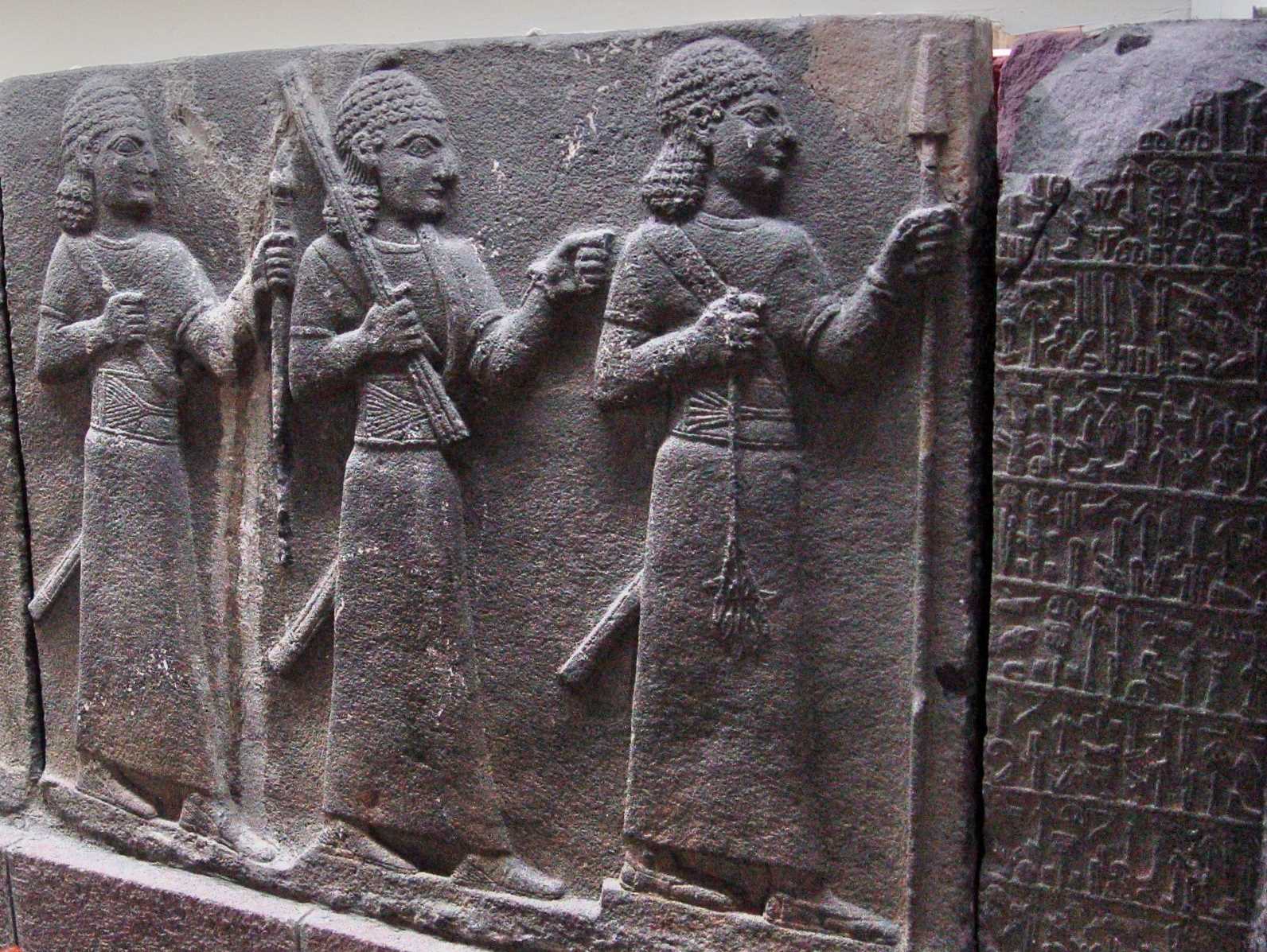
The Ankara (Capitol of modern Turkey) Museum is of international renown for its collection of Hittite artifacts. The relief below shows three Hittite warriors.

Hittite Warriors. Ankara Museum. Photo ©Leon Mauldin.

Hittite Warriors. Ankara Museum. Photo ©Leon Mauldin.

The accompanying placard entitled The Warriors  says, “Three figures with curly hair, and dressed in long tunics with wide belts. The figure at the front holds a spear, which is broken at one end, in his left hand and a leafed tree branch in the right. The figure in the middle clenches his left fist and holds up a tool at head level in his right hand. They are followed by a figure that carries a staff in the left hand. All three wear long swords at the waist.”

The Bible is not a book of fiction. When it mentions people, they were real people, living in real places, participating in real events as recorded in Scripture.


Jericho, First City of the Conquest of Canaan

February 15, 2014

The book of Joshua has one dominant theme: God was fulfilling His promise to the patriarchs Abraham, Isaac and Jacob, that He would give unto their descendants the land of Canaan (Gen. 12:6-7). As Joshua begins, Israel had recently conquered the transjordan territories of Sihon and Og, which would become the possession of Reuben, Gad, and half the tribe of Manasseh (Num. 21:21-35). Though the eastern territory was given to Israel by God, the land of Canaan proper did not include the transjordan, but rather was the land west of the Jordan River. (See discussion on this by Todd Bolen here. 

The book of Joshua is named after its prominent character, Joshua, the successor of Moses. Following Moses’ death (Deut. 34) and a 30-day period of mourning (v.8), Joshua sent out two spies across the Jordan. They were told “Go, view the land, especially Jericho” (Josh. 2:1).

Conquest of Canaan. Map by Marc Hinds.

Conquest of Canaan. Map by Marc Hinds.

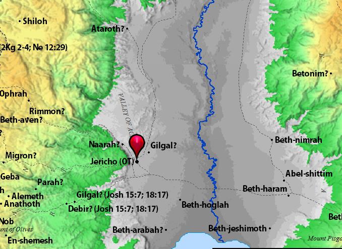
One can see that from their location in Shittim (Acacia Grove, NKJV, CSB) that the first city that must be taken in the Conquest was Jericho, believed to be the world’s most ancient city. It was a fortress city and guarded entrance into Canaan from the east. Located in the Jordan Valley, it is 670 feet below sea level, and was one the first cities in Israel to be excavated. The record of Jericho’s destruction by Israel is found in Joshua 6.

From the standpoint of military strategy, Israel would first conquer the central territory (Josh. 7-8), then the southern (Josh. 10), and finally the northern territory (Josh. 11).

Jericho. Map by BibleAtlas.org.

Jericho. Map by BibleAtlas.org.

I always enjoy seeing Jericho. This past October Jericho was included on our itinerary for my group, though it was later in the day than what is ideal for photos.

Excavations at Jericho. Photo by Leon Mauldin

Excavations at Jericho. Photo by Leon Mauldin.

Recommended reading: see Biblical Archaeology Review, “Did the Israelites Conquer Jericho? A New Look at the Archaeological Evidence,” by Dr. Bryant G. Wood (16:02, March/April 1990).

Click images for larger view.


William Ramsay on the Halys River and North Galatia

January 17, 2014

Sir William M. Ramsay (1851-1939), archaeologist, scholar, and author, was a champion of the South Galatia position (i.e., the N.T. letter to the Galatians was addressed to Antioch of Pisidia, Iconium, Lystra and Derbe) at a time when the North Galatia theory had been accepted for centuries. In his book, A Historical Commentary on St. Paul’s Epistles to the Galatians, he deals with the geography of north Galatia, giving evidence to eliminate that as the area intended in the book of Galatians. He was seeking to understand the geography of Galatia especially and specifically in the mid 1st century AD.

In that portion of his historical introduction, Ramsay mentions the Halys River and how it divided Galatia into two parts.

The country afterwards called Galatia was in primitive time divided ethnographically and politically into two parts, eastern and western: the division was made by the river Halys, which in this part of its course runs in a northerly direction towards the Black Sea. Galatia east of the Halys seems to have been originally reckoned to Cappadocia, though part of it was probably sometimes described as included in Paphlagonia; but the bounds of those countries were so indeterminate, and the ancient writers themselves were so ignorant of the geography of those lands, that it is quite impossible to say anything positive and certain on the subject. . .

Eastern Galatia lies mostly in the basin of the Halys (Kizil-Irmak, the “Red River”). The Halys itself has very few and quite insignificant tributaries. In Eastern Galatia the Delije-Irmak (whose ancient name is unknown) is the only tributary of any consequence; and most of the country lies in its basin; but the river, though it looks large on the map, carries very little water except in flood, when it becomes a broad and raging torrent, exactly as its name indicates, the “Mad River”. . .

Galatia west of the Halys, which was much larger than the eastern country, was the most important and the most typical part of the country; most of our scanty information relates to it; and in general, when any statement is made about North Galatia, the writer has the western part of it in his mind. This western region was originally part of the vast land called Phrygia; and, clearly, the population of the country in the early part of the fourth century were known to the Greeks as Phrygians (Φρύγες). (Ramsay, W. M. (1900). A Historical Commentary on St. Paul’s Epistle to the Galatians (pp. 15–17).

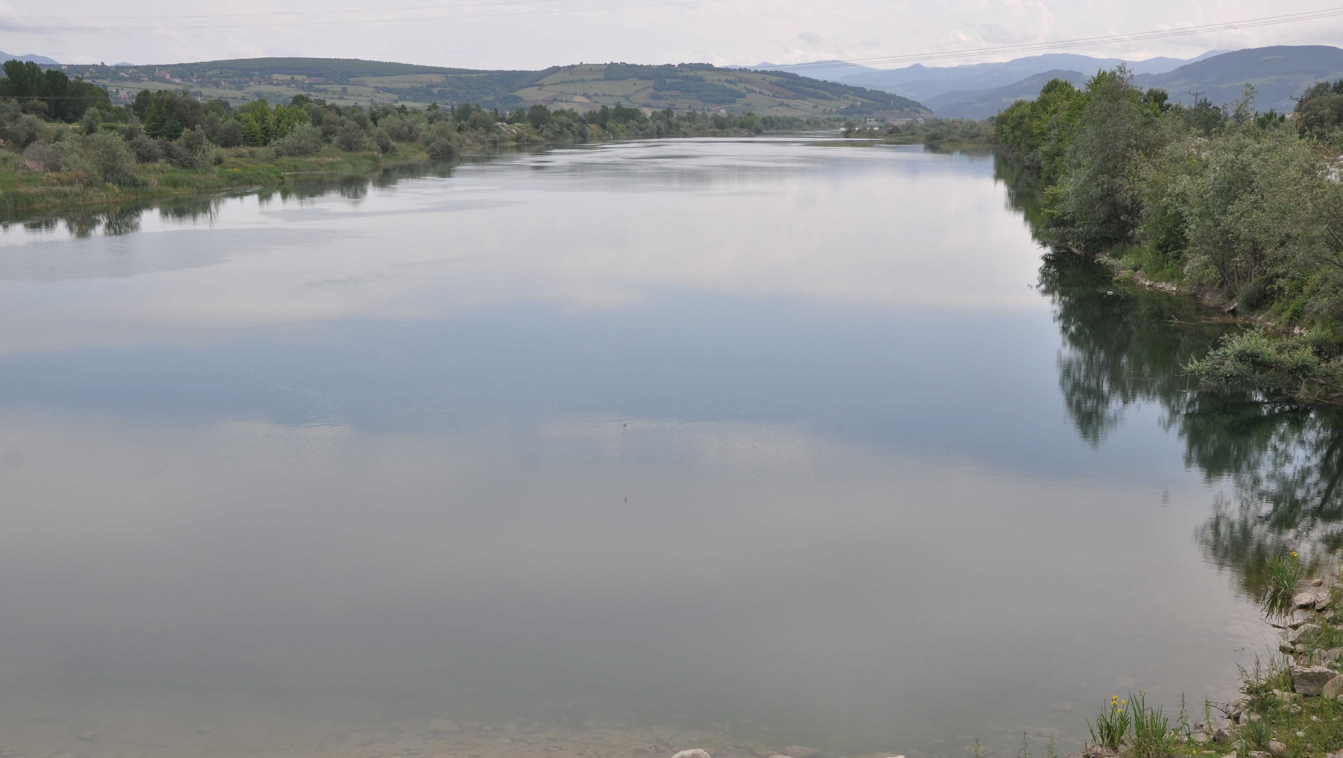
Halys River near the Black Sea. Photo by Leon Mauldin.

Halys River near the Black Sea. Photo by Leon Mauldin.

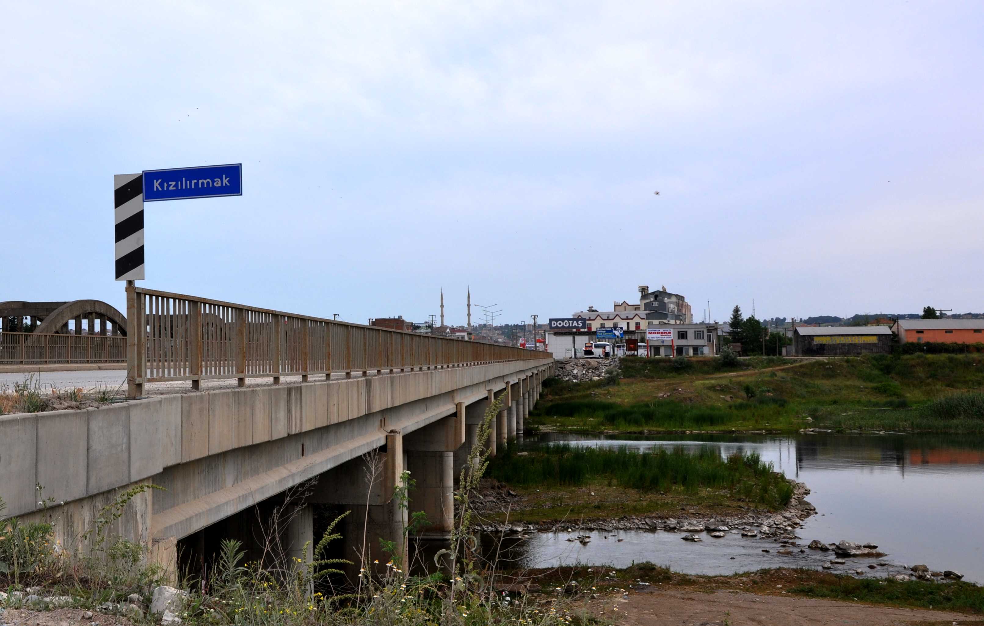
Sir Ramsay referenced the Halys as the Kizil-Irmak. Note the sign here at the bridge crossing the river.

Halys River/Kizil-Irmak. Photo by Leon Mauldin.

Halys River/Kizil-Irmak. Photo by Leon Mauldin.

Click images for larger view.


The Five Day Bible Reading Schedule

January 1, 2014

A Bible reading schedule which we have used and highly recommend is the one arranged by Mark Roberts. It is free. It takes the reader through the Bible in one year. Mark writes:

Are you looking for a reading plan for 2014? Consider the Five Day Bible Reading Schedule. It makes it much easier to complete the Bible in one year because you only have to read five days a week, not seven. This gives you time to catch up if you fall behind. Many Christians have successfully read the Bible with this plan and you can too!
With the Five Day Schedule you can read the entire Bible in 2014 or just the New Testament reading five days a week.
Best of all, it’s FREE. You can download your copy here:
www.BibleClassMaterial.com
May the Lord bless us all to know Him better through His Word.

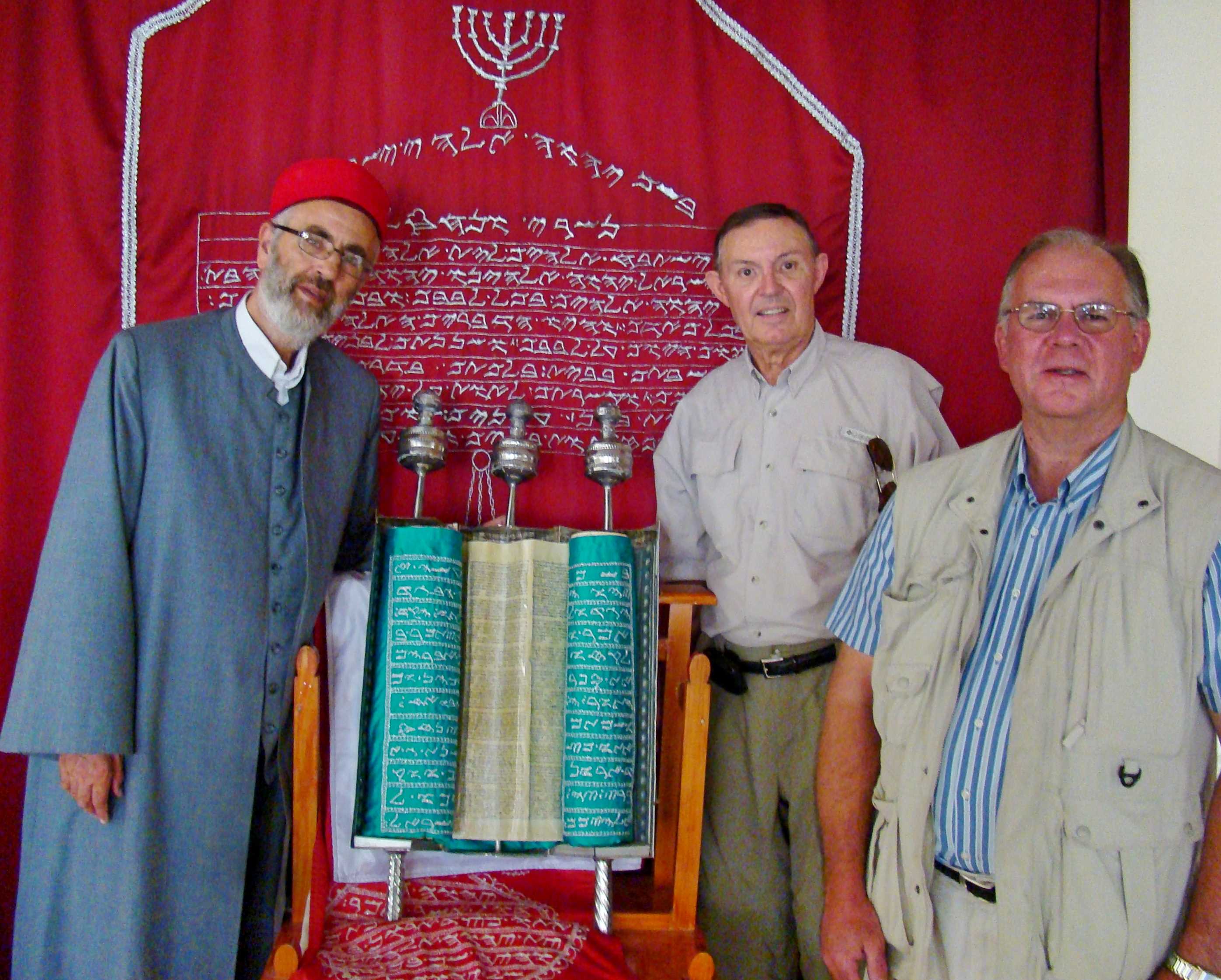
Samaritan Pentateuch at Mt. Gerizim. Photo by Leon Mauldin.

Samaritan Pentateuch at Mt. Gerizim. 

Photo shows Husney W. Cohen, a Samaritan priest and director of the Samaritan Museum, with Samaritan scroll, along with Ferrell Jenkins (center) and Leon Mauldin (right). The Samaritans accept only the first five books of the Old Testament.

I am so thankful for the easy access to the scriptures, and to the proliferation of good translations!