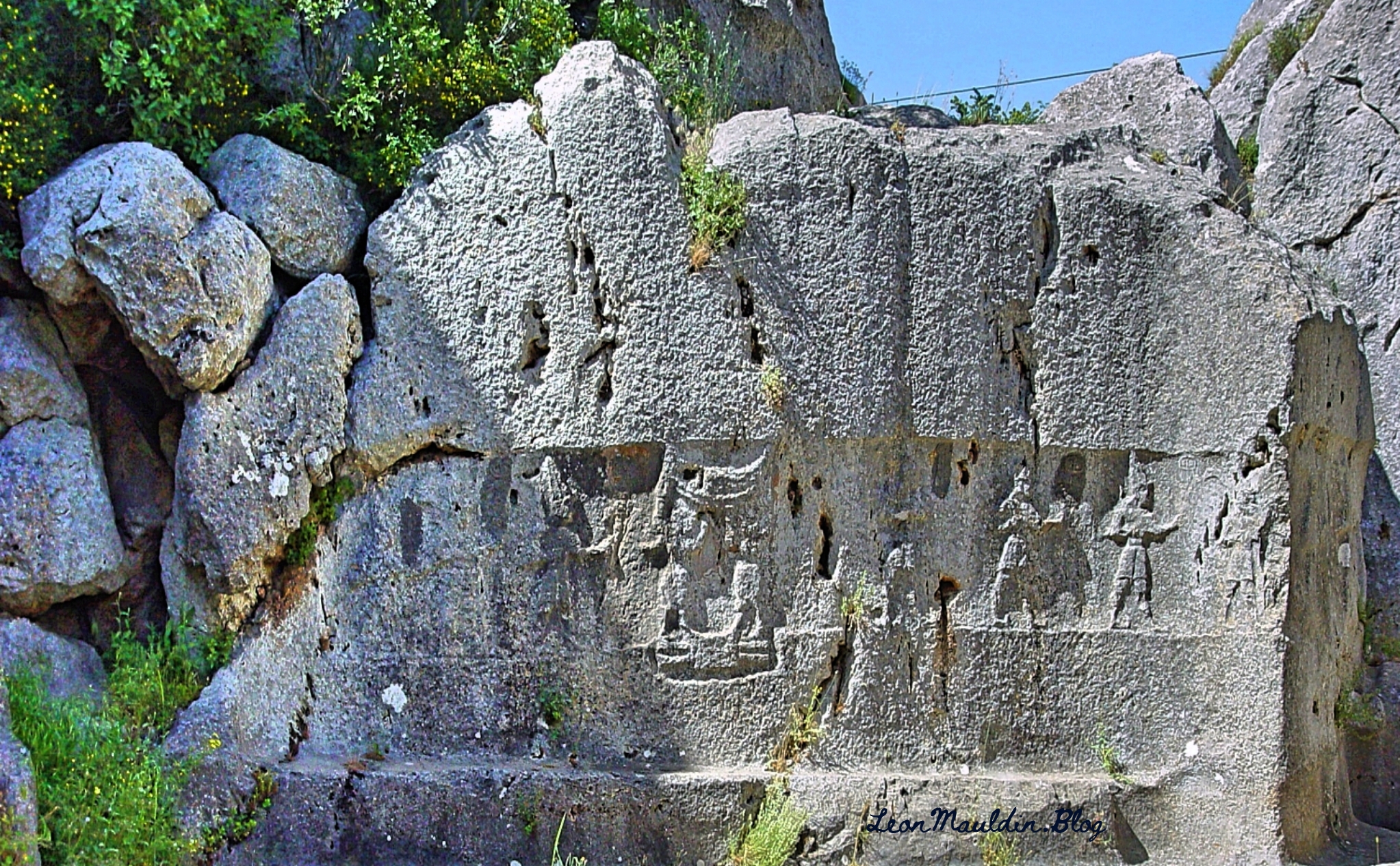
Yazılıkaya is an open-air rock sanctuary located about 1 mile NE of the Great Temple of Hattuşa, in the heart of Hittite country (New Kingdom). It consists of two chambers (A and B) formed inside a group of rock outcrops.
Hittite King Tudhaliya IV reigned 1245-1215 BC (Middle Chronology), or 1237-1209 BC (Short Chronology).
Trevor Bryce writes:
This renovation of the city was the inspiration of King Hattusili III (c. 1267–1237 B.C.), though his son and successor, Tudhaliya IV (c. 1237–1209 B.C.), did most of the work. Not only did Tudhaliya substantially renovate the acropolis; he more than doubled the city’s size, developing a new area lying south of and rising above the old city. In the new “Upper City,” a great temple complex arose. Hattusa could now boast at least 31 temples within its walls, many built during Tudhaliya’s reign. Though individually dwarfed by the enormous Temple of the Storm God in the “Lower City,” the new temples left no doubt about Hattusa’s grandeur, impressing upon all who visited the capital that it was the religious as well as the political and administrative heart of the Hittite empire.
Tudhaliya also constructed massive new fortifications. The main casemate wall was built upon an earthen rampart to a height of 35 feet, punctuated by towers at 70-foot intervals along its entire length. The wall twice crossed a deep gorge to enclose the Lower City, the Upper City and an area to the northeast; this was surely one of the most impressive engineering achievements of the Late Bronze Age. (https://library.biblicalarchaeology.org/article/the-last-days-of-hattusa/)
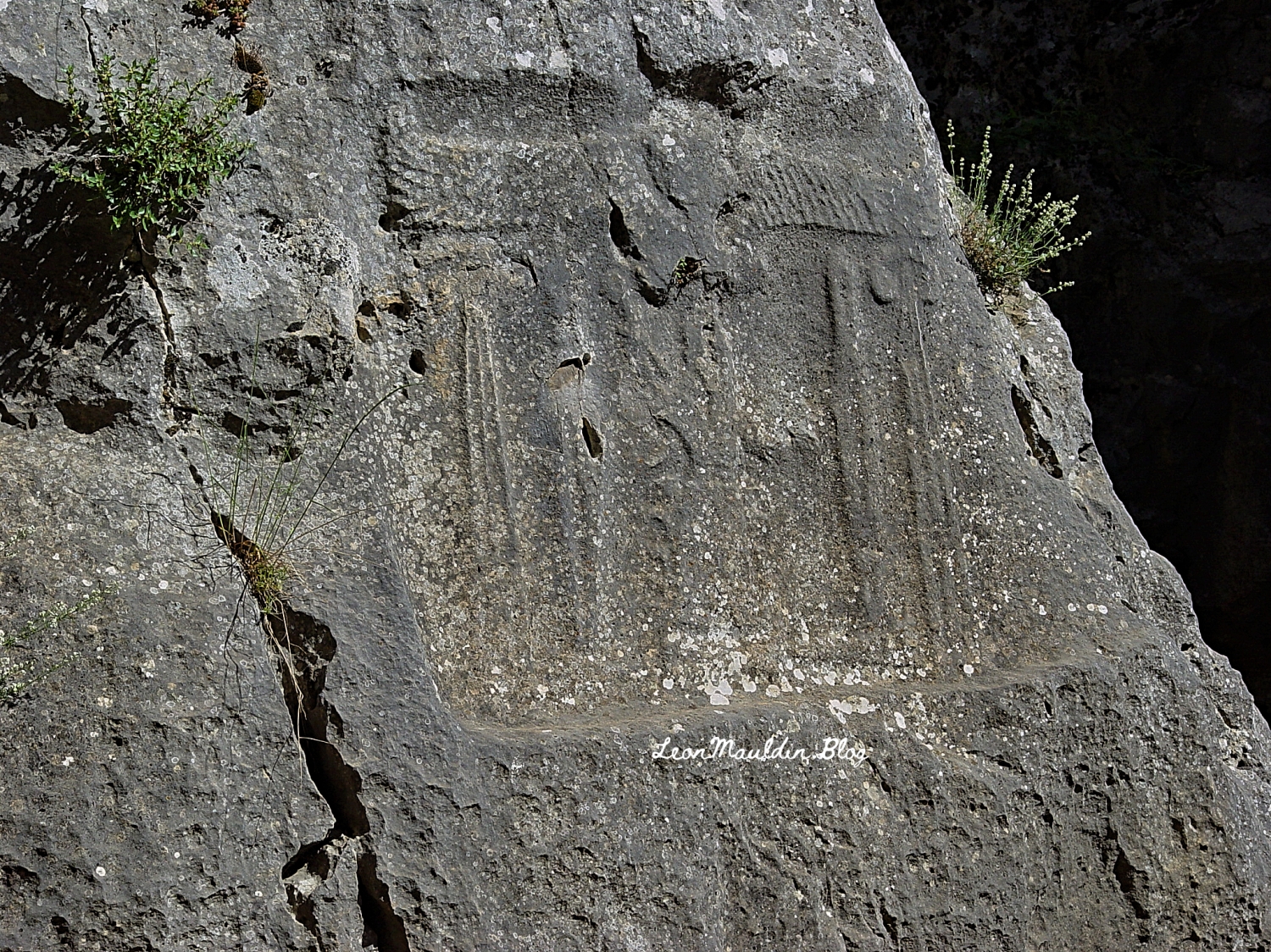
Here inscribed on the rock wall at Yazılıkaya is the cartouch of Great King Tudhaliya IV:
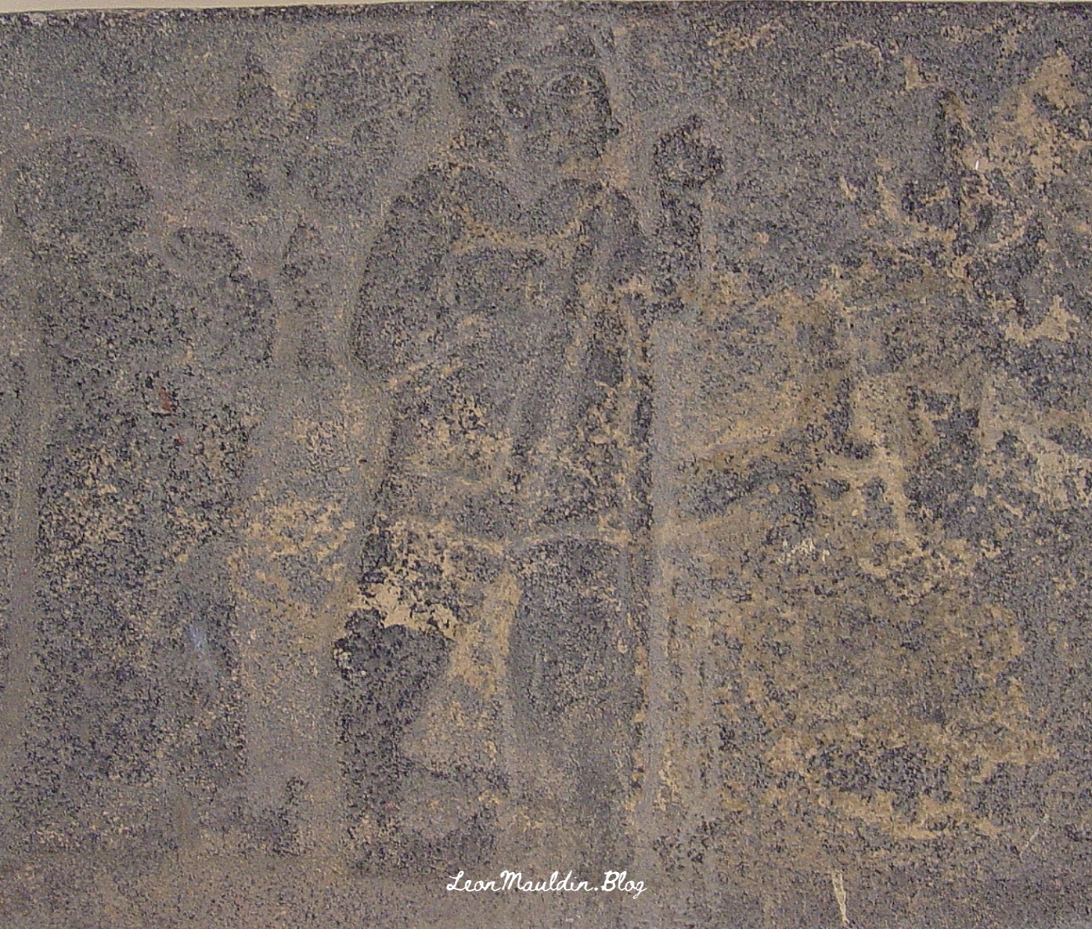
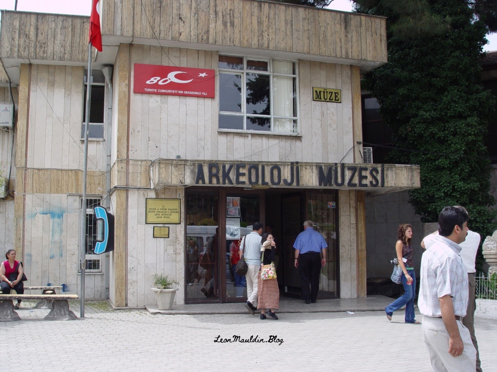
In 2007 I photographed this relief of Tudhaliya IV (dated to 13th century BC), at the Archaeological Museum in Antakya. Antakya is in Turkey, but in New Testament times was Antioch of Syria (Acts 11:20, etc.).
Early Aegean civilization developed on island of Crete. The king was called “minos” and the people of Crete became known as Minoans.
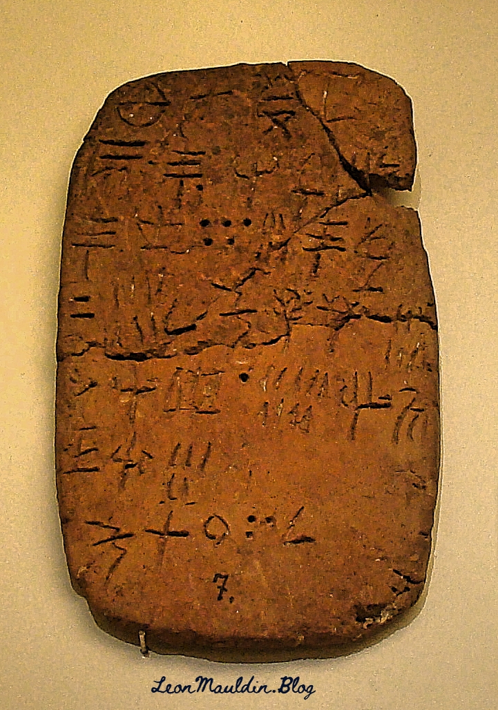
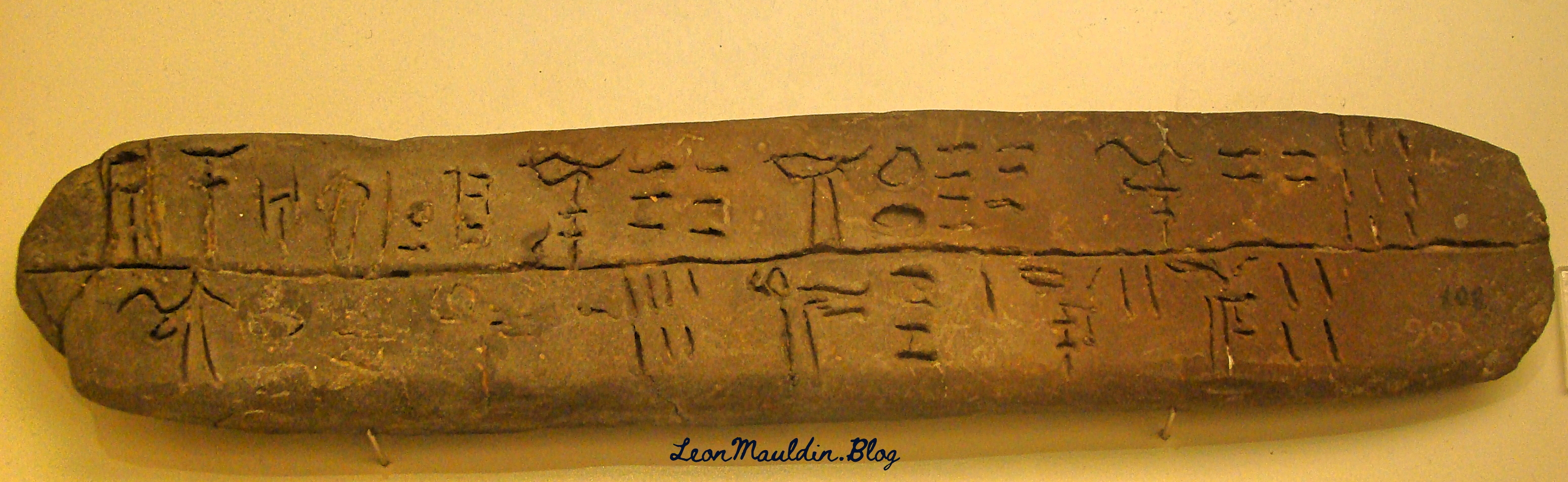
Some of the earliest writing can be traced to the Minoans. They developed three types of writing which included Linear Script A, B, and C. Linear Script B was a combination of Cretan and Greek scripts and is the only one to be translated.
The Heraklion Archaeological Museum in Knossos, Crete, has displays of some of these early scripts.
Linear Script A. This writing system was used by the Minoans of Crete from ca. 1800 to 1450 BC. This writing system was not in the Egyptian and Mesopotamian systems.
Linear Script B. This is script is said to be the earliest attested form of the Greek language. The earliest known examples are dated ca. 1450 BC. This script was deciphered in 1952 by Michael Ventris, who based his work on that of Alice Kober.
In doing some study in the prophet Malachi this morning I came across one of the many biblical references to Esau (from whom descended the Edomites). Malachi 1:2-3 illustrates the necessity of contextual biblical study: “Jacob I have loved, But Esau I have hated.” In short, this had nothing to do with the salvation of individual Edomites, or God’s personal like or dislike of Jacob or Esau, but rather underscores God’s sovereignty in choosing to provide salvation in that descendant of Jacob, Jesus the Christ.
The territory occupied by Edom included Petra. By Roman Times the Edomites had been displaced by a people known as the Nabateans. Petra was the capital of the Roman Province of Arabia.
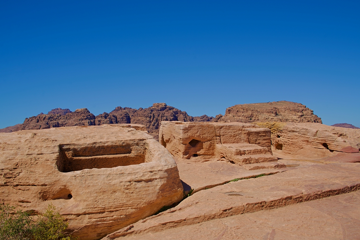
One of the many interesting archaeological finds at Petra is the High Place, including the altar for sacrifice. The photo here was taken in 2019 by tour member David Deason.
High Place at Petra. Altar at center (and slight right). Photo by David Deason.
The High Place at Petra is one of the best preserved of all such sacred installations in the ancient Near East. Its location is imposing, approximately 3,400 feet above sea level and 625 feet above the temenos. The altar platform was approached by three steps. It is situated about 3 feet above the level of an adjoining courtyard area and is equipped with drains and basins for sacrifices and ablutions.
The Biblical World in Pictures; BAS Biblical World in Pictures. (2003). Biblical Archaeology Society.
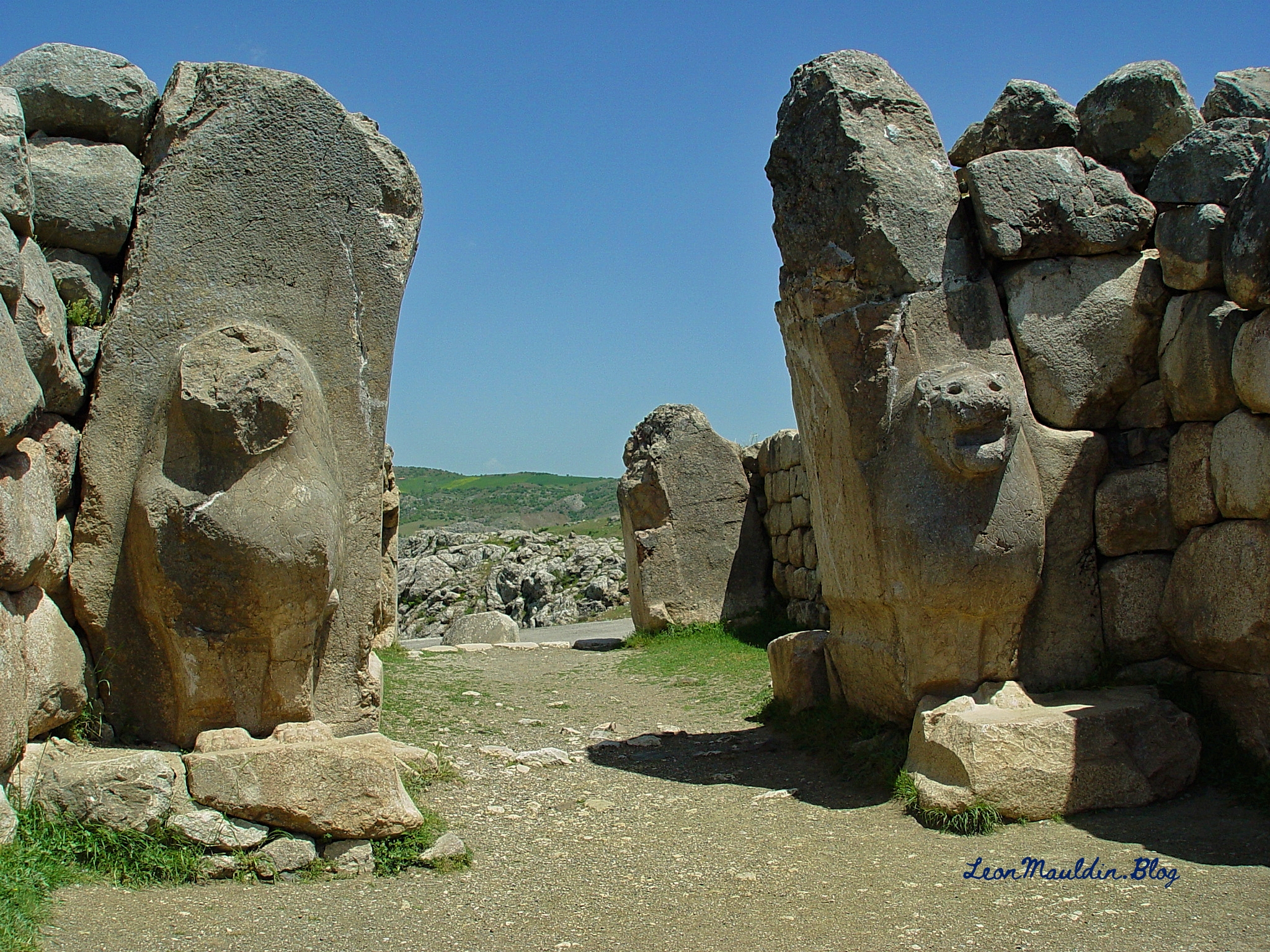
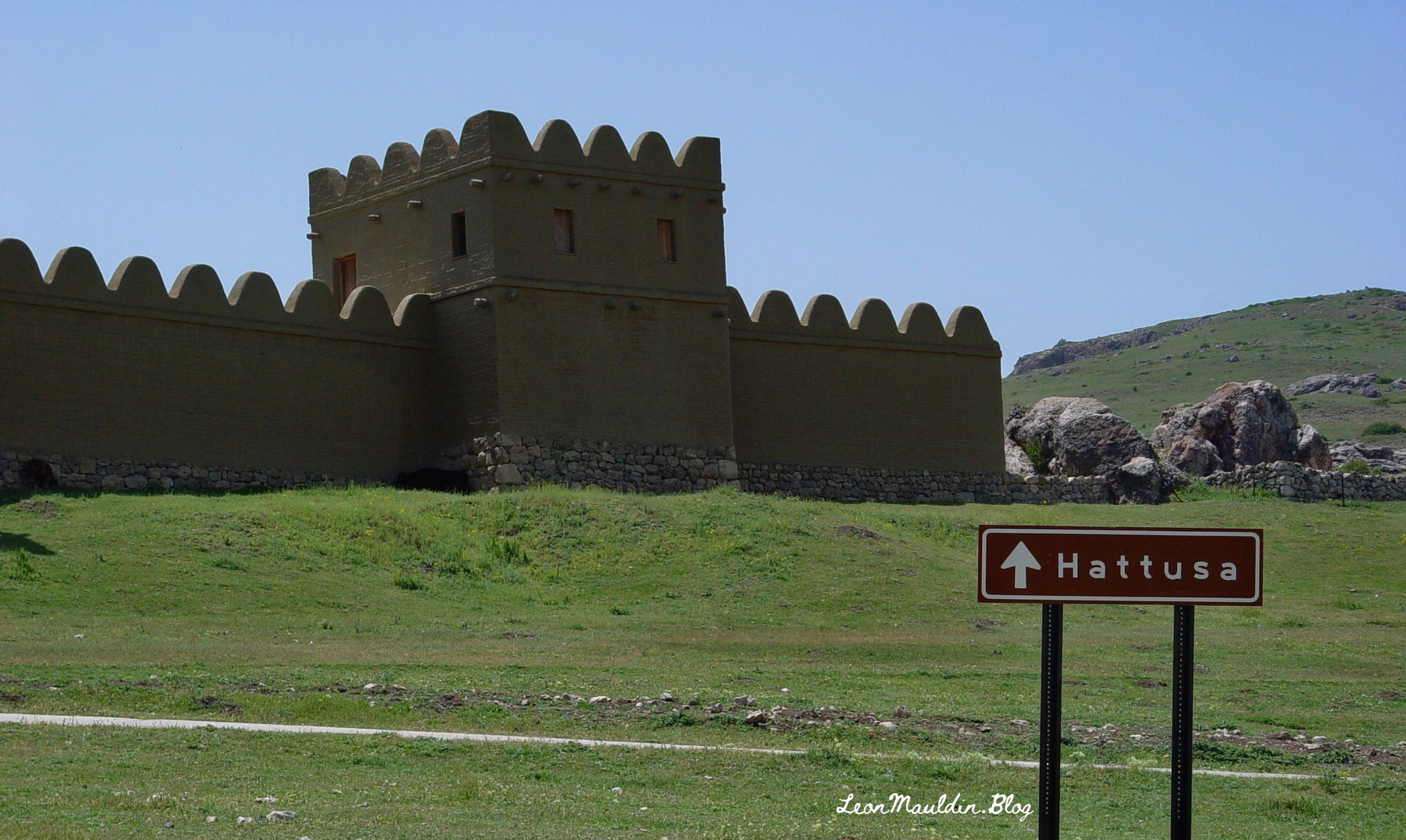
Numerous biblical references are made to the ancient Hittites. Hattuşa was the ancient capital of the Hittite Empire in the Late Bronze Age. Its location is near Boğazkale, Çorum Province, Turkey. One amazing archaeological find is the Lion Gate which features two sculptures of standing lions at the entrance. Previously there would have been an arch above the lions.
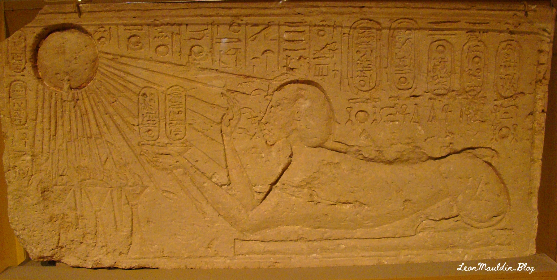
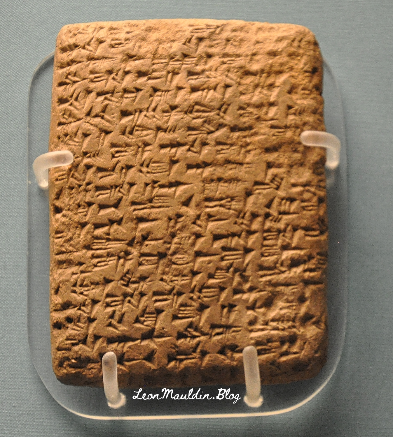
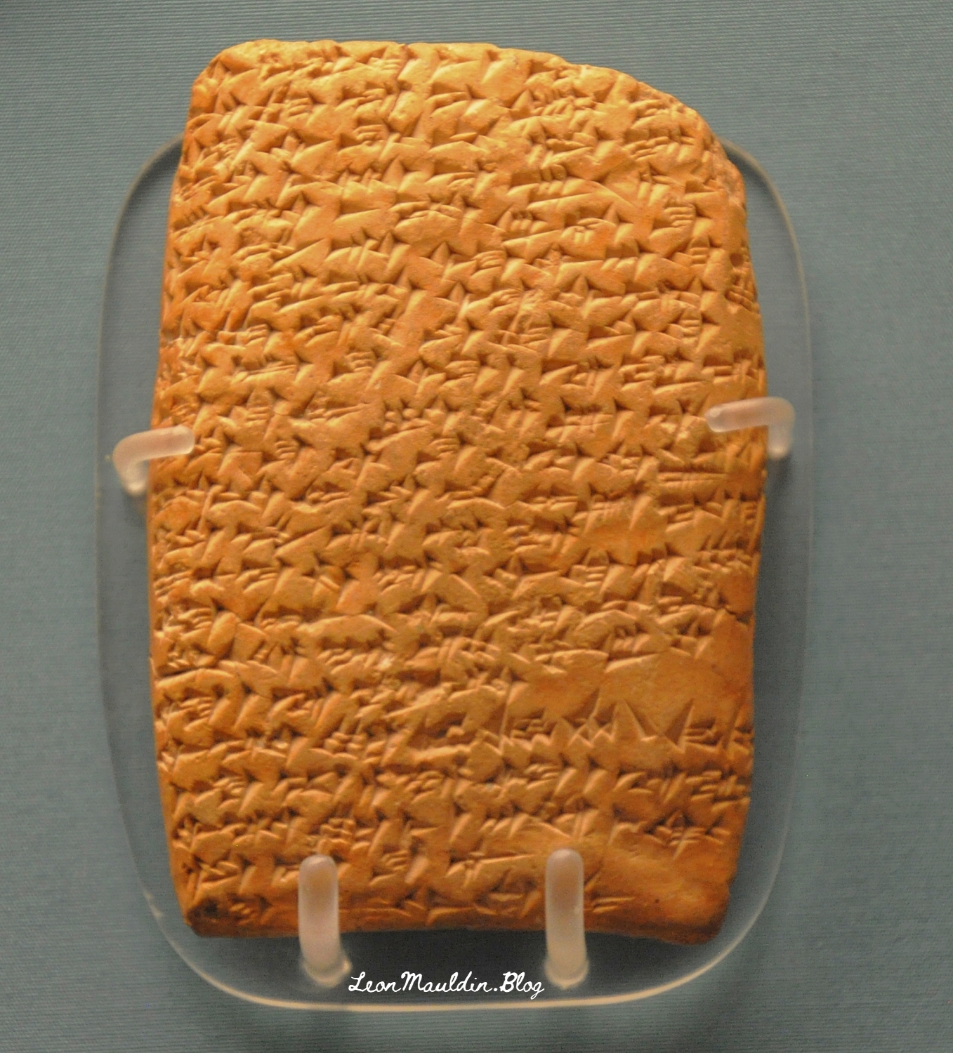
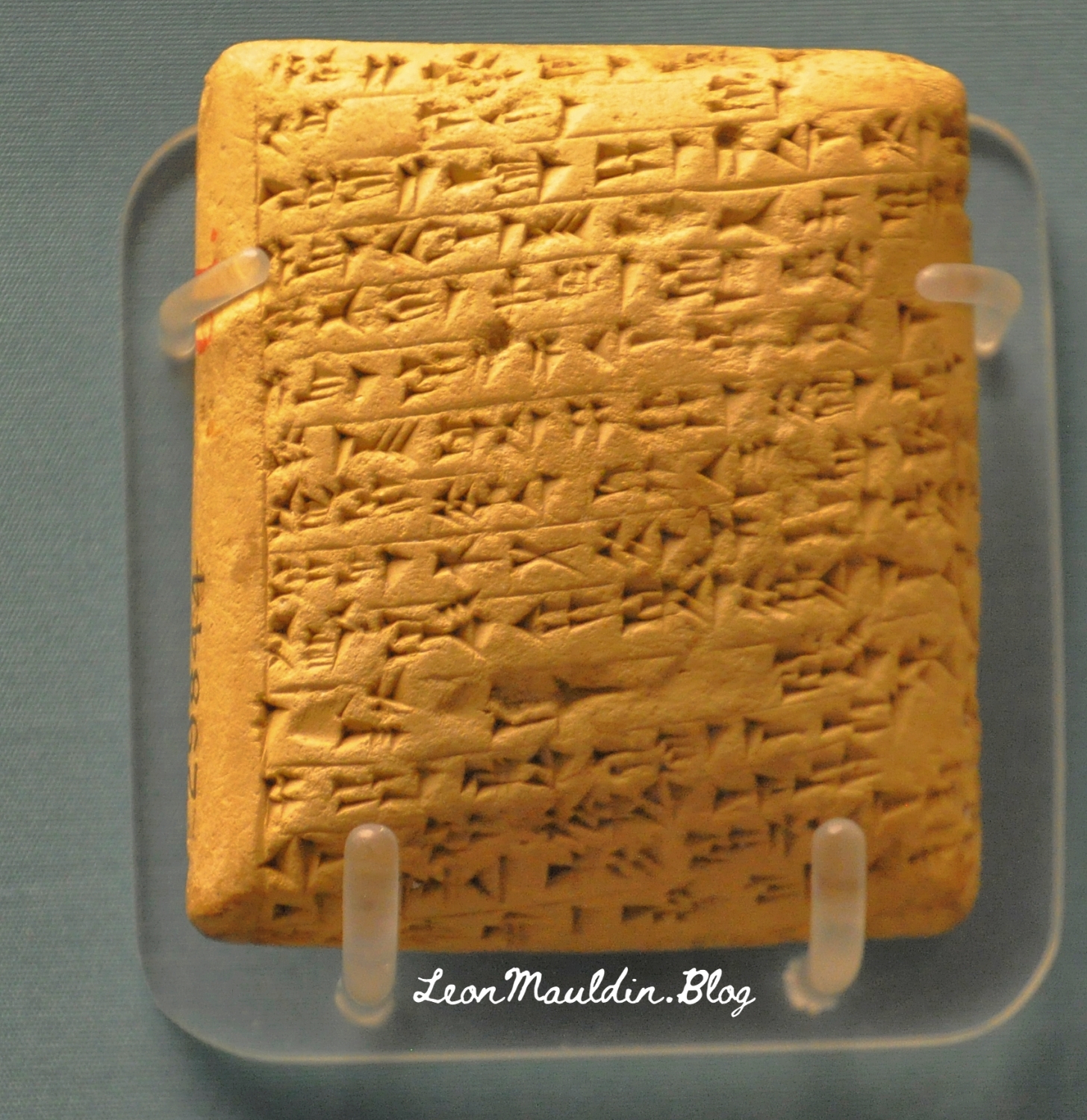
The collection of El-Amarna tablets represent diplomatic correspondence from princes/kings of from varioius parts of the Egpytian Empire during the reigns of Amenophis III, Akhenaton and Tutankhamun. These tablets were found in the ruins of Akhenaton’s (the “heretic” pharaoh) capital at El-Amarna. The British Museum displays some of the El-Amarna tablets from various locations in Canaan, which will be the focus of this post. We will feature tablets from Hazor, Lachish, Gezer, Megiddo and Shechem, all five of which were very important sites in Canaan.
Discovered at the site of Tell el-Amarna in Middle Egypt, these cuneiform documents are letters dating to the mid-14th century BCE that were written in varieties of Akkadian, the lingua franca of the time, by scribes from all over the ancient Near East on behalf of local kings. The letters are commonly divided into two groups: letters from the “greater” powers (the Egyptian, Mitannian, Hittite, Assyrian, and Kassite kings) and letters from the “lesser” powers (smaller kingdoms and city-states from across the Levant, including the land of Canaan). Interestingly, even though the Canaanite rulers were among the least powerful kings writing to Egypt (in fact, they were under Egyptian rule), they left behind the largest number of letters. Source: https://library.biblicalarchaeology.org/article/letters-to-pharaoh-the-canaanite-amarna-tablets/?utm_source=WhatCountsEmail&utm_medium=BHDA%20Spotlight%201-90&utm_campaign=TS%20BAS%20Scholars%20Series%208-21-24
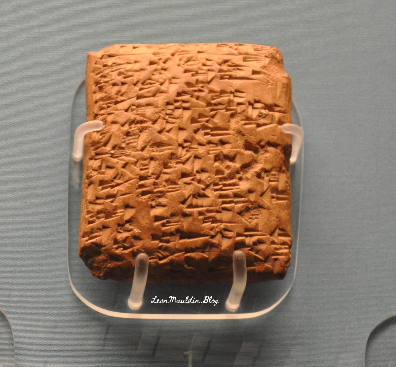
This tablet is from Abdi-Tirshi, King of Hazor. The info sign says that he “reassures pharaoh that he is loyal and is keeping his cities in good order.”
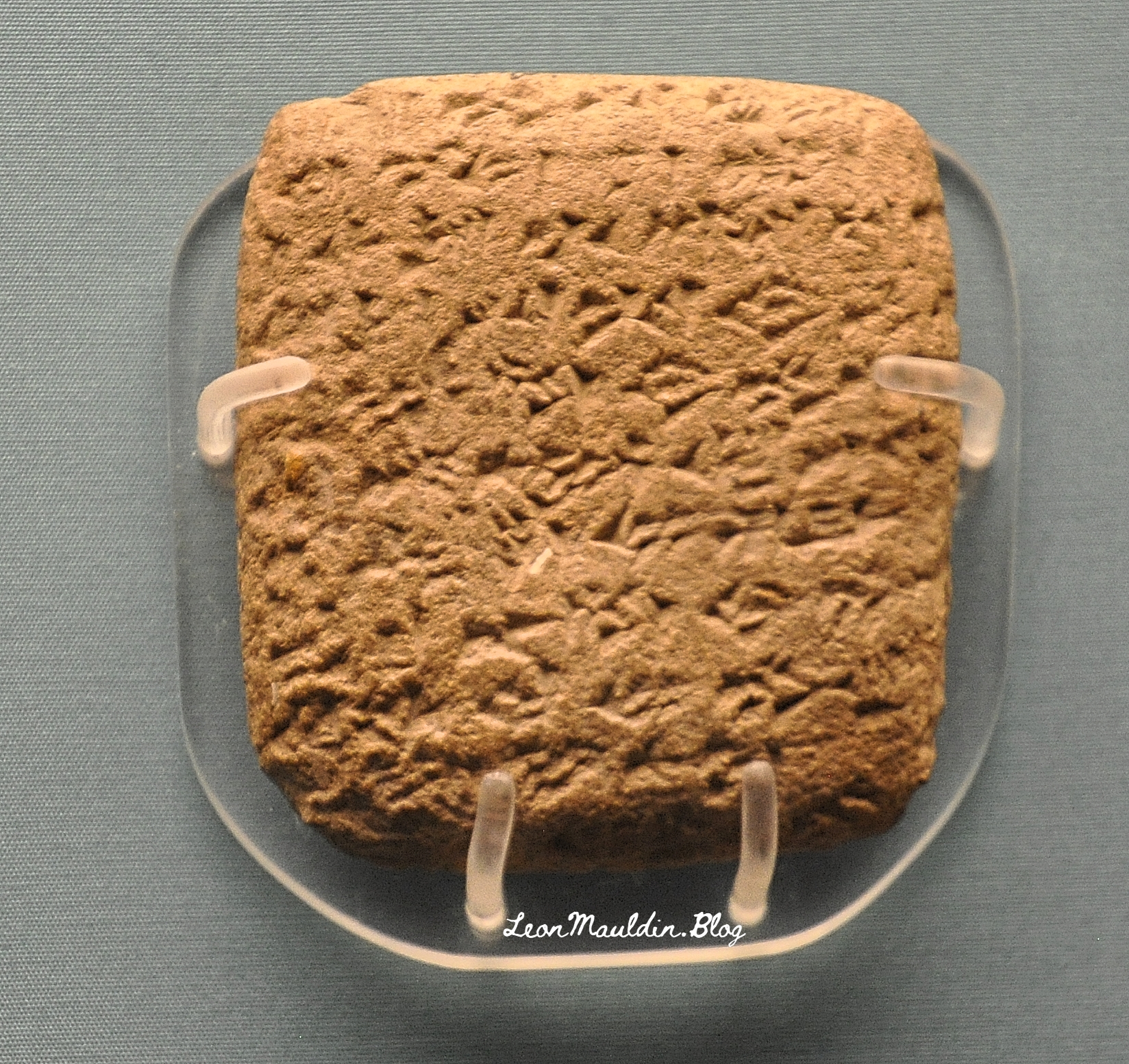
Here is the tablet from Gezer’s king Yapahu, who “begs pharaoh for help in defending his city against raids by the Hapiru.” Many scholars believe that the “Hapiru” here refer to the Hebrews.
Here is the tablet from Biridiya, king of Megiddo. He “accuses the king of Acco of treachery by releasing the captured Hapiru leader, Labayu, instead of sending him to Egypt.”
Mandell went on the say regarding the script of these tablets, “The Amarna Letters were not written in alphabetic or Egyptian scripts. They were written in cuneiform, a wedge-shaped script that was developed in Mesopotamia in the late fourth millennium BCE to write Sumerian and, later, Akkadian. By the Amarna period, ancient people from all over the Near East wrote in this script by impressing a stylus into clay to create wedge-shaped signs” (Ibid.).
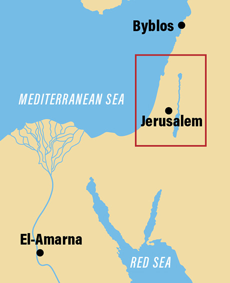
The BAS article also provided a couple of helpful maps.
Map shows the location of El-Amarna relative to Canaan.
Location of El-Amarna in Egypt. Map by BAS.
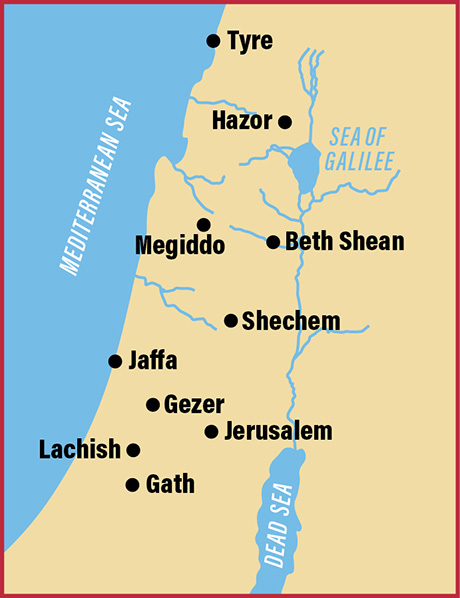
This map includes the sites of the origin of the tablets we featured above.
Cities in Canaan represented our display of tablets. Map by BAS.
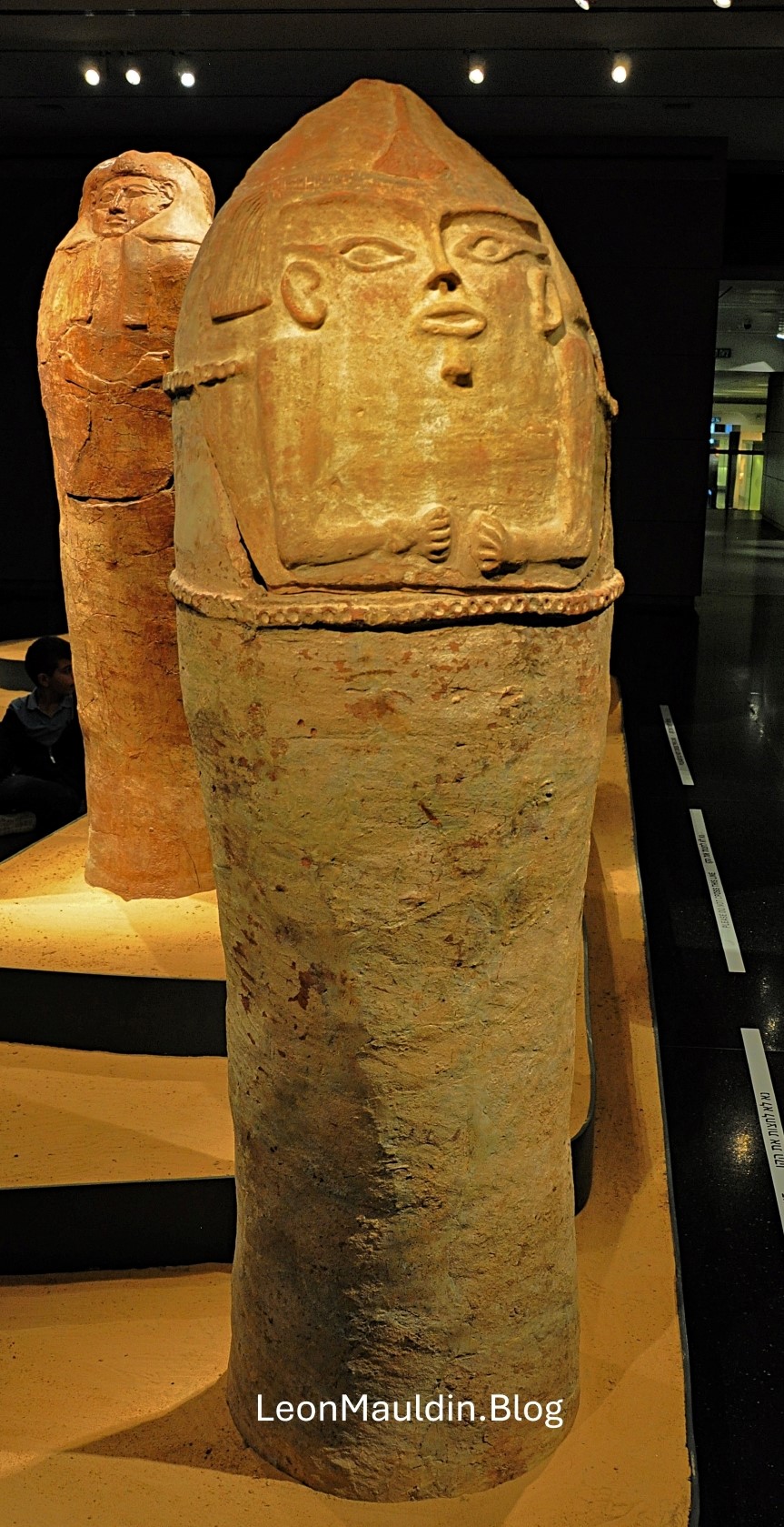
This post shows an Anthropoid Coffin from Deir el-Balah, south of Gaza, one of the cities of the Philistines. Scholars date this artifact to the 13th century BC. It demonstrates Egyptian influence reaching into the SW coast of Canaan. The patriarch Joseph may have been put in a coffin such as this.
The Philistines are mentioned numerous times in the Bible, in the days of the Judges and Kings, and as well as references in the prophets. For example, Zephaniah 2:4: “For Gaza shall be deserted, and Ashkelon shall become a desolation; Ashdod’s people shall be driven out at noon, and Ekron shall be uprooted” (ESV). This text mentions four of the five cities of the Philistine Pentapolis, the fifth being Gath (see 1 Sam. 6:16).
The context of Zephaniah’s prophecy is one of judgment, of the wrath of God, called “The great day of the LORD” (1:14). Though Zephaniah is addressing the Jews of Jerusalem/Judah, God is the God of all the nations. Here the prophet was warning of the destruction of the Philistines (2:5).
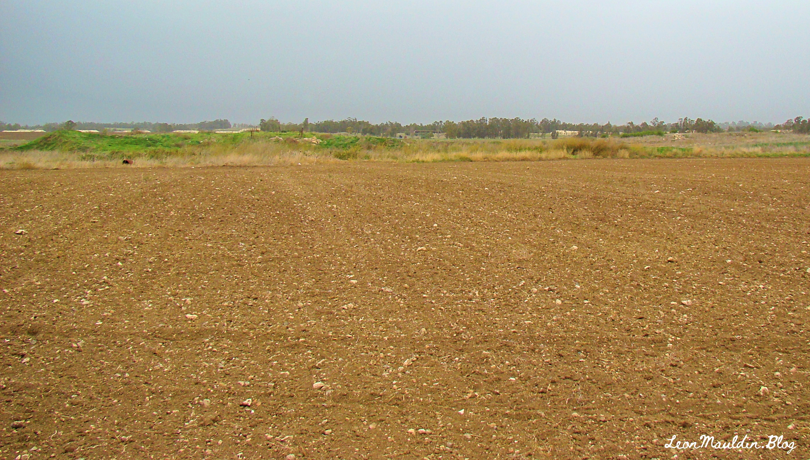
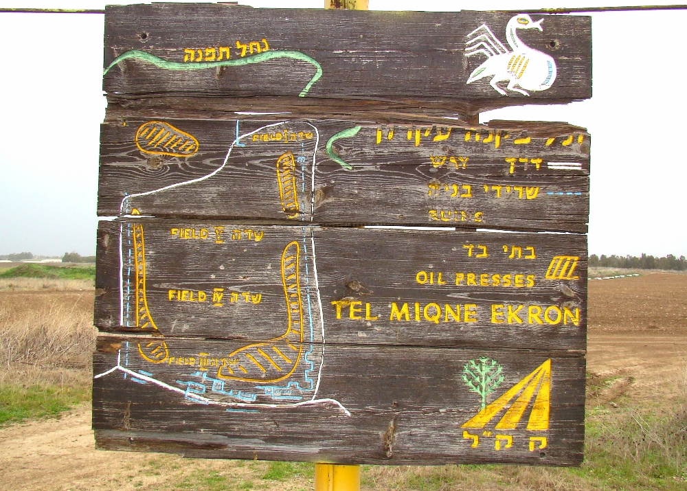
This post will deal briefly with Ekron, which today is known also as Tel Miqne.
Though originally in Israel’s territory at the time of the Conquest led by Joshua (Josh. 15:11, 45-56), Ekron was later in the hands of the Philistines by the time of the Judges. Much of the territory originally taken by the Israelites in the conquest was not retained in subsequent years, largely due to Israel’s lack of diligence and compromise with the surrounding nations.
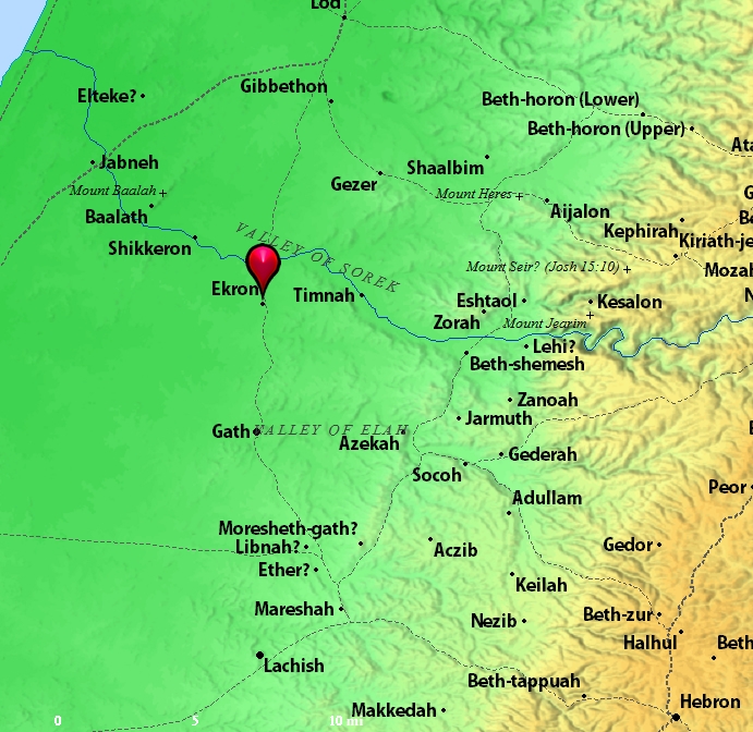
Location of Ekron. Map by BibleAtlas.Org.
Ekron is a tel composed of about 50 acres. It was known for its olive oil industry.
Holman Illustrated Bible Dictionary has this information on Ekron:
Northernmost of the five major Philistine cities known as the Pentapolis. The site of ancient Ekron has been much debated but now is generally agreed to be modern Tell Miqne, about 14 miles inland from the Mediterranean Sea and 10 miles from Ashdod. The site is one of the largest in Palestine, covering some 50 acres. Ekron lies on the road leading from Ashdod into the Judean hill country and up to Jerusalem through the Sorek Valley.
Ekron was assigned to both Judah (Josh. 15:11, 45–46) and Dan (Josh. 19:43) in the tribal allotments. It probably lay on the border between the tribes. Judges 1:18 reports that Judah captured Ekron along with other parts of the Philistine coast, but Ekron was certainly in Philistine hands at the time the ark was captured (1 Sam. 5:10). It was also the place to which the Philistines retreated after David slew Goliath (1 Sam. 17:52). Ahaziah, the son of King Ahab of Israel, called on the god of Ekron, Baal-zebub, when he was sick (2 Kings 1:2–16).
Excavations at Tell Miqne have discovered much pottery that is typically Philistine. From the last period before Tell Miqne was destroyed by the Babylonians, the excavators found an important industrial complex near the city gate. A hoard of iron agricultural tools was found. Hundreds of whole pottery vessels were present. Perhaps most importantly, a well-preserved olive press was discovered. This press is the largest and best preserved known in Israel. A horned altar was also found during the excavations. (pp. 469–470).
I have previously posted on Ekron, Tel Miqne, here.
As one studies the biblical text, such as the letter to the church at Sardis (Rev. 3:1-6), one of the Seven Churches of Asia addressed in the book of Revelation, it is helpful to know somewhat of the conditions in which those first century Christians lived.
The city of Sardis has a rich history in many ways. This post will deal with just one: the Royal Road. Cyrus the Great (r. 559-529 BC) was the founder of the Persian Empire following his conquering of the Babylonian Empire. Cambyses II succeeded him (r. 529-522 BC), whose successor was Darius (r.521-486 BC). (This is the king who was defeated in 490 BC at the battle of Marathon).
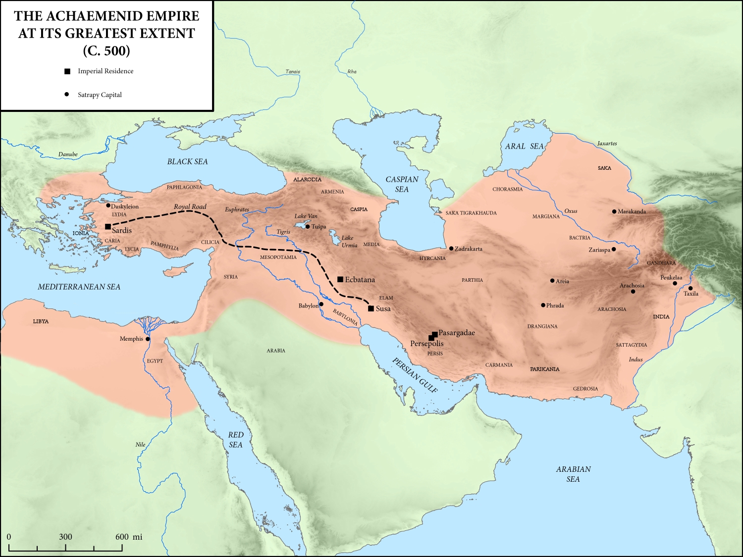
But scholars make the case that his great achievement was his construction of the Royal Road, which extended from the capitol of Susa to Sardis:
Darius is perhaps best remembered for instituting an advanced highway system throughout the empire, a route traditionally called the “Persian Royal Road.” According to Herodotus, the “father of history,” this roadway stretched from Susa (in Elam) to Sardis (in Lydia) and was comprised of a total of 111 intermediate resting-stages, passing through some six Persian provinces, and requiring a total of 90 days to travel the entire course of approximately 1,685 miles. Herodotus adds that another three days were required to journey from Sardis to the coast at Ephesus, from which some scholars have deduced that the “Royal Road” may have extended as far as the Aegean coast. At its other end, a road continued from Susa that ran to Persepolis and beyond.
Beitzel, B. J. (2009). The New Moody Atlas of the Bible (p. 206). Moody Publishers.
The following map depicts this route:
Map shows route of Royal Road from Persian capital at Susa westward to Sardis. Map courtesy of Wikipedia Commons.
This linkage from the capital to Sardis “located Sardis on a major trade and communications route that persisted into the Roman period, positioning the city for ongoing prosperity” (deSilva, Lexham Geographic Commentary, p. 667).
Official communication. The historian Herodotus said of the Persian royal messengers:
Now there is nothing mortal that accomplishes a course more swiftly than do these messengers, by the Persians’ skillful contrivance. It is said that as many days as there are in the whole journey, so many are the men and horses that stand along the road, each horse and man at the interval of a day’s journey. These are stopped neither by snow nor rain nor heat nor darkness from accomplishing their appointed course with all speed.
Herodotus. (1920). Herodotus, with an English translation by A. D. Godley (A. D. Godley, Ed.). Harvard University Press.
Administration.
Rapid Troop Movemnt.
Trace and commerce.
In later history, Alexander the Great would make use of the Royal Road in his conquest of Persia. Dr. Mark Wison notes, “After Alexander the Great captured the city from the Persians in 334 BC, Sardis served as the western capital of the Selucid Empire nor nearly a hundred years (281-190 BC)” (Biblical Turkey, p. 290). In 133 BC Sardis became a part of the Roman province of Asia.
God had his people in Sardis. The church at Sardis was the 5th of the Seven Churches addressed by John (Rev. 1-3).
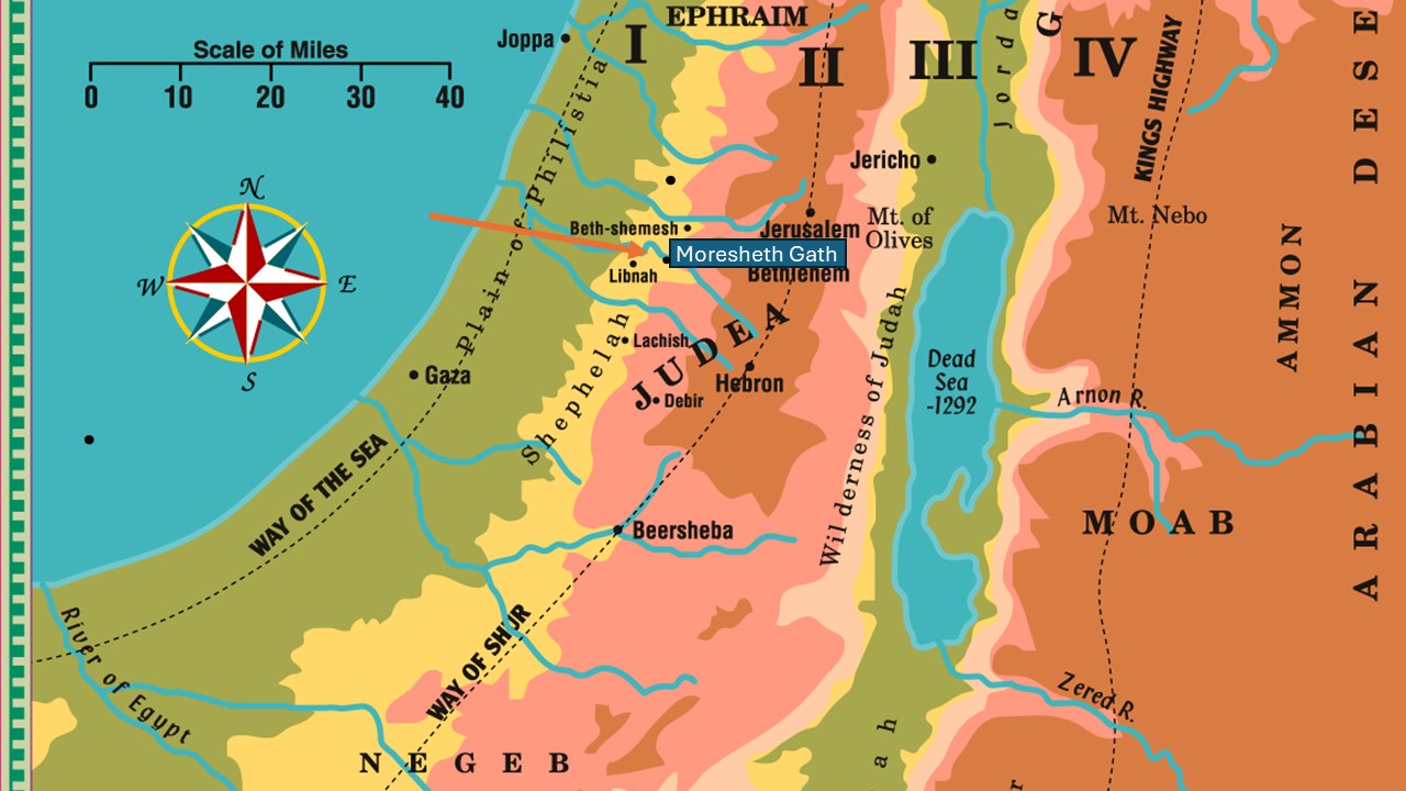
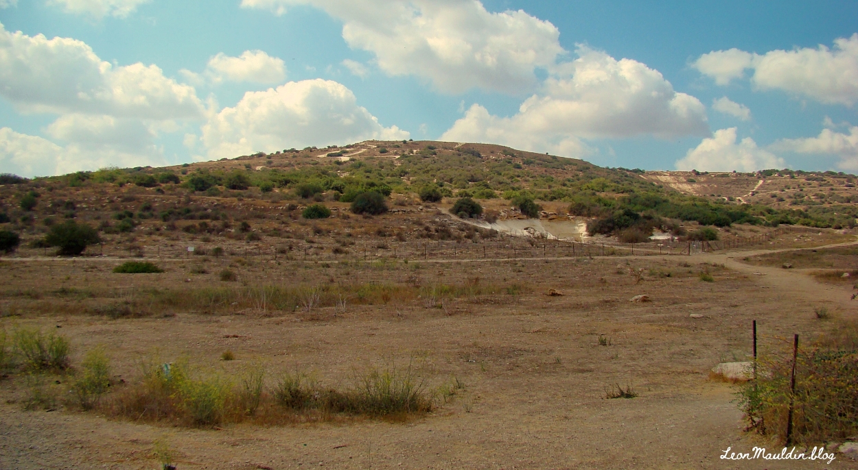
The 8th century BC prophet Micah identifies himself as “Micah of Moresheth” (Mic. 1:1). As his message continues in chapter one, he references “Moresheth Gath” (1:14). Moresheth Gath is tentatively identified by many scholars as Tel Goded (Tell ej-Judeideh).
The geography of Israel is defined by four longitudinal zones: The Coastal Plain, the Central Hill Country, the Jordan Valley, and the Transjordan Plateau. As one goes east from the coastal plain, before arriving in the hill country, one passes through the Shephelah (שְׁפֵלָה, usually rendered “lowland” in Scripture), which consists of gently rolling hills (see Deut. 1:7, etc.). See map here:
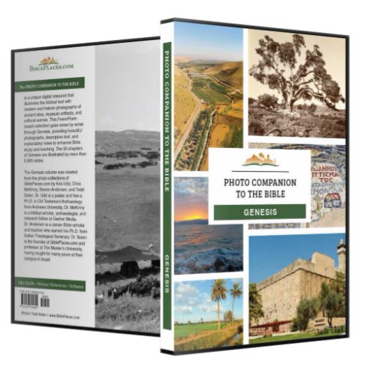
I am enjoying perusing the newly published Photo Companion to Genesis, the latest addition to the Photo Companion to the Bible, by Dr. Todd Bolen and his team. As with the other volumes in this set, each chapter in Genesis (all 50!) is treated separately with its own PowerPoint. For example, chapter one has 225 slides; chapter two has 171 slides, chapter 10 has 604 slides! Another helpful feature: the slides include notes with further explantion, suggested resources, photo credits, etc.
I have been using Dr. Bolen’s materials for more than 20 years, and highly recommend this new addition. Knowing the geographical, archaeological and cultural context of the Bible enhances our understanding of the biblical text, and can help fortify one’s faith. This collection of photos, maps, and explanation chapter by chapter is a great resource.


 Posted by Leon Mauldin