January 28, 2018
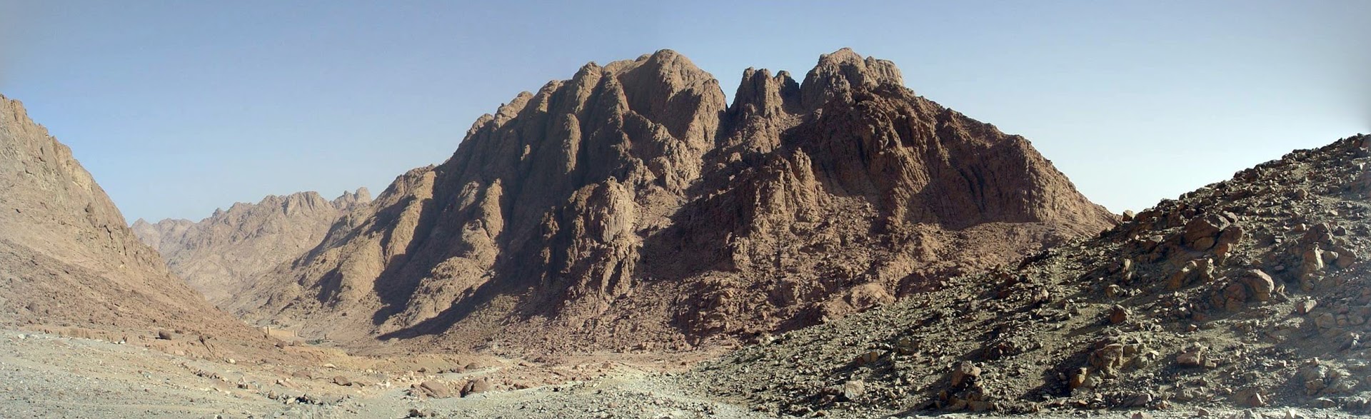
I took this shot of the Sinai region while walking up toward Mt. Sinai, looking at the area below, to give a feel for the geography of this part of the biblical world.

Rugged Region of Mt. Sinai. Photo by Leon Mauldin.
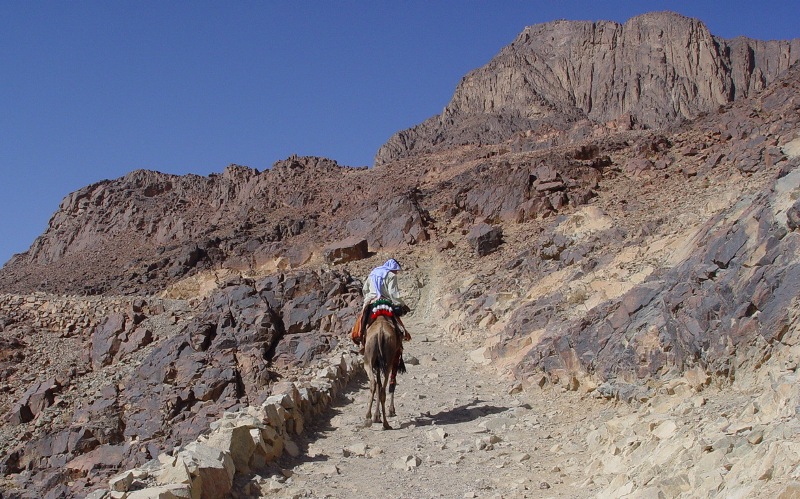
The Sinai Peninsula today is within Egyptian territory. You can see traditional Mt. Sinai itself in this photo, in upper right.

Mt. Sinai, upper right. Photo by Leon Mauldin.
Click images for larger view.
 1 Comment |
  Bible History and Geography, Bible Places, Egypt, Old Testament, photography, Sinai, Travel | Tagged: Mt. Sinai |
  Permalink
 Posted by Leon Mauldin
January 26, 2018
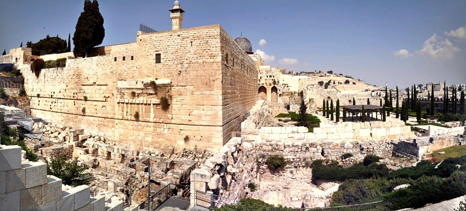
A panoramic view looking toward the SW corner of the Temple Mount in Jerusalem.

Panorama of Jerusalem, SW corner of Temple Mount. Photo by Leon Mauldin.
At the base of the ancient wall on your left (western side) you can see stones lying in place. These were from the Herodian Temple of Jesus day, falling down to their present position in the 70 AD Roman destruction of Jerusalem. Though seemingly small in our photo, some of these broken stones weight tons.
The view straight across shows southern side of temple mount. The distant view at right center is the Mount of Olives, across from the Kidron Valley (which cannot be seen from this view.
This photo is from Spring, 2017.
Click image for larger view.
1 Comment | Archaeology, Bible History and Geography, Bible Places, Israel, Jerusalem, New Testament, Old Testament, photography, Roman Empire, Temples, Travel | Tagged: Temple Mount | Permalink
Posted by Leon Mauldin
January 15, 2018
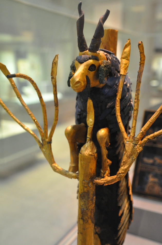
In 1927 the archaeologist Leonard Woolley uncovered spectacular finds in southern Mesopotamia, in the ancient city he had identified as Ur, home of Abraham. The treasury of his finds included this figure, known as “The Ram in the Thicket.”

Ram in the Thicket. British Museum. Photo by Leon Mauldin.
This statuette is composed of gold, silver, copper, lapis, shell and coral. Two of these were in what is called “the Great Death Pit.” The other is housed in the University of Pennsylvania Museum of Archaeology and Anthropology.
This figure is illustrative of the ram which Abraham offered at Moriah, in the stead of Isaac his son (Gen. 22:13). This figure here is actually a male goat.
Interestingly, this artifact predates Abraham by a few centuries.
Fant and Reddish suggest that
. . . the discoveries at Ur are a significant indication of an amazing level of cultural sophistication in an early period in the locale identified as the birthplace of the father of the Hebrews. If Abraham and his family came from Ur, a city of such considerable cultural advancement, to the tents of the land of Canaan, it further dramatizes the biblical story of his sacrificial following lowing of the promises of an unknown God. (Clyde E. Fant; Mitchell G. Reddish. Lost Treasures of the Bible: Understanding the Bible through Archaeological Artifacts in World Museums, Kindle Locations 580-581. Kindle Edition.)
1 Comment | Archaeology, Bible History and Geography, Bible Places, British Museum, Old Testament, photography, Travel, Uncategorized | Tagged: Abraham, Ram in the Thicket, Ur, Wooley | Permalink
Posted by Leon Mauldin
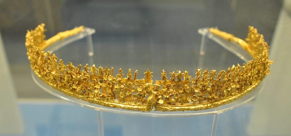
January 10, 2018
References to the diadem in the book of Revelation include 12:3, 13:1, and 19:2.

Gold Diadem. Made in southern Italy, 250-200 BC. Photo by Leon Mauldin.
“The diadem is the sign of royal status. Rev 12:3: the dragon had “seven diadems” on his seven heads; 13:1: the beast had “ten diadems” on his ten horns; 19:12: the rider of the white horse had “many diadems” on his head.” (Exegetical dictionary of the New Testament (Vol. 1, p. 298).
This is one of the literally thousands of interesting artifacts in the British Museum, so many of which can be used in the context of biblical teaching/illustrations, etc.
Click image for larger view.
1 Comment | Bible History and Geography, Bible Study, British Museum, New Testament, Old Testament, photography, Travel | Tagged: diadem | Permalink
Posted by Leon Mauldin
January 9, 2018
Among the many artifacts we photographed today was the Black Obelisk of Shalmaneser III (r. 858-824 BC). This Assyrian king forced Jehu, King of Israel (r. 841-814 BC) to pay tribute. This is one of those many exciting finds where the Bible and other historical records intersect! The Black Obelisk includes a pictograph/cuneiform record of this very important historical event. The reads:
The inscription reads: I received the tribute of Jehu of the House of Omri silver, gold, a golden bowl, a golden goblet, golden cups, golden buckets, tin, a staff of the king’s hand, (and) javelins (7).” All 14 of the Israelites pictured are bearded, with long hair and pointed caps. Each wears a belted tunic with fringe at the bottom. In addition, each of the 13 porters wears a mantle or cloak over the tunic, which extends over the shoulders and is fringed or tasseled down the front on both sides. Jehu is not wearing the outer garment, possibly as a sign of humiliation before Shalmaneser. (NIV Arch. Bible).
This is detailed on one of the four sides, second panel down:
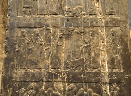
Shalmaneser’s Black Obelisk. This panel shows King Jehu paying tribute to the Assyrian King. The year was 841 BC. Photo by Leon Mauldin.
Here is a photo of the 4-sided stone in its entirety, with our facing the side that mentions Jehu:
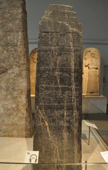
Shalmaneser’s Prism. The Black Obelisk. British Museum. Photo by Leon Mauldin.
Todd Bolen has an article on the Obelisk here.
You can read of Jehu in the Bible in 2 Kings 9-10.
Click images for larger view.
1 Comment | Bible History and Geography, Bible Study, Israel, Old Testament, photography, Travel, Uncategorized | Tagged: Assyria, Black Obelisk, British Museum, Inscriptions, Jehu, Shalmaneser III | Permalink
Posted by Leon Mauldin
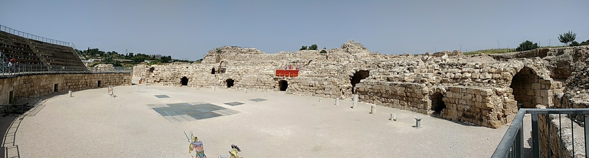
December 15, 2017
Beth Guvrin in Israel was a Roman city on the outskirts of biblical Maresha (see Josh. 15:44; Micah 1:15).
Emperor Septimus Severus turned Beth Guvrin into a major administrative center (ca. 200 AD). I took this photo of the amphitheater on April 27, 2017.

Panorama of amphitheater at Beth Guvrin. Photo by Leon Mauldin.
This amphitheater would have been used for animal and gladiator fights.
BTW: Often folks refer to theaters as “amphitheaters.” There is a difference: the amphitheater makes an oval shape while a theater only makes a half circle.
Click image for larger view.
1 Comment | Bible History and Geography, Bible Places, Israel, New Testament, Old Testament, photography, Roman Empire, Theater, Travel, Uncategorized | Tagged: Amphitheater, Beth Guvrin, Mareshah | Permalink
Posted by Leon Mauldin
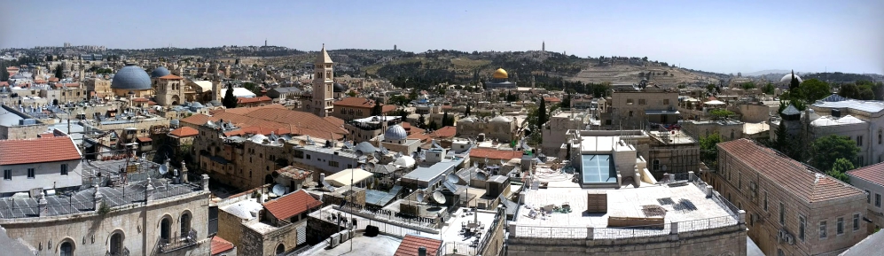
December 8, 2017
In this panoramic shot of Jerusalem you can see several landmarks, including the Church of the Holy Sepulcher at left, the Dome of the Rock, right center, and the Mount of Olives in the Distance.

Panorama of Jerusalem. Photo by Leon Mauldin.
It would be difficult to overestimate or overstate the importance of this city in both Old and New Testament studies!
I have numerous posts on Jerusalem, including here, here and here. Use the search box for more.
I took this photo this past April, 2017, on a personal study/photography trip with Ferrell Jenkins.
Leave a Comment » | Bible History and Geography, Israel, Jerusalem, New Testament, Old Testament, photography, Travel, Uncategorized | Tagged: Jerusalem | Permalink
Posted by Leon Mauldin
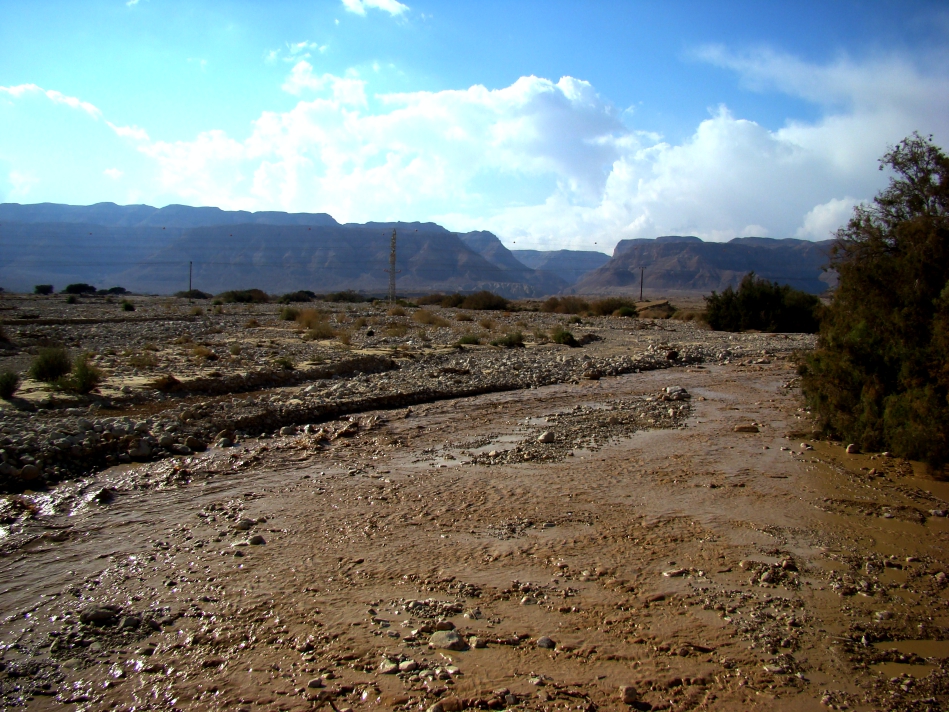
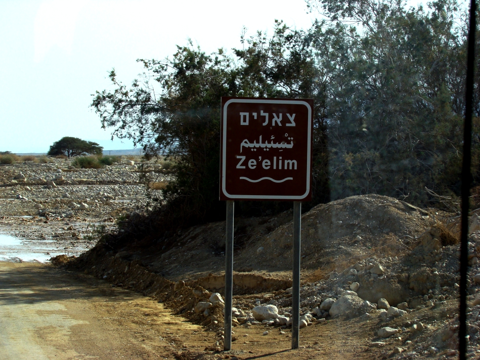
November 25, 2017
When Job was suffering so horribly, his “friend” Eliphaz “helped” by saying, “According to what I have seen, those who plow iniquity and those who sow trouble harvest it” (Job 4:8). I.e., You’ve brought this on yourself. Job responded to this and similar criticism, “My brothers have acted deceitfully like a wadi, Like the torrents of wadis which vanish” (6:15).

The wadi Ze’elim, near Masada, Israel. Ordinary this would be dry. Photo ©Leon Mauldin.
Our photo shows Nahal Ze’elim, near Masada, Israel. This area is ordinarily dry. To our back this stream empties into the Dead Sea. A wadi such as this will carry water for a while, then vanish. This is the word picture Job uses to describe Eliphaz. Job was looking for “kindness from his friend” (6:14) but looked in vain! Like a thirsty man looking for water, but finding the stream had disappeared. A vivid illustration!

Ze’elim sign. Photo ©Leon Mauldin.
Click image for larger view.
Leave a Comment » | Bible History and Geography, Biblical Interpretation, Israel, Old Testament, photography, Travel, Uncategorized | Tagged: Job, Nahal Ze'elim, wadi | Permalink
Posted by Leon Mauldin
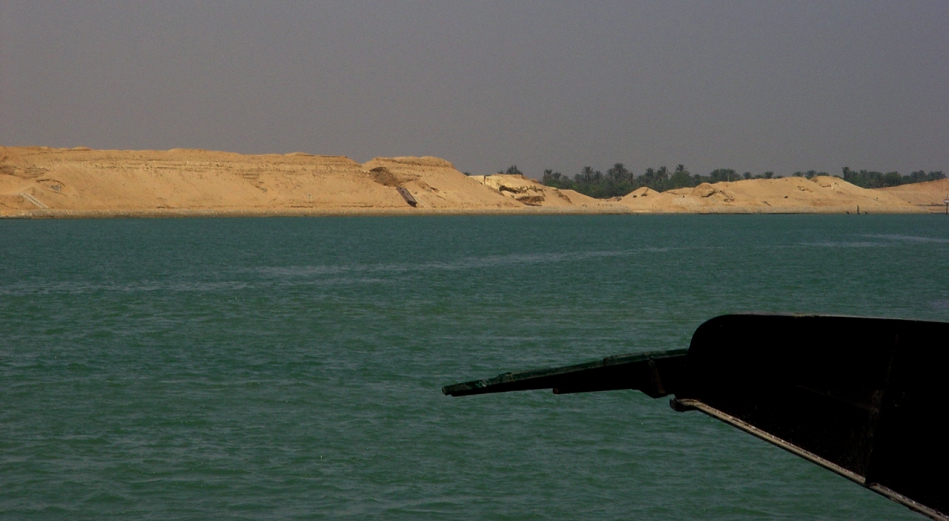
November 10, 2017
On most Friday afternoons I teach some homeschoolers (brilliant students) two subjects, Bible and History. Currently their world history is dealing with the 19th century. One of the topics in that time-frame is the construction of the Suez Canal. Said Pasha gave a concession to Ferdinand de Lesseps who created a French company, The Suez Canal Company, to join the Mediterranean Sea with the Red Sea. The canal opened under French control on November 17, 1869. (Said was Wāli of Egypt and Sudan from 1854 until 1863, officially owing allegiance to the Ottoman Sultan but in practice exercising virtual independence. 4th son of Muhammad Ali Pasha).

The Suez Canal. The Sinai Peninsula is at our back, looking across to Egypt. Photo ©Leon Mauldin.
Our text says:
Naturally, the countries of Europe were very interested in this canal–the Suez Canal. The canal could change the way that European countries traded with China, Japan, and the other countries of the Far East. Instead of travelling all the way down the coast of Africa, around the tip of that enormous continent, and then heading east, European ships could sail from the Mediterranean Sea straight down into the Red Sea and then turn east. When the canal was finished,it would be a hundred miles long, about twenty-six feet deep, and it would make the trip from Europe to the East six thousand miles shorter! (The Story of the World: History for the Classical Child. Vol.4, p. 109).
This area is of tremendous biblical importance as it pertains to Israel’s crossing of the Red Sea en route to the promised land of Canaan. I have previously written here and here on the Suez.
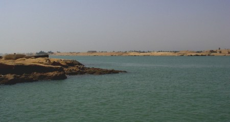
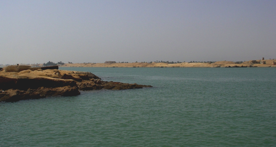
Another view of the Suez. Photo ©Leon Mauldin.
The canal separates the African continent from Asia, and it provides the shortest maritime route between Europe and the lands lying around the Indian and western Pacific oceans. It is one of the world’s most heavily used shipping lanes. The Suez Canal is one of the most important waterways in the world.
The canal is extensively used by modern ships , as it is the fastest crossing from the Atlantic Ocean to the Indian Ocean . Tolls paid by the vessels represent an important source of income for the Egyptian government.
Railway and a sweet water canal are run on the west bank parallel to the Suez Canal. The Canal runs between Port Said harbor and the Gulf of Suez, through soils which vary according to the region. At Port Said and the surrounding area, the soil is composed over thousands of years of silt and clay sedimentations deposited by the Nile waters drifted by Damietta branch. This formation extends to Kantara, 40 km to the south of Port Said , where silt mixes with sand. The central region of the Canal between Kantara and Kabret consists of fine and coarse sands, while the southern region contains dispersed layers of rocks, varying in texture from soft sand to some calcium rocks, The side gradient of the water cross-section differs according to the nature of the soil, which is 4:1 in the north and 3:1 in the south.
The Suez Canal is a sea level Canal and the height of water level differs slightly and the extreme tidal range is 65 cm in the north and 1.9 m in the south. The banks of the Canal are protected against the wash and waves, generated by the transit of ships, by revetments of hard stones and steel sheet piles corresponding to the nature of soil in every area. On both sides of the Canal, there are mooring bollards every 125 m for the mooring of vessel in case of emergency, and kilometric sign posts helping locate the position of ships in the waterway. The navigable channel is bordered by light and reflecting buoys as navigational aids to night traffic. (http://www.suezcanal.gov.eg).

Some current stats of the use of the Suez.
Click photos for larger view. Oh BTW did I mention that the home-school students I teach on Fridays are my grandchildren?
2 Comments | Bible History and Geography, Egypt, Old Testament, photography, Travel, Uncategorized | Tagged: Egypt, Red Sea, Suez | Permalink
Posted by Leon Mauldin
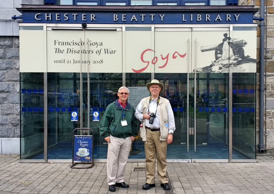
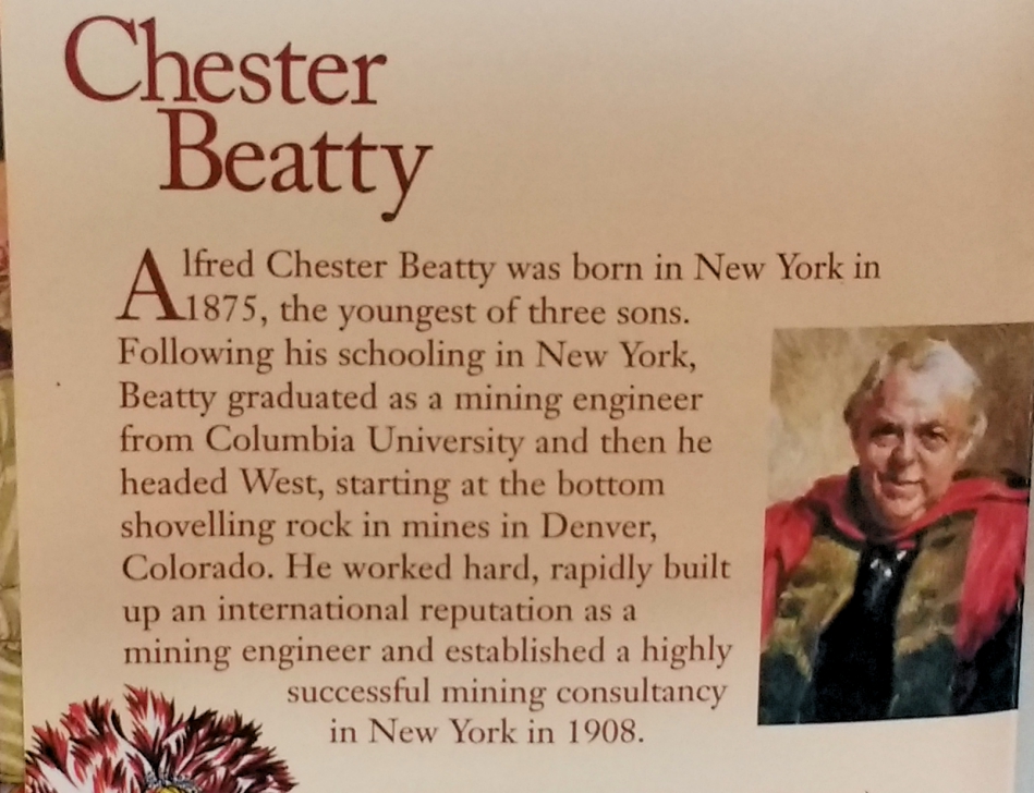
October 18, 2017
Today concludes our Emerald Tour of Ireland, and was a day of “free time” for our group. Some of us included a visit to the Dublin Castle, because here the Chester Beatty Library is located. Among the interesting collections there are some of the very earliest New Testament texts, dating to c.AD 200.

Johnny Felker & Leon Mauldin at Chester Beatty Library. Photo by Martha Felker.
Photos are not permitted inside the exhibition.
Some info re: the New Testament manuscripts:
There are three New Testament manuscripts that are part of the Chester Beatty Papyri. The first, P. I, is labeled under the Gregory-Aland numbering system as P45 and was originally a codex of 110 leaves that contained the four canonical gospels and Acts. 30 fragmentary leaves remain, consisting of two small leaves of the Gospel of Matthew chapters 20/21 and 25/26, portions of the Gospel of Mark chapters 4-9, 11-12, portions of the Gospel of Luke 6-7, 9-14, portions of the Gospel of John 4-5, 10-11, and portion of the Acts of the Apostles 4-17. The ordering of the gospels follows the Western tradition, Matthew, John, Luke, Mark, Acts. These fragments are palaeographically dated to the first half of the 3rd century.
P46 is the second New Testament manuscript in the Chester Beatty collection (P. II), and was a codex that contained the Pauline Epistles dating c. 200.[citation needed] What remains today of the manuscript is roughly 85 out of 104 leaves consisting of Romans chapters 5-6, 8-15, all of Hebrews, Ephesians, Galatians, Philippians, Colossians, virtually all of 1–2 Corinthians and 1 Thessalonians 1-2, 5. The leaves have partially deteriorated, resulting in the loss of some lines at the bottom of each folio. The manuscript split up between the Chester Beatty Library and the University of Michigan. Scholars do not believe the Pastoral epistles were included originally in the codex, based on the amount of space required in the missing leaves; they conclude 2 Thessalonians would have occupied the final portion of the codex. The inclusion of Hebrews, a book that was questioned canonically and not considered authored by Paul, is notable. The placement of it following Romans is unique against most other witnesses, as is the ordering of Galatians following Ephesians.
P. III is the last New Testament manuscript, P47, and contains 10 leaves from the Book of Revelation, chapters 9-17. This manuscript also dates to the 3rd century, and Kenyon describes the handwriting as being rough (Wikipedia).
It’s been a great tour.

From the Chester Beatty Library Brochure.
Leave a Comment » | Bible Study, New Testament, Old Testament, photography, Resources, Tours, Travel | Tagged: ancient manuscripts, Chester Beatty Library, Dublin | Permalink
Posted by Leon Mauldin