Saqqara, The Step Pyramid

May 13, 2011

In our local congregation we are currently engaged in a study of Exodus. The emphasis of the book is that of God’s covenant faithfulness. ‘El Shaddai, God Almighty, who promised Abraham, Isaac and Jacob that He would make of them a great nation, and give unto them the land of Canaan, now more fully reveals Himself as YHVH, Yahweh, Jehovah. He would redeem His covenant people. This He did “with outstretched hand,” demonstrating to all the Egyptians, as well as to Israel that He was indeed the LORD.

Israel was a numerous people when the book of Exodus opens, and through His great power God brought them to Mt. Sinai, where they would be for about eleven months. During that time God gave the 10 Commandments as well as the accompanying laws and ordinances, the tabernacle was built, and the Aaronic priesthood was consecrated.

The events of Scripture do not happen in a vacuum; we always do well to consider the historical and geographical setting.  The setting for Exodus 1-13 is Egypt.

When you think of Egypt, you likely think of the pyramids. Sometimes people erroneously believe that the Israelites were used as forced labor to construct the pyramids. Actually the pyramids were built before Abraham! The Israelites built storage cities (Ex. 1:11, NASB).
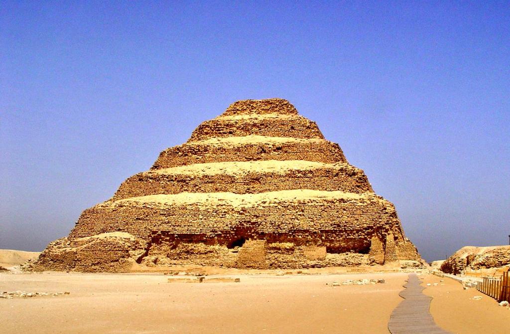
Step Pyramid at Saqqara, Egypt. Photo by Leon Mauldin.

Our photo shows the Step Pyramid at Saqqara, built during the 3rd Dynasty by Pharaoh Djoser. This pyramid is actually a mastaba (Arabic for “bench”),  meaning a structure in the “form of a flat-roofed, rectangular structure with outward sloping sides.” The Step Pyramid consists of six distinct steps. This is the oldest of the pyramids.

The burial chambers were underground. Excavation was done by Jean-Phillipe Lauer.

Click on image for higher resolution.


Cave of Machpelah, Tomb of the Patriarchs

May 3, 2011

This morning my wife and I safely arrived in Genk, Belgium, where I am to conduct a biblical lectureship focusing on Acts through Revelation. This is an opportunity to make use of photos of Bible lands in which the events of Scripture transpired as we survey this exciting portion of the New Testament.

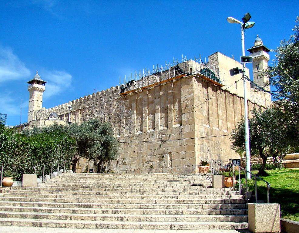
This past March we were able to go to Hebron and take a few photos there, including the site of the Cave of Machpelah, featured in this photo:

Site of Cave of Machpelah in Hebron. Photo by Leon Mauldin.

When Sarah died, the inspired narrator (Moses) tells us that “Abraham went in to mourn for Sarah and to weep for her” (Gen. 23:2). This was at Hebron. Abraham had to procure a burial place for his beloved wife. The Promise Land was to be possessed by his descendants, but Abraham owned no land in Canaan. Therefore he purchased the cave of Machpelah with its field from Ephron the Hittite. This transaction was duly made “before all who went in at the gate of his city” (Gen. 23:3-19).

“After this, Abraham buried Sarah his wife in the cave of the field at Machpelah facing Mamre (that is, Hebron) in the land of Canaan” (Gen. 23:19). Later, Abraham himself was buried here by his sons Isaac and Ishmael (Gen. 25:9). In Egypt, when Jacob was near death he called his twelve sons to hear his last words (Gen. 49:1). He commanded (ESV, Gen. 49:29) that he be buried at Machpelah also (v.30), and stated, “There they buried Abraham and his wife Sarah, there they buried Isaac and his wife Rebekah, and there I buried Leah” (v.31).

Herod the Great was a politician. To gain the favor of the Jews he lavishly renovated the temple in Jerusalem. Likewise, he built an impressive edifice around the cave of Machpelah, the tomb of the Patriarchs, using the same architectural style as that of Jerusalem’s Temple Mount, with similar sized stones, masonry and pilasters (engaged columns). In March we were able to visit Hebron and see the traditional burial site of the Patriarchs, featured in our photo.

Regarding these Patriarchs, centuries after their deaths, God said, “I am the God of Abraham, the God of Isaac, and the God of Jacob” (Matthew 22:31-32). Jesus said, “God is not the God of the dead, but of the living,”—these men, though dead and buried, were still very much alive, and God was/is still their God! The soul lives on after death; on the last day all will be raised from the dead (John 5:28-29; 1 Cor. 15:57).


Egypt: Plague upon the Cattle

April 26, 2011

Exodus 9:1-7 says:

Then the LORD said to Moses, “Go to Pharaoh and tell him, ‘Thus says the LORD, the God of the Hebrews, “Release my people that they may serve me! 2 For if you refuse to release them and continue holding them, 3 then the hand of the LORD will surely bring a very terrible plague on your livestock in the field, on the horses, the donkeys, the camels, the herds, and the flocks. 4 But the Lord will distinguish between the livestock of Israel and the livestock of Egypt, and nothing will die of all that the Israelites have.”‘” 5 The LORD set an appointed time, saying, “Tomorrow the LORD will do this in the land.” 6 And the LORD did this on the next day; all the livestock of the Egyptians died, but of the Israelites’ livestock not one died. 7 Pharaoh sent representatives to investigate, and indeed, not even one of the livestock of Israel had died. But Pharaoh’s heart remained hard, and he did not release the people (NET).

In our previous post we showed how the plagues were said to be judgments against the gods of Egypt. Regarding the plague upon the cattle, Dr. David Livingston said:

This judgment was against the bull god (revered as early as the Archaic Period (35), and the sacred cattle of Hathor, the cow-headed love goddess. It was a special reproach to pharaoh who worshipped Hathor. Hathor, whose name means “house of Horus,” was sacred as early as the Old Kingdom (41, 58). Other gods associated with cattle were Ptah and Amon.
Great cemeteries of embalmed cattle have been excavated. The symbol of the bull was the symbol of pharaoh himself (Bible and Spade, Vol. 4, Num. 1, p. 10).

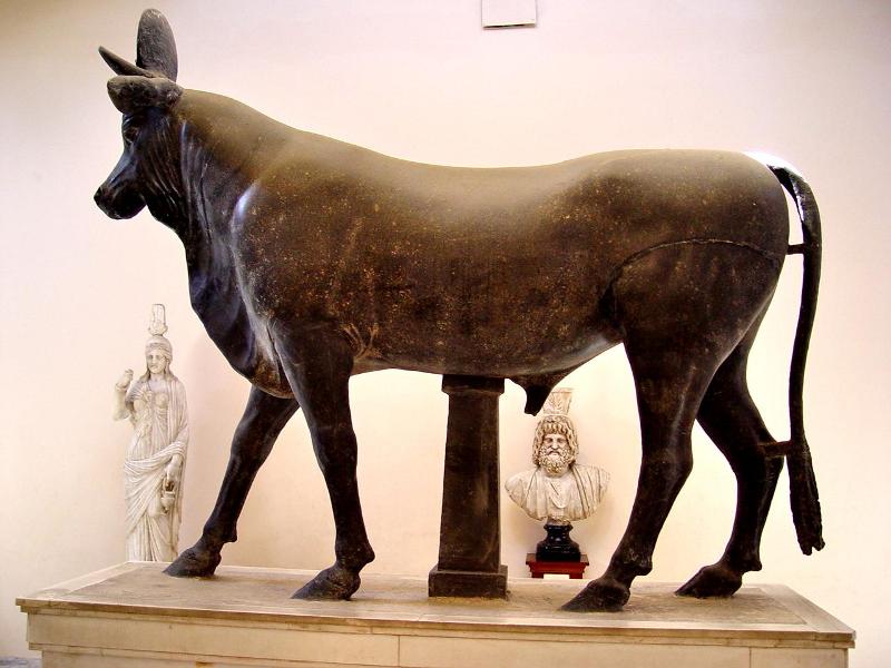
The museum at Alexandria, Egypt, has a display of a sacred bull.

Sacred Bull at Alexandria, Egypt. Photo by Leon Mauldin.

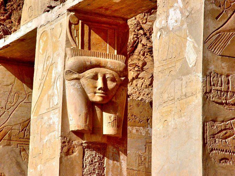
The cow-goddess Hathor was widely worship in Egypt. This image is from Hatshepsut’s three-tiered funerary palace at Deir el-Bahari.

Goddess Hathor at Hatshepsut's funerary temple. Photo by Leon Mauldin.

The best evidence is that these events transpired during Egypt’s Eighteen’s Dynasty, when the nation was at the peak of its power.


Canaanite Gate at Dan

April 21, 2011

Biblical Dan was a city of about 50 acres. It is located at the foothills of Mt. Hermon in northern Israel. It was situated on the main route from Galilee to Damascus.

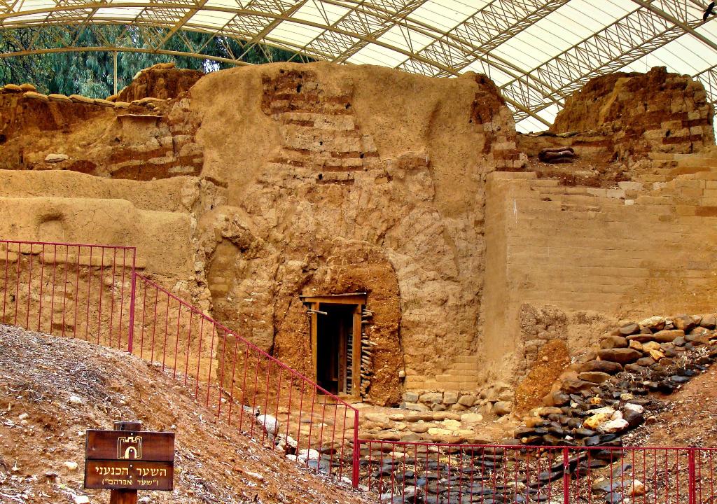
One of the very exciting discoveries at Dan (1979)  is the mud-brick Canaanite Gate. Todd Bolen writes:

Built about 1800 B.C., this mudbrick gate was in use approximately 50 years before it was covered (and thus preserved) by an earthen rampart.

The style of the gate is typical for this period; it is a “Syrian gate” with three pairs of piers and four chambers, like those found at Megiddo, Shechem and Gezer.

Mud-brick Canaanite Gate at Dan. Photo by Leon Mauldin.

This is said to be the oldest known intact archway–nearly 4,000 years old. It is now under a great canopy for protection from the elements. Here is a closer view:

Close up of Canaanite Gate at Dan. Photo by Leon Mauldin.


Megiddo Stables

April 17, 2011

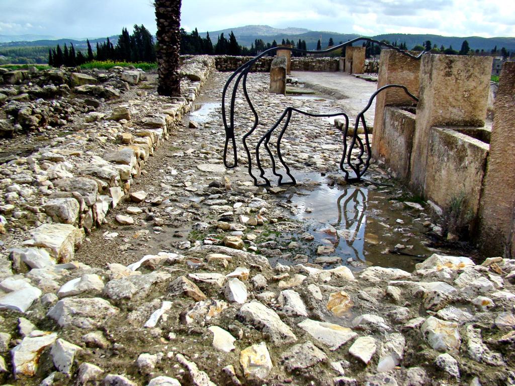
Another interesting discovery at Megiddo is the area which many believe were used for horse stables. The area seen in this photo is sometimes called “Solomon’s stables,” though many believe this should be dated a bit later to the time of King Ahab.

Stables at Megiddo. Photo by Leon Mauldin.

You can see the metal outline of a horse in our photo. Some suggest this site may have been used for barracks, market places, storage facilities, or other usages.

Click on photo for higher resolution.


Megiddo Water System

April 16, 2011

It would be hard to overemphasize the importance of the city of Megiddo. We have referenced the strategic location in our two previous posts. Crucial battles were fought here.

Excavations conducted at Megiddo have been “large and extensive,” and include the efforts of the German Society for Oriental Research (1903-1905), the Oriental Institute of Chicago (1925-1939). Excavations were interrupted with the outbreak of WWII, but were renewed by the Institute of Archaeology at the Hebrew University of Jerusalem (1960, 1961, 1966, 1967, and 1971) under the leadership of Y. Yadin (The New Encyclopedia of Archaeological Excavations in the Holy Land, Vol. 3, pp. 1005-1005).

More recent excavations have been undertaken by Tel Aviv University, with Pennsylvania State University as the senior American partner (ibid. Vol. 5, pp. 1944ff.).

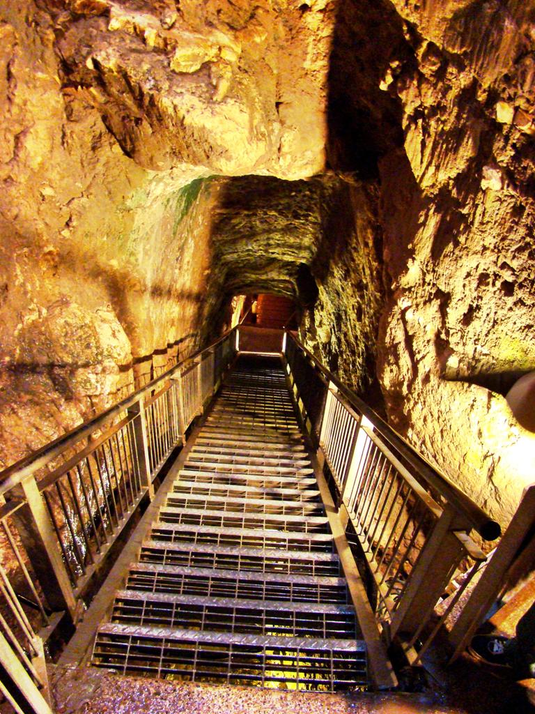
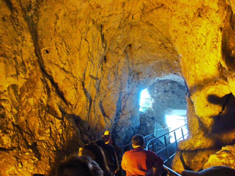
Among the more interesting discoveries is Megiddo’s water system. A 70 meter tunnel hewn through rock led down to the spring.

Megiddo. Tunnel to city spring. Photo by Leon Mauldin.

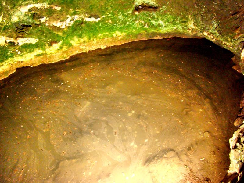
This dates back to the time of Israel’s king Ahab (874-853 BC). Prior to this engineering feat, it was necessary to go outside the city walls to access the spring.

Megiddo Spring. Citys water supply. Photo by Leon Mauldin.

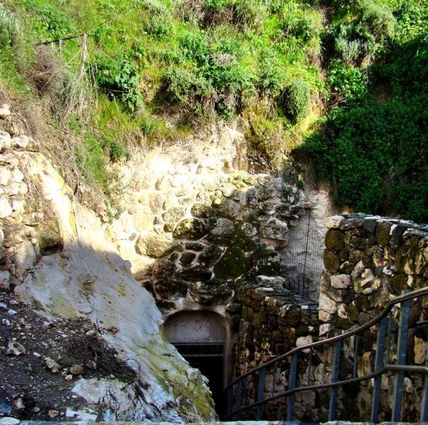
Here is a view from going up from the spring as you exit:

Megiddo. Exit from spring. Photo by Leon Mauldin.

And finally, a view back to the exit of the spring.

Megiddo. Outside Water System Exit. Photo by Leon Mauldin.

In our next post we plan to feature the stables of Megiddo.


Canaanite Altar at Megiddo

April 13, 2011

Archaeologists have discovered more than 20 layers of occupation at the ancient city of Megiddo.The city was strategically situated on the route that came to be known as the Via Maris, the ancient trade route that connected Egypt with Syria and Mesopotamia.

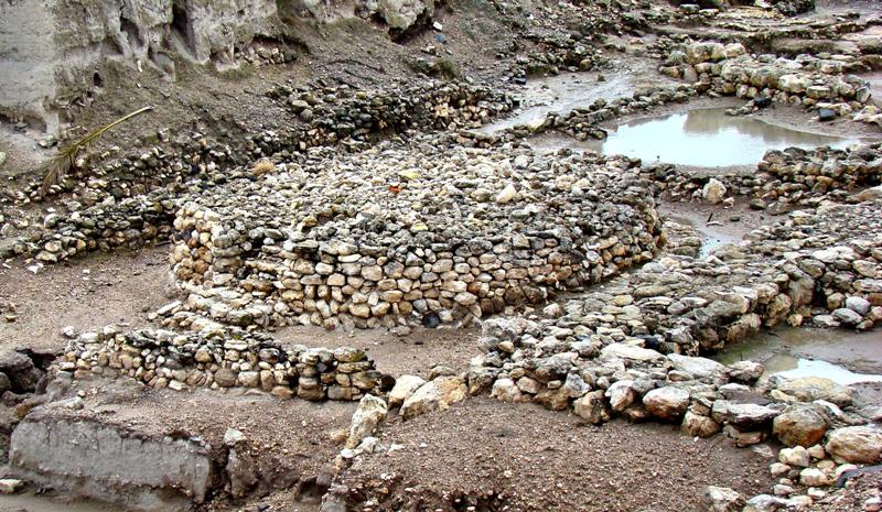
One of the more interesting finds is the circular Canaanite altar. It is nearly 26 feet in diameter and about five feet in height. This would have been used by the Canaanites in their pagan worship, and very likely was the site of human sacrifice. You can see the altar in the center of our photo.

Canaanite Altar at Megiddo. Photo by Leon Mauldin.

This illustrates the kind of thing God had in mind when He commanded Moses, “. . . you are to tear down their altars and smash their sacred pillars and cut down their Asherim” (Ex. 34:13). Likewise, in Deut. 12:3, “You shall tear down their altars and smash their sacred pillars and burn their Asherim with fire, and you shall cut down the engraved images of their gods and obliterate their name from that place.”

In the foreground of the photo and also to the right of the altar you can see the outline of the Canaanite temple.


Megiddo

April 6, 2011

Megiddo is first mentioned in Scripture in Joshua 12:21 as one of the cities captured under the leadership of Joshua and assigned to the tribe of Manasseh (17:11). Nelson’s NIBD speaks of the importance of this site:

Megiddo was situated on the main road that linked Egypt and Syria. Overlooking the Valley of Jezreel (Plain of Esdraelon), Megiddo was one of the most strategic cities in Palestine. All major traffic through northern Palestine traveled past Megiddo, making it a strategic military strong-hold.

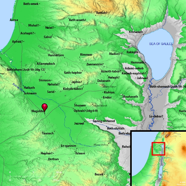
Therefore it was a great loss when Israel subsequently did not retain this city (Judges 1:27), whose location can be seen in the map below:

Megiddo. Map courtesy of BibleAtlas.org

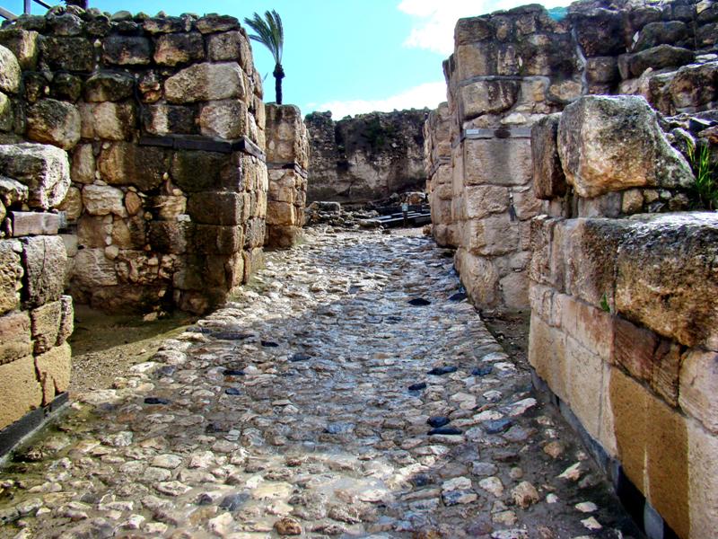
Megiddo was a city of great antiquity. The impressive Canaanite gate can be seen here in our photo:

Canaanite Gate at Megiddo. Photo by Leon Mauldin.

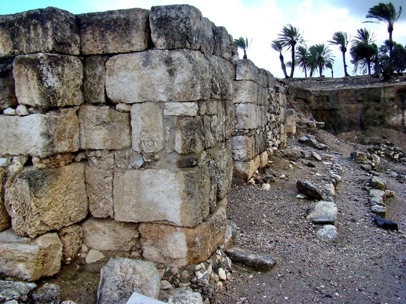
This was one of the cities later fortified by King Solomon (1 Kings 9:15) during the United Kingdom period (Iron Age). The Solomonic gate was here:

Solomonic Gate at Megiddo, a fortress city. Photo by Leon Mauldin.

Crucial battles were fought here or near here.

1.During the time of the Judges, Barak’s forces (Deborah was the Judge and Prophetess) defeated the Canaanite enemy near here (Judges 4-5). From Megiddo one can easily see Mt. Tabor, mentioned in the account (4:14) ; Judges 5:19 refers to the “waters of Megiddo.”

2. In 2 Kings 9:27, Judah’s king Ahaziah died here by the hand of Jehu; the year was 841 BC.

3. Good King Josiah (also of Judah) was killed here by Pharaoh Necho of Egypt; the year was 609 BC.

4. The word Armageddon (Rev. 16:16) is rendered Har-Magedon by the NASB and means The Mount of Magedon, i.e., Mt. Megiddo.

Click on images for higher resolution.


Jokneam in Carmel

March 24, 2011

Sometimes people ask what is my favorite place to see in Israel. I don’t know the answer to that. But one of my favorites is Mt. Carmel, not only because of Elijah’s victory over the Baal prophets which took place there (1 Kings 18), but also because of the view from there. From Mt. Carmel you can see the Jezreel Valley, trace the flow of the Kishon River, see Mt. Tabor (Judges 4-5), the Hill of Moreh (Judges 7), the pass to Gilead, Mt. Gilboa (1 Sam. 31), the central hill country of Samaria, and the Mediterranean coast! Also you can see the ruins of Jokneam, one of the city states named in the conquest listing of Joshua 12:21.

Jokneam in Carmel, listed in Joshua 12:22. Photo by Leon Mauldin.

The tel of Jokneam is in the center of our photo. The Archaeological Encyclopedia of the Holy Land has the following info re: Jokneam:


A city whose ruler was among the 31 Canaanite kings defeated by Joshua (Josh. 12:22), one of the Levitical cities of the family of Merari (Josh. 21:34).

One of the most important Canaanite city-states, it appears in the list of conquests made by Tuthmosis III; it was possibly conquered later by Tiglath-Pileser III. The site was also settled in the Roman period, when Eusebius knew it as Kammona, ‘a large village in the Great Plain, 6 miles to the north of Legio, on the way to Ptolemais (Acco)’. Identified with Tel Qaimin, an exceptionally large mound at the entrance to Wadi Milh, one of the important passes leading into the Jezreel Valley.

Since 1977 excavations have been carried out at Tel Yokneam under the direction of A. Ben-Tor on behalf of the Hebrew University, as part of a regional research project of the western part of the Jezreel Valley. This mound is outstanding by virtue of its continuous occupation. The following periods were found to be represented at the site: Ottoman, Mameluke, Crusader, early Arab, Byzantine, Roman, Hellenistic, Persian, Iron Age and Late Bronze Age. On the surface were also found potsherds of the Middle Bronze and Early Bronze Ages.

One is benefited by seeing not only the well-known sites, but also the more obscure! Note that the above entry states that Jokneam was one of Canaan’s most important city states.

Click on image for higher resolution.


Gibeon, El-Jib

March 14, 2011

Today’s biblical sites included Gibeon. Gibeon is the Canaanite city whose residents (the Hivites Josh. 9:7) pretended to be a long distance away from the land of Canaan, as they approached Joshua and the men of Israel in the days of the Conquest. They brought old dry, moldy bread and wore worn out clothes, and said the bread was fresh when they left, and their garments had worn out along the way. The text says, “Then the men of Israel took some of their provisions; but they did not ask counsel of the Lord” (Josh 9:14).

Later the Israelites found out they had been deceived. They honored their covenant with the Gibeonites, but made them wood cutters and water carriers for the house of God (v.23).

Because the Gibeonites had made a treaty with Israel, a coalition of kings to the south, led by the king of the Jebusites (ancient Jerusalem), attached. They sent to Joshua for help, and he responded, defeating these southern kings. Needed extra daylight to make the victory complete, Joshua prayed to the Lord, and the day was lengthened, giving the necessary time to defeat Israel’s enemies. “Sun, stand still over Gibeon; and Moon, in the Valley of Aijalon. So the sun stood still, and the moon stopped, Till the people had revenge upon their enemies” (Josh. 10:12-13).

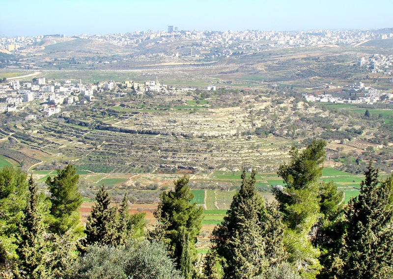
Our photo today shows the tel of Gibeon, which is the Arab village of El-Jib. This photo was taken from Nabi Samwil.

Tel of Gibeon. Modern Arab El-Jib. Photo by Leon Mauldin.


When the land was distributed, Gibeon became part of the tribal territory of Benjamin (Josh. 18:25), and was designated as a Levitical city (Josh. 21:17).

Click image for higher resolution.