The Euphrates, at Zeugma/Seleucia

June 20, 2017

We are currently teaching the OT book of Ezra in our local congregation. Ezra 8 mentions Ahava as a place (v.15) and a river (note NET: “canal” and NLT: “Ahava Canal” (vv.21,31).

This [Ahava] has not been identified, though it appears from v 21 that both the canal (lit., “river”) and the locality shared the same name. We must assume from the context that it was a large open space close to Babylon. Babylon itself was built on the Euphrates river from which flowed a number of artificial canals and waterways for defensive purposes (cf. IDB 1, 334–38; Ezek 1:1; Ps 137:1). Ahava was no doubt one of these (Williamson, H. G. M. Ezra, Nehemiah, Word Biblical Commentary, p. 116).

Our photo shows the Euphrates at Zeugma, named Selucia during the Grecian intertestamental period.
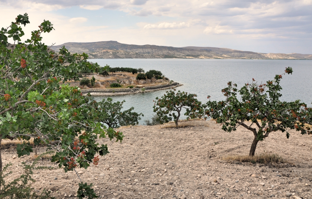
Euphrates River at Zeugma. Photo by Leon Mauldin.

I took this photo in Upper Mesopotamia, near the Birecik Dam, well north of the area referenced in Ezra 8, but it serves well for illustrative purposes. In the foreground are pistachio trees.
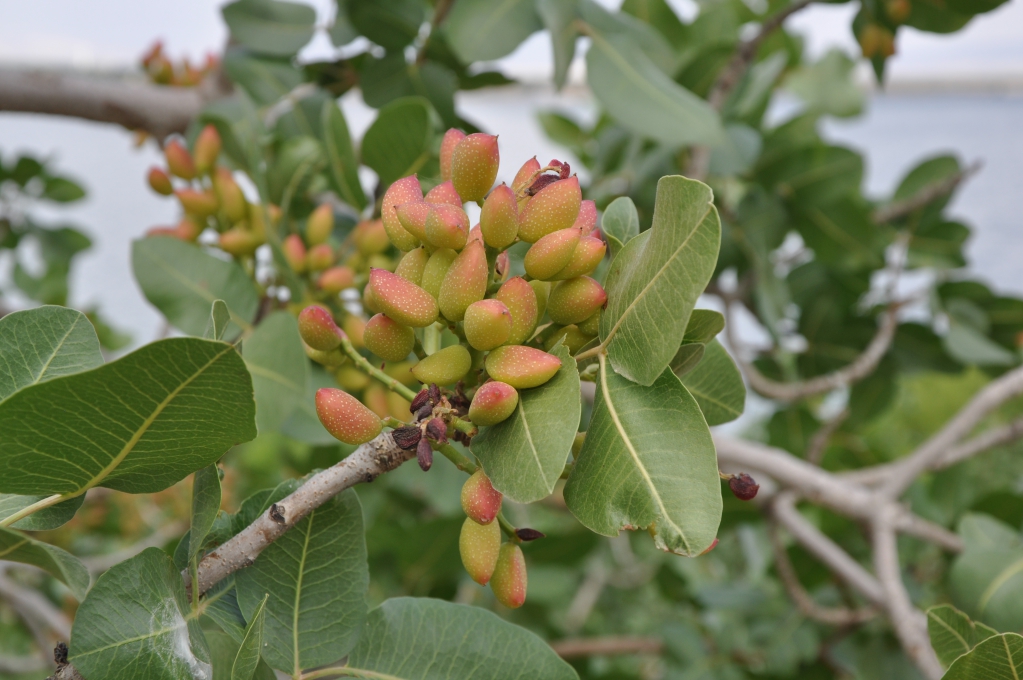
Pistachio tree, close-up. Photo by Leon Mauldin.

Originally, the ancient city of Zeugma was founded as a Greek settlement by Seleucus I Nicator, one of the generals of Alexander the Great, in 300 BC. The city was called “Zeugma”, because of the bridge across the Euphrates River that was made of pontoons, thus connecting the two banks of the river. In Greek, “zeugma” means “bridge-passage” or “bridge of boats”. The population of the city at its peak was approximately 80,000.

In 64 BC the city was conquered and ruled by the Roman Empire. During Roman rule, the city became one of the attractions in the region, due to its commercial potential originating from its geo-strategic location because the city was on the Silk Road connecting Antioch to China via a bridge of pontoons across the river Euphrates, which defined the border with the Persian Empire until the late 2nd century.

In 256 AD, Zeugma experienced an invasion and was destroyed by the Sassanid king, Shapur I. The damage from the invasion was so drastic that Zeugma was not able to recover for a long time. To make the situation even worse, a violent earthquake buried the city beneath rubble. Indeed, during the rest of its time under Roman rule, the city never regained the prosperity it had once achieved.

Zeugma and environs remained part of the Roman empire. During the 5th and 6th centuries the city was ruled by the Early Byzantium or Eastern Roman Empire. As a result of the ongoing Arab raids the city was abandoned once again. Later on, in the 10th and 12th centuries, a small Abbasid group settled in Zeugma.

Finally a village called Belkis was founded at the site in the 17th century. (Wikipedia).

To see another of my photos of the Euphrates click here. Ferrell Jenkins has several entries on the Euphrates including here and here.

Click images for larger view.


Armageddon (Megiddo), where Good King Josiah Was Slain

May 19, 2017

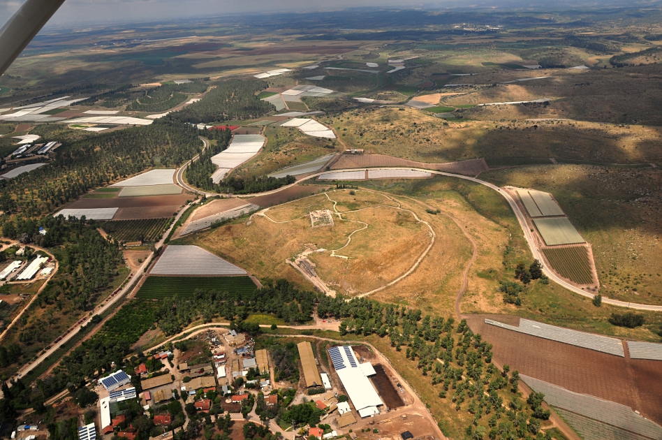
Megiddo is mentioned several times in the Old Testament, and once in the NT (Rev. 16:16). In the Old Testament, nearing the close of the kingdom of Judah, good King Josiah (r. 640-609 BC) was mortally wounded there in battle by Pharaoh Neco of Egypt, who was en route to Carchemish to war against Babylon. The international highway, the Via Maris, connected Egypt to Mesopotamia, so Neco was on that route, which passed through the strategic site of Megiddo.

However, Josiah would not turn away from him, but disguised himself in order to make war with him; nor did he listen to the words of Neco from the mouth of God, but came to make war on the plain of Megiddo.  The archers shot King Josiah, and the king said to his servants, “Take me away, for I am badly wounded.”  So his servants took him out of the chariot and carried him in the second chariot which he had, and brought him to Jerusalem where he died and was buried in the tombs of his fathers. All Judah and Jerusalem mourned for Josiah.  Then Jeremiah chanted a lament for Josiah. And all the male and female singers speak about Josiah in their lamentations to this day. (2 Chron. 35:22-25, NAU).

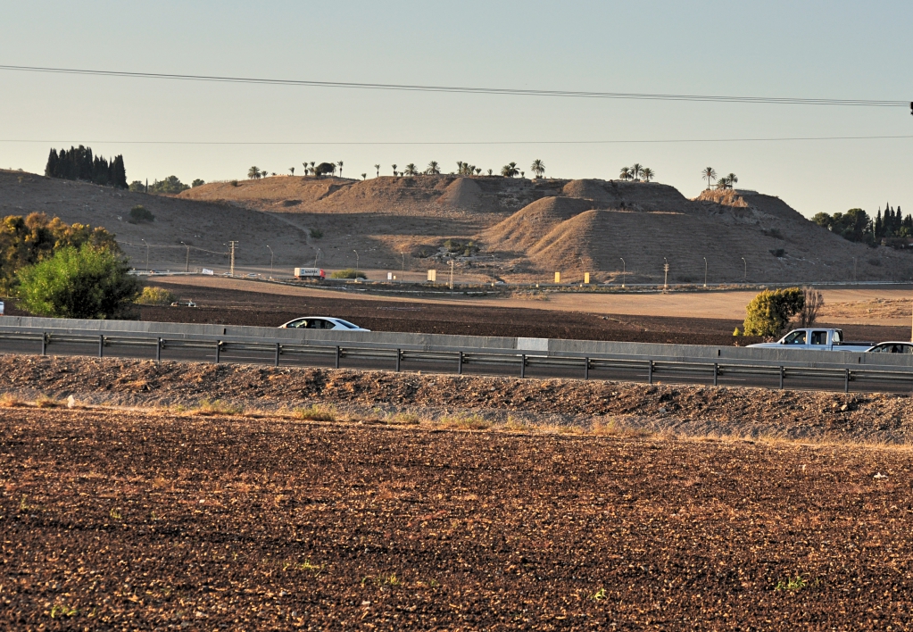
Tel Megiddo in distance. A portion of the “Plain of Megiddo” or the “Valley of Megiddo” is in foreground. Photo by Leon Mauldin.

One of the sites my group visited in November ’16 was Megiddo.

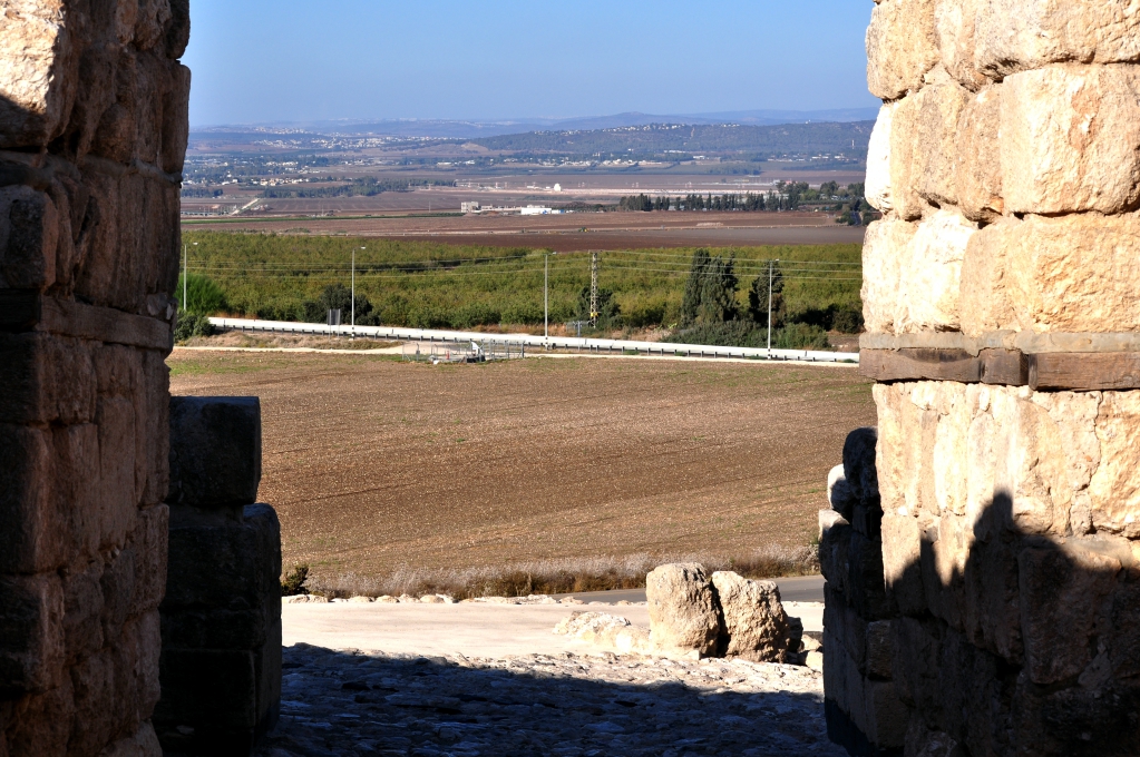
View from Megiddo through ancient gate looking to plain below. Photo by Leon Mauldin.

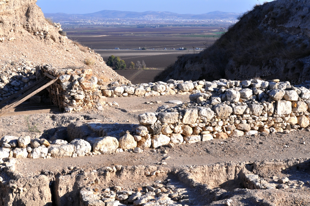
Here is a view of some of the archaeological excavations in foreground, with another view of the plain/valley below.

Excavations/view from Megiddo. Photo by Leon Mauldin.

These photos help provide the setting for the texts that mention biblical Megiddo.

I have made numerous posts on Megiddo; click here, here, here, here, here, and here.

Click images to enlarge.


What Time Is It?

May 4, 2017

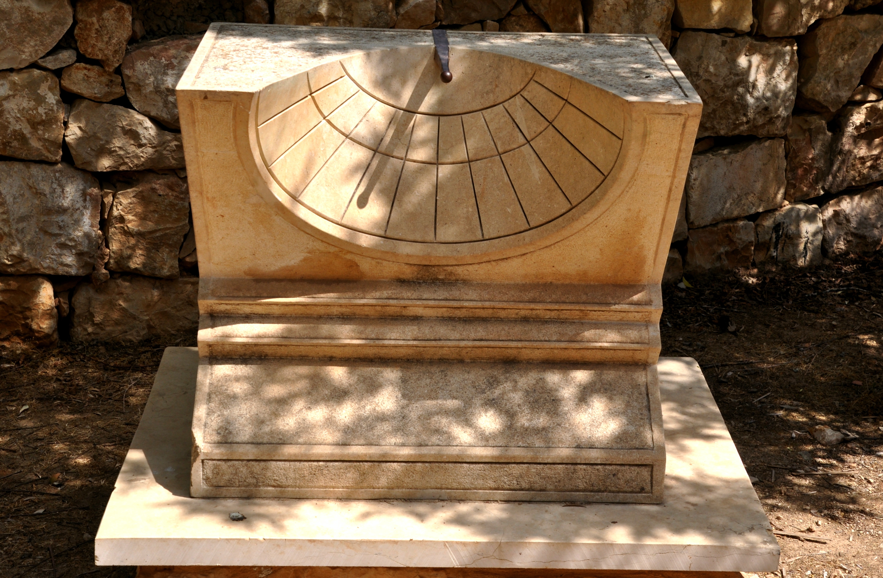
Today we were able to visit Ein Yael, Philip’s Spring, located on the ancient Jerusalem-Gaza route. A number of interesting artifacts were on the site, including this sundial.

Sundial at Ein Yael. Photo by Leon Mauldin.

This helps illustrate an event in the life of King Hezekiah of Judah, one of Judah’s best kings. He faithfully led the nation in very difficult times. Then he became sick and was near death. God sent the prophet Isaiah to Hezekiah with the message, “Set your house in order, for you shall die and not live” (Isaiah 38:1). Hezekiah fervently prayed to the Lord, his prayer was heard, and the Lord promised to add 15 years to his life. As a sign to confirm this promise, God said, “Behold, I will bring the shadow on the sundial, which has gone down with the sun on the sundial of Ahaz, ten degrees backward” (Isa. 38:7,8, NKJV).

Some translations render the Hebrew term maalah as “stairway” (see NAS, CSB). The NET Bible notes, “These steps probably functioned as a type of sundial.”

Whether the term means “steps” or “sundial,” certainly what is under consideration is a means of telling time by the moving shadow cast by the sun. The miraculous sign was that the shadow would return, it would go backward by 10 “steps” or “degrees.”

Whether what is intended in Isaiah 38 is this type of sundial, or another system (steps, stairway) is meant, the principle is the same. God miraculously returned the shadow to confirm to Hezekiah that He would extend his life as He had promised.

Click image for larger view.


Jerusalem’s Temple Mount

May 3, 2017

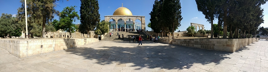
Today we had opportunity to visit the temple mount in Jerusalem. This is a wide-angle shot I made this morning:

Temple Mount in Jerusalem. Photo by Leon Mauldin.

The very recognizable Dome of the Rock at center approximates the site of Solomon’s temple, as well as the 2nd temple, built after the return from Babylonian Captivity and vastly renovated by Herod the Great.

This area is known as Mt. Moriah. This was the location where Abraham took Isaac in obedience to God’s command to offer him as a sacrifice, though He stopped Abraham prior to the actual event (Gen. 22:1-13). Years later, when Solomon built the temple, the Bible says, “Then Solomon began to build the house of the LORD in Jerusalem on Mount Moriah . . .” (2 Chron. 3:1, ESV).

The temple mount consists of about 36 acres. When the New Testament speaks of Jesus teaching in the temple, or of the early church meeting in the temple, those texts are not referring to the naos (holy place/most holy place) into which only the priests/Levites could enter; the most holy place only the high priest could enter, and that only once per year on the Day of Atonement. Rather, reference is made to the hieron, the greater temple area, consisting of its many courts and colonnades, etc.

Click image for larger view.


“Ye Kine of Bashan” (Amos 4:1)

April 29, 2017

The fearless prophet Amos was sent by Yahweh to the northern kingdom of Israel in the days of the Divided Kingdom. He cried out against the idolatry there. In this prosperous (albeit short-lived) time when Jeroboam II reigned (8th century BC), Amos also rebuked the luxury-loving women in Israel who cared nothing about God and His will: “Hear this word, ye kine of Bashan, that are in the mountain of Samaria, which oppress the poor, which crush the needy, which say to their masters, Bring, and let us drink.” (Amos 4:1, KJV).

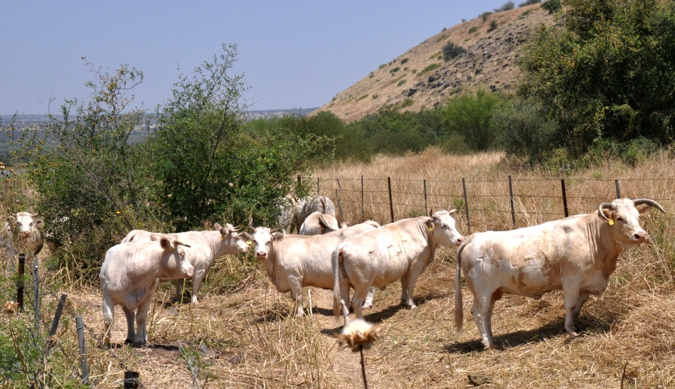
Cattle in Bashan, Israel. Photo ©Leon Mauldin.

The word kine as used in the KJV is old English; it is archaic plural for “cow.” The ESV renders the text, “Hear this word, you cows of Bashan, who are on the mountain of Samaria, who oppress the poor, who crush the needy, who say to your husbands, ‘Bring, that we may drink!'”

The women were not left in doubt as to the meaning of the imagery–they were behaving with no more concern for spiritual matters than a bunch of fat cows!

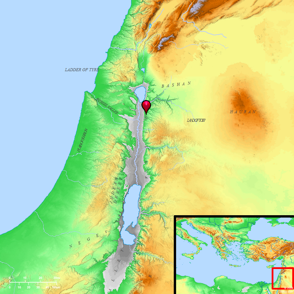
The background for Amos’ reference to cows of Bashan takes us back to Numbers 21, when Israel conquered the land of Og of Bashan, north and east of the Jordan (as well as the land of Sihon, to the south of Bashan). Then Numbers 32 tells how two and one half tribes (Reuben, Gad, and 1/2 tribe of Manasseh) asked that they might settle on the eastern side of the Jordan. That request was granted (conditioned upon the men of war helping with the conquest of Canaan). The reason given for the request: these lands “were ideal for cattle” (v.1, NET).

Land of Bashan, good for cattle. BibleAtlas.org.

The women Amos addressed did not live in Bashan, east of the Jordan. The text refers to their being in Samaria, which was the capital of Israel. But they were acting like cattle in that place which was so noted for its cattle.

Today I was in what was the OT land of Bashan when I photographed these cattle. I was put in mind of our text in Amos.

I do not know how the women in Israel responded to the preaching of Amos. We do know that the nation as a whole did not listen, and God would soon allow the Assyrians to destroy the northern kingdom. One can hope that at least some individuals may have responded appropriately and repented. Though they may have felt insulted, in reality Amos was their friend, their best friend.

“All Scripture is given by inspiration of God, and is profitable for doctrine, for reproof, for correction, for instruction in righteousness, that the man of God may be complete, thoroughly equipped for every good work” (2 Tim. 3:16,17).


The Jordan River

April 28, 2017

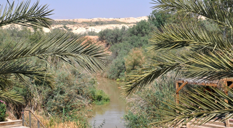
Today after leaving Jerusalem I made a stop at the Jordan before heading up the Rift Valley for the Galilee. This location is thought by many to be the area in the Jordan River where Jesus was baptized by John.

Jordan River. Traditional location of Jesus’ baptism. Photo by Leon Mauldin.

We had a safe late afternoon arrival at Tiberias, situated on the Sea of Galilee. While having dinner, Zachary Shavin, who is presently directing a tour, came by to visit a while and “talk shop.” Zack served as our guide for my Israel tour in November. His website is www.landofisraeltours.com

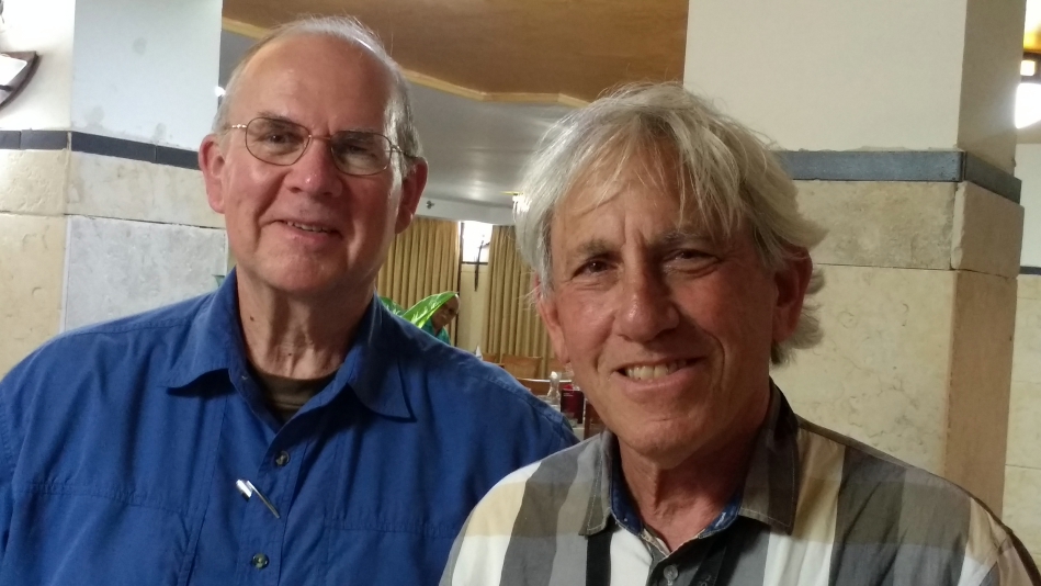
Leon Mauldin and Zachary Shavin.

To view my previous posts about the Jordan River, go up to search box and enter “Jordan.”

Click images for larger view.


King David’s Tomb in Jerusalem (Traditional)

April 26, 2017

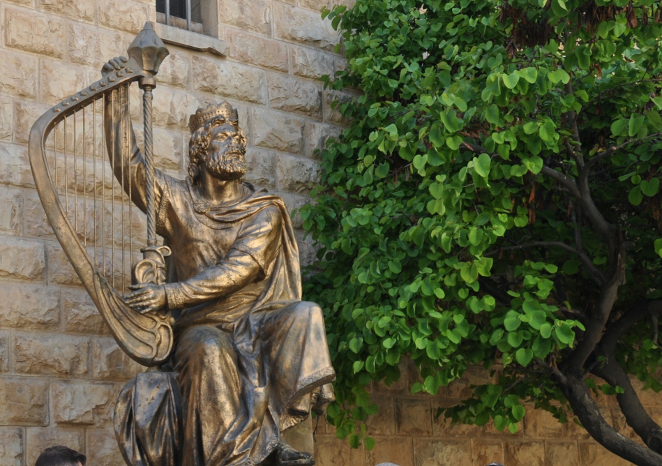
David was described as the “sweet psalmist of Israel” (2 Sam. 23:1) and authored about half of the collection of the 150 psalms.

Sculpture of David near site of traditional tomb in Jerusalem. Photo ©Leon Mauldin.

Approximately 2,000 years ago on the Day of Pentecost (Acts 2), Peter said, “Brothers, I may say to you with confidence about the patriarch David that he both died and was buried, and his tomb is with us to this day” (v.29, ESV).

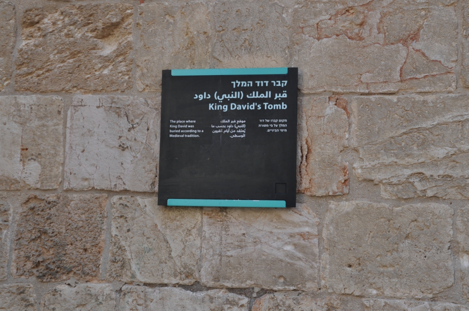
Yesterday I had the opportunity to visit the traditional tomb of David in Jerusalem.

Sign designating David’s Tomb. Photo ©Leon Mauldin.

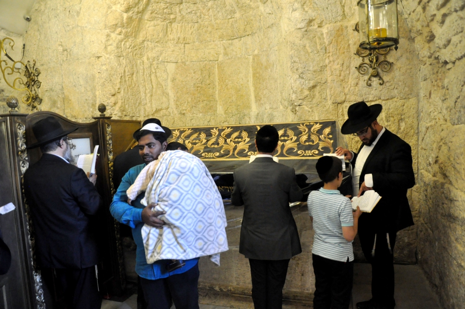
This location is said to be a pilgrimage for Jews, Muslims, and Christians. Inside is a massive cenotaph where visitors pay respect.

Inside David’s Tomb in Jerusalem. Photo ©Leon Mauldin.

The adjoining room is dedicated to reading/study.

Adjoining reading room. Photo ©Leon Mauldin.

Another text referencing David’s death is Acts 13:36: “For David, after he had served the purpose of God in his own generation, fell asleep and was laid with his fathers and saw corruption” (ESV).

We mentioned this is the “traditional site” of David’s tomb:

In the 10th century a belief that David’s tomb was on the present Mount Zion began to develop among Christian pilgrims, who celebrated David’s memory along with that of St James, the first bishop of Jerusalem.

It was actually the Christian Crusaders who built the present Tomb of David with its large stone cenotaph. However, three of the walls of the room where the cenotaph stands are much older — apparently from a synagogue-church used by first-century Judaeo-Christians, which became known as the Church of the Apostles.

Gradually this memorial came to be accepted as David’s tomb, first by the Jews and later also by Muslims. (http://www.seetheholyland.net/tomb-of-king-david/)

The real point of the two passages cited in Acts above is that David, having served God’s purpose, died, was buried, and his body experienced decay. He was not the subject of those prophecies he uttered that spoke of a coming resurrection–he was speaking of the resurrection of Jesus, which is at the very heart of the Gospel message. Apart from the resurrection of Jesus there IS no Gospel!

In the first century in Jerusalem Peter said the actual tomb of David could be seen. David had died, his flesh went through the normal decaying process. I like the old English translation of Acts 2:24 in the KJV, “Whom God hath raised up, having loosed the pains of death: because it was not possible that he should be holden of it. Where David’s earthly remains are today at this point is not of primary importance to one’s faith or salvation. But the point was that it was certain that he could not be the object of those Messianic passages that foretold the resurrection–only Jesus could and did fulfill those resurrection prophecies!

Click image for larger view.


Tel Lachish, where King Amaziah of Judah Was Killed

April 22, 2017

“From the time Amaziah turned from following the LORD, conspirators plotted against him in Jerusalem, so he fled to Lachish. But they sent assassins after him and they killed him there” (2 Chronicles 25:27, NET).

Tel Lachish at center. View is from the southwest. Photo ©Leon Mauldin.

Our photo gives the geographical setting for the biblical text, which tells of the assassination of one of Judah’s kings during the “Divided Kingdom” period. Amaziah reigned 796-767 BC. He is described by one author as “a mediocre king who suffered the consequences of his compromises” (Shepherds Notes, The Kings of Judah, p.79).

Later the city of Lachish would be one of 46 fortified cities captured by the Assyrian king Sennacherib, in 701 BC. His siege-mound formed for that invasion can still be seen at the southwest corner of tel Lachish.

Click photo for larger view.

We previously wrote about Lachish here and here.


The Nile River in Egypt

April 5, 2017

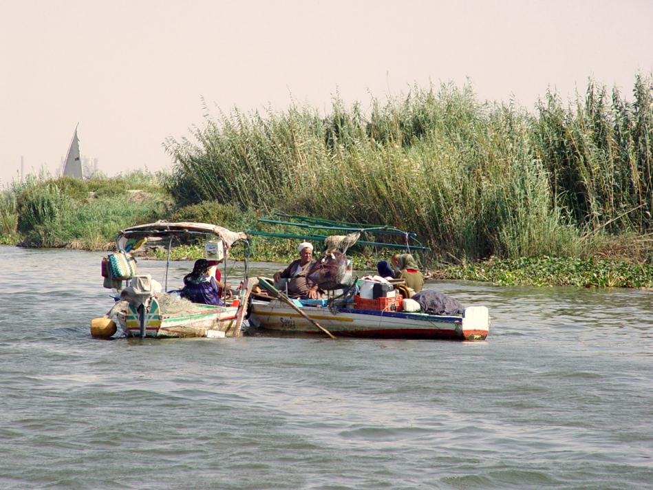
The Nile River is mentioned numerous times in the Bible. It was truly the “lifeblood” of Egypt.

Nile River. Photo by Leon Mauldin.

These folks in the two boats in the photo had either been fishing or were about to go, as they had fishing nets with them.

From Harper’s Bible Dictionary we have this info on the Nile:

the great river of Egypt flowing north from its sources in Lake Victoria in Uganda and in the highlands of Ethiopia, a distance of 4,037 miles, the entire length of the Sudan and Egypt, to the Mediterranean. The two major branches, the White Nile (from Lake Victoria) and the Blue Nile (from Ethiopia), merge at Khartoum, with one modest tributary somewhat farther to the north and none at all in Egypt itself. Beyond Khartoum the Nile flows through several cataracts, inhibiting navigation but not preventing it. The last cataract is at Aswan, the beginning of the Nile Valley proper. (Because the Nile flows from south to north, the southern Nile valley is referred to as Upper Egypt.) From here on the Nile flows north in a well-developed valley with cliffs on either side almost as far as Cairo, and the river becomes important for its overflow and the hydraulic irrigation of the adjoining floodplain. Within the Nile Valley the river is fairly constant at about six-tenths of a mile in width, whereas the valley varies from six to nine miles across (p.705).

The land of Egypt has great significance for the biblical narrative. God told Jacob, father of the twelve tribes of Israel, that He would make of him a great nation in Egypt (Gen. 46:3). As the book of Exodus opens, Israel is already a numerous people, and the new pharaoh of Egypt felt he had to take oppressive measures against them (Ex. 1).

While a young child, Jesus, along with Joseph and Mary, were told to leave Bethlehem (where Herod would seek to kill them), and flee to Egypt. “Now when they [the wise men from the East] had gone, behold, an angel of the Lord appeared to Joseph in a dream and said, “Get up! Take the Child and His mother and flee to Egypt, and remain there until I tell you; for Herod is going to search for the Child to destroy Him” (Matt. 2:13)

The Nile River makes life in Egypt possible, both in ancient as well as modern times.

I’ve previously written on the Nile here and here.


Valley of Beracah

March 24, 2017

Jehoshaphat (873-848 BC) was the fourth king of the southern kingdom of Judah during the Divided Kingdom period. His war with the combined forces of the Ammonites, Moabites and Edomites is described in 2 Chronicles 20. It was reported to the king that a great multitude was encamped at En-gedi (v.2), located on the western shore of the Dead Sea.

This good king prayed to God for deliverance (vv.4-13). God answered by a prophet named Jahaziel: “You will not need to fight in this battle. Stand firm, hold your position, and see the salvation of the LORD on your behalf, O Judah and Jerusalem. Do not be afraid and do not be dismayed. Tomorrow go out against them, and the LORD will be with you” (v.17, ESV).

Encouraged by this word, the text narrates what happened next: “And they rose early in the morning and went out into the wilderness of Tekoa. And when they went out, Jehoshaphat stood and said, ‘Hear me, Judah and inhabitants of Jerusalem! Believe in the LORD your God, and you will be established; believe his prophets, and you will succeed'” (v.20).

God overruled on Israel’s behalf:

And when they [Jehoshaphat and the people of Judah] began to sing and praise, the LORD set an ambush against the men of Ammon, Moab, and Mount Seir, who had come against Judah, so that they were routed. For the men of Ammon and Moab rose against the inhabitants of Mount Seir, devoting them to destruction, and when they had made an end of the inhabitants of Seir, they all helped to destroy one another (vv.22-23).

All that remained was for Israel to gather the spoil: “When Jehoshaphat and his people came to take their spoil, they found among them, in great numbers, goods, clothing, and precious things, which they took for themselves until they could carry no more. They were three days in taking the spoil, it was so much” (v.25).

The site where this occurred is known as the Valley of Beracah (meaning: Valley of Blessing).

Valley of Beracah, near Tekoa. Facing east toward the Dead Sea, and Edom & Moab. Photo ©Leon Mauldin.

The text reads, “On the fourth day they assembled in the Valley of Beracah, for there they blessed the LORD. Therefore the name of that place has been called the Valley of Beracah to this day” (v.26).

Photos such as this are helpful in visualizing the setting of the historical events narrated in Scripture. Click on photo for larger view.

Back in 2010 Ferrell Jenkins did a post on the Valley of Beracah. He and I visited this site in Dec. 2009.