Foundational to the Gospel message is the resurrection of Jesus Christ. Luke writes:
Now on the first day of the week, very early in the morning, they, and certain other women with them, came to the tomb bringing the spices which they had prepared. But they found the stone rolled away from the tomb. Then they went in and did not find the body of the Lord Jesus. And it happened, as they were greatly perplexed about this, that behold, two men stood by them in shining garments. Then, as they were afraid and bowed their faces to the earth, they said to them, “Why do you seek the living among the dead? “He is not here, but is risen! Remember how He spoke to you when He was still in Galilee, “saying, ‘The Son of Man must be delivered into the hands of sinful men, and be crucified, and the third day rise again.’ ” And they remembered His words. (Luke 24:1-8).
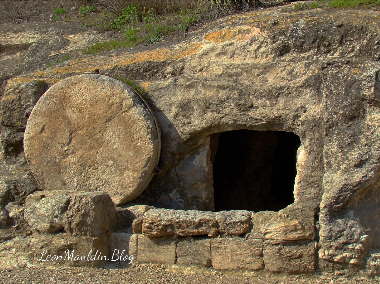
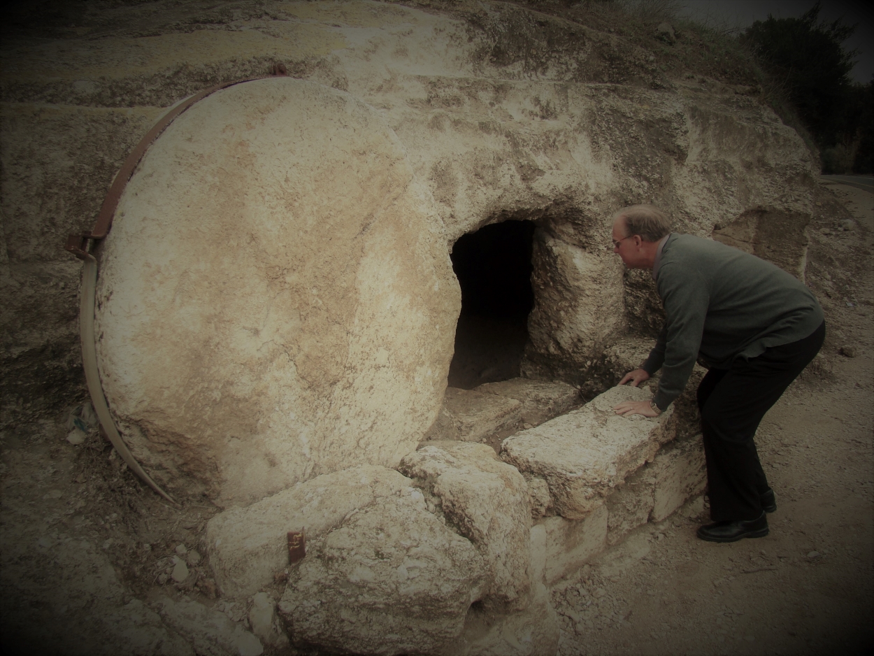
This tomb was discovered during road construction. It so well illustrates the biblical texts that narrate the burial of Jesus. Joseph of Arimathea had a new tomb (one which had not been previously used, John 19:38-42). Assisted by Nicodemus, Joseph wrapped Jesus’ body in a clean linen cloth, “and laid it in his new tomb which he had hewn out of the rock; and he rolled a large stone against the door of the tomb, and departed” (Mt. 27:59-60). The tomb in our photo was hewn out of the rock, and you can see the large stone positioned to the left of the opening.
On Sunday, the 1st day of the week when Jesus was raised from the dead, the text says this about Peter and “the other disciple:”
So they both ran together, and the other disciple outran Peter and came to the tomb first. And he, stooping down and looking in, saw the linen cloths lying there; yet he did not go in. Then Simon Peter came, following him, and went into the tomb; and he saw the linen cloths lying there, and the handkerchief that had been around His head, not lying with the linen cloths, but folded together in a place by itself. Then the other disciple, who came to the tomb first, went in also; and he saw and believed. (John 20:4-8).
Note the record says the disciple stooped down to look in. The tomb in our photo shows how this would of necessity be true.
Rolling Stone Tomb. Stooping to Look Inside. Photo by Ferrell Jenkins.
Note that we are not suggesting that this is the tomb in which Jesus was buried; it does however illustrate the type of tomb that would have been used.
For New Testament Christians, each first day of the week is significant. Christians assemble in the name of Jesus Christ to partake of His memorial feast, the Lord’s Supper. That Supper points back to His death, His body and His blood. But we serve a risen Savior! We proclaim His death till He comes (1 Cor. 11:26).
Click herefor an excellent post detailing “The Week of the Death and Resurrection,” by Ferrell Jenkins.
2 Kings 17 records the sad, catastrophic fall of the northern Kingdom of Israel (722 BC), as well as the reasons for that calamity: their sin and rebellion against Yahweh. The siege of Israel’s capital city Samaria, begun by Assyrian King Shalmaneser (r. 726-722 named in v. 3), lasted three years (v.5). The text continues to narrate that “the king of Assyria took Samaria and carried Israel away to Assyria. . .” (v.6). According to Assyrian records, Shalmaneser V died just before the siege was finished; the conquest was completed by his successor Sargon II (r. 722-705).
Though not mentioned by name in the 2 Kings text, Sargon II is cited in Isaiah 20:1, in the context of his capturing Ashdod of Philistia.
When you study the Scriptures, you’re reading about real events, real people, real places! The Bible is not a book of fiction. It is the inspired word of God.
A scheduled study for today includes 1 Kings 19, the chapter which follows the triumph on Mt. Carmel (1 Kings 18) which showed that Elijah was the true servant of God, and Yahweh was the true God; Baal was nothing! But in 1 Kings 19, a discouraged Elijah leaves Jezebel & Ahab’s jurisdiction (northern Kingdom of Israel) and travels hundreds of miles south.
1 Kings 19:3 notes that he first traveled as far as Beersheba, which was the southernmost extent of Judah’s border.
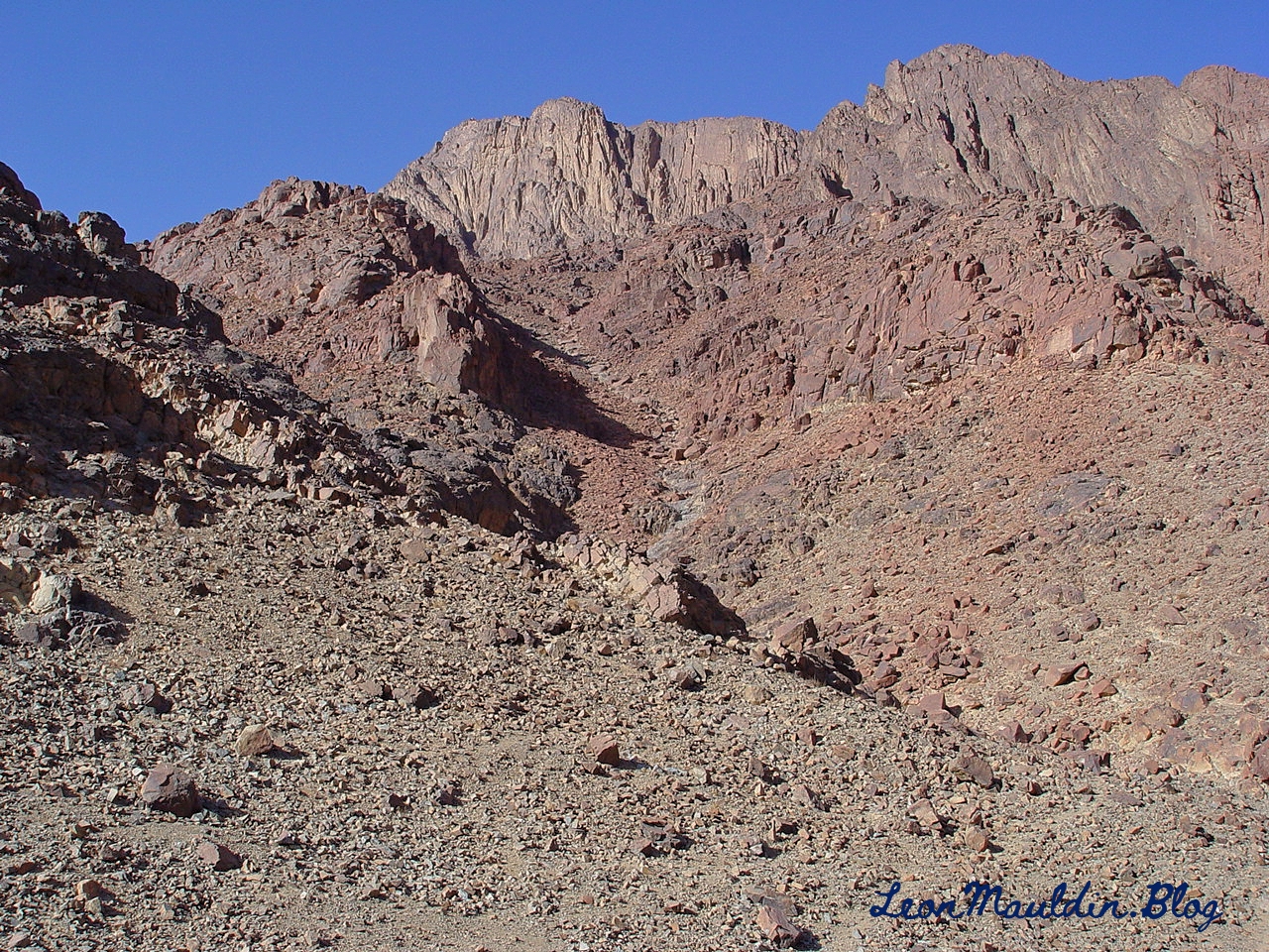
After some food and rest, Elijah continued his journey down to Mt. Sinai, here designated as “Horeb, the mountain of God” (1 Kings 19:8). Earlier at Mt. Sinai when God brought Israel out of Egypt by His servant Moses, He gave the Israelites the 10 Commandments (along with the other laws and ordinances) to Israel. (Note rendering of NLT is “Mount Sinai.”).
At various points in biblical history, we sometimes see that opposition to God’s purpose came from the outside, from those who are enemies of God’s revealed will. But on other occasions, the source of problems and discord is from within, from professed followers. This was the case in Nehemiah 5. Previously the inspired narrative had traced the opposition to rebuilding Jerusalem’s wall to men such as Sanballat the Horonite, Tobiah the Ammonite and Gehsem the Arab (2:10,19; 4:1,7), enemies from “without.” But in chapter 5 it is the “Jewish brethren” (v. 1), their “nobles and rulers” (v.7), who were taking advantage of the poor (Jews) for their own financial profit. The poor were having to borrow money, and even reduced to selling their children as slaves, to have something to eat. (Neh. 5:1-5). Hence their plea to Nehemiah: “Therefore let us get grain for them, that we may eat and live” (v.2).
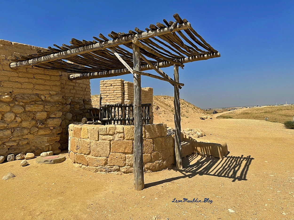
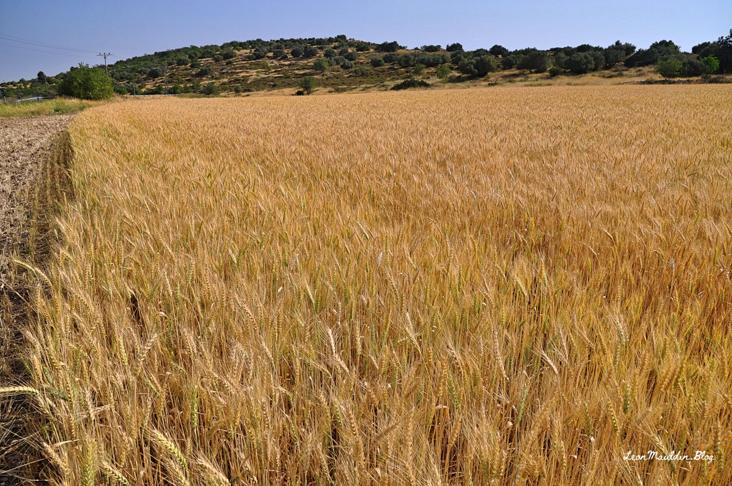
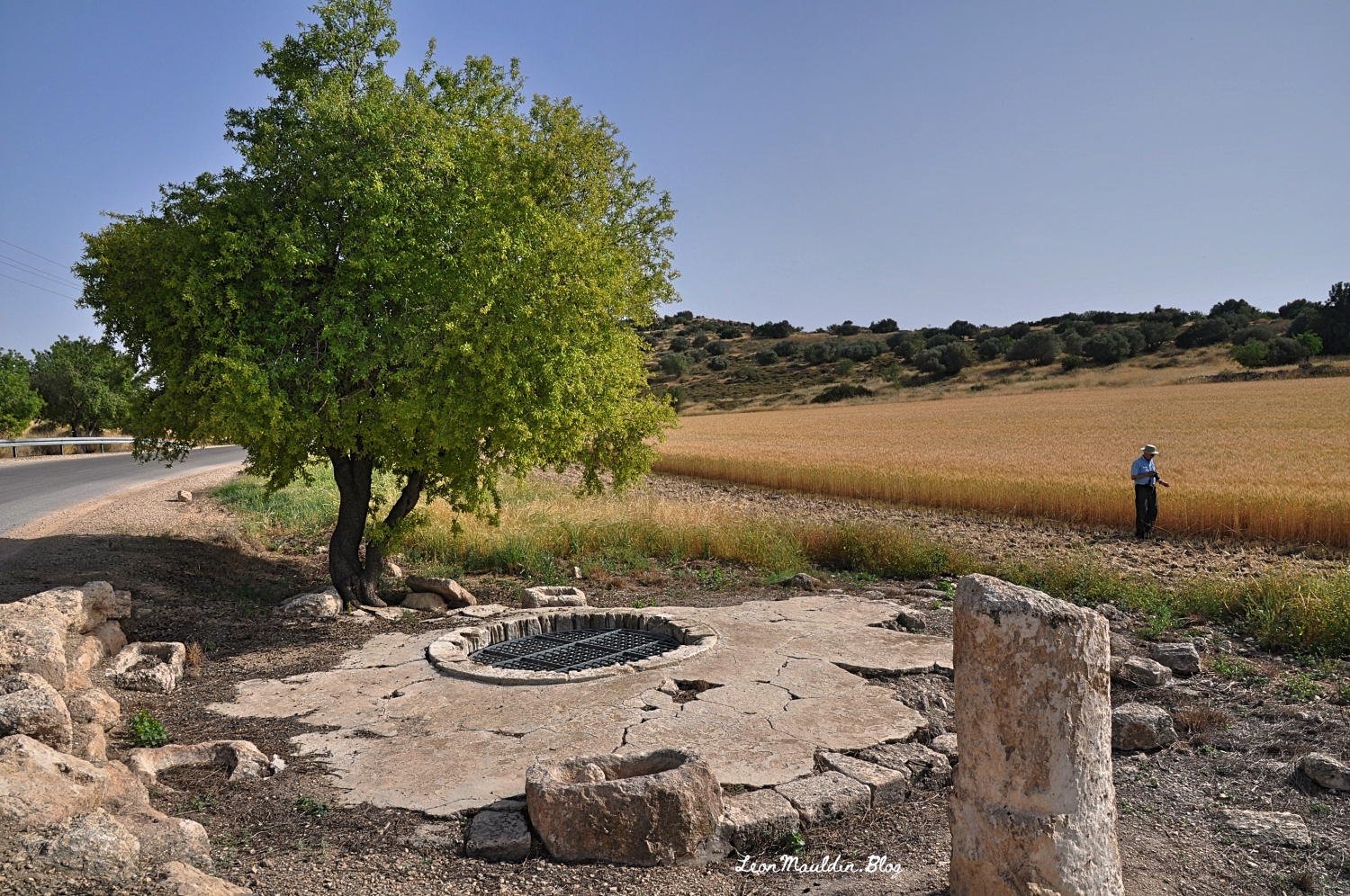
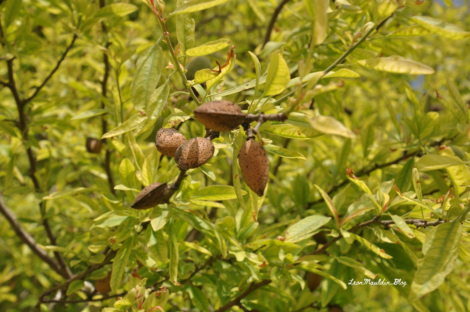
To illustrate, I want to share some photos from Maresha, near Beit Guvrin, Israel.
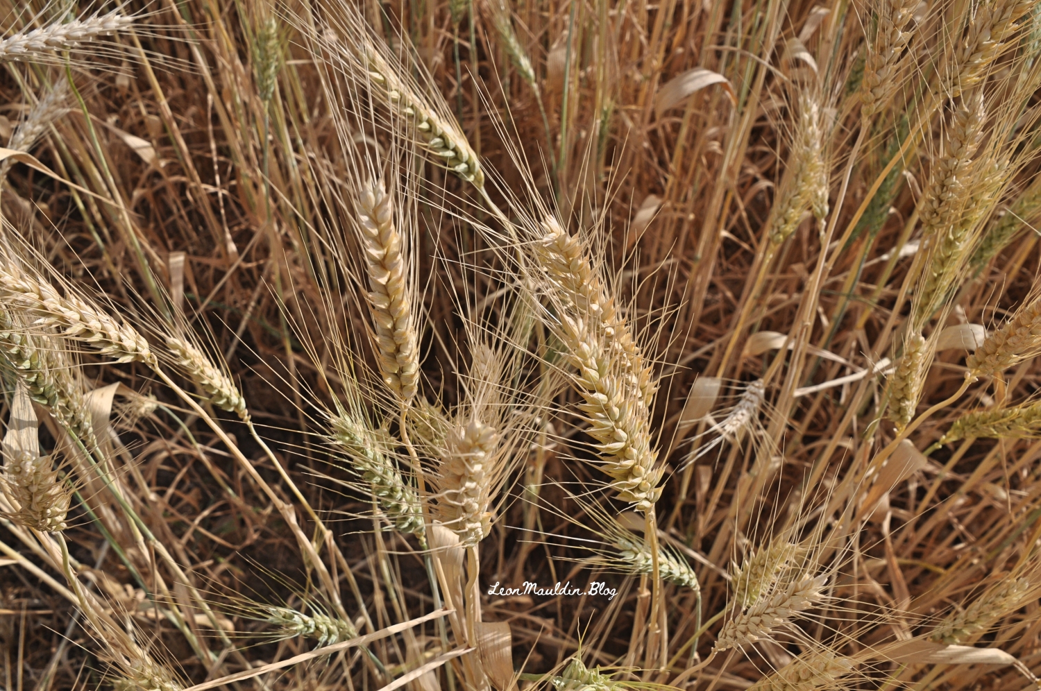
This photo shows a portion of the wheat field, plus an ancient well (note the rope marks), a manger, a milestone, an almond tree, and my good friend/brother Ferrell Jenkins. (He is “out standing” in his field). That’s a lot to get in one photo 🙂
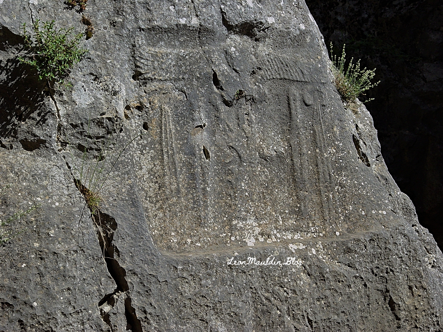
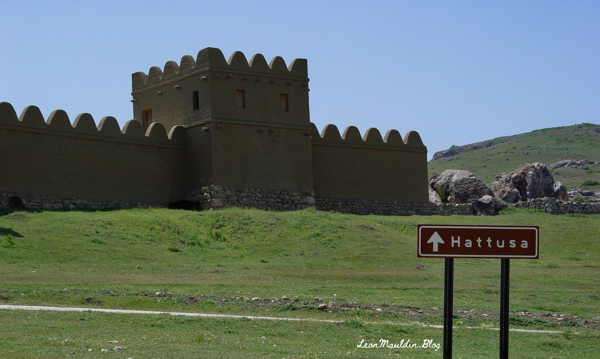
Yazılıkaya is an open-air rock sanctuary located about 1 mile NE of the Great Temple of Hattuşa, in the heart of Hittite country (New Kingdom). It consists of two chambers (A and B) formed inside a group of rock outcrops.
Hittite King Tudhaliya IV reigned 1245-1215 BC (Middle Chronology), or 1237-1209 BC (Short Chronology).
Trevor Bryce writes:
This renovation of the city was the inspiration of King Hattusili III (c. 1267–1237 B.C.), though his son and successor, Tudhaliya IV (c. 1237–1209 B.C.), did most of the work. Not only did Tudhaliya substantially renovate the acropolis; he more than doubled the city’s size, developing a new area lying south of and rising above the old city. In the new “Upper City,” a great temple complex arose. Hattusa could now boast at least 31 temples within its walls, many built during Tudhaliya’s reign. Though individually dwarfed by the enormous Temple of the Storm God in the “Lower City,” the new temples left no doubt about Hattusa’s grandeur, impressing upon all who visited the capital that it was the religious as well as the political and administrative heart of the Hittite empire.
Tudhaliya also constructed massive new fortifications. The main casemate wall was built upon an earthen rampart to a height of 35 feet, punctuated by towers at 70-foot intervals along its entire length. The wall twice crossed a deep gorge to enclose the Lower City, the Upper City and an area to the northeast; this was surely one of the most impressive engineering achievements of the Late Bronze Age. (https://library.biblicalarchaeology.org/article/the-last-days-of-hattusa/)
Here inscribed on the rock wall at Yazılıkaya is the cartouch of Great King Tudhaliya IV:
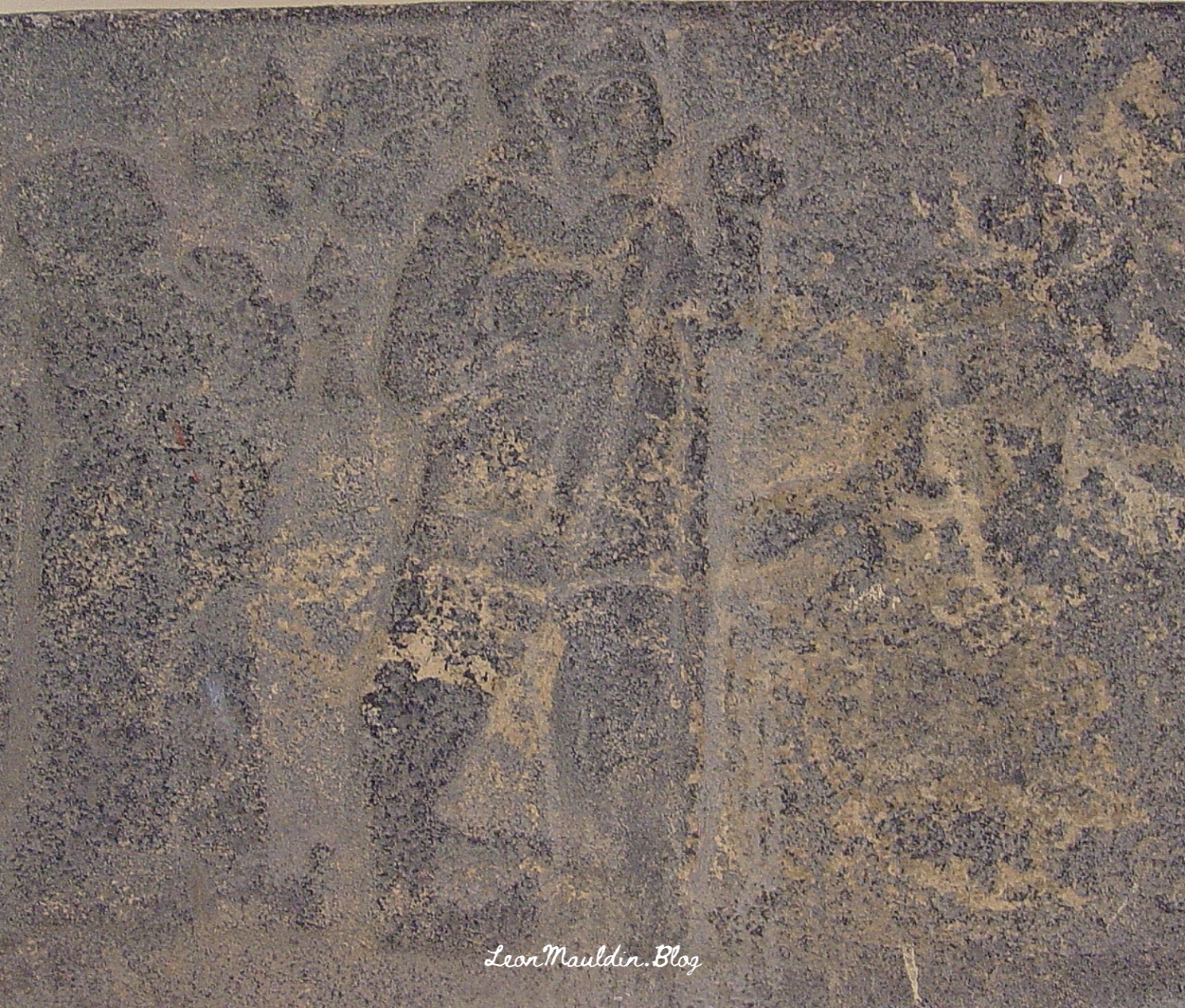
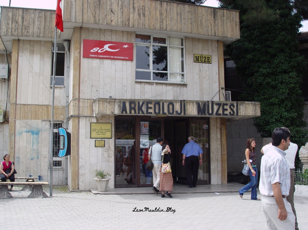
In 2007 I photographed this relief of Tudhaliya IV (dated to 13th century BC), at the Archaeological Museum in Antakya. Antakya is in Turkey, but in New Testament times was Antioch of Syria (Acts 11:20, etc.).
In doing some study in the prophet Malachi this morning I came across one of the many biblical references to Esau (from whom descended the Edomites). Malachi 1:2-3 illustrates the necessity of contextual biblical study: “Jacob I have loved, But Esau I have hated.” In short, this had nothing to do with the salvation of individual Edomites, or God’s personal like or dislike of Jacob or Esau, but rather underscores God’s sovereignty in choosing to provide salvation in that descendant of Jacob, Jesus the Christ.
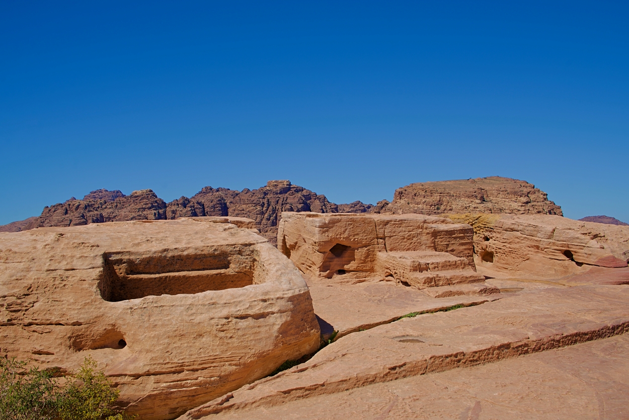
The territory occupied by Edom included Petra. By Roman Times the Edomites had been displaced by a people known as the Nabateans. Petra was the capital of the Roman Province of Arabia.
One of the many interesting archaeological finds at Petra is the High Place, including the altar for sacrifice. The photo here was taken in 2019 by tour member David Deason.
High Place at Petra. Altar at center (and slight right). Photo by David Deason.
The High Place at Petra is one of the best preserved of all such sacred installations in the ancient Near East. Its location is imposing, approximately 3,400 feet above sea level and 625 feet above the temenos. The altar platform was approached by three steps. It is situated about 3 feet above the level of an adjoining courtyard area and is equipped with drains and basins for sacrifices and ablutions.
The Biblical World in Pictures; BAS Biblical World in Pictures. (2003). Biblical Archaeology Society.
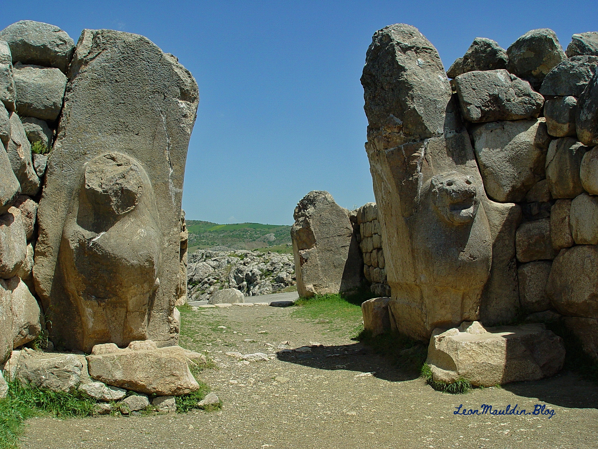
Numerous biblical references are made to the ancient Hittites. Hattuşa was the ancient capital of the Hittite Empire in the Late Bronze Age. Its location is near Boğazkale, Çorum Province, Turkey. One amazing archaeological find is the Lion Gate which features two sculptures of standing lions at the entrance. Previously there would have been an arch above the lions.
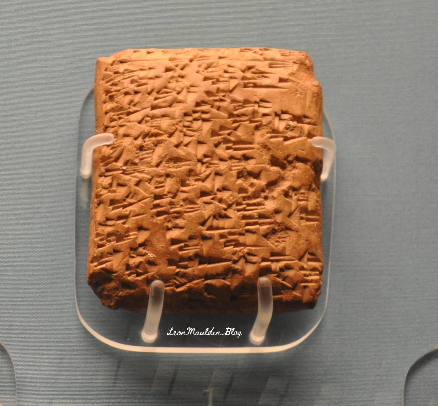
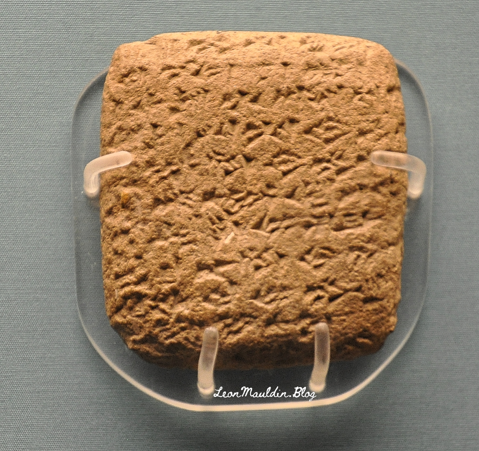
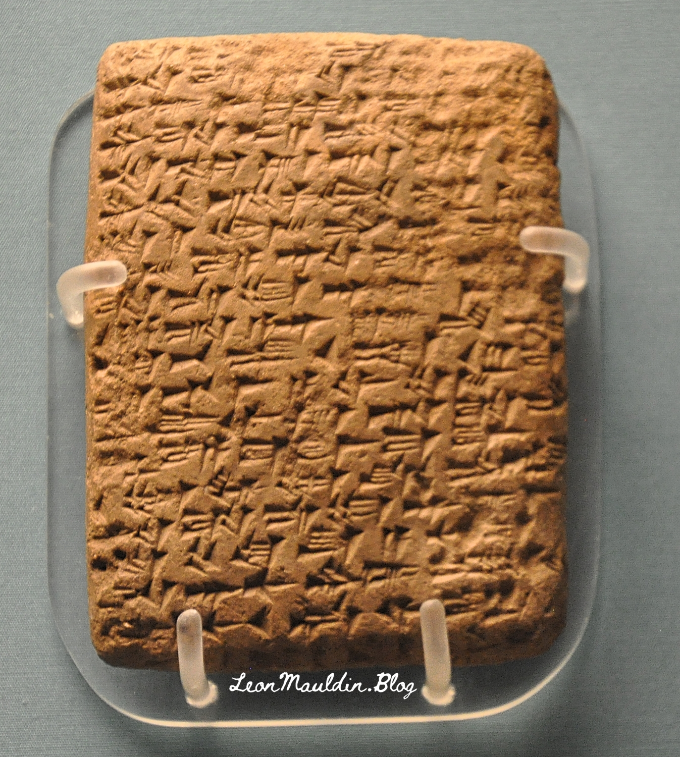
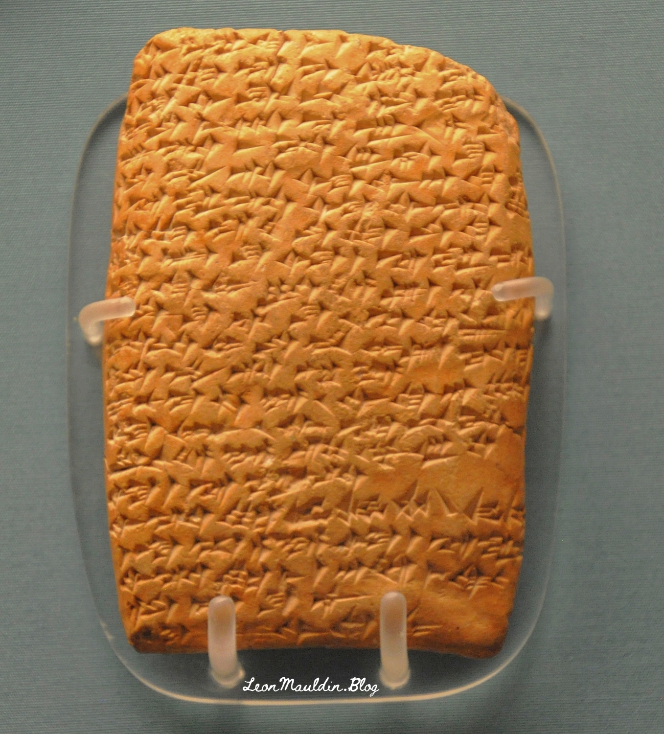
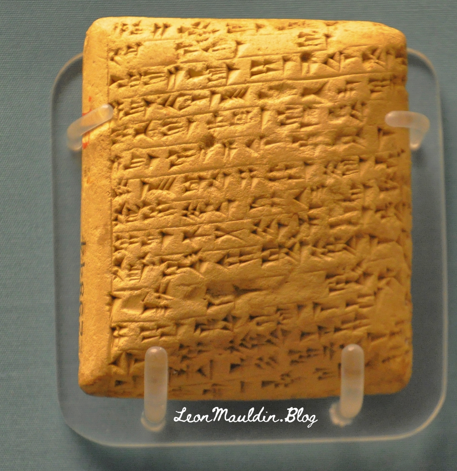
The collection of El-Amarna tablets represent diplomatic correspondence from princes/kings of from varioius parts of the Egpytian Empire during the reigns of Amenophis III, Akhenaton and Tutankhamun. These tablets were found in the ruins of Akhenaton’s (the “heretic” pharaoh) capital at El-Amarna. The British Museum displays some of the El-Amarna tablets from various locations in Canaan, which will be the focus of this post. We will feature tablets from Hazor, Lachish, Gezer, Megiddo and Shechem, all five of which were very important sites in Canaan.
Discovered at the site of Tell el-Amarna in Middle Egypt, these cuneiform documents are letters dating to the mid-14th century BCE that were written in varieties of Akkadian, the lingua franca of the time, by scribes from all over the ancient Near East on behalf of local kings. The letters are commonly divided into two groups: letters from the “greater” powers (the Egyptian, Mitannian, Hittite, Assyrian, and Kassite kings) and letters from the “lesser” powers (smaller kingdoms and city-states from across the Levant, including the land of Canaan). Interestingly, even though the Canaanite rulers were among the least powerful kings writing to Egypt (in fact, they were under Egyptian rule), they left behind the largest number of letters. Source: https://library.biblicalarchaeology.org/article/letters-to-pharaoh-the-canaanite-amarna-tablets/?utm_source=WhatCountsEmail&utm_medium=BHDA%20Spotlight%201-90&utm_campaign=TS%20BAS%20Scholars%20Series%208-21-24
This tablet is from Abdi-Tirshi, King of Hazor. The info sign says that he “reassures pharaoh that he is loyal and is keeping his cities in good order.”
Here is the tablet from Gezer’s king Yapahu, who “begs pharaoh for help in defending his city against raids by the Hapiru.” Many scholars believe that the “Hapiru” here refer to the Hebrews.
Here is the tablet from Biridiya, king of Megiddo. He “accuses the king of Acco of treachery by releasing the captured Hapiru leader, Labayu, instead of sending him to Egypt.”
Mandell went on the say regarding the script of these tablets, “The Amarna Letters were not written in alphabetic or Egyptian scripts. They were written in cuneiform, a wedge-shaped script that was developed in Mesopotamia in the late fourth millennium BCE to write Sumerian and, later, Akkadian. By the Amarna period, ancient people from all over the Near East wrote in this script by impressing a stylus into clay to create wedge-shaped signs” (Ibid.).
The BAS article also provided a couple of helpful maps.
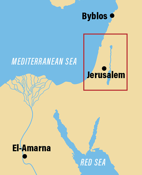
Map shows the location of El-Amarna relative to Canaan.
Location of El-Amarna in Egypt. Map by BAS.
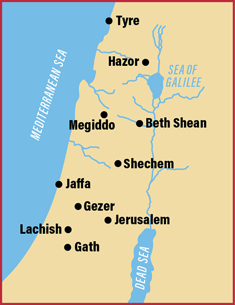
This map includes the sites of the origin of the tablets we featured above.
Cities in Canaan represented our display of tablets. Map by BAS.
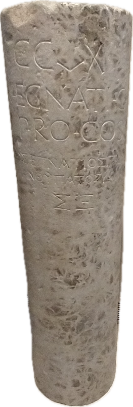
One of the most important roads in the Roman world was the Via Egnatia, which linked Dyrrhachium on the Adriatic Sea, to Byznatium, a distance of 260 miles. From the standpoint of Paul’s travels in Acts, the road crossed through Macedonia westward to Illyricum, linking the Aegean Sea to the Adriatic Sea.
Dr. Mark Wilson writes:
Around 146 BC the governor Gnaeus Egnatius began a road project across the Balkan Peninsula to link the Adriatic to his province of Macedonia on the Aegean Sea. Before 56 BC the road had been extended through Thrace to Byzantium (Cicero, On the Consular Provinces 2.4). Its length was 746 RM (696 mi. [1,120 km]). Travelers wishing to continue east from the port of Brundisium ferried across the Adriaticum (modern Adriatic) either to Dyrrachium or Apollonia (Strabo, Geography 7.7.4,8; he calls the former city by its Greek name Epidamnus). Branches of the Via Egnatia terminated at these Adriatic ports in the province of Illyricum. The remains of a mutatio are found at Ad Quintum (modern Bradashesh). Lychnidos (modern Ohrid) was the last major city in eastern Illyricum. Heraclea Lyncestis (modern Bitola) was the first major Macedonian city, then Edessa where a branch ran south to Berea. After Pella came the provincial capital Thessalonica on the Aegean coast. Eastward the road ran through Apollonia, Amphipolis, Philippi, and back to the coast at Neapolis.
Wilson, M. (2019). The Roman Road System around the Mediterranean (Acts 8:26; 20:1–3; 23:23–33; 28:13–16; Romans 15:19). In B. J. Beitzel, J. Parks, & D. Mangum (Eds.), Lexham Geographic Commentary on Acts through Revelation (pp. 180–181). Lexham Press.
One very important archaeological find on the Via Egnatia is the milestone pictured here above. The inscription is bilingual. It contains the name of the governor of the province of Macedonia, Gnaius Egnatus (served in late 140s BC), who was responsible for the construction of this Roman road. Hence the name, Via Egnatia. The milestone was found near the point where the Via Egnatia crossed the Gallikos River, west of Thessaloniki. This inscription also accurately reports the length of the road to be 260 miles.
The Via Egnatia (like other Roman roads) was built to move the Roman army to the East. But the special significance of this road to Bible students is seen (beginning with the Second Missionary Journey) as Paul (and companions) crosses the Aegean from Troas to Neapolis, and from there gets on the Via Egnatia. Luke, the author of Acts and having joined Paul at Troas, traces the evangelist work from Philippi (Acts 16), passing through Amphipolis and Apollonia (Acts 17:1f; did not preach there) then to Thessalonica, where “a great multitude” (Acts 17:4) were persuaded to become Christians. But because of intense persecution, Paul then left the Via Egnatia and moved southward to Berea, where there was great success (Acts 17:10-15). Paul would have made use of this road again on the Third Journey (Acts 20:1-3).
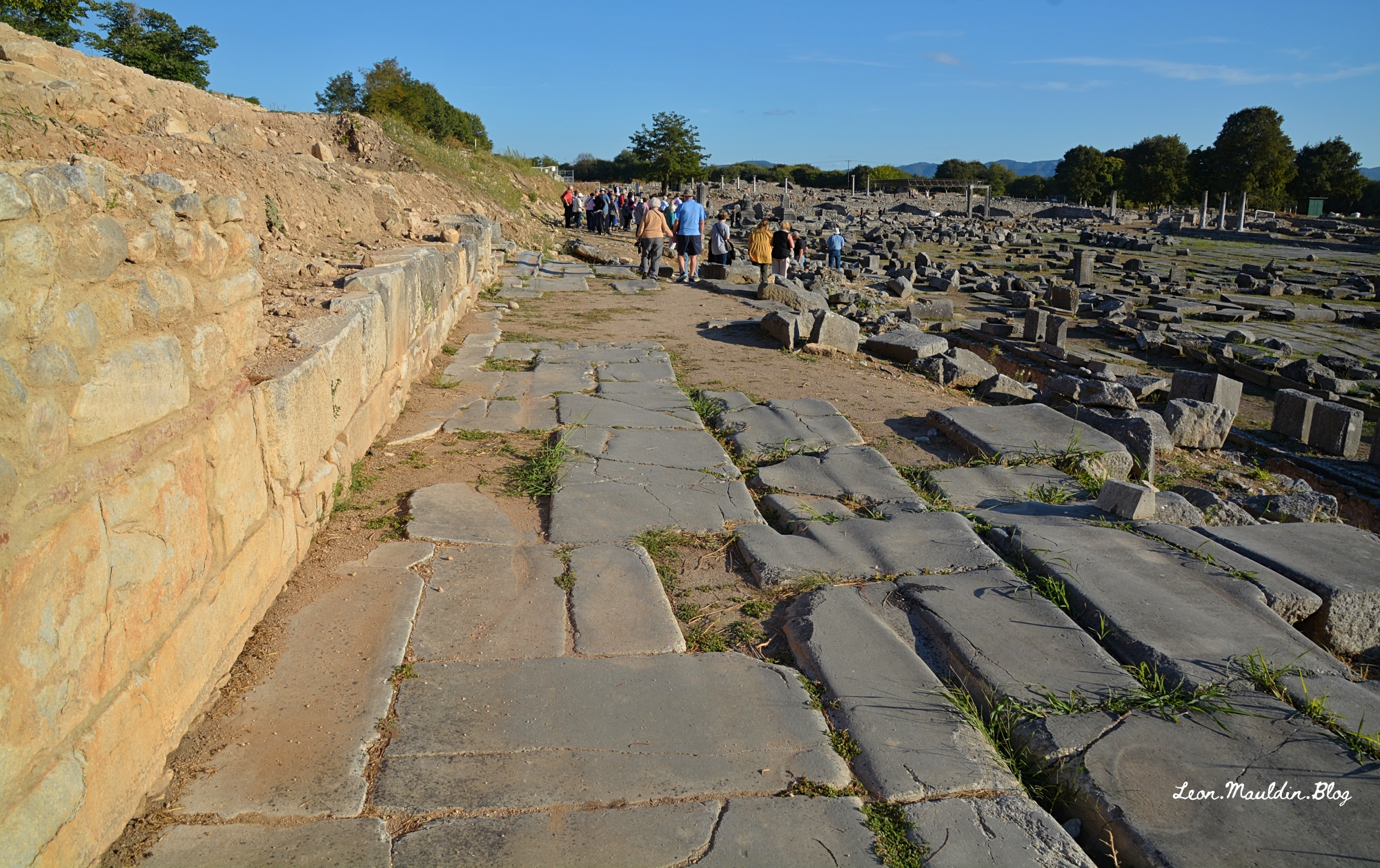
Here is a view of the Via Egnatia in Philippi, looking east. You can also see the agora to your right.
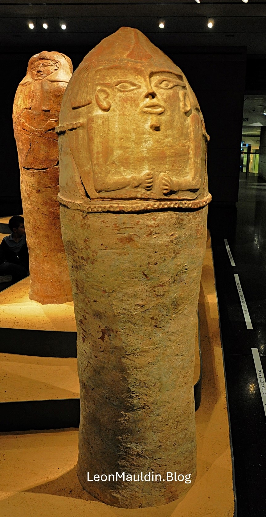
This post shows an Anthropoid Coffin from Deir el-Balah, south of Gaza, one of the cities of the Philistines. Scholars date this artifact to the 13th century BC. It demonstrates Egyptian influence reaching into the SW coast of Canaan. The patriarch Joseph may have been put in a coffin such as this.


 Posted by Leon Mauldin