Egypt’s 4th Dynasty was founded by Snefru c. 2613 BC. His son Cheops (Khufu) succeeded him, and is the builder of the largest of the great pyramids, one of the Seven Wonders of the Ancient World.
Cheops’s reign is dated c. 2589-2566 BC. This tiny statue depicts the king wearing the crown of Lower Egypt. This artifact was discovered by Flinders Petrie in the Osiris temple at Abydos in 1903. “In a curious inverse ratio we find that the smallest statue represents the builder of the greatest pyramid, while some of the finest multiple statues extant from the Old Kingdom represent the builder of the smallest of the Giza pyramids, Menkaure (fifth ruler of the 4th Dynasty)” (Chronicles, Clayton, p. 49.
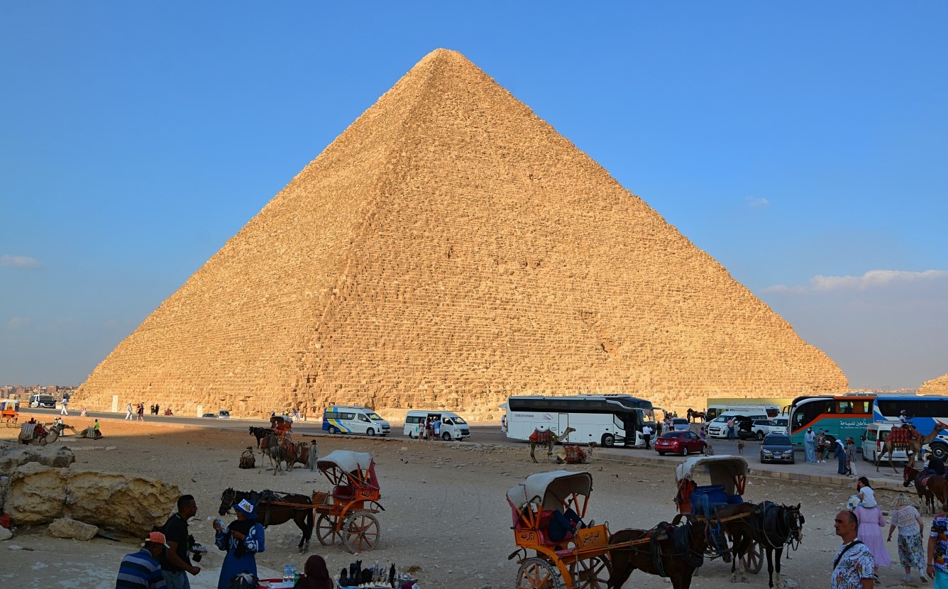
Cheops’s Great Pyramid is located on the Giza plateau. Originally reaching 481 feet, it was the tallest building in the world until the 19th century AD, an architectural record that stood for 4 1/2 thousand years. There are said to be 2,300,000 building blocks averaging about 2 1/2 tons.
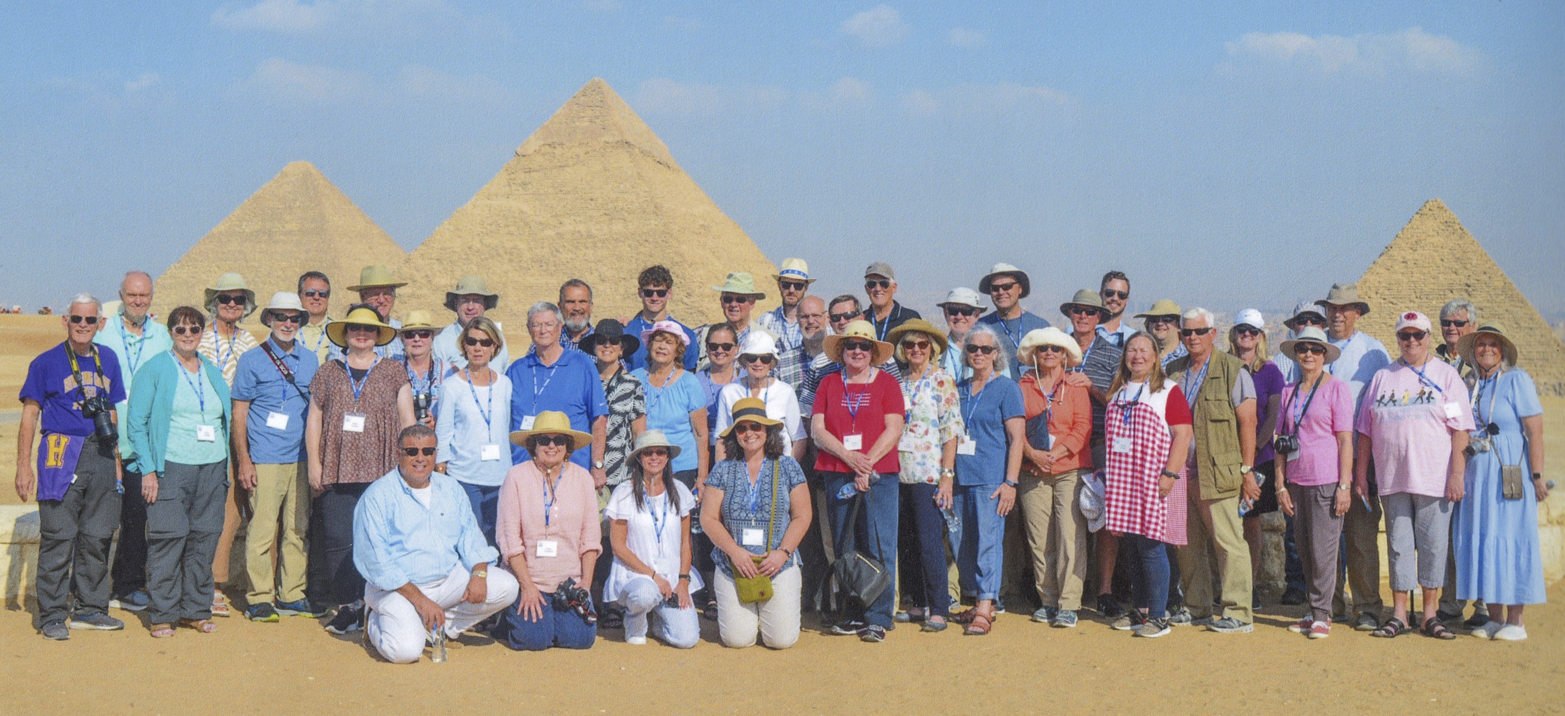
At far left you can see the Great Pyramid of Cheops. At left center you see the pyramid of Chephren (Khafra/Khafre), which appears to be taller, but is in fact on higher ground. At far right is the pyramid of Mycerinus.
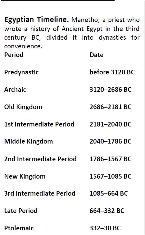
In this post we will give consideration to the first of the pyramid Builders, in the context of Egypt’s Old Kingdom (2686-2181 BC). For your convenience we share the following chart (keep in mind that dates are approximate and may vary):
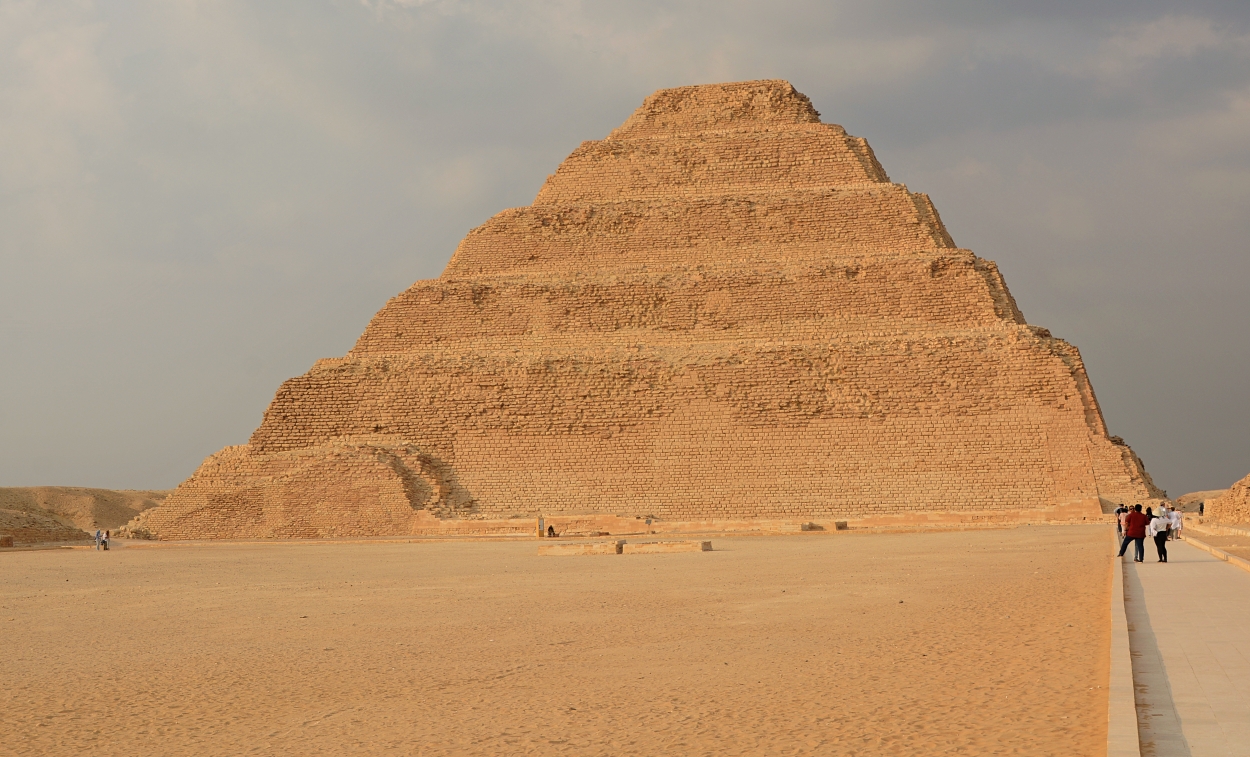
“Djoser’s pyramid and its surrounding mortuary complex is recognized as the first stone building in the world” (Chronicles of the Pharaoh’s, by Peter Clayton, p. 33), built by his vizier, Imhotep. Though begun “as a simple tomb, the structure was enlarged in height and breadth on five occasions, eventually rising to its present 197 feet. Unlike Egypt’s other pyramids, the Step Pyramid was built with comparatively small limestone blocks” (BAR Nov/Dec 1990, Richard Nowitz).
The pyramid, known as the Step Pyramid, began as a mastaba (an ancient Egyptian tomb rectangular in shape with sloping sides and a flat roof) “but was subsequently subject to several major enlargements, adding one mastaba upon another, until it consisted of six unequal steps rising t to 204 ft 962 m). Its base area is 358 X 411 ft (109 X 125 m)” (Clayton, p. 34).
The statue was found in a small chapel on the north face of the pyramid.
We should note that many have the mistaken notion that the Israelites were used as slave labor to build the pyramids. The pyramids were built some centuries before Israel came into being. They were built prior to the time of Abraham!
Having just returned from a 12-day tour of Egypt, I want to share some of our photos in upcoming posts, beginning with some from the Egyptian Museum in Cairo.
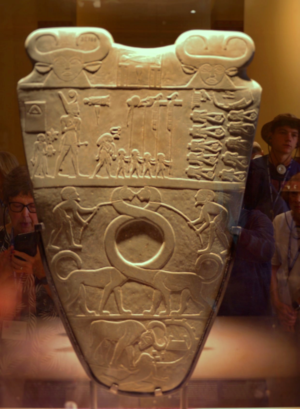
One of the very significant displays considered to be “of major artistic and historical importance” (Illustrated Guide to the Egyptian Museum, eds. Bongioanni and Croce, p. 28, discussed in “Protodynastic and Predynastic Periods”) is the Narmer Palette. This votive tablet “is the earliest record from Egypt (Chronicle of the Pharaohs, Clayton, p.18).
Gary Byers wrote:
More than 100 years ago, archaeologists excavated an ancient Egyptian temple in the Upper Egyptian city of Hierakonpolis. Here they discovered a stone palette used to grind cosmetics, with carving on both sides. One side had the picture of a man wearing the crown of Upper Egypt, and the other side had a man wearing the crown of Lower Egypt. Scholars decided the picture on each side was the same man, and his name was Narmer. This was the earliest representation of anyone wearing the crowns of both Upper and Lower Egypt. It suggests that this was the first king of a united Egypt.
Byers, G. A. (2003). The Scorpion King. Bible and Spade, 15(3), 28.
The hieroglyphs of the royal name are a mud fish depicted horizontally above a vertical chisel, read as the name of Narmer (Chronicles, 18). He is shown in as wearing the White Crown of Upper Egypt (the hedjet) and the Red Crown of Lower Egypt (dishret), indicating that he is now king of both lands, i.e., the unification of the country is commemorated. Narmer is presented as a victorious king, smiting a prisoner with his mace. This became an icon of majesty from ancient Egyptian history down to Roman times.
At the top are facing heads of the cow-faced goddess Hathor. The Horus falcon is depicted in front of Narmer.
On the obverse of the Palette the king is escorted by officials towards two rows of decapitated corpses.
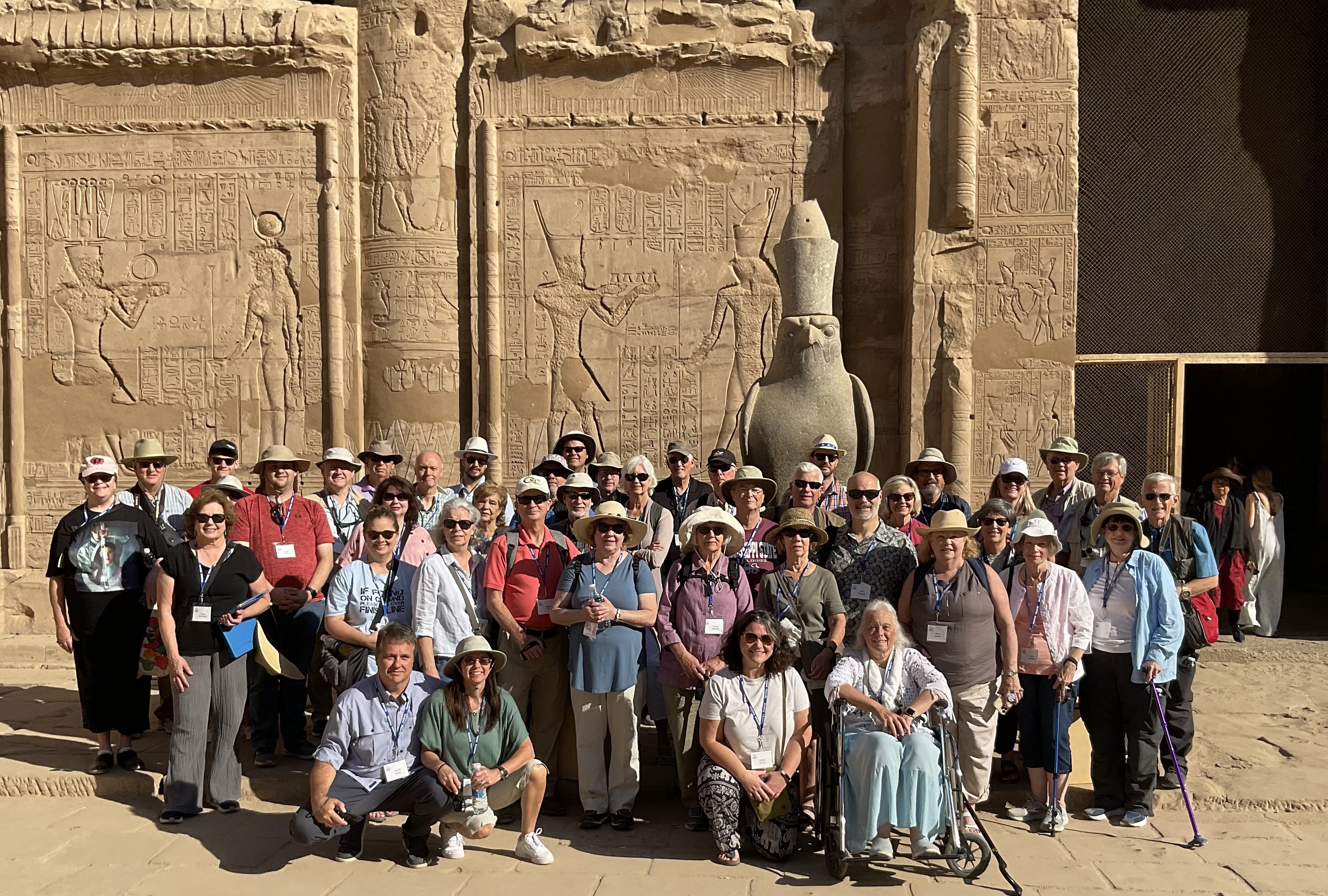
This is a photo of our group at the well-preserved Ptolemaic Temple of Horus at Edfu. In Egyptian mythology, Horus, the Falcon-headed god, was the son of Osiris and Isis. 
I have received the Photo Companion to the Bible on 1 & 2 Kings, from Dr. Todd Bolen. This is a portion of scripture on which I’m currently focused in study and writing, so it is a very welcome resource to me personally. I’ve made use of the BiblePlaces library for almost 20 years now, and am glad to highly recommend this most recent addition. More info and how to order is found here: https://www.bibleplaces.com/june-2022-newsletter/
The Books of Kings has long been an area of specialized study for Dr. Bolen, as explained in his newsletter.
This new resource has PowerPoint presentations on all 47 chapters of 1 & 2 Kings, with more than 7,400 slides! But this is not just a collection of photos–the descriptive text and explanatory notes are most helpful.
This type of resource is most helpful in giving the text of scripture its cultural and geographical context, and thus enhancing ones understanding of the Bible.
Thanks to Dr. Bolen and his colleagues for yet another great resource in this series!
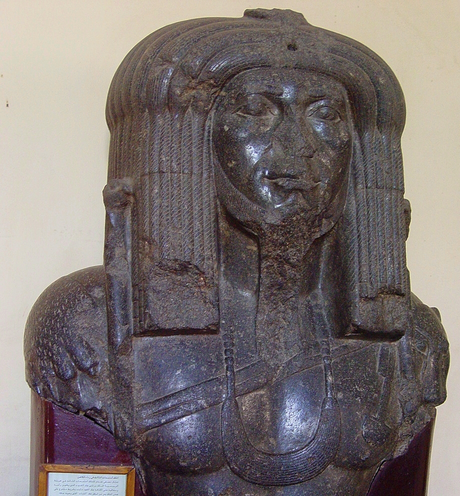
In our previous post we featured the Sphinx of Amenemhat III (ca. 1859-1813), who ruled during the time of the biblical patriarchs. This unique colossal bust of Amenemhat III was found on the site of the ancient capital of The Fayum, Shedet (the Crocodilopolis of the Greeks). The Pharaoh is dressed in a panther skin, with its head and paws lying on the king’s shoulders. A double band across his chest passes under the menat collar worn about his neck. The upper portion of two scepters terminating in falcon heads are visible on each side of his head.
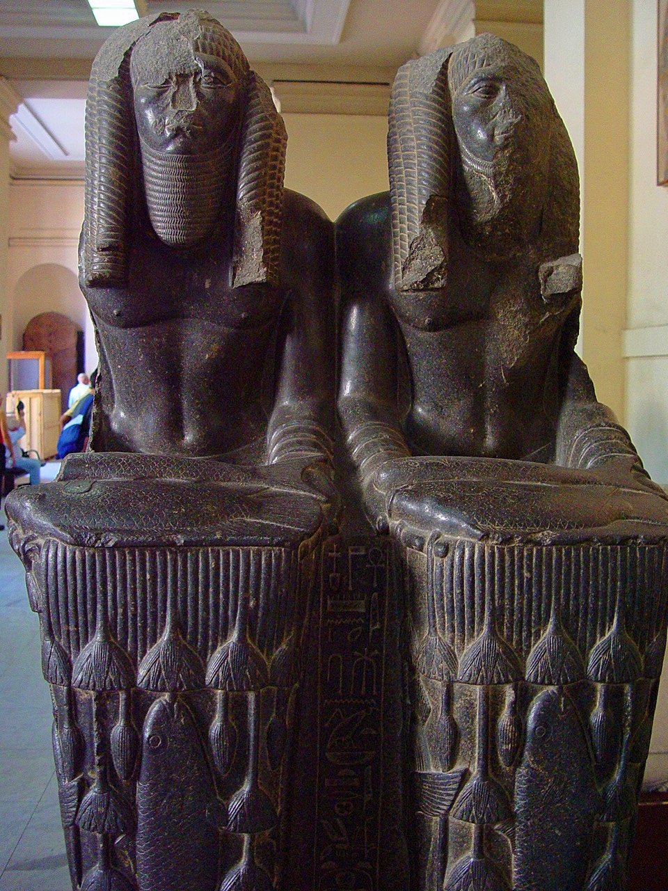
In this double statue, Amenemhat III is represented as the Nile god bearing all the nourishment indispensable to life. One explanation of the doubling of the king is that the two figures represent him as ruler of both Upper and Lower Egypt. Others suggest that one image depicts the reigning king and the other his deified counterpart.
During his long reign, Amenemhet III had almost continual turquoise mining expeditions in the Sinai. More than fifty rock inscriptions have been found there referencing this. He was the last great ruler of the Middle Kingdom.
The Egyptian Museum in Cairo displays the sphinx of King Amenemhet III, who ruled in the Middle Kingdom, 12th dynasty. This is one of seven sphinxes of Amenemhat III that were found in Tanis in the eastern Delta.
The sphinx has the head of the king and the body of a lion, symbolizing the vitality and power of the pharaoh.
Amenemhet III reigned for 45 years (ca. 1859-1813 BC), which included a long coregency with his father Sesostris III. Dr. Douglas Petrovich states:
The major project of his reign was the reclamation of more arable land in the Fayyum by manipulating the water level of Lake Moeris, which led to his veneration in the Fayyum. His long and peaceful reign is viewed as the time when the MK [Middle Kingdom] reached its cultural peak. He also strengthened the border at Semna and enlarged some of the fortresses, in addition to constructing a large temple to Sobek at the site of Crocodilopolis, in the Fayyum.
(Origins of the Hebrews, p. 13).
Petrovich identifies Sesostris III (ca. 1878-1840 BC) as the pharaoh of the famine at the time Joseph (Ibid., 29). The patriarch Jacob’s death is dated as 1859 BC (Ibid., cf. Andrew E. Steinmann, From Abraham to Paul, p. 74). “Amenemhet III ascended the throne as coregent with his father in ca. 1860/59 BC, which took place either just before so soon after Jacob’s death” (Petrovich, 29).
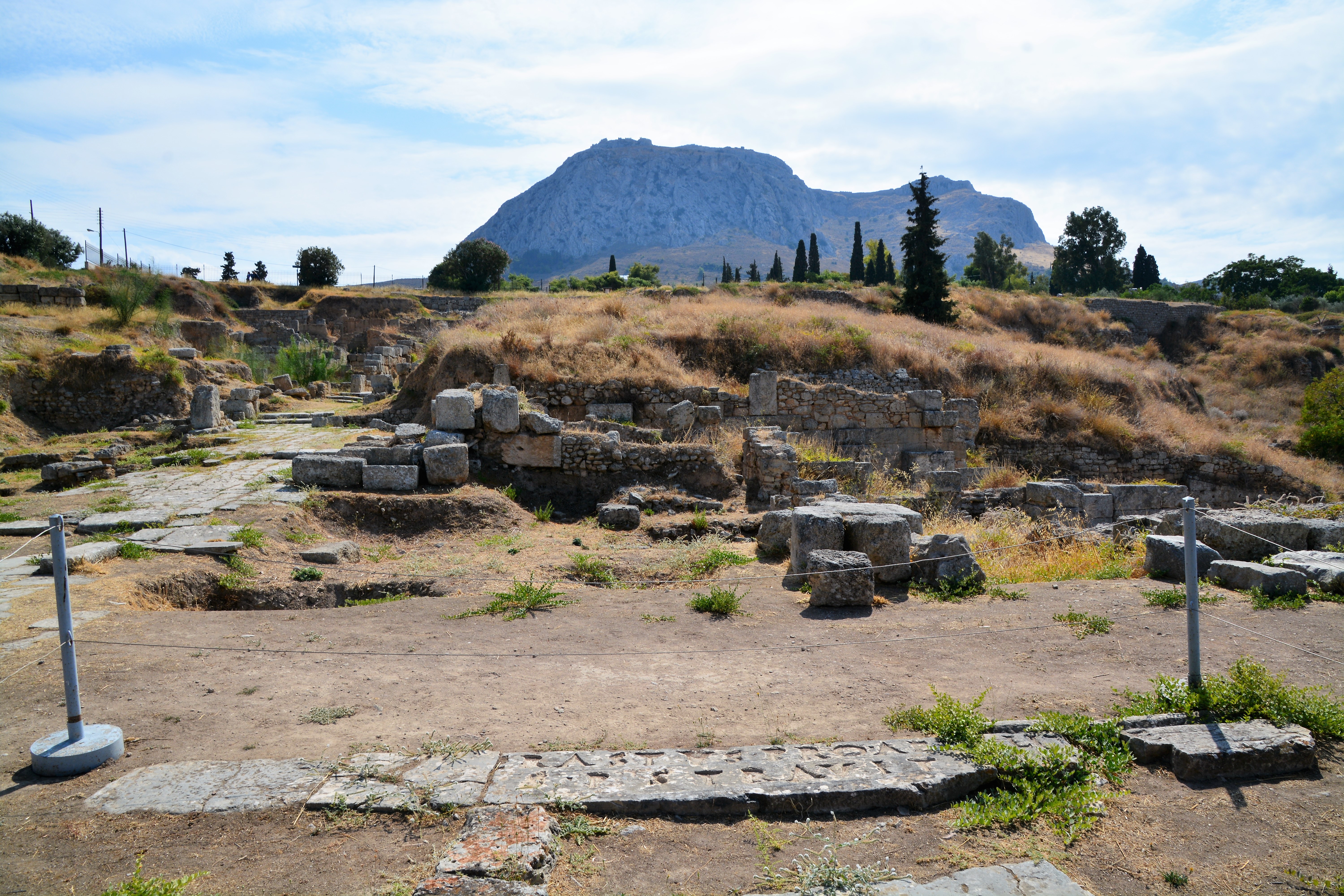
Among the sites our group was able to visit in Corinth was the bema, the judgment seat, mentioned in Acts 18:12-17:
When Gallio was proconsul of Achaia, the Jews with one accord rose up against Paul and brought him to the judgment seat, 13 saying, “This fellow persuades men to worship God contrary to the law.” 14 And when Paul was about to open his mouth, Gallio said to the Jews, “If it were a matter of wrongdoing or wicked crimes, O Jews, there would be reason why I should bear with you. 15 “But if it is a question of words and names and your own law, look to it yourselves; for I do not want to be a judge of such matters.” 16 And he drove them from the judgment seat. 17 Then all the Greeks took Sosthenes, the ruler of the synagogue, and beat him before the judgment seat. But Gallio took no notice of these things.
The Bema, Judgment Seat of Galillo at Corinth where charges against Paul were dismissed. Acrocorinth is in background. Photo by Leon Mauldin.
We also saw the Erastus inscription:
Erastus Inscription in foreground. Many identify this Erastus with Paul’s host at Corinth mentioned in Romans 16:23. Photo by Leon Mauldin.
Paul wrote the New Testament letter of Romans from Corinth, 3rd Missionary Journey. In Romans 16:23 we read, “Gaius, my host and the host of the whole church, greets you. Erastus, the treasurer of the city, greets you, and Quartus, a brother.”
In 1929 an inscription was discovered at Corinth naming an Erastus as the one who paid for the paving of the street. The inscription reads “ERASTVS. PRO. AED. S. P. STRAVIT” which is translated, “Erastus in return for his aedilelship laid [the pavement] at his own expense.” It would seem that the Erastus of the inscription is the same as the one mentioned in the biblical text.
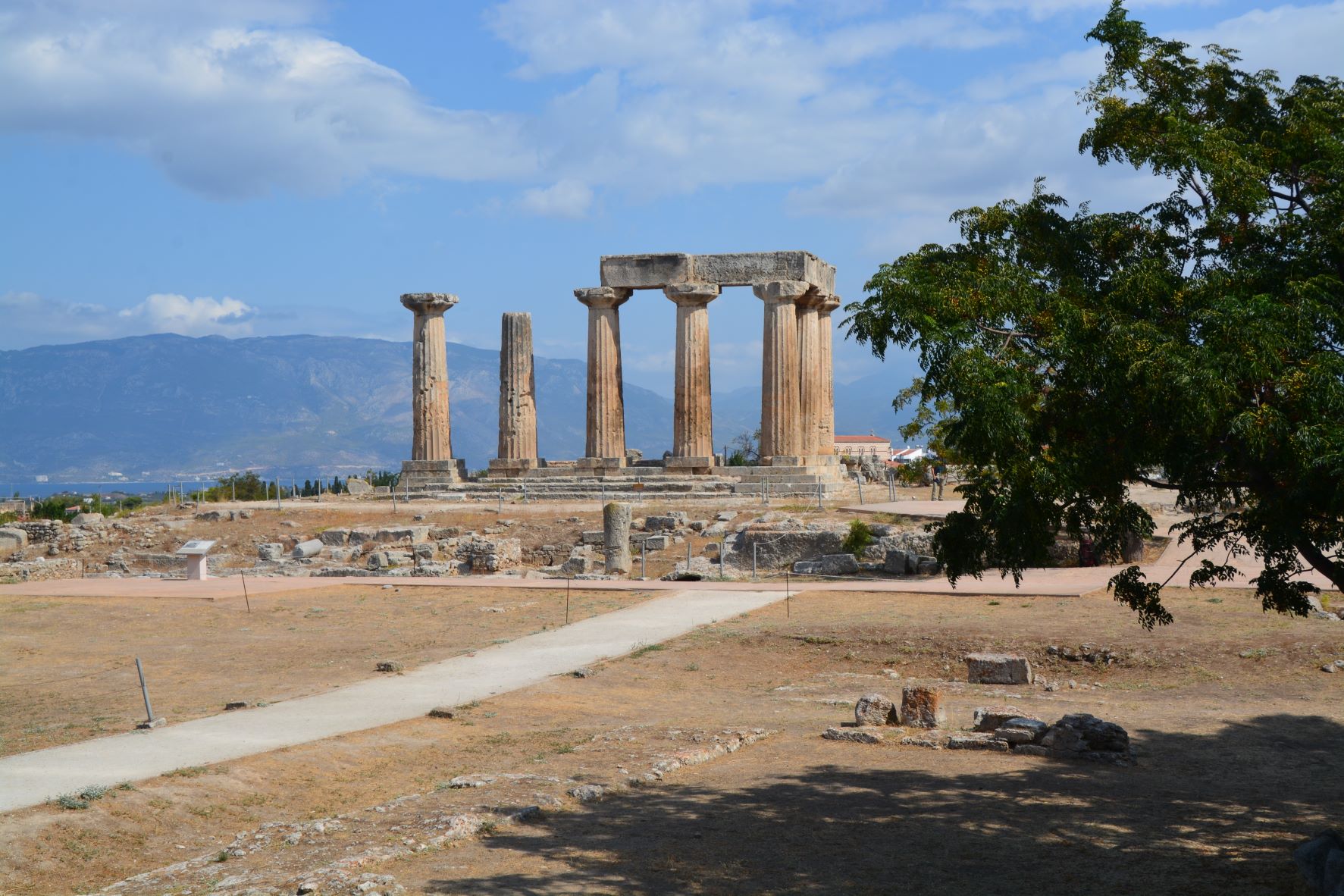
We also saw the famous ruins of the temple of Apollo.
Temple of Apollo at Corinth. Photo by Leon Mauldin
Regarding this site BAS says,
The Temple of Apollo at Corinth was 700 years old by Paul’s time. On the hill directly overlooking the Roman city’s main forum, its sturdy Doric columns served as a dramatic reminder of Corinth’s ancient grandeur. But the temple was already in ruins; to Paul it would have served merely as a sermon illustration of the impotence of the Greeks’ “pagan” gods.
As noted above, the temple was in ruins in the days of Paul, but the centuries of pagan idolatrous influence was still very much there.
The Apollo temple originally had 38 columns of the Doric order. Today seven are standing.
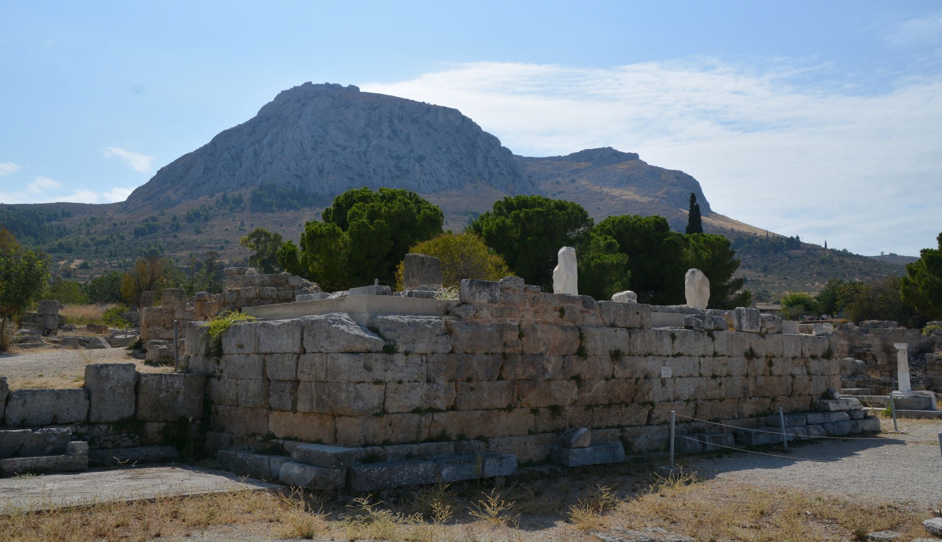
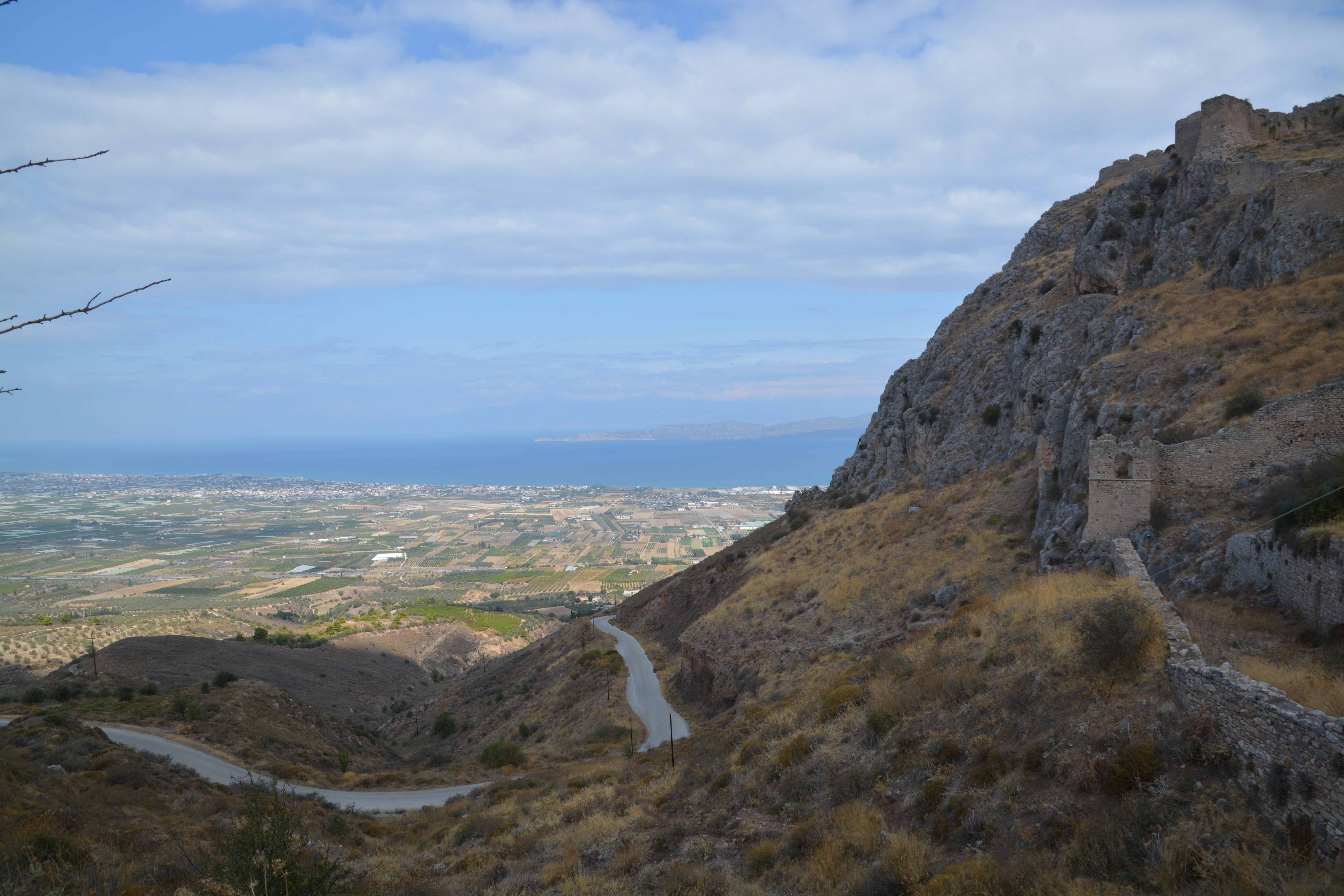
We also drove to the base of the Acrocorinth. What a view!
Acrocorinth. Photo by Leon Mauldin.
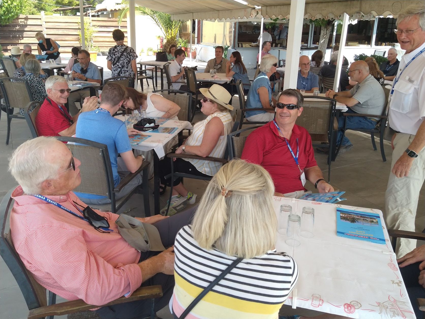
Finally, time for lunch at the Corinth Canal.
Some of our group sitting down to lunch at the Corinth Canal. Photo by Leon Mauldin.
This nice restaurant is on the eastern side of the Corinth Canal. You might see someone you know.
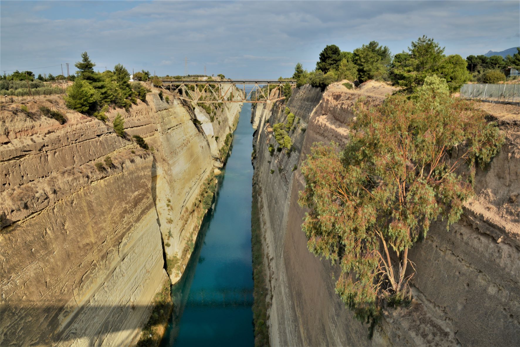
On our way to the archaeological site of Corinth our group made a couple of very important stops. The first was to see the Corinth Canal.
The narrowest point of the isthmus of Corinth is only 4 miles wide. A canal was engineered and completed between 1882 and 1893. Nero (A.D. 67) had the idea of building a canal at that exact route utilized by the modern engineers. He planned to use 6,000 Jewish prisoners as his work force, but the idea was abandoned.
Corinth Canal. Photo by Leon Mauldin
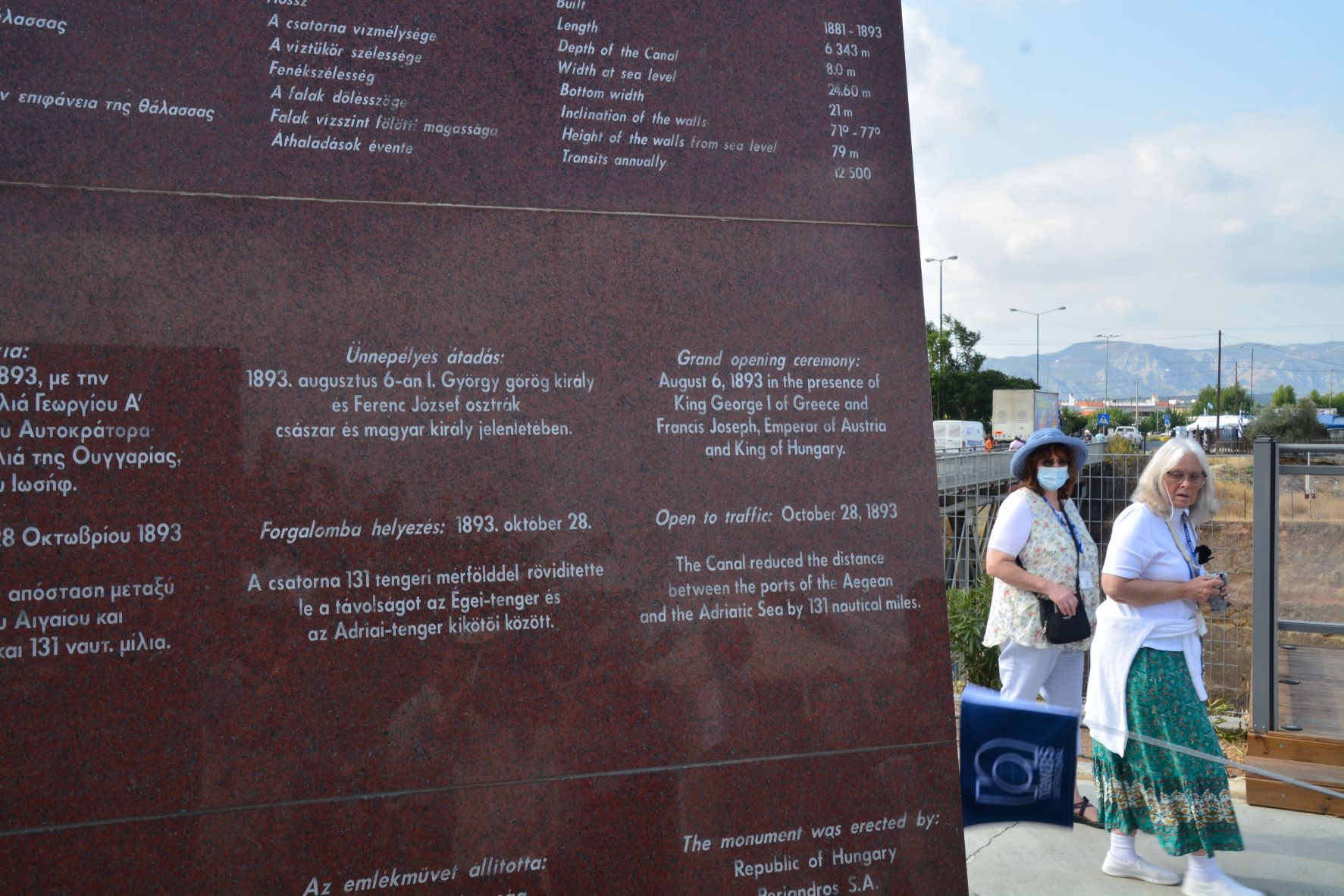
The canal cuts through the Isthmus of Corinth, separating the Peloponnesian peninsula from the Greek mainland. It connects the Gulf of Corinth with the Aegean Sea. On the site is a sign with info:
Info sign at Canal. Photo by Leon Mauldin.
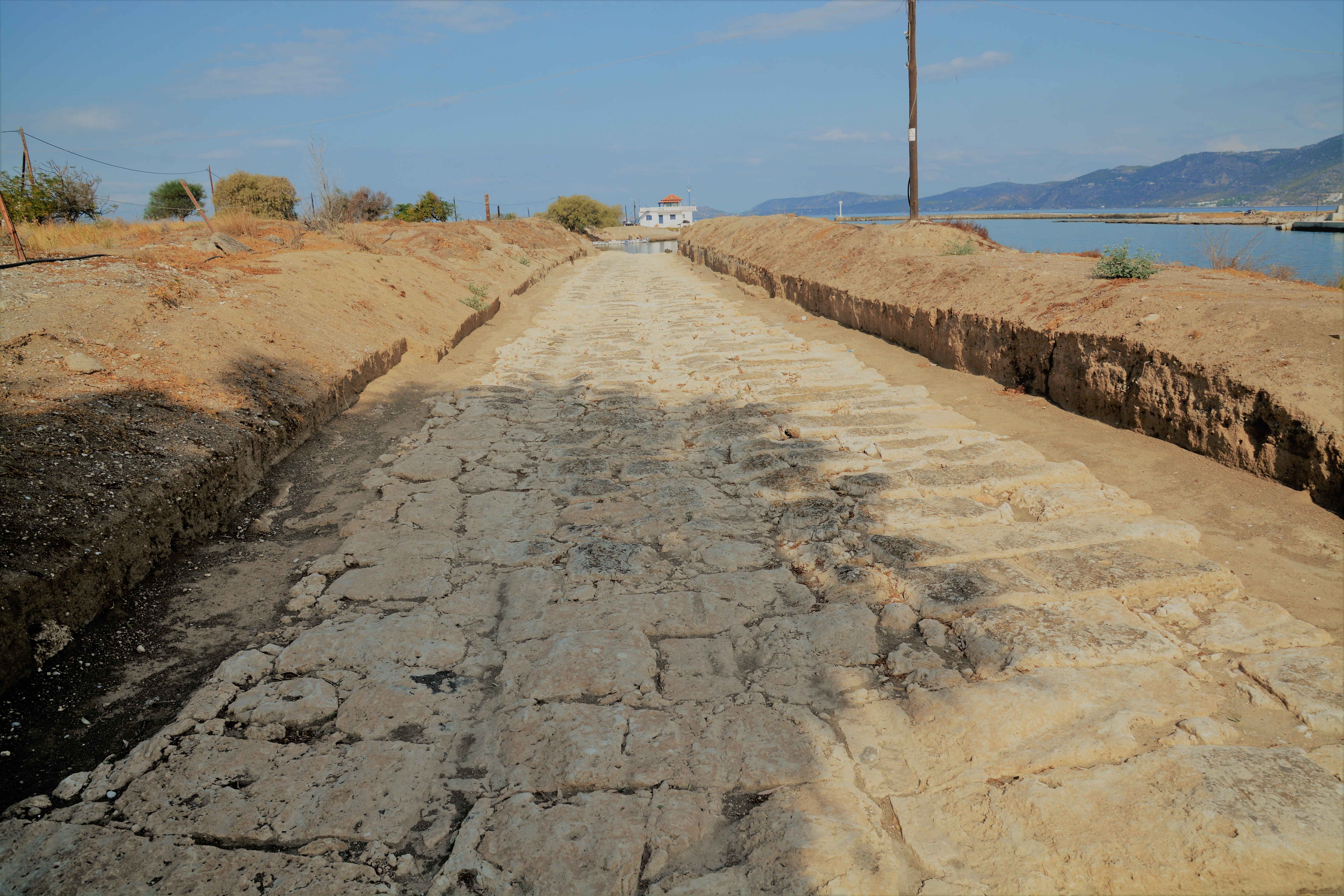
In ancient times there was a paved road that stretched across the isthmus, called the diolkos, which enabled cargo and smaller ships to be hauled overland, thus avoiding the dangerous circumnavigation of the Peloponnese.
Our photos below show two remaining portions of the western end of the diolkos. Photos are on the south side of the canal.
On this pavement cargo could transferred across the Isthmus. Built in 600 BC. Photo by Leon Mauldin.
The BAS has this information re: this site in their collection, The Biblical World in Pictures commenting on their photo taken in the same area as mine above:
In Paul’s day a stone-paved sledway, called the Diolkos, was used to haul ships and their cargoes across the isthmus. At both ends of the road the pavement continued down beneath the waterline, allowing the shallow-draft ships to be floated onto and off of the sleds. The sleds were then pulled out of the water and across the isthmus by mule-power.
This view of the Diolkos is near the western end, looking beyond to the Gulf of Corinth (and the mountains along its northern coast sheltering the oracle shrine of Apollo at Delphi). At the right can be seen the western outlet of the modern canal. The stone pavement of the Diolkos clearly shows the ruts formed by sled runners over centuries of use. Corinth, of course, controlled the Diolkos traffic. Moreover, since ship crews and passengers using this route had to leave their vessels temporarily at Corinth anyway, they had less reason to make an additional port-call at Athens’ harbor on the Piraeus. Thus, many more travelers of the Roman era passed through Corinth than through Athens.


 Posted by Leon Mauldin