Traveling in Israel (in 2005)

September 21, 2012

In November 2005 Ferrell Jenkins and I made a personal study trip to Israel. One factor that made that trip significant was the fact that this was Mr. Jenkin’s (who has directed scores of tours to Israel) first visit to Israel since the events of 9/11/2001. So the purpose in part was exploratory, to see what had changed and new developments/excavations, etc. He made posts of photos and comments every day.  You can still access that Nov. ’05 Israel trip info here. I thought some of our readers might enjoy the photos and info. This was before the widely read Ferrell’s Travel Blog.

I can tell you, that was a great trip. There is nothing quite like on-site Bible study! I think we each took around 2,500-3,000 photos.

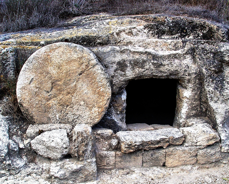
Rolling Stone Tomb in Northern Israel, Nov. 2005. Photo by Leon Mauldin.

This is one of my favorite shots from that trip. You can see there is no green grass, as it was dead and dry in Nov. It is good to be able to see the land at different times of the year if possible.

This Roman tomb is not far from Megiddo. Its use dates back to the time of Jesus, and well illustrates the kind of tomb in which Jesus was buried. Unfortunately it is not possible to get this same photo today as there is a safety railing in front of the tomb.

Click on photo for larger view.


More Re: Omrit

September 13, 2012

Archaeologists have determined there were three building phases at Omrit: first, the temple built by Herod the Great, second, the temple built probably by Trajan (AD 98-117), and third, an industrial complex to the north constructed in the Byzantine period.

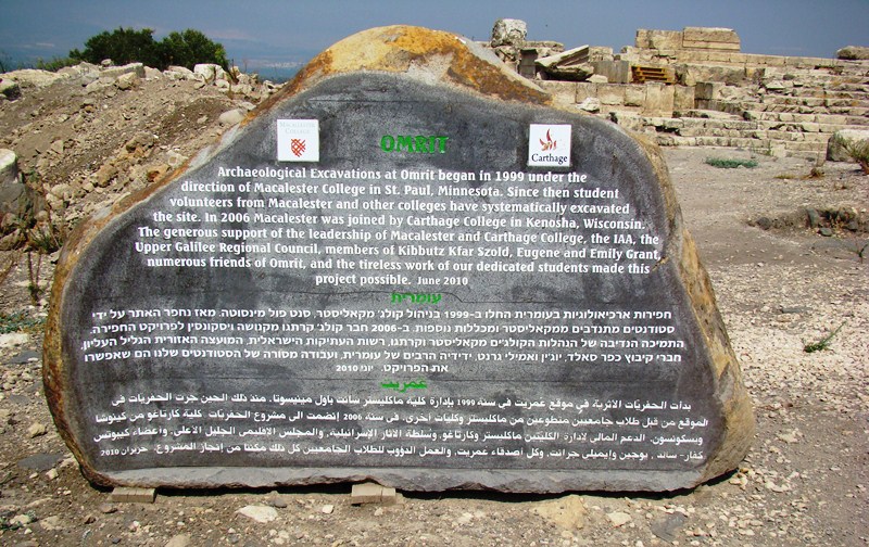
Entrance to Omrit. Photo by Leon Mauldin.

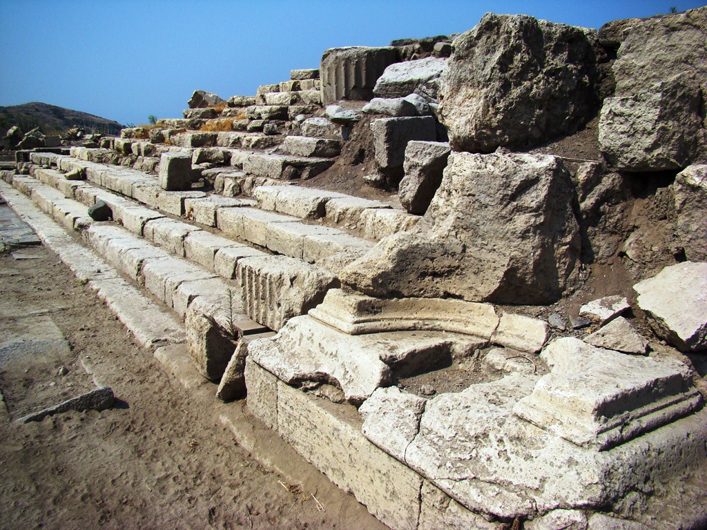
Here you can see the steps leading up to the temple. This site has been identified as a location for Imperial Cult Worship.

Steps to Imperial Temple at Omrit. Photo by Leon Mauldin.

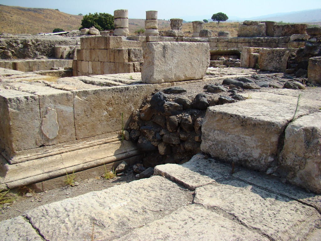
This photo shows the southwest corner of the temple. The large stones horizontally placed at center have been identified as Herodian. Herod was a politician and he overtly courted the favor of the Emperor Augustus.

Section of Herodian stones in Omrit Temple. Photo by Leon Mauldin.

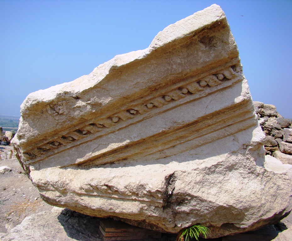
The site abounds with interesting architectural fragments.

Architectural fragment at Omrit. Photo by Leon Mauldin.

Click on images for larger view.


Omrit, cont’d.

September 11, 2012

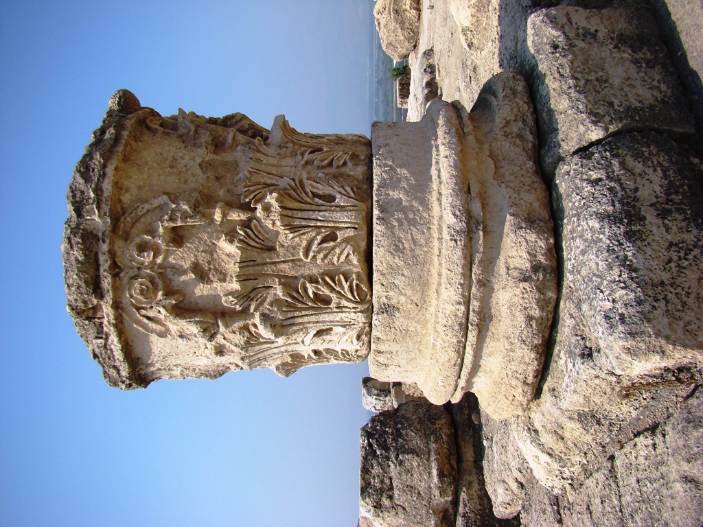
Among the interesting ruins at Omrit are several composite capitals. These are a combination of Corinthians and Ionic orders.

Composite Capital at Omrit. Photo by Leon Mauldin.

Note the beautiful acanthus leaves.

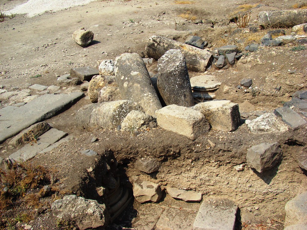
Omrit was destroyed by earthquakes in the 4th and 8th centuries AD.

Evidence of Earthquake at Omrit. Photo by Leon Mauldin.

Click on images for larger view.


Herodian Imperial Cult Temple at Omrit

September 10, 2012

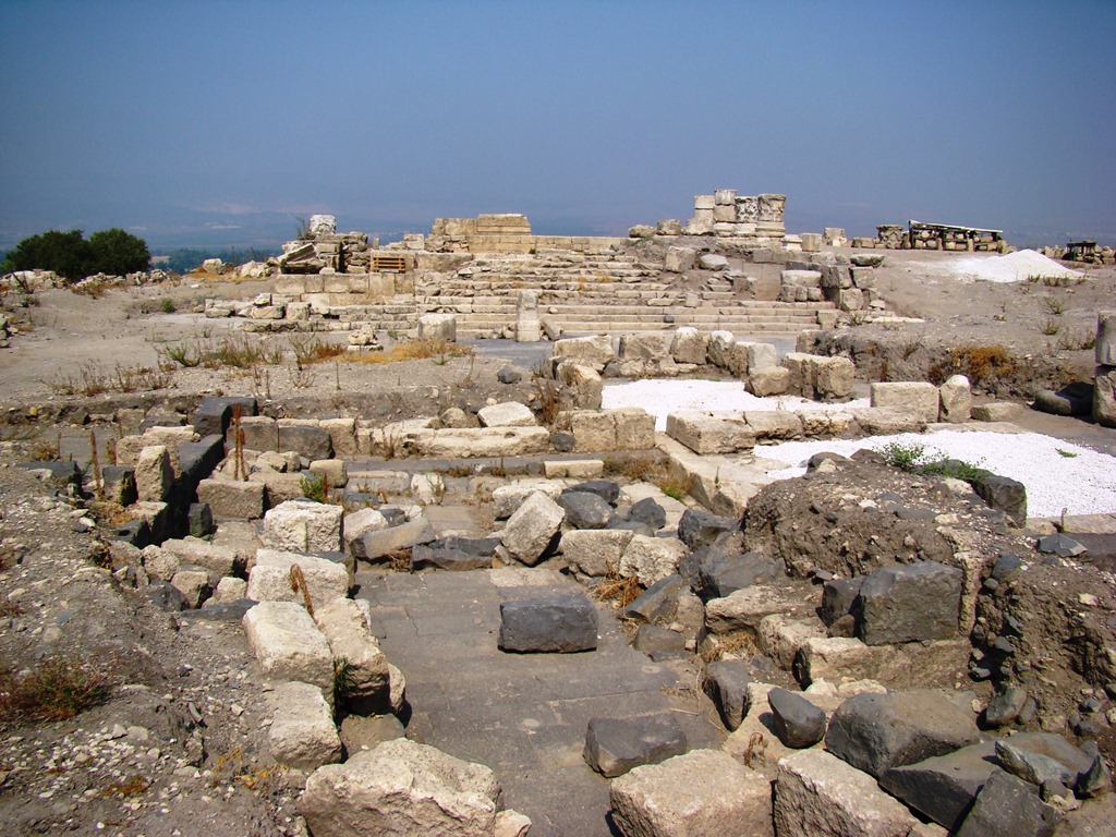
Omrit is located at the foothills of the Hermon Range, and is 2.5 miles from Caesarea Philippi (Banias). It was strategically situated near the crossroads of the Tyre-Damascus and Scythopolis (Beth-shean)-Damascus roads. Impressive remains of a temple devoted to Emperor worship may be seen here.

Herodian Imperial Cult Temple at Omrit. Excavators believe this temple was built by Herod to honor Caesar Augustus. Photo by Leon Mauldin.

I have enjoyed Dr. Carl Rasmussen’s recent posts re: Omrit. He said this was his “favorite site in Israel” (a statement I found very interesting) and just today posted another article on the site, dealing with Emperor worship that took place here in the Bible land. There are interesting implication of Peter’s confession that Jesus was the Christ, the Son of the living God so near a site where the Roman Emperor was worshiped as a “son of god.”

I was glad to visit this site this past September 2011, along with Ferrell Jenkins when he and I made a personal study trip at that time. BTW, Mr. Jenkins is currently directing a tour in Israel. You can follow their journeys here.


Antioch, on the Orontes River

August 7, 2012

In our post yesterday we mentioned that Antioch of Syria was located on the Orontes River.

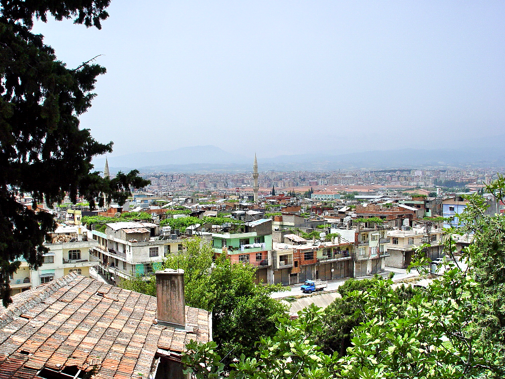
Orontes River. Biblical Antioch was situated here. Photo by Leon Mauldin.

The Holman Illustrated Bible Dictionary has this information:

Principal river of Syria which originates east of the Lebanon ridge (modern Asi [Turkish], Nahr el-’Asi [Arabic]), rises near Heliopolis (Bealbek) in the Beka Valley of Lebanon, and flows north some 250 miles through Syria and Turkey before turning southwest into the Mediterranean south of Antioch-on-the-Orontes (Antakya) to reach the coast just south of ancient Seleucia, the seaport of Antioch. This river is never actually mentioned in the Bible but was famous for its association with Antioch, which owed to the river the fertility of its district. Cities of the Orontes Valley include Antioch (Acts 11:19; 13:1), Hamath (2 Sam. 8:9; 2 Kings 17:24; 2 Chron. 8:4; Isa. 11:11), Qarqar, where King Ahab of Israel joined a coalition of Syrian kings warring against Shalmaneser III, and Riblah (2 Kings 23:33; 25:6, 21). Nahr el-’Asi (rebellious river) is the modern name of the Orontes (p.1231).

Bruce Metzer wrote:

Antioch was founded about 300 B.C. by Seleucus I. Nicator who named it either after his father or his son, both of whom bore the name Antiochus. It was situated about three hundred miles north of Jerusalem where the chain of Lebanon, running northward, and the chain of Taurus, running southward, are brought to an abrupt meeting. Here the Orontes breaks through the mountains, and Antioch was placed at a bend of the river, about twenty miles from the Mediterranean on the west. In the immediate neighborhood was Daphne, the celebrated sanctuary of Apollo (see II Maccabees 4:33), whence the city was sometimes called “Antioch-by-Daphne” to distinguish it from the fifteen other Asiatic cities built by Seleucus and named Antioch. Advantageously located for trade, being easily approached by caravans from the East and through its seaport, Seleucia, having maritime communications with the West, it grew under successive Seleucid kings until it became a city of great extent and of remarkable beauty. People would refer to it as “Antioch the Great,” “the Queen of the East,” and “the Beautiful.” One feature which seems to have been characteristic of the great Syrian cities—a vast street with colonnades, intersecting the whole from end to end—was added by Antiochus Epiphanes. Among ancient cities Antioch was distinctive in being the only one known to us to possess a regular system of street lighting. . . (Biblical Archaeologist: Volume 11:4).


The Disciples Were Called Christians First at Antioch

August 6, 2012

Luke narrates the preaching of the good news of salvation in the city of Antioch:

But some of them [disciples who scattered by the persecution in Jerusalem] were men from Cyprus and Cyrene, who, when they had come to Antioch, spoke to the Hellenists, preaching the Lord Jesus. 21 And the hand of the Lord was with them, and a great number believed and turned to the Lord. 22 Then news of these things came to the ears of the church in Jerusalem, and they sent out Barnabas to go as far as Antioch. 23 When he came and had seen the grace of God, he was glad, and encouraged them all that with purpose of heart they should continue with the Lord. 24 For he was a good man, full of the Holy Spirit and of faith. And a great many people were added to the Lord. 25 Then Barnabas departed for Tarsus to seek Saul. 26 And when he had found him, he brought him to Antioch. So it was that for a whole year they assembled with the church and taught a great many people. And the disciples were first called Christians in Antioch. (Acts 11:20-27).

This is a very instructive passage, helpful in defining who is a Christian. A Christian is:

1. one who has heard Jesus preached (v.20).

2. one who believes (v.21).

3. one who turns to the Lord (v.21). This would include repentance from sins (Acts 2:38), confession of faith (Rom. 10:9,10), and baptism (Acts 22:16).

4. one who has been added to the Lord (v.24).

5. one who continues with the Lord (v.23).

Antioch (modern Antakya) was located in Syria in biblical days, but today is within the territory of Turkey.  Antioch is twelve miles east of the Mediterranean, on the southern bank of the Orontes river and near the slopes of Mt. Silpius.

Antioch of Syria. BibleAtlas.com.

Antioch turned out to be the beginning point for Paul’s preaching journeys (Acts 13:1ff).

Antioch of Syria. Modern Antakya, Turkey. Photo by Leon Mauldin.

Eerdman’s Bible Dictionary has this info re: Antioch:

Built by Seleucus I Nicator (300 B.C.) as the capital of the Seleucid kingdom, it became the third most important city of the Roman Empire (after Rome and Alexandria). The layout of the city was a marvel. It was traversed from west to east by a colonnade of four rows of marble pillars between which lay three roads, a central road for the traffic of heavy vehicles and two outer ones for pedestrians, horses, and luxury carriages. A second colonnade began in the north at an island in the Orontes river and ran southward, and the city was thus divided into four districts by a gigantic, glittering, white-marble cross. North of the winding Orontes was the royal Seleucid palace, and on the northeast side of the city was the wall of Tiberius. The enchanting nature paradise of Daphne, where worshippers frequented the temple of Apollo, was to the south; its springs supplied ample water to the city. Archaeological excavations have uncovered mosaic floors of villas, an altar to unknown deities, a temple of Demeter, and numerous sculptures and images of deities (pp.60–61).


Monastery of St. Barnabas at Salamis

May 25, 2012

BAS has this information re: the island of Cyprus:

Cyprus served as a stepping stone on the trade routes that crossed the eastern Mediterranean. Archaeological remains from as early as the Early Bronze Age (3rd millennium B.C.E.) show it to have been a cultural meeting ground and “melting pot” for the successive cultures that flourished on all sides of it.

Salamis was the main port and principal city of the island in the Roman age. Located about five miles north of modern Famagusta, on its great bay, the city has yielded extensive Roman remains, including a theater, gymnasium, baths and a forum (BAS Biblical World in Pictures).

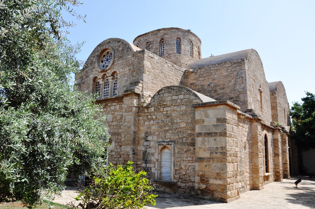
Our photo features the Monastery of St. Barnabas at Salamis.

Monastery of St. Barnabas at Salamis, Cyprus. Photo by Leon Mauldin.

We are introduced to Barnabas as a “Levite of Cyprian birth” (Acts 4:36). He, along with Paul, preached at Cyprus on the 1st Missionary Journey (Acts 13:1-5). Then when it was time for the 2nd Journey, Paul traveled with Silas, revisiting Galatia and going onward to Macedonia and Greece, and Barnabas took John Mark back to Cyprus (Acts 15:39).

The earliest buildings of the monastery  date to AD 477.


Theater at Salamis, Cyprus

May 17, 2012

It was an exciting time in the early church as Luke narrates his inspired history in Acts 13:

Now in the church that was at Antioch there were certain prophets and teachers: Barnabas, Simeon who was called Niger, Lucius of Cyrene, Manaen who had been brought up with Herod the tetrarch, and Saul. 2 As they ministered to the Lord and fasted, the Holy Spirit said, “Now separate to Me Barnabas and Saul for the work to which I have called them.” 3 Then, having fasted and prayed, and laid hands on them, they sent them away. 4 So, being sent out by the Holy Spirit, they went down to Seleucia, and from there they sailed to Cyprus. 5 And when they arrived in Salamis, they preached the word of God in the synagogues of the Jews. They also had John as their assistant.

Ferrell Jenkins and I had opportunity to visit Salamis today. Fant and Reddish observe that “more than 4 miles of walking are required to cover the entire site” (A Guide to Biblical Sites in Greece and Turkey, p. 542). It is a large site, and does not have the features of your typical tel.

The apostle Paul’s pattern upon entering a city, as seen here in our text of Acts 13, was to begin his preaching in the synagogue. Though Luke almost always describes the results of the preaching, whether favorable or not, he does not do so here.

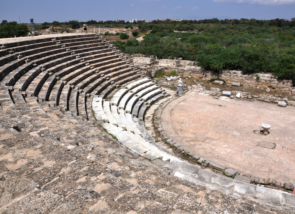
Roman cities of significance typically had a theater. Our photo shows the theater at Salamis.

Salamis Theater. Photo by Leon Mauldin.

This theater would have once seated 15,000 spectators (ibid), making it the largest on the island of Cyprus.

Click image for larger view.


Arch of Titus

March 3, 2012

The Arch dedicated to Titus is in the Forum at Rome, located at the highest point of the Via Sacra. It was on this street that most of the religious processions took place.

Arch of Titus, located in Forum of Ancient Rome. Photo by Nancy Picogna.

The arch was built to commemorate the Roman defeat of Judea, including the destruction of Jerusalem and its Temple. Inside the arch, one side depicts the Roman soldiers removing the menorah, table of showbread and silver trumpets from the temple as it was destroyed in AD 70. Vespasian was Emperor and Titus was the commander of the Roman army at that time.  Titus was Emperor AD 79-81. After Titus’ death, the arch was constructed ca.AD 81 by Titus’ brother, the new Emperor Domitian.

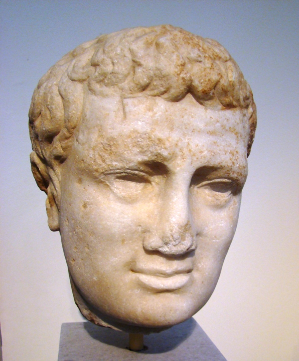
Emperor Titus, AD 79-81. Photo by Leon Mauldin.

This head of Titus (exhibit #348, Athens Museum), is made of Pentelic marble and was “probably found at Smyrna, Asia Minor. It is an earlier portrait head (possibly of the emperor Caligula) with parts reworked to render the features of Titus.”


Some (Brief) Features of Italian Geography

February 25, 2012

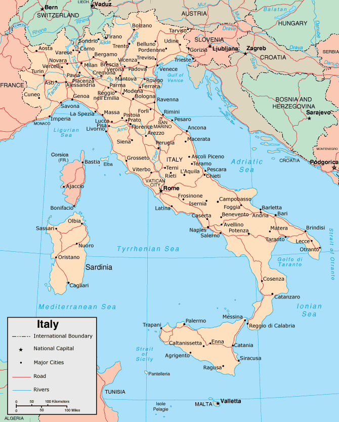
A resource I have found beneficial is The Cultural Atlas of the World series. There are several volumes in the series; one I’ve recently been gleaning is The Roman World, by Tim Cornell and John Matthews. The opening chapter, “A City Destined to Grow Great,” is obviously dealing with the city of Rome. But first an overview of the geography of Italy is given, including some reasons why the location was chosen for the foundation of this ancient city (ca. 753 BC).

The most important feature of the historical geography of Italy is the close interaction of plain, hill and mountain. Only about 1/5 of the total land surface of Italy is officially classified as plain (that is, land below 300 meters), and of this lowland area more than 70% is accounted for by the valley of the Po [north Italy, runs east-west, LM]. Of the rest, about 2/5 is classified as mountain (land over 1000 meters) and the remaining 2/5 as hill (land between 300 and 1000 meters). The alternation of these types of relief and their distribution throughout the country create a great diversity of climatic conditions and sharp contrasts in the physical appearance of the landscape from one region to another.

Italy is separated from central Europe by the great barrier of the Alps. In spite of their altitude these mountains have not kept Italy isolated from the rest of the continent. Although the winter snows make them impenetrable for more than half the year, most of the passes have been known since the earliest times; movements of people across the Alps have taken place throughout history, sometimes on a very large scale, for example during the incursions of the Celts and the Cimbri in the republican period and the barbarian invasions in the 5th and 6th centuries of our era.

In general the Tyrrhenian side [western side, LM] enjoys certain natural advantages over the Adriatic side . . . These differences relate largely to climate and to the nature of the soil . . . The Tyrrhenian coast is moreover fortunate in being served by relatively large rivers, at least two of which, the Tiber and the Arno, were navigable waterways in classical antiquity. The streams which flow into the Adriatic on the other hand are mostly dried up in the summer, and in winter become raging torrents which erode the thin soil from the upland slopes. The Adriatic coast is at a further disadvantage in having no good harbors.

The consequence of this natural imbalance has been that the western side of Italy has played a more prominent part in the history of civilization than the east, ever since the earliest Greek colonists rejected the desolate Adriatic coast and chose to make their homes on the Ionian and Tyrrhenian shores.

. . . Along the Tyrrhenian coast is a series of small alluvial plains, while the interior of the region is traversed by an interconnected chain of elevated basins which borders the eastern side; the most important of these alluvial valleys are the upper Arno between Florence and Arezzo, The Val di Chiana, the middle Tiber, and the Liri, Sacco and Volturno valleys which connect Latium and Campania.

These river valleys are also natural corridors of communication, and together they form the main longitudinal route along the western side of Italy which is followed today by the main railroad track and the Autostrada del Sole between Florence and Naples. The chief natural lines of communication from the coast to the interior also run along the river valleys, and above all along the Tiber. The lower Tiber valley is the nodal point of the network of natural communications of central Italy, and it was inevitable that the lowest available crossing of the Tiber, which occurs at Rome, should become an important center (emp. mine, LM). A defensible position with a good supply of fresh water, it dominated the crossing point at the Tiber island, where the first bridge, the Pons Sublicius, was constructed in the reign of King Ancus Marcius. In historical times, this part of the city comprised the commercial harbor (the Portus) and the cattle marker (the Forum Boarium). It was also the site of the “Great Altar” of Hercules. . . (pgs. 11-14).
Map of Italy, by Wikipedia

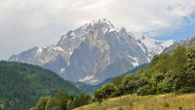
The highest point of elevation in Italy is Mont Blanc, in Aosta Valley.
Mont Blanc. Photo: Wikipedia Commons.

Italy is mentioned 4 times in the New Testament:

Acts 18:2 “And he [Paul] found a Jew named Aquila, a native of Pontus, having recently come from Italy with his wife Priscilla, because Claudius had commanded all the Jews to leave Rome.”

Acts 27:1 “When it was decided that we would sail for Italy, they proceeded to deliver Paul and some other prisoners to a centurion of the Augustan cohort named Julius.”

Acts 27:6 “There the centurion found an Alexandrian ship sailing for Italy, and he put us aboard it.”

Hebrews 13:24 “Greet all of your leaders and all the saints. Those from Italy greet you.”

There are several scriptural references to Rome, which we plan to consider at a later time.

Click on images for larger view.