October 9, 2012
We read in Joshua 10:29,30:
29 Then Joshua and all Israel with him passed on from Makkedah to Libnah, and fought against Libnah. 30 The LORD gave it also with its king into the hands of Israel, and he struck it and every person who was in it with the edge of the sword. He left no survivor in it. Thus he did to its king just as he had done to the king of Jericho.
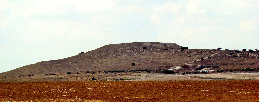
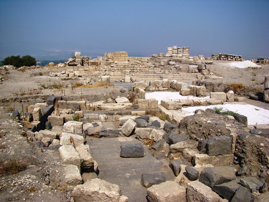
We had the occasion last year to visit Tel Burna, in Israel’s Shephelah, a location which many believe to be biblical Libnah.
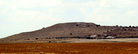
Tel Burna, believed to be biblical Libnah. Photo by Leon Mauldin.
The Tel Burna Excavation Project is devoted to this site and may be viewed here.
Another biblical reference to Libnah is found in 2 Kgs. 19:8, contextually speaking of the Assyrian invasion of Judah, 701 BC: “Then Rabshakeh returned and found the king of Assyria fighting against Libnah, for he had heard that the king had left Lachish.”
 Leave a Comment » |
  Archaeology, Bible History and Geography, Bible Study, Israel, Old Testament, photography, Travel | Tagged: Libnah, Tel Burna |
  Permalink
 Posted by Leon Mauldin
October 4, 2012
I never tire of reading John 4, which narrates Jesus’ stop at Jacob’s well as He left Judea and was en route to Galilee. This was early in Jesus’ ministry, prior to the Galilean ministry. On this occasion He skillfully led an unnamed woman from the mundane task of coming to draw water, to a point of faith in Him as the Messiah. Additionally, it turned out that there were many in the area that became believers in him.
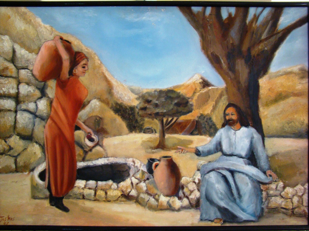
At nearby Mt. Gerizim, the mountain referenced by the woman as the place where the Samaritans worshiped (v.20), there is today the Samaritan Museum. There one can see a painting that points back to that day recorded in John’s Gospel.
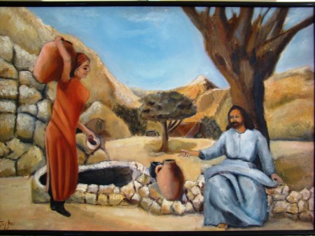
Painting depicting Jesus and the Samaritan Woman of John 4. Photo by Leon Mauldin.
We are currently in Canada, speaking in a 6-day meeting at Jordan, Ontario.
4 Comments | Bible History and Geography, Bible Study, Israel, New Testament, photography, Shechem, Travel | Permalink
Posted by Leon Mauldin
September 22, 2012
A resource I own and would recommend is Dr. Carl G. Rasmussen’s Zondervan Atlas of the Bible. It is currently on sale for the bargain price of 19.99 at Christianbook.com. Click here to read more. Click here to order.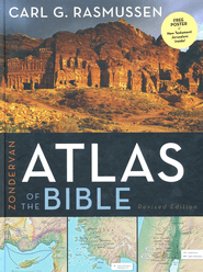 A good resource for a great price!
Publisher’s Description:
Zondervan Atlas of the Bible … a thoroughly revised edition of the most comprehensive Bible atlas ever designed for * Students * Bible Study Groups * Adult Learners * Travelers/Pilgrims to the Lands of the Bible * Pastors * Teachers * All Lovers of the Bible This major revision of the Gold Medallion Award-winning Zondervan NIV Atlas of the Bible is a visual feast that will help you experience the geography and history of Scripture with unprecedented clarity. The first section of the Atlas introduces the ‘playing board’ of biblical history–using three–dimensional maps and photographic images to help the lands of the Bible come alive. The next section, arranged historically, begins with Eden and traces the historical progression of the Old and New Testaments. It provides an engaging, accurate, and faithful companion to God’s Word–illuminating the text with over one hundred full-color, multidimensional maps created with the help of Digital Elevation Modeling data. It concludes with chapters on the history of Jerusalem, the disciplines of historical geography, and the most complete and accurate listing and discussion of place-names found in any atlas. Throughout the Atlas, innovative graphics, chronological charts, and over one hundred specially selected images help illuminate the geographical and historical context of biblical events. The Zondervan Atlas of the Bible is destined to become a favorite guide to biblical geography for students of the Bible. This accessible and complete resource will assist you as you enter into the world of the Bible as never before.
Leave a Comment » | Bible History and Geography, Bible Study, Israel, New Testament, Old Testament, photography, Resources, Travel, Uncategorized | Permalink
Posted by Leon Mauldin
September 19, 2012
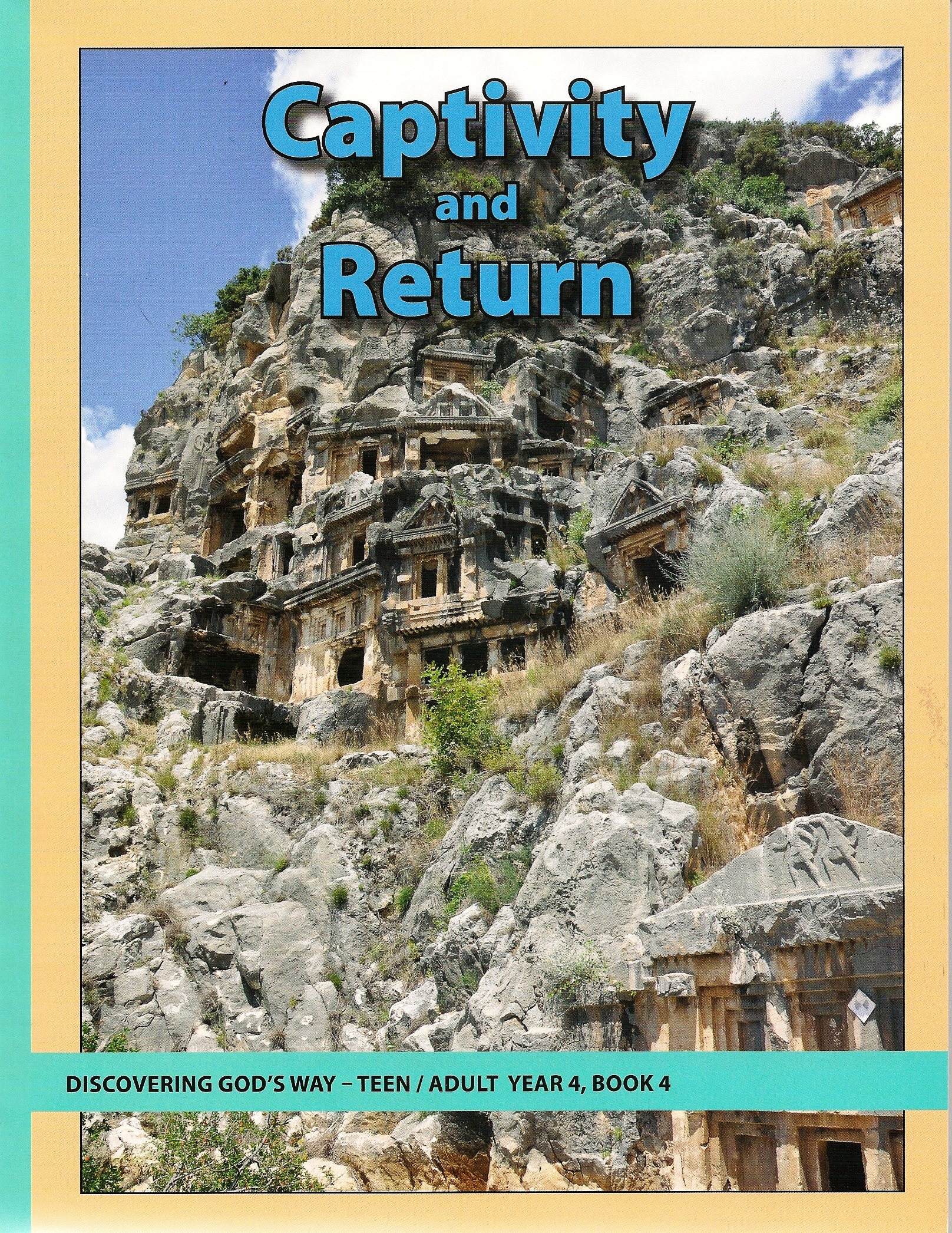
Discovering God’s Way is a Bible class curriculum for ages nursery through adult, edited by Robert Harkrider, and published by Religious Supply Center of Louisville, KY. I have written two books for the teen/adult level, Divided Kingdom, and Captivity and Return, the latter of which has just now been printed. Here is the cover:
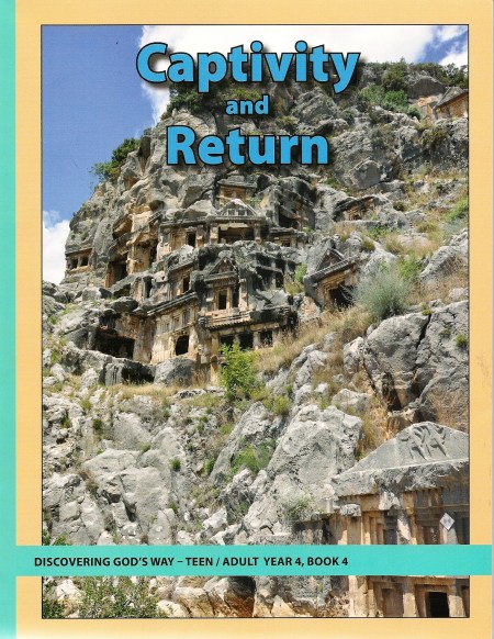
Cover, Captivity and Return, authored by Leon Mauldin.
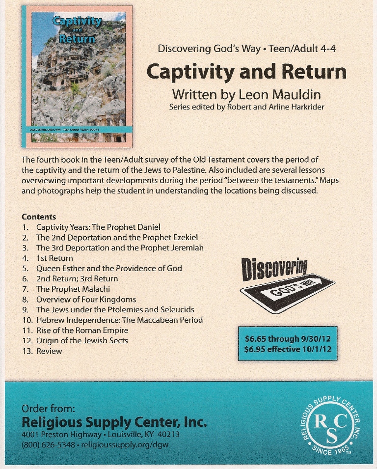
The book is 118 pages, and has 13 lessons. It is illustrated with maps, as well as color photos of biblical places and artifacts relating to the places and periods studied. Here is the table of contents:
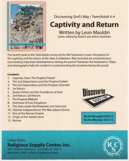
Table of Contents for Captivity and Return, by Leon Mauldin.
The captivity and return can be a challenging period of biblical history. It is hoped that this book will help contribute to a better understanding of these times, as well as provide some background for New Testament studies.
Toll free number for orders is 1-800-626-5348. It is $6.65 through 9/30/2012, and then $6.95. Price does not include shipping.
1 Comment | Bible History and Geography, Bible Study, Biblical Interpretation, Israel, Old Testament, photography, Resources, Uncategorized | Tagged: class curriculum | Permalink
Posted by Leon Mauldin
September 13, 2012
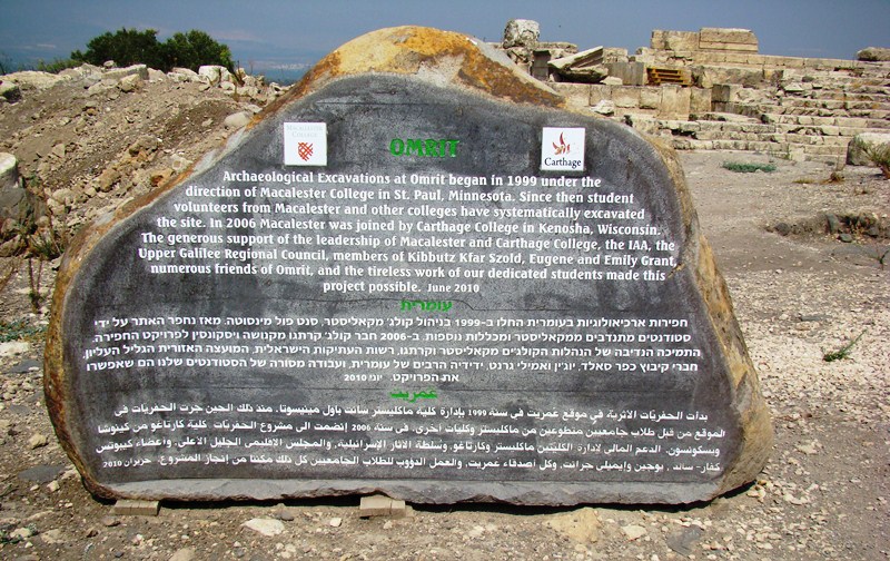
Archaeologists have determined there were three building phases at Omrit: first, the temple built by Herod the Great, second, the temple built probably by Trajan (AD 98-117), and third, an industrial complex to the north constructed in the Byzantine period.

Entrance to Omrit. Photo by Leon Mauldin.
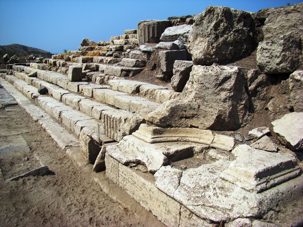
Here you can see the steps leading up to the temple. This site has been identified as a location for Imperial Cult Worship.

Steps to Imperial Temple at Omrit. Photo by Leon Mauldin.
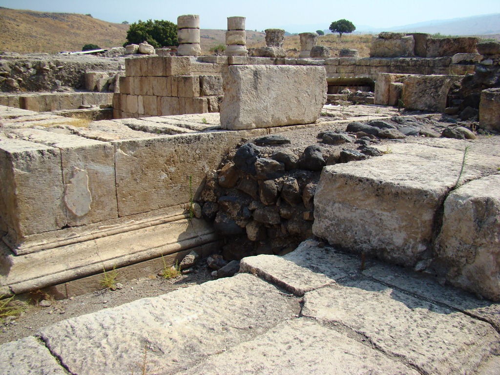
This photo shows the southwest corner of the temple. The large stones horizontally placed at center have been identified as Herodian. Herod was a politician and he overtly courted the favor of the Emperor Augustus.

Section of Herodian stones in Omrit Temple. Photo by Leon Mauldin.
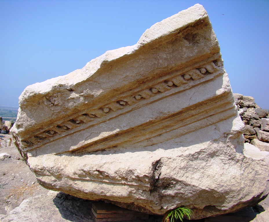
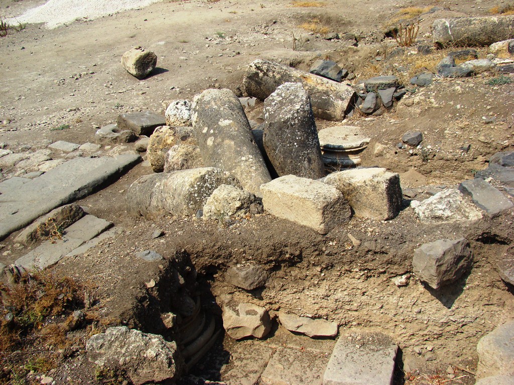
The site abounds with interesting architectural fragments.
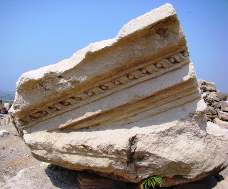
Architectural fragment at Omrit. Photo by Leon Mauldin.
Click on images for larger view.
1 Comment | Archaeology, Bible History and Geography, Bible Study, Israel, New Testament, photography, Roman Empire, Travel | Tagged: Omrit | Permalink
Posted by Leon Mauldin
September 11, 2012
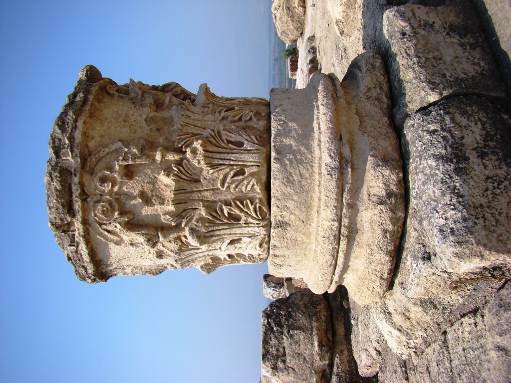
Among the interesting ruins at Omrit are several composite capitals. These are a combination of Corinthians and Ionic orders.
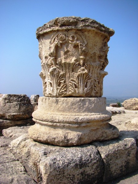
Composite Capital at Omrit. Photo by Leon Mauldin.
Note the beautiful acanthus leaves.
Omrit was destroyed by earthquakes in the 4th and 8th centuries AD.
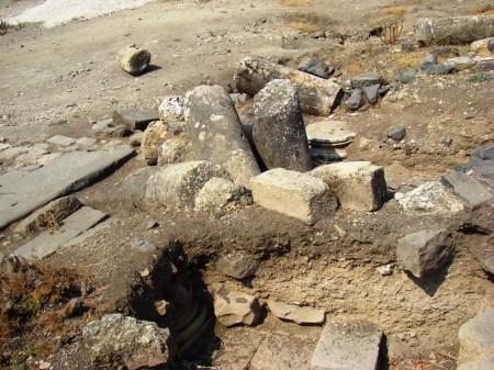
Evidence of Earthquake at Omrit. Photo by Leon Mauldin.
Click on images for larger view.
1 Comment | Archaeology, Bible History and Geography, Bible Study, Israel, New Testament, photography, Roman Empire, Travel | Tagged: Omrit | Permalink
Posted by Leon Mauldin
September 10, 2012
Omrit is located at the foothills of the Hermon Range, and is 2.5 miles from Caesarea Philippi (Banias). It was strategically situated near the crossroads of the Tyre-Damascus and Scythopolis (Beth-shean)-Damascus roads. Impressive remains of a temple devoted to Emperor worship may be seen here.

Herodian Imperial Cult Temple at Omrit. Excavators believe this temple was built by Herod to honor Caesar Augustus. Photo by Leon Mauldin.
I have enjoyed Dr. Carl Rasmussen’s recent posts re: Omrit. He said this was his “favorite site in Israel” (a statement I found very interesting) and just today posted another article on the site, dealing with Emperor worship that took place here in the Bible land. There are interesting implication of Peter’s confession that Jesus was the Christ, the Son of the living God so near a site where the Roman Emperor was worshiped as a “son of god.”
I was glad to visit this site this past September 2011, along with Ferrell Jenkins when he and I made a personal study trip at that time. BTW, Mr. Jenkins is currently directing a tour in Israel. You can follow their journeys here.
Leave a Comment » | Archaeology, Bible History and Geography, Bible Study, Israel, New Testament, photography, Roman Empire, Travel | Tagged: Omrit | Permalink
Posted by Leon Mauldin
August 11, 2012
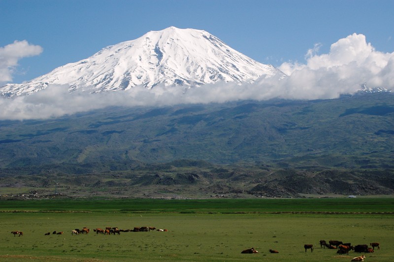
In today’s post we share another photo of Mt. Ararat.

Mount Ararat. Photo by Leon Mauldin.
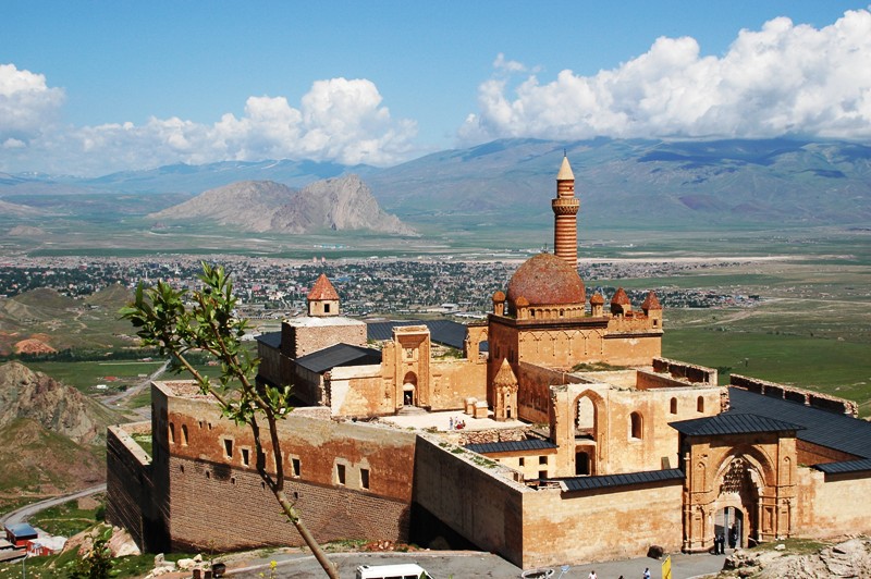
One attraction in the immediate vicinity of Mt. Ararat is Ishak Pasa Palace.

Ishak Pasa Palace. Photo by Leon Mauldin.
Wikipedia has this information:
Ishak Pasha Palace is a semi-ruined palace and administrative complex located in the Doğubeyazıt district of Ağrı province of eastern Turkey.
The Ishak Pasha palace is an Ottoman-period palace whose construction was started in 1685 by Colak Abdi Pasha, the bey of Beyazit province, continued by his son İshak Pasha and completed by his grandson Mehmet Pasha. According to the inscription on its door, the Harem Section of the palace was completed by his grandson Ishak (Isaac) Pasha in 1784.
The Palace is more of a complex than a palace; it is the second administrative campus after the Topkapı Palace in Istanbul and the most famous of the palaces built in recent decades.
The palace is built on a hill at the side of a mountain 5 km (3 mi) east of Doğubeyazıt. It was the last large monumental structure in the Ottoman Empire from the “Lale Devri” period. It is one of the most distinguished and magnificent examples of the 18th century Ottoman architecture and is very valuable in terms of art history. According to the top of the door inscription at the Harem Section it was constructed in 1784 (1199 H.).
As the ground building sits on is a valley slope, it is rocky and hard. Despite the fact that it is at the center of the Old Beyazıt city its three sides (north, west, south) are steep and sloped. There is a suitable flat area only to the east. The entrance of the palace is on that side, and it is also its narrowest façade.
As the palace was built in an age when castles ceased to be special and firearms were developed and were abundantly available, its defense towards the hills on the east is weak. Its main gate is the weakest point in that respect. The structure of the main gate is no different than those seen in the palaces built in Istanbul and elsewhere in Anatolia and has a neat stone workmanship and carving.
The Ishak Pasha Palace is a rare example of the historical Turkish palaces.
The palace was depicted on the reverse of the Turkish 100 new lira banknote of 2005-2009.
Click image for larger view.
5 Comments | Bible History and Geography, Bible Study, Old Testament, photography, Travel, Turkey | Tagged: Ishak Pasa Palace | Permalink
Posted by Leon Mauldin
August 10, 2012
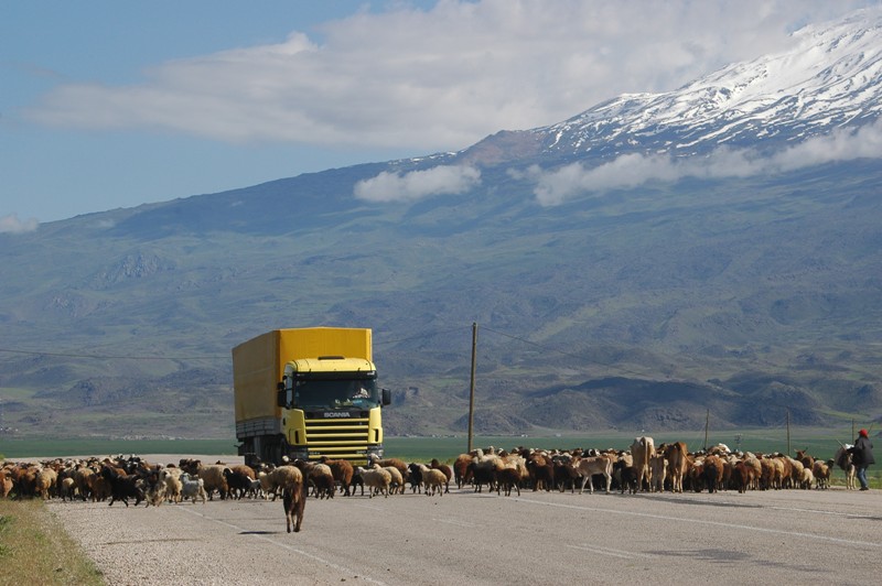
A lot of sheep and cattle are raised in Turkey. They take priority when the shepherd needs them to cross the road. Traffic just has to wait.
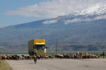
Ararat Traffic Jam. Photo by Leon Mauldin.
You can see Mt. Ararat in background. I love moments like this.
Click image for larger view.
5 Comments | Bible History and Geography, Bible Study, Old Testament, photography, Sheep, Travel, Turkey | Tagged: Ararat | Permalink
Posted by Leon Mauldin
August 9, 2012
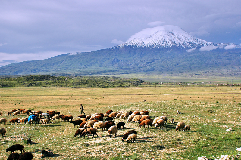
When traveling in the lands where biblical events occurred, I never tire of scenes of sheep with their shepherd. This is certainly true down from the slopes of Mt. Ararat, known as Greater Ararat, located in the mountain range where the ark came to rest.
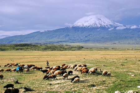
Shepherds with sheep at Mt. Ararat. Photo by Leon Mauldin.
Mt. Ararat reaches 16,945 feet in altitude, and is snow-capped year round.
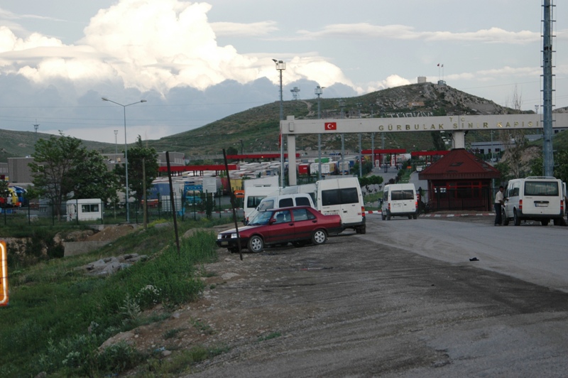
Mt. Ararat is situated near Dogubeyazit, Turkey. This peak is only 10 miles west of the border of Iran, seen in this photo:
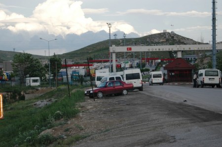
Turkey/Iran border. Mt. Ararat is 10 miles west (to our back) from this point. Photo by Leon Mauldin.
This kind of trip makes for some wonderful memories. Four of us, Ferrell Jenkins, David Padfield, Gene Taylor and myself, made this trip to eastern Turkey in 2007.
Check yesterday’s post for biblical references to the mountains (and kingdom) of Ararat. Ferrell Jenkin’s has made numerous posts on Ararat, including here.
Click on images for larger view.
Leave a Comment » | Bible History and Geography, Bible Study, Old Testament, photography, Sheep, Shepherd, Travel, Turkey | Tagged: Ararat, Iran | Permalink
Posted by Leon Mauldin