A scheduled study for today includes 1 Kings 19, the chapter which follows the triumph on Mt. Carmel (1 Kings 18) which showed that Elijah was the true servant of God, and Yahweh was the true God; Baal was nothing! But in 1 Kings 19, a discouraged Elijah leaves Jezebel & Ahab’s jurisdiction (northern Kingdom of Israel) and travels hundreds of miles south.
1 Kings 19:3 notes that he first traveled as far as Beersheba, which was the southernmost extent of Judah’s border.
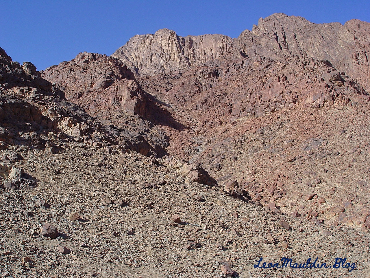
After some food and rest, Elijah continued his journey down to Mt. Sinai, here designated as “Horeb, the mountain of God” (1 Kings 19:8). Earlier at Mt. Sinai when God brought Israel out of Egypt by His servant Moses, He gave the Israelites the 10 Commandments (along with the other laws and ordinances) to Israel. (Note rendering of NLT is “Mount Sinai.”).
Our recent tour visiting biblical sites in Greece and Turkey concluded in the city of Istanbul (Byzantion, Byzantium, Constantinople). Sites on this final leg of our itinerary included the Chora Church, the Yedikule Fortress, the dungeon, the city walls, and one of the underground water systems. (The Fall 2023 issue of Biblical Archaeology Review had a feature article on this city, which it entitled, “Explore Christianity’s First Capital.”)
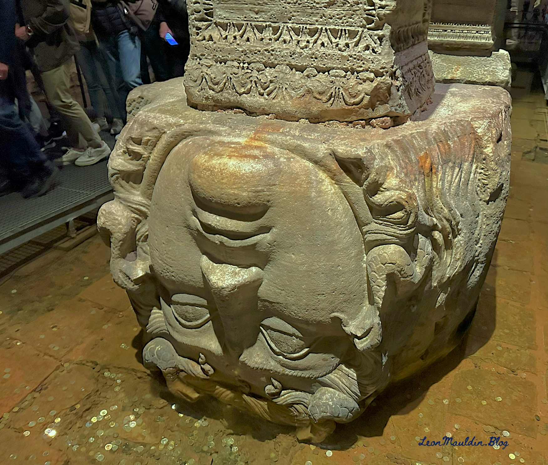
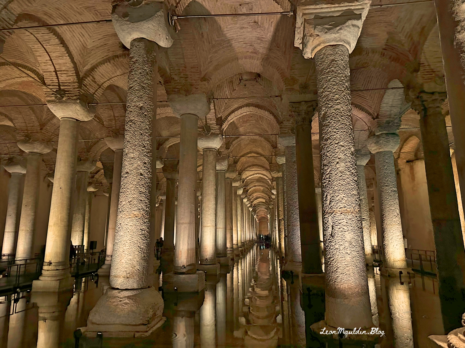
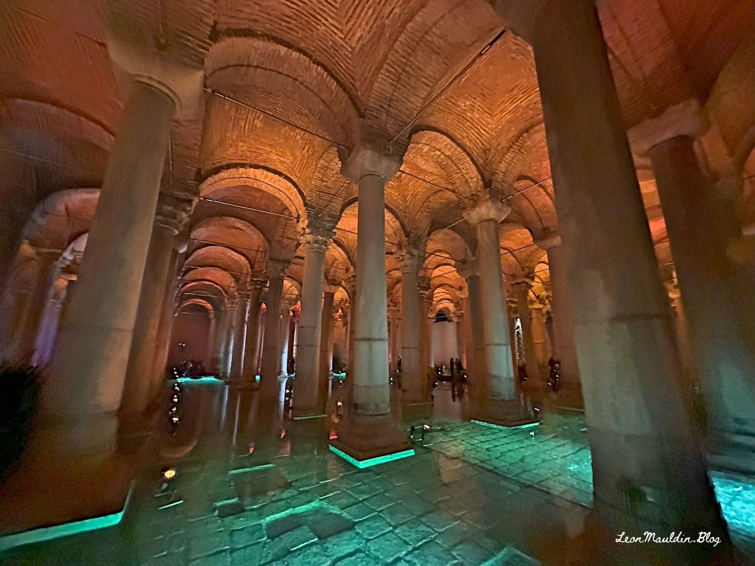
The underground cistern we visited (the Basilica Cistern) is presently beneath Istanbul’s streets (rediscovered in 1545 by Petrus Gyllius). It was built by Justinian I in the 6th century BC, and supplied water to Justinian’s palace, the Hagia Sophia, and other major structures of Constantinople. It has 336 marble columns and holds up to 20 million gallons of water. Justinian believed in “recycling.” He used architectural elements from other buildings, as illustrated here:
Lonely Planet Istanbul notes that “the cistern has played a starring role in innumerable motion pictures (remember From Russia with Love?) and is now one of the city’s best-loved tourist attractions” (p. 25). The authors lists the Basilica Cistern as among “Istanbul’s Top 10” attractions to visit.
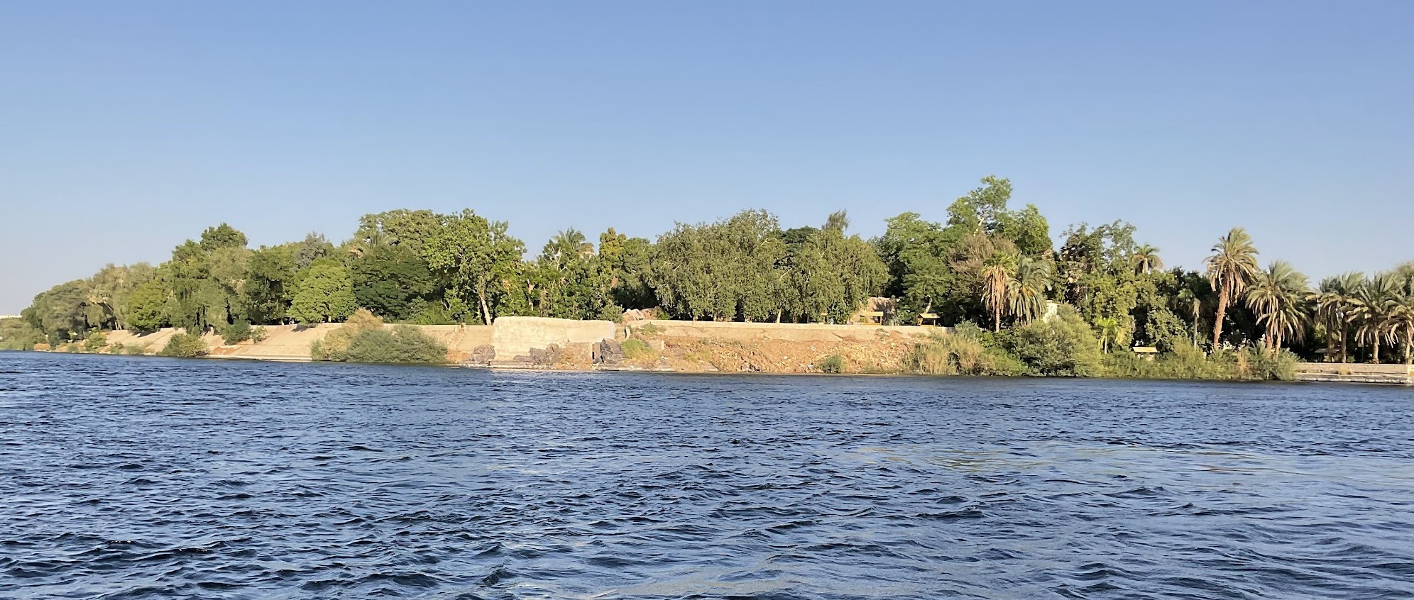
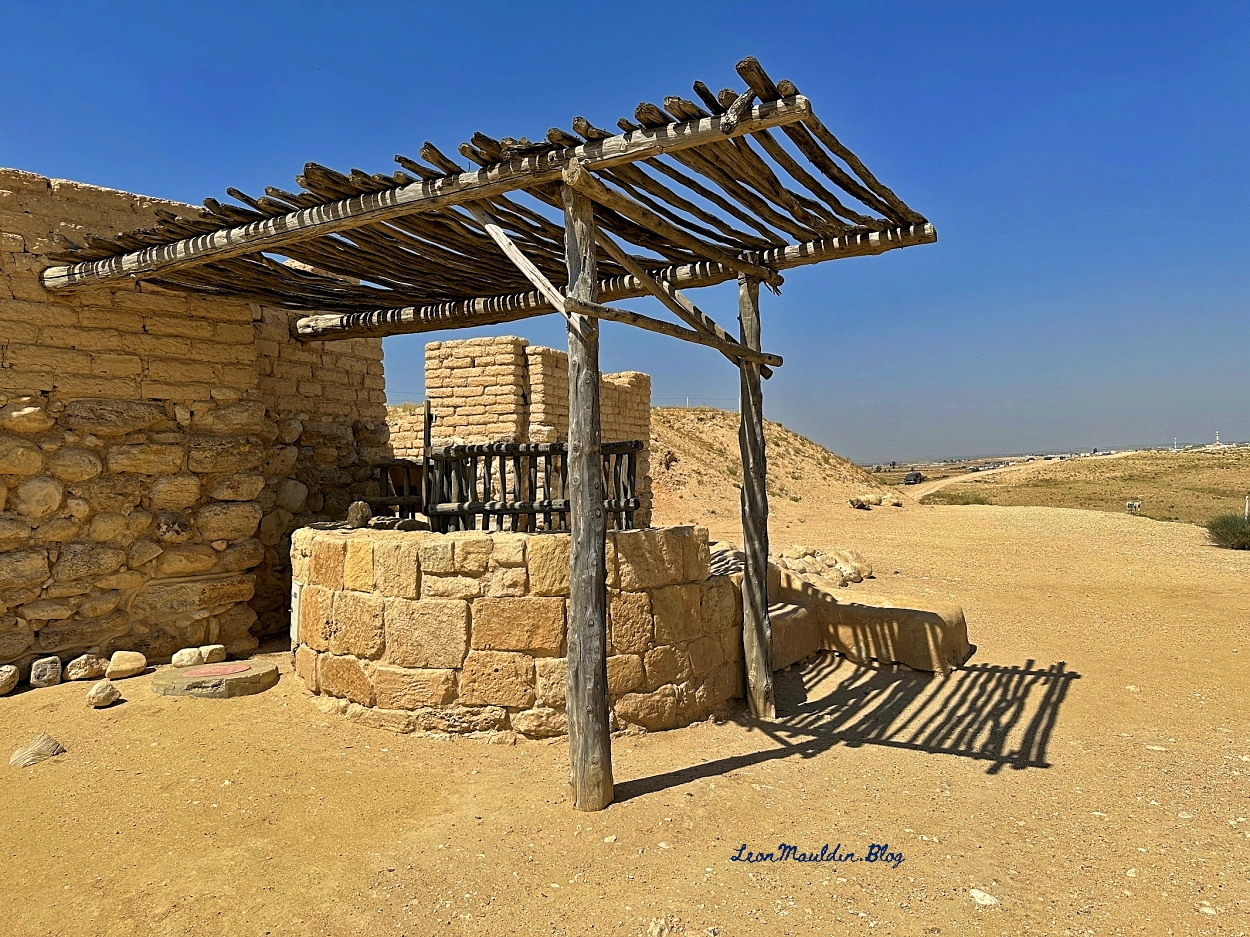
Having just returned from a 13-day tour of Greece & Turkey, I plan to share some of those photos asap. But for now, as I’m preparing for a study on Nehemiah, I wanted to post a photo of Elephantine Island, on the Nile River, as papyri discovered there has a bearing on the timeframe of the book of Nehemiah.
Elephantine Island on the Nile, in Egypt. Photo by Leon Mauldin.
The Lexham Bible Dictionary has this informative entry:
An island located along the Nile in upper Egypt, opposite modern-day Aswan. The island was named Elephantine in Greek, either because it was the center of the ivory trade between Egypt and Nubia or because it is surrounded by black rocks shaped like elephants.
Location and Dates Elephantine is located along the first cataract of the Nile in upper Egypt. The island was important for trade and as a Persian military garrison. Jewish residents lived on the island, and there is evidence that a temple existed for Yahweh worship. Little documentation about the island exists apart from fifth-century BC literary and legal texts—there are also inscriptions and letters documenting Elephantine correspondence with Jerusalem. Excavations of the island have revealed a Persian period complex of multistoried, mud-brick houses with earthen floors. An area with tiled flooring was also discovered and determined to be part of the temple courtyard. It is uncertain how long the Jewish community existed at Elephantine. There are texts that claim the community arrived prior to Cambyses’ arrival in Egypt in 525 BC, but, according to MacLaurin, the community may even date back to Moses’ time (MacLaurin, “Date of the Foundation of the Jewish Colony at Elephantine,” 93–95). Porten argues for a mid-seventh century BC arrival date (Porten, “Settlement of the Jews at Elephantine,” 456–462). Documentation is limited to 495–398 BC, indicating that the community existed on the island during the height of the Persian Empire.
Biblical Relevance The site of Elephantine is not mentioned in the Bible, but the community that lived there during the Persian period provides us with insights about Judaism. The garrison at Elephantine and neighboring Syene—ultimately controlled by Persian imperial officials—was a multicultural colony of Jews, Aramaeans, Egyptians, and Persians. Much like Jews in other parts of the empire, the inhabitants at Elephantine would have interacted with other peoples of the empire while continuing to identify with other Jews. Although they were geographically separated from Jerusalem and Judaea, they called themselves Judaeans (יהודין, yhwdyn)—the Aramaic form of the biblical word for Judaeans or Jews (יְהוּדִים, yehudim). This suggests a desired identification with other Jews and with Judaea. In Elephantine, the temple to the Jewish deity Yahu (a variant form of the biblical names for the God of Israel, Yah and Yahweh) was destroyed in the fifth century BC. According to correspondence with the priests in Jerusalem, the destruction was caused by priests of the Egyptian ram god Khnum—to whom a temple was built on Elephantine during the 18th–19th centuries BC (or the 16th–13th centuries BC). The Jewish community responded by praying, fasting, and putting on sackcloth, which were common biblical responses to disaster. The leaders petitioned Jerusalem to permit the rebuilding of the temple, pointing out that they had made no oil, incense, or burnt offerings in the temple since it had been destroyed—indicating both an awareness of the authority of the Jerusalem priesthood and a shared practice of presenting offerings at an authorized temple. The temple was apparently never rebuilt.
(Source: Whitcomb, K. A. (2016). Elephantine. In J. D. Barry, D. Bomar, D. R. Brown, R. Klippenstein, D. Mangum, C. Sinclair Wolcott, L. Wentz, E. Ritzema, & W. Widder (Eds.), The Lexham Bible Dictionary. Lexham Press.).
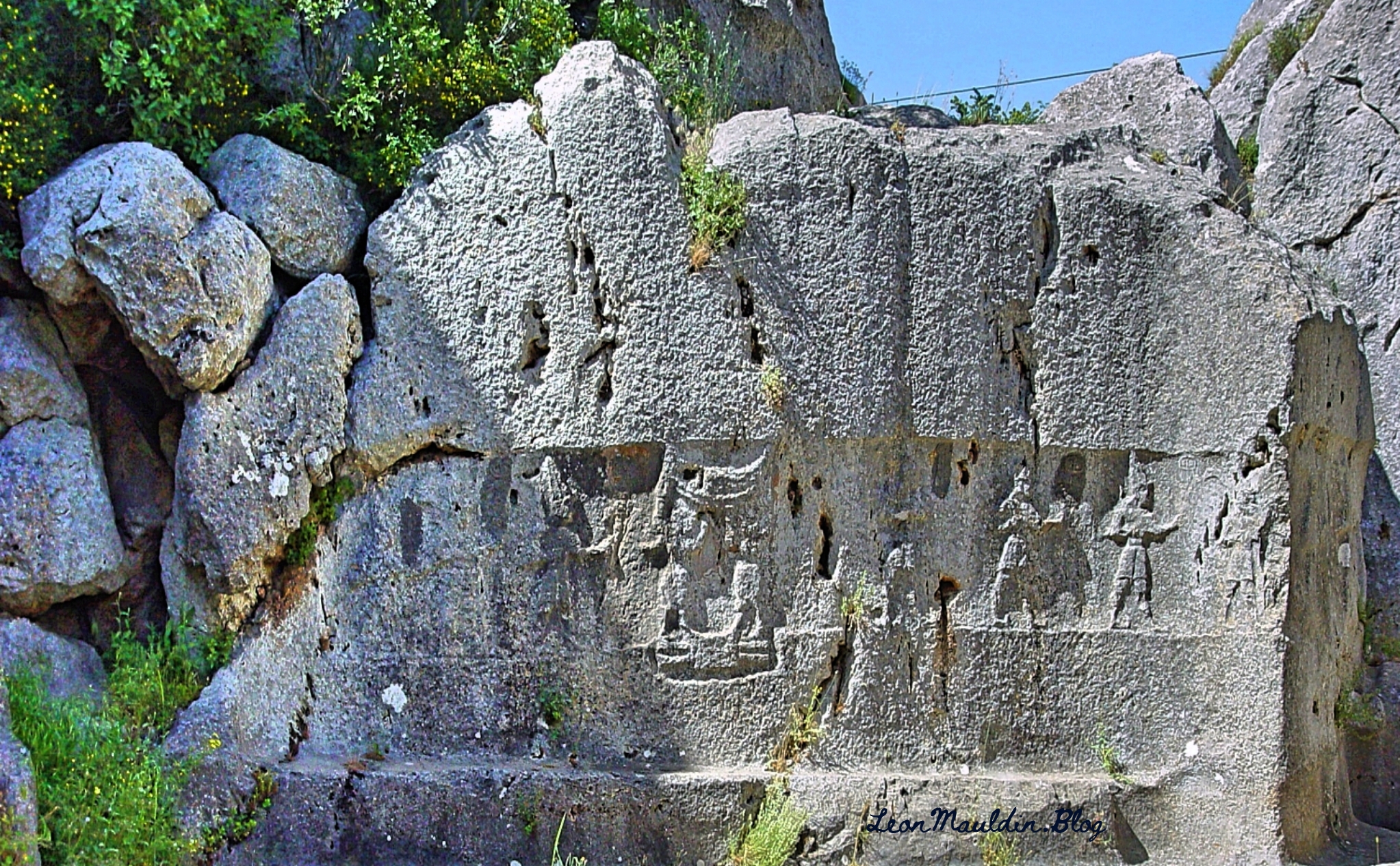
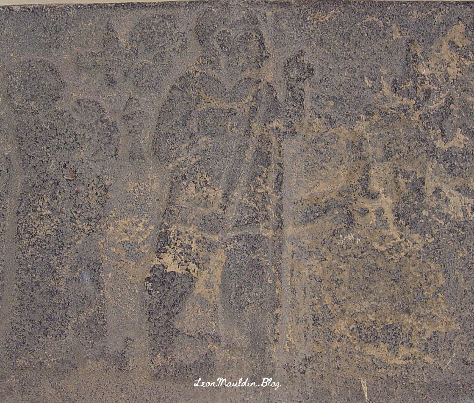
Yazılıkaya is an open-air rock sanctuary located about 1 mile NE of the Great Temple of Hattuşa, in the heart of Hittite country (New Kingdom). It consists of two chambers (A and B) formed inside a group of rock outcrops.
Hittite King Tudhaliya IV reigned 1245-1215 BC (Middle Chronology), or 1237-1209 BC (Short Chronology).
Trevor Bryce writes:
This renovation of the city was the inspiration of King Hattusili III (c. 1267–1237 B.C.), though his son and successor, Tudhaliya IV (c. 1237–1209 B.C.), did most of the work. Not only did Tudhaliya substantially renovate the acropolis; he more than doubled the city’s size, developing a new area lying south of and rising above the old city. In the new “Upper City,” a great temple complex arose. Hattusa could now boast at least 31 temples within its walls, many built during Tudhaliya’s reign. Though individually dwarfed by the enormous Temple of the Storm God in the “Lower City,” the new temples left no doubt about Hattusa’s grandeur, impressing upon all who visited the capital that it was the religious as well as the political and administrative heart of the Hittite empire.
Tudhaliya also constructed massive new fortifications. The main casemate wall was built upon an earthen rampart to a height of 35 feet, punctuated by towers at 70-foot intervals along its entire length. The wall twice crossed a deep gorge to enclose the Lower City, the Upper City and an area to the northeast; this was surely one of the most impressive engineering achievements of the Late Bronze Age. (https://library.biblicalarchaeology.org/article/the-last-days-of-hattusa/)
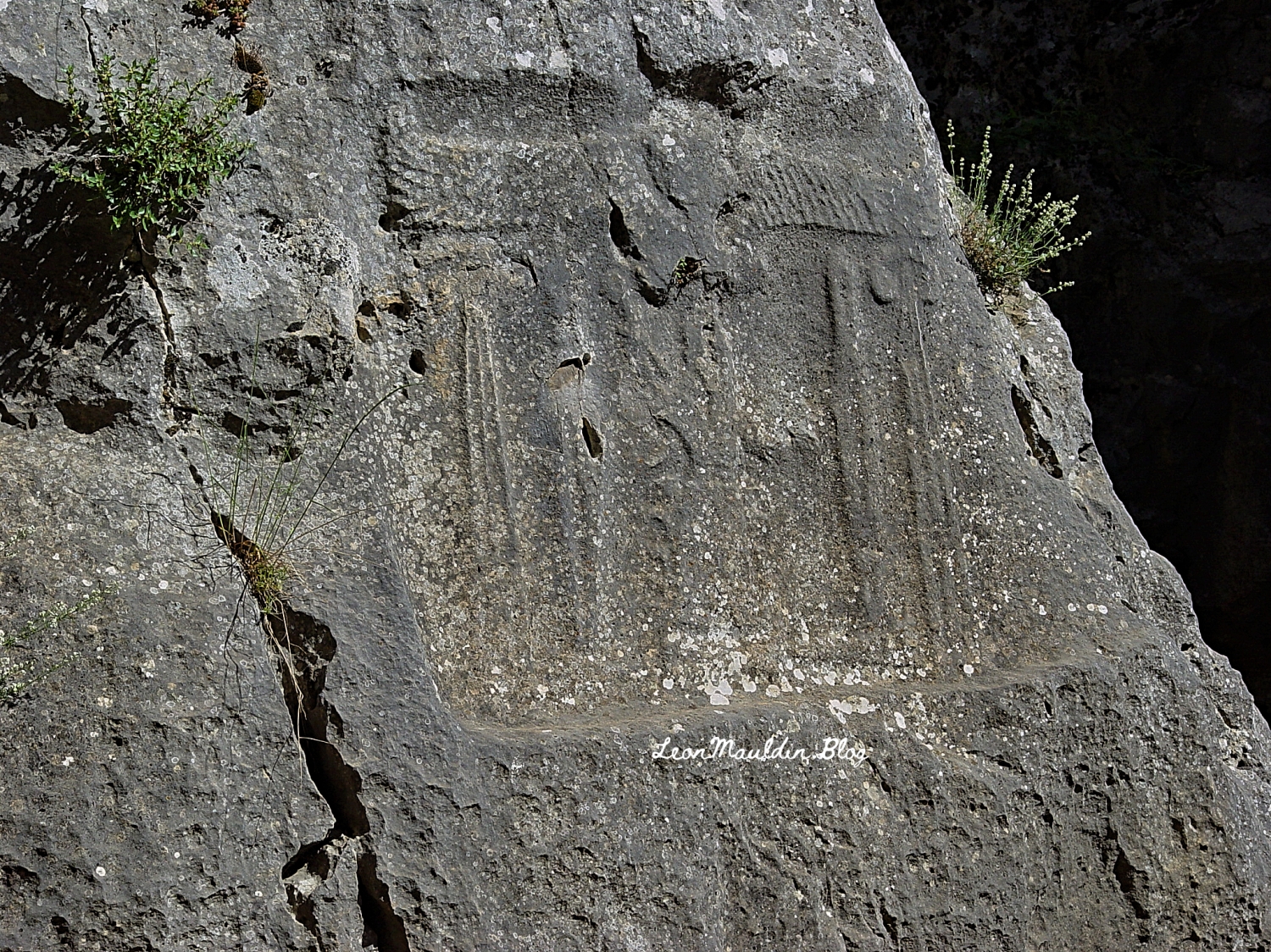
Here inscribed on the rock wall at Yazılıkaya is the cartouch of Great King Tudhaliya IV:
In 2007 I photographed this relief of Tudhaliya IV (dated to 13th century BC), at the Archaeological Museum in Antakya. Antakya is in Turkey, but in New Testament times was Antioch of Syria (Acts 11:20, etc.).
Early Aegean civilization developed on island of Crete. The king was called “minos” and the people of Crete became known as Minoans.
Some of the earliest writing can be traced to the Minoans. They developed three types of writing which included Linear Script A, B, and C. Linear Script B was a combination of Cretan and Greek scripts and is the only one to be translated.
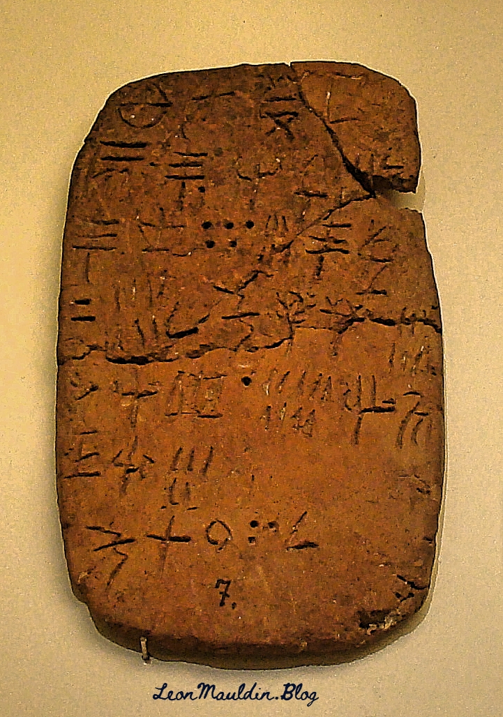
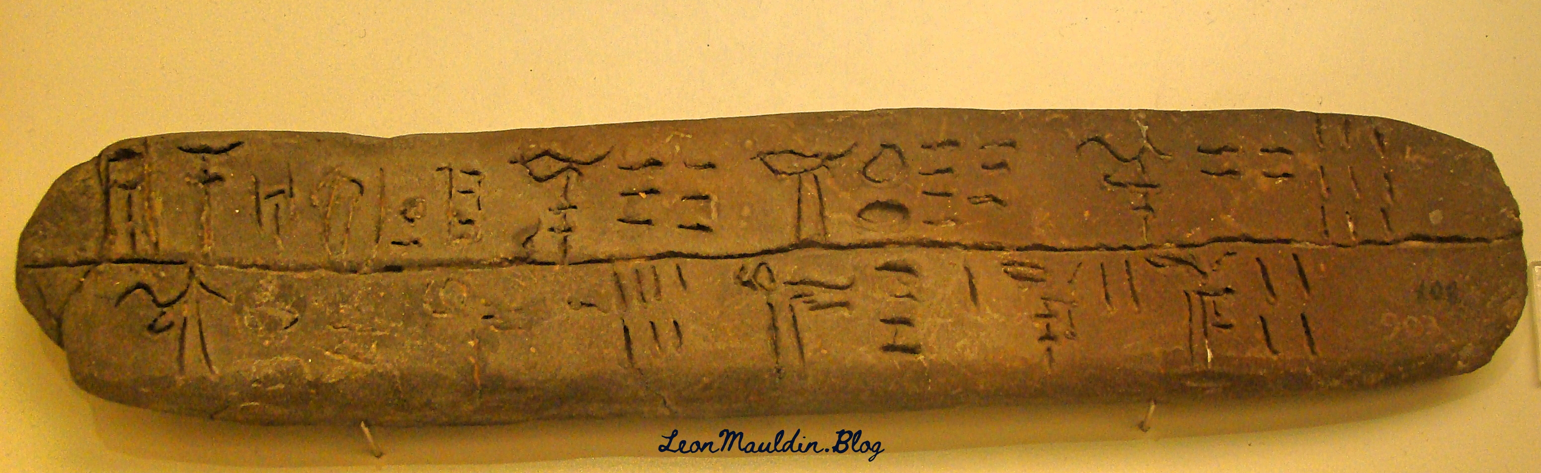
The Heraklion Archaeological Museum in Knossos, Crete, has displays of some of these early scripts.
Linear Script A. This writing system was used by the Minoans of Crete from ca. 1800 to 1450 BC. This writing system was not in the Egyptian and Mesopotamian systems.
Linear Script B. This is script is said to be the earliest attested form of the Greek language. The earliest known examples are dated ca. 1450 BC. This script was deciphered in 1952 by Michael Ventris, who based his work on that of Alice Kober.
In doing some study in the prophet Malachi this morning I came across one of the many biblical references to Esau (from whom descended the Edomites). Malachi 1:2-3 illustrates the necessity of contextual biblical study: “Jacob I have loved, But Esau I have hated.” In short, this had nothing to do with the salvation of individual Edomites, or God’s personal like or dislike of Jacob or Esau, but rather underscores God’s sovereignty in choosing to provide salvation in that descendant of Jacob, Jesus the Christ.
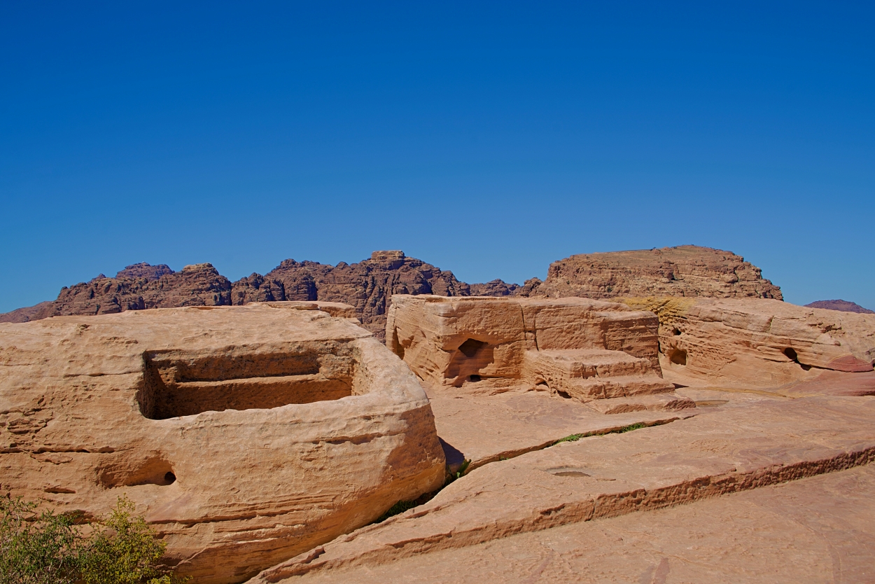
The territory occupied by Edom included Petra. By Roman Times the Edomites had been displaced by a people known as the Nabateans. Petra was the capital of the Roman Province of Arabia.
One of the many interesting archaeological finds at Petra is the High Place, including the altar for sacrifice. The photo here was taken in 2019 by tour member David Deason.
High Place at Petra. Altar at center (and slight right). Photo by David Deason.
The High Place at Petra is one of the best preserved of all such sacred installations in the ancient Near East. Its location is imposing, approximately 3,400 feet above sea level and 625 feet above the temenos. The altar platform was approached by three steps. It is situated about 3 feet above the level of an adjoining courtyard area and is equipped with drains and basins for sacrifices and ablutions.
The Biblical World in Pictures; BAS Biblical World in Pictures. (2003). Biblical Archaeology Society.
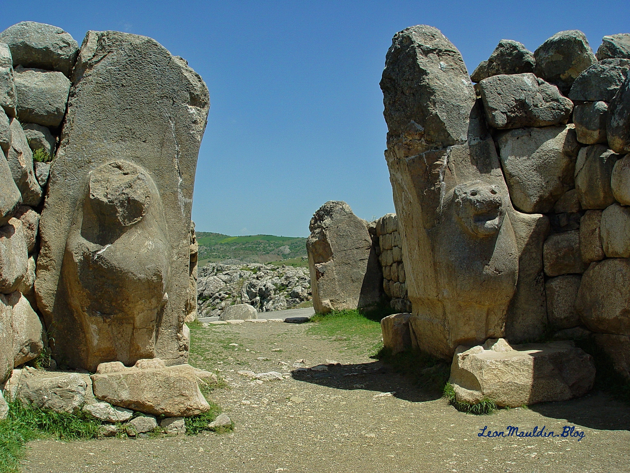
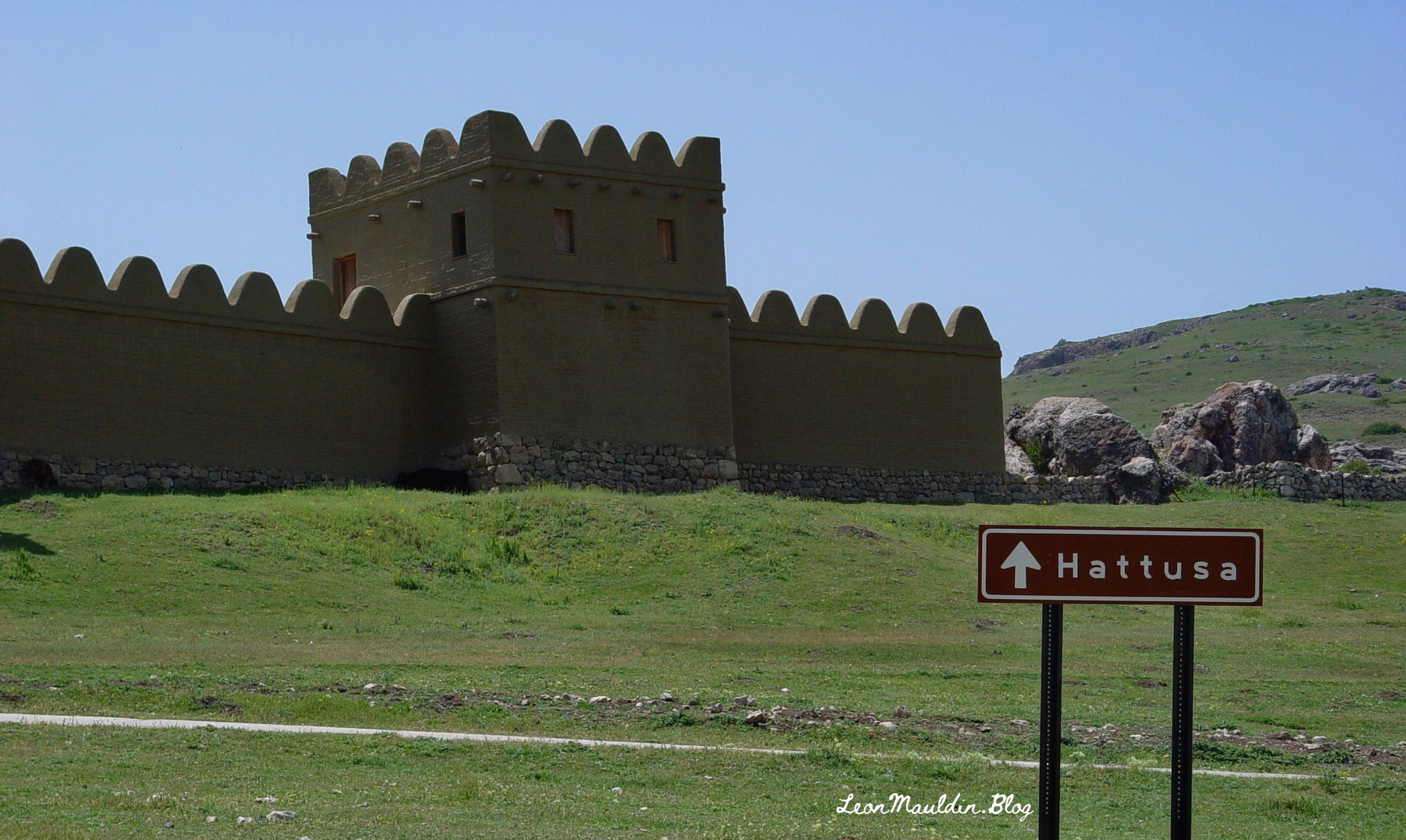
Numerous biblical references are made to the ancient Hittites. Hattuşa was the ancient capital of the Hittite Empire in the Late Bronze Age. Its location is near Boğazkale, Çorum Province, Turkey. One amazing archaeological find is the Lion Gate which features two sculptures of standing lions at the entrance. Previously there would have been an arch above the lions.
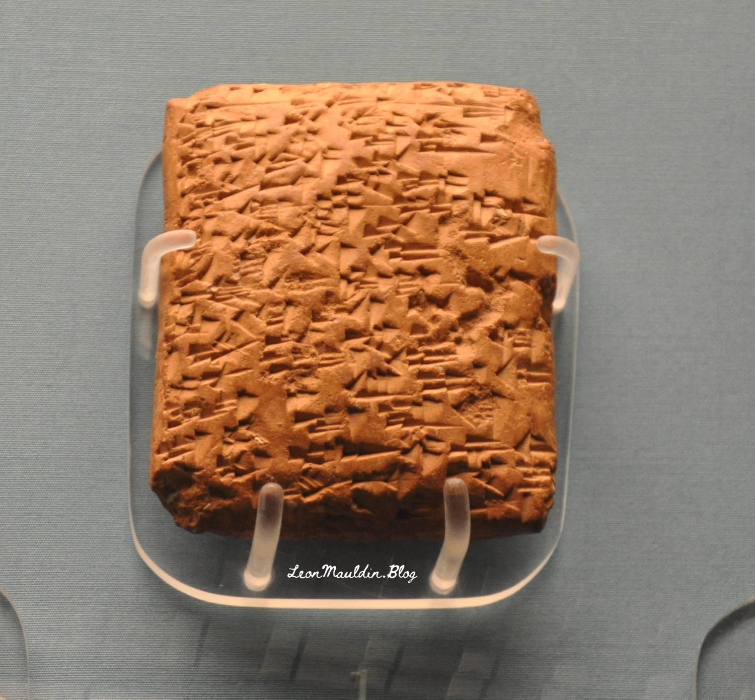
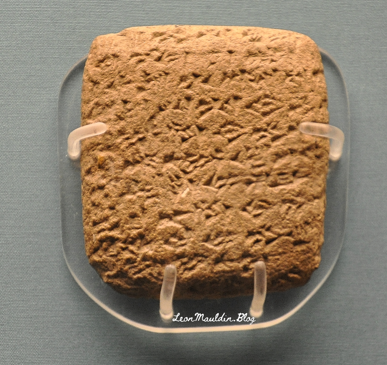
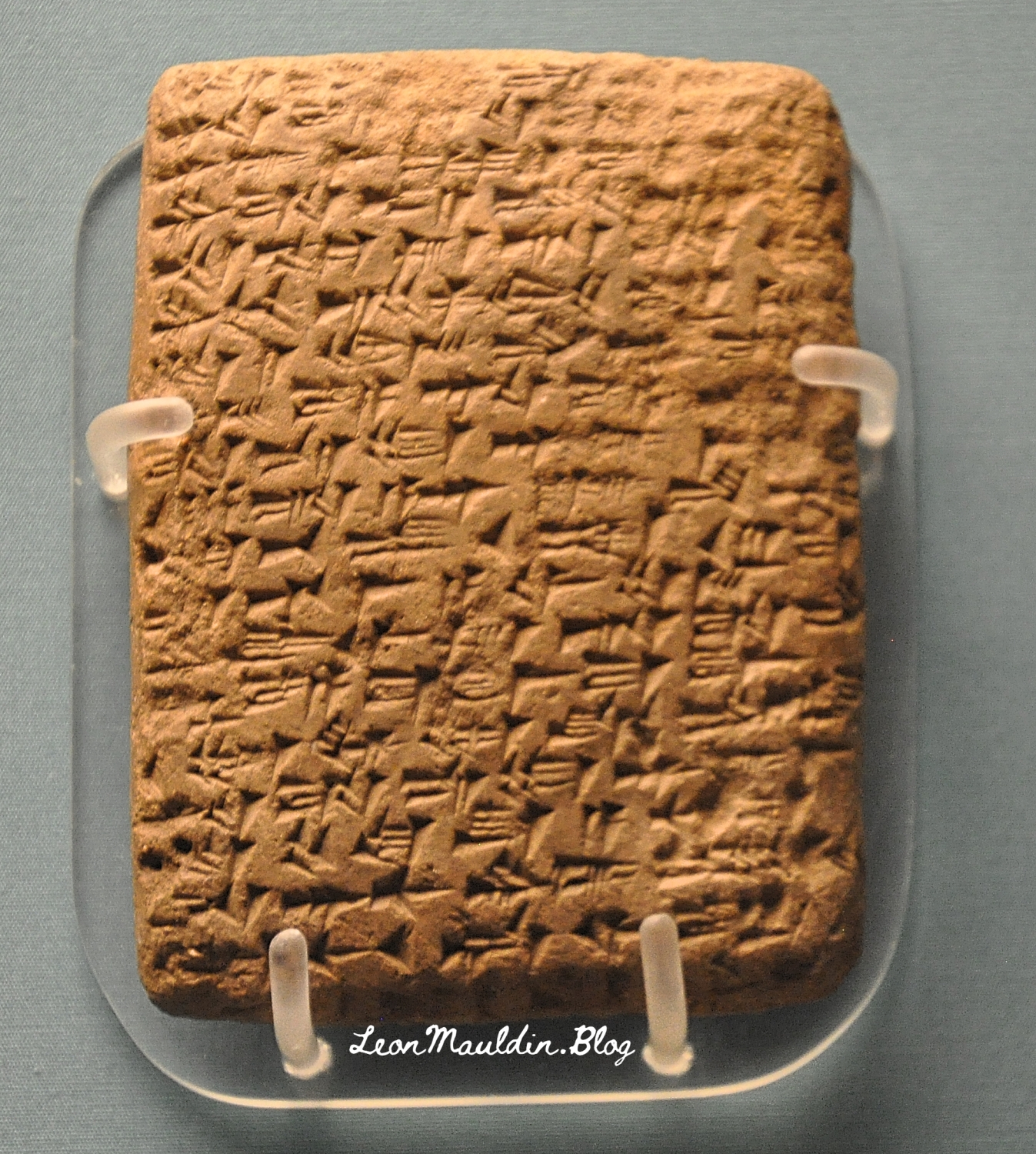
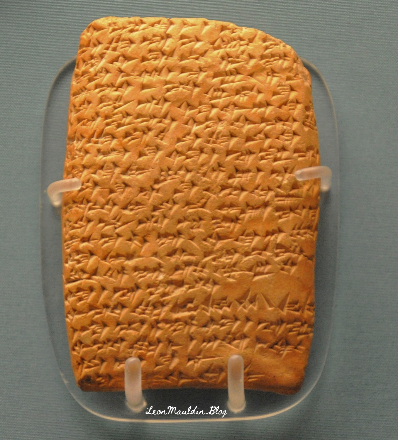
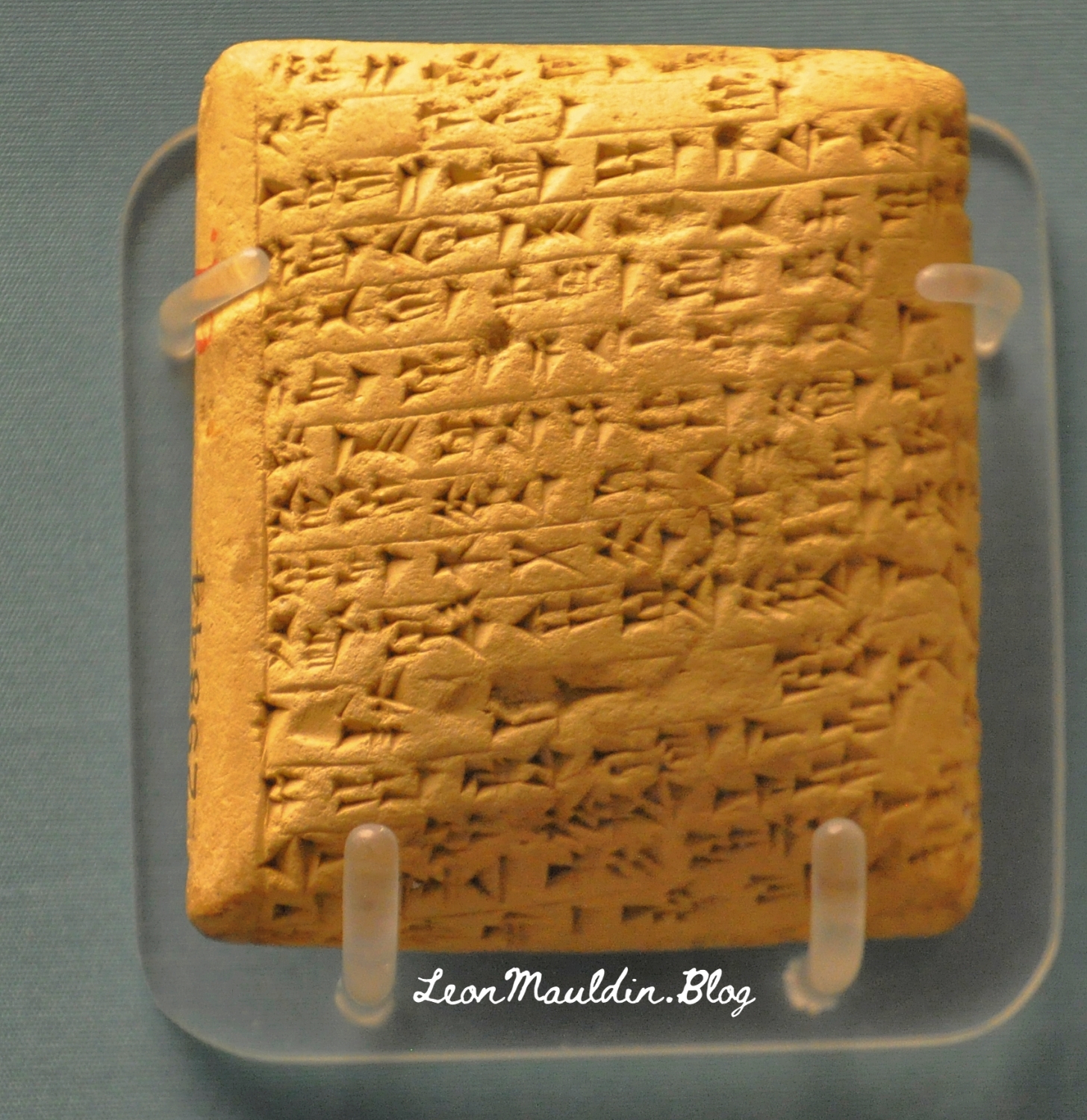
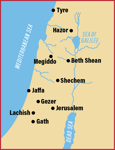
The collection of El-Amarna tablets represent diplomatic correspondence from princes/kings of from varioius parts of the Egpytian Empire during the reigns of Amenophis III, Akhenaton and Tutankhamun. These tablets were found in the ruins of Akhenaton’s (the “heretic” pharaoh) capital at El-Amarna. The British Museum displays some of the El-Amarna tablets from various locations in Canaan, which will be the focus of this post. We will feature tablets from Hazor, Lachish, Gezer, Megiddo and Shechem, all five of which were very important sites in Canaan.
Discovered at the site of Tell el-Amarna in Middle Egypt, these cuneiform documents are letters dating to the mid-14th century BCE that were written in varieties of Akkadian, the lingua franca of the time, by scribes from all over the ancient Near East on behalf of local kings. The letters are commonly divided into two groups: letters from the “greater” powers (the Egyptian, Mitannian, Hittite, Assyrian, and Kassite kings) and letters from the “lesser” powers (smaller kingdoms and city-states from across the Levant, including the land of Canaan). Interestingly, even though the Canaanite rulers were among the least powerful kings writing to Egypt (in fact, they were under Egyptian rule), they left behind the largest number of letters. Source: https://library.biblicalarchaeology.org/article/letters-to-pharaoh-the-canaanite-amarna-tablets/?utm_source=WhatCountsEmail&utm_medium=BHDA%20Spotlight%201-90&utm_campaign=TS%20BAS%20Scholars%20Series%208-21-24
This tablet is from Abdi-Tirshi, King of Hazor. The info sign says that he “reassures pharaoh that he is loyal and is keeping his cities in good order.”
Here is the tablet from Gezer’s king Yapahu, who “begs pharaoh for help in defending his city against raids by the Hapiru.” Many scholars believe that the “Hapiru” here refer to the Hebrews.
Here is the tablet from Biridiya, king of Megiddo. He “accuses the king of Acco of treachery by releasing the captured Hapiru leader, Labayu, instead of sending him to Egypt.”
Mandell went on the say regarding the script of these tablets, “The Amarna Letters were not written in alphabetic or Egyptian scripts. They were written in cuneiform, a wedge-shaped script that was developed in Mesopotamia in the late fourth millennium BCE to write Sumerian and, later, Akkadian. By the Amarna period, ancient people from all over the Near East wrote in this script by impressing a stylus into clay to create wedge-shaped signs” (Ibid.).
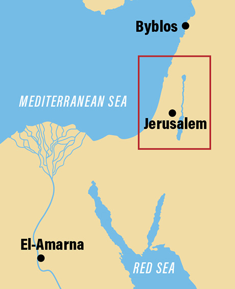
The BAS article also provided a couple of helpful maps.
Map shows the location of El-Amarna relative to Canaan.
Location of El-Amarna in Egypt. Map by BAS.
This map includes the sites of the origin of the tablets we featured above.
Cities in Canaan represented our display of tablets. Map by BAS.
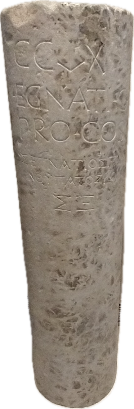
One of the most important roads in the Roman world was the Via Egnatia, which linked Dyrrhachium on the Adriatic Sea, to Byznatium, a distance of 260 miles. From the standpoint of Paul’s travels in Acts, the road crossed through Macedonia westward to Illyricum, linking the Aegean Sea to the Adriatic Sea.
Dr. Mark Wilson writes:
Around 146 BC the governor Gnaeus Egnatius began a road project across the Balkan Peninsula to link the Adriatic to his province of Macedonia on the Aegean Sea. Before 56 BC the road had been extended through Thrace to Byzantium (Cicero, On the Consular Provinces 2.4). Its length was 746 RM (696 mi. [1,120 km]). Travelers wishing to continue east from the port of Brundisium ferried across the Adriaticum (modern Adriatic) either to Dyrrachium or Apollonia (Strabo, Geography 7.7.4,8; he calls the former city by its Greek name Epidamnus). Branches of the Via Egnatia terminated at these Adriatic ports in the province of Illyricum. The remains of a mutatio are found at Ad Quintum (modern Bradashesh). Lychnidos (modern Ohrid) was the last major city in eastern Illyricum. Heraclea Lyncestis (modern Bitola) was the first major Macedonian city, then Edessa where a branch ran south to Berea. After Pella came the provincial capital Thessalonica on the Aegean coast. Eastward the road ran through Apollonia, Amphipolis, Philippi, and back to the coast at Neapolis.
Wilson, M. (2019). The Roman Road System around the Mediterranean (Acts 8:26; 20:1–3; 23:23–33; 28:13–16; Romans 15:19). In B. J. Beitzel, J. Parks, & D. Mangum (Eds.), Lexham Geographic Commentary on Acts through Revelation (pp. 180–181). Lexham Press.
One very important archaeological find on the Via Egnatia is the milestone pictured here above. The inscription is bilingual. It contains the name of the governor of the province of Macedonia, Gnaius Egnatus (served in late 140s BC), who was responsible for the construction of this Roman road. Hence the name, Via Egnatia. The milestone was found near the point where the Via Egnatia crossed the Gallikos River, west of Thessaloniki. This inscription also accurately reports the length of the road to be 260 miles.
The Via Egnatia (like other Roman roads) was built to move the Roman army to the East. But the special significance of this road to Bible students is seen (beginning with the Second Missionary Journey) as Paul (and companions) crosses the Aegean from Troas to Neapolis, and from there gets on the Via Egnatia. Luke, the author of Acts and having joined Paul at Troas, traces the evangelist work from Philippi (Acts 16), passing through Amphipolis and Apollonia (Acts 17:1f; did not preach there) then to Thessalonica, where “a great multitude” (Acts 17:4) were persuaded to become Christians. But because of intense persecution, Paul then left the Via Egnatia and moved southward to Berea, where there was great success (Acts 17:10-15). Paul would have made use of this road again on the Third Journey (Acts 20:1-3).
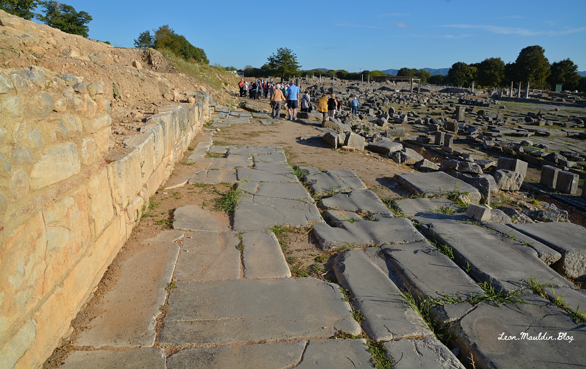
Here is a view of the Via Egnatia in Philippi, looking east. You can also see the agora to your right.
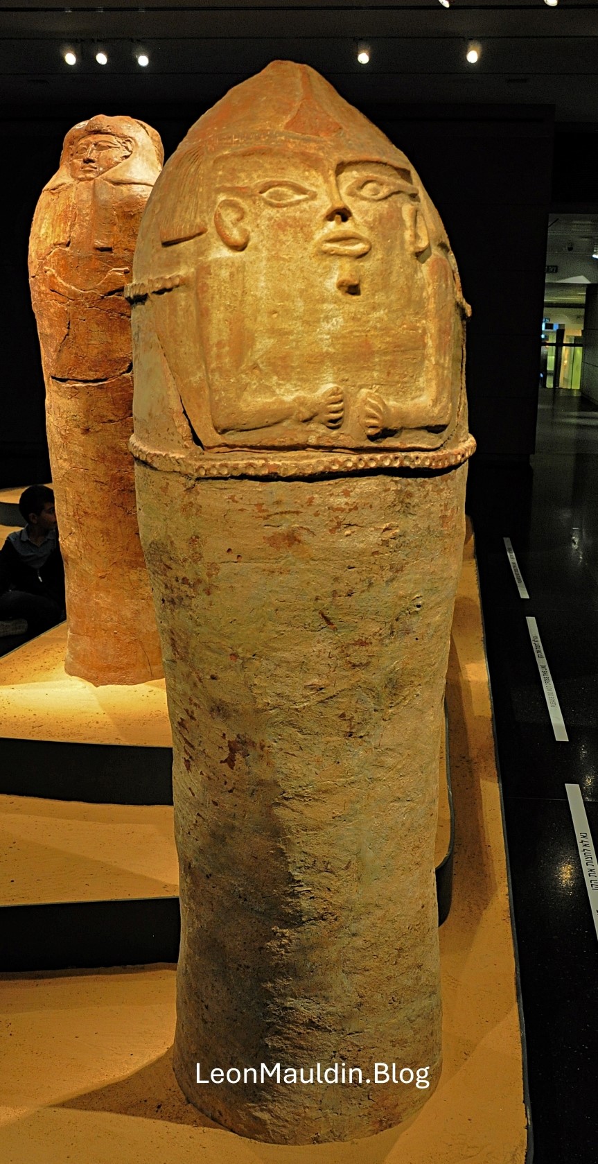
This post shows an Anthropoid Coffin from Deir el-Balah, south of Gaza, one of the cities of the Philistines. Scholars date this artifact to the 13th century BC. It demonstrates Egyptian influence reaching into the SW coast of Canaan. The patriarch Joseph may have been put in a coffin such as this.


 Posted by Leon Mauldin