Bible and Archaeology Site

January 25, 2012

Todd Bolen called attention to Bible and Archaeology-Online Museum, a site that features fifty items in chronological order, beginning with the oldest artifacts first. Images are high resolution, and helpful explanations are included. I recommend it as a handy and helpful resource. Visit the site here.

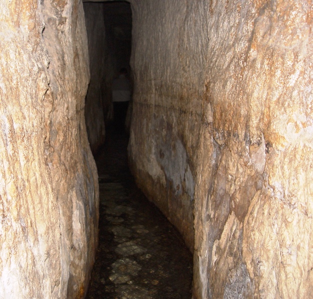
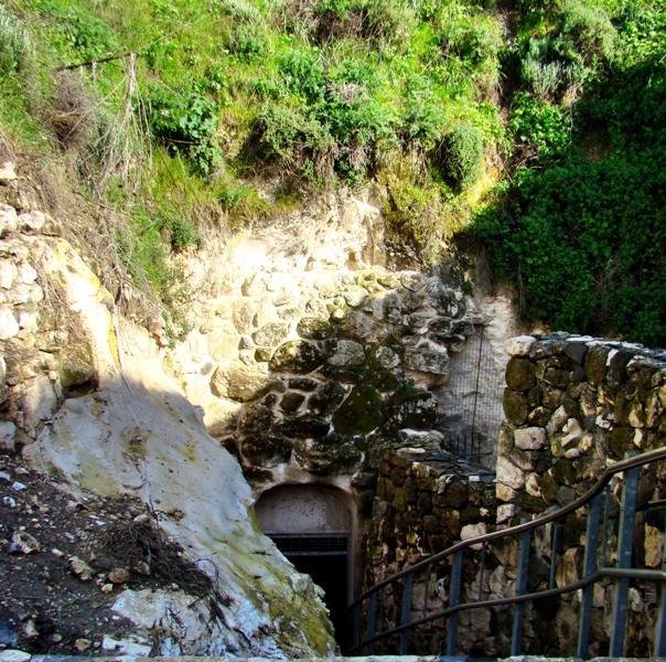
Among the items listed was Hezekiah’s tunnel, dug (701 BC) in anticipation of the Assyrian threat under King Sennacherib. The tunnel brought water from the source, the Gihon Spring, which was outside Jerusalem’s wall, to a pool within the city. Thus the Assyrians would have no water, while the Jewish inhabitants inside Jerusalem would have a ready supply.

Hezekiah's Tunnel in Jerusalem, City of David. Photo by Leon Mauldin.

I previously posted an article on the tunnel here, entitled “The Siloam Inscription.”

Todd’s article may be seen here.


Ancient Street in Tarsus

December 16, 2011

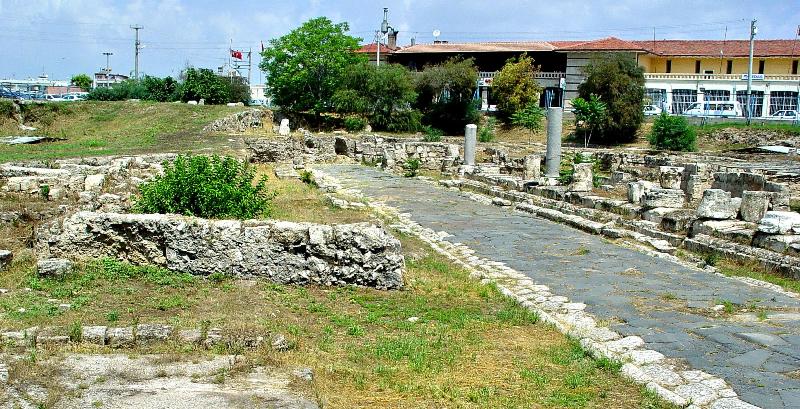
As we further explore what can be seen of ancient Tarsus, one important archaeological point of interest is a street built during the late Hellenistic period, thus predating the Apostle Paul.

Tarsus, Ancient Street. Dates back to the time of Paul. Photo by Leon Mauldin.

The discovery of this street, along with the ancient shops and houses that have been unearthed, is a story that has been often repeated. Work was being initiated for an underground parking deck when this discovery was made. So frequently it is the case that it is in connection with various construction projects that such discoveries are made (see here for “rolling stone tomb” in Israel).

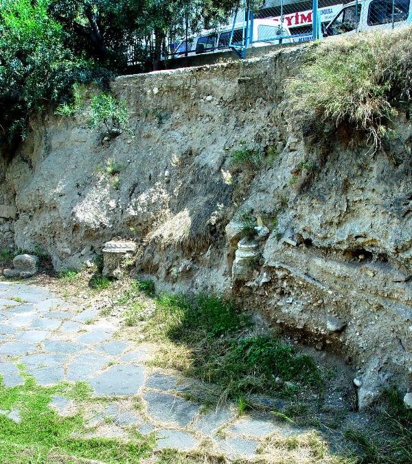
Behind and to our right of our position in the above photo you can get a glimpse of how much silt has built up above street level: 23 feet at this point.

23 feet of silt accumulated above Tarsus Street of Paul's Day. Photo by Leon Mauldin.

This allows you to see the location of the modern city in relation to the ancient ruins below.

Click on image for larger view.


Cities Not Taken in the Conquest, cont’d., Dor

May 23, 2011

Joshua is the biblical book of the conquest of Canaan, and the fulfilling of the land promise given to Abraham (Gen. 12:7). But Israel failed to follow through as they were commanded, thus leaving the seeds of idolatry in their midst, but also leaving themselves politically and economically thwarted. As we have noted in the last couple of posts, it turns out that those cities mentioned as not being taken or retained were in many, if not most, cases strategic sites, needed for defense or commerce.

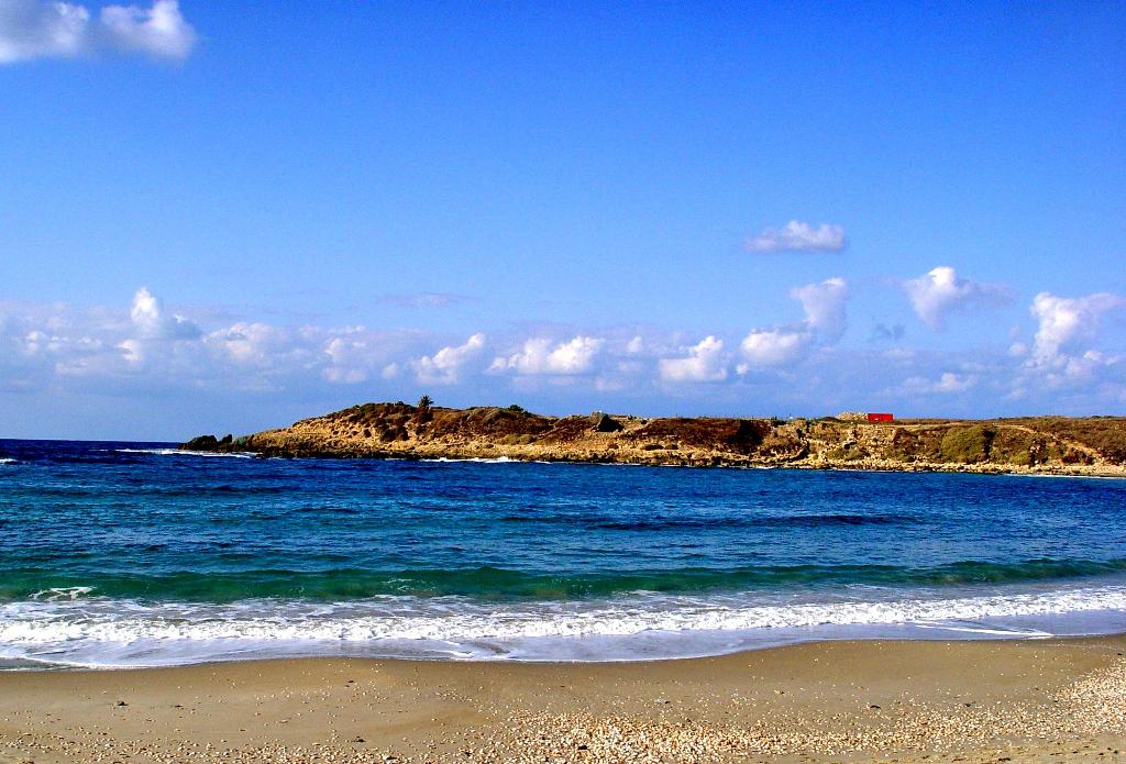
Joshua 17:11-12 mentions Dor in this connection (see also Judges 1:27).
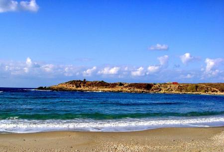
Dor, important harbor not taken during the Conquest. Photo by Leon Mauldin.

In an interesting article in Bible and Spade, author Hela Crown-Tamir writes,

Thirteen miles north of Caesarea. and almost equadistant from Haifa, Dor was a flourishing port and international commercial center throughout the Biblical period. The excavators note four distinct civilizations at Dor: the Canaanites, the Sikil Tribe of Sea Peoples, the Phoenicians, and the Hellenistic-Roman culture. With artifacts from Old Testament Egypt to Napoleon’s cannons found here and displayed at the Dor Museum, the site was inhabited throughout the Biblical period. This coastal city is a perfect illustration of treasures hidden in the sand.

Canaanites first settled Dor during the Middle Bronze Age (2000 BC). While the city was part of Manasseh’s tribal inheritance, the Sikils of the Sea Peoples settled here during the Iron Age (1150–1050 BC). They were followed by the Phoenicians, descendants of the Canaanites, from the 11th century BC on. They inhabited Dor during the Israelite, Assyrian. Babylonian. Persian, and much of the Hellenistic periods.

Finds from the late Bronze Age (1500–1200 BC) at Dor indicate it was exceedingly rich with far-flung international connections. Throughout most of the Old Testament, Dor was one of the important harbor towns along the country’s Mediterranean coastline.

It was from the west, by sea. that the Sikils came to Dor. Possibly coming from as far away as the island of Sicily, this tribe of Sea Peoples made the port city of Dor their home. During the Phoenician occupation, masters of the eastern Mediterranean, the port city rivaled the four major Phoenician cities in size and importance. The excavators are correct in calling Dor “Ruler of the Seas.” ( 2001, Vol. 14, No. 1, P. 12).

Note the portions in the above text with bold print (emp. mine): Reference to the Bronze Age of 1500-1200 BC fits the time period referenced in Joshua, with the conquest occurring about 1406 BC.  Note that Dor is described as having “far-flung international” connections. Also, the “Ruler of the Seas.” Again it would seem that an understand of these facts regarding Dor would be helpful in appreciating the significance of those verses which inform us that Israel did not possess this very important location.

That would change by the time of Solomon. King Solomon divided the land into twelve districts with twelve governors “who provided food for the king and his household: each one made provision for one month of the year” (1 Kings 4:7). v. 11 goes on to list “Ben-Abinadab, in all the regions of Dor; he had Taphath the daughter of Solomon as wife. Thus Dor became the capital of one of Solomon’s administrative districts.

By the way, I am currently in Chipley, FL., conducting a 6-day Gospel Meeting. Wesley Webb is the local preacher here. It always great to see old friends. Waltina Shoraga is our host this week. She was living in Waycross, Ga., and I was preaching in Blackshear when I first met her, in 1973.


Megiddo Stables

April 17, 2011

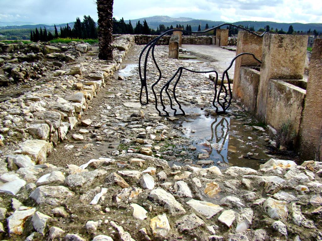
Another interesting discovery at Megiddo is the area which many believe were used for horse stables. The area seen in this photo is sometimes called “Solomon’s stables,” though many believe this should be dated a bit later to the time of King Ahab.

Stables at Megiddo. Photo by Leon Mauldin.

You can see the metal outline of a horse in our photo. Some suggest this site may have been used for barracks, market places, storage facilities, or other usages.

Click on photo for higher resolution.


Megiddo Water System

April 16, 2011

It would be hard to overemphasize the importance of the city of Megiddo. We have referenced the strategic location in our two previous posts. Crucial battles were fought here.

Excavations conducted at Megiddo have been “large and extensive,” and include the efforts of the German Society for Oriental Research (1903-1905), the Oriental Institute of Chicago (1925-1939). Excavations were interrupted with the outbreak of WWII, but were renewed by the Institute of Archaeology at the Hebrew University of Jerusalem (1960, 1961, 1966, 1967, and 1971) under the leadership of Y. Yadin (The New Encyclopedia of Archaeological Excavations in the Holy Land, Vol. 3, pp. 1005-1005).

More recent excavations have been undertaken by Tel Aviv University, with Pennsylvania State University as the senior American partner (ibid. Vol. 5, pp. 1944ff.).

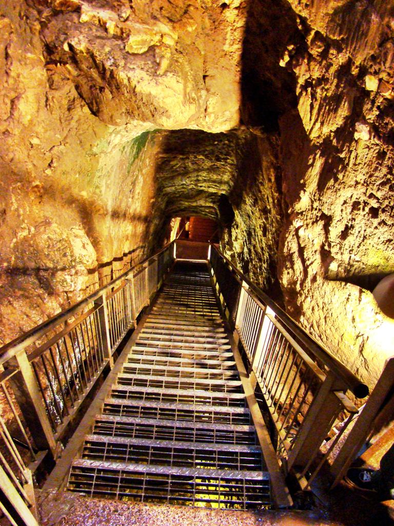
Among the more interesting discoveries is Megiddo’s water system. A 70 meter tunnel hewn through rock led down to the spring.

Megiddo. Tunnel to city spring. Photo by Leon Mauldin.

This dates back to the time of Israel’s king Ahab (874-853 BC). Prior to this engineering feat, it was necessary to go outside the city walls to access the spring.

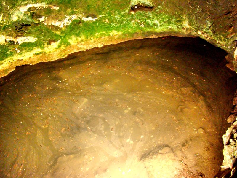
Megiddo Spring. Citys water supply. Photo by Leon Mauldin.

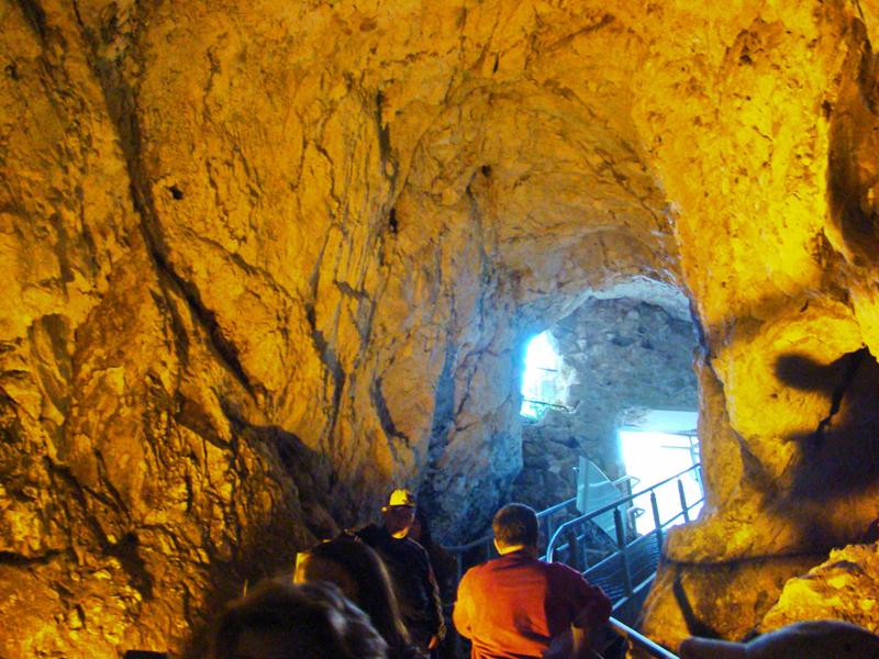
Here is a view from going up from the spring as you exit:

Megiddo. Exit from spring. Photo by Leon Mauldin.

And finally, a view back to the exit of the spring.

Megiddo. Outside Water System Exit. Photo by Leon Mauldin.

In our next post we plan to feature the stables of Megiddo.


Canaanite Altar at Megiddo

April 13, 2011

Archaeologists have discovered more than 20 layers of occupation at the ancient city of Megiddo.The city was strategically situated on the route that came to be known as the Via Maris, the ancient trade route that connected Egypt with Syria and Mesopotamia.

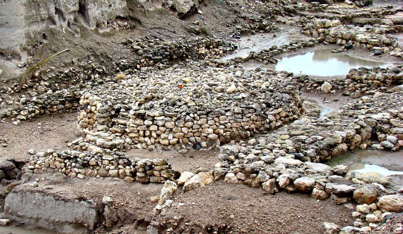
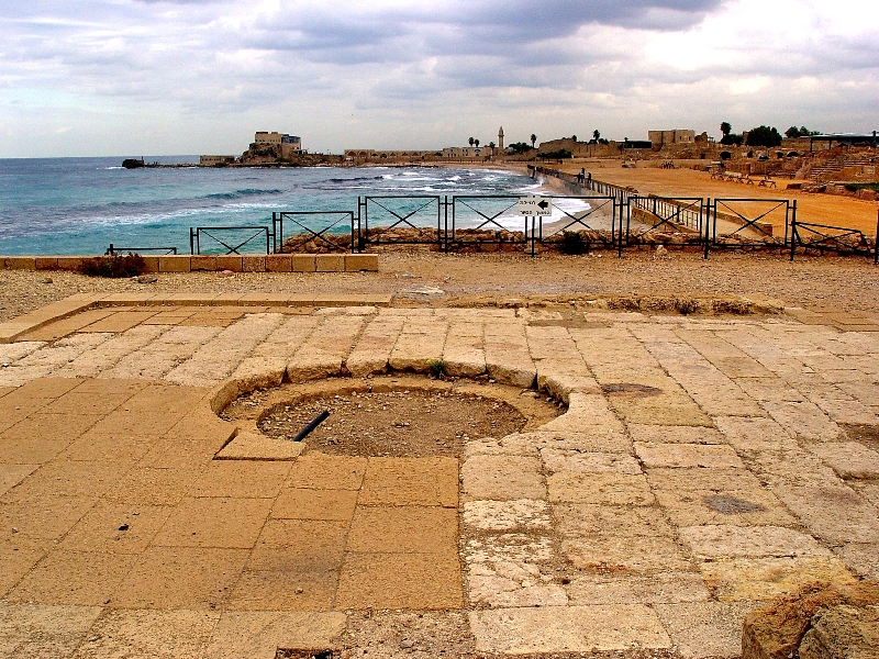
One of the more interesting finds is the circular Canaanite altar. It is nearly 26 feet in diameter and about five feet in height. This would have been used by the Canaanites in their pagan worship, and very likely was the site of human sacrifice. You can see the altar in the center of our photo.

Canaanite Altar at Megiddo. Photo by Leon Mauldin.

This illustrates the kind of thing God had in mind when He commanded Moses, “. . . you are to tear down their altars and smash their sacred pillars and cut down their Asherim” (Ex. 34:13). Likewise, in Deut. 12:3, “You shall tear down their altars and smash their sacred pillars and burn their Asherim with fire, and you shall cut down the engraved images of their gods and obliterate their name from that place.”

In the foreground of the photo and also to the right of the altar you can see the outline of the Canaanite temple.


Megiddo

April 6, 2011

Megiddo is first mentioned in Scripture in Joshua 12:21 as one of the cities captured under the leadership of Joshua and assigned to the tribe of Manasseh (17:11). Nelson’s NIBD speaks of the importance of this site:

Megiddo was situated on the main road that linked Egypt and Syria. Overlooking the Valley of Jezreel (Plain of Esdraelon), Megiddo was one of the most strategic cities in Palestine. All major traffic through northern Palestine traveled past Megiddo, making it a strategic military strong-hold.

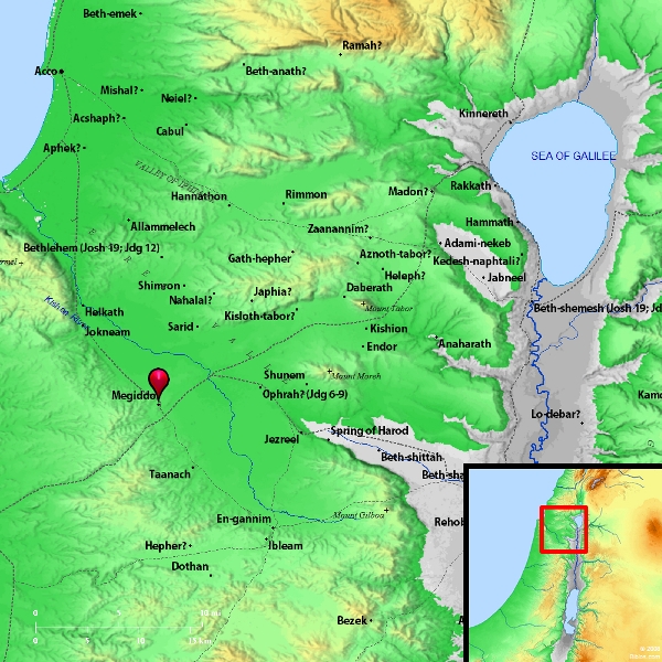
Therefore it was a great loss when Israel subsequently did not retain this city (Judges 1:27), whose location can be seen in the map below:

Megiddo. Map courtesy of BibleAtlas.org

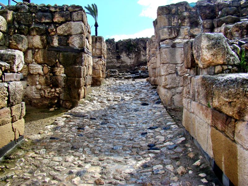
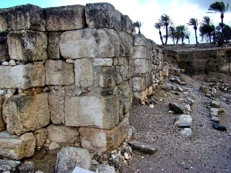
Megiddo was a city of great antiquity. The impressive Canaanite gate can be seen here in our photo:

Canaanite Gate at Megiddo. Photo by Leon Mauldin.

This was one of the cities later fortified by King Solomon (1 Kings 9:15) during the United Kingdom period (Iron Age). The Solomonic gate was here:

Solomonic Gate at Megiddo, a fortress city. Photo by Leon Mauldin.

Crucial battles were fought here or near here.

1.During the time of the Judges, Barak’s forces (Deborah was the Judge and Prophetess) defeated the Canaanite enemy near here (Judges 4-5). From Megiddo one can easily see Mt. Tabor, mentioned in the account (4:14) ; Judges 5:19 refers to the “waters of Megiddo.”

2. In 2 Kings 9:27, Judah’s king Ahaziah died here by the hand of Jehu; the year was 841 BC.

3. Good King Josiah (also of Judah) was killed here by Pharaoh Necho of Egypt; the year was 609 BC.

4. The word Armageddon (Rev. 16:16) is rendered Har-Magedon by the NASB and means The Mount of Magedon, i.e., Mt. Megiddo.

Click on images for higher resolution.


Paul Preached at Caesarea

April 2, 2011

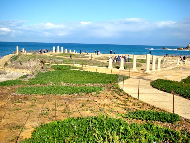
After the third missionary journey, Paul was taken by a military escort from Jerusalem to Caesarea (Acts 23:23ff.). He would be there at Caesarea as a prisoner for two years, although provisions were made for his friends to attend to his needs (Acts 24:23). It is believed that Paul would have been confined in the palace built by Herod the Great, the ruins of which can be seen in our photo.

Governor's Palace at Caesarea. Photo by Leon Mauldin.


BAR informs us,

This ancient building, which we now call the Promontory Palace, was first excavated in 1976 by Ehud Netzer of the Institute of Archaeology of the Hebrew University of Jerusalem. Netzer returned to the site in 1990 and brought in a new American team led by Kathryn Gleason and Barbara Burrell under the auspices of the University of Pennsylvania. Its members are mainly student volunteers, though in 1992 they were joined by a contingent of Israeli workers, most of them new immigrants from Russia (May/June 1993).

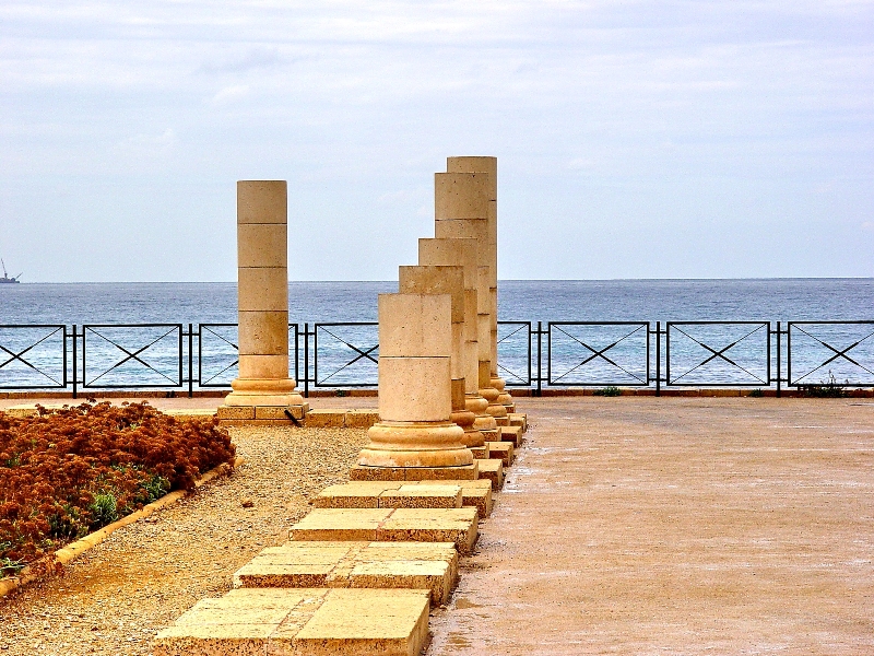
Our previous post featured photos of the swimming pool and mosaics. Below is a more detailed shot of some of the columns.

Palace at Caesarea. Photo by Leon Mauldin.

Paul would have the occasion here to preach before Felix (Acts 24) and his successor Festus (Acts 25) as well as Herod Agrippa II (Acts 26). The audience hall in our photo is likely the site where Paul would have given his defense of the Gospel before these dignitaries.

Audience Hall at Palace at Caesarea. Likely site of Paul's preaching. Photo by Leon Mauldin.


It was here that Paul exercised his right as a Roman citizen–“I appeal to Caesar” (Acts 25:11). Festus responded, “To Caesar you have appealed; to Caesar you shall go” (v.12, ESV).

Click on images for higher resolution.


The Pilate Inscription at Caesarea

March 21, 2011

We arrived safely home Saturday from our Israel tour. It was a great trip and a wonderful opportunity for all of our group to learn more about the geographical setting of the events of Scripture. I agree with James Houston’s observation in his entry, “The Geographical Setting of the Bible”:

The geography of the Bible is relevant to biblical study because the acts of God with men are dealt with in a particular geographical setting and a specific historical context. (The Expositor’s Bible Commentary, Volume 1:, p. 83).

We plan to continue to post some photos from this trip. Today’s photo is that of the “Pilate Inscription,” discovered at Caesarea in 1961.

Pilate Inscription at Caesarea. Photo by Leon Mauldin.

One of the most sensational discoveries at Caesarea was this inscribed stone mentioning Pontius Pilate. Found in a step of the theater, it was originally part of a nearby temple honoring the emperor Tiberius. The stone was moved to the theater to repair a step after the temple fell into disuse. The Latin reads: “Pontius Pilate, the Prefect of Judea, has dedicated to the people of Caesarea a temple in honor of Tiberius” (BAR 08:03 May/June 1982).

John 18 records Pilate’s questioning of Jesus at his “trial:”

33 So Pilate entered his headquarters again and called Jesus and said to him, “Are you the King of the Jews?” 34 Jesus answered, “Do you say this of your own accord, or did others say it to you about me?” 35 Pilate answered, “Am I a Jew? Your own nation and the chief priests have delivered you over to me. What have you done?” 36 Jesus answered, “My kingdom is not of this world. If my kingdom were of this world, my servants would have been fighting, that I might not be delivered over to the Jews. But my kingdom is not from the world.” 37 Then Pilate said to him, “So you are a king?” Jesus answered, “You say that I am a king. For this purpose I was born and for this purpose I have come into the world- to bear witness to the truth. Everyone who is of the truth listens to my voice.” 38 Pilate said to him, “What is truth?” After he had said this, he went back outside to the Jews and told them, “I find no guilt in him.

Pilate really did not want to crucify Jesus. His purpose in scourging Jesus was to satisfy the Jewish leaders and thereby avoid putting Jesus to death (John 19:1-6), but he underestimated their determination. John 19 continues,

7 The Jews answered him, “We have a law, and according to that law he ought to die because he has made himself the Son of God.” 8 When Pilate heard this statement, he was even more afraid. 9 He entered his headquarters again and said to Jesus, “Where are you from?” But Jesus gave him no answer. 10 So Pilate said to him, “You will not speak to me? Do you not know that I have authority to release you and authority to crucify you?” 11 Jesus answered him, “You would have no authority over me at all unless it had been given you from above. Therefore he who delivered me over to you has the greater sin.”

The display in Caesarea is a replica. The original is in the Israel Museum. Click on image for higher resolution.


From Dan to Beersheba

March 17, 2011

Tonight as I write this we are in Beersheba, so we have traveled the biblical “from Dan to Beersheba” that is referenced so many times in Scripture (1 Sam. 3:20, etc.), having been to Dan earlier last week.

Last evening we spent the night at the Dead Sea at En Boqeq, but the internet was down when I was attempting to use it. Yesterday AM before leaving Jerusalem we visited the Wailing Wall. This wall was not part of the temple itself, but was the retaining wall for the temple and the structures on the temple mount.

Wailing Wall in Jerusalem. Photo by Leon Mauldin.

Jerusalem is defined by three valleys: the Kidron, Tyropean and Hinnom. In the above photo we are standing in the Tyropean Valley.

The first several courses of larger stones starting from bottom are Herodian. Jews come here to mourn the destruction of the temple, among other reasons.

Just south of the wailing wall, excavations have reached down to first century street level. There you can see the stones that have been uncovered that were part of the temple buildings, hurled down into the valley during the AD 70 destruction. This photo shows the fulfillment of Jesus’ promise that not 0ne stone would be left upon another, that would not be cast down (Matt. 24:2). He said that this would occur during that generation (v.34).

Temple Stones from AD 70 Destruction. Photo by Leon Mauldin.

After leaving Jerusalem, we went to see Anathoth. This was the site of the city which was home to Jeremiah.

Anathoth, home of prophet Jeremiah. Photo by Leon Mauldin.

We also went to Old Testament Jericho. While there I took a group photo.

Group Photo at OT Jericho. Photo by Leon Mauldin.

We’ve learned a lot on this journey. We are truly blessed.

This morning upon leaving En Boqeq we went to Masada.

Leon Mauldin at Zoar.

En route to Masada we stopped at Zoar for the view. The brook drains down to the Dead Sea. It is not clear if there is any connection between  this location and the Zoar mentioned in Gen. 19:22ff., in connection with the narrative of lot and the destruction of Sodom and its surrounding cities. The mountains just south of this area are called the Mountains of Sodom.

Masada was a Herodian fortress. It was here that the Zealots fled after the Roman destruction of Jerusalem in AD 70. The Romans laid siege to Masada, and in AD 73 broke through the wall. They found the Jews inside chose death by their own hands rather than be captured by the Romans.

Tomorrow is a full schedule of sites from Tel Sheva (Beersheba) working our way up to Joppa, and from then to TLV for our departing flight home, the Lord willing.  Thanks again for following our travels, and for the many kind notes & prayers.

Click on photos for higher resolution.