Ahab’s Water Tunnel at Megiddo

October 16, 2013

Today our group enjoyed a profitable start at Caesarea, located on the Mediterranean coast, capital of Judea during New Testament times. There is so much to see there. Leaving there we ascended Mt. Carmel, one of my personal favorites because so many biblical locations can be viewed from there. There was considerable haze in the air, so that did not lend itself to good photos.

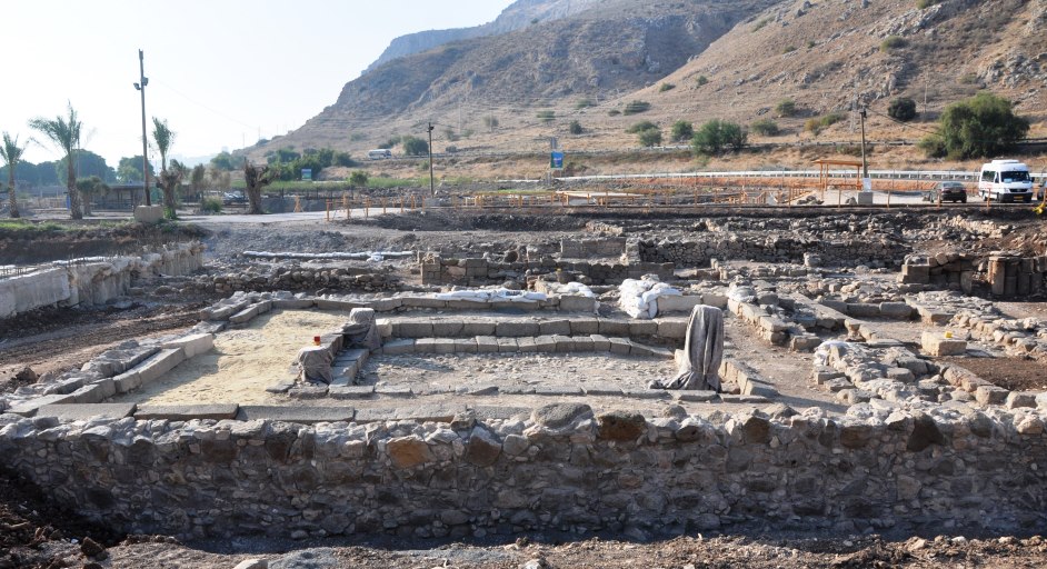
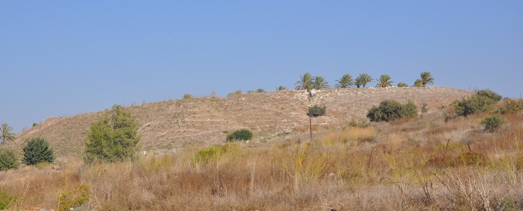
We then proceeded to Megiddo, a very strategic city formerly occupied by the Canaanites (among others) located on the international trade route which connected Egypt to Mesopotamia. Solomon made this one of his fortified cities.

Tel Megiddo. Photo by Leon Mauldin.

Tel Megiddo. Photo by Leon Mauldin.

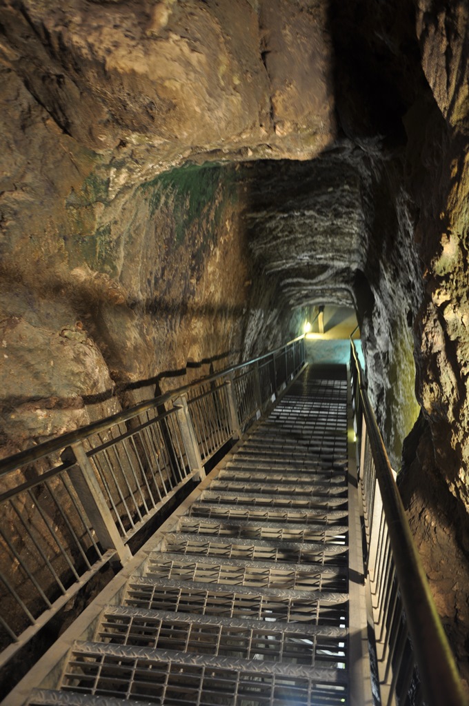
Megiddo was also an important site during the Divided Kingdom period in the days of Ahab, king of Israel. Ahab accomplished an amazing engineering feat of tunneling through solid rock down to the water supply. Our group walked through the tunnel today.

Ahab's water tunnel at Megiddo. Photo by Leon Mauldin.

Ahab’s water tunnel at Megiddo. Photo by Leon Mauldin.

We plan to post more tomorrow. Click images for larger view.


In Netanya, Israel

October 15, 2013

Though Netanya is not a biblical city, it is located on the Mediterranean Coast within the biblical Plain of Sharon. As our bus was transporting our group to Netanya, I noticed a sign which said Ha Sharon, (the Sharon). Texts mentioning Sharon include:

Song of Solomon 2:1 I am the rose of Sharon, And the lily of the valleys.

Acts 9:35 So all who dwelt at Lydda and Sharon saw him [Aeneas, raised from the dead] and turned to the Lord.

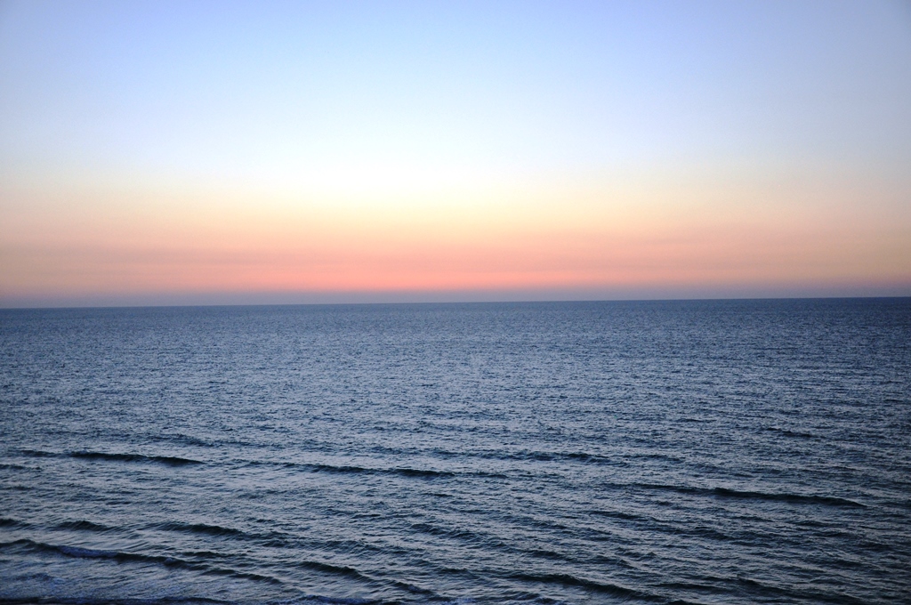
I took this photo just after sunset 2+ hrs. ago.

Natana, located within the biblical Plain of Sharon. Photo by Leon Mauldin.

Netanya, within the biblical Plain of Sharon, facing west. Photo by Leon Mauldin.

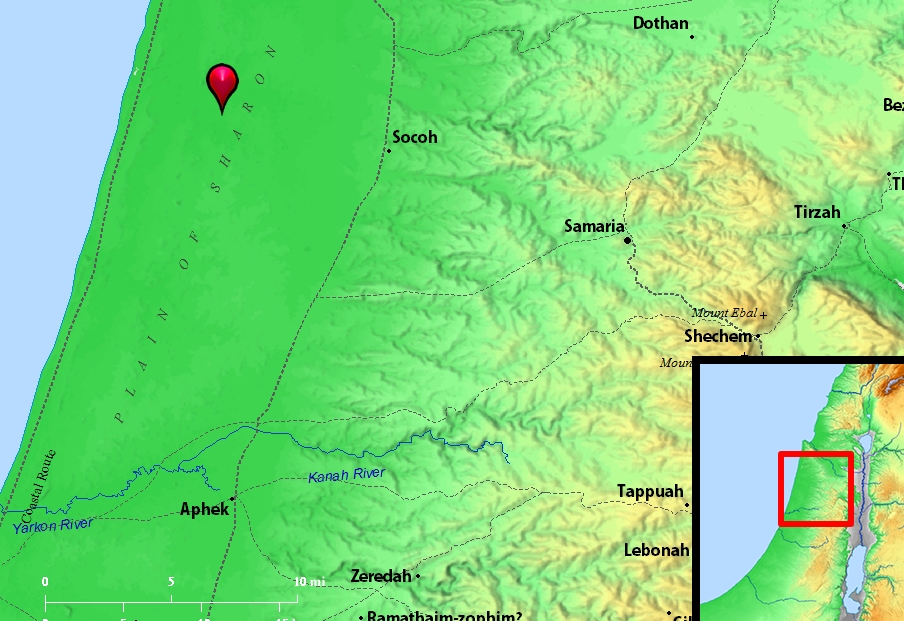
Map shows the Plain of Sharon:

Plain of Sharon. BibleAtlas.org

Plain of Sharon. BibleAtlas.org

Wikipedia has this info re Netanya, and its relation to Sharon:

Netanya (Hebrew: נְתַנְיָה, lit., “gift of God”) is a city in the Northern Central District of Israel, and is the capital of the surrounding Sharon plain. It is located 30 km (18.64 mi) north of Tel Aviv, and 56 km (34.80 mi) south of Haifa, between the ‘Poleg’ stream and Wingate Institute in the south and the ‘Avichail’ stream in the north. Netanya was named in honor of Nathan Straus, a prominent Jewish American merchant and philanthropist in the early twentieth century.

Click on images for larger view.


You May Eat the Wild Goat

September 27, 2013

Under Mosaic legislation, Israel was given strict dietary guidelines. This was for a stated purpose: “For you are a people holy to the LORD your God, and the LORD has chosen you to be a people for his treasured possession, out of all the peoples who are on the face of the earth” (Deut. 14:2, ESV). The dietary restrictions were but one means that YHWH used to mold His people into a holy nation and teach them that they were uniquely His.

Deut. 14:4 lists three domestic animals which could be eaten: “These are the animals you may eat: the ox, the sheep, the goat,” (This follows v. 3 which states, “You shall not eat any abomination.”)

Then v. 5 lists seven kinds of wild animals: “the deer, the gazelle, the roebuck, the wild goat, the ibex, the antelope, and the mountain sheep.” “Some of these animals cannot be identified with certainty.” [1] One thing that obviously makes the text challenging is that three of the seven words are hapax legomena (words that appear only once in a document). The word usually translated “wild goat” (ya’el) is a different word than the one used here (aqqo).

ya’el is found in Psalm 104:18 “The high mountains are for the wild goats. . .”

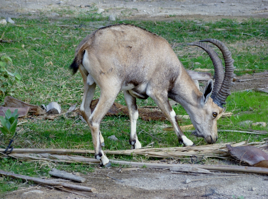
Another interesting text: “When Saul returned from following the Philistines, he was told, ‘Behold, David is in the wilderness of Engedi.’ Then Saul took three thousand chosen men out of all Israel and went to seek David and his men in front of the Wildgoats’ Rocks” (1 Sam. 24:1-2, ESV). Note that the site of Engedi is the location of the Rocks of the Wild Goats. The word Engedi means “spring of a kid,” and is located on the western shore of the Dead Sea. The biblical “wild goat” is still frequently seen there today and is most often identified with the ibex.

Goat at Engedi. Photo by Leon Mauldin.

Goat/Ibex at Engedi. Photo by Leon Mauldin.

See more on the wild goat in Ferrell Jenkin’s posts here and here.

Click on image for larger view.


[1] Christensen, D. L. (2001). Deuteronomy 1–21:9 (Vol. 6A, p. 291). Dallas: Word, Incorporated.


Sarcophagus at Caesarea Maritima

September 23, 2013

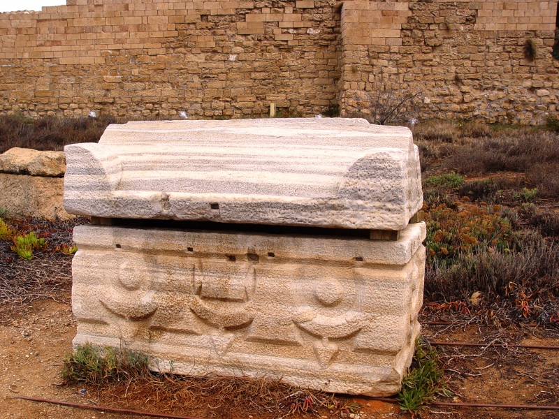
Among the remains near the theater at Caesarea Maritima is a sarcophagus, a burial box. The word sarcophagus means flesh eater. This is due to the fact that a common practice was to remove the bones from the sarcophagus once the flesh had decomposed, and place the bones in an ossuary, a depository for the bones. The sarcophagus would then be reused as needed by other deceased family members.

Sarcophagus at Caesarea Maritima. Photo by Leon Mauldin.

Sarcophagus at Caesarea Maritima. Photo by Leon Mauldin.

The information sign informs us:

Stone coffins were made out of two huge blocks – a cavity in which the corpse was placed and a double-slopped roof lid on which a Greek inscription was engraved: “the grave of Prokopios the Deacon.” The coffins were decorated with flora, hunting mythological scenes or with geometric shapes for more modest coffins.

Most sarcophagi [plural of sarcophagus] discovered in Caesarea belonged to the Roman-Byzantine cemetery which is still to be fully excavated.

Caesarea was the Roman capital of Judea during the ministry of Jesus.

Click image for larger view.


Physical Features of the Land of Israel

September 19, 2013

Fundamental to an understanding of the land of Israel is the feature of four longitudinal zones that define the land.

Features of the Land. Longitudinal Zones. Map by Scott Richardson.

Features of the Land. Four Longitudinal Zones. Map by Scott Richardson.

The land is naturally divided into four narrow zones running north and south.

1. Coastal Plain, from Philistia to Phoenicia. The coastal plain was the highway of commerce and conquest for centuries.

2. Central Hill Country. Rugged terrain, running from Judea though Samaria and into upper Galilee. The only major break in the mountain range is the Plain of Esdraelon also called the Valley of Jezreel. To the SW is the Shephelah,  a belt of gently rolling hills between 500 and 1,000 feet in height. Many of the OT events transpired here.

3. Jordan Valley. Follows the fault  that extends from Lebanon south to the earth’s surface, south to the dry Arabah Valley, the Gulf of Aqabah, and, eventually, the string of lakes on the African continent.

4. Transjordan Plateau. The zone east of the Jordan, where Reuben, Gad and the half-tribe of Manasseh settled.  The setting of Decapolis and Perea in NT times.

These factors helped determine where people lived, what crops could be grown where, and what land was good for cattle, etc. No place on earth has as much variety as the Bible land.


Mount Gerizim, the Mount of Blessing

August 24, 2013

Our previous couple of posts pertain to mounts Ebal and Gerizim, the setting of the curses and blessings of the law’s being read and accepted by all Israel as the basis of their receiving the land promise (Deut. 11:26-32; Deut. 27-28; Josh. 8:30-35).

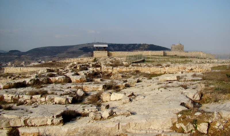
At the top of Gerizim there are archaeological ruins that date to the Persian and Hellenistic periods, as well as a Byzantine church.
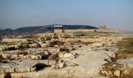
Mount Gerizim, view at top. Photo by Leon Mauldin.

Mount Gerizim, view at top. Photo by Leon Mauldin.

In distance at right you are seeing the tomb of a 12th century sheikh. The mountain in background is Mt. Ebal, the mount of cursing. Out of sight below in the valley between lies Shechem.

In later times Mt. Gerizim would become sacred to the Samaritans, and still is today. In the intertestamental period there was a temple here, but it was destroyed by John Hyrcanus (Maccabean ruler) in 111-110 BC.

When Jesus conversed with the woman at the well, she said, “Our fathers worshiped on this mountain” (John 4:20). She was speaking of Mount Gerizim, which was very much in sight of Jacob’s well, where they were talking.

Click image for larger view.

Todd Bolen has an interesting post on the acoustics of mounts Ebal and Gerizim here. See also Ferrell Jenkin’s post here.

Hopefully this info and these photos will help you visualize the events of Joshua 8, at the time of the conquest under Joshua:

33 All the people, rulers, leaders, and judges were standing on either side of the ark, in front of the Levitical priests who carried the ark of the covenant of the LORD. Both resident foreigners and native Israelites were there. Half the people stood in front of Mount Gerizim and the other half in front of Mount Ebal, as Moses the LORD’s servant had previously instructed to them to do for the formal blessing ceremony. 34 Then Joshua read aloud all the words of the law, including the blessings and the curses, just as they are written in the law scroll. 35 Joshua read aloud every commandment Moses had given before the whole assembly of Israel, including the women, children, and resident foreigners who lived among them (Josh. 8:33-35, NET). 


View of Mt. Ebal and Mt. Gerizim

August 15, 2013

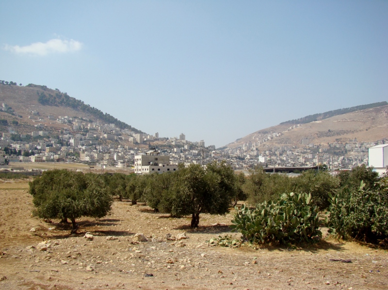
In our last post we referenced some biblical texts regarding Mt. Ebal, the “mount of cursing.” Our photo today shows the view from the east of Mt. Ebal (right) and Mt. Gerizim (left). Shechem is located between the two.

Mt. Ebal (right) and Mt. Gerizim (left). Shechem is at center. Photo by Leon Mauldin.

Mt. Ebal (right) and Mt. Gerizim (left). Shechem is at center. Photo by Leon Mauldin.

When Joshua led Israel to Shechem (Josh. 8) they would have seen this view. Likewise this would have been the scene when Jesus went through Samaria en route to Galilee when he stopped here at Jacob’s well, and had that fascinating conversation with the woman who came to draw water. She left there knowing the Source of the Water of Life (John 4).

We have previously posted on Shechem here, here and here.

Click image for larger view.


Mount Ebal

August 13, 2013

The first mention of Mount Ebal is Deuteronomy 11:29: “Now it shall be, when the LORD your God has brought you into the land which you go to possess, that you shall put the blessing on Mount Gerizim and the curse on Mount Ebal.”

More instructions were to follow in Deut. 27. When Israel crossed over to receive the promised land of Canaan, they were to go to Mount Gerizim and Mount Ebal, which are situated opposite each other, with Shechem in between. Six tribes were to stand on Mount Gerizim (representing the blessings of the law, conditioned upon obedience), and the other six on Mount Ebal (representing the curses/punishment resultant from disobedience).

Joshua 8 shows Israel’s compliance with God’s instructions. The Levites and Joshua were positioned at Shechem. There all the blessings and curses of the law were read, and all the people shouted, “Amen.”

It is significant that Shechem is where childless Abraham stood when God promised Canaan to his descendants (Genesis 12:6,7). Now his descendants, the nation of Israel, were there to receive the promise, to stake their claim to the land. But more was involved than their receiving the land–it was based on their covenant relationship with their God.

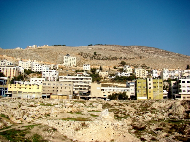
Our photo shows Mount Ebal, the mount of cursing. You will notice how barren it is; very little grows there.

Mount Ebal, the mount of cursing. Six tribes ascended here in Josh. 8.

Mt Ebal, the mount of cursing. 6 tribes ascended here in Josh. 8. Photo: Leon Mauldin.

In the foreground you can see the ruins of ancient Shechem. Click image for larger view.


Dor on the Coastal Plain

August 13, 2013

I’ve been enjoying my Holman Bible Atlas on my Kindle Fire by Thomas V. Brisco. In his section on “Regions and Subdivisions” in the land of Israel he looks at the four major longitudinal zones that are characteristic of the  land, the first of which is the coastal plain. He includes a brief mention of the plain of Dor. “One of the most important harbors of Palestine, Dor gave the plain a strategic importance.”

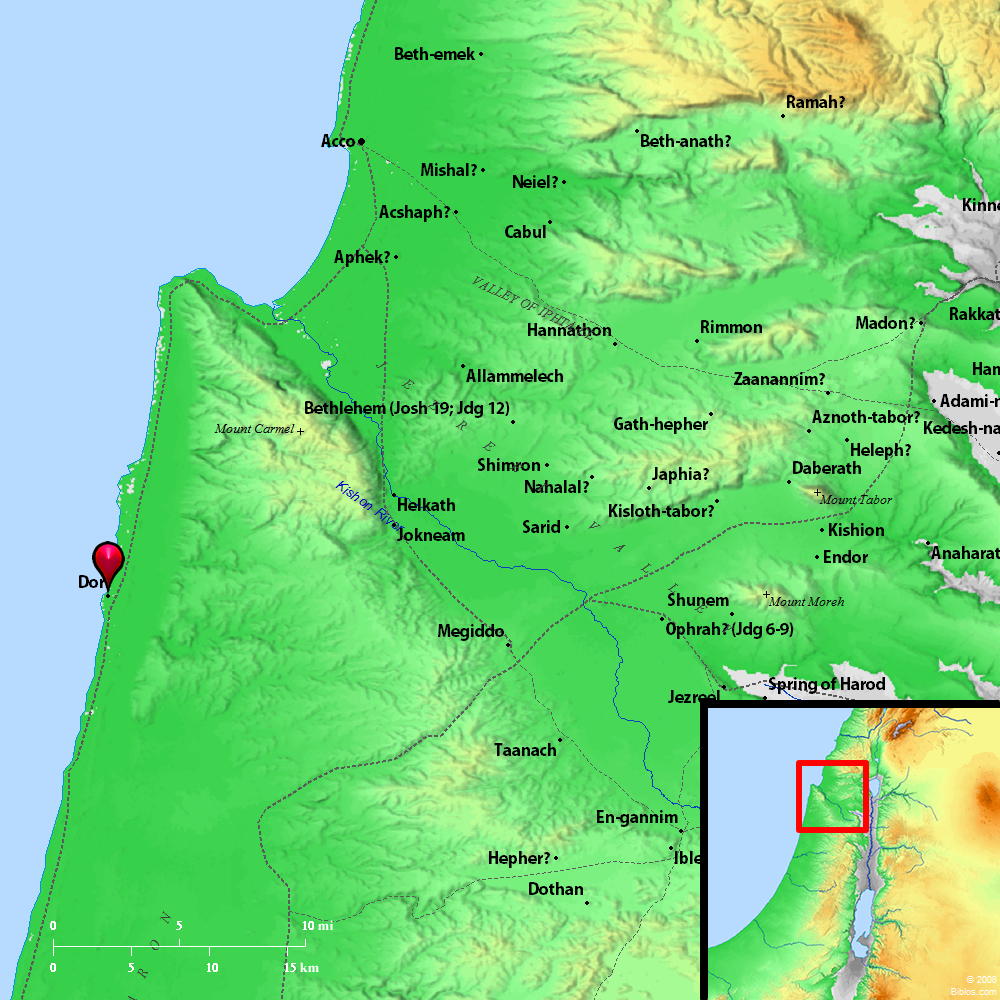
This map shows the location of Dor, the harbor city and the plain running north and south and for a short distance to the east.

Dor, an important harbor in ancient Israel. Map by Bibleatlas.com.

Dor, an important harbor in ancient Israel. Map by Bibleatlas.com.

Here is a view of the harbor.

Harbor of Dor on Coast of Israel. Photo by Leon Mauldin.

Harbor of Dor on Coast of Israel. Photo by Leon Mauldin.

Here you can see some of the excavations (from a distance) at the city of Dor.

Excavations at Dor. Photo by Leon Mauldin.

Excavations at Dor. Photo by Leon Mauldin.

We previously posted on Dor here.

Click on images for larger view.


Kids at the Herodium

June 19, 2013

The Herodium was a fortress in sight of Bethlehem built by Herod the Great. It was also where he was buried. His tomb was discovered and excavated by Ehud Netzer, who met an untimely death resulting from a fall at the site.

Herodium, built by Herod. Photo by Leon Mauldin.

Herodium, built by Herod. Photo by Leon Mauldin.

Ferrell Jenkins & I had the opportunity to visit here in 2009. When we made a stop closer to the Herodium where we had a good view for photos, a group of kids approached us. We thought we had the site to ourselves when we stopped, but they seemed to spring up from nowhere.

Kids near Herodium. Photo by Leon Mauldin.

Kids near Herodium. Photo by Leon Mauldin.

We have observed that most kids seem to like having their picture made, even when there is a language barrier.

I have a couple of previous posts on the Herodium here and here.

We are writing this from Houston, TX, where we are visiting with one of our sons and attending some of the lectures at Southside church of Christ at Pasadena. Today we heard Bob Owens, David Posey and Wilson Adams. This week’s theme: “We Would See Jesus.”