February 10, 2016
John records the beginning of Jesus’ ministry, including this visit to Jerusalem for Passover:
The Passover of the Jews was near, and Jesus went up to Jerusalem. And He found in the temple those who were selling oxen and sheep and doves, and the money changers seated at their tables. And He made a scourge of cords, and drove them all out of the temple, with the sheep and the oxen; and He poured out the coins of the money changers and overturned their tables; and to those who were selling the doves He said, “Take these things away; stop making My Father’s house a place of business.” (John 2:13-16).
It is noteworthy that Jesus both began (above text) and concluded (Matt. 21:12-13) His ministry by cleansing the temple (hieros), “My Father’s house,” of its abuses–of its being turned into a “house of merchandise.”
I’ve thought of these biblical texts when walking through Old Jerusalem and seeing signs such as this one:

Money-changers in Jerusalem. Photo by Leon Mauldin.
Money-changers were:
bankers who exchanged one nation’s currency, or one size of coin, for another. These people provided a convenience, charging a fee (often exorbitant) for their services. Some moneychangers operated in the temple area (the Court of the Gentiles), because all money given to the Temple had to be in the Tyrian silver coin. According to Exodus 30:11–16, every Israelite 20 years old or older was required to pay an annual tax of a half-shekel into the treasury of the sanctuary (Nelson’s New Illustrated Bible Dictionary).
Note the location is the hieros (temple area with its spacious courts, John 2:14-15) and not the naos, or sanctuary, where only the priests could go.
What do you think Jesus might do if He were to walk among “modern churches” today? (I know the church in the biblical sense is not the physical church building/meeting place, but rather is the people of God).
Click image for larger view.
 1 Comment |
  Bible History and Geography, Bible Study, Biblical Interpretation, Israel, Jerusalem, New Testament, photography, Travel | Tagged: Money-changers, Temple |
  Permalink
 Posted by Leon Mauldin
January 6, 2016
Jesus’ second miracle recorded by John (4:46-54) was that of His healing a royal official’s son. The official came to Jesus at Cana of Galilee, asking Jesus to go to his home Capernaum to heal his son who was “at the point of death” (v.47). Jesus’ response: “Go your way; your son lives: (v.50). When the official returned home the next day (distance from Cana to Capernaum is ca. 20 miles), he learned that his son had recovered the exact hour on the previous day when Jesus spoke the word.
Such miracles show who Jesus is (see John 20:30-31). Because He is God, Jesus did not have to be physically at Capernaum to heal the sick boy. He has power not only over sickness, but over distance!
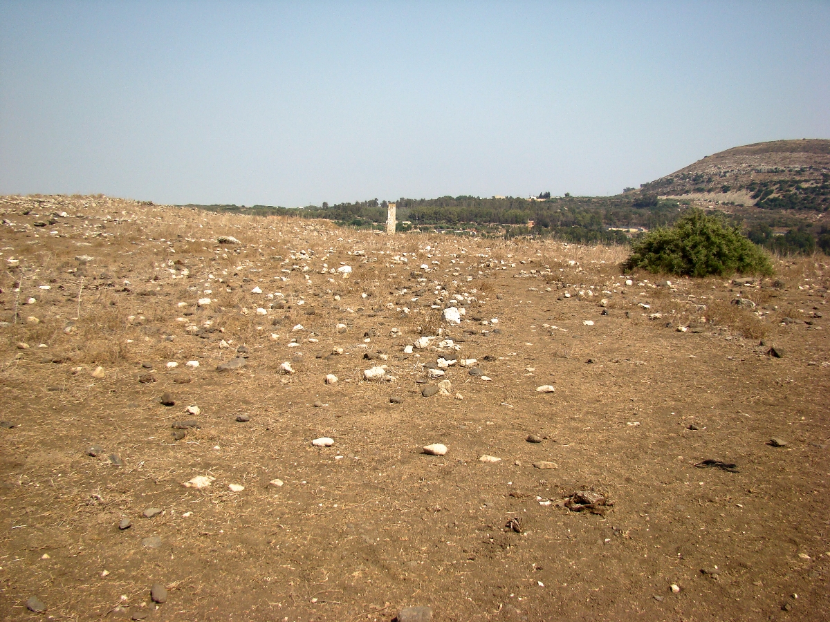
In New Testament times (and somewhat previously), an important road connected the coastal city of Ptolemais with Cana, which then passed through Sde Amudim (Khirbet Umm el-Amud), then on to Magdala and f to Capernaum. It is likely that the royal official of our text would have traveled this route, passing through the area pictured here.
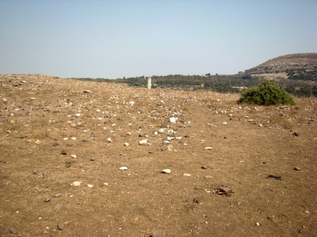
Sde Amudim in lower Galilee looking east toward Capernaum. Photo by Leon Mauldin.
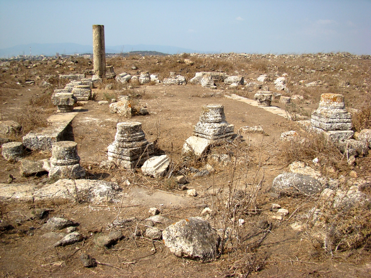
Here at this site are the remains of a synagogue (dates to AD 3rd century).
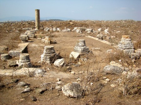
Synagogue at Sde Amudim. Photo by Leon Mauldin.
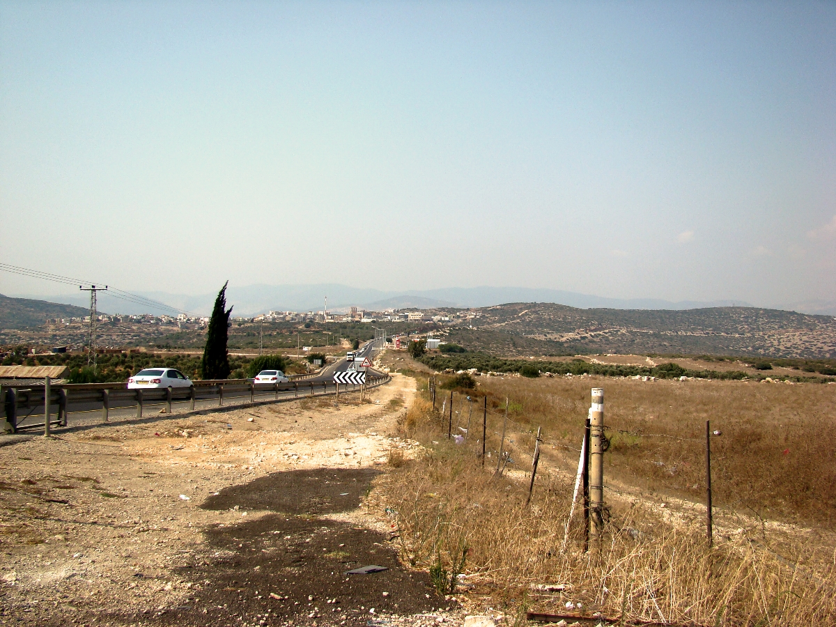
Interestingly, this location serves as a watershed. In this photo we look north. The Bet Netofa Valley drains to the west (to your left); the drainage to your right is east going down to the Sea of Galilee at Magdala.
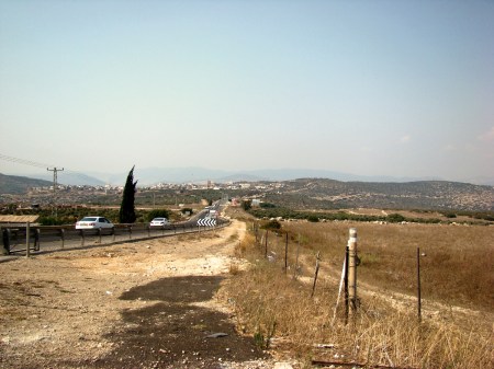
Watershed at Sde Amudim. Photo by Leon Mauldin.
Click images for larger view.
Leave a Comment » | Archaeology, Bible History and Geography, Bible Study, Israel, New Testament, photography, Travel | Tagged: John 4, Kh. Umm el–Amud, Miracles, Sde Amudim | Permalink
Posted by Leon Mauldin
December 11, 2015
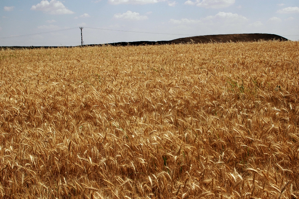
Luke 6 records one of several clashes Jesus had with the Jewish leaders: “Now it happened that He was passing through some grainfields on a Sabbath; and His disciples were picking the heads of grain, rubbing them in their hands, and eating the grain. But some of the Pharisees said, ‘Why do you do what is not lawful on the Sabbath?'” (vv.1-2).
Lenski observes, “The time of this occurrence is certainly determined by the condition of the grain, which was ripe enough to be rubbed out ‘with the hands,’ dative of means, Robertson, 533. It was April, shortly after the Passover, a year before Jesus’ death” (The Interpretation of St. Luke’s Gospel, p. 321).
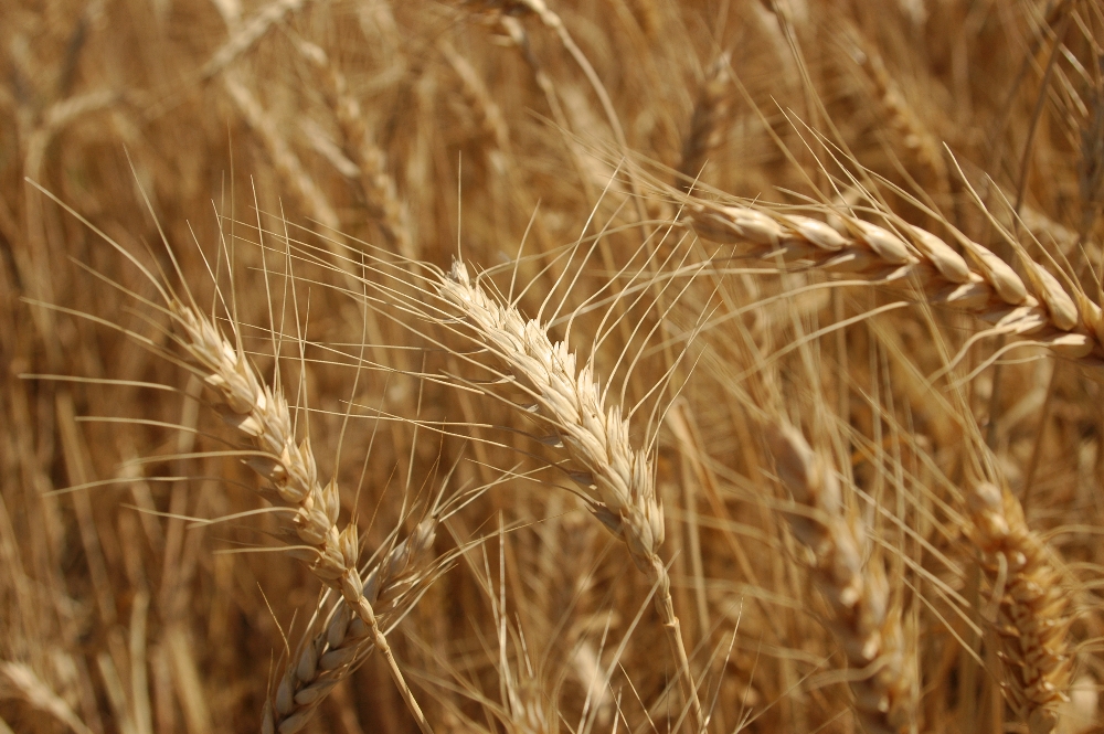
What Jesus disciples did was permitted by Scripture: “When you enter your neighbor’s standing grain, then you may pluck the heads with your hand, but you shall not wield a sickle in your neighbor’s standing grain” (Deut. 23:25). However the Pharisees had erroneously determined that this was working, and therefore in violation of the Sabbath.
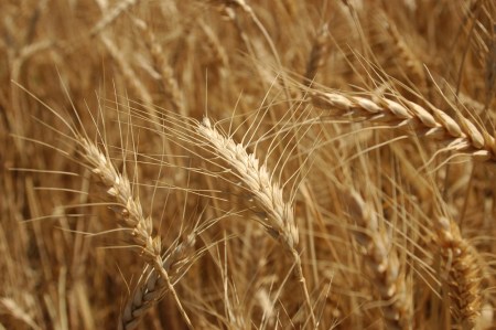
Ripened Wheat. Photo by Leon Mauldin.
Besides the fact that Mosaic Law actually permitted the disciples’ actions, Jesus showed the inconsistency of his opponents. They found no fault with David, even though when fleeing from Saul he and his men ate showbread from the tabernacle (Lk. 6:3-4). And yet they condemned the disciples, who were guiltless of wrongdoing.
Further: “The Son of Man is also Lord of the Sabbath” (v.5), and as such He knew what was right and wrong (re: the Sabbath and all things), and would not permit His disciples to violate the Sabbath. What was totally escaping Jesus’ opponents was the fact that “The Lord of the Sabbath” was in their midst and they did not see it! How sad!
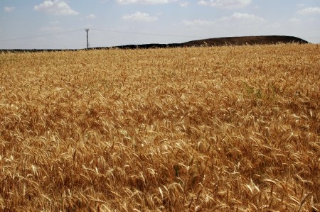
Fields of Wheat near Euphrates. Carchemish is in background. Photo by Leon Mauldin.
Leave a Comment » | Bible History and Geography, Bible Study, Biblical Interpretation, Israel, New Testament, photography, Travel, Turkey | Tagged: wheat | Permalink
Posted by Leon Mauldin
December 2, 2015
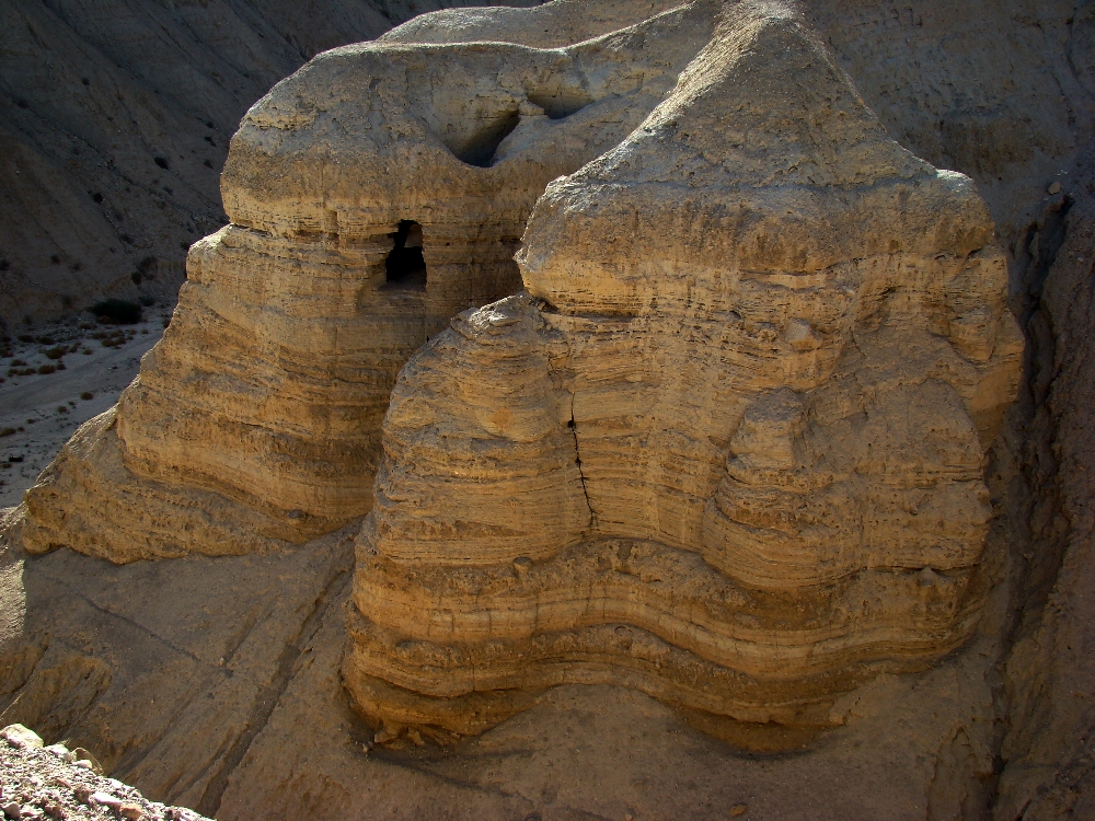
“The Dead Sea Scrolls are undoubtedly the most important discovery found in Israel in the field of the Bible and history of Judaism and Christianity.”1 Fragments of about 900 scrolls from the 2nd Temple period (some dating as early as 3rd century BC) were found in the Qumran caves (NW shore of Dead Sea), between 1947 and 1956. Every book of the Old Testament (except Esther) were represented in the finds, including one complete copy of Isaiah.
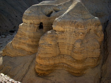
Some of the Qumran Caves where the Dead Sea Scrolls were discovered (1946ff.). Photo by Leon Mauldin.
I remember when studying archaeology under the late Dr. James Hodges that he said the main value of the Dead Sea Scrolls was in the discipline of apologetics. The scrolls were about 1,000 years older (!) than the previously available manuscripts with which translators had to work. The huge find of fragments provided abundant samples with which to compare our Hebrew manuscripts. The result was:
it may now be more confidently asserted than ever before that the modern Hebrew text faithfully represents the Hebrew text as originally written by the authors of the Old Testament. Dead Sea discoveries have enabled us to answer this question with much greater assurance than was possible before 1948.2
Dr. Hodges pointed out that no new translations had to be made as a result of the discovery of the scrolls; they confirmed the accuracy of transmission of what we already have.
Another contribution:
“As a result of Dead Sea Scroll discoveries, it is no longer possible to date portions or entire Old Testament books as late as some scholars used to do. It is impossible to date any biblical work or any extensive part of one later than the early second century B.C. Fragments of the Pentateuch and the prophets date from the second century B.C. Ecclesiastes, sometimes believed to have been composed in the second or first century B.C., appears in a Cave 4 manuscript dating from 175 to 150 B.C. A second-century B.C. Copy of the Psalms indicates that the collection of Psalms was fixed by Maccabean times. A manuscript of Daniel dating about 120 B.C. brings into question the alleged Maccabean date of its composition. Moreover, the Dead Sea Scrolls do not support the existence of a deutero- or trito-Isaiah, at least during the second century B.C. The complete Isaiah and the long fragment of Isaiah from Cave 1 (second century B.C.) treat the book as a unit.”3
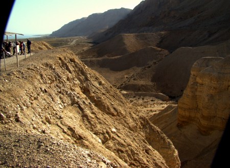
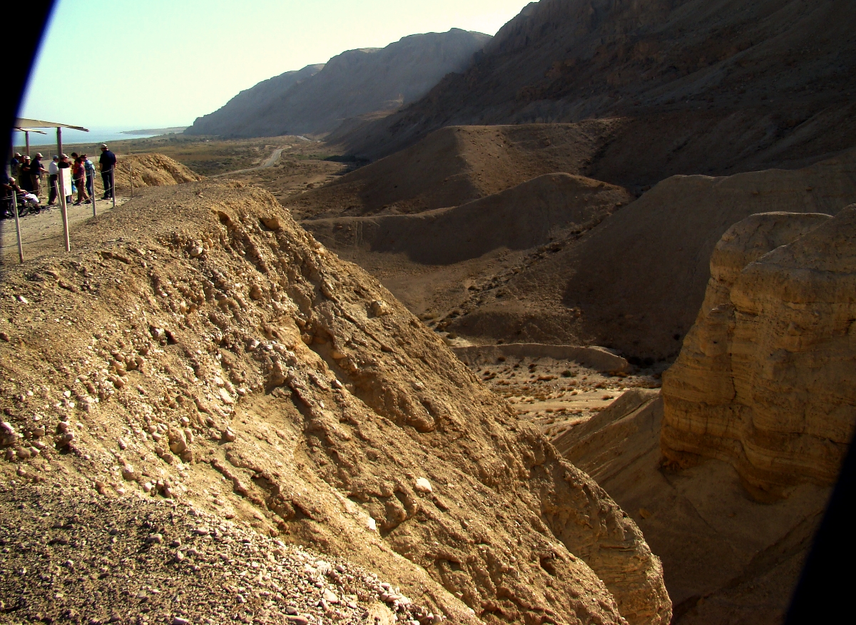
View from Qumran looking south. Dead Sea is in upper left of photo. Photo by Leon Mauldin.
Click photos for larger view.
1 Yigael Yadin quoted by Hanan Eshel in Qumran: Scrolls∙Caves∙History (p.7)
2 See F. B. Bruce, Second Thoughts on the Dead Sea Scrolls (pp.61-69)
3 Bible and Spade (1978), 7(1), pp.12–14.
Leave a Comment » | Bible History and Geography, Bible Study, Biblical Interpretation, Israel, Old Testament, photography, Travel | Tagged: Dead Sea Scrolls, Qumran | Permalink
Posted by Leon Mauldin
November 19, 2015
At ETS in Atlanta this afternoon I heard Dr. Tremper Longman III, professor of Biblical Studies at Westmont College in Santa Barbara, California, and prolific author (including commentaries on the Song of Solomon), lecture on the Song of Solomon. His view of the book is that it is an anthology of love poems, rather than a narrative with a plot; a collection of poems that both celebrate sexual love (within marriage) but also give warnings. It was an interesting lecture.
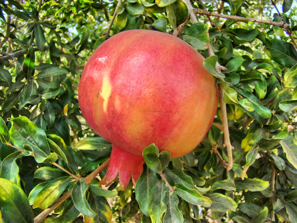
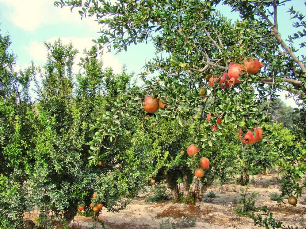
He read from Song of Solomon 4:3, which includes this compliment: “Your lips are like a scarlet thread, And your mouth is lovely. Your temples are like a slice of a pomegranate Behind your veil.” You might want to remember this text when you wish to praise your wife for her beauty.
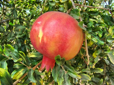
Pomegranate such as that referenced in Song of Solomon 4:3. Photo by Leon Mauldin.
This pomegranate orchard is located near biblical Lachish.
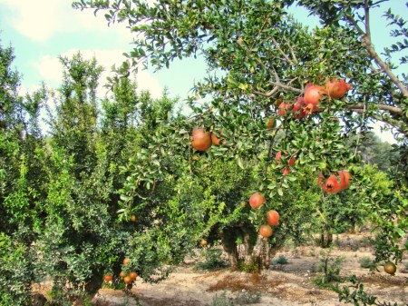
Pomegranate orchard near Lachish in southern Israel. Photo by Leon Mauldin.
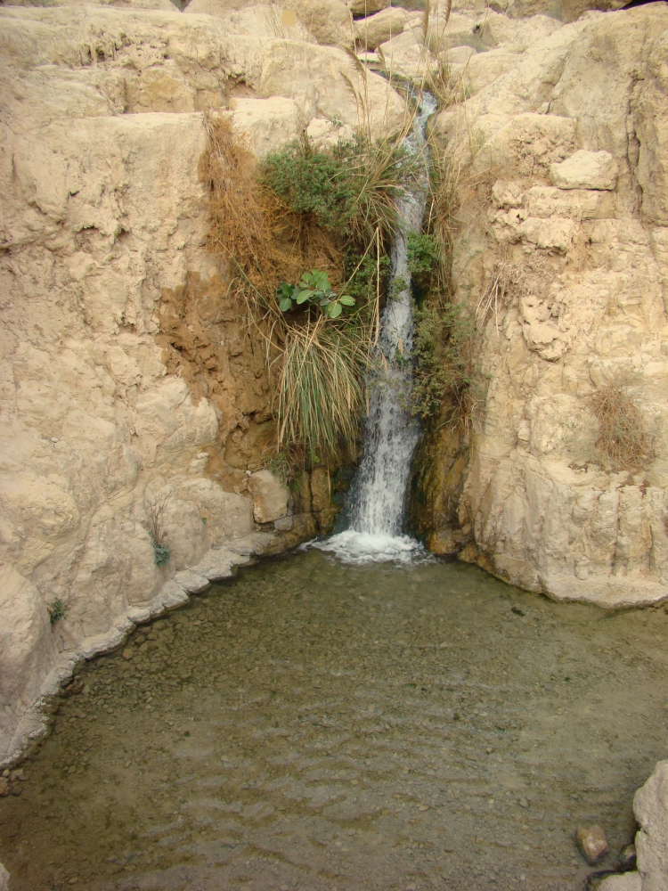
One of the geographical references in the Song of Solomon is found in 1:14, where the young woman/bride says, “My beloved is to me a cluster of henna blossoms In the vineyards of Engedi.” Pictured here is a beautiful waterfall at Engedi, located on the west side of the Dead Sea.
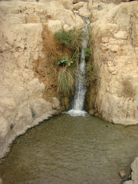
Waterfall at Engedi. Photo by Leon Mauldin.
I have a previous post making a brief reference to the pomegranate here.
Click images for larger view.
Leave a Comment » | Bible History and Geography, Bible Study, Israel, Old Testament, photography, Travel | Tagged: Engedi, Pomegranate, Song of Solomon | Permalink
Posted by Leon Mauldin
November 17, 2015
In ATL, attending meetings of the Near East Archaeological Society. Two of the eight sessions I attended today were on biblical Gezer. A great deal of archaeological work has been done here for the past several seasons, including the ancient tunnel/water system, with more yet scheduled.
There are several Old Testament references to this site. It was one of the cities King Solomon fortified:
Now this is the account of the forced labor which King Solomon levied to build the house of the LORD, his own house, the Millo, the wall of Jerusalem, Hazor, Megiddo, and Gezer. 16 For Pharaoh king of Egypt had gone up and captured Gezer and burned it with fire, and killed the Canaanites who lived in the city, and had given it as a dowry to his daughter, Solomon’s wife. 17 So Solomon rebuilt Gezer and the lower Beth-horon 18 and Baalath and Tamar in the wilderness, in the land of Judah, 19 and all the storage cities which Solomon had, even the cities for his chariots and the cities for his horsemen, and all that it pleased Solomon to build in Jerusalem, in Lebanon, and in all the land under his rule. (1 Kings 9:15-19).
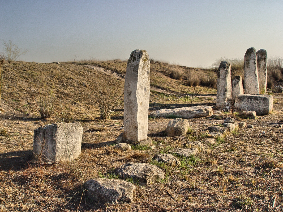
Our photo here shows the standing stones at the high place at Gezer.
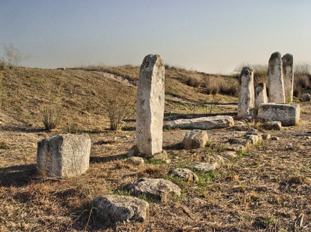
Standing Stones at Gezer. Photo by Leon Mauldin.
Gezer guarded the entrance into the Shephelah region. It is located approximately thirty kilometers northwest of Jerusalem. Gezer was strategically situated at the junction of the Via Maris, the international coastal highway, and the highway connecting it with Jerusalem through the valley of Ajalon.
I have several previous posts with photos & info here, here, here, here, and here.
Hint: pronounce Gezer with “short” e, not GEEzer (def.: old man).
1 Comment | Archaeology, Bible History and Geography, Bible Study, Israel, Old Testament, photography, Travel | Tagged: Gezer | Permalink
Posted by Leon Mauldin
November 10, 2015
It is fascinating to view the gates of Old Jerusalem!
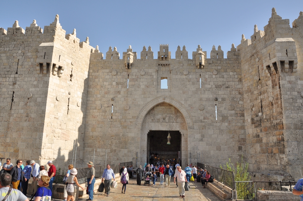
The Damascus Gate is located on the north side of Jerusalem, so named because this would be the direction going out of Jerusalem to Damascus, ca. 150 miles NNW. The Jews call this gate the Shechem Gate, and the Arabs call it Bab el-Amud.
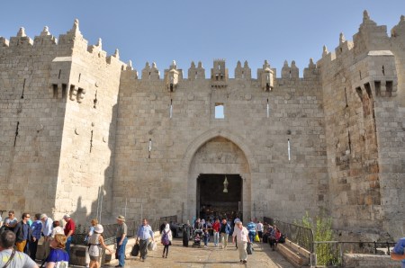
Damascus Gate Jerusalem. North entrance. Photo by Leon Mauldin.
This entrance gate
along the present north wall dramatically accents the spot that has been the main north entrance to Jerusalem for almost two millennia. R. W. Hamilton’s sounding here in 1937 and Basil Hennessey’s excavations in the 1960s; have revealed, below the modern entrance, layer upon layer of earlier gateways, reaching back through Arab, Crusader and Byzantine constructions to Roman Age foundations. The earliest certain construction here dates to Aelia Capitolina, the second to fourth-century C.E. city of Hadrian, but both Hamilton and Hennessey felt they found evidence that Hadrian’s gateway was built on foundations that went back to the Second Temple period. BAS Biblical World in Pictures. (2003).
Hadrian had built a triple-arched gateway to serve as entrance here. The eastern arch is well-preserved.
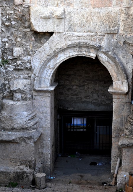
Hadrian Gate, eastern arch. ca. AD 135. North wall, Jerusalem. Photo by Leon Mauldin.
The Latin inscription above the keystone of the arch says, “…according to the decurians [the city council] of Col[onia] Ael[ia] Cap[itolina],” Hadrian’s designation for Jerusalem.
Click images for larger view.
Leave a Comment » | Archaeology, Bible History and Geography, Bible Study, Gates, Israel, Jerusalem, New Testament, photography, Travel | Tagged: Damascus Gate, Hadrian Gate | Permalink
Posted by Leon Mauldin
October 1, 2015
A study of the biblical “Divided Kingdom” period is challenging, (1 Kgs. 11ff. and 2 Chron. 11ff.) to say the least. The 1st of Israel’s kings, Jeroboam, made several (unauthorized) changes in the pattern for worship that Yahweh had revealed (see our previous post here). Jeroboam’s motive was to solidify his power, and to prevent his subjects from going south to Jerusalem to worship, which he thought would likely cause their loyalty to shift.
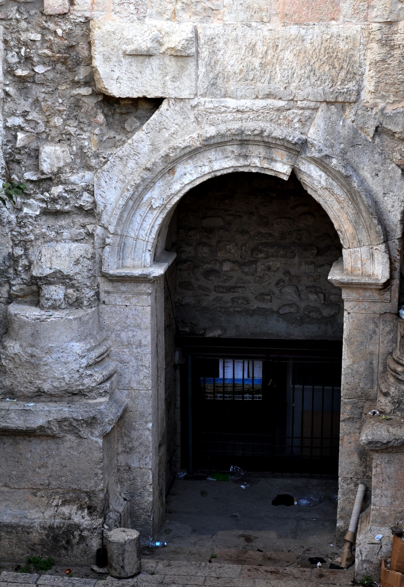
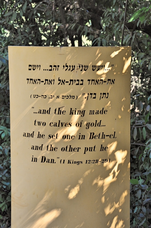
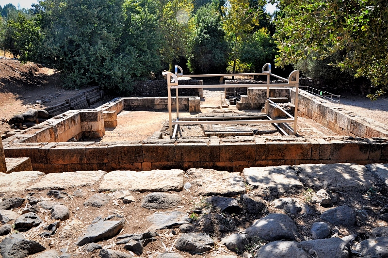
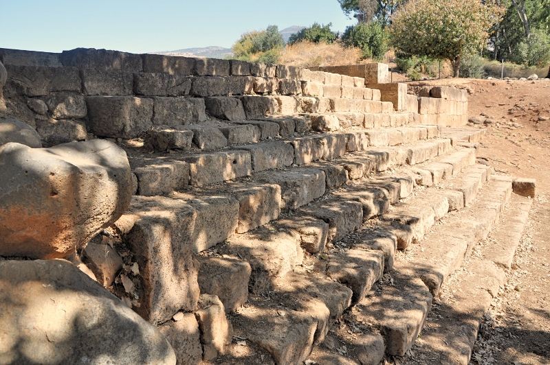
At Dan it is possible today to see the site referenced so many times in scripture, that of the high place where Jeroboam placed his golden calf. cf. 1 Kings 12:30: “Now this thing became a sin, for the people went to worship before the one [golden calf] at Dan.” “This event became sin to the house of Jeroboam, even to blot it out and destroy it from off the face of the earth” (13:34). Reference is made to the sins of Jeroboam “which he committed and with which he made Israel to sin” (14:16).
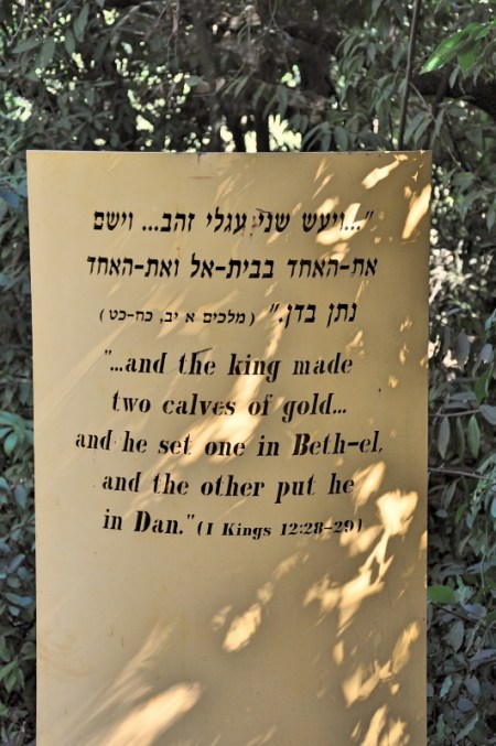
Info Sign at High Place at Dan. Photo by Leon Mauldin.
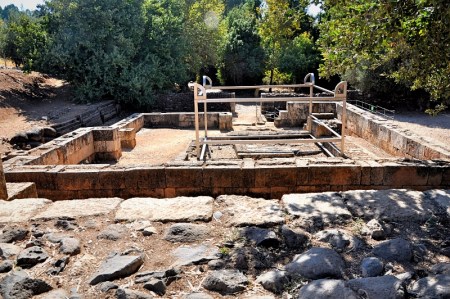
View of the altar where sacrifices were offered. Photo by Leon Mauldin.
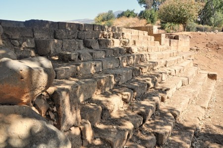
Steps leading up to the platform where the golden calf was enshrined. Photo by Leon Mauldin.
Click images for larger view.
2 Comments | Bible History and Geography, Bible Places, Bible Study, Dan, Israel, Old Testament, photography, Travel | Tagged: High Place, Idolatry | Permalink
Posted by Leon Mauldin
September 25, 2015
In perusing some homeschooling curriculum on the Roman Empire there was a heading entitled “Amazing Architects.”
The Romans were among the best builders in history. They built things that served practical purposes, such as canals, bridges, sewers, harbors, and roads. But it was perhaps in constructing aqueducts that their engineering skills were most impressive.
Aqueducts were developed by the Romans. They are channels for carrying water that were mostly dug into the earth, following the contours of hills. Where this was not possible, the Romans build arches made of concrete and stone. It took great skill to build an aqueduct. The water channels had to slop at exactly the right angle all the way along its length to give a steady flow of water. (Peter Chrisp, Ancient Rome, p.46).
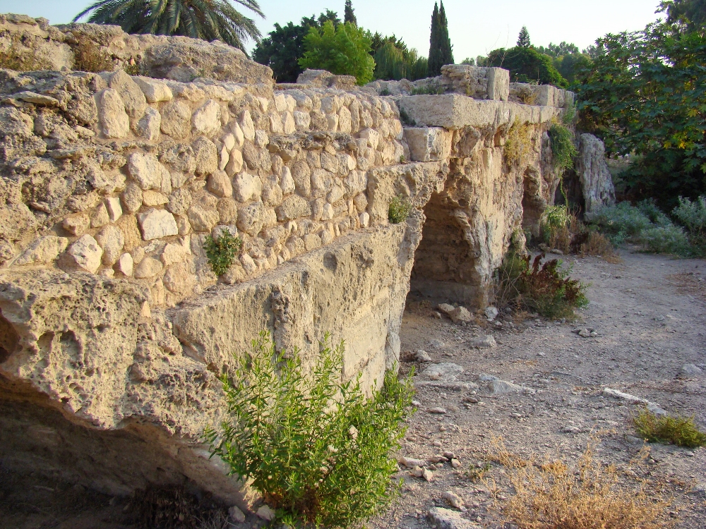
Many sections of the ancient Roman aqueducts still survive in various parts of the former Roman Empire. The aqueduct that emptied into Caesarea on Israel’s coast is a prime example. Caesarea was the capital of Judea during the ministry of Jesus. See our post here.
In Sept. 2011, Ferrell Jenkins & I made a personal study trip to Israel that included a stop at Beit Hananya, in the biblical “Plain of Sharon,” where a portion of the aqueduct can still be seen. This is north of Caesarea by a few miles. (Fresh water was channeled to Caesarea from a distance of 8.5 miles).
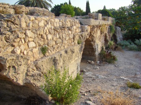
Roman Aqueduct at Beit Hananya, north of Caesarea. Photo by Leon Mauldin.
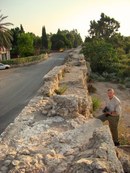
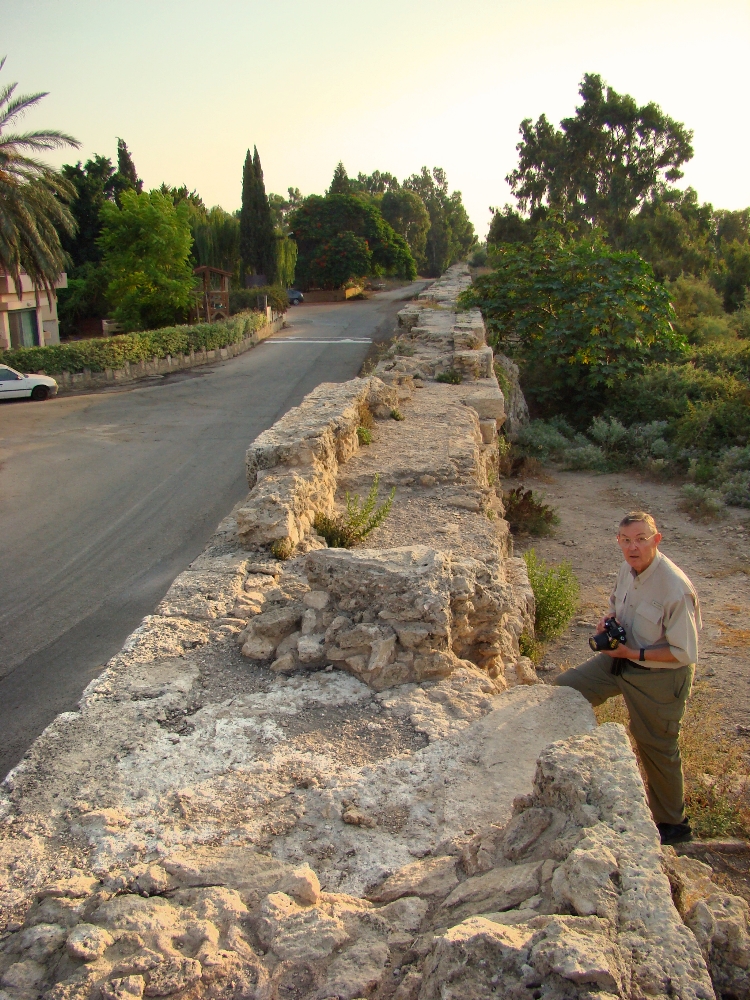
Beit Hananya Aqueduct as seen from top. Photo by Leon Mauldin.
The water was channeled to course down the top of the aqueduct.
Click photos for larger view.
Leave a Comment » | Archaeology, Bible History and Geography, Biblical Interpretation, Caesarea Maritima, Israel, New Testament, photography, Roman Empire, Travel | Tagged: Beit Hananya | Permalink
Posted by Leon Mauldin
June 25, 2015
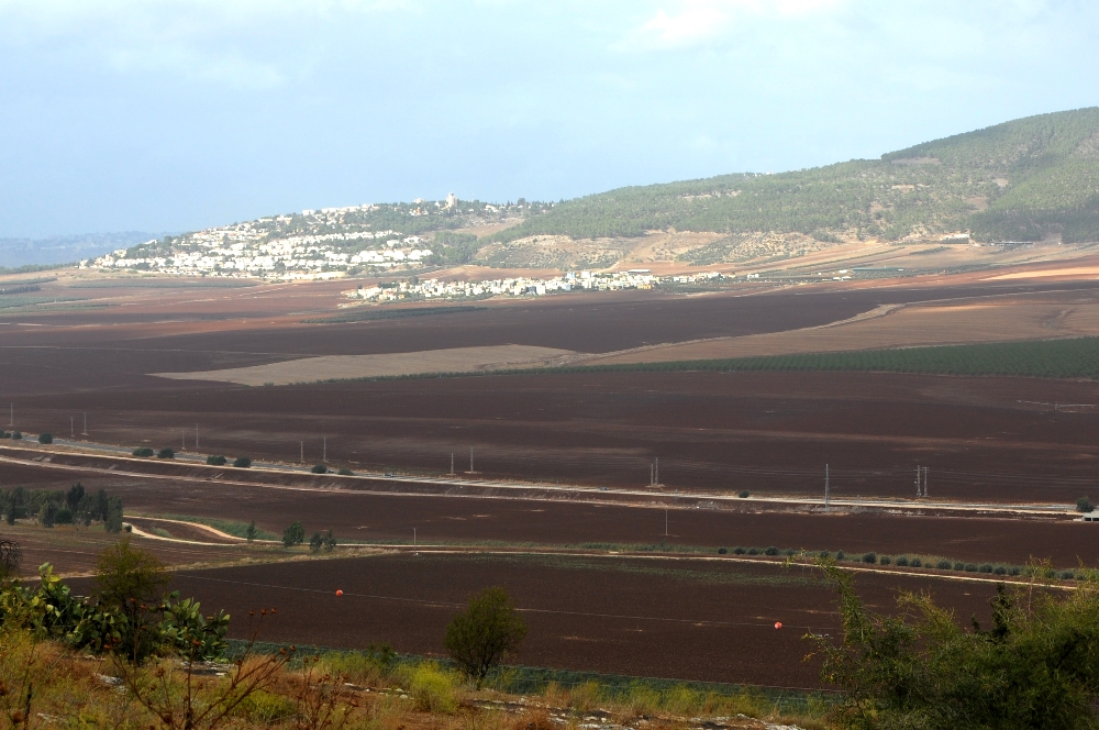
1 Sam. 28:4: “So the Philistines gathered together and came and camped in Shunem; and Saul gathered all Israel together and they camped in Gilboa.”
The horizontal cluster of white buildings in the upper center of photo mark the spot of ancient Shunem, the site of the Philistine encampment referenced in our text.
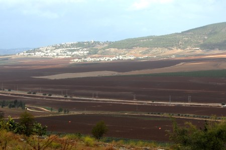
Shunem, note white buildings upper center. Photo by Leon Mauldin.
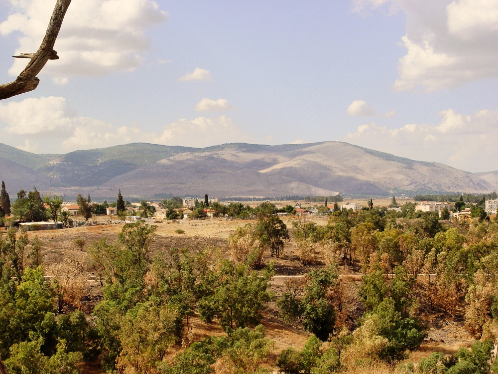
Saul and the forces of Israel were encamped at Gilboa. This view of Gilboa is from Beth Shan.
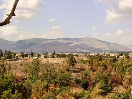
Gilboa as seen from Beth Shan. Photo by Leon Mauldin.
As the 1 Samuel narrative continues, the next chapter states, ” Now the Philistines gathered together all their armies to Aphek, while the Israelites were camping by the spring which is in Jezreel” (29:1) We have previously posted photos/articles on Aphek here and here, where the Philistines at this time gathered all their armies. At Jezreel one can see the spring mentioned here in 1 Sam. 29:1.
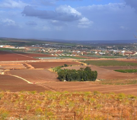
Jezreel Spring. Note greenery at center. Tel Jezreel is in foreground. Photo by Leon Mauldin.
Saul and his three sons (including David’s best friend Jonathan) died at Mt. Gilboa, a great victory for the Philistines. It was a sad day for Israel:
8 It came about on the next day when the Philistines came to strip the slain, that they found Saul and his three sons fallen on Mount Gilboa. 9 They cut off his head and stripped off his weapons, and sent them throughout the land of the Philistines, to carry the good news to the house of their idols and to the people. 10 They put his weapons in the temple of Ashtaroth, and they fastened his body to the wall of Beth-shan. (1 Sam. 31:8-10).
We are told that also the bodies of Saul’s sons were nailed to the walls of Beth Shan (1 Sam. 31:12).
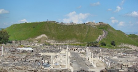
Beth Shan, where the Philistines nailed the bodies of Saul & sons. Photo by Leon Mauldin.
These photos may be used along with maps to show where the events of 1 Sam. 28-31 transpired. Click on images for larger view.
4 Comments | Bible History and Geography, Biblical Interpretation, Israel, Old Testament, photography, Travel | Tagged: Beth Shan, Beth-shean, Gilboa, Jezreel, Shunem | Permalink
Posted by Leon Mauldin