Last evening a grandson, along with my wife & me, were reading his daily Bible reading which was in 1 Samuel 13-15. Chapters 13-14 record a battle between Israel and the Philistines, which was initiated by the faith of King Saul’s son Jonathan. A site repeatedly mentioned in the text is that of Michmash.
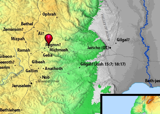
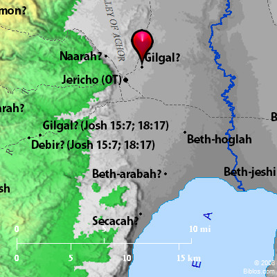
Michmash. Map by BibleAtlas.org.
Michmash is about seven miles north and slightly east of Jerusalem. Consider how far into Israel’s territory the coastal Philistines had advanced at this point. Further, Israel’s forces were greatly outnumbered. The Philistines had 30,000 chariots and 6,000 horsemen, and “people as the sand which is on the seashore in multitude,” and were also “encamped in Michmash (1 Sam. 13:5). Jonathan had 1,000 men with him (at Gibeah at the point of 1 Sam. 13:2). Saul had only 2,000 men (ibid.) but as the chapter continues that number had shrunk down to a mere 600 men (v.15).
But Jonathan’s faith was not in numbers, but in YHWH. He told his armorbearer, “Come, let us go over to the garrison of these uncircumcised; it may be that the LORD will work for us. For nothing restrains the LORD from saving by many or by few” (1 Sam. 14:6). The two of them climbed up the steep pass to Michmash on hands and knees, attacked the Philistines, and “that first slaughter which Jonathan and his armorbearer made was about twenty men within about half an acre of land” (1 Sam. 14:14). The Philistine camp went into confusion. “So the LORD saved Israel that day” (v.23). Israel drove “back the Philistines that day from Michmash to Aijalon” (v.31).
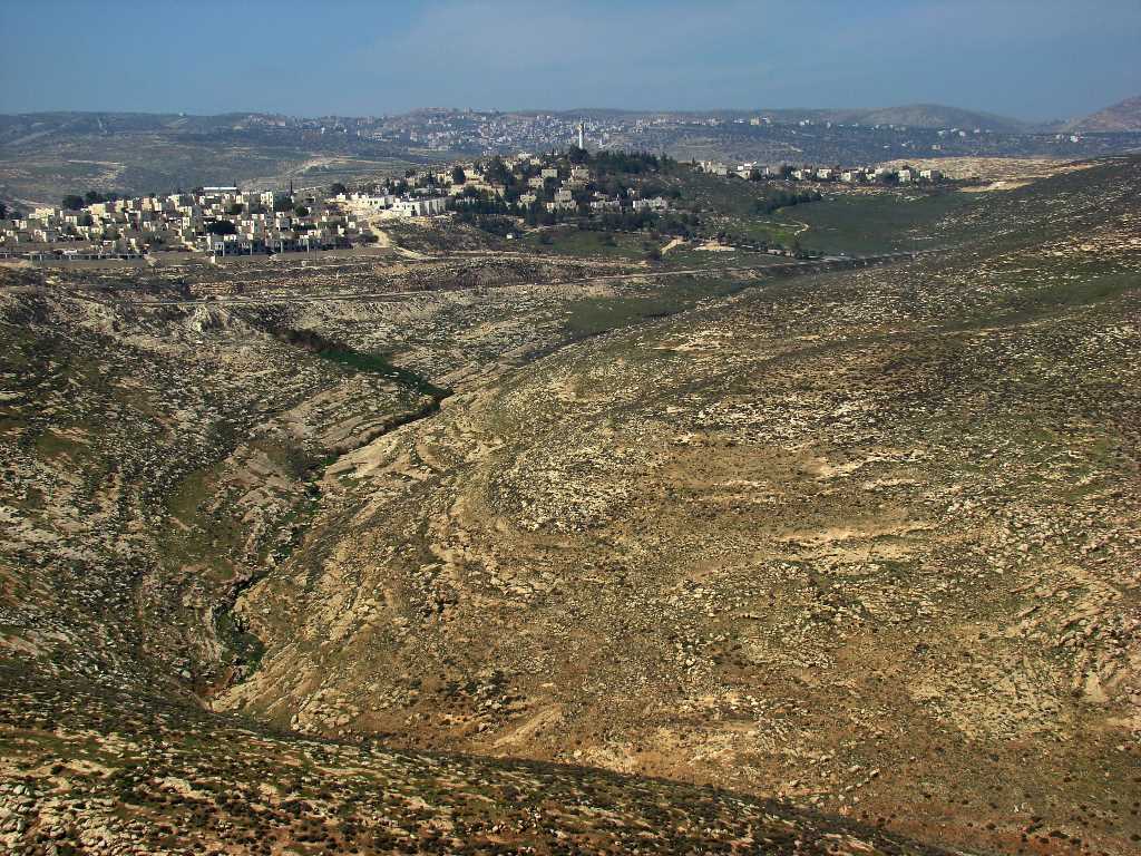
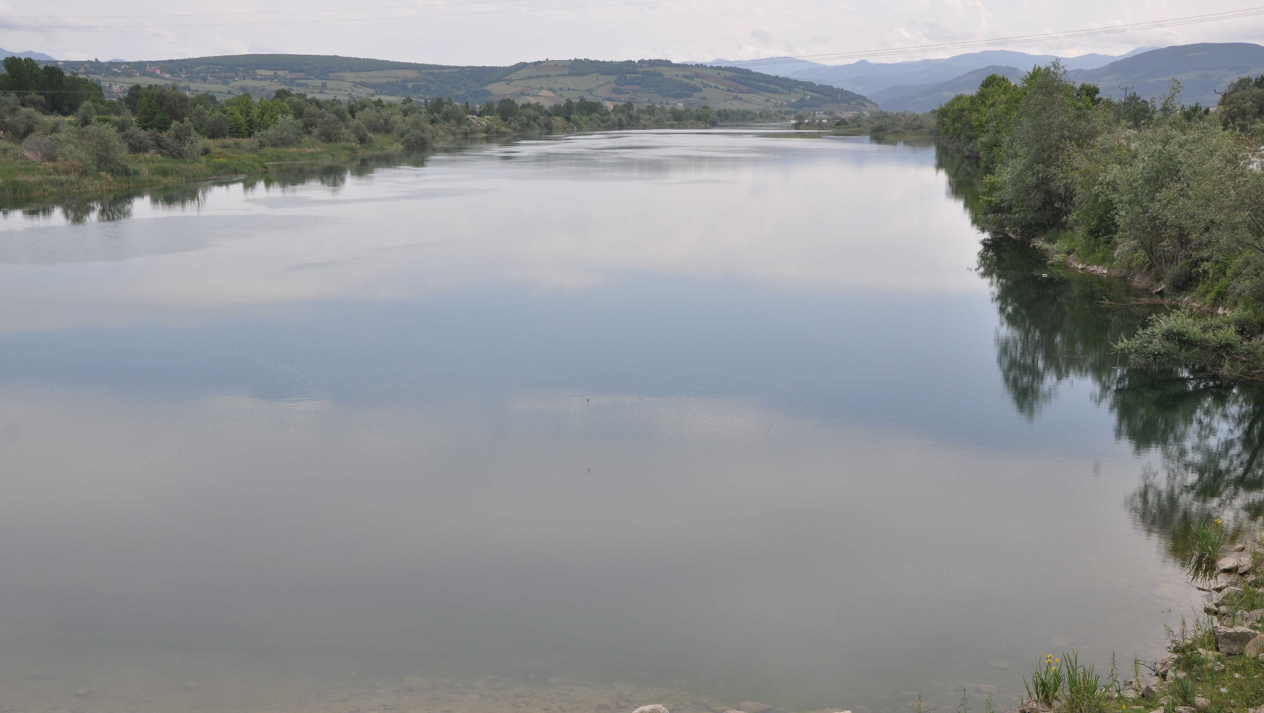
Michmash. Area of battle between Israel and Philistines. Photo by Leon Mauldin.
After we read the biblical narrative, I showed my grandson some photos of the Michmash area, such as the one here above, and was able to say that what we just read took place in this area. He responded, “Have they found any skeletons there?” “Wouldn’t it be cool if they found skeletons there?” Also, “Do they still fight battles there?”
While I don’t know of any skeletal remains, this area was the site of an important battle between Britain and the Turks during WWI. Major Vivian Gilbert, in his book The Romance of the Last Crusade, “relates the story of an unnamed brigade major who was reading his Bible while contemplating the situation against the Ottoman forces. The brigade major remembered a town by the name of Michmash mentioned somewhere in the Bible. He found the verses, and discovered that there was supposedly a secret path around the town. He woke the brigadier general, and they found that the path still existed and was very lightly guarded. The British forces used this path to outmaneuver the Ottomans, and so took the town” (Wikipedia, referencing pp. 183-186).
The use of maps and photos of biblical sites helps children (and the rest of us) to better visualize and understand the biblical events.


 Posted by Leon Mauldin