Lydia’s Baptism at Philippi

March 28, 2015

We leave momentarily for Turkey. Yesterday we visited Philippi, where Lydia and her household were the first converts. Luke writes in Acts 16:

11 Therefore, sailing from Troas, we ran a straight course to Samothrace, and the next day came to Neapolis, 12 and from there to Philippi, which is the foremost city of that part of Macedonia, a colony. And we were staying in that city for some days. 13 And on the Sabbath day we went out of the city to the riverside, where prayer was customarily made; and we sat down and spoke to the women who met there. 14 Now a certain woman named Lydia heard us. She was a seller of purple from the city of Thyatira, who worshiped God. The Lord opened her heart to heed the things spoken by Paul. 15 And when she and her household were baptized, she begged us, saying, “If you have judged me to be faithful to the Lord, come to my house and stay.” So she persuaded us.

West of Philippi is the Krenides River, where the women would have been gathered for prayer, and where Lydia and her household were baptized into Christ.

At Krenides River at Philippi. Setting of Acts 16.

At Krenides River at Philippi. Setting of Acts 16.


Propylaea of Athens

January 23, 2015

The Propylaea (entrance before the gate) still stands as the access to the Acropolis today. This monumental entrance gate was commissioned by the great statesman and builder of the Acropolis, Pericles. Construction was begun in 437 B.C.

Propylaea leading to Athens Acropolis. Photo by Leon Mauldin.

Propylaea leading to Athens Acropolis. Photo by Leon Mauldin.

Fant and Reddish have this information:

The Propylaea (“before the gate”) visible today is the fourth of such structures to be built at this site; earlier ones were destroyed in various wars. The road from the agora below, the Panathenaic Way, led up to this point. A flight of marble steps ascends to the hall of the Propylaea. One step is of gray Eleusinian marble; the others are of white Pentelic marble. The monumental pedestal (25 feet tall) on the left of the steps originally was designed for a statue with a chariot and four horses to honor King Eumenes II of Pergamum for his contribution of the Stoa of Eumenes. Later it was reinscribed with a dedication to Marcus Agrippa in honor of the odeion he contributed to the agora. Designed by the architect Mnesicles and begun upon the completion of the Parthenon (437 B.C.E.), the Propylaea consisted of a central section with five doorways, originally fitted with wooden doors, and projecting wings on either side. The wing on the left side, the north wing, was known as the Pinakotheke, or art gallery, because of the magnificent collection of paintings inside. In 150 C.E. Pausanius named a number of the paintings he could recognize, including some by Polygnatus of Homer (5th century B.C.E.). The room was used for official banquets by dignitaries who reclined on couches in the Greek fashion. The wing on the right side, the south wing, could not match the other in design because of the Temple of Athena Nike and other buildings that impinged upon it. This wing was never completed due to the start of the Peloponnesian War (431 B.C.E.). (A Guide to Biblical Sites in Greece and Turkey).

We are looking forward to seeing Athens again in a couple of months.

Click image for larger view.


William Ramsay on the Halys River and North Galatia

January 17, 2014

Sir William M. Ramsay (1851-1939), archaeologist, scholar, and author, was a champion of the South Galatia position (i.e., the N.T. letter to the Galatians was addressed to Antioch of Pisidia, Iconium, Lystra and Derbe) at a time when the North Galatia theory had been accepted for centuries. In his book, A Historical Commentary on St. Paul’s Epistles to the Galatians, he deals with the geography of north Galatia, giving evidence to eliminate that as the area intended in the book of Galatians. He was seeking to understand the geography of Galatia especially and specifically in the mid 1st century AD.

In that portion of his historical introduction, Ramsay mentions the Halys River and how it divided Galatia into two parts.

The country afterwards called Galatia was in primitive time divided ethnographically and politically into two parts, eastern and western: the division was made by the river Halys, which in this part of its course runs in a northerly direction towards the Black Sea. Galatia east of the Halys seems to have been originally reckoned to Cappadocia, though part of it was probably sometimes described as included in Paphlagonia; but the bounds of those countries were so indeterminate, and the ancient writers themselves were so ignorant of the geography of those lands, that it is quite impossible to say anything positive and certain on the subject. . .

Eastern Galatia lies mostly in the basin of the Halys (Kizil-Irmak, the “Red River”). The Halys itself has very few and quite insignificant tributaries. In Eastern Galatia the Delije-Irmak (whose ancient name is unknown) is the only tributary of any consequence; and most of the country lies in its basin; but the river, though it looks large on the map, carries very little water except in flood, when it becomes a broad and raging torrent, exactly as its name indicates, the “Mad River”. . .

Galatia west of the Halys, which was much larger than the eastern country, was the most important and the most typical part of the country; most of our scanty information relates to it; and in general, when any statement is made about North Galatia, the writer has the western part of it in his mind. This western region was originally part of the vast land called Phrygia; and, clearly, the population of the country in the early part of the fourth century were known to the Greeks as Phrygians (Φρύγες). (Ramsay, W. M. (1900). A Historical Commentary on St. Paul’s Epistle to the Galatians (pp. 15–17).

Halys River near the Black Sea. Photo by Leon Mauldin.

Halys River near the Black Sea. Photo by Leon Mauldin.

Sir Ramsay referenced the Halys as the Kizil-Irmak. Note the sign here at the bridge crossing the river.

Halys River/Kizil-Irmak. Photo by Leon Mauldin.

Halys River/Kizil-Irmak. Photo by Leon Mauldin.

Click images for larger view.


Yodfat of the Galilee

May 22, 2013

Yodfat (also Jotapata, Iotapata, Yodefat) was the site of a 47 day siege in AD 67 by Roman forces led by General Vespasian and his son Titus (both of whom would later be emperors). It is said that this was the second bloodiest battle of the Jewish revolt. The historian Josephus chronicled the siege. He was at that time the commander of the Jewish forces. (See The Wars of the Jews, III.7-8). The Jewish forces were killed, some died of suicide; the Romans sold the women and children into slavery.

Site of ancient Yodfat. Photo by Leon Mauldin.

Site of ancient Yodfat. Photo by Leon Mauldin.

This site gave archaeologists what can be a rare opportunity; it was never resettled or built over after its destruction in AD 67.

Click on image for higher resolution.


Traveling in Israel (in 2005)

September 21, 2012

In November 2005 Ferrell Jenkins and I made a personal study trip to Israel. One factor that made that trip significant was the fact that this was Mr. Jenkin’s (who has directed scores of tours to Israel) first visit to Israel since the events of 9/11/2001. So the purpose in part was exploratory, to see what had changed and new developments/excavations, etc. He made posts of photos and comments every day.  You can still access that Nov. ’05 Israel trip info here. I thought some of our readers might enjoy the photos and info. This was before the widely read Ferrell’s Travel Blog.

I can tell you, that was a great trip. There is nothing quite like on-site Bible study! I think we each took around 2,500-3,000 photos.

Rolling Stone Tomb in Northern Israel, Nov. 2005. Photo by Leon Mauldin.

This is one of my favorite shots from that trip. You can see there is no green grass, as it was dead and dry in Nov. It is good to be able to see the land at different times of the year if possible.

This Roman tomb is not far from Megiddo. Its use dates back to the time of Jesus, and well illustrates the kind of tomb in which Jesus was buried. Unfortunately it is not possible to get this same photo today as there is a safety railing in front of the tomb.

Click on photo for larger view.


Egypt: the Nile Turned to Blood

April 23, 2011

God referred to 10 plagues as “great acts of judgment” (Exodus 6:6). Prior to the 10th plague, the death of the firstborn, God warned, “For I will go through the land of Egypt on that night, and will strike down all the firstborn in the land of Egypt, both man and beast; and against all the gods of Egypt I will execute judgments– I am the LORD” (Ex. 12:12). In reality, all of the plagues showed that YHWH (the LORD) was the true God; all of the plagues were judgments against the gods of Egypt.

The first plague turned the water of the Nile into blood.

Nile River. Photo by Leon Mauldin.

In an article entitled, “The Plagues and the Exodus,” David Livingston wrote:

This plague was against the god Hapi, spirit of the Nile in flood and “giver of life to all men.” The annual innundation was called “the arrival of Hapi” (57). He was especially worshipped at Gebel Silsileh and Elephantine. The Nile water was the transformed life-blood of Osiris. The fact that the Nile turned to blood, which was abominable to Egyptians, was a direct affront to one of their chief gods. Although the fish-goddess was Hatmeyt, all the fish in the Nile River died! (Bible and Spade Vol. 4, No. 1, P. 4).

Osiris was believed to be the goddess of the afterlife.

The Goddess Osiris. Brooklyn Museum. Photo by Leon Mauldin.

By the way, I recently added the email subscription feature to this site. If you like, just enter your email address in the box provided, and you will receive notice when new posts are added to this site.


From Dan to Beersheba

March 17, 2011

Tonight as I write this we are in Beersheba, so we have traveled the biblical “from Dan to Beersheba” that is referenced so many times in Scripture (1 Sam. 3:20, etc.), having been to Dan earlier last week.

Last evening we spent the night at the Dead Sea at En Boqeq, but the internet was down when I was attempting to use it. Yesterday AM before leaving Jerusalem we visited the Wailing Wall. This wall was not part of the temple itself, but was the retaining wall for the temple and the structures on the temple mount.

Wailing Wall in Jerusalem. Photo by Leon Mauldin.

Jerusalem is defined by three valleys: the Kidron, Tyropean and Hinnom. In the above photo we are standing in the Tyropean Valley.

The first several courses of larger stones starting from bottom are Herodian. Jews come here to mourn the destruction of the temple, among other reasons.

Just south of the wailing wall, excavations have reached down to first century street level. There you can see the stones that have been uncovered that were part of the temple buildings, hurled down into the valley during the AD 70 destruction. This photo shows the fulfillment of Jesus’ promise that not 0ne stone would be left upon another, that would not be cast down (Matt. 24:2). He said that this would occur during that generation (v.34).

Temple Stones from AD 70 Destruction. Photo by Leon Mauldin.

After leaving Jerusalem, we went to see Anathoth. This was the site of the city which was home to Jeremiah.

Anathoth, home of prophet Jeremiah. Photo by Leon Mauldin.

We also went to Old Testament Jericho. While there I took a group photo.

Group Photo at OT Jericho. Photo by Leon Mauldin.

We’ve learned a lot on this journey. We are truly blessed.

This morning upon leaving En Boqeq we went to Masada.

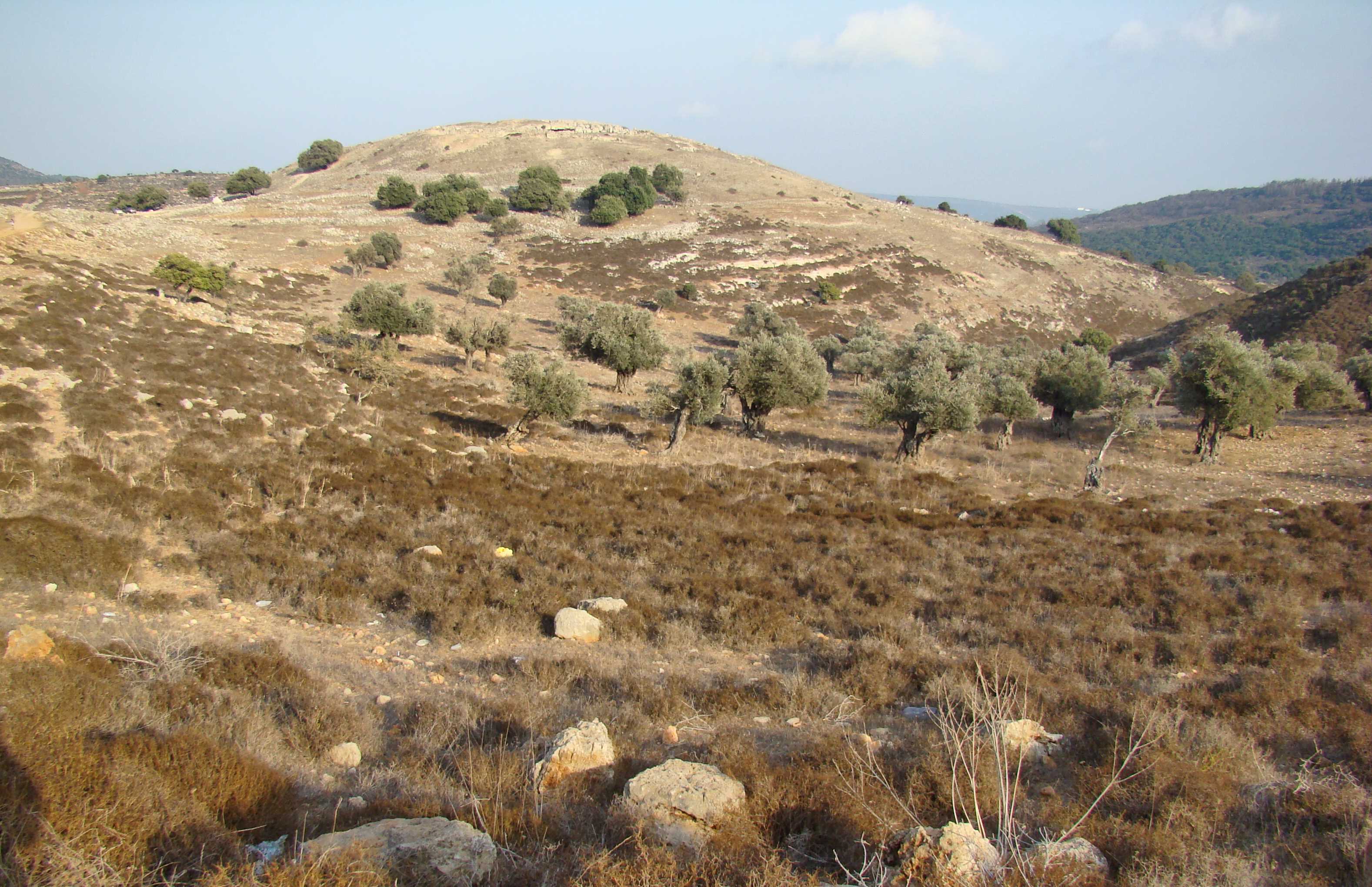
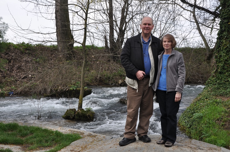
Leon Mauldin at Zoar.

En route to Masada we stopped at Zoar for the view. The brook drains down to the Dead Sea. It is not clear if there is any connection between  this location and the Zoar mentioned in Gen. 19:22ff., in connection with the narrative of lot and the destruction of Sodom and its surrounding cities. The mountains just south of this area are called the Mountains of Sodom.

Masada was a Herodian fortress. It was here that the Zealots fled after the Roman destruction of Jerusalem in AD 70. The Romans laid siege to Masada, and in AD 73 broke through the wall. They found the Jews inside chose death by their own hands rather than be captured by the Romans.

Tomorrow is a full schedule of sites from Tel Sheva (Beersheba) working our way up to Joppa, and from then to TLV for our departing flight home, the Lord willing.  Thanks again for following our travels, and for the many kind notes & prayers.

Click on photos for higher resolution.


Memphis of Egypt

September 27, 2010

Today’s post will deal with Memphis of Egypt.  To give some context, let me lead into this with the following:

The message of the biblical prophets may be broadly summarized into three subject areas:

1. God’s message to His people of the prophet’s time.

2. God is the God of all the earth; His message to the nations.

3. Most importantly, the Messianic prophecies; Christ, His redemptive work, His kingdom.

Today’s post will deal with the second category; God is the God of the nations.  This is why you will find in some instances in the prophets back-to-back chapters dealing with the nations of men.  Ezekiel was one of the captivity prophets (taken to Babylon with the second deportation, 597 B.C.).  Though he had much to say to his contemporary captives (Jews), and had many Messianic prophecies, Ezekiel proclaimed the word of the LORD to the nations.

Ezekiel 30 addresses Egypt and includes specifically Memphis. “Thus says the Lord GOD, “I will also destroy the idols And make the images cease from Memphis. And there will no longer be a prince in the land of Egypt; And I will put fear in the land of Egypt” (v.13).

For so many centuries Egypt had been a world power.  Memphis had been one of the most important administrative centers.  Only Thebes in the south was comparable in economic, political and religious importance.

But God said He would “execute judgments on Egypt” (v.19). The prophecy was fulfilled.  Egypt fell, and the city of Memphis, royal residence and capital of Egypt, one of the renowned places of the whole ancient world, has disappeared almost completely.  The most significant ruins can be seen near the modern village of Mit Rahina.

Sign indicating site of biblical Memphis, Egypt. Near modern Mit Rahina. Photo ©Leon Mauldin.

Within the enclosure of the temple of Ptah one can see a large alabaster sphinx. This dates to the reign of Ramesses II (1279-1213 B.C.).

Alabaster Sphinx in Memphis, Egypt. Dates to reign of Ramesses II. Photo ©Leon Mauldin.

Ezekiel’s prophecy was that God would “cause the images to cease from Memphis.”  Our photo below illustrates what the prophet had in mind.  This is an image of the Egyptian goddess Hathor.

Image of Egyptian goddess Hathor. Memphis, Egypt. Photo ©Leon Mauldin.

More to come on Memphis, Egypt.  Remember to click on image for higher resolution. Photos may freely be used in teaching.


Laodicea, cont’d.

June 26, 2010

In our previous post we saw a startling difference between the Laodiceans’ assessment of themselves, and the Lord’s evaluation.  They thought they were rich and in need of nothing; Jesus said that spiritually they were “wretched, pitiful, poor, blind, and naked” (Rev.3:17).  They were blissfully unaware of their true condition before God! Further, their lukewarmness was a condition that nauseated the Lord.

That’s why we have the Bible. Therein is revealed how to be saved by the provisions of God in Jesus Christ, and then further teaching furnishes the Christian with what God wants His people to be.  In other words, to avoid the condemnation of the Lord, and to have His approval, requires constant looking at the Scriptures as the standard, and examining self in light of that Word.

But we want to explore further the city itself where the church addressed in Rev. 3 was located.

Besides the evidence of many public buildings and facilities, archaeologist have also excavated some private residences, such as the one in this photo. Note the storage jar at left center.

Private Residence at Laodicea. Photo ©Leon Mauldin.

Such storage jars would have been used in homes for storage of grain and other such items.  Such items are indicative of considerable purchasing power.

Storage Jar in Private Residence at Laodicea. Photo ©Leon Mauldin.

Still more to come on Laodicea.  Click on image for larger view.


Philadelphia, its Environs, cont’d

June 15, 2010

We continue in today’s post to explore biblical Philadelphia, the sixth of the seven cities with churches addressed in Rev. 2-3.

Nelson’s New Illustrated Bible Dictionary gives this info regarding Philadelphia:

Philadelphia was situated on the Cogamus River, a tributary of the Hermus (modern Gediz) and was about 45 kilometers (28 miles) southeast of Sardis. It was founded by Attalus II (Philadelphus), who reigned as king of Pergamos from 159 B.C. until 138 B.C. Philadelphia was a center of the wine industry. Its chief deity was Dionysus, in Greek mythology the god of wine (the Roman Bacchus).

Volcanic activity has contributed to the fertility of the soil.  In ancient times as well as the present, Philadelphia is well suited for vineyards.  See our photo below.

Vineyards at Philadelphia. Photo ©Leon Mauldin.

Philadelphia and its environs were prone to earthquake.  Bible and Spade (1976, vol. 5) quotes the Greek geographer Stabo:

…the city Philadelphia [is] ever subject to earthquakes. Incessantly the walls of the houses are cracked, different parts of the city being thus affected at different times. For this reason but few people live in the city, and most of them spend their lives as farmers in the country, since they have a fertile soil. Yet one may be surprised at the few, that they are so fond of the place when their dwellings are so insecure; and one might marvel still more at those who founded the city. (Strabo 13.4.10; trans. Jones)

At the acropolis one may see a few artifacts of interest, such as this architrave fragment.

Architrave Fragment at Philadelphia. Photo ©Leon Mauldin.

One may also view an ancient wall, as seen in our photo.

Ancient Wall in Philadelphia. Photo ©Leon Mauldin.

A woman walked by in front of that wall.  Apparently she was gathering material for a broom.

Woman with broom materials at Philadelphia. Photo ©Leon Mauldin.

Every ancient city of significance had a theater.  The one at Philadelphia has not been excavated, but its slope and semi-circular form can easily be detected.

Unexcavated Theater at Philadelphia. Photo ©Leon Mauldin.