One of the most important roads in the Roman world was the Via Egnatia, which linked Dyrrhachium on the Adriatic Sea, to Byznatium, a distance of 260 miles. From the standpoint of Paul’s travels in Acts, the road crossed through Macedonia westward to Illyricum, linking the Aegean Sea to the Adriatic Sea.
Dr. Mark Wilson writes:
Around 146 BC the governor Gnaeus Egnatius began a road project across the Balkan Peninsula to link the Adriatic to his province of Macedonia on the Aegean Sea. Before 56 BC the road had been extended through Thrace to Byzantium (Cicero, On the Consular Provinces 2.4). Its length was 746 RM (696 mi. [1,120 km]). Travelers wishing to continue east from the port of Brundisium ferried across the Adriaticum (modern Adriatic) either to Dyrrachium or Apollonia (Strabo, Geography 7.7.4,8; he calls the former city by its Greek name Epidamnus). Branches of the Via Egnatia terminated at these Adriatic ports in the province of Illyricum. The remains of a mutatio are found at Ad Quintum (modern Bradashesh). Lychnidos (modern Ohrid) was the last major city in eastern Illyricum. Heraclea Lyncestis (modern Bitola) was the first major Macedonian city, then Edessa where a branch ran south to Berea. After Pella came the provincial capital Thessalonica on the Aegean coast. Eastward the road ran through Apollonia, Amphipolis, Philippi, and back to the coast at Neapolis.
Wilson, M. (2019). The Roman Road System around the Mediterranean (Acts 8:26; 20:1–3; 23:23–33; 28:13–16; Romans 15:19). In B. J. Beitzel, J. Parks, & D. Mangum (Eds.), Lexham Geographic Commentary on Acts through Revelation (pp. 180–181). Lexham Press.
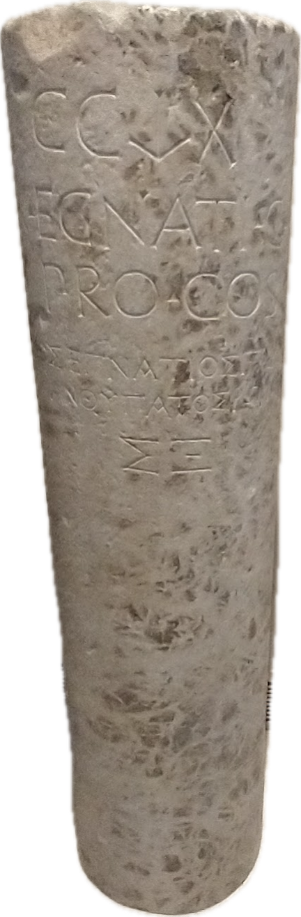
One very important archaeological find on the Via Egnatia is the milestone pictured here above. The inscription is bilingual. It contains the name of the governor of the province of Macedonia, Gnaius Egnatus (served in late 140s BC), who was responsible for the construction of this Roman road. Hence the name, Via Egnatia. The milestone was found near the point where the Via Egnatia crossed the Gallikos River, west of Thessaloniki. This inscription also accurately reports the length of the road to be 260 miles.
The Via Egnatia (like other Roman roads) was built to move the Roman army to the East. But the special significance of this road to Bible students is seen (beginning with the Second Missionary Journey) as Paul (and companions) crosses the Aegean from Troas to Neapolis, and from there gets on the Via Egnatia. Luke, the author of Acts and having joined Paul at Troas, traces the evangelist work from Philippi (Acts 16), passing through Amphipolis and Apollonia (Acts 17:1f; did not preach there) then to Thessalonica, where “a great multitude” (Acts 17:4) were persuaded to become Christians. But because of intense persecution, Paul then left the Via Egnatia and moved southward to Berea, where there was great success (Acts 17:10-15). Paul would have made use of this road again on the Third Journey (Acts 20:1-3).
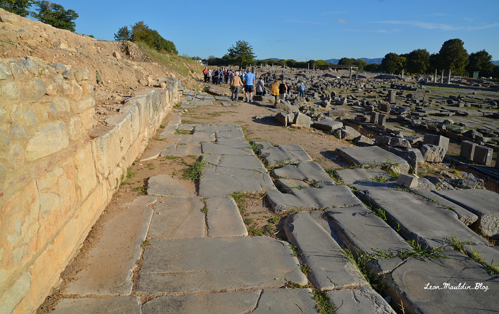
Here is a view of the Via Egnatia in Philippi, looking east. You can also see the agora to your right.
Click images for larger view.


 Posted by Leon Mauldin
