August 18, 2017
I love to study the book of Nehemiah. Jerusalem’s walls that had been in ruins since the Babylonian destruction (586 BC) were rebuilt (444 BC) in just 52 days! (Neh. 6:15). The people had a mind to work (4:6); they had a godly and capable leader in Nehemiah, and the good hand of God was upon them. But the remainder of the book (chapters 7ff.) is about the necessary follow-up; the necessary commitment to covenant faithfulness, without which the newly rebuilt walls would be meaningless.

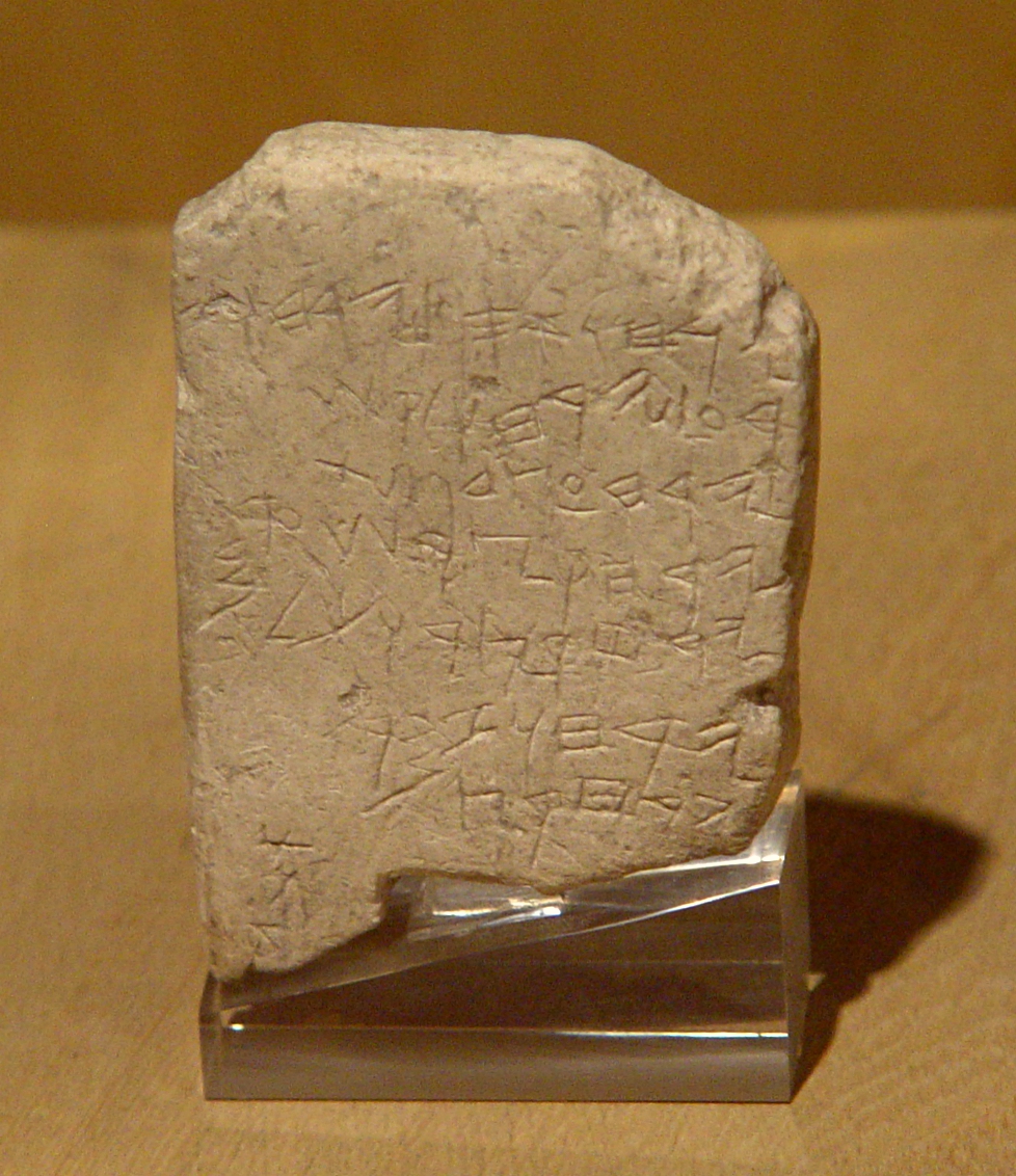
Gezer Calendar. One of the oldest examples of Hebrew script. Istanbul Archaeological Museum. Photo by Leon Mauldin.
To that end Israel’s leaders/Levites promised God: “Now because of all this We are making an agreement in writing; And on the sealed document are the names of our leaders, our Levites and our priests” (Neh. 9:38). What follows is a listing of 84 names (Neh. 10:1-27). Nehemiah’s name appropriately is first.
The Gezer Calendar is one of the oldest examples of Hebrew script. We share it here to illustrate our Nehemiah text. Those men who signed their renewed covenant with God, as well as “the rest of the people” (10:28), were pledging themselves to obey (v.29) in their homes (v.30), their business (v.31) and worship (v.32). In short: “We will not neglect the house of our God” (v.39).
By the way, the Gezer Calendar in our photo is a school-boy’s exercise in learning the months of the year, associated with agricultural events.
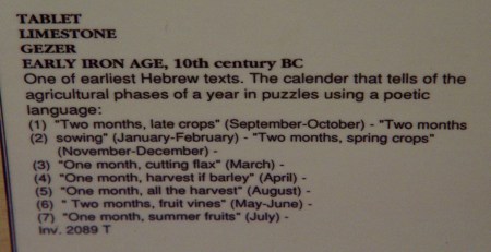
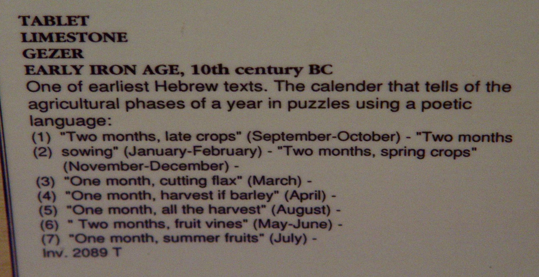
Explanation of the Gezer Calendar. Photo by Leon Mauldin.
Click images for larger view.
 Leave a Comment » |
  Archaeology, Bible History and Geography, Israel, Jerusalem, Old Testament, Persian Empire, photography, Travel, Turkey | Tagged: Gezer Calendar, Inscriptions, Nehemiah |
  Permalink
 Posted by Leon Mauldin
August 16, 2017
On the day of Pentecost (Acts 2), for the first time conditions of salvation were proclaimed under the New Covenant. Three thousand responded!
“Therefore let all the house of Israel know for certain that God has made Him both Lord and Christ– this Jesus whom you crucified.” 37 Now when they heard this, they were pierced to the heart, and said to Peter and the rest of the apostles, “Brethren, what shall we do?” 38 Peter said to them, “Repent, and each of you be baptized in the name of Jesus Christ for the forgiveness of your sins; and you will receive the gift of the Holy Spirit. 39 “For the promise is for you and your children and for all who are far off, as many as the Lord our God will call to Himself.” 40 And with many other words he solemnly testified and kept on exhorting them, saying, “Be saved from this perverse generation!” 41 So then, those who had received his word were baptized; and that day there were added about three thousand souls. (vv. 36-41, NASB).
There were many pools right there in Jerusalem which would have been suitable for the baptism of so many, including the Pool of Siloam, the Pool(s) of Bethesda, etc. I am also mindful of “Solomon’s Pools,” south of Jerusalem, located between Bethlehem and Hebron, which were water sources for Jerusalem in the days of Jesus.
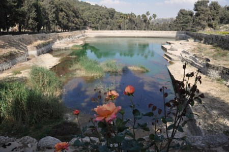
“Solomon’s Pool.” The middle of three. Photo by Leon Mauldin.
These three pools, the middle of which is in our photo here, were not built by Solomon, but by Herod the Great, or possibly by the Hasmoneans (intertestamental period). Pilate later made repairs to the pools.
Today the pools are located in the Palestinian Authority’s West Bank.
Click photo for larger image.
Leave a Comment » | Bible History and Geography, Hebron, Israel, Jerusalem, New Testament, photography, Travel, West Bank | Tagged: Solomon's Pools | Permalink
Posted by Leon Mauldin
August 15, 2017
On the Day of Pentecost (Acts 2), which marked the beginning of the preaching of the Gospel and the discharge of the Great Commission, Peter affirmed the resurrection of the crucified Christ, showing the fulfillment of Psalm 16:8-11 (Acts 2:25-28). Peter explained,
Brethren, I may confidently say to you regarding the patriarch David that he both died and was buried, and his tomb is with us to this day. And so, because he was a prophet and knew that GOD HAD SWORN TO HIM WITH AN OATH TO SEAT one OF HIS DESCENDANTS ON HIS THRONE, he looked ahead and spoke of the resurrection of the Christ, that HE WAS NEITHER ABANDONED TO HADES, NOR DID His flesh SUFFER DECAY. This Jesus God raised up again, to which we are all witnesses (Acts 2:29-32, NASB). (Note: the NASB uses upper-case in NT texts to indicate quotations from the OT).
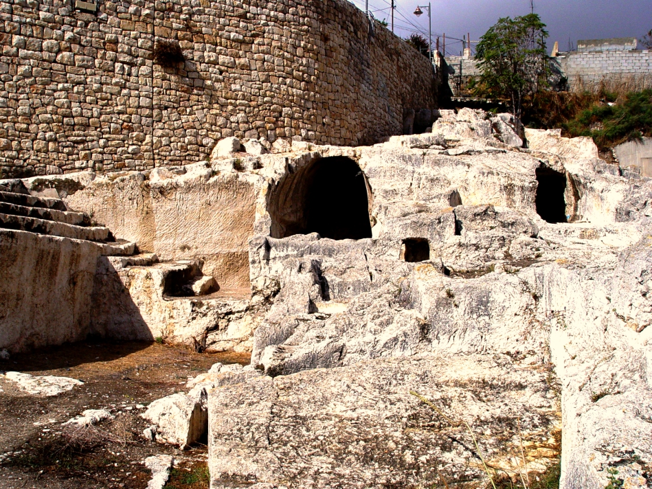
Here is the proposed site for the tombs of the house of David located at the SE portion of the City of David, excavated by Raymond Weill, 1913-1914.

Royal Tombs of the House of David, proposed site. Photo by Leon Mauldin.
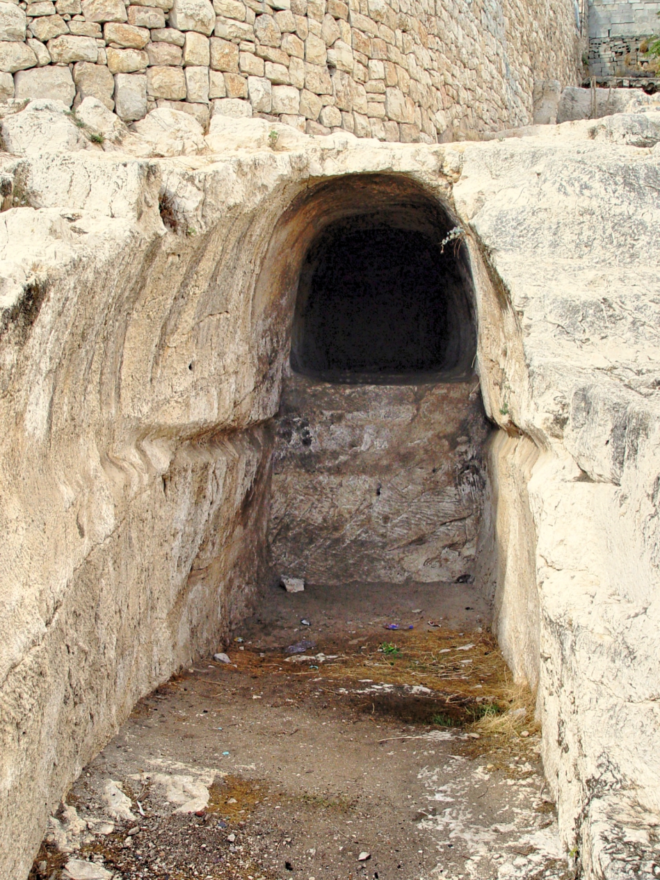
And a close-up shot:
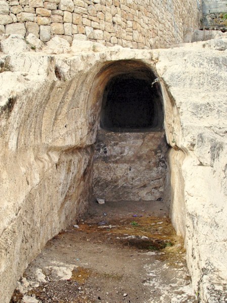
Proposed Tomb of the House of David. Photo by Leon Mauldin.
Dr. Todd Bolen notes,
Most scholars today reject this identification. These structures do not have features typical of Iron Age tombs; there are no burial benches or repositories. Because of later destruction, there is no stratigraphy, pottery, or burial gifts which would make dating the structure possible. Some scholars think that it dates to the Herodian period and may have been used as wine cellars for the structures built above it. There is no other candidate for the tomb of David.
The point to be remembered is that unlike the Subject of David’s psalm, David was buried, and his body saw corruption. The One of Whom he spoke saw no corruption. His body did not decay, and His spirit was not left in the Hadean realm–up from the grave He arose! The resurrection of Jesus is at the very heart of the Gospel message. Apart from the resurrection of Jesus there IS no Gospel!
We recently wrote on David’s Tomb here.
Click images for larger view.
Leave a Comment » | Bible History and Geography, Israel, Jerusalem, New Testament, Old Testament, photography, tombs, Travel | Tagged: David, Jesus' Resurrection | Permalink
Posted by Leon Mauldin
August 9, 2017
The Bible tells us of Judas’ remorse and subsequent suicide after his betrayal of Jesus (Matt. 27:3-10). Afterward the book of Acts continues with the selection of an apostle to take the place of Judas. To lead into that topic Peter reviewed what had happened:
“Brothers, the Scripture had to be fulfilled, which the Holy Spirit spoke beforehand by the mouth of David concerning Judas, who became a guide to those who arrested Jesus. For he was numbered among us and was allotted his share in this ministry.” (Now this man bought a field with the reward of his wickedness, and falling headlong he burst open in the middle and all his bowels gushed out. And it became known to all the inhabitants of Jerusalem, so that the field was called in their own language Akeldama, that is, Field of Blood.) “For it is written in the Book of Psalms, “‘ May his camp become desolate, and let there be no one to dwell in it’; and “‘Let another take his office.'” (Acts 1:16-20).

Akeldama, south of Jerusalem. Photo by Leon Mauldin.
Our photo shows the traditional site of Akeldama at center, just beyond the valley. This is the area were the Kidron and Hinnom valleys converge. The structure you see is a Greek Orthodox Monastery, built in 1874, named after Onuphrius, an Egyptian anchorite known for the length of his beard.
Leen & Kathleen Ritmeyer note:
This area was identified as Akeldama as early as the third and fourth centuries. The earliest chroniclers—Eusebius, who visited the land in 335 A.D., among whose writings was a life of the Emperor Constantine, and Jerome, 400 A.D., the author of an onomasticon (a list of proper names, which sought to locate sites hallowed by Scripture)—both identify this place with confidence as the Field of Blood referred to in the New Testament. In 570 A.D., the pilgrim Antoninus made the same identification. (1994). BAR, 20(6).
Even so, the Ritmeyers think this site to be implausible as the Field of Blood, because “here are some of the most splendid Herodian tombs ever discovered” . . . “a field of elegant and elegantly decorated burial caves.” “One of them probably belonged to the high priest Annas” (Ibid.).
Click photo for larger view.
2 Comments | Bible History and Geography, Israel, Jerusalem, New Testament, photography, Travel | Tagged: Akeldama, Judas | Permalink
Posted by Leon Mauldin
July 20, 2017
Nehemiah, whom God used to rebuild the walls of Jerusalem (444 BC), served during the administration of the Persian King Artaxerxes (464-423 BC). Nehemiah states, “For I was the king’s cupbearer” (Nehemiah 1:11).
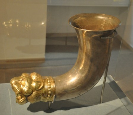
Drinking Cup. Bible Lands Museum, Jerusalem. Photo by Leon Mauldin.
Professor Edwin Yamauchi has some helpful information on what it would have meant to be a “cupbearer”:
“Cupbearer” (mašqeh is a Hiphil participle of the verb šaqāh) literally means “one who gives (someone) something to drink.” It occurs twelve times in the OT in the sense of “cupbearer,” e.g., in 1 Kings 10:5 and 2 Chronicles 9:4 of Solomon’s attendants. In the Joseph story it occurs nine times (Gen 40:1–41:9), but its significance is obscured by the KJV and the RSV, which translate the word “butler.” That the cupbearer could have other responsibilities as well is indicated by Tobit 1:22: “Now Ahikar was cupbearer, keeper of the signet, and in charge of administration of the accounts, for Esarhaddon had appointed him second to himself.” For archaeological evidence of Persian wine services, see P.R.S. Moorey, “Metal Wine-Sets in the Ancient Near East,” Iranica Antiqua 15 (1980): 181ff.
Varied sources suggest something about Nehemiah as a royal cupbearer:
1. He would have been well-trained in court etiquette (cf. Dan 1:4–5).
2. He was probably a handsome individual (cf. Dan 1:4, 13, 15; Jos. Antiq. XVI, 230 [viii.1]).
3. He would certainly know how to select the wines to set before the king. A proverb in the Babylonian Talmud (Baba Qamma 92b) states: “The wine belongs to the master but credit for it is due to his cupbearer.”
4. He would have to be a convivial companion, willing to lend an ear at all times.
5. He would have great influence as one with the closest access to the king, able to determine who was able see his master.
6. Above all Nehemiah had to be one who enjoyed the unreserved confidence of the king. The great need for trustworthy court attendants is underscored by the intrigues endemic to the Achaemenid court. Xerxes, father of Artaxerxes I, was killed in his own bedchamber by Artabanus, a courtier (The Expositor’s Bible Commentary: 1 & 2 Kings, 1 & 2 Chronicles, Ezra, Nehemiah, Esther, Job. Vol. 4, p. 683).
H.G.M. Williamson notes:
Royal cupbearers in antiquity, in addition to their skill in selecting and serving wine and their duty in tasting it as proof against poison, were also expected to be convivial and tactful companions to the king. Being much in his confidence, they could thus wield considerable influence by way of informal counsel and discussion. Texts and pictures from many Ancient Near Eastern sources (including Achaemenid) supporting this statement have been helpfully collected by Yamauchi, ZAW 92 (1980) 132–42. The portrayal fits admirably with the sequel in chap. 2. It may be noted also that the office of cupbearer could be combined with other important offices. (Word Biblical Commentary, Ezra, Nehemiah. Vol. 16, p. 174).
Click image for larger view.
Leave a Comment » | Bible History and Geography, Bible Study, City Walls, Israel, Jerusalem, Old Testament, Persian Empire, photography, Travel | Tagged: Artaxerxes, Cupbearer, Nehemiah | Permalink
Posted by Leon Mauldin
June 20, 2017
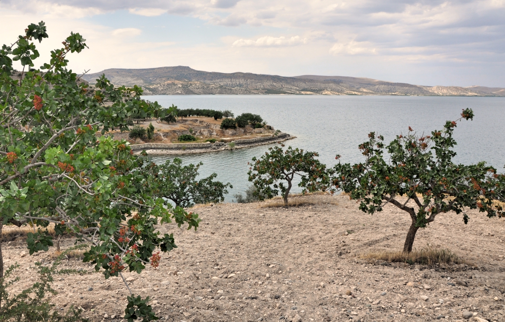
We are currently teaching the OT book of Ezra in our local congregation. Ezra 8 mentions Ahava as a place (v.15) and a river (note NET: “canal” and NLT: “Ahava Canal” (vv.21,31).
This [Ahava] has not been identified, though it appears from v 21 that both the canal (lit., “river”) and the locality shared the same name. We must assume from the context that it was a large open space close to Babylon. Babylon itself was built on the Euphrates river from which flowed a number of artificial canals and waterways for defensive purposes (cf. IDB 1, 334–38; Ezek 1:1; Ps 137:1). Ahava was no doubt one of these (Williamson, H. G. M. Ezra, Nehemiah, Word Biblical Commentary, p. 116).
Our photo shows the Euphrates at Zeugma, named Selucia during the Grecian intertestamental period.

Euphrates River at Zeugma. Photo by Leon Mauldin.
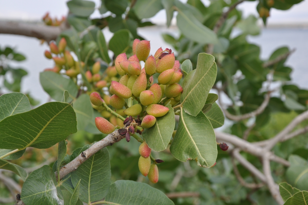
I took this photo in Upper Mesopotamia, near the Birecik Dam, well north of the area referenced in Ezra 8, but it serves well for illustrative purposes. In the foreground are pistachio trees.

Pistachio tree, close-up. Photo by Leon Mauldin.
Originally, the ancient city of Zeugma was founded as a Greek settlement by Seleucus I Nicator, one of the generals of Alexander the Great, in 300 BC. The city was called “Zeugma”, because of the bridge across the Euphrates River that was made of pontoons, thus connecting the two banks of the river. In Greek, “zeugma” means “bridge-passage” or “bridge of boats”. The population of the city at its peak was approximately 80,000.
In 64 BC the city was conquered and ruled by the Roman Empire. During Roman rule, the city became one of the attractions in the region, due to its commercial potential originating from its geo-strategic location because the city was on the Silk Road connecting Antioch to China via a bridge of pontoons across the river Euphrates, which defined the border with the Persian Empire until the late 2nd century.
In 256 AD, Zeugma experienced an invasion and was destroyed by the Sassanid king, Shapur I. The damage from the invasion was so drastic that Zeugma was not able to recover for a long time. To make the situation even worse, a violent earthquake buried the city beneath rubble. Indeed, during the rest of its time under Roman rule, the city never regained the prosperity it had once achieved.
Zeugma and environs remained part of the Roman empire. During the 5th and 6th centuries the city was ruled by the Early Byzantium or Eastern Roman Empire. As a result of the ongoing Arab raids the city was abandoned once again. Later on, in the 10th and 12th centuries, a small Abbasid group settled in Zeugma.
Finally a village called Belkis was founded at the site in the 17th century. (Wikipedia).
To see another of my photos of the Euphrates click here. Ferrell Jenkins has several entries on the Euphrates including here and here.
Click images for larger view.
Leave a Comment » | Bible History and Geography, Old Testament, photography, Travel, Turkey, Uncategorized | Tagged: Euphrates, Seleucia, Zeugma | Permalink
Posted by Leon Mauldin
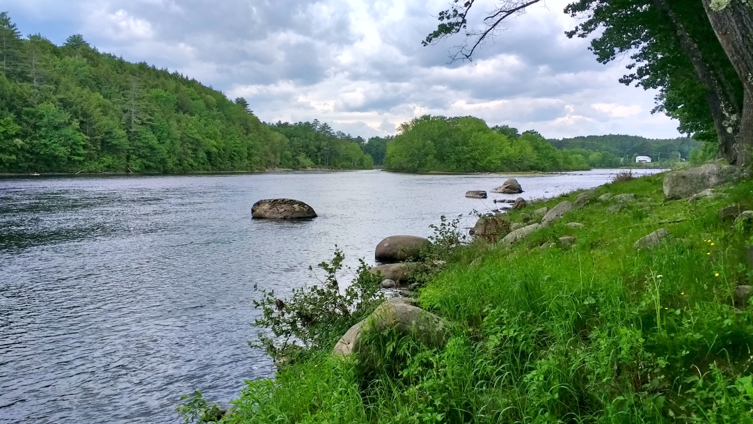
June 13, 2017
The sub-title for Leon’s Message Board is “Bible History and Geography…and More.” Today’s post from Maine is in the “and more” category. Before Benedict Arnold became know as the infamous traitor to his country, he led a force of 1,100 Continental Army troops on an expedition from Cambridge, Massachusetts to the gates of Quebec City. Part of that journey took him and his men up the Kennebec River coming to what is now Skowhegan, October 4, 1775. We had opportunity today while in nearby Waterville to visit this area.

Looking down the Kennebec. Arnold and his men came upstream here, south of Skowhegan. Photo by Leon Mauldin.
Here is a view looking up the Kennebec toward Skowhegan.

Looking up the Kennebec to Skowhegan. Photo by Leon Mauldin.
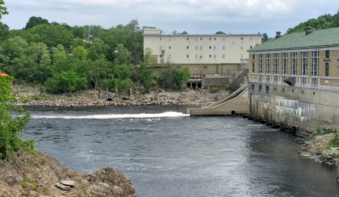
When Arnold and his men arrived at the falls at Skowhegan, portage was necessary. This is the location; now there is a dam.

At the Falls at Skowhegan where Arnold and his men took portage. Photo by Leon Mauldin.
An interesting diary entry from a solder, Captain Thayer wrote in his journal while passing through Skowhegan: at this time:
The carrying place is across an island…The people call this place Canaan; a Canaan indeed! the land is good, the timber large and of various kinds, such as pine, oak, hemlock and rock maple. Last night our clothes being wet were frozen a pane of glass thick, which proved very disagreeable, being obliged to lie in them…The people are courteous and breathe nothing but liberty.
We’re enjoying our visit in Maine, as our speaking appointments continue this week.
Click images for larger view.
2 Comments | American History, photography, Travel, Uncategorized | Tagged: Benedict Arnold, Kennebec, Maine, Skowhegan | Permalink
Posted by Leon Mauldin
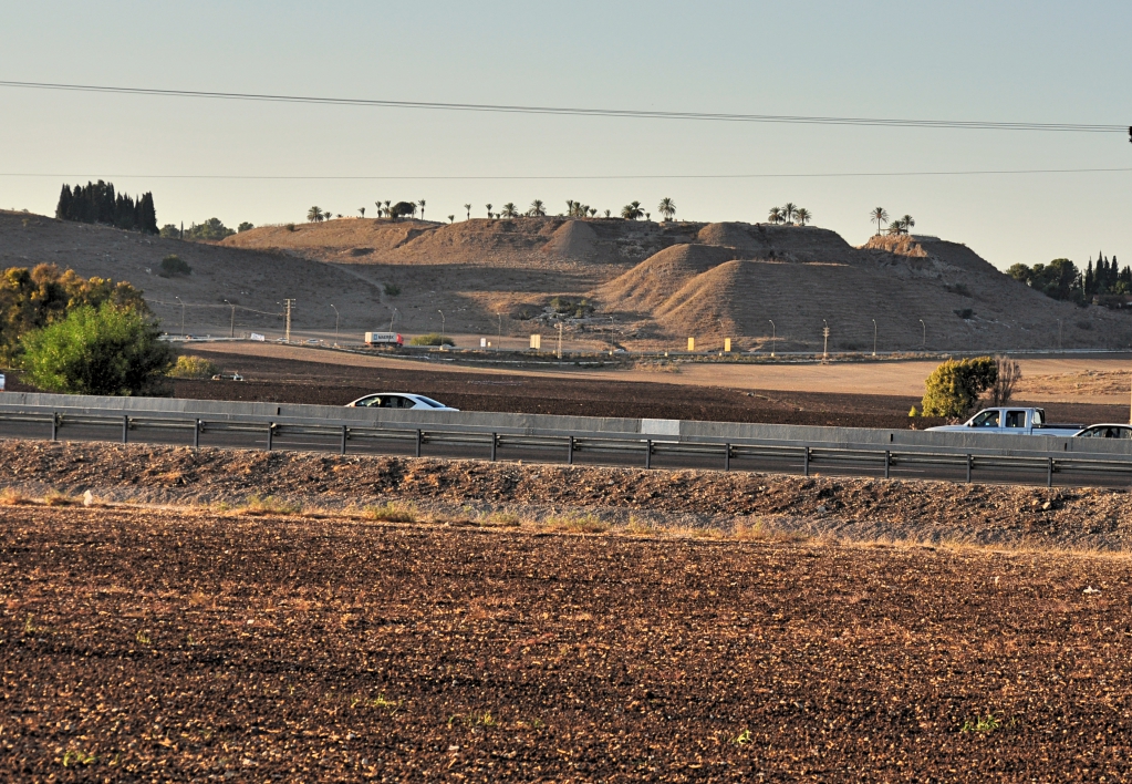
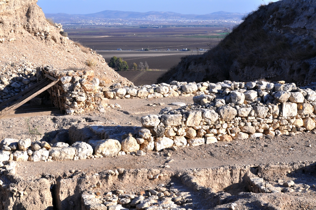
May 19, 2017
Megiddo is mentioned several times in the Old Testament, and once in the NT (Rev. 16:16). In the Old Testament, nearing the close of the kingdom of Judah, good King Josiah (r. 640-609 BC) was mortally wounded there in battle by Pharaoh Neco of Egypt, who was en route to Carchemish to war against Babylon. The international highway, the Via Maris, connected Egypt to Mesopotamia, so Neco was on that route, which passed through the strategic site of Megiddo.
However, Josiah would not turn away from him, but disguised himself in order to make war with him; nor did he listen to the words of Neco from the mouth of God, but came to make war on the plain of Megiddo. The archers shot King Josiah, and the king said to his servants, “Take me away, for I am badly wounded.” So his servants took him out of the chariot and carried him in the second chariot which he had, and brought him to Jerusalem where he died and was buried in the tombs of his fathers. All Judah and Jerusalem mourned for Josiah. Then Jeremiah chanted a lament for Josiah. And all the male and female singers speak about Josiah in their lamentations to this day. (2 Chron. 35:22-25, NAU).
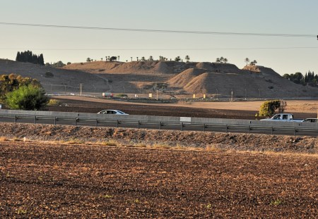
Tel Megiddo in distance. A portion of the “Plain of Megiddo” or the “Valley of Megiddo” is in foreground. Photo by Leon Mauldin.
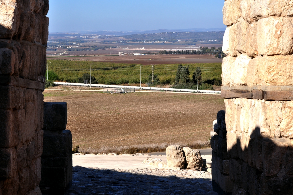
One of the sites my group visited in November ’16 was Megiddo.

View from Megiddo through ancient gate looking to plain below. Photo by Leon Mauldin.
Here is a view of some of the archaeological excavations in foreground, with another view of the plain/valley below.

Excavations/view from Megiddo. Photo by Leon Mauldin.
These photos help provide the setting for the texts that mention biblical Megiddo.
I have made numerous posts on Megiddo; click here, here, here, here, here, and here.
Click images to enlarge.
Leave a Comment » | Bible History and Geography, Bible Places, Bible Study, City Gates, Israel, New Testament, Old Testament, photography, Travel, Uncategorized | Tagged: Armageddon, Megiddo | Permalink
Posted by Leon Mauldin
May 18, 2017
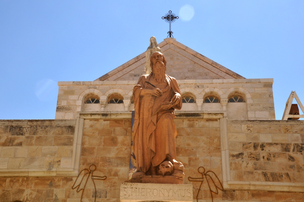
We recently had the opportunity to visit Bethlehem, the town where Jesus was born. In addition to Bethlehem’s being important for that reason (Micah 5:2; Luke 2:1-20; Matt. 2:1-13), this location is also significant due to the work of Jerome (Eusebius Sophronius Hieronymus).

Statue of Jerome in Bethlehem, outside of the Church of St. Catherine. Photo by Leon Mauldin.
Jerome was born at Stridon, Dalmatia, ca. AD 347. He is especially noted for his translation of the Bible into Latin.
In 384 Jerome took up residence in Bethlehem, to be joined two years later by Paula and her daughter Eustochium. Together they made Bethlehem a great monastic centre; within this framework Jerome wrote prolifically, his most notable achievement being a new translation of the Old and New Testaments (the Vulgate) which remained the authoritative version of the Bible for Catholics until the C20. (Murphy-O’Connor, The Holy Land: An Oxford Archaeological Guide from Earliest Times to 1700, Oxford Archaeological Guides, p.233).
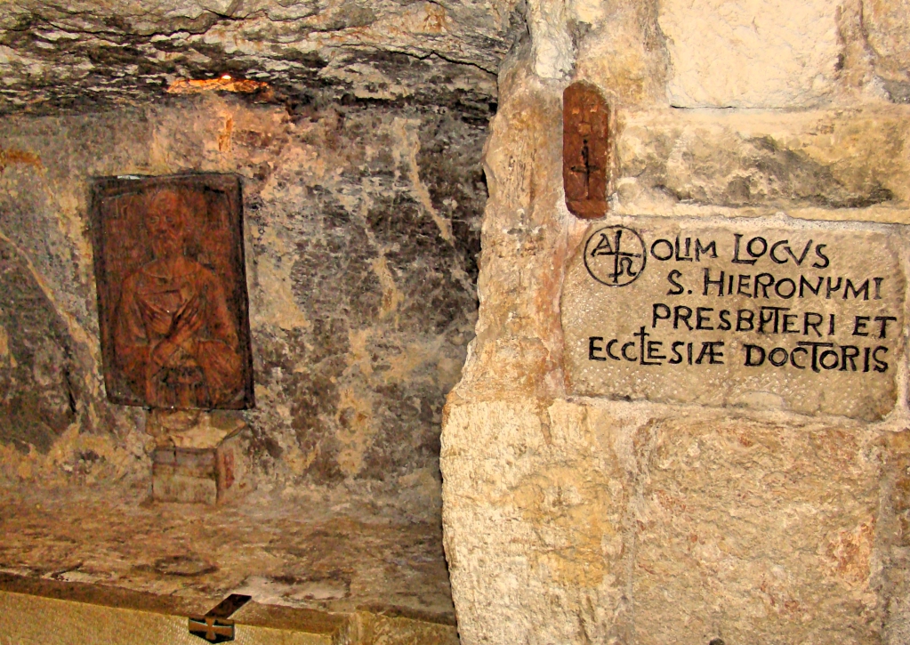
This cave is said to be Jerome’s study, where he did his monumental literary work.

Jerome’s study in Bethlehem. Photo by Leon Mauldin.
See Ferrell Jenkin’s article (Dec. ’08) on Jerome here.
Click on photos for larger view.
Leave a Comment » | Bethlehem, Bible History and Geography, Bible Places, Bible Study, Israel, New Testament, photography, Travel, Uncategorized | Permalink
Posted by Leon Mauldin
May 17, 2017
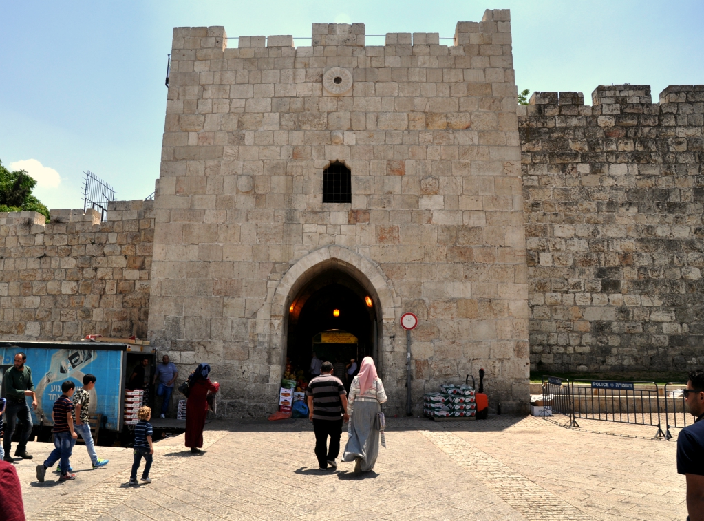
We continue to explore some of the gates of Jerusalem, as we share some our photos from our recent trip to Israel. Today’s post features Herod’s Gate.
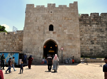
Herod’s Gate in Jerusalem. Photo by Leon Mauldin.
Jerome Murphy-O’Connor writes:
The official name of this gate is Bab ez-Zahr, ‘the Flowered Gate’. It got its present name only in the C16 or C17 because pilgrims believed a Mamluk house inside near the Franciscan Monastery of the Flagellation to be the palace of Herod Antipas. The original entrance is in the east face of the tower. It was at this point that the Crusaders first established a bridgehead on the walls at noon on 15 July 1099. Just beside the west face of the first tower going towards Damascus Gate the channel of an aqueduct is marked by a series of irregular covering slabs. Pottery embedded in the plaster of the last repair show it to have been in use until the late C3AD or early C4. The ditch in which the present road runs must therefore be subsequent to this date, because it cuts the aqueduct. This suggests that the earliest wall on the present line at this point must be dated to the last years of Aelia Capitolina. Slightly further west the wall makes a curve inward and follows the rim of an ancient quarry which extended across the road into what is now the bus station; for details see SOLOMON’S QUARRIES (p. 162). The weight of the wall caused part of the roof of the quarry to cave in. The small walled section in the centre at ground level enshrines part of a sloping glacis of uncertain date. The wall of Herod Agrippa I (AD 41–4) linking Damascus Gate with the East Gate in the ECCE HOMO CONVENT (p. 35), must have turned south on the highest point to the west now occupied by the Spafford Hospital. (The Holy Land: An Oxford Archaeological Guide from Earliest Times to 1700, Oxford Archaeological Guides, p. 14).
We previously posted (in 2011) on Herod’s Gate here.
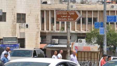
Sign pointing to Herod’s Gate. Photo by Leon Mauldin.
Click photo for larger view.
Leave a Comment » | Bible History and Geography, Bible Places, City Gates, Israel, Jerusalem, New Testament, photography, Travel, Uncategorized | Tagged: Herod's Gate | Permalink
Posted by Leon Mauldin