Zarethan (Tell es Sa’idiyeh) in the Jordan Valley

March 22, 2018

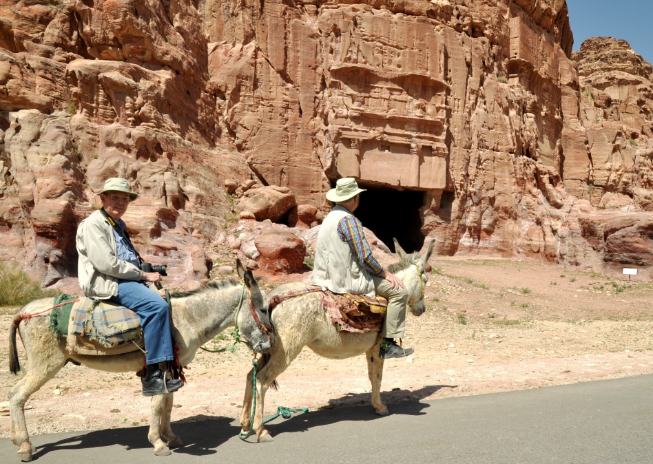
This morning we left  the Dead Sea, made our way to the border crossing at the King Hussein Bridge into Israel, and arrived after dark at Tiberias on the Sea of Galilee, with brief stops at Jerusalem and Caesarea on the way. We plan as time permits to share more photos/info from this past week in Jordan, as well as more to come in Israel.

For tonight I wanted to mention Zarethan in the Jordan Valley, of biblical significance in the Old Testament. When Solomon was building the temple and its vessels, some of the metal casting  (bronze) was done in the area of Zarethan.

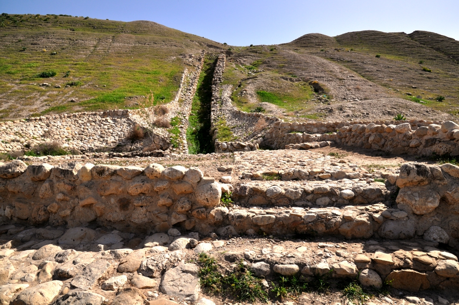
Zarephan, mentioned in connection with casting bronze for use in Solomon’s temple. Photo by Leon Mauldin.

1 Kings 7:

40 Now Hiram made the basins and the shovels and the bowls. So Hiram finished doing all the work which he performed for King Solomon in the house of the LORD: 41 the two pillars and the two bowls of the capitals which were on the top of the two pillars, and the two networks to cover the two bowls of the capitals which were on the top of the pillars; 42 and the four hundred pomegranates for the two networks, two rows of pomegranates for each network to cover the two bowls of the capitals which were on the tops of the pillars; 43 and the ten stands with the ten basins on the stands; 44 and the one sea and the twelve oxen under the sea; 45 and the pails and the shovels and the bowls; even all these utensils which Hiram made for King Solomon in the house of the LORD were of polished bronze. 46 In the plain of the Jordan the king cast them, in the clay ground between Succoth and Zarethan. (verses 40-46)

The British Museum website has some interesting info:

Tell es Sa’idiyeh, identified as the biblical city of Zarethan, lies at the heart of the central Jordan Valley. The huge, double occupation mound occupies a key strategic position, commanding the crossroads of two major trade routes, and dominating some of the richest and most fertile agricultural land east of the River Jordan.

Excavations undertaken since 1985, by a British Museum expedition under the direction of Jonathan N. Tubb, have revealed the great antiquity of the site’s occupational history, with settlement phases extending from the Early Islamic period of the seventh century AD, as far back at least as the Early Bronze Age of the third millennium BC. Excavations have shown that by about 2900 BC, Tell es-Sa’idiyeh was a large and prosperous city, with well constructed architecture and evidence for highly developed municipal planning. The most significant finding in this Early Bronze Age phase has been of a large palace complex on the lower tell, with areas set aside for olive oil production and storage, wine-making and textile preparation. All three of these activities were conducted on an industrial scale, clearly designed for international commerce. The pottery and other artifacts recovered from this early city display a level of refinement and sophistication unparalleled elsewhere in the Levant.

Equally remarkable discoveries relate to the city of the twelfth century BC, where excavations have uncovered evidence to suggest that Tell es-Sa’idiyeh, like Beth Shan or Gaza on the other side of the Jordan River, was a major centre for the Egyptian control of Canaan during the final years of its New Kingdom empire. Substantial architecture, including an elaborate water system and Egyptian-style public buildings have been found on the upper mound, and the same strong Egyptian component is also found in the contemporary cemetery which was cut into the long-abandoned and eroded ruins of the Early Bronze Age city on the lower mound. The expedition has excavated, to date, some 450 graves, many of which show unusual Egyptian features, both in terms of the grave-goods and burial customs. (http://www.britishmuseum.org/research/research_projects/tell_es-sa%E2%80%98idiyeh_excavations.aspx).

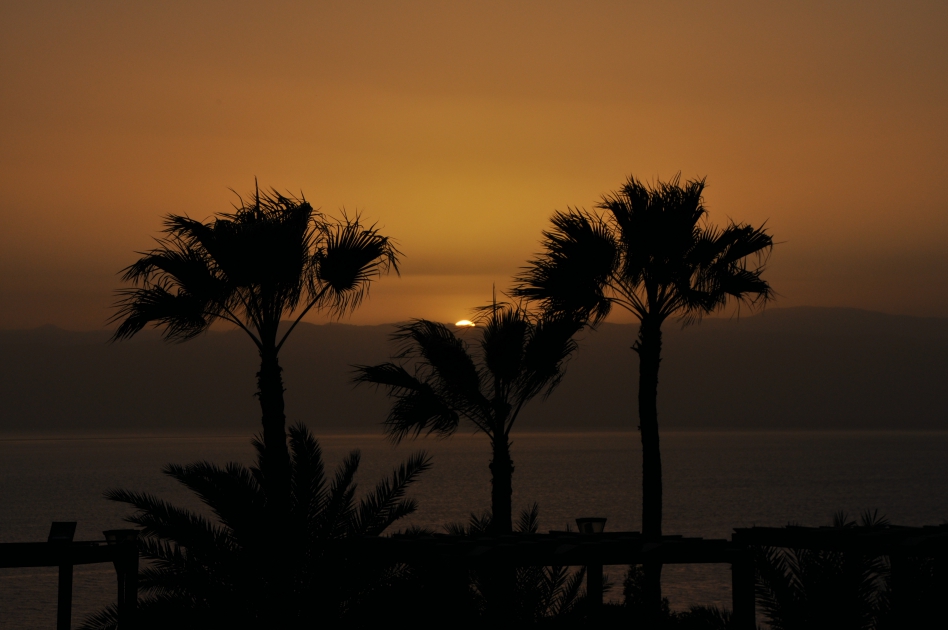
A couple of days ago I posted a sunset view of the Dead Sea; here is our view of the Dead Sea from the Jordan side looking across to Israel this morning.

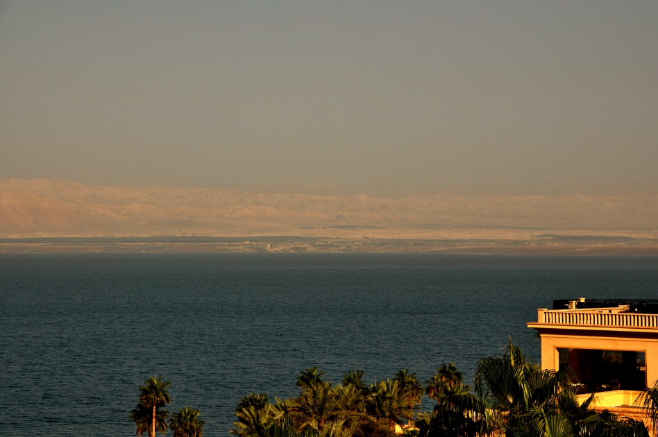
Morning view of Dead Sea looking west. Photo by Leon Mauldin.

Click images for larger view.


Making Friends in the Jordan Valley

March 21, 2018

Ferrell Jenkins & I are continuing to enjoy our present opportunity to visit and photograph biblical/archaeological sites in Jordan and Israel. We also enjoy meeting many friendly people along the way. Today as we were looking for Tell es Sa’idiyeh, identified as the biblical city of Zarethan, we stopped for a bite of lunch in the Jordan Valley, in the biblical region of Perea.

Photo by Leon Mauldin.

Photo by Leon Mauldin.

The food was good (we each had a 1/2 chicken), but it was also pleasant to meet friendly people.

Thanks for continuing to follow our travels.


Greetings from Jordan

March 20, 2018

Today’s travels/photography included the proposed site of Tel Heshbon (mentioned numerous times, Num. 21:25, etc.) and Madaba, famous for its large Byzantine-era mosaic map of Israel.

Here is today’s sunset view from Jordan, across the Dead Sea looking to Israel. The mountains of Moab are at our back.

Sunset at Dead Sea. Photo by Leon Mauldin.

Thanks for following our travels.

Click image for larger view.


The Treasury at Petra

March 19, 2018

This morning we enjoyed a visit to Petra, the capital of the Roman province of Arabia during the time of Christ. During Old Testament times Petra was in the territory of Edom. There is so much to see. For now I will share a photo of the “Treasury.”

“Treasury” at Petra. Photo by Leon Mauldin.

Known locally as the Treasury, this tomb is where most visitors fall in love with Petra. The Hellenistic facade is an astonishing piece of craftsmanship. Although carved out of iron-laden sandstone to serve as a tomb for the Nabataean King Aretas III (c 100 BC– AD 200), the Treasury derives its name from the story that an Egyptian pharaoh hid his treasure here (in the facade urn) while pursuing the Israelites. Some locals clearly believed the tale because the 3.5m-high urn is pockmarked by rifle shots. As with all rock-hewn monuments in Petra, the interior is unadorned. (Lonely Planet).

It’s been a while since I’ve been on horseback, and I had never ridden a donkey, but I did both today.

Ferrell Jenkins and Leon Mauldin riding donkeys at Petra. Photo by local Bedouin.

Tonight we’re on the eastern shore of the Dead Sea as we continue to explore and photograph Jordan.

Click images for larger view.


On the Banks of Jordan

March 18, 2018

On the banks of the Jordan River: Ferrell Jenkins and I are enjoying an opportunity to explore biblical sites in Israel/Jordan, currently in Jordan. We have seen Pella and Jerash, which were cities of the Decapolis. The past two nights we stayed at Bethany, within easy walking distance of the Jordan.

On the banks of the Jordan at Bethany, the traditional location of Jesus’ baptism. Photo by Ferrell Jenkins.

Seeing the reeds here along the Jordan reminded me of some biblical references. Jesus asked the people regarding John: “As these men were going away, Jesus began to speak to the crowds about John, “What did you go out into the wilderness to see? A reed shaken by the wind?” (Mt. 11:7). John was certainly no reed shaken by the wind!

Today we saw Mt. Nebo, where Moses stood when he looked across to see the Promise Land, then Dibon, where the famous Moabite stone was discovered. We had stunning views of the Arnon gorge, and made our way on the King’s Highway to Petra, arriving after dark.

I’ve previously posted on the Jordan River here, here, and here.

I’ve not posted until now due to internet issues, but plan to be able now to share more photos.


Thessalonian Politarch Inscription & its Bearing on Acts 17:6,8

February 21, 2018

Acts 17:6,8 mention the “rulers of the city” of Thessalonica, who beat and imprisoned Paul and Silas. Luke, the inspired writer of Acts, is a most careful historian. Different cities/districts used specific words to designate their rulers. Here Luke uses the word “politarch” (πολιτάρχης) which was a “very rare title for magistrates” (see Schaff below). Was Luke correct or was he mistaken?

Last month in London I was able to photograph a very important inscription, the Politarch Inscription of Thessalonica, removed from a Roman gateway of the city.

Inscription from Thessalonica using the word “politarchs” to designate rulers, as found in Acts 17:6,8. Photo ©Leon Mauldin. British Museum.

Church historian Philip Schaff, in a section entitled “The Acts and Secular History,” wrote:

The “politarchs” of Thessalonica, 17:6, 8 (Greek text: τοὺς πολιτάρχας, i.e., τοὺς ἄρχοντας τῶν πολιτῶν, praefectos civitatis, the rulers of the city).

This was a very rare title for magistrates, and might easily be confounded with the more usual designation “poliarchs.” But Luke’s accuracy has been confirmed by an inscription still legible on an archway in Thessalonica, giving the names of seven “politarchs” who governed before the visit of Paul.

The Thessalonian inscription in Greek letters is given by Boeckh. Leake, and Howson (in Conybeare and Howson’s Life and Letters of St. Paul, ch. IX., large Lond. ed., I. 860). Three of the names are identical, with those of Paul’s friends in that region-Sopater of Beraea (Acts 20:4), Gaius of Macedonia (19:29), and Secundus of Thessalonica (20:4). I will only give the first line:

ΠΟΛΕΙΤΑΡΧΟΥΝΤΩΝ ΣΩΣΙΠΑΤΡΟΥ ΤΟΥ ΚΛΕΟ. (Schaff, P., & Schaff, D. S. (1910). History of the Christian church (Vol. 1, p. 735). New York: Charles Scribner’s Sons.

Inscription in its original setting in Thessalonica. Photo ©Leon Mauldin. British Museum.

Schaff earlier in that section mentioned the significance and importance of such artifacts as pertains to the book of Acts:

Bishop Lightfoot asserts that no ancient work [as that of Acts, L.M.] affords so many tests of veracity, because no other has such numerous points of contact in all directions with contemporary history, politics, and typography, whether Jewish or Greek or Roman. The description of persons introduced in the Acts such as Gamaliel, Herod, Agrippa I., Bernice, Felix, Festus, Gallio, agrees as far as it goes entirely with what we know from contemporary sources. The allusions to countries, cities, islands, in Syria, Asia Minor, Greece, and Italy are without exception correct and reveal an experienced traveler. Ibid.732)

In other words, time and time again, Luke has been proven to be right! You can trust the Bible!

The British Museum Curator’s comments are interesting:

This large stone was built into a wall at the Vardar Gate of Thessalonica and was removed in 1877. The stone has been assumed to name city officials of the era. The inscription is important to New Testament scholars because it is one of the few stones that attests the existence of the office of politarch, mentioned in the Bible (Acts 17:6 and 8) and in only a few other literary sources. It is also curious because it mentions the mothers as well as the fathers of two of the politarchs. How the number of politarchs in this inscription should be counted varies among the modern editions; the translation here presents the usual interpretation of the inscription (see vom Brocke). (http://www.britishmuseum.org/research/collection_online/collection_object_details.aspx?objectId=398975&partId=1)

I should mention that this inscription is not regularly on display. It took three days to get an appointment to go into the room where is it housed, but it was worth it!

Click images for larger view.


Cathedral of the Holy Cross, Akdamar (Aghtamar) Island, Lake Van, Eastern Turkey

February 9, 2018

Some homeschoolers I’m teaching this afternoon will be studying in their history, among other topics, the plight of the Armenians during the Ottoman Empire, including the bloody reign of Sultan Abdul Hamid II, 1876–1909. Reading the material on the Armenians put me in mind of a visit to that part of the world I made in 2007, where I visited a church that dates back to the 10th century.

Cathedral of the Holy Cross, Akdamar Island. Photo by Leon Mauldin.

Wikipedia notes:

During his reign, King Gagik I Artsruni (r. 908-943/944) of the Armenian kingdom of Vaspurakan chose the island of Aght’amar as one of his residences, founding a settlement there. The only structure standing from that period is the Cathedral. It was built of pink volcanic tufa by the architect-monk Manuel during the years 915-921, with an interior measuring 14.80m by 11.5m and the dome reaching 20.40m above ground. In later centuries, and until 1915, it formed part of a monastic complex, the ruins of which can still be seen to the south of the church.

Between 1116 and 1895 Aght’amar Island was the location of the Armenian Catholicosate of Aght’amar. Khachatur III, who died in 1895, was the last Catholicos of Aght’amar. In 1915, during the Armenian Genocide, the church was looted, and the monastic buildings destroyed.

Among the carvings on the outside of the church was this scene of David’s battle with Goliath.

David and Goliath. A scene on the outside wall of the Armenian church. Photo ©Leon Mauldin.

To get to the island we took a boat from this location.

Dock where we secured a boat to go to Akdamar Island. Photo by Leon Mauldin.

This area is very near the Ararat mountain range, where Noah’s ark came to rest (Gen. 8:4).

See Ferrell Jenkins article here.

Click images for larger view.


Heket, the Goddess of Childbirth

February 8, 2018

Among the fascinating artifacts displayed in the British Museum is this andesite porphyry statue devoted to the frog goddess Heket. In Egyptian mythology, the “frog goddess Heket, at one time regarded as the consort of the creator god Khnum, acted as the divine midwife and was said to attend royal births” (Oakes & Gahlin, Ancient Egypt, p.347).

The frog goddess Heket. British Museum. Photo by Leon Mauldin.

The accompanying museum placard states, “The frog goddess Heket watched over childbirth, a connection forged by the myriad tadpoles visible on the Nile banks . . . [this is] one of the few sizable animal sculptures surviving from the Early Dynastic period.” That would be c. 3100 BC.

When I photographed this display last month I was reminded of the ten plagues which brought Egypt to its knees (Exodus 7-12). Though some try to explain these events as the result of natural phenomena, the Bible is clear as to the Lord’s involvement and intention. These were divine acts of judgment not only designed to humble the mighty Pharaoh, but also to demonstrate that YHWH was the true God; these were judgments against the gods of Egypt. Note the following biblical texts:

Exodus 6:6- “I will redeem you with an outstretched arm and great acts of judgment.

Exodus 12:12- “against all the gods of Egypt I will execute judgment: I am the LORD.”

Numbers 33:4- ” Also on their [the Egyptians] gods the LORD had executed judgments.”

Psalm 78:45- “He sent swarms of flies among them, which devoured them, And frogs, which destroyed them.”

Gods and goddesses such as Heket had no power at all. The true God brought the hoards of frogs, and when He was ready He destroyed them (Ex. 8:2ff).

Initially when Moses and Aaron appeared before Pharaoh with the request, “Thus says the LORD God of Israel: ‘Let My people go, that they may hold a feast to Me in the wilderness,'” Pharaoh arrogantly responded, “Who is the LORD, that I should obey His voice to let Israel go? I do not know the LORD, nor will I let Israel go. (Ex. 5:1-2). The ten plagues were his Ten Lesson Course. Pharaoh, and all of Egypt, would come to know that the LORD is God, the God of all the earth.


Mt. Sinai Region, a Panaroma

January 28, 2018

I took this shot of the Sinai region while walking up toward Mt. Sinai, looking at the area below, to give a feel for the geography of this part of the biblical world.

Rugged Region of Mt. Sinai. Photo by Leon Mauldin.

The Sinai Peninsula today is within Egyptian territory. You can see traditional Mt. Sinai itself in this photo, in upper right.

Mt. Sinai, upper right. Photo by Leon Mauldin.

Click images for larger view.


Jerusalem, SW Temple Mount Panaroma

January 26, 2018

A panoramic view looking toward the SW corner of the Temple Mount in Jerusalem.

Panorama of Jerusalem, SW corner of Temple Mount. Photo by Leon Mauldin.

At the base of the ancient wall on your left (western side) you can see stones lying in place. These were from the Herodian Temple of Jesus day, falling down to their present position in the 70 AD Roman destruction of Jerusalem. Though seemingly small in our photo, some of these broken stones weight tons.

The view straight across shows southern side of temple mount. The distant view at right center is the Mount of Olives, across from the Kidron Valley (which cannot be seen from this view.

This photo is from Spring, 2017.

Click image for larger view.