May 18, 2017
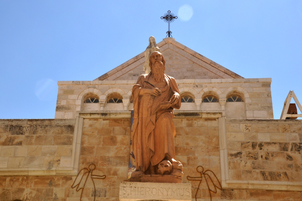
We recently had the opportunity to visit Bethlehem, the town where Jesus was born. In addition to Bethlehem’s being important for that reason (Micah 5:2; Luke 2:1-20; Matt. 2:1-13), this location is also significant due to the work of Jerome (Eusebius Sophronius Hieronymus).

Statue of Jerome in Bethlehem, outside of the Church of St. Catherine. Photo by Leon Mauldin.
Jerome was born at Stridon, Dalmatia, ca. AD 347. He is especially noted for his translation of the Bible into Latin.
In 384 Jerome took up residence in Bethlehem, to be joined two years later by Paula and her daughter Eustochium. Together they made Bethlehem a great monastic centre; within this framework Jerome wrote prolifically, his most notable achievement being a new translation of the Old and New Testaments (the Vulgate) which remained the authoritative version of the Bible for Catholics until the C20. (Murphy-O’Connor, The Holy Land: An Oxford Archaeological Guide from Earliest Times to 1700, Oxford Archaeological Guides, p.233).
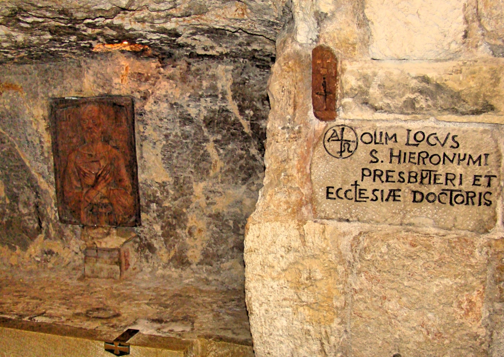
This cave is said to be Jerome’s study, where he did his monumental literary work.

Jerome’s study in Bethlehem. Photo by Leon Mauldin.
See Ferrell Jenkin’s article (Dec. ’08) on Jerome here.
Click on photos for larger view.
 1 Comment |
  Bethlehem, Bible History and Geography, Bible Places, Bible Study, Israel, New Testament, photography, Travel, Uncategorized |
  Permalink
 Posted by Leon Mauldin
May 17, 2017
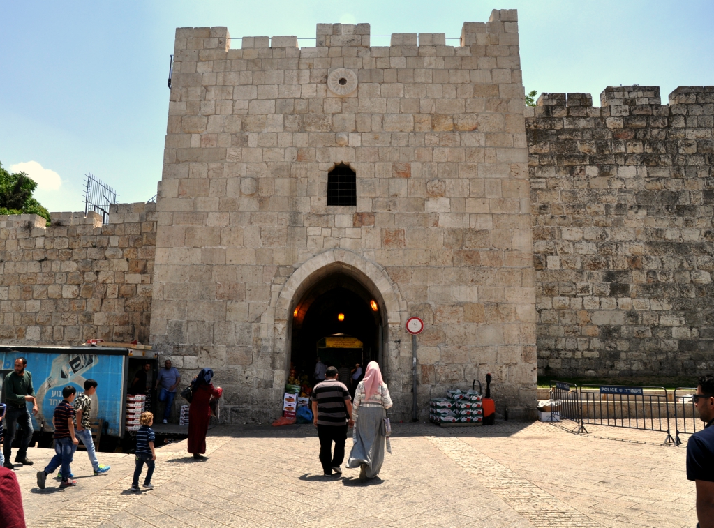
We continue to explore some of the gates of Jerusalem, as we share some our photos from our recent trip to Israel. Today’s post features Herod’s Gate.
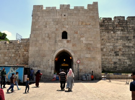
Herod’s Gate in Jerusalem. Photo by Leon Mauldin.
Jerome Murphy-O’Connor writes:
The official name of this gate is Bab ez-Zahr, ‘the Flowered Gate’. It got its present name only in the C16 or C17 because pilgrims believed a Mamluk house inside near the Franciscan Monastery of the Flagellation to be the palace of Herod Antipas. The original entrance is in the east face of the tower. It was at this point that the Crusaders first established a bridgehead on the walls at noon on 15 July 1099. Just beside the west face of the first tower going towards Damascus Gate the channel of an aqueduct is marked by a series of irregular covering slabs. Pottery embedded in the plaster of the last repair show it to have been in use until the late C3AD or early C4. The ditch in which the present road runs must therefore be subsequent to this date, because it cuts the aqueduct. This suggests that the earliest wall on the present line at this point must be dated to the last years of Aelia Capitolina. Slightly further west the wall makes a curve inward and follows the rim of an ancient quarry which extended across the road into what is now the bus station; for details see SOLOMON’S QUARRIES (p. 162). The weight of the wall caused part of the roof of the quarry to cave in. The small walled section in the centre at ground level enshrines part of a sloping glacis of uncertain date. The wall of Herod Agrippa I (AD 41–4) linking Damascus Gate with the East Gate in the ECCE HOMO CONVENT (p. 35), must have turned south on the highest point to the west now occupied by the Spafford Hospital. (The Holy Land: An Oxford Archaeological Guide from Earliest Times to 1700, Oxford Archaeological Guides, p. 14).
We previously posted (in 2011) on Herod’s Gate here.
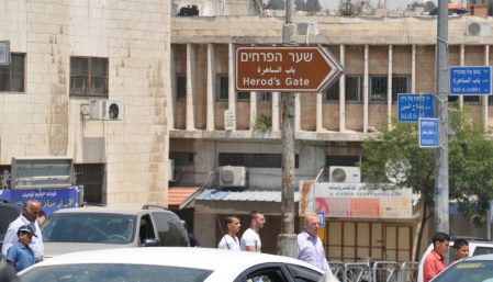
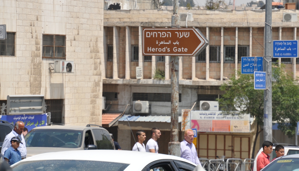
Sign pointing to Herod’s Gate. Photo by Leon Mauldin.
Click photo for larger view.
Leave a Comment » | Bible History and Geography, Bible Places, City Gates, Israel, Jerusalem, New Testament, photography, Travel, Uncategorized | Tagged: Herod's Gate | Permalink
Posted by Leon Mauldin
May 12, 2017
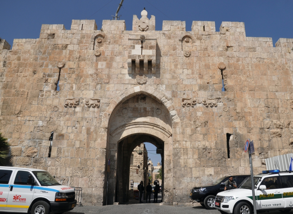
St. Stephen’s Gate, also known as the “Lion’s Gate,” is one of seven open Gates in Jerusalem’s Old City Walls. This gate is located on the Eastern Wall. It is It is called “St. Stephen’s Gate” because of the tradition that Stephen, the first martyr of the church (Acts 6-7), was stoned to death at this location just outside the city walls.
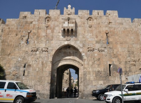
St. Stephen’s Gate, located on Jerusalem’s Eastern Wall. Photo by Leon Mauldin.
In Acts 7, Luke records Stephen’s sermon to the Sanhedrin (the ruling council overseen by the High Priest), as well as the response:
“You stiff-necked people, uncircumcised in heart and ears, you always resist the Holy Spirit. As your fathers did, so do you. Which of the prophets did not your fathers persecute? And they killed those who announced beforehand the coming of the Righteous One, whom you have now betrayed and murdered, . . . you who received the law as delivered by angels and did not keep it.” Now when they heard these things they were enraged, and they ground their teeth at him. But he, full of the Holy Spirit, gazed into heaven and saw the glory of God, and Jesus standing at the right hand of God. And he said, “Behold, I see the heavens opened, and the Son of Man standing at the right hand of God.” But they cried out with a loud voice and stopped their ears and rushed together at him.Then they cast him out of the city and stoned him. And the witnesses laid down their garments at the feet of a young man named Saul. And as they were stoning Stephen, he called out, “Lord Jesus, receive my spirit.” And falling to his knees he cried out with a loud voice, “Lord, do not hold this sin against them.” And when he had said this, he fell asleep (Acts 7:51-60).
Murphy-O’Connor notes, “The current Hebrew name, ‘Lions’ Gate’, is due to a mistake. The pairs of animals are in fact panthers, the heraldic emblem of the Mamluk sultan Baybars (1260–77), which Suliman’s architects set on either side of the gate to celebrate the Ottoman defeat of the Mamluks in 1517” (The Holy Land: An Oxford Archaeological Guide from Earliest Times to 1700 (Oxford Archaeological Guides, p.21).
I previously posted on this gate here.
Click image for larger view.
2 Comments | Bible History and Geography, Bible Study, City Gates, City Walls, Israel, Jerusalem, New Testament, photography, Travel | Tagged: St. Stephen's Gate | Permalink
Posted by Leon Mauldin
May 4, 2017
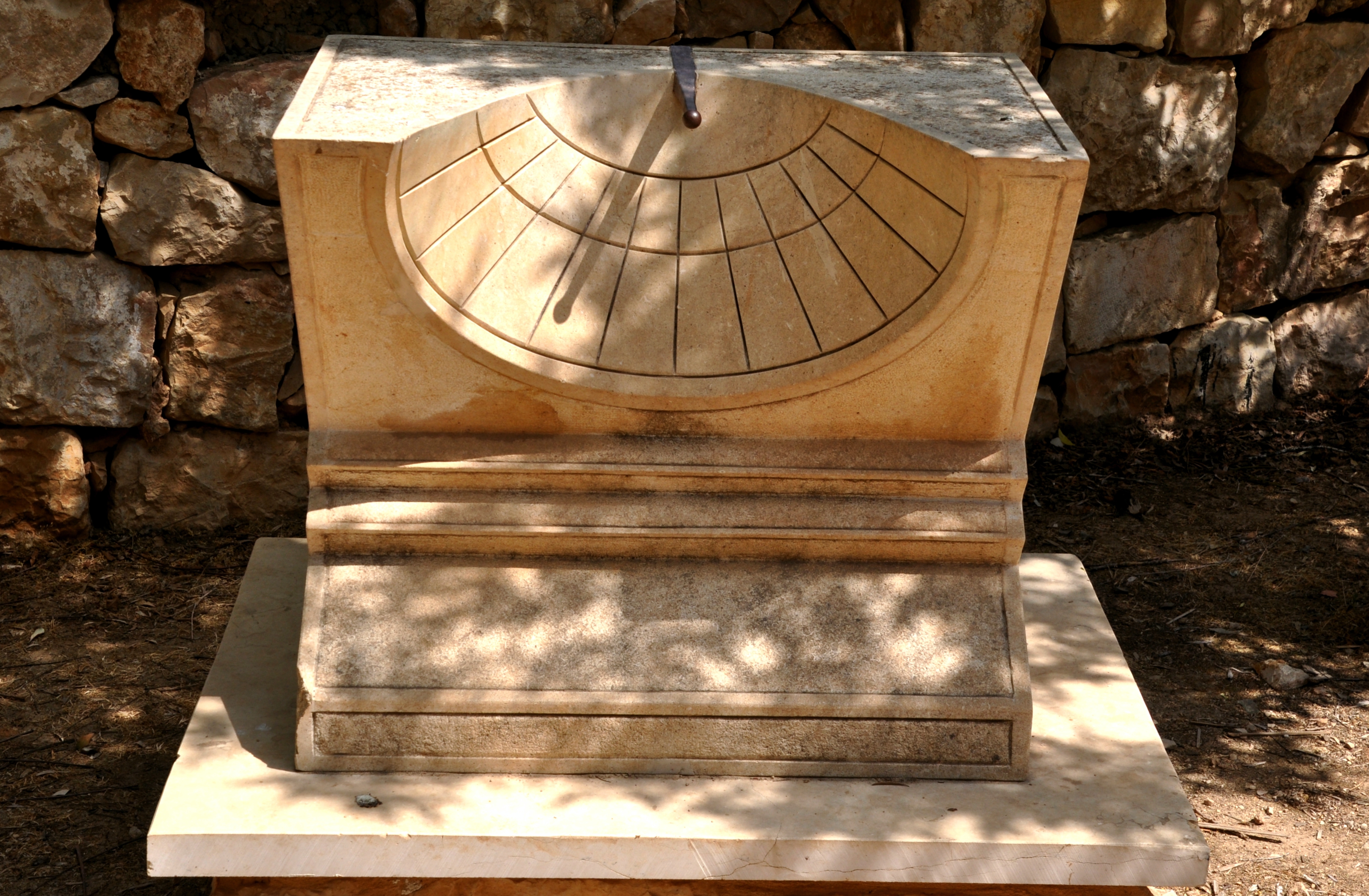
Today we were able to visit Ein Yael, Philip’s Spring, located on the ancient Jerusalem-Gaza route. A number of interesting artifacts were on the site, including this sundial.

Sundial at Ein Yael. Photo by Leon Mauldin.
This helps illustrate an event in the life of King Hezekiah of Judah, one of Judah’s best kings. He faithfully led the nation in very difficult times. Then he became sick and was near death. God sent the prophet Isaiah to Hezekiah with the message, “Set your house in order, for you shall die and not live” (Isaiah 38:1). Hezekiah fervently prayed to the Lord, his prayer was heard, and the Lord promised to add 15 years to his life. As a sign to confirm this promise, God said, “Behold, I will bring the shadow on the sundial, which has gone down with the sun on the sundial of Ahaz, ten degrees backward” (Isa. 38:7,8, NKJV).
Some translations render the Hebrew term maalah as “stairway” (see NAS, CSB). The NET Bible notes, “These steps probably functioned as a type of sundial.”
Whether the term means “steps” or “sundial,” certainly what is under consideration is a means of telling time by the moving shadow cast by the sun. The miraculous sign was that the shadow would return, it would go backward by 10 “steps” or “degrees.”
Whether what is intended in Isaiah 38 is this type of sundial, or another system (steps, stairway) is meant, the principle is the same. God miraculously returned the shadow to confirm to Hezekiah that He would extend his life as He had promised.
Click image for larger view.
Leave a Comment » | Bible History and Geography, Bible Places, Bible Study, Israel, Jerusalem, New Testament, Old Testament, photography, Travel, Uncategorized | Tagged: Sundial | Permalink
Posted by Leon Mauldin
May 3, 2017
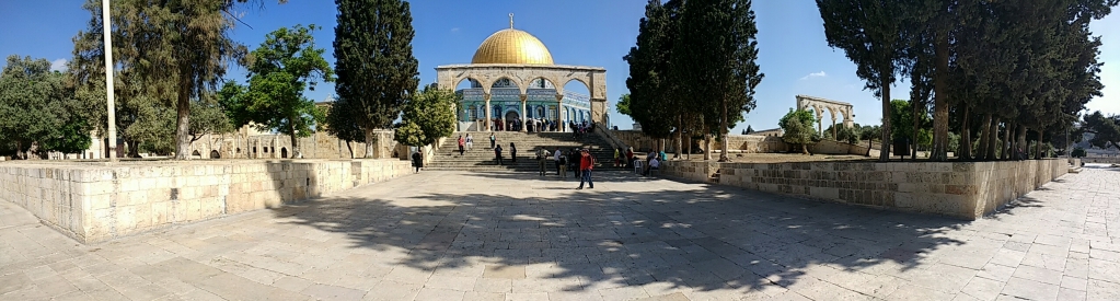
Today we had opportunity to visit the temple mount in Jerusalem. This is a wide-angle shot I made this morning:

Temple Mount in Jerusalem. Photo by Leon Mauldin.
The very recognizable Dome of the Rock at center approximates the site of Solomon’s temple, as well as the 2nd temple, built after the return from Babylonian Captivity and vastly renovated by Herod the Great.
This area is known as Mt. Moriah. This was the location where Abraham took Isaac in obedience to God’s command to offer him as a sacrifice, though He stopped Abraham prior to the actual event (Gen. 22:1-13). Years later, when Solomon built the temple, the Bible says, “Then Solomon began to build the house of the LORD in Jerusalem on Mount Moriah . . .” (2 Chron. 3:1, ESV).
The temple mount consists of about 36 acres. When the New Testament speaks of Jesus teaching in the temple, or of the early church meeting in the temple, those texts are not referring to the naos (holy place/most holy place) into which only the priests/Levites could enter; the most holy place only the high priest could enter, and that only once per year on the Day of Atonement. Rather, reference is made to the hieron, the greater temple area, consisting of its many courts and colonnades, etc.
Click image for larger view.
1 Comment | Bible History and Geography, Bible Places, Bible Study, Israel, Jerusalem, New Testament, Old Testament, photography, Temples, Travel, Uncategorized | Tagged: Temple Mount | Permalink
Posted by Leon Mauldin
May 2, 2017
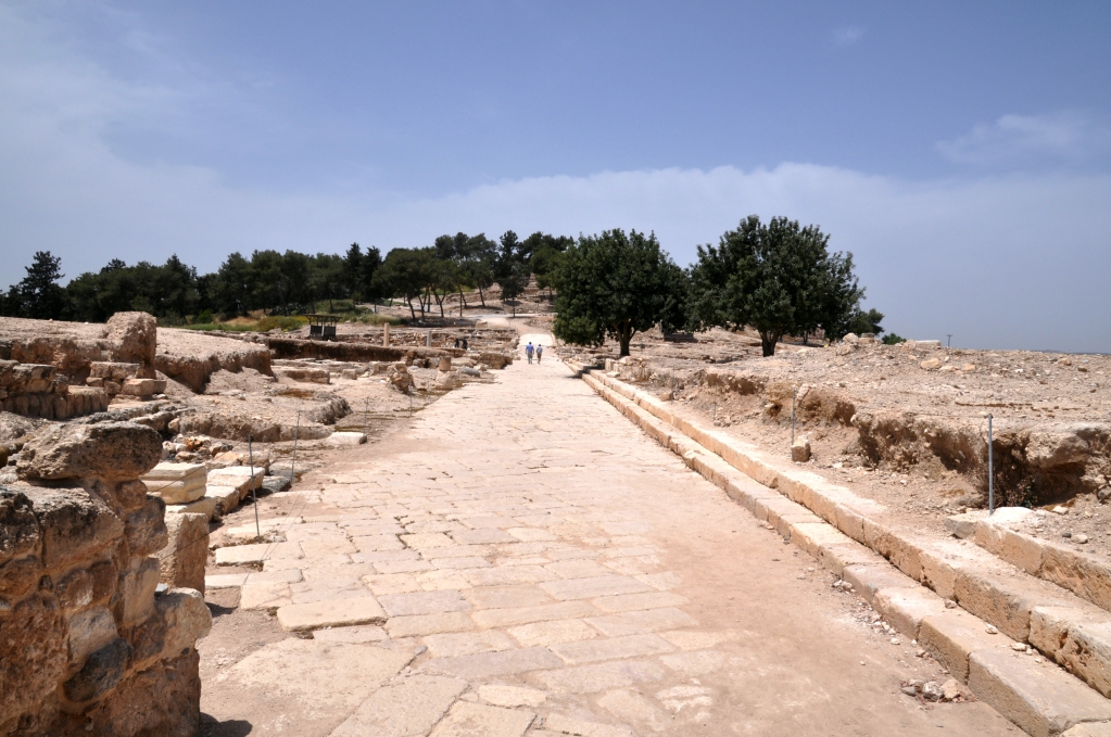
The Tetrarch Herod Antipas, son of Herod the Great, chose Sepphoris as his capital in Galilee (BC 4). (Later he would build Tiberias and move his capital there, 20 AD).
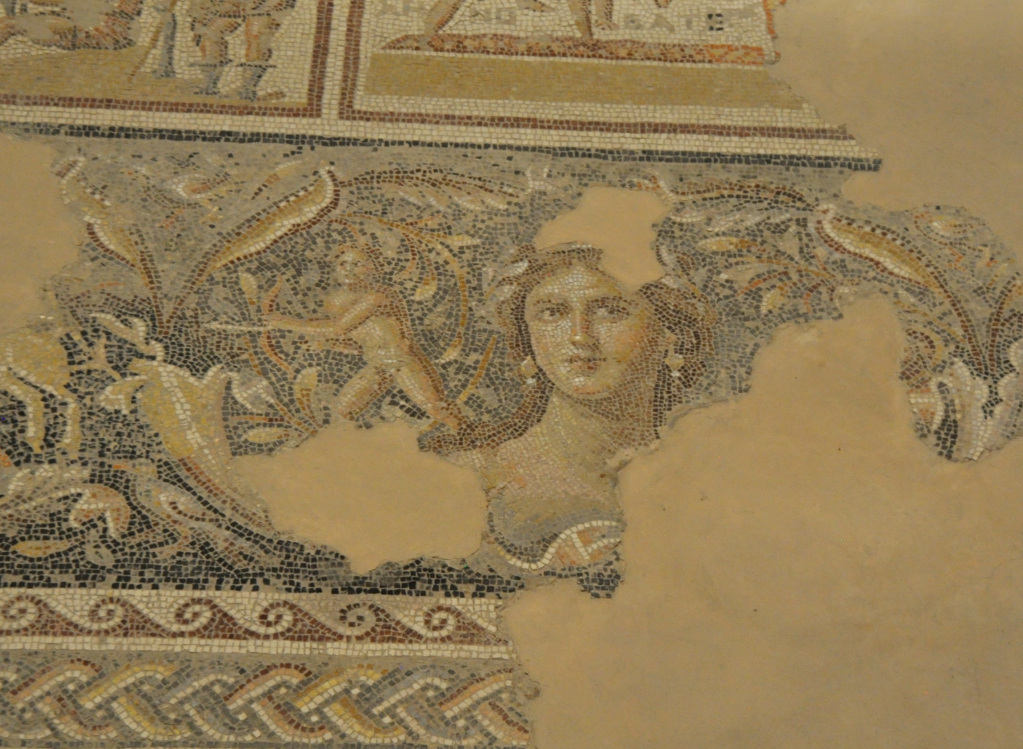
Much excavation, beginning in 1931, has been done in Sepphoris. In the house of Dionysus several mosaics were found, including this one featuring a woman often referred to as “Mona Lisa of the Galilee.”

The “Mona Lisa of the Galilee.” Photo by Leon Mauldin.
Sepphoris is only about an hour’s walk away from Jesus’ hometown of Nazareth. This was one of the sites I wanted to see on this current trip to Israel.
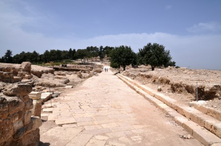
One of the main streets of Sepphoris. Photo by Leon Mauldin.
Click on images for larger view.
1 Comment | Bible History and Geography, Bible Study, Galilee, Israel, New Testament, photography, Travel, Uncategorized | Tagged: Sepphoris, Zippori | Permalink
Posted by Leon Mauldin
May 1, 2017
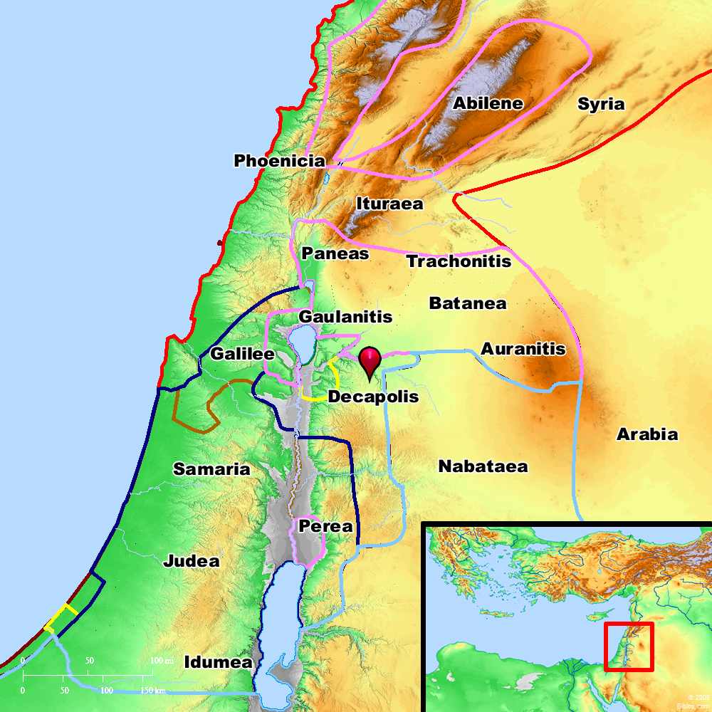
Matthew tells us that during Jesus’ Galilean Ministry, “great crowds followed him from Galilee and the Decapolis, and from Jerusalem and Judea, and from beyond the Jordan (4:25, ESV).
I had the opportunity today to visit Hippos, one of the ten cities of the Decapolis.
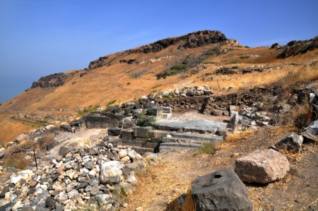
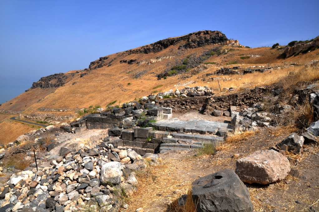
Hippos, one of the cities of the Decapolis. Photo by Leon Mauldin.
In the foreground you can see the ancient ruins of a temple. If you look carefully to the left center you can get a glimpse of the Sea of Galilee.
Though Jesus would later go to the Decapolis (Mark 5, Mark 7), the text in Matthew is saying that people from all the areas listed, including the Decapolis, traveled to Galilee to see and hear Jesus when He was engaged in the Galilean Ministry.
The cities of the Decapolis are ordinarily listed as follows:
- Gerasa (Jerash) in Jordan.
- Scythopolis (Beth-Shean) in Israel, the only city west of the Jordan River.
- Hippos (or Sussita) in Israel (Golan Heights).
- Gadara (Umm Qais) in Jordan.
- Pella (West of Irbid) in Jordan.
- Philadelphia, modern-day Amman, the capital of Jordan.
- Capitolias, also Dion, today Beit Ras in Jordan.
- Canatha (Qanawat) in Syria.
- Raphana in Jordan.
- Damascus, the capital of modern Syria.
The city of Hippos (Sussita) was the central city of the Golan during the Hellenistic and Roman/Byzantine periods. It is located on a diamond (or horse) shaped mountain which rises 350M above the Sea of Galilee. Recent excavations revealed the impressive plan and structures of the city. During the Byzantine period there were eight churches, indicating its importance for Christians. The city was devastated by a massive earthquake in 749 AD which left it in ruins since then. (http://www.biblewalks.com/Sites/Hippos.html)
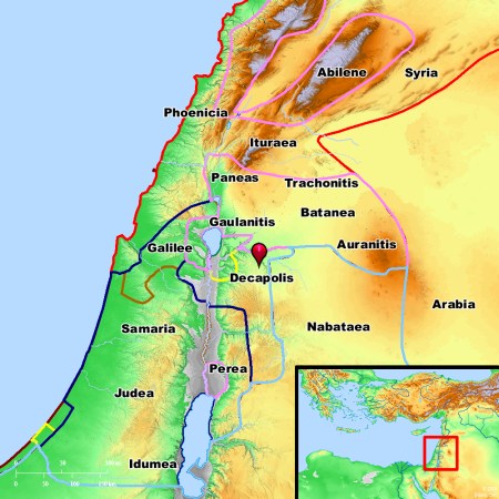
The Decapolis. Ten cities given autonomy by Rome. BibleAtlas.org.
Click image for larger view.
2 Comments | Bible History and Geography, Bible Places, Decapolis, Israel, New Testament, photography, Travel, Uncategorized | Tagged: Hippos, Sussita | Permalink
Posted by Leon Mauldin
April 30, 2017
Early in Jesus’ ministry, He traveled from Jerusalem to Galilee, and went through Samaria. It was at the well at Sychar (today’s Nablus) that Jesus had a conversation with a woman who had come to the well to draw water. Jesus skillfully led her from a starting point of a request for a drink of water, step by step, to the point of faith in Him as Messiah! (John 4:1-26).
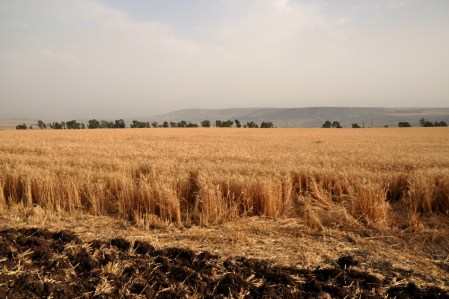
Field of wheat in the Galilee. Photo by Leon Mauldin.
When the disciples returned, having gone into the city to buy food, this interesting conversation took place:
27 And at this point His disciples came, and they marveled that He talked with a woman; yet no one said, “What do You seek?” or, “Why are You talking with her?” 28 The woman then left her waterpot, went her way into the city, and said to the men, 29 “Come, see a Man who told me all things that I ever did. Could this be the Christ?” 30 Then they went out of the city and came to Him. 31 In the meantime His disciples urged Him, saying, “Rabbi, eat.” 32 But He said to them, “I have food to eat of which you do not know.” 33 Therefore the disciples said to one another, “Has anyone brought Him anything to eat?” 34 Jesus said to them, “My food is to do the will of Him who sent Me, and to finish His work. 35 “Do you not say, ‘There are still four months and then comes the harvest’? Behold, I say to you, lift up your eyes and look at the fields, for they are already white for harvest! 36 “And he who reaps receives wages, and gathers fruit for eternal life, that both he who sows and he who reaps may rejoice together. 37 “For in this the saying is true: ‘One sows and another reaps.’ 38 “I sent you to reap that for which you have not labored; others have labored, and you have entered into their labors.” (John 4:27-38, ESV).
Today I photographed this field of wheat in the Galilee, near the Horns of Hattin. Jesus used the image of fields that were ready for harvest to illustrate lost souls that will be receptive to the call of the Gospel, with its hope and promises!
Click image for larger view.
Leave a Comment » | Bible History and Geography, Bible Study, Galilee, Israel, New Testament, photography, Travel, Uncategorized | Tagged: John 4, wheat | Permalink
Posted by Leon Mauldin
April 28, 2017
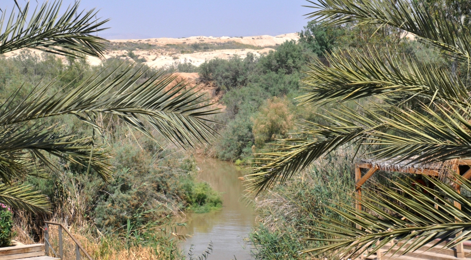
Today after leaving Jerusalem I made a stop at the Jordan before heading up the Rift Valley for the Galilee. This location is thought by many to be the area in the Jordan River where Jesus was baptized by John.
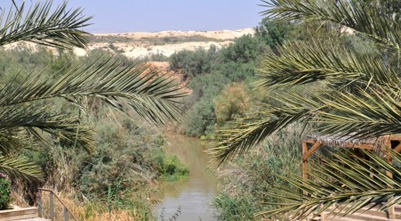
Jordan River. Traditional location of Jesus’ baptism. Photo by Leon Mauldin.
We had a safe late afternoon arrival at Tiberias, situated on the Sea of Galilee. While having dinner, Zachary Shavin, who is presently directing a tour, came by to visit a while and “talk shop.” Zack served as our guide for my Israel tour in November. His website is www.landofisraeltours.com
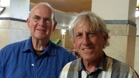
Leon Mauldin and Zachary Shavin.
To view my previous posts about the Jordan River, go up to search box and enter “Jordan.”
Click images for larger view.
2 Comments | Bible History and Geography, Bible Places, Israel, Jordan Valley, New Testament, Old Testament, photography, Travel, Uncategorized | Tagged: Jordan River | Permalink
Posted by Leon Mauldin
April 27, 2017
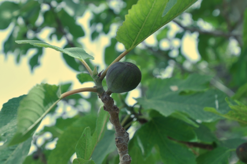
In the Final Week of Jesus’ ministry, Bethany and Bethphage (cities located on the slope of the Mount of Olives) are mentioned. It was from here that Jesus arranged for the donkey on which He would ride triumphantly into Jerusalem (Mark 11:1ff.). That final week would find Jesus walking back and forth from Bethany to Jerusalem.
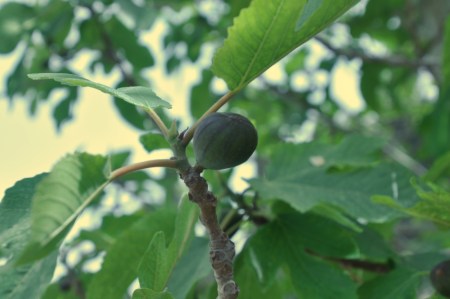
Fig close up at Bethphage. Photo © Leon Mauldin.
An interesting event happened in this area at this time:
And leaving them, he went out of the city to Bethany and lodged there. In the morning, as he was returning to the city, he became hungry. And seeing a fig tree by the wayside, he went to it and found nothing on it but only leaves. And he said to it, “May no fruit ever come from you again!” And the fig tree withered at once. (Matt. 21:17-19).
Unlike our photo above, that fig tree in our text received a curse because though it had a pretense of leaves, it was barren; there was no fruit. This was a great object lesson for Jesus’ disciples.
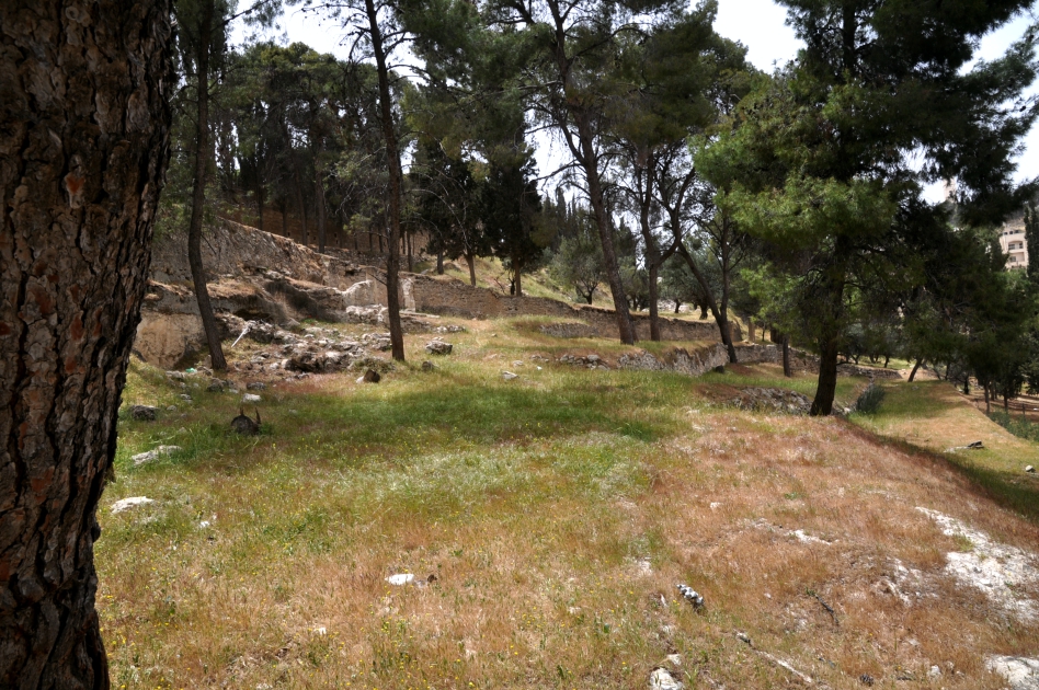
Here is a view of the terrain at Bethphage, with Bethany behind, and the Mount of Olives continuing to rise ahead.
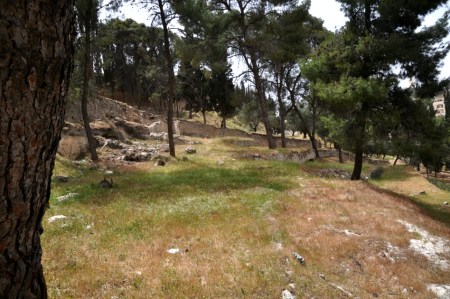
Bethphage. Jesus passed through this area during His Final Week of ministry. Photo ©Leon Mauldin.
I was glad to have the opportunity to visit Bethphage yesterday. There are also several ancient tombs located there.
Click images for larger view.
Leave a Comment » | Bible History and Geography, Bible Places, Biblical Interpretation, Israel, New Testament, photography, Travel, Uncategorized | Tagged: Bethphage, figs | Permalink
Posted by Leon Mauldin