Laodicea, a Wealthy City — a Poor Church

June 18, 2014

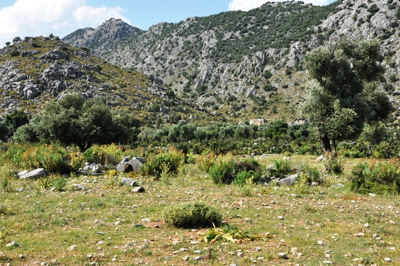
There is some beautiful scenery as you make the drive from the Mediterranean coast at Antalya (biblical Attalia) north and west to Laodicea.
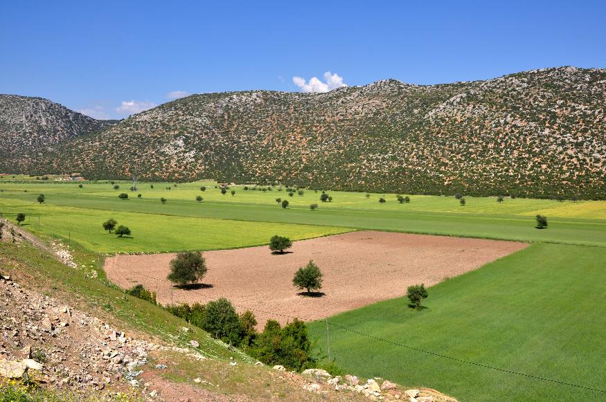
En Route NW to Laodicea from Med. coast. Photo ©Leon Mauldin.

En Route NW to Laodicea from Med. coast. Photo ©Leon Mauldin.

Laodicea was known to be a wealthy city. It was a banking center, had a medical school specializing in ophthalmology, and manufactured clothing, especially known for its black wool market.

It is always a danger that God’s people become like the world around them. Jesus addressed the church at Laodicea (Revelation 3:14-21) and rebuked them for their self-satisfied, complacent attitude:

Because you say, “I am rich, and have become wealthy, and have need of nothing,” and you do not know that you are wretched and miserable and poor and blind and naked, I advise you to buy from Me gold refined by fire so that you may become rich, and white garments so that you may clothe yourself, and that the shame of your nakedness will not be revealed; and eye salve to anoint your eyes so that you may see (vv.16-18).

Excavations have shown numerous indications of Laodicea’s wealth.
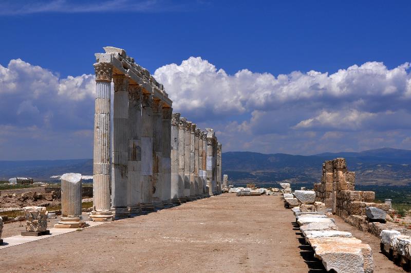
Columns lining street in Laodicea. Photo ©Leon Mauldin.

Columns lining street in Laodicea. Photo ©Leon Mauldin.

W.M. Ramsay wrote:

It is characteristic of a city devoted to commercial interests and the material side of life, that the Church of Laodicea is entirely self-satisfied. It says, as the city said in A.D. 60, when it recovered its prosperity after the great earthquake without any of that help which the Imperial government was generally ready to bestow, and which the greatest cities of Asia had always been ready to accept, “I have grown rich, and have need of nothing.” It has never seen its real condition: it is poor and blind and naked (Letters to the Seven Churches, p.428).

Their complacency led to lukewarmness, and this nauseated the Lord (v.16). This is the only church of the seven addressed in Rev. 2-3 about which nothing good is said.

We have made several other posts on Laodicea. Use search box at upper right for more articles & photos.

Click on images for larger view.


Decorations at Nicaea’s Eastern Gate

May 31, 2014

Recently we posted here on Nicaea. A remarkable portion of the Roman walls and gates can still be seen.

Some useful info on the decor of the gates at Nicaea and elsewhere can be found here:

Nicaea’s walls are well decorated with reliefs, with large heads, and also with column-shafts, both as horizontal wall-ties and as decoration: in the central one of the three square towers of the north wall, some 37 columns are used to decorate the upper stories and, at the same time, to act as floor-joists. The East Gate has reliefs, still visible, which impressed Kinnear, as did the reliefs and heads on the North (Constantinople) Gate. The south gate, for Bursa, has marble blocks and an inscription. The walls and towers on the north side are noticeably of creamy-white marble (in contrast with the much darker blocks used elsewhere: it is far from fanciful to perceive the desire to create an effect on the side of the city facing Constantinople, since we find exactly the same attention given to marble display in the more important parts of other citadels, such as Seljuk. Thus the antique monuments of Nicaea have been reused in the construction of the first set of mediaeval walls, in a direct echo of the marble prestige of the finest of Constantinople’s set pieces, the Porta Aurea itself.

Nicaea Head Decor at East Gate. Photo ©Leon Mauldin.

Nicaea Head Decor at East Gate. Photo ©Leon Mauldin.

See also Ferrell Jenkins’ earlier post here.


Pagan Temple at Laodicea

May 30, 2014

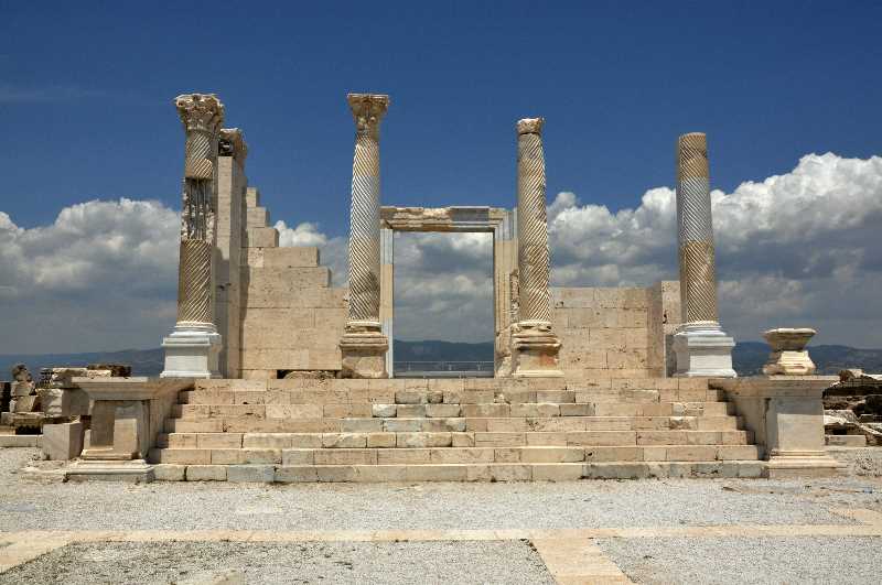
The last few years have seen an enormous amount of excavation in Laodicea. It is still ongoing, as Ferrell Jenkins and I saw several sectors of the very large tel that had teams of workers. One site of importance is the restoration of a pagan temple which reflects some of the wealth and splendor for which this city was famous. Remember God had His people here in Laodicea also, and they were the recipients of the 7th of the Seven Letters (Rev. 2-3).

Pagan Temple at Laodicea. Photo ©Leon Mauldin.

Pagan Temple at Laodicea. Photo ©Leon Mauldin.

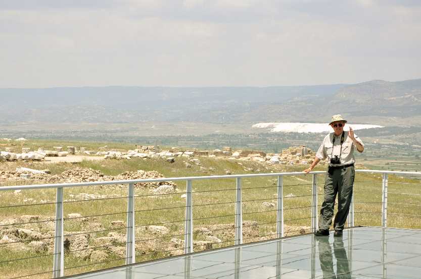
At the back of the temple there is a clear platform through which you can look down and see more excavation several meters below.

Ferrell Jenkins behind temple. The white spot 6 miles distance is Hierapolis. Photo ©Leon Mauldin.

Ferrell Jenkins behind temple. The white spot behind (6 miles distance across the Lycus Valley) is Hierapolis. Photo ©Leon Mauldin.

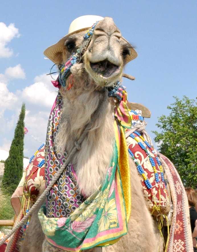
On the lighter side I present you with a camel photo.

Happy Camel at Hierapolis. Photo ©Leon Mauldin.

Happy Camel at Hierapolis. Photo ©Leon Mauldin.

May I say it’s good to be back in Sweet Home Alabama!


Theater At Hierapolis

May 27, 2014

Today was devoted to exploring Hierapolis. I think today was the hottest day of our trip, and we did a lot of walking. There is a lot to see here.

First century Christians living in Hierapolis are mentioned in Colossians 4:12-13:

Epaphras, who is one of you, a servant of Christ Jesus, greets you, always struggling on your behalf in his prayers, that you may stand mature and fully assured in all the will of God. 13 For I bear him witness that he has worked hard for you and for those in Laodicea and in Hierapolis.

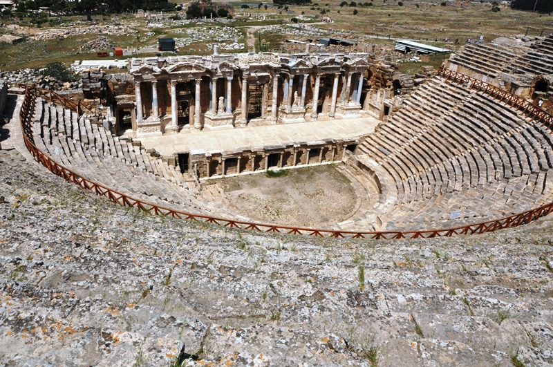
Every significant Roman city ordinarily had a theater.

Hierapolis Theater. Photo by Leon Mauldin.

Hierapolis Theater. Photo by Leon Mauldin.

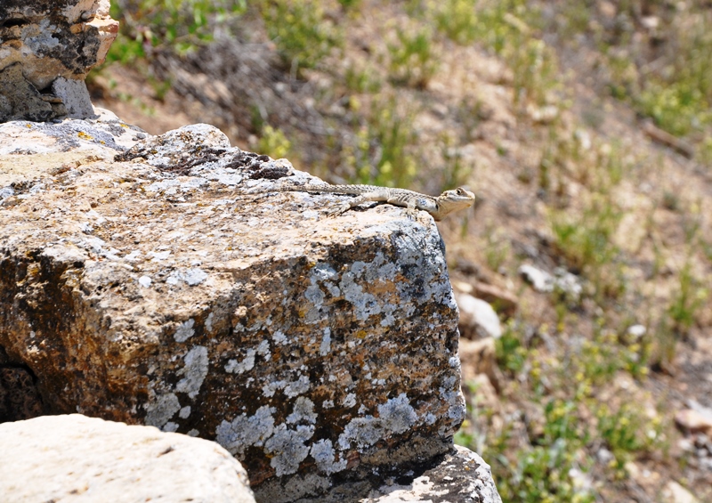
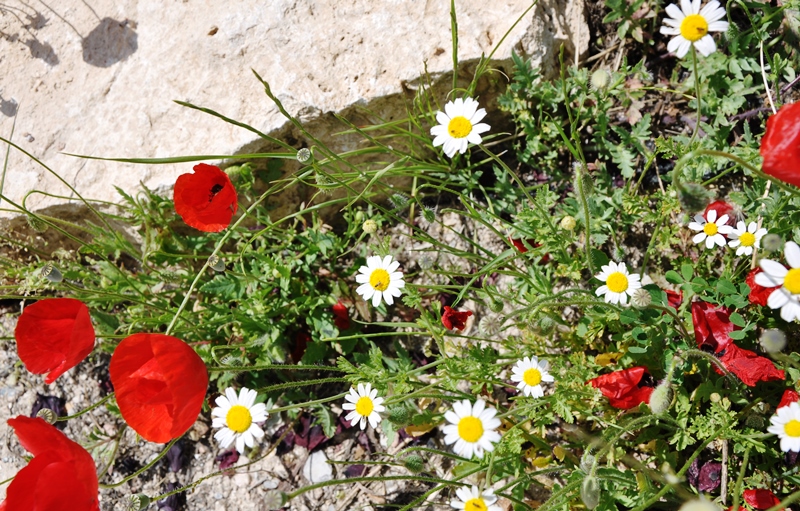
Some flora and fauna at Heriapolis:

Gecko at Hierapolis. Photo by Leon Mauldin.

Gecko at Hierapolis. Photo by Leon Mauldin.

Wild flowers at Hierapolis. Photo by Leon Mauldin.

Wild flowers at Hierapolis. Photo by Leon Mauldin.

Today wraps up this photo/study trip for various sites in Turkey for Ferrell Jenkins & me.  We have made several trips of this nature, and I always enjoy them and learn a lot. Tomorrow morning is a 4 hr. drive back to the airport at Antalya and then a flight to Istanbul and homeward bound from there.


Turkey Travel contd: Pamphylia

May 26, 2014

On Paul’s First Journey, he and Barnabas passed through Perga in Pamphylia (Acts 13:13-14). On the return portion of the trip they came again to Pamphylia (Acts 14:24), “and when they had spoken the word in Perga, they went down to Attalia, and from there they sailed to Antioch” (vv. 24-25). Notice here the region of Pamphylia:

Region of Pamphylia. Map by BibleAtlas.com.

Region of Pamphylia. Map by BibleAtlas.com.

Now notice specifically Antalia:

Attalia, seaport for Pamphylia. Photo by BibleAtlas.com.

Attalia, seaport for Pamphylia. Photo by BibleAtlas.com.

Ferrell Jenkins and I have been in biblical Attalia, modern Antalya, and the greater Pamphylia area for the past couple of days as we have visited sites in Turkey.

Notice the topography on the first map, and see as you leave the coastal area and go northward you run into the mountains, using Attalia and Perga in your second map as reference points. The plains of Pamphylia give way to the formidable terrain of the Taurus mountain range.

Pamphylian Plain Ends at Taurus Mountains. Photo by Leon Mauldin.

Pamphylian Plain Ends at Taurus Mountains. Photo by Leon Mauldin.

We spent some time exploring this area where a Roman Road cuts through the mountain pass. Dedicated men such as Paul and Barnabas had to negotiate through this type of terrain in their travels.

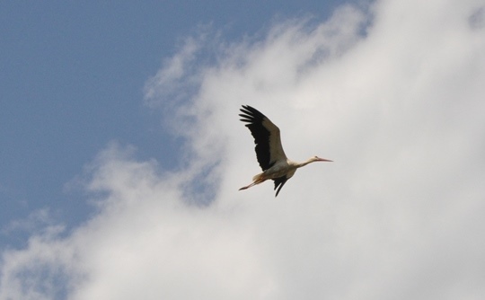
We found several matters of interest while there, such as this stork

Stork in flight in Pamphylia. Photo ©Leon Mauldin.

Stork in flight in Pamphylia. Photo ©Leon Mauldin.

and this field of Barley:

Barley in Pamphylia. Photo ©Leon Mauldin.

Barley in Pamphylia. Photo ©Leon Mauldin.

Tonight we are north of biblical Hierapolis (mentioned in Colossians 4:13). En route here we saw Laodicea and Colossae. There is much to see at Hierapolis, and tomorrow we plan to explore and photograph in that area. Thanks for following along the journey. Much more to share as time permits.

Mr. Jenkins and I are both well. There’s nothing quite like on-site Bible study! It’s truly a continuing education course for us.


At Nicaea of Bithynia

May 21, 2014

I am thankful for safe arrival yesterday at Istanbul, meeting up with Ferrell Jenkins who had just concluded a tour in Turkey. Today we crossed the Sea of Marmara by ferry to save driving time on our way to Nicaea, called Iznik today. Nicaea was one of the important cities in New Testament times in the Roman Province of Bithynia. Peter addressed Christians over a widely scattered area (covering much of what is the country of Turkey today): “Peter, an apostle of Jesus Christ, To the pilgrims of the Dispersion in Pontus, Galatia, Cappadocia, Asia, and Bithynia” (1 Pet. 1:1). Dr. Mark Wilson writes that Nicaea “vied with Nicomedia for the distinction of being the principle city of Bithynia” (Biblical Turkey: A Guide to the Jewish and Christian Sites of Asia Minor,  p.369).

It was a great opportunity to be in Nicaea today. The weather was very pleasant, and the lighting was excellent for most of the photos we made. Plus it’s just great to be in what was biblical Bithynia. The gospel made inroads there, as evidenced from 1 Peter (most conservative scholars believe that Peter’s second letter was written to the same audience). That means it was highly likely that the messenger with Peter’s letter would have contacted brethren there. Dr. Wilson says it a bit more emphatically, “. . . the messenger caring 1 Peter would certainly have visited Nicaea” p.370).

Nicaea is characterized by an ancient city plan which makes use of the decumanus maximus running east and west and the cardo maximus north and south. Nicaea was a walled city with four gates. Wilson says of the walls and gates that they are the most unique in western Turkey” (v.371). The Roman walls were built on Hellenistic walls, but the Roman walls then were reconstructed by the Goths after the Goths destroyed them (AD 268-270).

In AD 325 the first of the Ecumenical Councils (as well as the seventh) were held in Nicaea. It has been long-standing to date church history as pre-Nicaean and post-Nicaean.

Nicaea is situated on the east side of a beautiful lake which had commercial importance. We drove along side of it at times en route to Nicaea. This city was established under the Greek rule during the intertestamental period, 316 BC).

So Bithyna for sure and Nicaea almost certainly was important to the church in the first century, and Nicaea became very important in church history for time to come. Tonight we share a photo of Nicaea’s east gate.

Nicea East Gate. Photo  ©Leon Mauldin.

Nicaea East Gate. Photo ©Leon Mauldin.

Neither Mr. Jenkins nor I had been to Nicaea before today. We agreed it was really a good day. We got to the ferry with 5 minutes to spare.

Tomorrow we are to fly east to Gaziantep and see such sites as Zeugma and Haran. Haran, today spelled Harran, was Abraham’s home for a time, at of family that are prominent in the biblical Narrative.


Imperial Cult Worship

April 11, 2014

A book I have found helpful in understanding the background of Revelation is Imperial Cults and the Apocalypse of John: Reading Revelation in the Ruins, by Steven J. Friesen (pub Oxford). Friesen states:

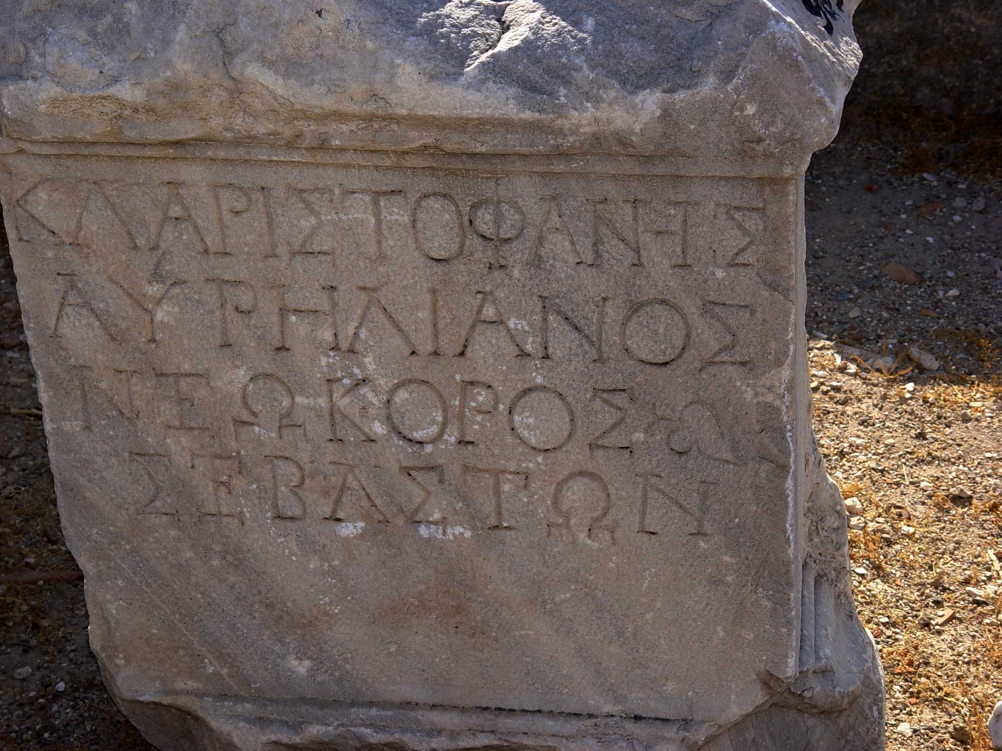
The signal development, first manifest in the dedications of the Temple of the Sebastoi but reflecting broader trends in society was the use of neokoros as a technical title for a city with a provincial temple of the emperors. The power of this innovation was explosive. In a matter of years it changed the public rhetoric of empire in Asia. Within a century it had transformed the discourse of Roman imperialism in the eastern Mediterranean. From the late first century onward, the most prestigious self-designation that could be employed by a city in Asia was neokoros, indicating the presence of a provincial temple where the emperors and their relatives were worshipped (p.150).

Neokoros literally means one who sweeps and cleans a temple; one who has charge of a temple, to keep and adorn it. It came to designate a city which maintained a temple for imperial worship. It is a historical fact that cities competed for this “honor.”

G. K. Beale observes, “Revelation presupposes that Christians were being required to participate to some degree in the imperial cult (e.g., 13:4-8,15-17; 14:9-11; 15:2; 16:2; 19:20; 20:4). . . in the Apocalypse persecution arises because of refusal to worship the ungodly king” (NIGTC Revelation, p.5).

Smyrna Inscription, designating it neokoros. Photo by Leon Mauldin.

Smyrna Inscription, designating it neokoros. Photo by Leon Mauldin.

This inscription found in biblical Smyrna (see Revelation 2:8-11; Smyrna was one of the seven churches of the Roman province of Asia addressed in Rev. 2-3), in lines 3 and 4 designates Smyrna as neokoros of Sebaston [Greek equivalent to Latin Augusti]. Dr. David McClister says, “This inscription is known in the scholarly literature as Smyrna 162. It is an honorary inscription for Cl(audius) Aristophanes Aurelianus,  dated AD 193/235” [lines 1 and 2), and further, “It appears to me to have been a statue base honoring this individual for his leadership in the emperor cult.”


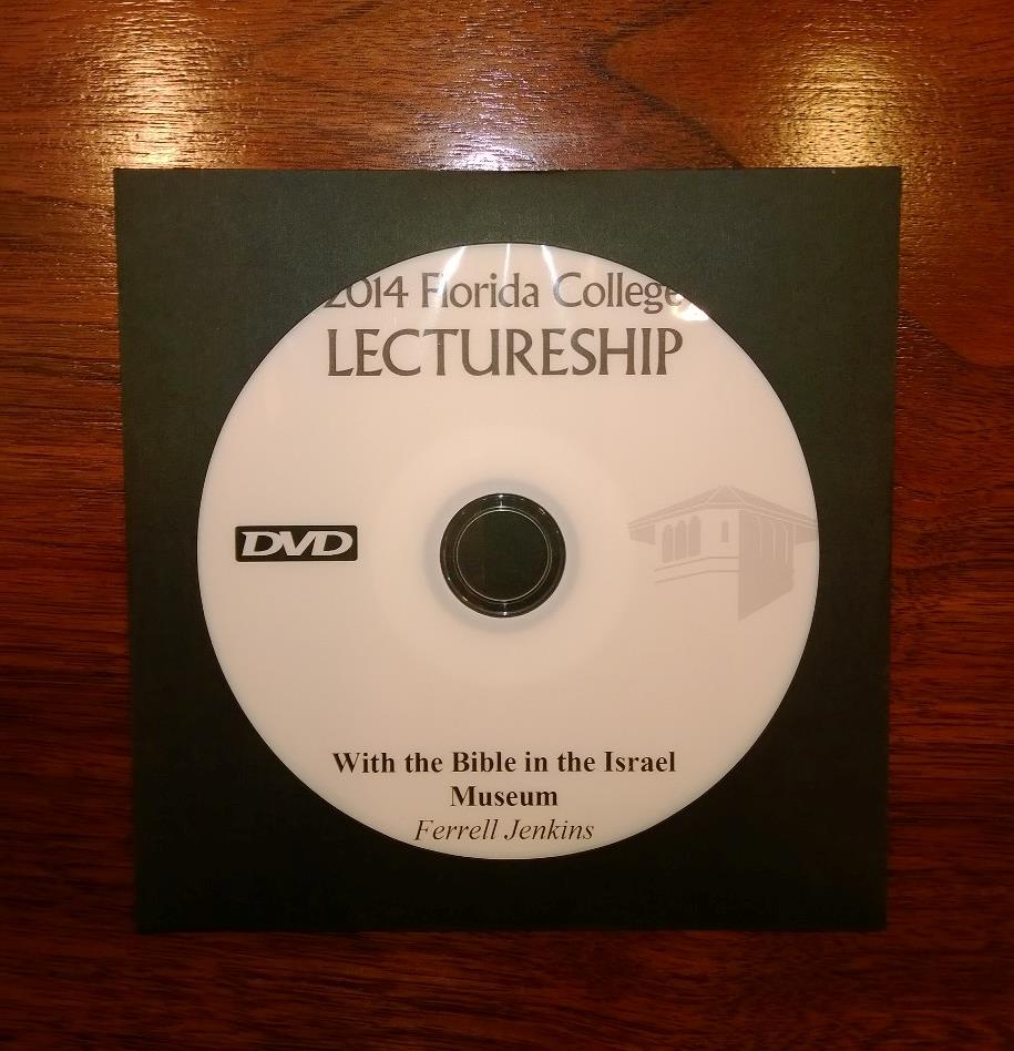
Recommended Resource: “With the Bible in the Israel Museum” DVD by Ferrell Jenkins

March 14, 2014

It is only in the last two years that photos have been permitted in the Israel Museum in Jerusalem. There are so many wings with so many artifacts, it is helpful to have some sort of guideline to serve as a starting point to make the most of a visit to the museum.

Ferrell Jenkins delivered a lecture entitled, “With the Bible in the Israel Museum” during the 2014 lecture series at Florida College, Temple Terrace, FL. In the lecture he selectively (because of so much to choose from) makes use of recent photos to deal with artifacts beginning with time of the patriarchs, continuing through Old Testament history (United Kingdom, Divided Kingdom, Captivity, Persian Period) and concluding with the Roman and Early Christianity. Included are numerous examples from various sites of Israel’s propensity to engage in idolatrous worship. Also there is insightful information on burial customs for different periods.

Ferrell Jenkins' DVD on biblical artifacts in the Israel Museum.

Ferrell Jenkins’ DVD on biblical artifacts in the Israel Museum. Photo by Leon Mauldin.

I recommend the DVD both as helpful to prepare for a visit to the museum, as well as to review and restudy if you have had opportunity already to go to.

You can place your order here with the FC Bookstore. Use the search box to enter keywords. Cost is $5.00 plus shipping.


The Conquest: Crossing Jordan

February 17, 2014

Joshua 3 records Israel’s crossing Jordan from the eastern side, to set up camp temporarily at Gilgal, and from there to take the city of Jericho. See our map in previous post.

The timing at this point was just prior to Passover (Josh. 5:10), meaning this was the early harvest season.  When Israel was crossing the notation is made, “Now the Jordan overflows its banks throughout the harvest season” (Josh. 3:15, CSB). The text records divine intervention: the priests were carrying the ark, and when their feet touched the Jordan,

. . . the water flowing downstream stood still, rising up in a mass that extended as far as Adam, a city next to Zarethan. The water flowing downstream into the Sea of the Arabah (the Dead Sea) was completely cut off, and the people crossed opposite Jericho. The priests carrying the ark of the LORD’s covenant stood firmly on dry ground in the middle of the Jordan, while all Israel crossed on dry ground until the entire nation had finished crossing the Jordan (Josh. 3:16-17, CSB).

The study note in the Holman Christian Standard Bible states:

At spring flood, after the winter rains and during the barley harvest, the Jordan River could reach a width in excess of 100 feet and a depth of 10 feet. The priests as the leaders of the people were the first to step down into the water. Doing so was a risky activity with the river at flood stage. Carrying the ark could easily have caused them to be swept away by the current unless the promised miracle took place.

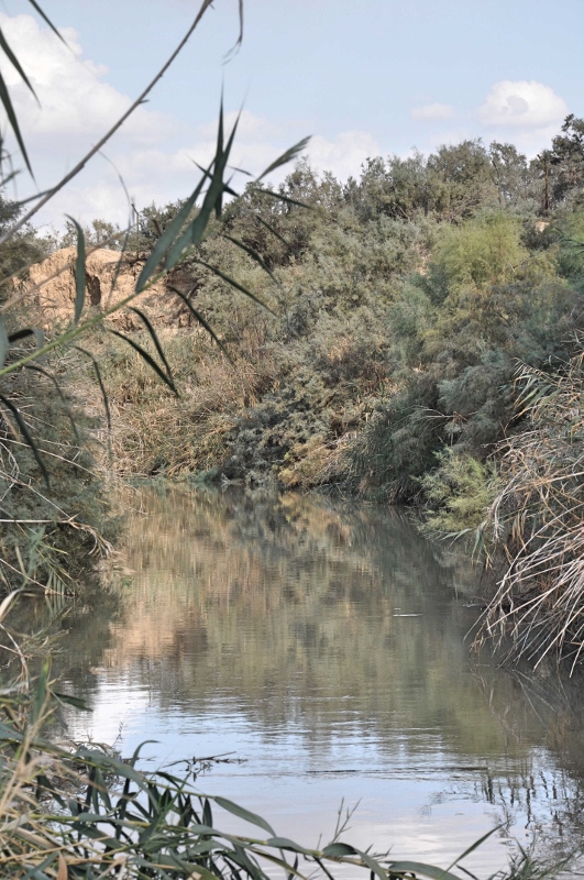
Note that the people crossed “opposite Jericho.” Our photo below is at the Jordan at Qasr el-Yahud, opposite and a little south of Jericho. It would be somewhere near here that the crossing of Joshua 3 took place. Our photo looks to the north.

Jordan River at  Qasr el-Yahud. Photo by Leon Mauldin.

Jordan River at Qasr el-Yahud. Photo by Leon Mauldin.

In their introduction to the book of Joshua, the HCSB Study Bible has an interesting note about the change in volume of the flow of the Jordan:

The Jordan River was at flood stage when God commanded Joshua to lead the people across. Just as when God opened the Red Sea, He provided a dry path through the Jordan when the priests, bearing the ark of the covenant, touched the edge of the river. . . Up until the 1950’s, more than 3 billion cubic feet flowed through the southern Jordan annually. with construction of a number of dams on the Jordan north of the Sea of Galilee and on rivers that feed the Jordan, that volume of water has been reduced to 300 million cubic feet a year (p.338).

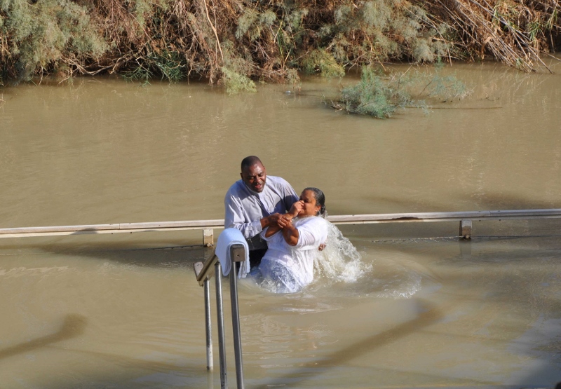
Qasr el-Yahud is a site on the Jordan thought by some to be across from the Bethany referenced in John 1:28, where John the Baptist did some of his baptizing. We had the opportunity to visit here in October.

Baptism in the Jordan River. Photo by Leon Mauldin.

Baptism in the Jordan River. Photo by Leon Mauldin.

Click images for larger view.


William Ramsay on the Halys River and North Galatia

January 17, 2014

Sir William M. Ramsay (1851-1939), archaeologist, scholar, and author, was a champion of the South Galatia position (i.e., the N.T. letter to the Galatians was addressed to Antioch of Pisidia, Iconium, Lystra and Derbe) at a time when the North Galatia theory had been accepted for centuries. In his book, A Historical Commentary on St. Paul’s Epistles to the Galatians, he deals with the geography of north Galatia, giving evidence to eliminate that as the area intended in the book of Galatians. He was seeking to understand the geography of Galatia especially and specifically in the mid 1st century AD.

In that portion of his historical introduction, Ramsay mentions the Halys River and how it divided Galatia into two parts.

The country afterwards called Galatia was in primitive time divided ethnographically and politically into two parts, eastern and western: the division was made by the river Halys, which in this part of its course runs in a northerly direction towards the Black Sea. Galatia east of the Halys seems to have been originally reckoned to Cappadocia, though part of it was probably sometimes described as included in Paphlagonia; but the bounds of those countries were so indeterminate, and the ancient writers themselves were so ignorant of the geography of those lands, that it is quite impossible to say anything positive and certain on the subject. . .

Eastern Galatia lies mostly in the basin of the Halys (Kizil-Irmak, the “Red River”). The Halys itself has very few and quite insignificant tributaries. In Eastern Galatia the Delije-Irmak (whose ancient name is unknown) is the only tributary of any consequence; and most of the country lies in its basin; but the river, though it looks large on the map, carries very little water except in flood, when it becomes a broad and raging torrent, exactly as its name indicates, the “Mad River”. . .

Galatia west of the Halys, which was much larger than the eastern country, was the most important and the most typical part of the country; most of our scanty information relates to it; and in general, when any statement is made about North Galatia, the writer has the western part of it in his mind. This western region was originally part of the vast land called Phrygia; and, clearly, the population of the country in the early part of the fourth century were known to the Greeks as Phrygians (Φρύγες). (Ramsay, W. M. (1900). A Historical Commentary on St. Paul’s Epistle to the Galatians (pp. 15–17).

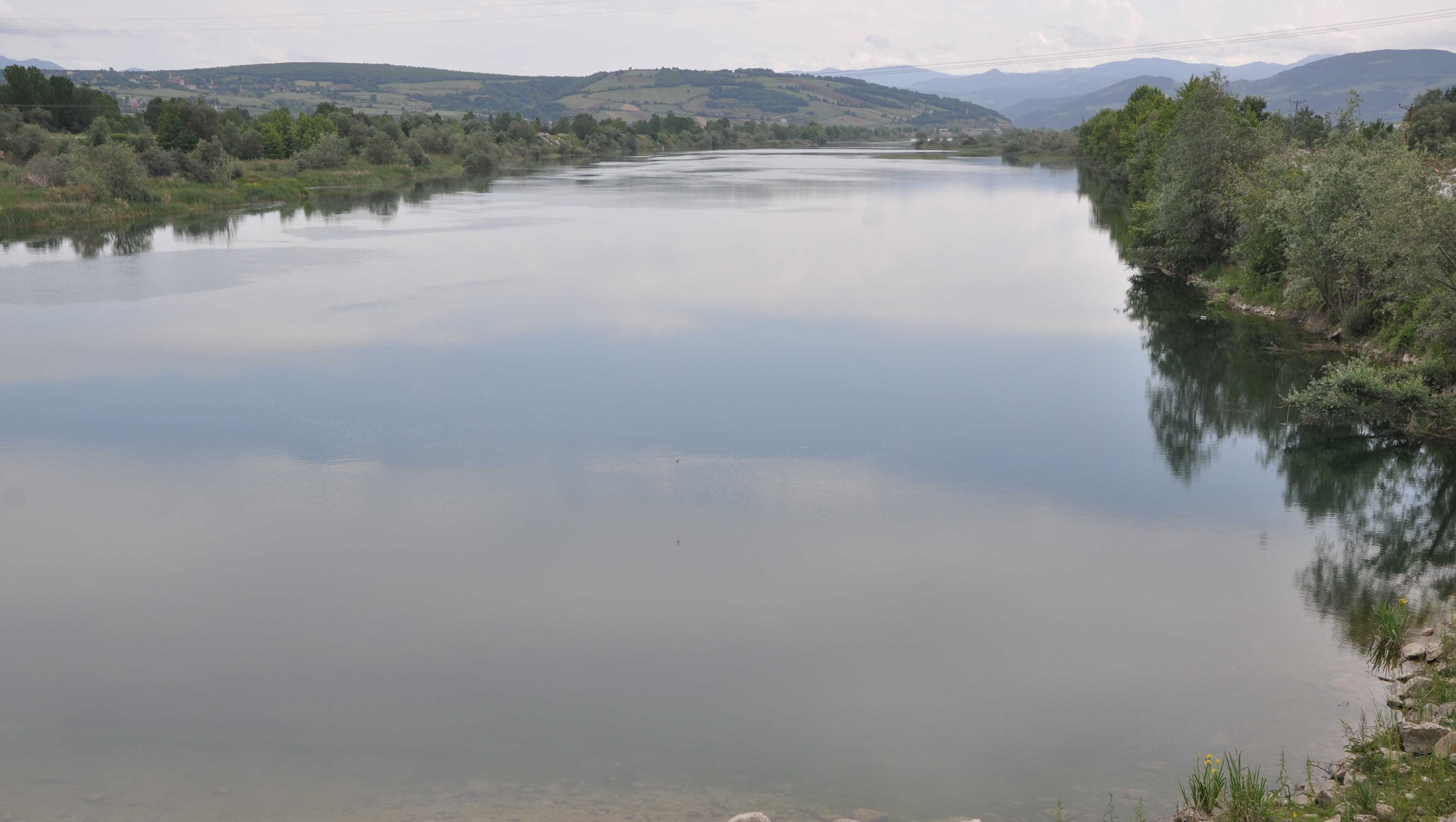
Halys River near the Black Sea. Photo by Leon Mauldin.

Halys River near the Black Sea. Photo by Leon Mauldin.

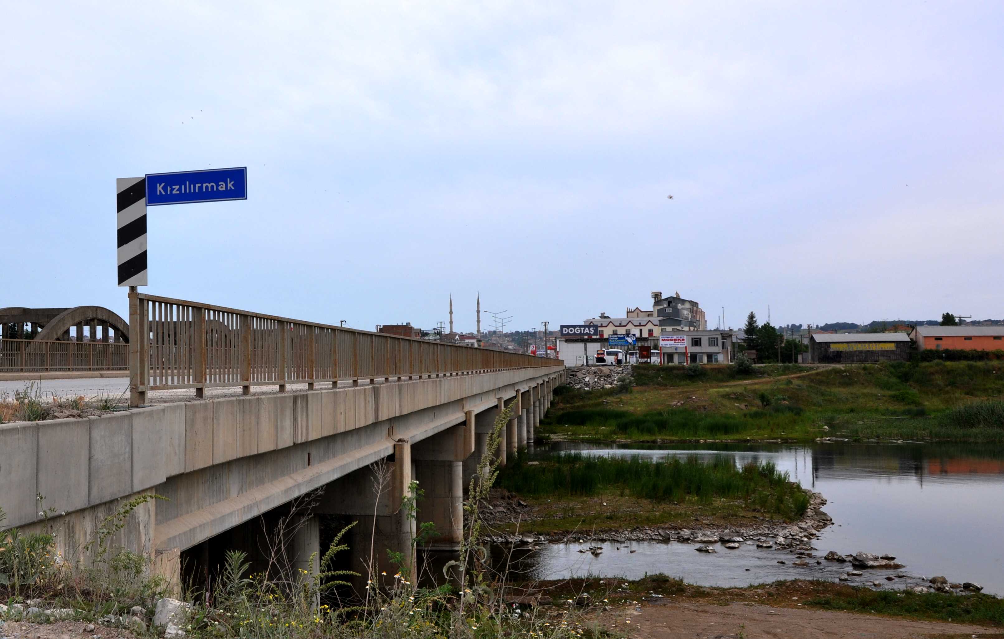
Sir Ramsay referenced the Halys as the Kizil-Irmak. Note the sign here at the bridge crossing the river.

Halys River/Kizil-Irmak. Photo by Leon Mauldin.

Halys River/Kizil-Irmak. Photo by Leon Mauldin.

Click images for larger view.