Follow-up on Bethlehem of Galilee–Reader Response

September 2, 2014

In our previous post (click here) on Bethlehem of Galilee we referenced Ibzan (of Judges 12:8-10) of Bethlehem and observed: “Very likely this is the Bethlehem of Galilee, not the Bethlehem of Judah.” A reader asks, “I’ve learned about the existence of this town sometime ago, but I’ve never found out WHY it is likely that this Bethlehem is Ibzan’s hometown. Which arguments support this assumption?”

That is a good question. First, remember that Joshua 19:15 lists Bethlehem among other cities Zebulun inherited.

Wolf, in The Expositor’s Bible Commentary observes, “The Zebulun location is favored because the southern city is usually identified as “Bethlehem in Judah” (17:7-9; 19:1-2, 18)” (Vol. 3, p.459). Note that is the wording repeatedly in each of these verses. It seems consistent that when the southern Bethlehem is intended, it is indicated, for example, Judges 17:7: “Now there was a young man from Bethlehem in Judah, of the family of Judah, who was a Levite; and he was staying there” (NASB). Note the rendering of the KJV: “And there was a young man out of Bethlehemjudah of the family of Judah, who was a Levite, and he sojourned there.”

Keil & Delitzsch: “Ibzan sprang from Bethlehem,—hardly, however, the town of that name in the tribe of Judah, as Josephus affirms (Ant. v. 7, 13), for that is generally distinguished either as Bethlehem ‘of Judah’ (Judg. 17:7, 9; Ruth 1:2; 1 Sam. 17:12), or Bethlehem Ephratah (Micah 5:1), but probably Bethlehem in the tribe of Zebulun (Josh. 9:15)” (Vol 2, p. 287). To the Micah passage we could add Gen. 35:19: “So Rachel died and was buried on the way to Ephrath (that is, Bethlehem)” (see also Gen. 48:7).

Pulpit Commentary: “But as Bethlehem of the tribe of Judah is generally called Bethlehem of Judah, or Bethlehem-Ephratah, and as Elon and Abdon were judges in North-East Israel, it is perhaps more probable that Bethlehem of Zebulun is meant” (p. 136). In his comment above, author A.C. Hervey is making two points: the fuller designation (of Judah or Ephratah) is used when Bethlehem of the south is intended, and second, the context of Judges 12:8-10. Verse 11 mentions Judge Elon of Zebulun, and Judge Abdon (vv. 13-15), on the border between Ephraim and Manasseh. While it is not conclusive proof, Ibzan’s placement in the text is in the context of judges to the north. Note in this connection that Butler, in the Word Biblical Commentary observes, “The context appears to point to the northern location. . .” (Vol. 8, p. 297).

Avraham Negev states regarding Bethlehem of Galilee: “A town in the territory of Zebulun, (Josh. 19:15), the birth-place of the judge Ibzan and the place where he was buried (Judg. 12:8–10)” (The Archaeological Encyclopedia of the Holy Land).

While I do not think that truth is determined by the number of people who advocate a particular position, it is true that the majority of scholars favor Bethlehem of Zebulun of Galilee as best fitting the text and context of Judges 12:8-10.
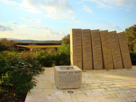
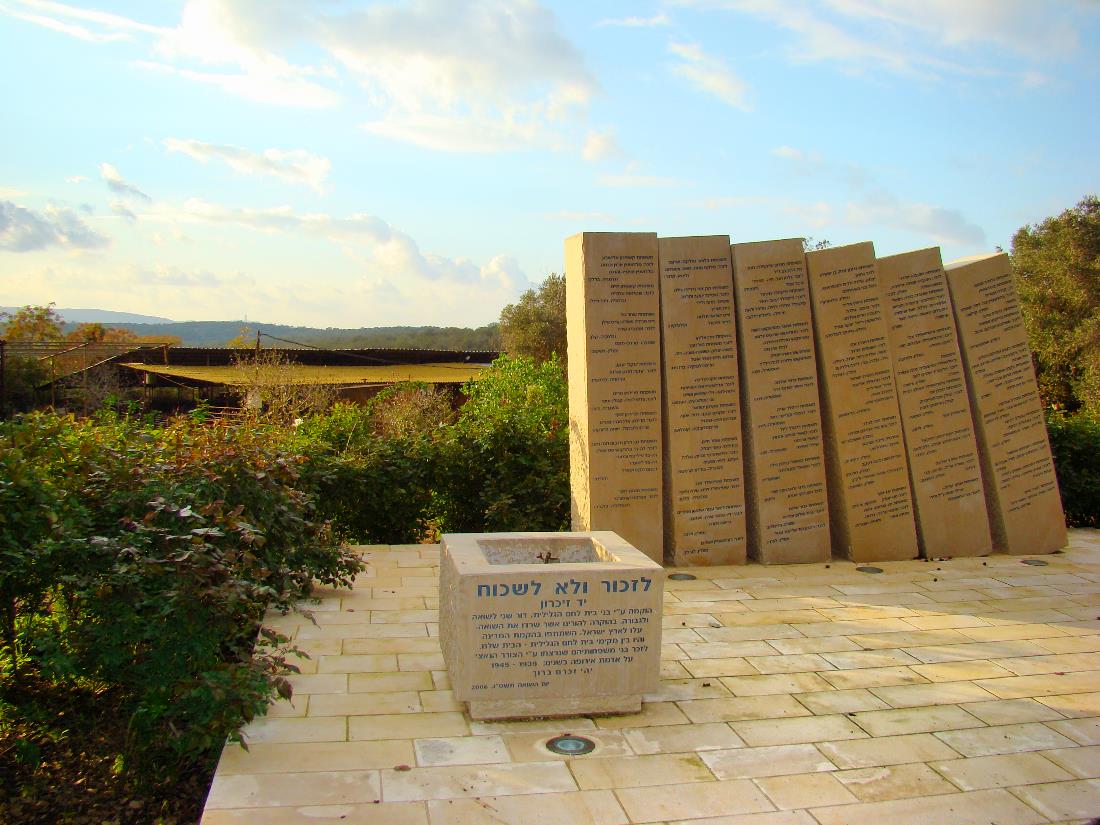
Bethlehem of Galilee. Further remains from the Templars. Photo by Leon Mauldin.

Bethlehem of Galilee. Further remains from the Templars. Photo by Leon Mauldin.

Click image for larger view.

Bethlehem of Galilee

August 28, 2014

In studying the book of Judges, brief mention is made of Ibzan of Bethlehem. The text notes that he had 30 sons and 30 daughters, and states that he judged Israel for seven years (Jud. 12:8-10). Very likely this is the Bethlehem of Galilee, not the Bethlehem of Judah, the latter being remembered of course as the birthplace of Jesus (Micah 5:2; Matt. 2:1). There were two biblical cities named Bethlehem. This is why the Bible is very specific in clarifying that Jesus was born in Bethlehem of Judah in these texts.

Joshua 19 describes the inheritance of Zebulun (of Galilee) and Bethlehem is included in the list: “Included also were Kattah and Nahalal and Shimron and Idalah and Bethlehem; twelve cities with their villages” (v.15). Note the location of the map here:

Bethlehem of Galilee. Map by BibleAtlas.org.

Bethlehem of Galilee. Map by BibleAtlas.org.

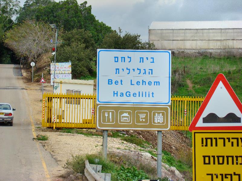
Here is a shot of the city sign upon entering from the south.

Bethlehem of the Galilee sign. Photo by Leon Mauldin.

Bethlehem of the Galilee sign. Photo by Leon Mauldin.

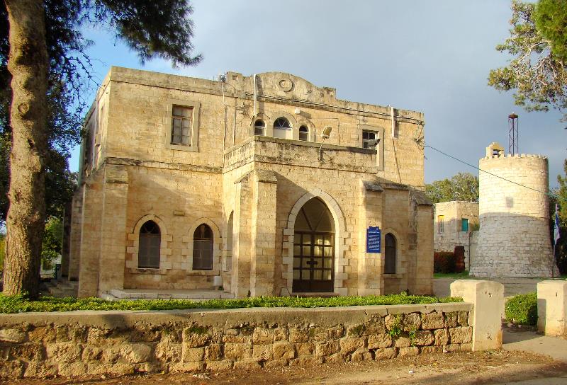
The earlier presence of the Templars may still be seen.

Bethlehem Templar Folk House. Photo by Leon Mauldin.

Bethlehem Templar Folk House. Photo by Leon Mauldin.

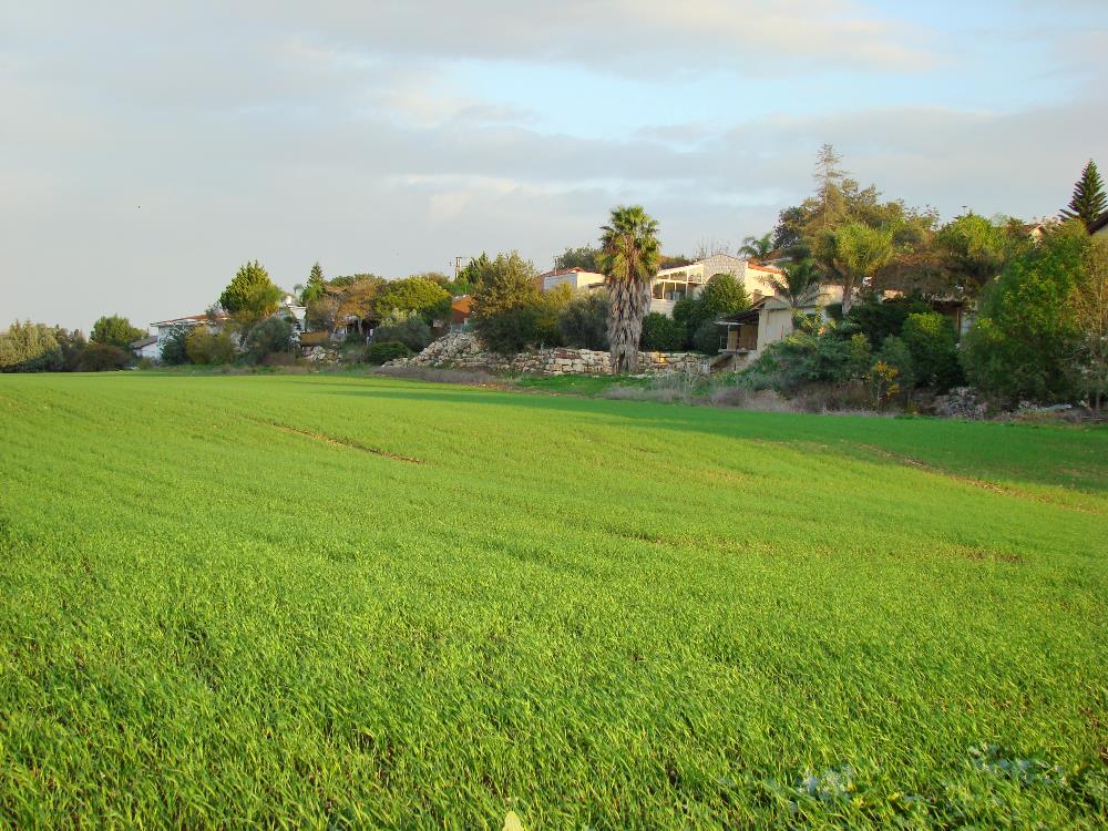
Today Bethlehem of the Galilee is a moshav, a cooperative agricultural community of individual farms.

Pasture in Bethlehem. Photo by Leon Mauldin.

Pasture in Bethlehem. Photo by Leon Mauldin.

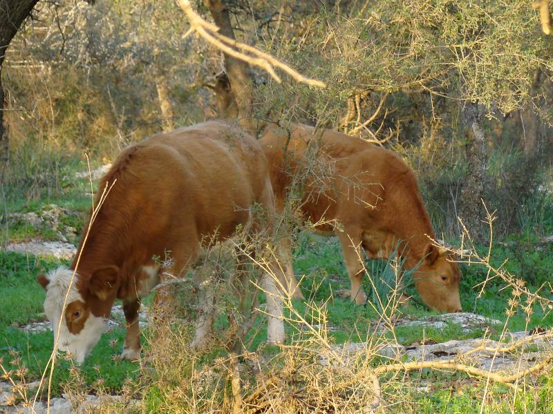
Cattle at Bethlehem. Photo by Leon Mauldin.

Cattle at Bethlehem. Photo by Leon Mauldin.


Farewell to a Friend: Eliemelech (Elie) Ben Meir

June 10, 2014

Ferrell Jenkins (May 31) wrote a very fitting tribute to Eliemelech Ben Meira guide he has used in Israel for two decades. Elie died May 23, following a stroke.  Also Barry Britnell (who is currently leading a tour in Israel) made a nice post here.

I also wanted to share a few memories of Elie, whom I first met in 1999. I began taking groups to Israel in 2009. I never considered asking for any guide except Elie. He and driver Fawzi were close friends. Elie always wanted to be sure I put in a request for Fawzi to be our driver.

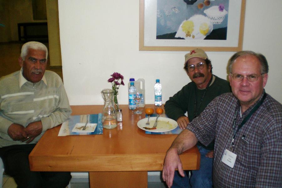
At Natana, Israel. Fawzi, driver at left, and Elie, center. Photo ©Leon Mauldin.

At Natanya, Israel. Fawzi, driver at left, and Elie, center. Photo ©Leon Mauldin.

I selected a few photos from this past Oct. 2013, that are from a variety of places.

At Dan, the northern most city in ancient Israel, and the site of Jeroboam’s shrine, which was condemned by faithful prophets.

Elie at Dan. Photo ©Leon Mauldin.

Elie at Dan. Photo ©Leon Mauldin.

In Jerusalem our group saw the “wailing wall.” At our approach to the site Elie was giving info and instructions.

Elie instructing our group as we neared Wailing Wall. Photo by Gary Kerr, ©Leon Mauldin.

Elie instructing our group as we neared Wailing Wall. Photo by Gary Kerr, ©Leon Mauldin.

At the Jordan River, at the traditional site of the Jesus baptism, there is a high water mark for Jan. 1, 2013. Though the Jordan does not flood as it did in biblical times (see here), it still gets well out of its banks at times as this photo shows. (click to enlarge photo; see info on board upper left).

Upper left shows high water mark reached Jan 2013. Elie is seated; tour member Keith Crews is at right. Photo ©Leon Mauldin.

Upper left shows high water mark reached Jan 2013. Elie is seated; tour member Keith Crews is at right. Photo ©Leon Mauldin.

Of course Masada has tremendous historical significance.

Elie instructing our group at Masada. Photo ©Leon Mauldin.

Elie instructing our group at Masada. Photo ©Leon Mauldin.

At Masada in particular Elie would remind everyone to bring their water.

This sampling also represents somewhat of the tremendous variety within the land of Israel itself. Elie was versatile and well equipped to help us very literally “from Dan to Beersheba.” I hate to say goodbye to old friends. He will be missed.


Achzib on the Mediterranean

May 16, 2014

I love to study the book of Joshua. After Joshua led Israel in the Conquest of Canaan, the book bearing his name lists two biblical cities known as Achzib.

Josh. 15:44 lists Achzib among the cities with their villages designated as Judah’s tribal inheritance. The prophet Micah also mentions Achzib (Mic. 1:14), referencing this same southern city.

The other Achzib (featured in this post) was on the Mediterranean coast, and was included in the inheritance given to the tribe of Asher. “Then the boundary turns to Ramah, reaching to the fortified city of Tyre. Then the boundary turns to Hosah, and it ends at the sea; Mahalab, Achzib” (Josh. 19:29, ESV). Of course the “sea” mentioned in this verse is the Mediterranean Sea.

Note the location on the map:

Achzib. Map by BibleAtlas.org.

Achzib. Map by BibleAtlas.org.

Achzib was a significant settlement dating back to the Middle Bronze age (approximate time of Abraham), when it was a fortified harbor town.

Information Sign at Achzib. Photo ©Leon Mauldin.

Information Sign at Achzib. Photo ©Leon Mauldin.

But this city with its coastal access, and location on a major international route, was unfortunately not retained by Israel. Achzib is listed among seven cities not possessed within Asher’s inheritance: ” Asher did not drive out the inhabitants of Acco, or the inhabitants of Sidon or of Ahlab or of Achzib or of Helbah or of Aphik or of Rehob” (Judges 1:31). For much of its history Achzib was a Phoenician city.

Achzib was listed in Assyrian records as one of the cities during Sennacherib’s campaign in Syria and Palestine in 701 BC. In Roman times it was a thriving coastal town known as Ecdippon or Ecdippa.

Today it is just barely south of Israel’s border with Lebanon. Our photo here below was taken at Achzib looking south toward Acco (see above Judges text).

At Achzib looking south toward biblical Acco. Photo ©Leon Mauldin.

At Achzib looking south toward biblical Acco. Photo ©Leon Mauldin.

Click on images for larger view.


Battle at Michmash (1 Samuel 13-14)

March 27, 2014

Last evening a grandson, along with my wife & me, were reading his daily Bible reading which was in 1 Samuel 13-15. Chapters 13-14 record a battle between Israel and the Philistines, which was initiated by the faith of King Saul’s son Jonathan. A site repeatedly mentioned in the text is that of Michmash.

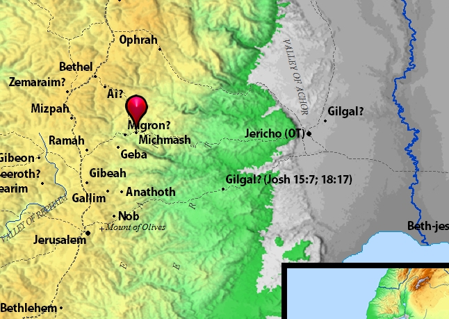
Michmash. Map by BibleAtlas.org.

Michmash. Map by BibleAtlas.org.

Michmash is about seven miles north and slightly east of Jerusalem. Consider how far into Israel’s territory the coastal Philistines had advanced at this point. Further, Israel’s forces were greatly outnumbered. The Philistines had 30,000 chariots and 6,000 horsemen, and “people as the sand which is on the seashore in multitude,” and were also “encamped in Michmash (1 Sam. 13:5). Jonathan had 1,000 men with him (at Gibeah at the point of 1 Sam. 13:2). Saul had only 2,000 men (ibid.) but as the chapter continues that number had shrunk down to a mere 600 men (v.15).

But Jonathan’s faith was not in numbers, but in YHWH. He told his armorbearer, “Come, let us go over to the garrison of these uncircumcised; it may be that the LORD will work for us. For nothing restrains the LORD from saving by many or by few” (1 Sam. 14:6). The two of them climbed up the steep pass to Michmash on hands and knees, attacked the Philistines, and “that first slaughter which Jonathan and his armorbearer made was about twenty men within about half an acre of land” (1 Sam. 14:14). The Philistine camp went into confusion. “So the LORD saved Israel that day” (v.23). Israel drove “back the Philistines that day from Michmash to Aijalon” (v.31).

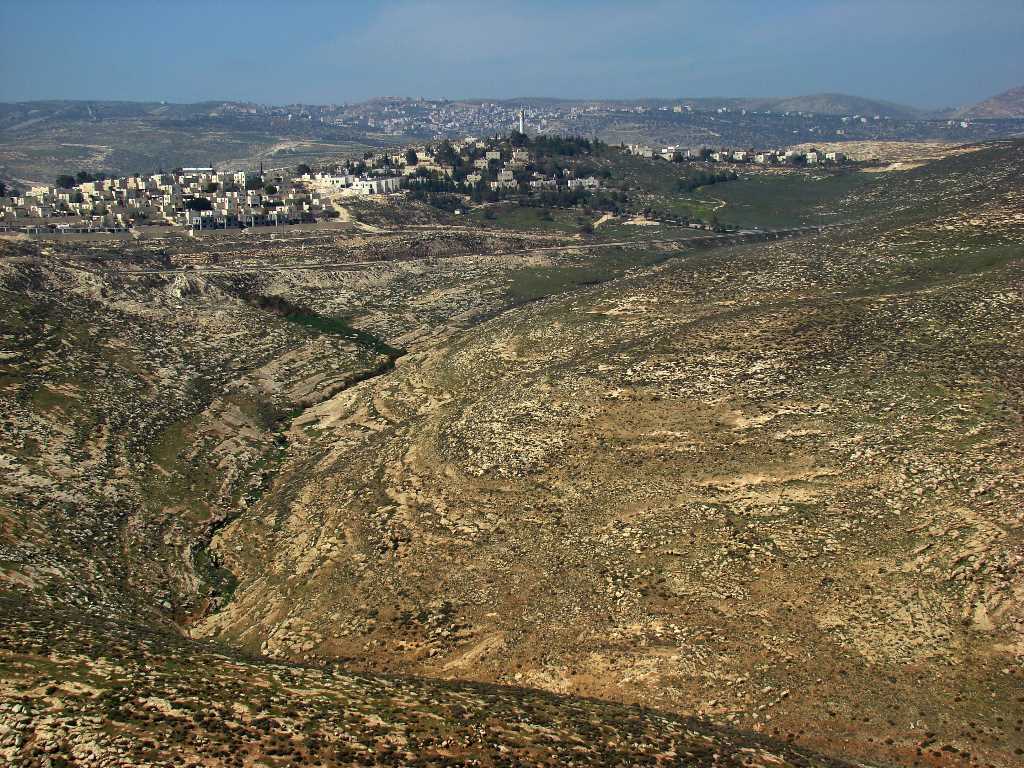
Michmash. Area of battle between Israel and Philistines. Photo by Leon Mauldin.

Michmash. Area of battle between Israel and Philistines. Photo by Leon Mauldin.

After we read the biblical narrative, I showed my grandson some photos of the Michmash area, such as the one here above, and was able to say that what we just read took place in this area. He responded, “Have they found any skeletons there?” “Wouldn’t it be cool if they found skeletons there?” Also, “Do they still fight battles there?”

While I don’t know of any skeletal remains, this area was the site of an important battle between Britain and the Turks during WWI. Major Vivian Gilbert, in his book The Romance of the Last Crusade, “relates the story of an unnamed brigade major who was reading his Bible while contemplating the situation against the Ottoman forces. The brigade major remembered a town by the name of Michmash mentioned somewhere in the Bible. He found the verses, and discovered that there was supposedly a secret path around the town. He woke the brigadier general, and they found that the path still existed and was very lightly guarded. The British forces used this path to outmaneuver the Ottomans, and so took the town” (Wikipedia, referencing pp. 183-186).

The use of maps and photos of biblical sites helps children (and the rest of us) to better visualize and understand the biblical events.


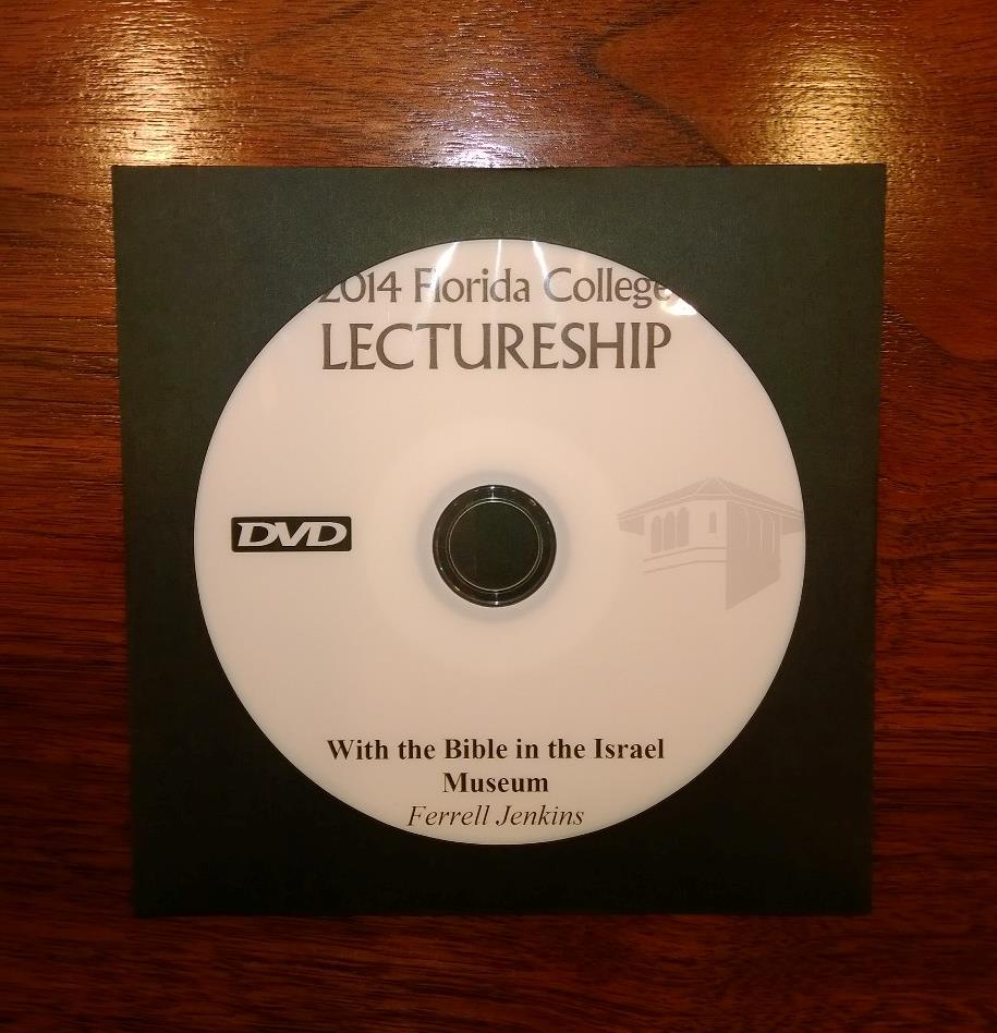
Recommended Resource: “With the Bible in the Israel Museum” DVD by Ferrell Jenkins

March 14, 2014

It is only in the last two years that photos have been permitted in the Israel Museum in Jerusalem. There are so many wings with so many artifacts, it is helpful to have some sort of guideline to serve as a starting point to make the most of a visit to the museum.

Ferrell Jenkins delivered a lecture entitled, “With the Bible in the Israel Museum” during the 2014 lecture series at Florida College, Temple Terrace, FL. In the lecture he selectively (because of so much to choose from) makes use of recent photos to deal with artifacts beginning with time of the patriarchs, continuing through Old Testament history (United Kingdom, Divided Kingdom, Captivity, Persian Period) and concluding with the Roman and Early Christianity. Included are numerous examples from various sites of Israel’s propensity to engage in idolatrous worship. Also there is insightful information on burial customs for different periods.

Ferrell Jenkins' DVD on biblical artifacts in the Israel Museum.

Ferrell Jenkins’ DVD on biblical artifacts in the Israel Museum. Photo by Leon Mauldin.

I recommend the DVD both as helpful to prepare for a visit to the museum, as well as to review and restudy if you have had opportunity already to go to.

You can place your order here with the FC Bookstore. Use the search box to enter keywords. Cost is $5.00 plus shipping.


Out of the Wilderness and into Canaan

February 28, 2014

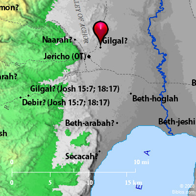
The book of Joshua transitions the reader from Israel’s wilderness wandering to their entrance into Canaan, the Promised Land. Upon their crossing the Jordan, and before taking the city of Jericho, they encamped at Gilgal.

Israel's encampment at Gilgal. BibleAtlas.org

Israel’s encampment at Gilgal. BibleAtlas.org

At Gilgal all the men were circumcised who during the 40 years of wilderness wandering had neglected (i.e., their parents had neglected) this special covenant token.

So Joshua made flint knives and circumcised the Israelite men at Gibeath-haaraloth.  This is the reason Joshua circumcised them: All the people who came out of Egypt who were males– all the men of war– had died in the wilderness along the way after they had come out of Egypt.  Though all the people who came out were circumcised, none of the people born in the wilderness along the way were circumcised after they had come out of Egypt.  For the Israelites wandered in the wilderness 40 years until all the nation’s men of war who came out of Egypt had died off because they did not obey the LORD. So the LORD vowed never to let them see the land He had sworn to their fathers to give us, a land flowing with milk and honey.  Joshua raised up their sons in their place; it was these he circumcised. They were still uncircumcised, since they had not been circumcised along the way.  After the entire nation had been circumcised, they stayed where they were in the camp until they recovered.  The LORD then said to Joshua, “Today I have rolled away the disgrace of Egypt from you.” Therefore, that place has been called Gilgal to this day (Josh. 5:3-9).

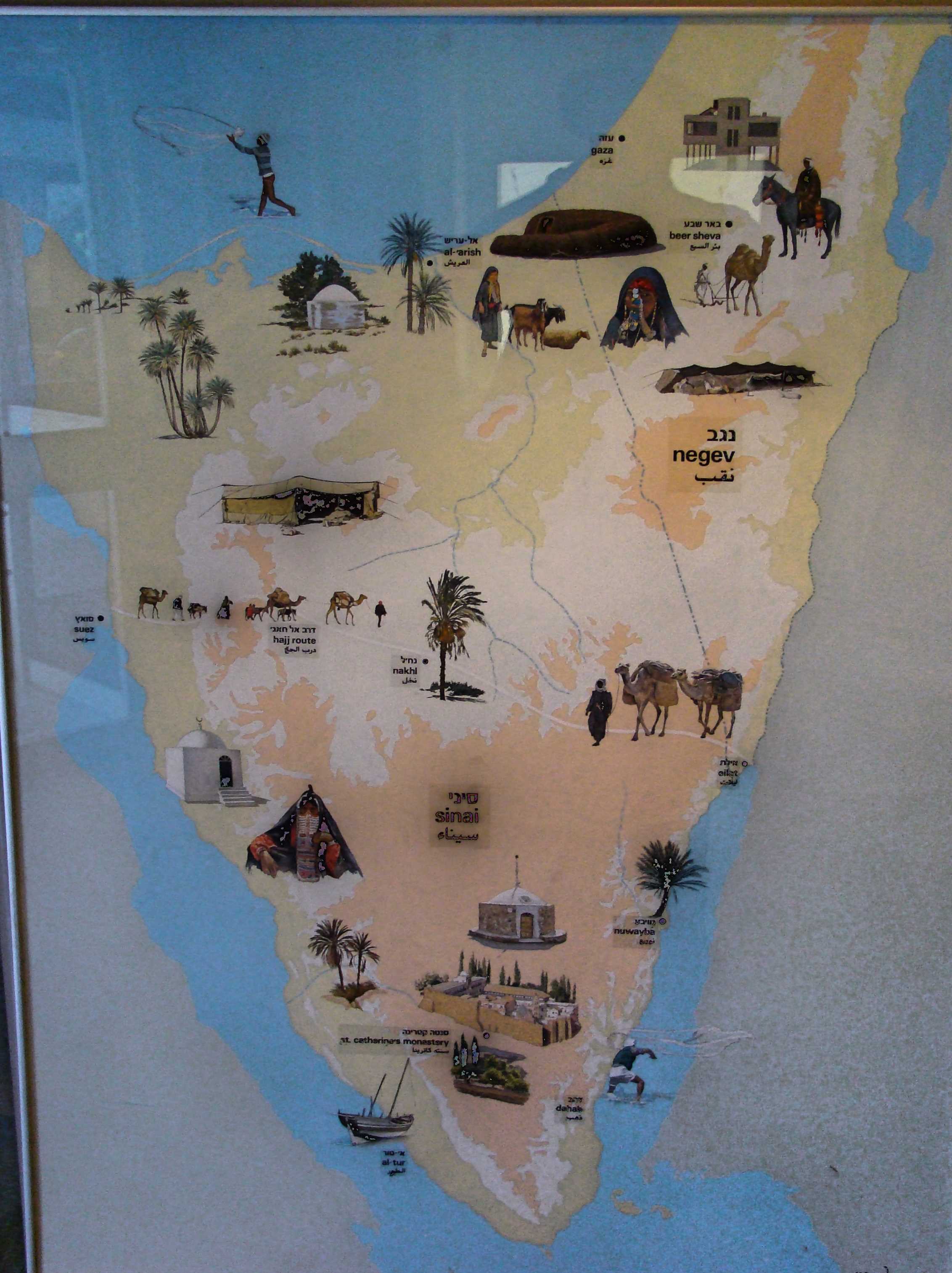
The Peninsula of Sinai was Israel’s home for that period referenced in this text.

Area of Wilderness Wandering.  Museum of Bedouin Culture. Photo ©Leon Mauldin.

Area of Wilderness Wandering. Museum of Bedouin Culture. Photo ©Leon Mauldin.

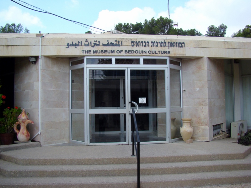
The photo of this artwork was taken in the Museum of Bedouin Culture at Kibbutz Lahav in the Israel’s Negev.

Museum of Bedouin Culture at Kibbutz Lahav. Photo ©Leon Mauldin.

Museum of Bedouin Culture at Kibbutz Lahav. Photo ©Leon Mauldin.

It was also at Gilgal that Israel observed the Passover at the appointed time, the 1st month, 14th day. It was at this time that the manna stopped, and Israel began to eat the produce of the land. This was at harvest season. The 40 years of wandering were over; a new era had dawned!

Click on images for larger view.


All the Land of the Hittites

February 26, 2014

Following the death and 30-day period of mourning for Moses (Deut. 34), Yahweh spoke words of encouragement to his successor, Joshua:

After the death of Moses the LORD’s servant, the LORD spoke to Joshua son of Nun, who had served Moses: “Moses My servant is dead. Now you and all the people prepare to cross over the Jordan to the land I am giving the Israelites. I have given you every place where the sole of your foot treads, just as I promised Moses.  Your territory will be from the wilderness and Lebanon to the great Euphrates River– all the land of the Hittites— and west to the Mediterranean Sea” (Joshua 1:1-4, CSB).

Holman’s Christian Standard Bible (Study Bible) has the following notation regarding the expression, “land of the Hittites”:

The land of the Hittites seems not to refer to the Hittite Empire of modern Turkey but the Egyptian and later Assyrian usage of this term to describe the region controlled by the Hittites in the western part of modern Syria. These lands and boundaries identify Canaan as it was known both to the Bible (Gn 10:19; Nm 13:17,21-22; 34:3-12) and to Egyptian writers of the second millennium B.C.

In numerous passages the Hittites are mentioned as one of several groups populating the land of Canaan. For example, Joshua told the Israelites, “You will know that the living God is among you and that He will certainly dispossess before you the Canaanites, Hittites, Hivites, Perizzites, Girgashites, Amorites, and Jebusites” (Joshua 1:10; cf. Gen. 15:20; Deut. 7:1, and etc.).

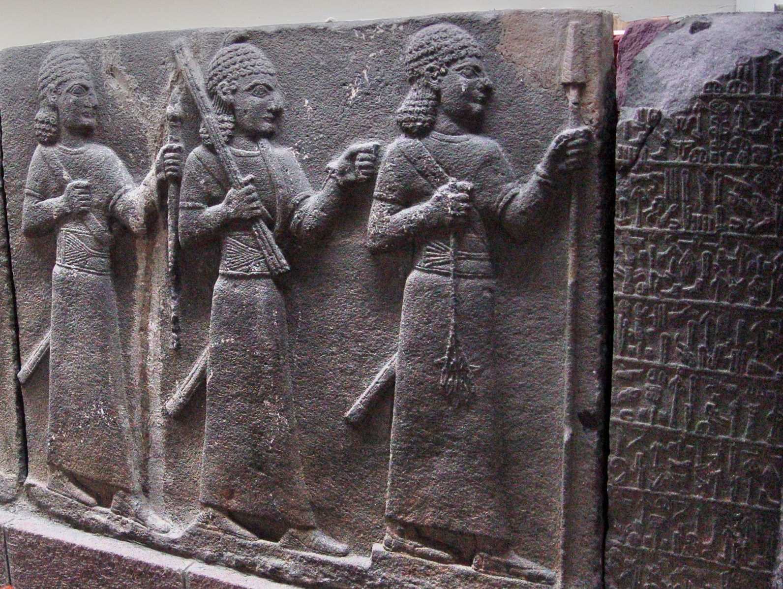
The Ankara (Capitol of modern Turkey) Museum is of international renown for its collection of Hittite artifacts. The relief below shows three Hittite warriors.

Hittite Warriors. Ankara Museum. Photo ©Leon Mauldin.

Hittite Warriors. Ankara Museum. Photo ©Leon Mauldin.

The accompanying placard entitled The Warriors  says, “Three figures with curly hair, and dressed in long tunics with wide belts. The figure at the front holds a spear, which is broken at one end, in his left hand and a leafed tree branch in the right. The figure in the middle clenches his left fist and holds up a tool at head level in his right hand. They are followed by a figure that carries a staff in the left hand. All three wear long swords at the waist.”

The Bible is not a book of fiction. When it mentions people, they were real people, living in real places, participating in real events as recorded in Scripture.


The Conquest: Crossing Jordan

February 17, 2014

Joshua 3 records Israel’s crossing Jordan from the eastern side, to set up camp temporarily at Gilgal, and from there to take the city of Jericho. See our map in previous post.

The timing at this point was just prior to Passover (Josh. 5:10), meaning this was the early harvest season.  When Israel was crossing the notation is made, “Now the Jordan overflows its banks throughout the harvest season” (Josh. 3:15, CSB). The text records divine intervention: the priests were carrying the ark, and when their feet touched the Jordan,

. . . the water flowing downstream stood still, rising up in a mass that extended as far as Adam, a city next to Zarethan. The water flowing downstream into the Sea of the Arabah (the Dead Sea) was completely cut off, and the people crossed opposite Jericho. The priests carrying the ark of the LORD’s covenant stood firmly on dry ground in the middle of the Jordan, while all Israel crossed on dry ground until the entire nation had finished crossing the Jordan (Josh. 3:16-17, CSB).

The study note in the Holman Christian Standard Bible states:

At spring flood, after the winter rains and during the barley harvest, the Jordan River could reach a width in excess of 100 feet and a depth of 10 feet. The priests as the leaders of the people were the first to step down into the water. Doing so was a risky activity with the river at flood stage. Carrying the ark could easily have caused them to be swept away by the current unless the promised miracle took place.

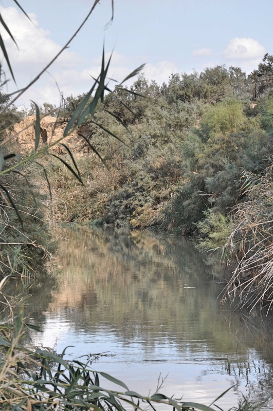
Note that the people crossed “opposite Jericho.” Our photo below is at the Jordan at Qasr el-Yahud, opposite and a little south of Jericho. It would be somewhere near here that the crossing of Joshua 3 took place. Our photo looks to the north.

Jordan River at  Qasr el-Yahud. Photo by Leon Mauldin.

Jordan River at Qasr el-Yahud. Photo by Leon Mauldin.

In their introduction to the book of Joshua, the HCSB Study Bible has an interesting note about the change in volume of the flow of the Jordan:

The Jordan River was at flood stage when God commanded Joshua to lead the people across. Just as when God opened the Red Sea, He provided a dry path through the Jordan when the priests, bearing the ark of the covenant, touched the edge of the river. . . Up until the 1950’s, more than 3 billion cubic feet flowed through the southern Jordan annually. with construction of a number of dams on the Jordan north of the Sea of Galilee and on rivers that feed the Jordan, that volume of water has been reduced to 300 million cubic feet a year (p.338).

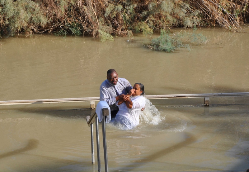
Qasr el-Yahud is a site on the Jordan thought by some to be across from the Bethany referenced in John 1:28, where John the Baptist did some of his baptizing. We had the opportunity to visit here in October.

Baptism in the Jordan River. Photo by Leon Mauldin.

Baptism in the Jordan River. Photo by Leon Mauldin.

Click images for larger view.


Jericho, First City of the Conquest of Canaan

February 15, 2014

The book of Joshua has one dominant theme: God was fulfilling His promise to the patriarchs Abraham, Isaac and Jacob, that He would give unto their descendants the land of Canaan (Gen. 12:6-7). As Joshua begins, Israel had recently conquered the transjordan territories of Sihon and Og, which would become the possession of Reuben, Gad, and half the tribe of Manasseh (Num. 21:21-35). Though the eastern territory was given to Israel by God, the land of Canaan proper did not include the transjordan, but rather was the land west of the Jordan River. (See discussion on this by Todd Bolen here

The book of Joshua is named after its prominent character, Joshua, the successor of Moses. Following Moses’ death (Deut. 34) and a 30-day period of mourning (v.8), Joshua sent out two spies across the Jordan. They were told “Go, view the land, especially Jericho” (Josh. 2:1).

Conquest of Canaan. Map by Marc Hinds.

Conquest of Canaan. Map by Marc Hinds.

One can see that from their location in Shittim (Acacia Grove, NKJV, CSB) that the first city that must be taken in the Conquest was Jericho, believed to be the world’s most ancient city. It was a fortress city and guarded entrance into Canaan from the east. Located in the Jordan Valley, it is 670 feet below sea level, and was one the first cities in Israel to be excavated. The record of Jericho’s destruction by Israel is found in Joshua 6.

From the standpoint of military strategy, Israel would first conquer the central territory (Josh. 7-8), then the southern (Josh. 10), and finally the northern territory (Josh. 11).

Jericho. Map by BibleAtlas.org.

Jericho. Map by BibleAtlas.org.

I always enjoy seeing Jericho. This past October Jericho was included on our itinerary for my group, though it was later in the day than what is ideal for photos.

Excavations at Jericho. Photo by Leon Mauldin

Excavations at Jericho. Photo by Leon Mauldin.

Recommended reading: see Biblical Archaeology Review, “Did the Israelites Conquer Jericho? A New Look at the Archaeological Evidence,” by Dr. Bryant G. Wood (16:02, March/April 1990).

Click images for larger view.